Heat expands across the Desert Southwest, Plains, Mississippi Valley and Midwest into Monday. Fire weather concerns continue for portions of the Intermountain West. Active monsoonal moisture fuels thunderstorms over the Southwest with possible flash flooding. Tropical cyclone Fausto in the Pacific, should weaken as it approaches Hawaii; Dangerous surf, swells and rip currents are expected. Read More >
Overview
|
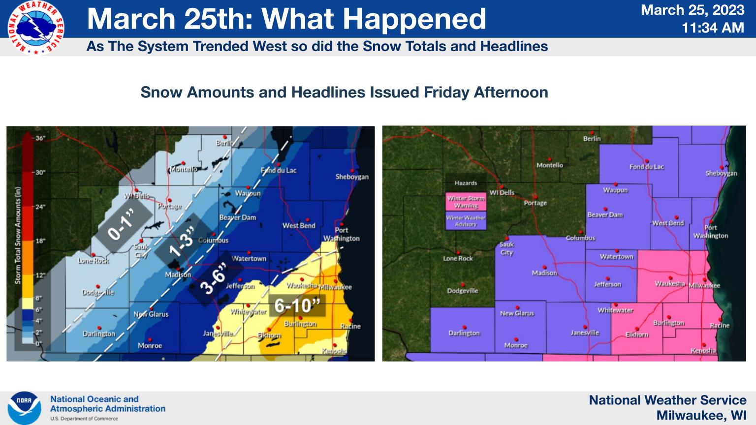
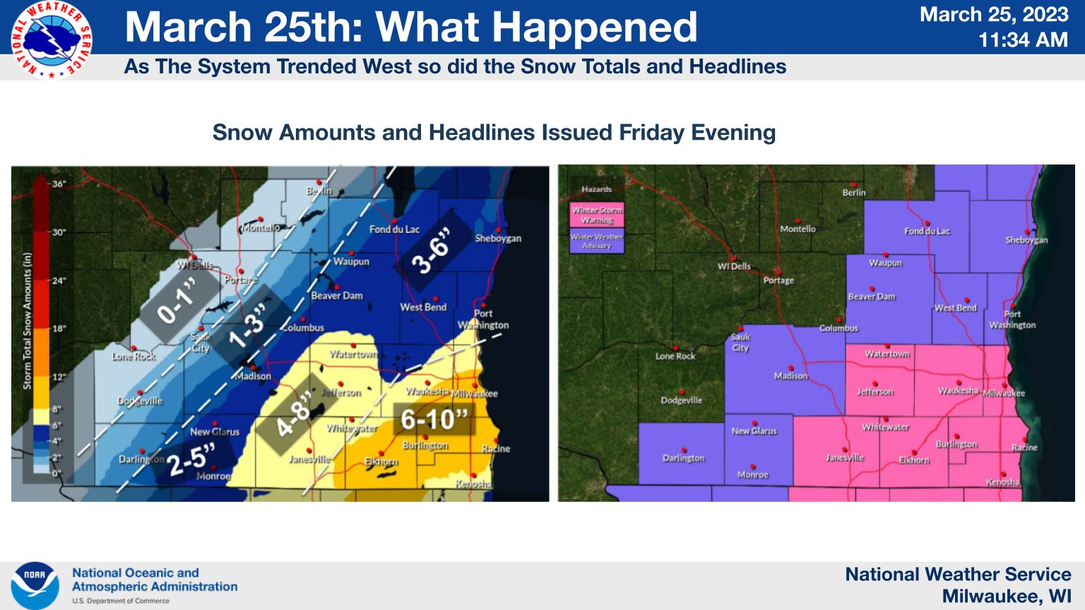
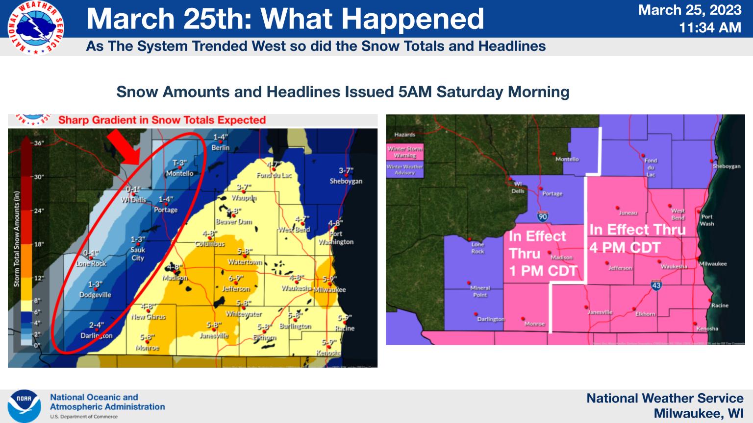
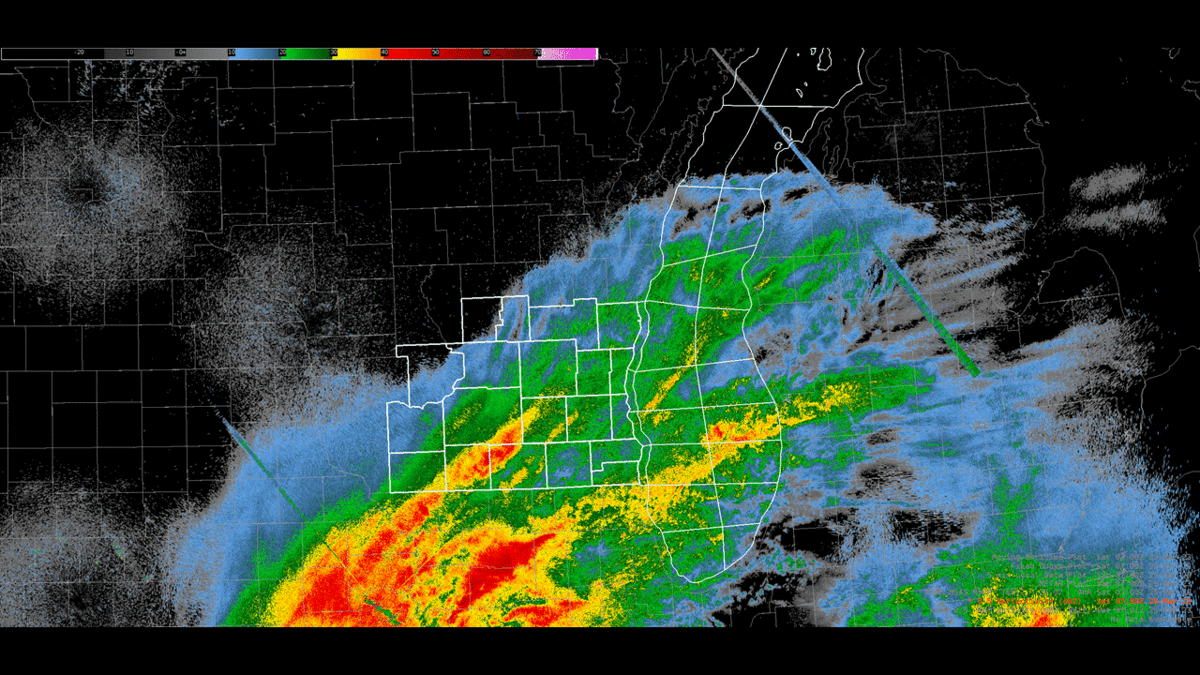
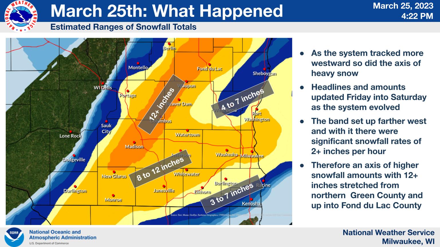
A strong area of low pressure listed northeast across the region, bringing a swath of heavy snow to southern Wisconsin late Friday, March 24th into Saturday, March 25th, 2023. Initially, the surface low was forecast to track northeast across southern Illinois and central Indiana, with a west to east area of banded snowfall. However, as the event unfolded the surface low tracked further northwest across northeast Illinois and northwest Indiana. This allows the banded area of heavy snow to shift to the west and become oriented more south to north. The snow stacked up quickly due to impressive snowfall rates on Saturday morning, leading to difficult travel and a few isolated power outages. Both Madison and Milwaukee saw record snowfall during this event. Head over to the Snow Records and Reports tab to see these records! |
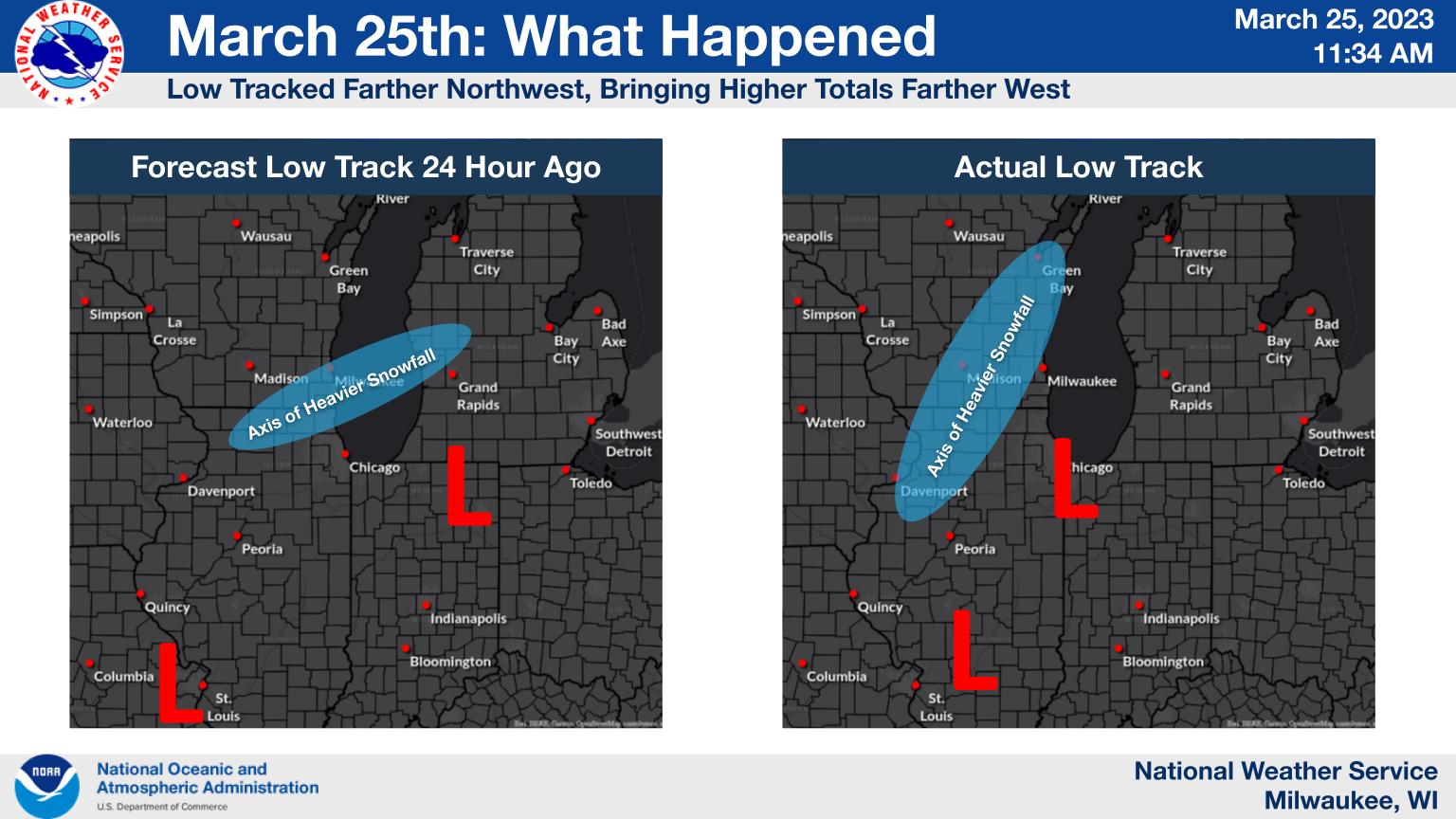 How the storm track and axis of heavier snow shifted west. |
What Happened
Progression of Snowfall Forecast and Winter Weather Headlines
 |
 |
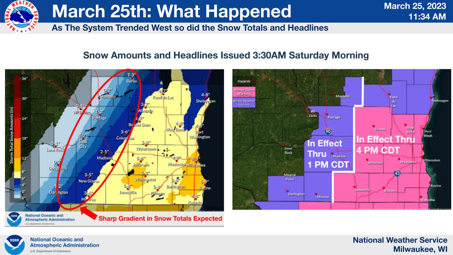 |
| Friday Afternoon | Friday Evening | 3:30 AM Saturday Morning |
 |
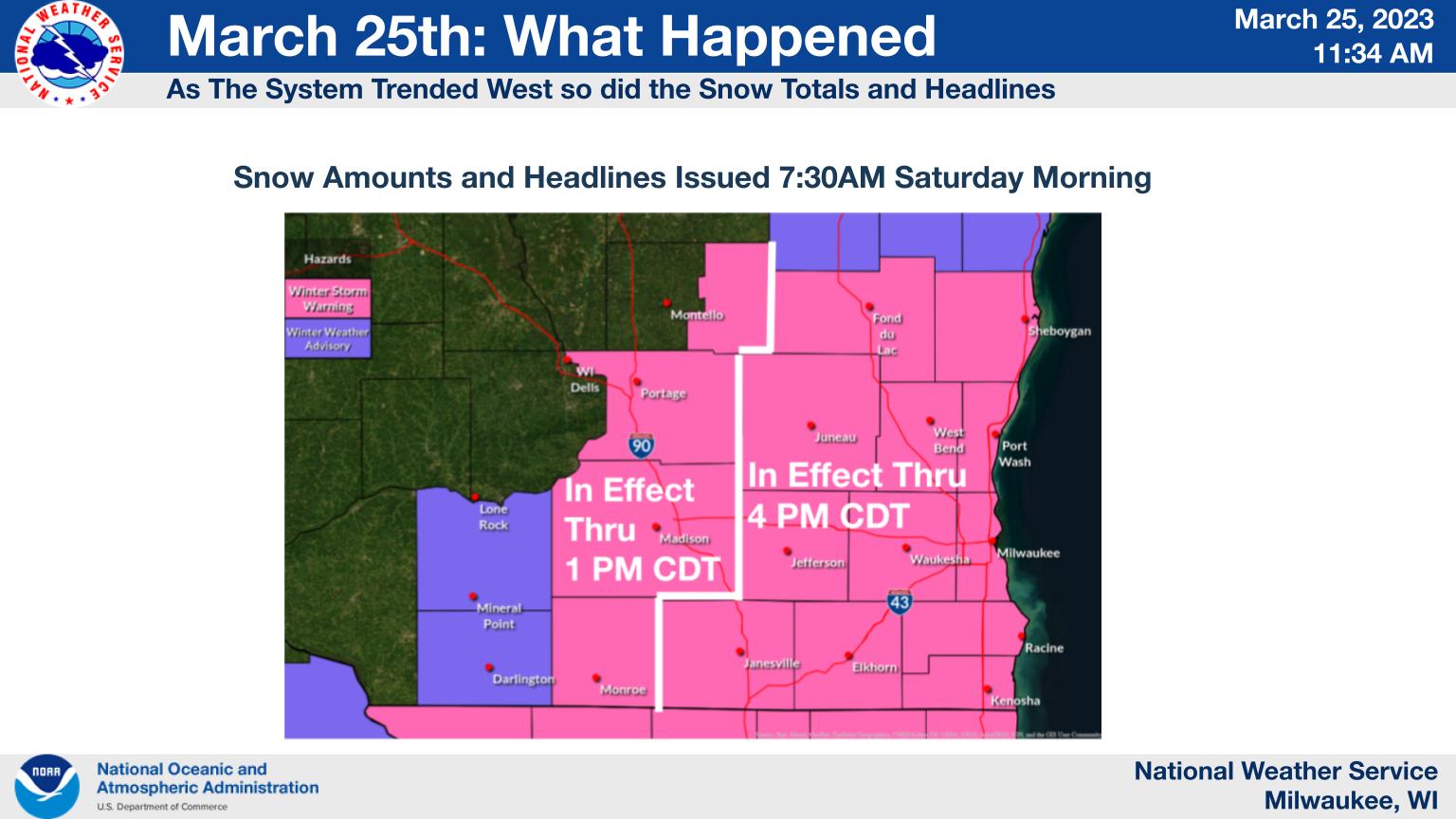 |
| 5 AM Saturday Morning | 7:30 AM Saturday Morning |
Radar & Satellite
 |
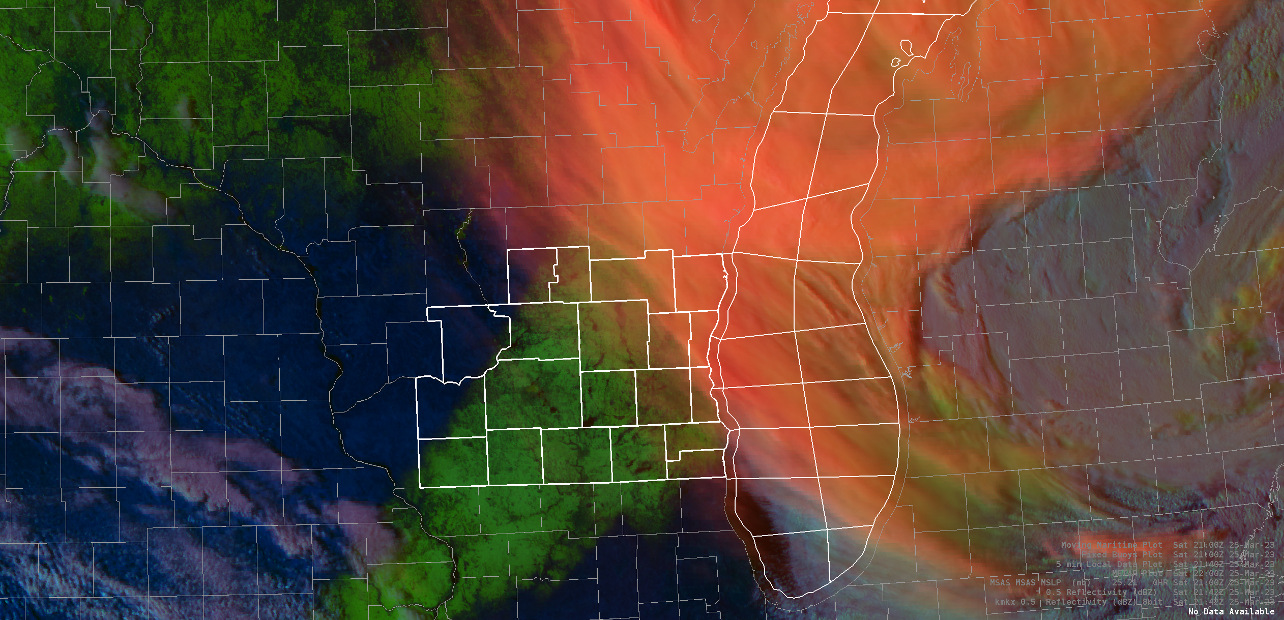 |
| Radar Loop | Satellite image shows snow on the ground (shown in green) as high clouds (shown in red) began to clear. Note the sharp cutoff where little no accumulating snow fell across much of Sauk and portions of Marquette and Iowa counties. |
Snowfall Records:
|
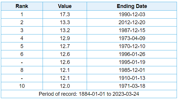
Dane County Regional Airport (Madison, WI) picked up 12.1 inches of new snow!
|
Top 10 - 1 Day Snowfall Records for Madison, WI.
|
|
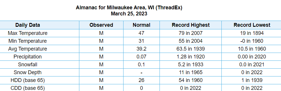
General Mitchell International Airport (Milwaukee, WI) picked up 8.9 inches of new snow!
|
Daily Climate Record for March 25, 2023 in Milwaukee, WI.
|
Snowfall Reports:
HIGHEST SNOWFALL REPORTS FOR MARCH 24-25TH SNOW STORM BY COUNTY

LOCATION                     AMOUNT    TIME/DATE

...COLUMBIA COUNTY...
PARDEEVILLE                  9.1 IN    1148 AM 03/25

...DANE COUNTY...
2 S MIDDLETON                13.9 IN   1130 AM 03/25
2 NNW BROOKLYN               13.0 IN   0944 AM 03/25
2 S SHOREWOOD HILLS          13.0 IN   1254 PM 03/25
2 WNW SUN PRAIRIE            12.5 IN   0100 PM 03/25
1 WSW SHOREWOOD HILLS        12.4 IN   1200 PM 03/25
OREGON                       12.3 IN   1100 AM 03/25
2 NNE MAPLE BLUFF            12.1 IN   0100 PM 03/25
WINDSOR                      12.0 IN   1211 PM 03/25
1 N MONONA                   11.3 IN   1215 PM 03/25
1 S OREGON                   10.5 IN   1120 AM 03/25
MCFARLAND                    10.0 IN   1130 AM 03/25
2 SE MAPLE BLUFF             10.0 IN   1205 PM 03/25

...DODGE COUNTY...
2 WNW BEAVER DAM             10.5 IN   0238 PM 03/25
3 NW WATERTOWN               9.9 IN    1100 AM 03/25
5 ENE FALL RIVER             6.5 IN    0100 PM 03/25
THERESA                      6.0 IN    0100 PM 03/25

...FOND DU LAC COUNTY...
RIPON                        12.0 IN   1100 AM 03/25
FOND DU LAC                  12.0 IN   0530 PM 03/25

...GREEN COUNTY...
2 N NEW GLARUS               8.6 IN    1147 AM 03/25
NEW GLARUS 1.9 NNW           8.0 IN    0700 AM 03/25
BRODHEAD                     6.1 IN    0700 AM 03/25

...GREEN LAKE COUNTY...
3 W RIPON                    7.5 IN    1028 AM 03/25

...IOWA COUNTY...
MINERAL POINT 7.3 ENE        5.5 IN    0700 AM 03/25
1 NE DODGEVILLE              3.6 IN    1144 AM 03/25
DODGEVILLE 2.7 NE            2.9 IN    0700 AM 03/25

...JEFFERSON COUNTY...
5 SE JOHNSON CREEK           12.5 IN   1145 AM 03/25
1 WSW JOHNSON CREEK          11.0 IN   0100 PM 03/25
LAKE MILLS                   8.0 IN    1015 AM 03/25

...KENOSHA COUNTY...
1 NW PADDOCK LAKE            5.0 IN    0515 PM 03/25
2 NNW PLEASANT PRAIRIE       3.5 IN    0450 PM 03/25

...LAFAYETTE COUNTY...
GRATIOT                      9.4 IN    1000 AM 03/25

...MILWAUKEE COUNTY...
1 SSW GREENDALE              8.9 IN    0223 PM 03/25
2 WSW SAINT FRANCIS          8.9 IN    0400 PM 03/25
FRANKLIN                     6.5 IN    0810 AM 03/25

...OZAUKEE COUNTY...
1 WSW PORT WASHINGTON        7.5 IN    0445 PM 03/25
1 SW MEQUON                  7.0 IN    0300 PM 03/25
2 E BELGIUM                  6.5 IN    0400 PM 03/25

...RACINE COUNTY...
3 S BROWNS LAKE              7.0 IN    0500 PM 03/25
RACINE                       6.5 IN    0850 AM 03/25
WIND LAKE                    6.5 IN    1000 AM 03/25
1 W RACINE                   5.5 IN    0723 AM 03/25
NORTH BAY                    4.3 IN    0838 AM 03/25

...ROCK COUNTY...
JANESVILLE                   11.0 IN   1122 AM 03/25

...SHEBOYGAN COUNTY...
CEDAR GROVE                  5.0 IN    0428 PM 03/25
4 E DUNDEE                   3.0 IN    0415 PM 03/25

...WALWORTH COUNTY...
ELKHORN                      8.8 IN    1200 PM 03/25
1 WSW WILLIAMS BAY           7.5 IN    0230 PM 03/25
2 WNW PELL LAKE              6.0 IN    0200 PM 03/25

...WASHINGTON COUNTY...
1 SE GERMANTOWN              7.0 IN    0200 PM 03/25
HARTFORD                     5.8 IN    0100 PM 03/25
3 W JACKSON                  5.6 IN    0525 PM 03/25

...WAUKESHA COUNTY...
NEW BERLIN                   11.3 IN   0149 PM 03/25
1 NNW WAUKESHA               11.0 IN   0123 PM 03/25
EAGLE                        9.0 IN    1225 PM 03/25
ELM GROVE                    7.5 IN    0100 PM 03/25
2 N OCONOMOWOC               7.4 IN    0330 PM 03/25
MUKWONAGO                    7.3 IN    0100 PM 03/25
3 ESE PEWAUKEE               7.2 IN    0158 PM 03/25
2 S WALES                    7.0 IN    0140 PM 03/25

OBSERVATIONS ARE COLLECTED FROM A VARIETY OF SOURCES WITH VARYING
EQUIPMENT AND EXPOSURES. WE THANK ALL VOLUNTEER WEATHER OBSERVERS
FOR THEIR DEDICATION. NOT ALL DATA LISTED ARE CONSIDERED OFFICIAL.
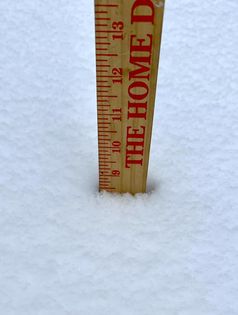
Photos
 |
 |
 |
 |
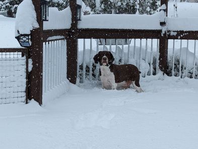
| Rebecca Selle - Cedarburg (Facebook) |
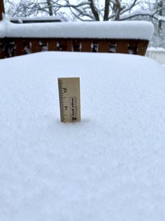
Michael Meyer - Waukesha (Facebook) |
Linda Lou - Fond du Lac (Facebook) |
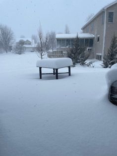
Jam Nado - New Berlin (Facebook) |
 |
 |
 |
 |
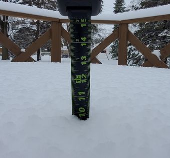
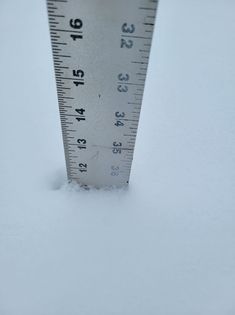
| Dan McKee - Watertown (Facebook) |
Dan Harrier - Deforest (Facebook) |
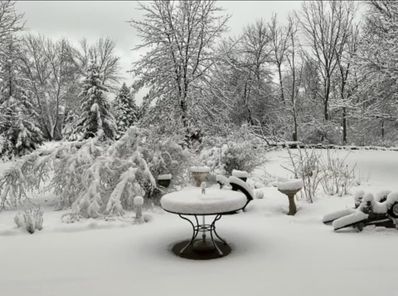
Bob Gates - Sun Prarie (Facebook) |
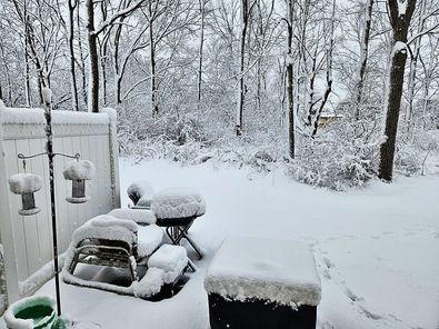
Amy Portelli Unbehaun - Middleton (Facebook) |
 |
 |
 |
|
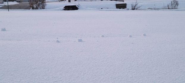
| Snow Rollers - Julie Meyer-Nigh, Sheboygan (Facebook) | Julie Wiemer Miller - Racine (Facebook) |
Kimberlee Allhands Dorst, Cottage Grove, (Facebook) |
 |
Media use of NWS Web News Stories is encouraged! Please acknowledge the NWS as the source of any news information accessed from this site. |
|