
Heat expands across the Desert Southwest, Plains, Mississippi Valley and Midwest into Monday. Fire weather concerns continue for portions of the Intermountain West. Active monsoonal moisture fuels thunderstorms over the Southwest with possible flash flooding. Tropical cyclone Fausto in the Pacific, should weaken as it approaches Hawaii; Dangerous surf, swells and rip currents are expected. Read More >
Milwaukee/Sullivan, WI
Weather Forecast Office
What's New?
Flood Inundation Maps are now available for 2 locations in Cedarburg in Ozaukee county in southeast Wisconsin: The Cedar Creek in Cedarburg and the Milwaukee River near Cedarburg. These interactive maps will help convey the impacts of flooding for local officials and property owners. Use it to answer questions like, " What roads may be impacted at 11 feet?" or "If the river reaches 12 feet, how may my property be affected?". This service is also available for parts of the Rock River and Fox River.
How You Find It
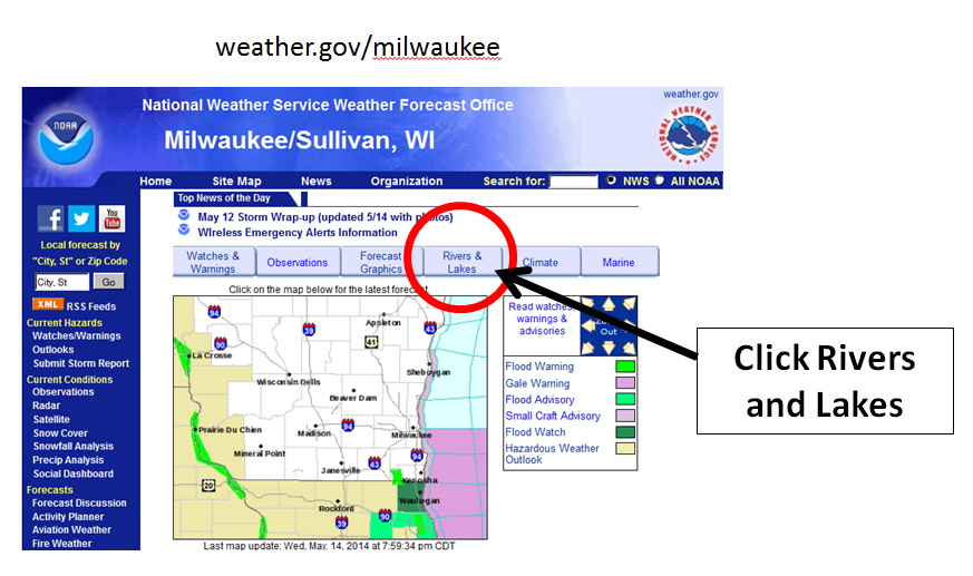
Go to our main webpage and Select the Rivers and Lakes tab:
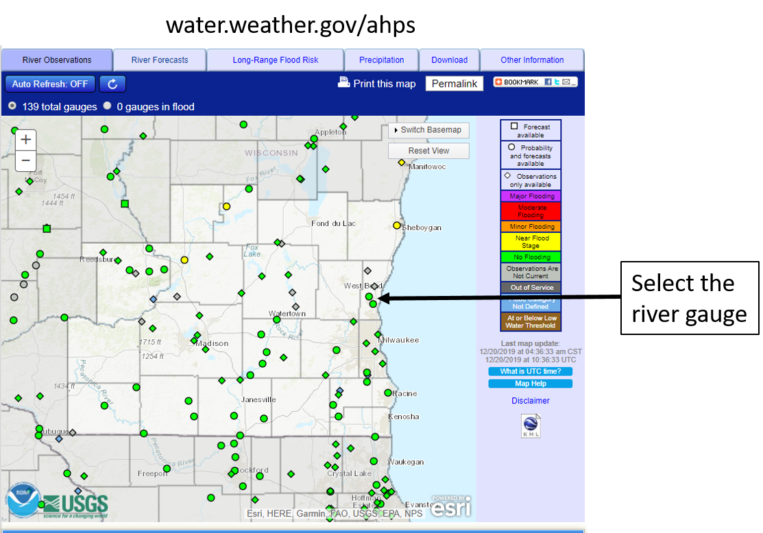
Then select the river gauge you are interested in:
View the observed and forecast river levels. River flooding impacts are listed below the graphic on the webpage.
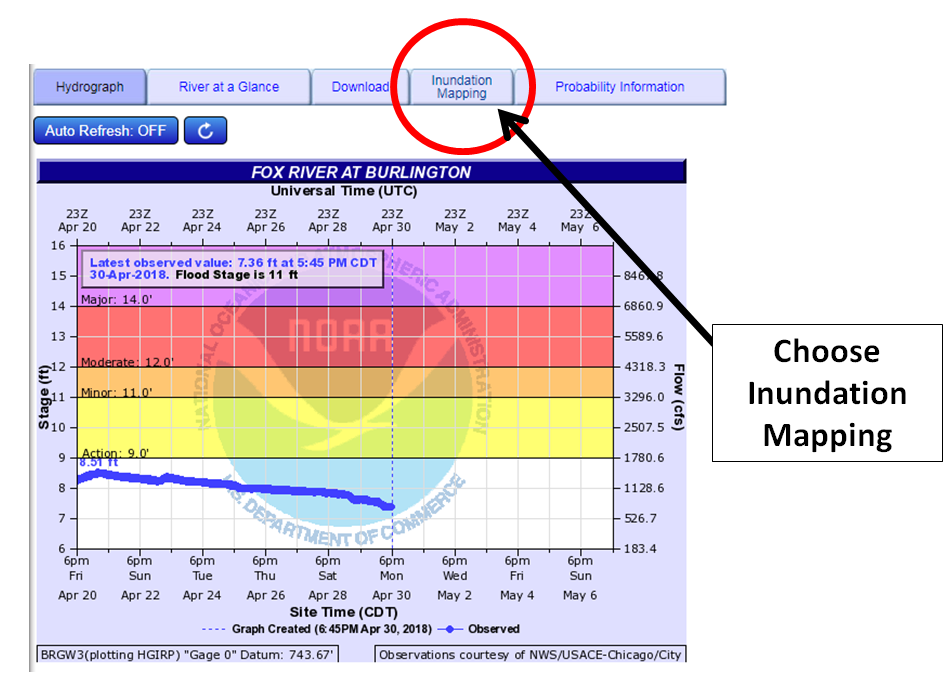
Then select Inundation Mapping to get to the interactive tool:
Note, below is not a current hydrograph - example only!
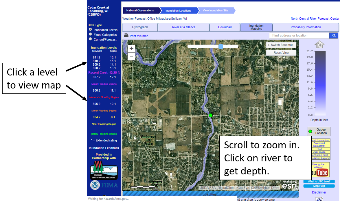
Click the map to zoom. Click on the river level on left to view inundation. Click the river to view approximate depth.
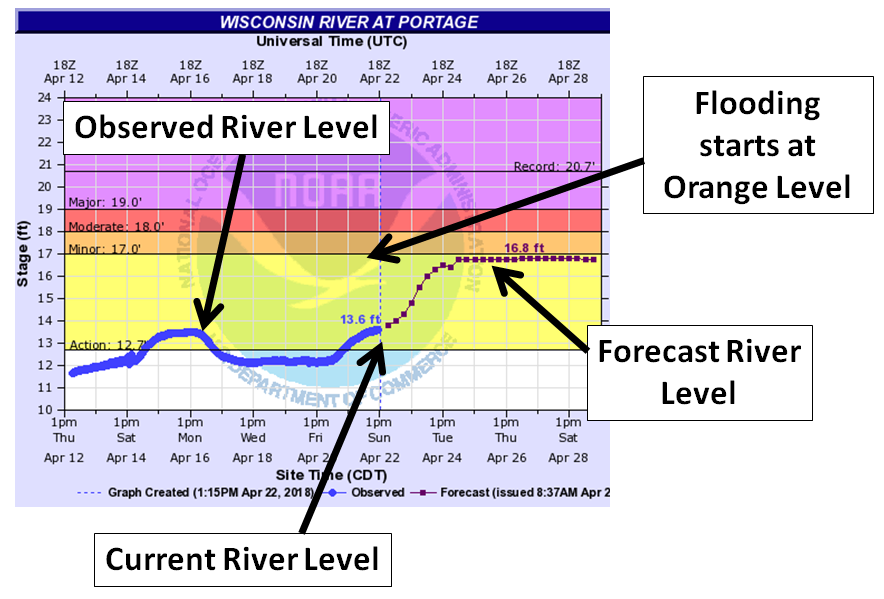
How Do You Interpret River Forecasts?
Note, below is not a current forecast - example only!
Contact sarah.marquardt@noaa.gov for questions or more information.
Hazards
National Briefing
Hazardous Weather Outlook
Skywarn
View Local Storm Reports
Submit A Storm Report
Winter Weather
Summer Weather
Beach Hazards
Local Forecasts
Marine
Aviation
Fire
Local Text Products
Local Precip Forecast
Hourly Forecast Graphics
Forecast Discussion
Climate
CoCoRaHS
Historic Events For Srn WI
Lightning Plot Archive
Daily Climate Graphics
Local Climate Products
Normals/Records MKE/MSN
US Dept of Commerce
National Oceanic and Atmospheric Administration
National Weather Service
Milwaukee/Sullivan, WI
N3533 Hardscrabble Road
Dousman, WI 53118
262-965-2074
Comments? Questions? Please Contact Us.

