
Arctic air lingers for the east, however, winds will slowly subside and a slow moderating trend starts during the week. Moisture continues to provide rainfall and higher elevation snow for the Pacific Northwest, northern California and northern Rockies through Monday. For the State of Hawaii, dangerous surf conditions with strong winds and heavy rainfall will impact the islands through Monday. Read More >

 |
|
 |
|
Table of Contents: |
|

.PNG)
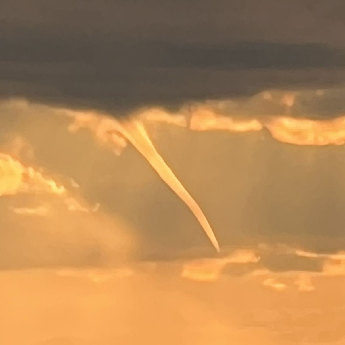
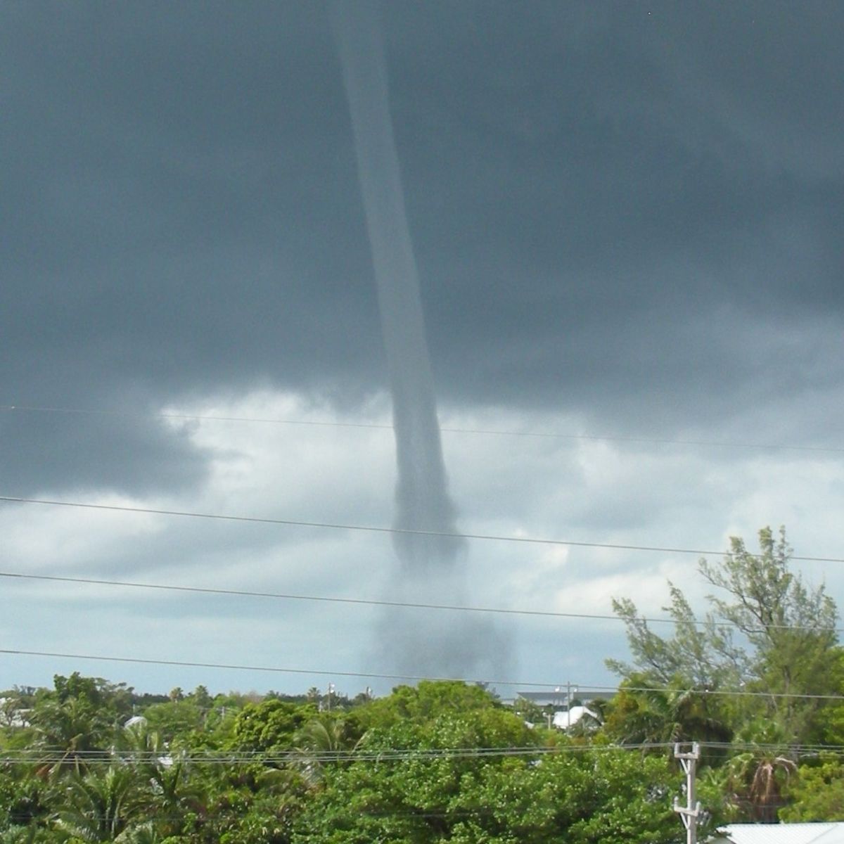
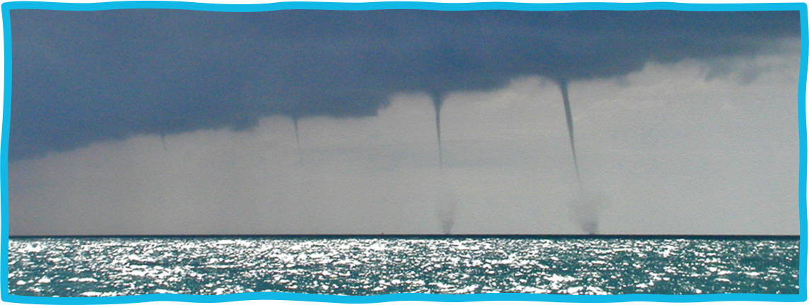
Waterspouts are tornadoes over water, and they are very common in the Florida Keys. They range in size and shape, with only a portion of the waterspout being visible, more often than not. Mature waterspouts will feature a spray ring on the surface of the water, which indicates that wind speeds exceed 40 knots (46 mph) based on U.S. Navy research. There are two types of waterspouts: supercell and non-supercell. This website will focus on non-supercell waterspouts, as they are the most common type observed in the Keys.
.png)
Supercell waterspouts:
Non-supercell waterspouts:
.PNG)
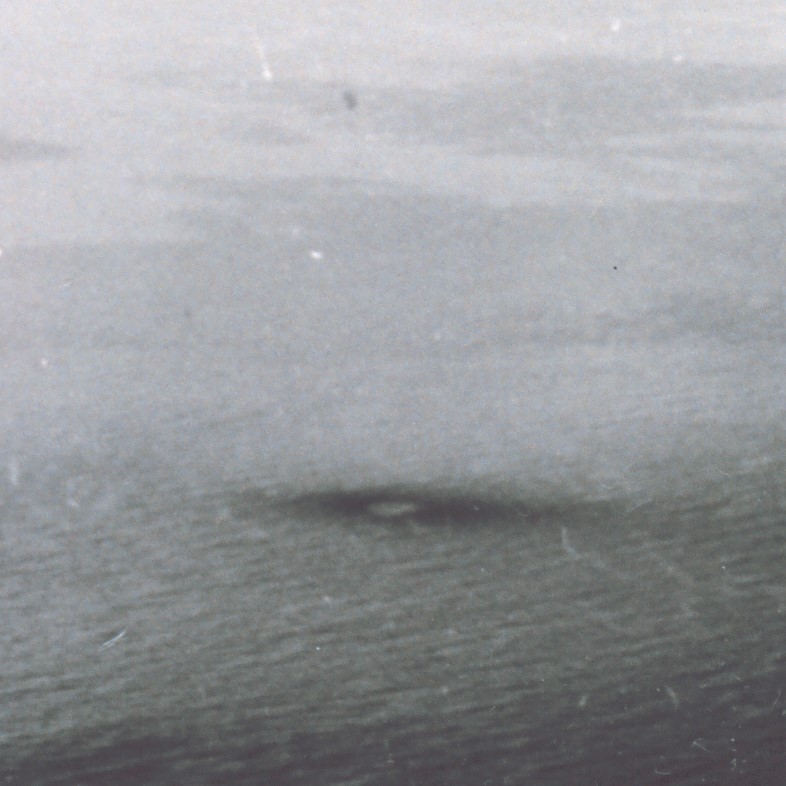
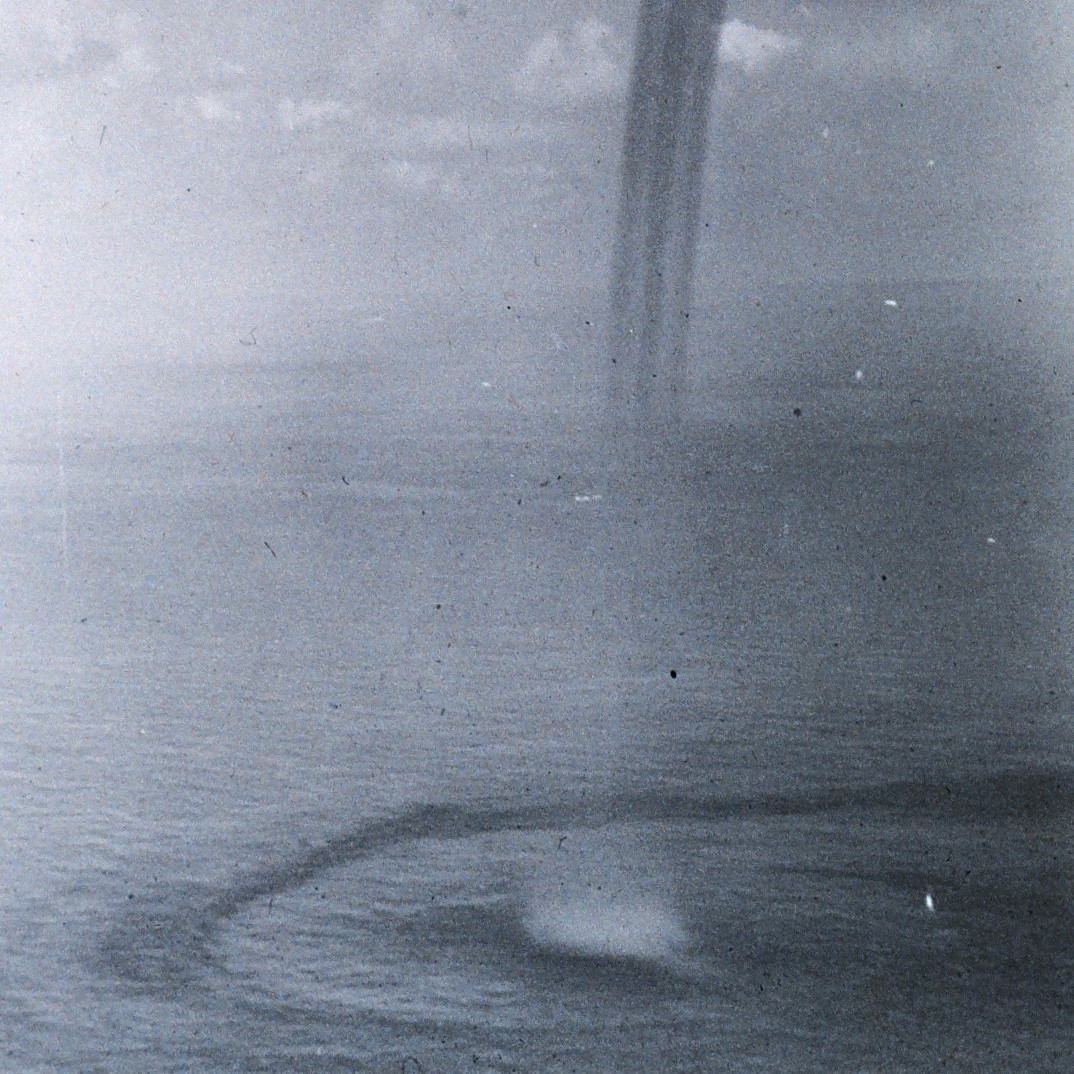
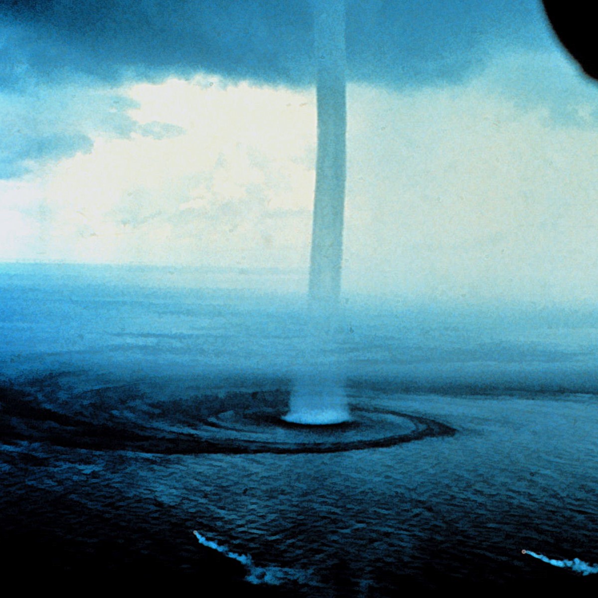
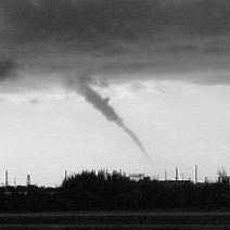
Waterspouts undergo a regular lifecycle, composed of five overlapping stages:
 |
 |
 |
 |
 |
|
Stage 1: |
Stage 2: |
Stage 3: |
Stage 4: |
Stage 5: |
| Dark Spot | Spiral Pattern | Spray Ring | Mature Waterspout | Decay |
Photos of the waterspout lifecycle. Credit: Stages 1-4, 1969 Lower Keys Waterspout Project; Stage 5, Chip Kasper
1) Dark Spot Stage
- Prominent light-colored disc on the sea surface surrounded by a dark patch
- Diffuse on the outer edges
- Typically only visible from above
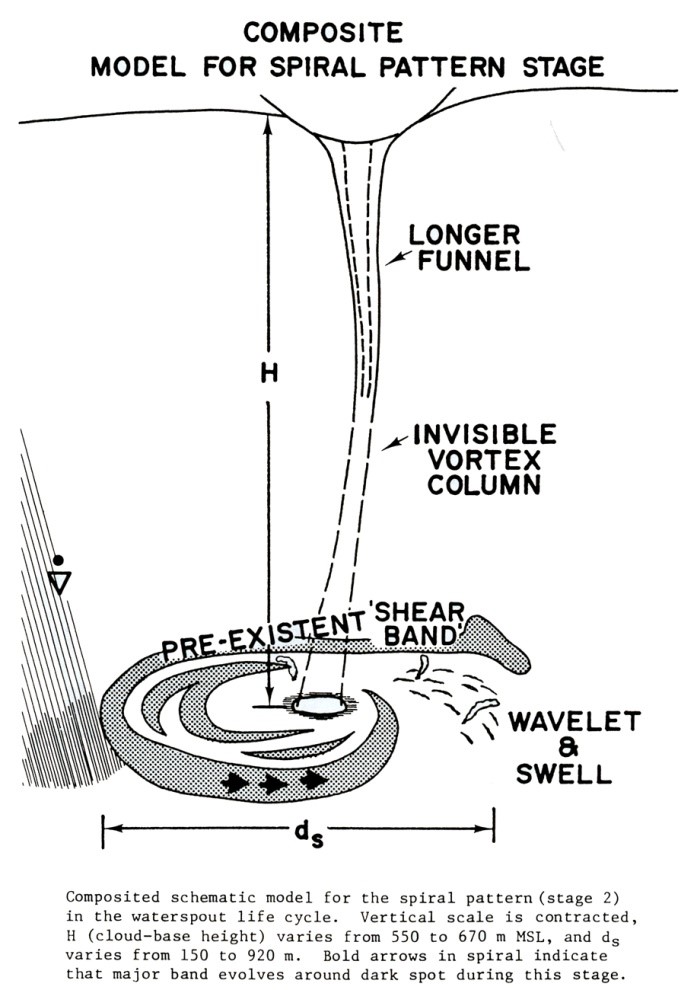
2) Spiral Pattern Stage
- Primary growth phase of the waterspout
- Development of alternating dark- and light-colored bands spiraling around the dark spot on the sea surface
- Best viewed from above
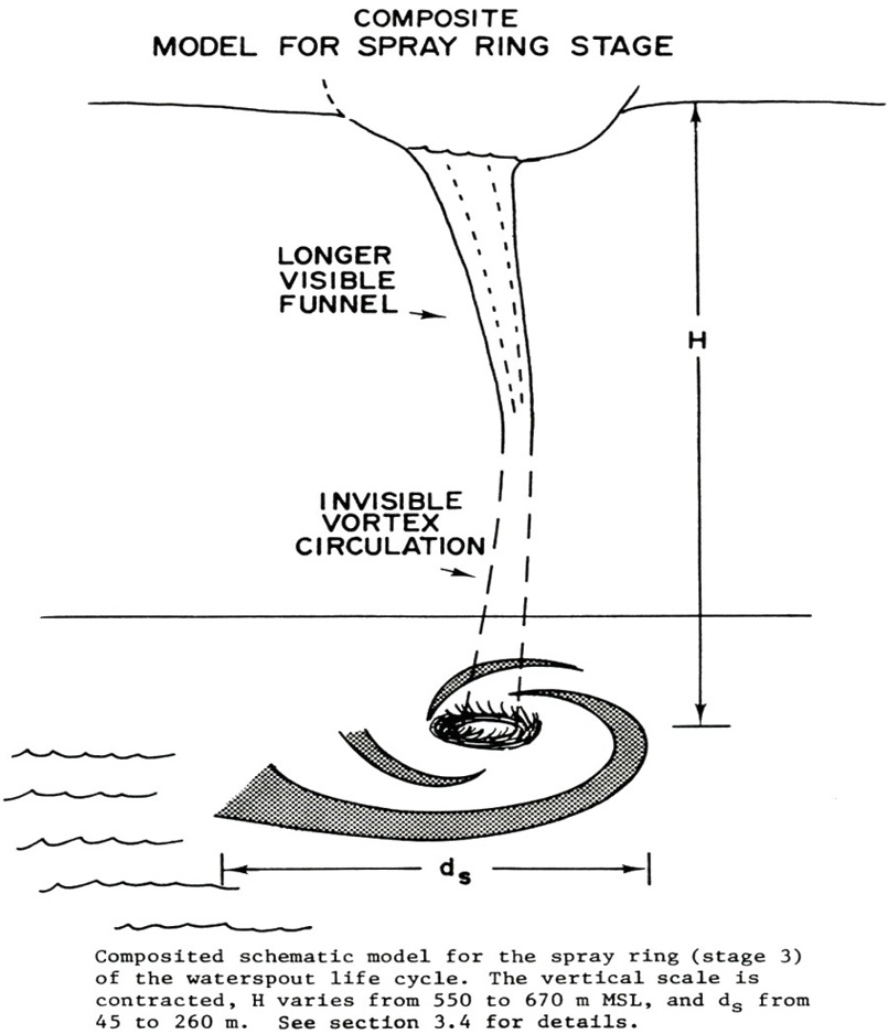
3) Spray Ring Stage
- Spray ring is visible around the dark spot
- Lengthening condensation cloud or funnel visible from the parent cloud base
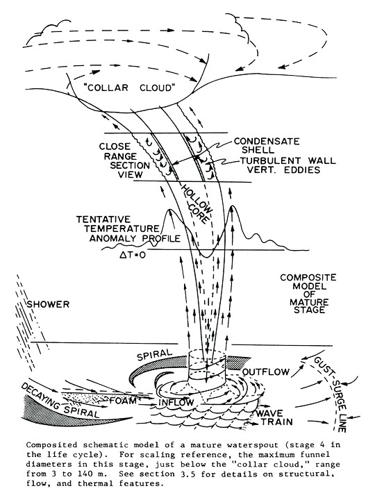
4) Mature Waterspout Stage
- Spray ring of maximum intensity and organization
- Maximum condensation cloud/funnel length and diameter
- Gradual weakening of spiral pattern
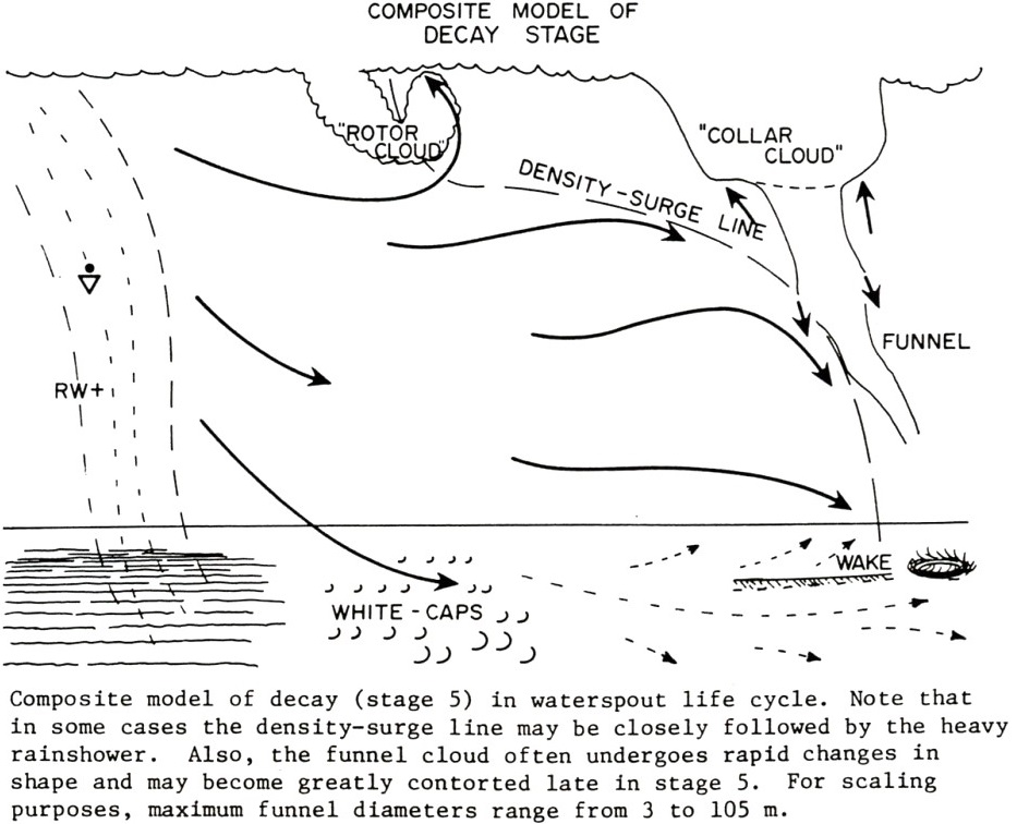
5) Decay Stage
- Cool downdrafts from nearby rain showers can undercut the buoyancy and the vertical heat and moisture gradient
- Waterspout interacts with land
- Waterspouts often dissipate abruptly
- Most common appearance of the decay stage is a very tilted waterspout
Reviewing Local Storm Reports (LSR) issued by the Florida Keys NWS from May 2006 through September 2024, 70% of waterspouts reported had a duration of 5-15 minutes. Aircraft and surface observations from the 1969 Lower Keys Waterspout Project indicated a strong correlation between waterspout size and duration, with larger waterspouts lasting longer.
.png)
Non-supercell waterspouts form when heating of the surface or convergent wind flow leads to the vertical development of a parent cloud. This process involves vorticity, or a rotating motion, near the surface that extends vertically or, if horizontal, is tilted and then stretched vertically. This is an important distinction between the two types of waterspouts, as the non-supercell variety form from the surface of the water upwards, while the supercell variety extend downward from the parent cloud.
Waterspouts of the non-supercell variety are most often associated with cloud lines along or near the Florida Keys island chain. A cloud line is formed as the heating of the islands generates warm air that rises. This rising motion, or lift, in turn can create cumulus clouds, given sufficient moisture in the atmosphere. If there is little wind shear (differing wind speeds or direction with height) then the updrafts can form and eventually result in a towering cumulus or cumulonimbus cloud. Waterspouts commonly form beneath these types of clouds when they have flat, smooth bases.
One thing to keep in mind is that while generally light winds are what help foster a waterspout-friendly environment, the cloud line needs to be a little displaced from the island chain so that it is over the warm waters of the Keys where there is less friction. Thus, calm days provide a slightly lower chance for waterspout formation.
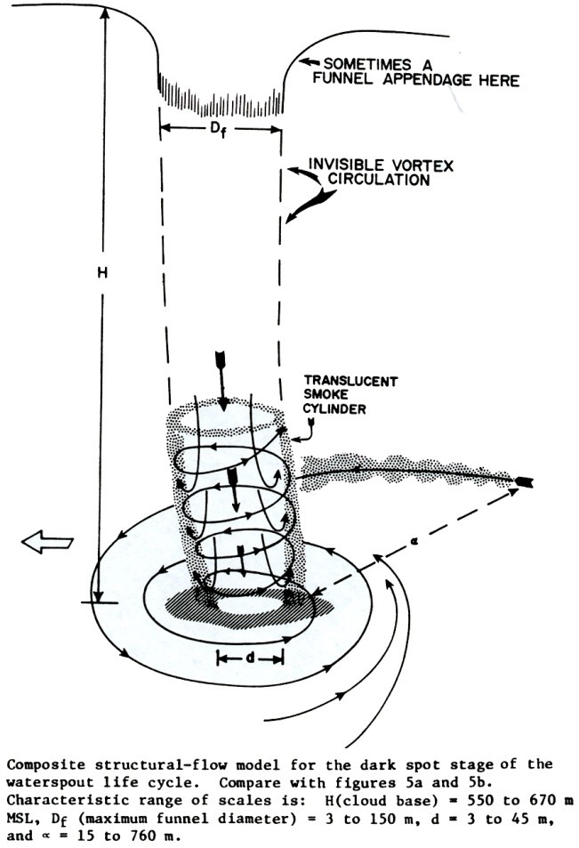
The below diagrams provide a little more information on the stages of waterspout structure and formation.
 |
 |
 |
 |
 |
| Stage 1: | Stage 2: | Stage 3: | Stage 4: | Stage 5: |
| Dark Spot | Spiral Pattern | Spray Ring | Mature Waterspout | Decay |
Diagrams of the waterspout lifecycle, 1969 Lower Keys Waterspout Project
The two photos below are examples of cloud lines observed near the Lower Keys. In the second photo, the shower from the towering cumulus is visible toward the end of the cloud line.
Cloud line seen from the Key West Lighthouse. Credit: Nancy Barnhardt
Cloud line seen from Mallory Square. Credit: Nancy Barnhardt
This example of a waterspout, appearing as a tilted funnel cloud, was associated with a cloud line over the Lower Keys and Key West. Note the heavy shower on the left side of the picture; rain shafts that develop near waterspouts introduce cold downdrafts to the area and tend to disrupt a waterspout's ability to maintain structure. In this case, it is also leading to the sharply-tilted angle of the waterspout.
Cloud line shower and waterspout funnel cloud. Credit: Florida Keys NWS
.PNG)
The observed diameters of waterspouts average around 39 meters (128 feet), with diameters as small as 3 meters (10 feet) and as large as 105 meters (345 feet). Unfortunately, with the average WSR-88D beam width of 280 meters (918 feet) non-supercell waterspouts are not detected by NWS radars. Supercell waterspouts are typically larger and can be detected by radar.
.PNG)
During the 1969 Lower Keys Waterspout Project, the maximum rotational wind speeds observed were 165 knots (190 mph). The average outer wall wind speeds of three large, mature waterspouts was observed to be 52 knots (60 mph). Maximum wind speeds observed from aircraft Doppler Lidar measurements were 64 knots (74 mph). The overall average wind speed during this project was 27 knots (31 mph).
It's important to note that once a spray ring is present, the wind speeds are over 40 knots (46 mph). Winds of this strength are hazardous to small vessels and should always be avoided when possible.
.PNG)
Movement of waterspouts is dependent on the average wind speed and direction associated with the parent cloud. Non-supercell waterspouts generally move on the order of 10-15 knots (12-17 mph), but can also be nearly stationary on days with very light winds.
.png)
During the 1969 Lower Keys Waterspout Project, around 400 waterspouts were documented. Observations from the Key West International Airport since the late 1950s indicate that anywhere from 20 to 70 form each year. Data from 1958-2001 indicate that most waterspouts have occurred between June and September and that most of the non-supercell ones during this period occurred between 11 AM and 8 PM.
Looking at LSRs issued by the Florida Keys NWS between May 2006 and September 2024, most waterspouts have been observed between May and September, accounting for 75% of the waterspouts reported. In terms of hourly activity, 68% of waterspouts have been observed between 12 PM and 8 PM, with 45% of them occurring between 12 PM and 5 PM. As of September 2024, there are only 121 days of the year with no waterspout reported, and only 4 days with none reported from May through September.
Waterspouts have been reported in every month of the year in the Florida Keys. Dry Season (November-April) vortices are often associated with supercells or bow echoes. Wet season (May-October) vortices are typically of the non-supercell variety and are associated with cloud lines or convection occurring over outflow boundary collisions.
Dating back to May 2006, there have been 1,068 waterspout reports received by the Florida Keys NWS, for over 1,400 waterspouts. The map below shows the locations of these reports from May 2006 to September 2024.
Notes: Some of these report locations include multiple waterspouts. The appearance that they are most common close to the island chain is a result of these reports being based off visual confirmation, so the locations are heavily skewed toward land-based areas.
Waterspout LSRs issued by the Florida Keys NWS from May 2006 to September 2024. Credit: Florida Keys NWS
The map below shows the locations of waterspout reports from May 2006 to September 2024, with the size and color of the dot corresponding to the number of waterspouts included in the report. The highest number recorded for a single report was 14 waterspouts. These 14 waterspouts occurred during an outbreak near Key West, visible from the Florida Keys NWS, on March 28th, 2017 between 1:13-2:30 PM EST. Another report of 12 waterspouts occurred during an outbreak near Key West on November 4th, 2022 between 4:58-6:08 PM EDT. Two additional waterspouts were observed around 6:38 PM EDT that same evening, near the Harbor Keys, bringing the total for the day to 14.
Waterspout(s) reported to the Florida Keys NWS from May 2006 to September 2024. Credit: Florida Keys NWS
The interactive map below shows the location of waterspout LSRs issued by the Florida Keys NWS. Clicking on a waterspout icon will pull up the text details of that report. Note: the latitude/longitude of report locations only extend 2 decimal points, which is why some report locations may be over land.
Interactive map of waterspout LSRs issued by the Florida Keys NWS from May 2006 to September 2024. Credit: Florida Keys NWS
.png)
Waterspouts do pose a hazard to mariners and even those on land when they come ashore. The winds associated with waterspouts have resulted in damage to vessels, especially sails and rigging. They have also been known to damage docks, trees/foliage, patio furniture/grills, and even A/C compressors and roofs once onshore.
Mariners that encounter a waterspout should move at a 90° angle from its apparent motion to put as much distance between their vessel and the waterspout as possible.
Below are a couple of photos from a waterspout that moved ashore in the Silver Shores community of Key Largo in 2022.
Damage to a dock, palm tree, and outdoor furniture following a waterspout moving onshore in Key Largo. Credit: Jerry Baker
.PNG)
See A Spout, Give Us A Shout!
"See A Spout... Give Us A Shout!" waterspout awareness campaign sign, Florida Keys NWS
.png)
This is a collection of waterspout photos from around the Florida Keys.
|
Credit: Unknown |
Credit: E J Quinby |
Credit: Eric Anderson |
|
Credit: James Christopher |
Credit: Jason Harding |
Credit: Stu Ostro |
|
Credit: Lauren Carpenter-Rennicks |
Credit: Eva Jensen |
Credit: Charlie Coffman |
|
Credit: Nancy Barnhardt |
Credit: Jerry Baker |
Credit: Deputy Lazaro Valdes |
|
Credit: David Ross |
Credit: David Ross |
Credit: Fitz |
|
Credit: Herschel Coger |
Credit: Andy Devanas |
Credit: Debbie Toppino |
|
Credit: Kathy McFadden |
||
|
Credit: Lt. Jeff Shoup |
Credit: Unknown |
Credit: Charles Anderson |
|
Credit: Unknown |
Credit: Unknown |
Credit: Unknown |
|
Credit: Casey Moll |
Credit: Matthew Strahan |
Credit: Unknown |
|
Credit: Billy Wagner |
Credit: Unknown |
Credit: Unknown via Key West Citizen |
|
Credit: Unknown |
Credit: Brenda Boskind |
Credit: Brenda Boskind |