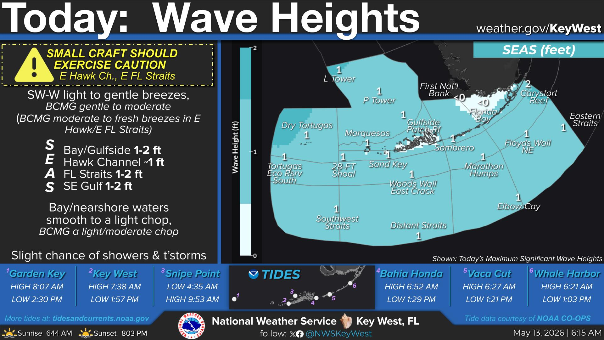
National Weather Service United States Department of Commerce
Click a location below for detailed forecast.

Last Map Update: Fri, Aug 15, 2025 at 1:58:13 pm EDT

Very warm summer conditions for the remainder of the week in the Florida Keys! Remember to stay hydrated and take cooldown breaks when performing work or activities outdoors!
TODAY...Mostly sunny with a chance of showers and a slight chance of thunderstorms. Highs in the lower 90s. Variable winds near 5 mph early, becoming west to northwest and increasing to 5 to 10 mph. Chance of rain 30 percent.
TODAY:
N&W of Island Chain: Variable winds 5-10 kts early, becoming W-NW & incr to 10-15 kts. Nearshore and Bay waters smooth to a light chop, becoming a light to moderate chop. Seas around 1 foot, building to 1 to 2 feet. Scattered showers and isolated thunderstorms.
S&E of Island Chain: Variable winds 5-10 kts early, becoming W-NW 10 to 15 kts. Nearshore waters S of the Island Chain, smooth to a light chop, becoming a light to moderate chop. Seas around 1 foot, building to 1-2 ft,. except bldg to 2-3 ft across the E Straits from N swell. Scattered showers and isolated thunderstorms.


Text Product Selector
(Selected product opens in a new window) 


Sunrise & Sunset

Sunrise & Sunset


Moon Rise & Set

Moon Rise & Set


Moon Illumination

Moon Illumination


Tide Information

Tide Information


Tropical

Tropical


Coastal Flooding

Coastal Flooding


Tallship

Marine


Nearshore Waves

Wave Prediction


Thumbnail for a local waterspouts website, showing 4 waterspouts.

Waterspouts


Airplane

Aviation


Key West & Marathon Climographs 2020

Climographs


Tropical

Forecast Discussion


NOAA Weather Radio

NOAA Weather Radio