Heavy rainfall capable of causing flash flooding will continue to impact Hawaii through Monday. Severe thunderstorms and heavy rain are possible in parts of Texas and the southern Plains and the Upper Great Lakes. Heavy mountain snow continues in California's Sierra Nevada and rain with gusty winds to lower elevations. Super Typhoon Sinlaku will impact the Marianas through midweek. Read More >
Low Clouds
Type 1 (cumulus of little vertical extent):
Cumulus clouds are very common, especially in warm and moist climates. In the Keys, cumulus clouds are usually based between 1,500 feet and 3,500 feet above ground, and can occur at any time of year. Type 1 cumulus clouds are flat and thin in appearance, and indicate that the air that is rising to form them is not able to rise very far. Most of the time this is because there is insufficient heating/lifting or moisture to cause deeper (taller) cloud development. These clouds are too thin to produce rain, lightning, or waterspouts.
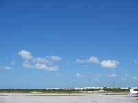

Type 2 (cumulus of moderate/strong vertical extent, or towering cumulus [TCU]):
Type 2 cumulus are formed by the same processes as type 1, except that there is a deeper layer in which heating/lifting and moisture are sufficient to promote cloud development, and thus the resulting clouds are taller. In the Keys, type 2 cumulus can occur at any time of year, and are very common in the Summer. When a cumulus cloud is much taller than it is wide, it is often called a towering cumulus (TCU) cloud. The taller these clouds are, the more likely they are to produce showers, and sometimes waterspouts. A TCU producing a shower is shown in the third picture below.


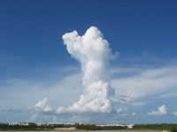
Type 3 (cumulonimbus [CB] whose tops are not fibrous or in the form of an anvil):
Cumulonimbus (CB) clouds are very large, tall, billowing cumulus clouds, sometimes referred to as thunderheads. They often produce lightning, thunder, rain, sometimes waterspouts, and on rare occasions severe weather such as hail, high winds, or tornadoes. In the Keys, CB can occur at any time of year, but are much more common in the Summer months (June through September) than the Winter months (December through February), because they usually need a very deep layer of warm, moist, rising air in order to form. CB can occur in Summer under a wide variety of conditions, but in the Winter are usually caused by cold fronts moving into warm, humid air. In the Keys, CB are usually based less than 2,000 feet above ground in the Summer, and sometimes slightly higher in the Winter. Type 3 CB are generally puffy and billowy on top, sometimes resembling the head of a cauliflower.
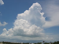
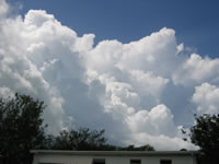

Type 4 (stratocumulus [SC] formed by the spreading/flattening of cumulus):
Stratocumulus (SC) clouds can form at any time of year in the Keys, and under a variety of conditions, but are most common during Winter and Spring. They are not as puffy or sharp-edged as cumulus clouds, and tend to form in more relatively continuous layers. Type 4 SC form when cumulus clouds flatten and spread out. Sometimes this happens because the heating/lifting that produced the cumulus has lessened, but the atmosphere is moist enough that the clouds change character rather than dissipating.
Type 5 (SC not formed by the spreading/flattening of cumulus):
Type 5 SC often appear as a fairly continuous sheet or layer of large, flat, round cloud elements (as in the first two pictures below). At other times, they appear as low scraps or lumps of cloud (as in the third picture below). The former are usually based between 4,000 and 6,500 feet above ground, while the latter are usually based between 1,000 and 2,000 feet above ground. Extensive layers of flat stratocumulus (as in the first picture below) are common behind cold fronts in the Winter months, but in general the presence of stratocumulus clouds does not give any significant indication of impending weather conditions.



Type 6 (stratus in a fairly continuous sheet and/or layer):
Stratus clouds are diffuse, generally grey and shapeless, and very low (based less than 1,500 feet above ground). They usually form in a relatively continuous layer, and often look like a fog bank based above the surface. In the Keys, these clouds occur almost exclusively in the Winter, because they usually result from cold air passing over relatively warm water, which happens behind sharp cold fronts. Thus, type 6 stratus generally indicate that colder air is moving into the area.
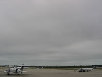
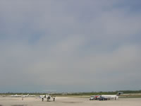
Type 7 (stratus fractus or cumulus fractus of bad weather):
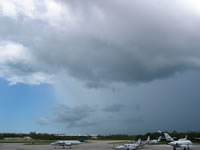
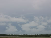
Fractus clouds are small and ragged, and very low (usually based less than 1,500 feet above ground). They appear as small, broken pieces of cloud, sometimes like wisps of cotton candy, and individual fractus clouds can form and dissipate very rapidly. Type 7 stratus or cumulus fractus often form near the edges of showers and thunderstorms (as in the first picture below), and/or behind a storm after the rain has passed (as in the second picture below). They are most common in the warm and humid Summer months, and usually indicate that it is raining nearby.
Type 8 (cumulus and SC not formed by the spreading/flattening of cumulus, based at different levels):
Sometimes cumulus clouds (usually type 1 or type 2) form beneath previously existing type 5 SC, resulting in a mix of different clouds. This combination is classified as type 8 low clouds, which can occur year-round in the Keys, but are most common in the Spring and early Summer.


Type 9 (CB with fibrous or anvil-shaped tops):
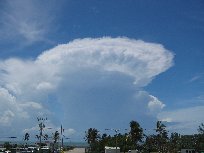
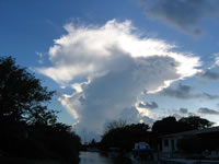
Type 9 CB are virtually identical to type 3 CB, except that their tops are flat and wispy or fibrous, often in the shape of an anvil cloud.
