
Bitter cold temperatures and dangerous wind chills will persist from Florida to the Northeast through Monday. Daily record low temperatures are forecast across the Southeast and Florida, with some all-time February low temperature records possible across Florida. An Alberta clipper will spread wintry precipitation across the Northern Plains today and into the upper Great Lakes into tonight. Read More >
Last week, several members of the NWS Jackson Weather Service Office visited the US Forest Service at the Red River Gorge and met with two of the rangers. The goal of this visit was to better understand the flash flooding problems they face, mainly along Indian Creek. We had many good discussions with the park rangers through the course of our visit, including ways in which we can better serve their needs and keep the campers safe in the threat of flash flooding.
Indian Creek is a tributary which runs into the Red River and crosses through portions of both Powell and Menifee Counties. While there are no defined camp grounds along the creek, campers are invited to camp anywhere they find a spot, as long as they have purchased a tag at one of the visitor centers or local convenience stores. It is a very remote area, but more than 200 campers can be found here on the busiest holiday weekends.
-Click here for more information about the area-
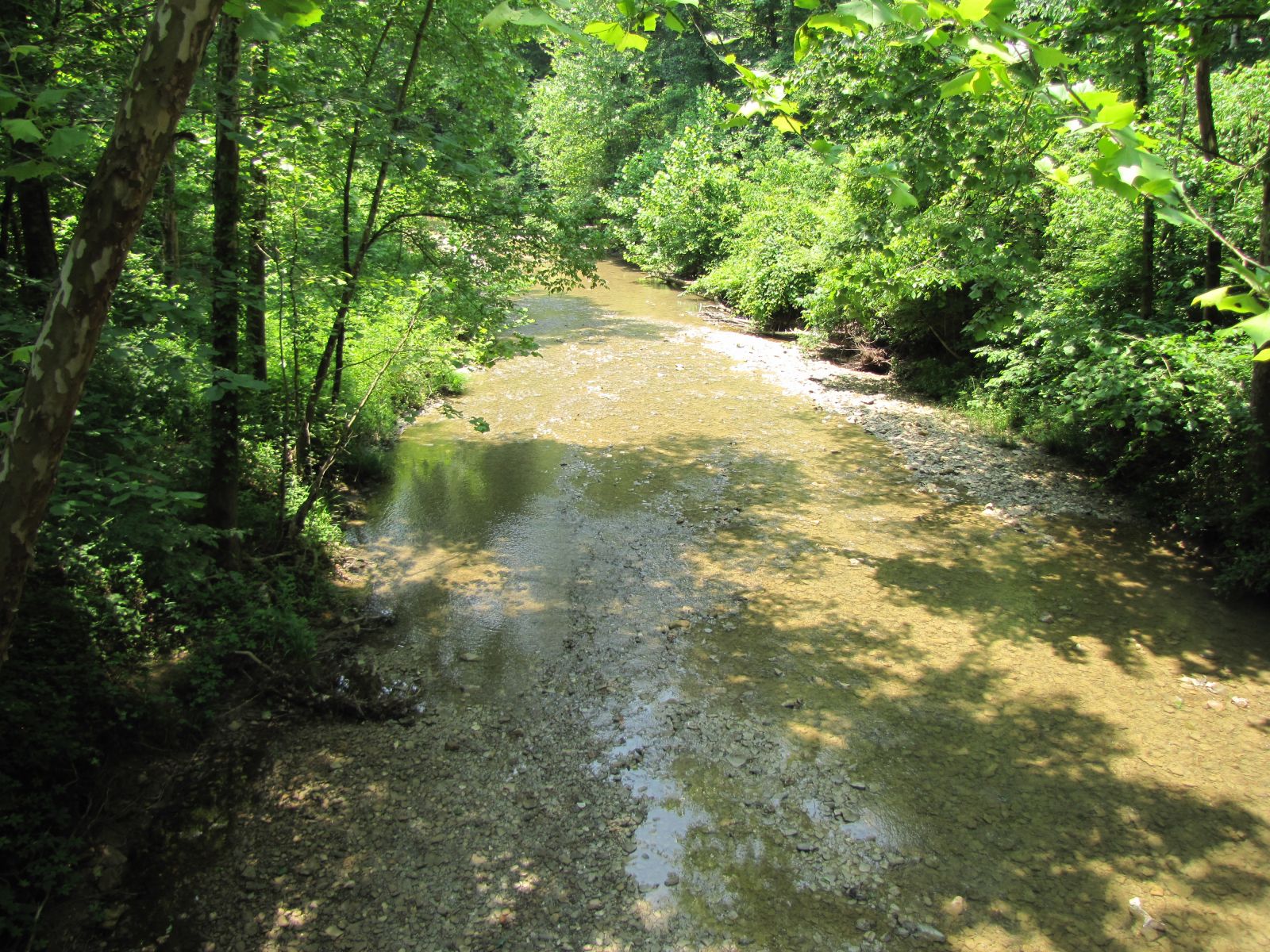
Several problems were quickly brought to our attention by the rangers with concerns to flash flooding in this area. First, as can be seen in the pictures, Indian Creek is a relatively small and narrow creek, surrounded by steep and wooded terrain. This leaves the flat lands right along the creek as the only places to set up camp. In heavy rain/flash flooding situations, this creek can quickly rise, putting campers in imminent danger. Unfortunately, the majority of campers are not equipped with flash flood safety information or weather radios, and there is no cell phone coverage in this area. In other words, there is no way, in many cases, to warn the campers of the impeding dangers of the quickly rising waters, especially if the flash flood occurs at night. The only thing these campers can do is get out or climb to higher ground. Also you will notice in these pictures that the creek is currently quite low (given the dry conditions we've had over the last month). This exposes the creek bed, and lets many campers easily cross the creek and camp and/or fish on the other side (as can be seen in the bottom right picture). However, if the waters rise, especially if they rise quickly and catch the campers off-guard, they can become trapped with no way to get back to the road on the other side and head to safety.
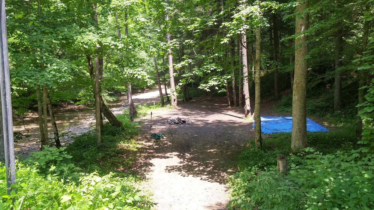
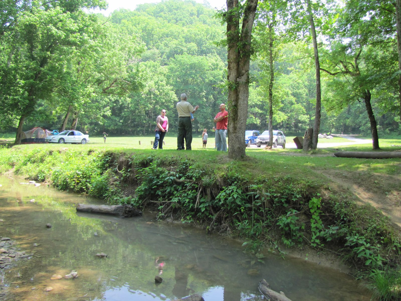
This next set of pictures is from one of the largest open areas along Indian Creek, and is the site for several annual activities for the Red River Gorge. This campsite is located downstream of the headwaters and closer to the intersection with the Red River. According to the rangers, during the extensive flooding this past March, the creek rose above the bank (which is between 3 and 5 feet high in most places), over the brown trash bins, covered the field, and made it all the way to the road. The rangers didn't think it had actually run across the road in this location. However, in order for the water to even make it up to the road, the creek would have had to rise at least 5 to 7 feet! (And that is probably a low estimate). Water did make it over the road in several other locations upstream, making it impassable and campsites inaccessible.
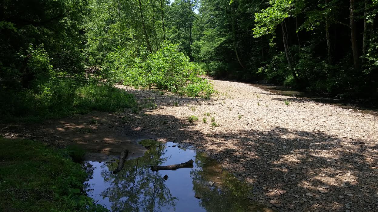
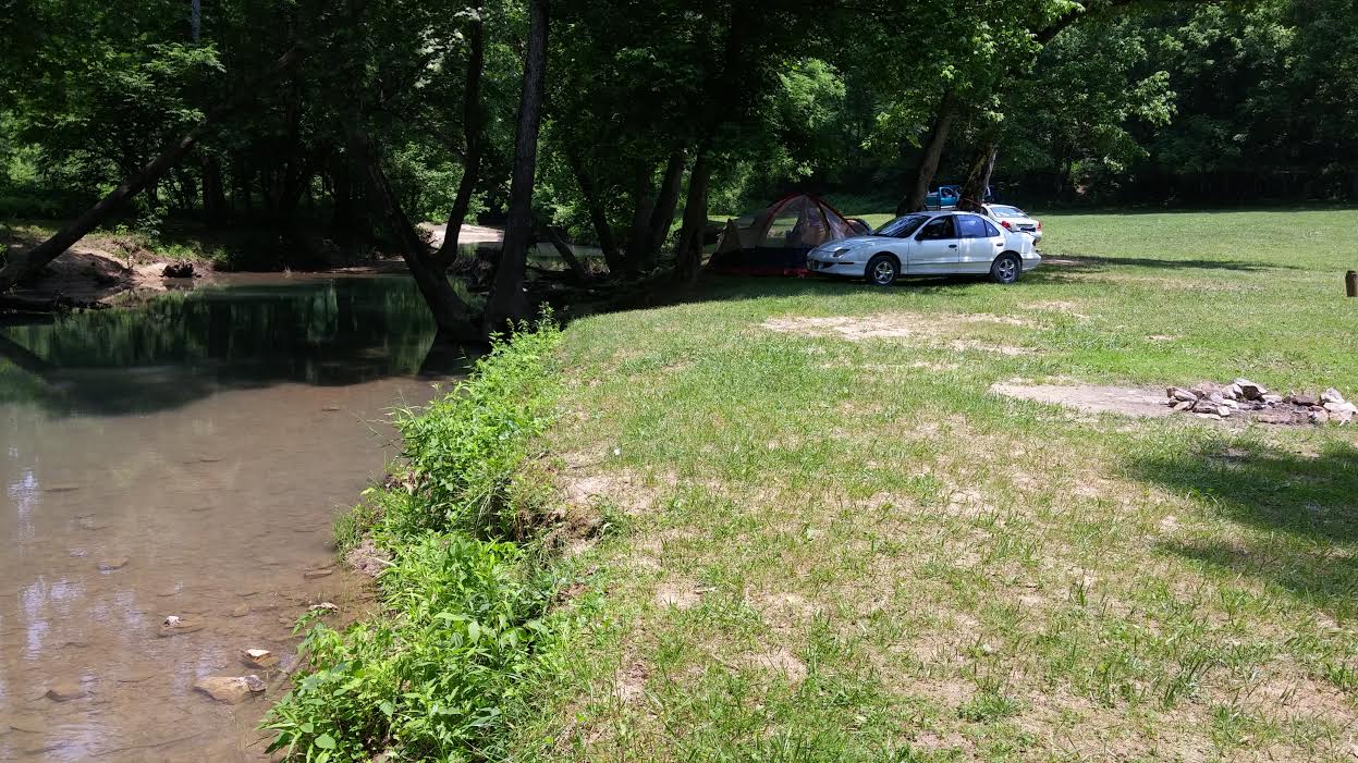
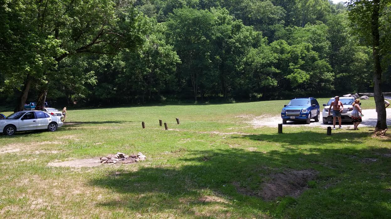
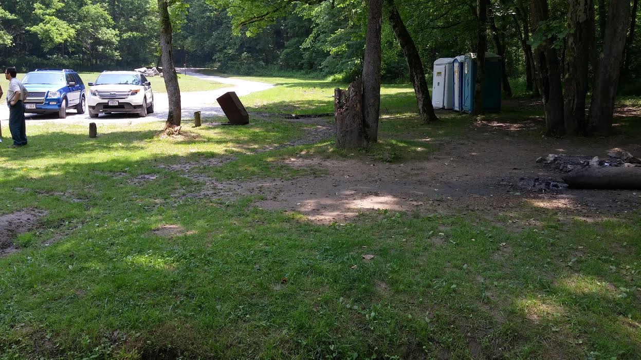
While there is a sign or two posted around the area warning campers about flash flood dangers, the one sign that we passed was quite small, and would require the driver to have to literally stop and get outside of their car to read the small print. The rangers told us that they are in need of new signs but were trying to decide where to best place the signs so that campers would see them. Pete, one of our lead forecasters here at Jackson, suggested they place the signs on the trash bins, since nearly all the campers will need to use these bins throughout their stay, and are scattered all along Indian Creek.
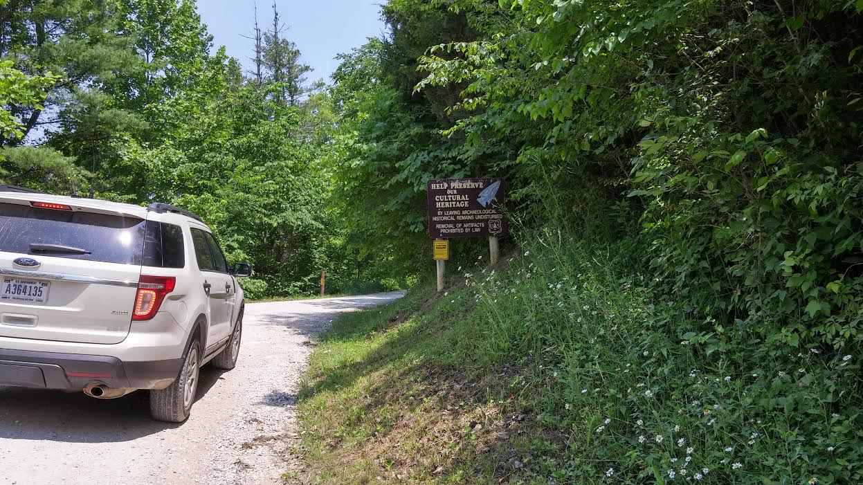
So if you are planning a camping trip to the Indian Creek area (or anywhere else for that matter), here are some tips we would like to pass along...
First, since cell phone reception is not reliable, we would strongly suggest that campers purchase a battery operated weather radio! There are multiple companies which produce these weather radios, and you can purchase them at many retailers, including Wal-Mart, Lowes, and Amazon. By just googling "Where to buy a handheld weather radio?", a large amount of vendors and radio brands came up in the search results.
Next, we recommend that you be aware of the forecast! Check to see if any heavy rains are expected during your stay. Regardless of where you buy your camping tags, take the time to stop by the visitor's center. The Gladie Cultural-Environmental Learning Center is just a short drive down the road from Indian Creek, and always has our current weather forecast posted as soon as you walk in the door. The rangers working will also be on alert for any heavy rain that might affect the area and can pass along this information to you. You can also visit our website (if using a smart phone use this link instead), or call to listen to the latest forecast using the phone number (606)-666-8000. We also talked with the rangers about producing some flash flood safety brochures which can be handed out to the campers at the visitor's centers. Eventually we would also like to be able to distribute these brochures to the local convenience stores as well, so that they are available if campers are choosing to buy their tags at these locations instead.
And last, we ask that you have a plan! We encourage taking advantage of this beautiful area, but make sure you know how to keep yourself safe in the case of a catastrophic event. Be situationally aware and ready to quickly exit if needed. Study a map and make sure you know which roads to take and where to seek shelter (this is also true in the event of severe weather). The road along Indian Creek has only one way in and out, so you pretty much have two options: Get to your car and drive back the way you came in towards the main roads (though NEVER drive across flooded roads), or second, start climbing up the hillside. (We recommend the first option if you can help it!)
We would like to extend a big THANK YOU to the USFS rangers for taking the time out of their day to drive around with us and share their thoughts and concerns. It is visits like this that help our office to become more situationally aware of the potential hazards in our area, as well as how to address the needs of those we serve. We were very excited to see how involved the rangers were with these efforts, and their desire to build a working relationship with the National Weather Service.