Heat expands across the Desert Southwest, Plains, Mississippi Valley and Midwest into Monday. Fire weather concerns continue for portions of the Intermountain West. Active monsoonal moisture fuels thunderstorms over the Southwest with possible flash flooding. Tropical cyclone Fausto in the Pacific, should weaken as it approaches Hawaii; Dangerous surf, swells and rip currents are expected. Read More >
Jackson, KY
Weather Forecast Office
Overview
|
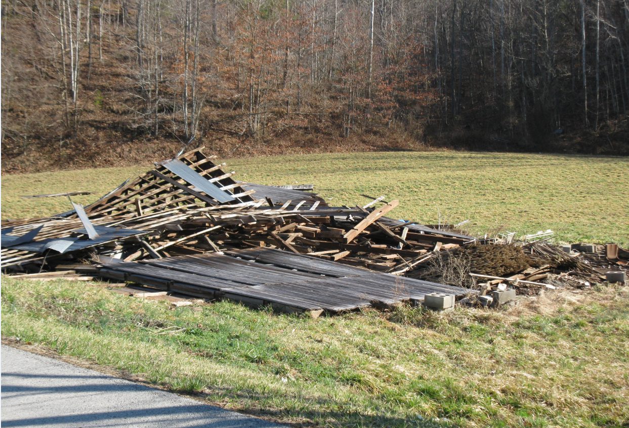
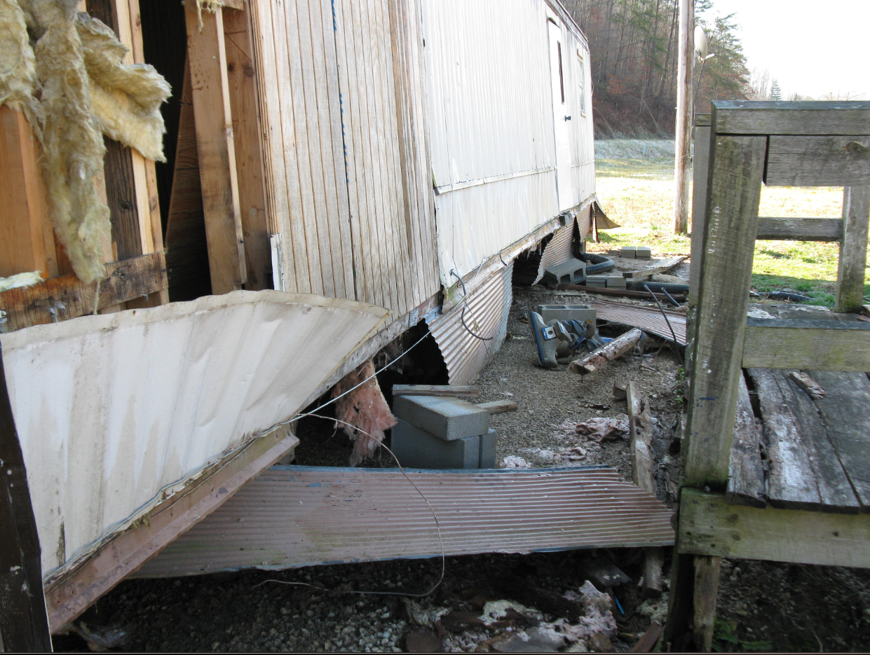
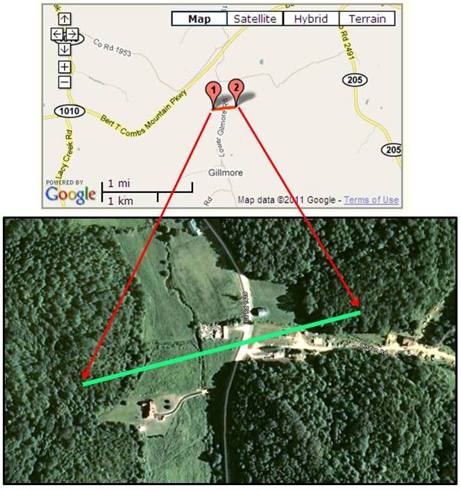
An early season severe weather outbreak occurred across eastern KY on February 28th. The first storms began moving across the area around 6am on Monday. The final warnings were issued around 915 am. The primary mode of severe weather was lines of strong to severe storms with bowing segments and embedded supercell structures. Most of the events were straight line wind damage, with a few reports of large hail and one confirmed short lived tornado that occurred in Wolfe county. An EF-1 tornado was confirmed to have touched down 1 mile north of Gilmore. The tornado's track was one quarter of a mile long and 100 yards wide. Numerous trees were snapped and scattered along the tornado's path. One mobile home had its roof blow off and was also pushed about 5 feet off of its foundation. One barn was destroyed. Two other mobile homes had roof and siding damage. One outbuilding used as a sawmill was also destroyed. |
 |
Tornado damage survey results, tornado track, and damage photographs
| DATE: FEBRUARY 28TH 2011 TIME: TOUCHDOWN AROUND 737 AM EST EF-SCALE: EF-1 ESTIMATED MAX WINDS: 90 MPH PATH LENGTH: 0.25 OF A MILE PATH WIDTH: 100 YARDS |
 |
|
 |
Media use of NWS Web News Stories is encouraged! Please acknowledge the NWS as the source of any news information accessed from this site. |
|
Warnings/Hazards
Decision Support - Outlooks
Current Weather Hazards
Hazards Criteria
Weather Story Graphic
Recent Storm Reports
Submit a Report
Forecasts
Decision Support - Forecast
Aviation Forecasts
Fire Weather Forecasts
Hourly Weather Forecast
Activity Planner
River Forecasts
Forecast Discussion
Current Conditions
Regional Radar
Decision Support - Current
Rivers and Lakes
Hourly Airport Weather
Local Radar
Satellite
Kentucky Mesonet
Past Weather
Local Climate Info
Temp/Precip Summary
How Much Rain Fell?
How Much Snow Fell?
Past Weather Events
Drought Information
Local Coop Observers
US Dept of Commerce
National Oceanic and Atmospheric Administration
National Weather Service
Jackson, KY
1329 Airport Road
Jackson, KY 41339
606-666-8000
Comments? Questions? Please Contact Us.