Heat expands across the Desert Southwest, Plains, Mississippi Valley and Midwest into Monday. Fire weather concerns continue for portions of the Intermountain West. Active monsoonal moisture fuels thunderstorms over the Southwest with possible flash flooding. Tropical cyclone Fausto in the Pacific, should weaken as it approaches Hawaii; Dangerous surf, swells and rip currents are expected. Read More >
Overview
|
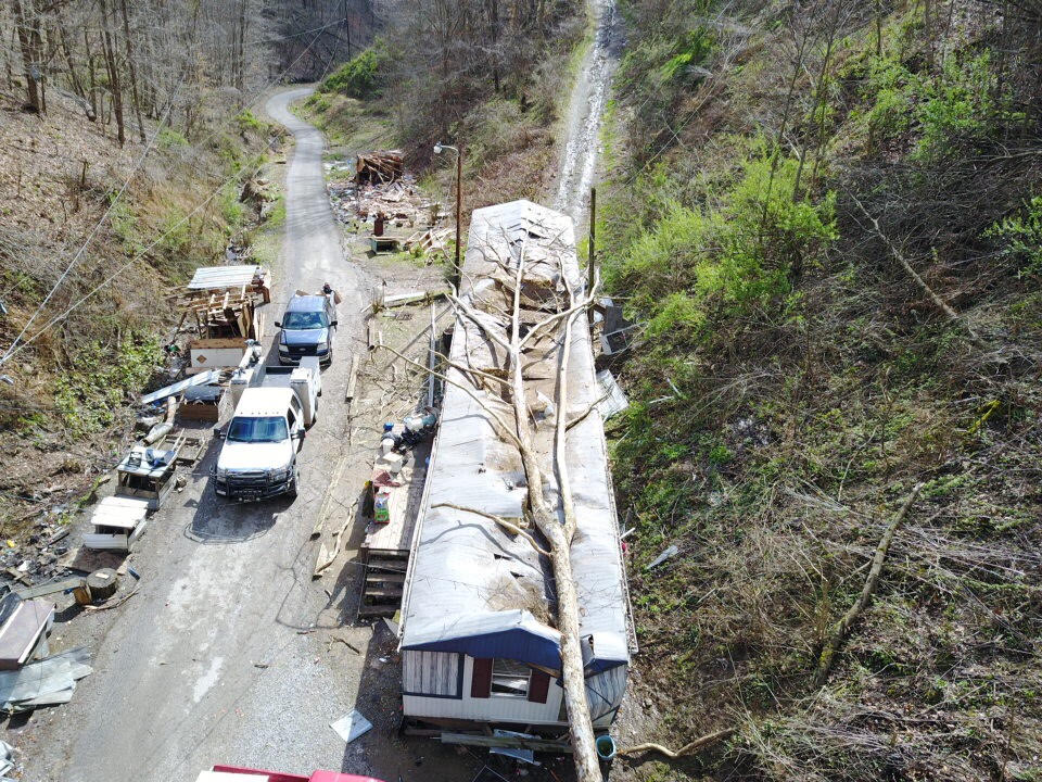
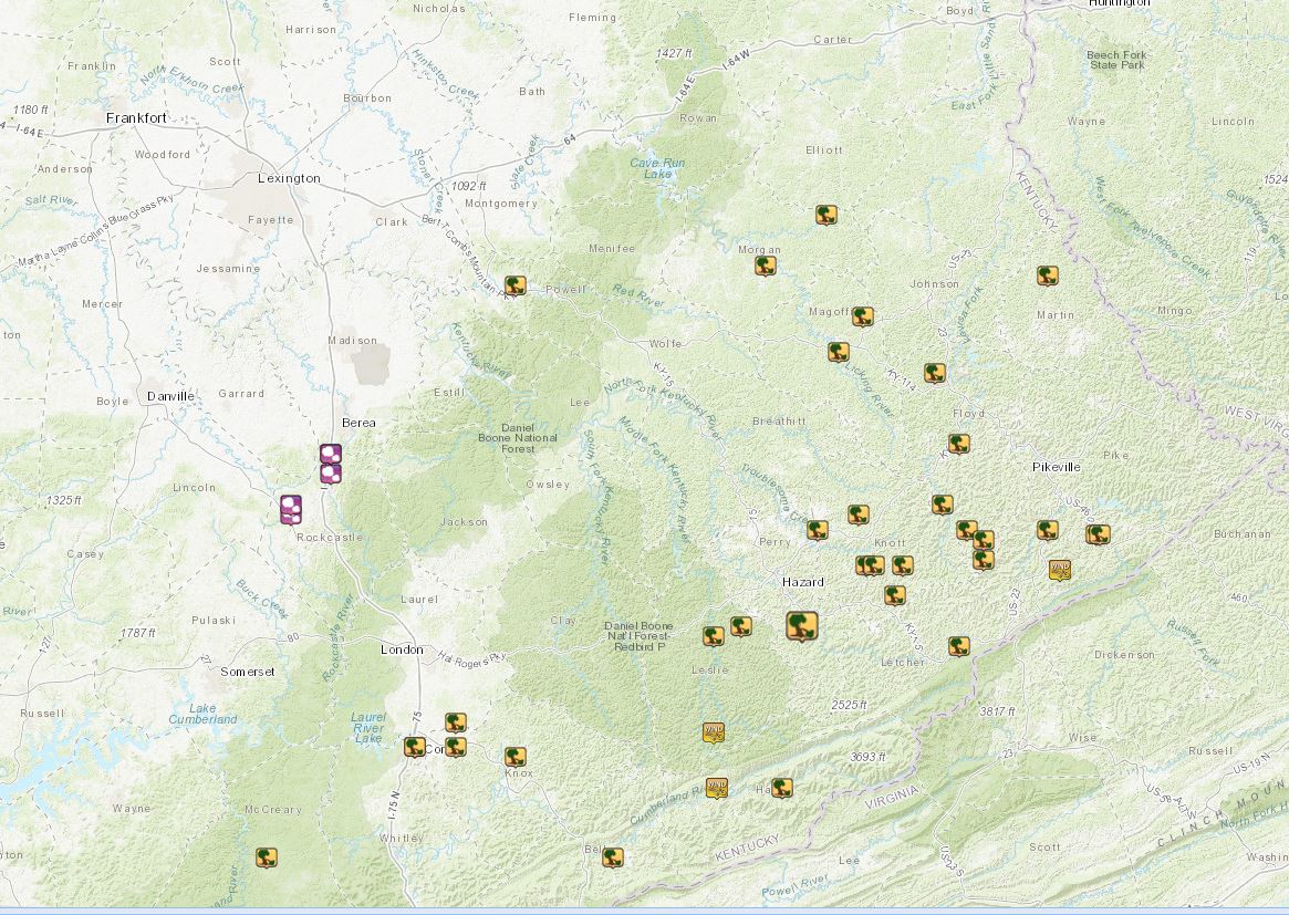
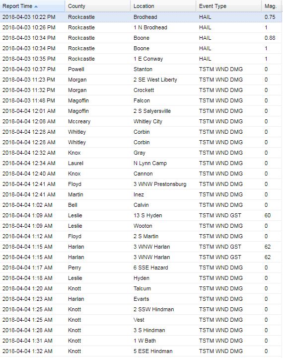
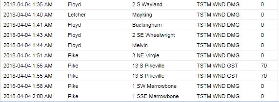
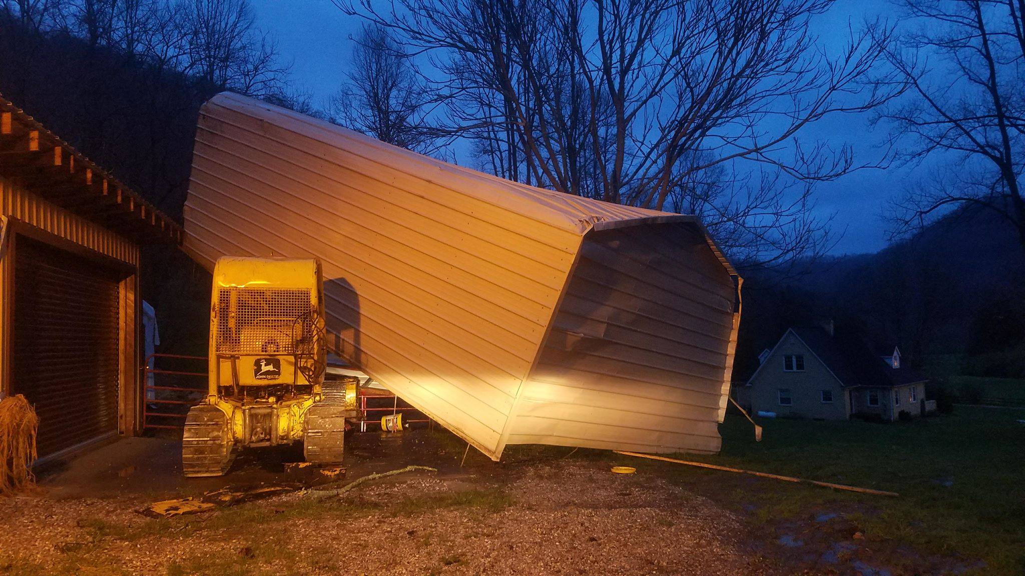
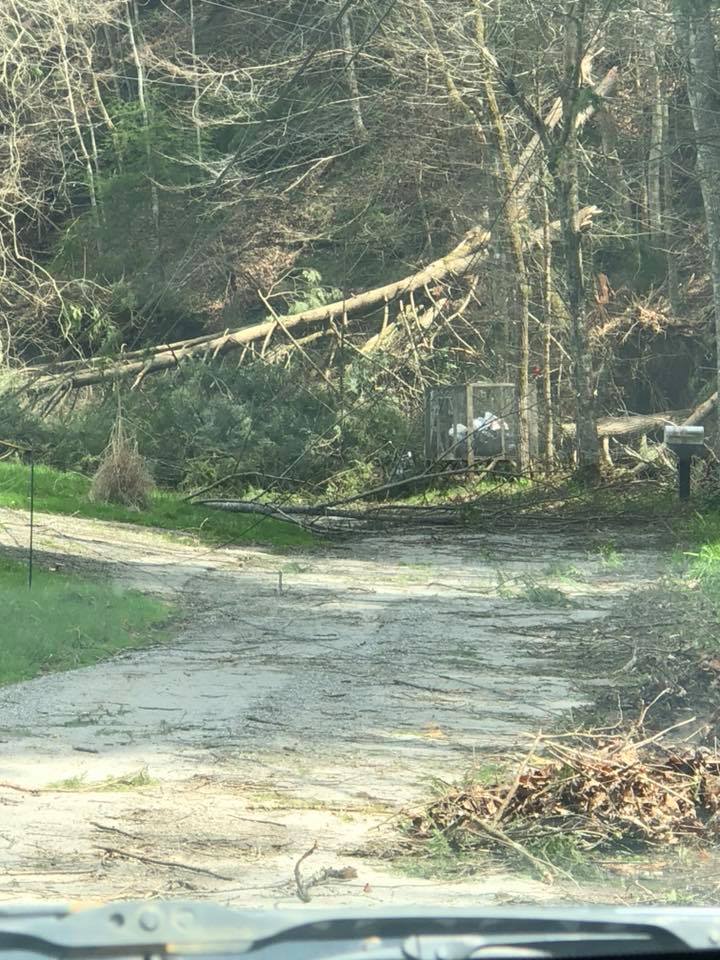
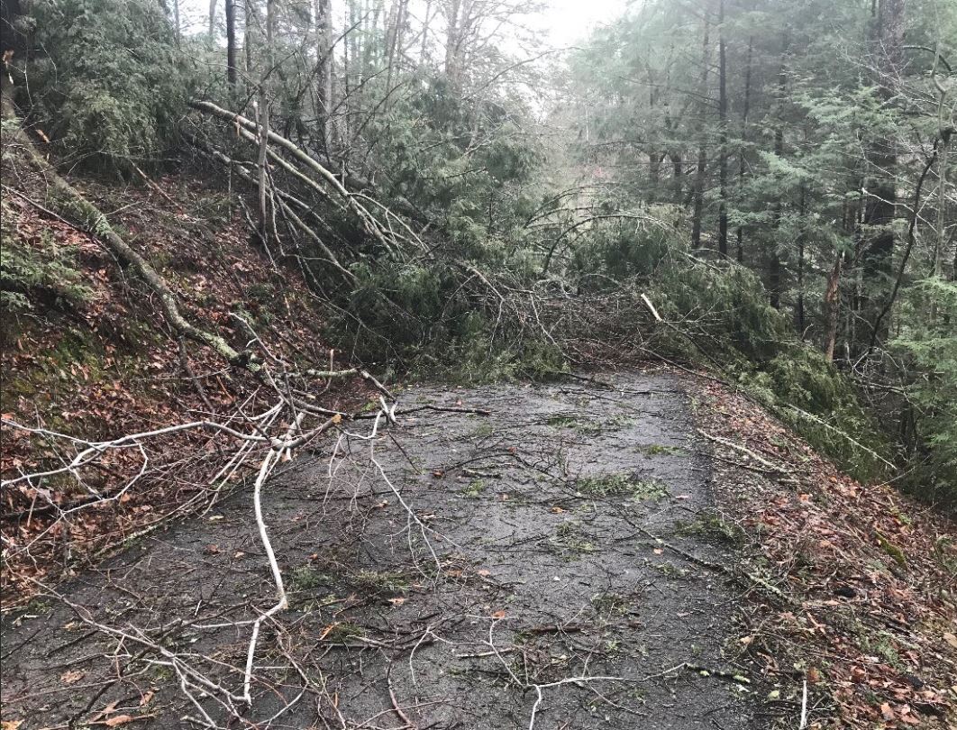
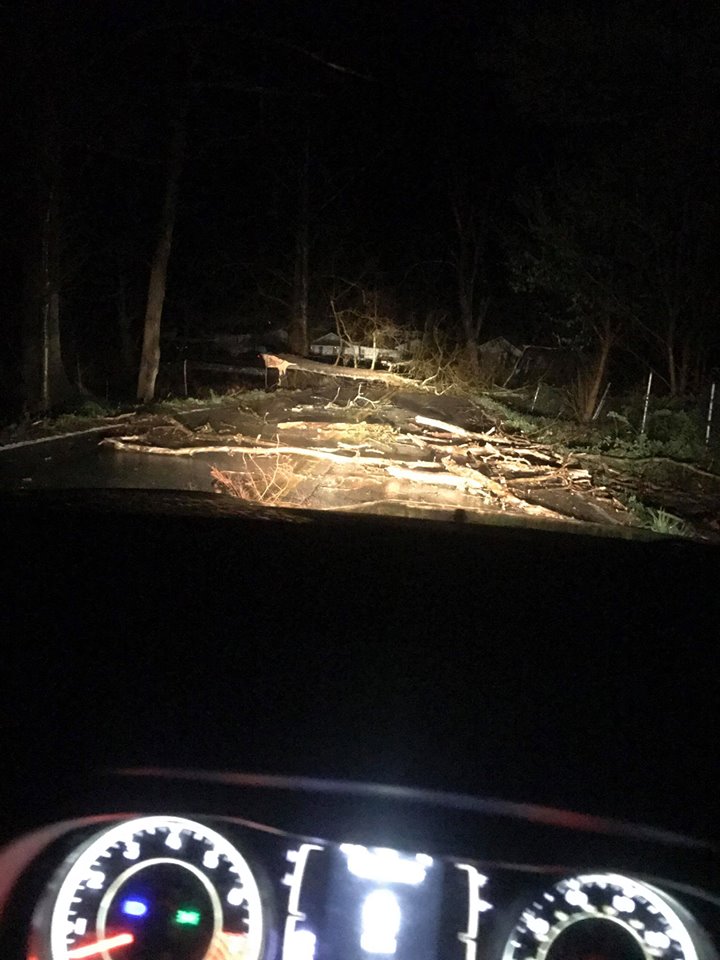
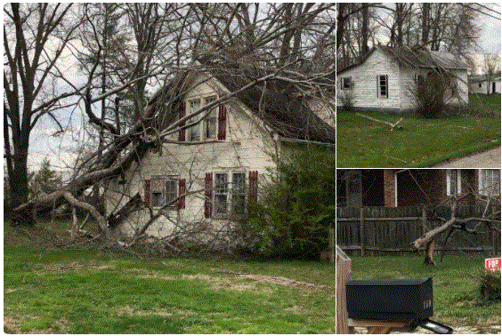
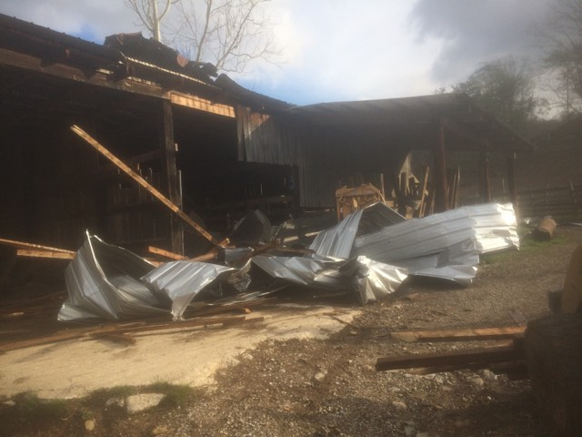
A complex of showers and thunderstorms developed across the Midwestern U.S. in the afternoon and later pushed through eastern Kentucky during the late evening and overnight hours. Initially, a few embedded supercell thunderstorms produced large hail due to their rotation and stronger updrafts. Damaging wind gusts ended up being the primary threat across eastern Kentucky as these features became organized into line segments later into the night. Numerous reports of downed trees and power lines were received across southeastern Kentucky where the greatest amount of instability was present. Homes in Leslie, Letcher, and Pike Counties suffered extensive damage from trees falling onto them, including one at Willow Tree Hollow near Marrowbone and Regina southeast of Pikeville that led to an injury to a person inside. More scattered wind damage was also reported up toward and north of Mountain Parkway as individual storm cells embedded within the larger line intensified. |
|
Photos
 |
 |
 |
| Letcher County Between Blackey and Roxana (Courtesy of Dr. Shane McDougal) |
Letcher County near Mayking (Courtesy of Medina Cook) |
Harlan County near Evarts (Courtesy of Kimberly Wehner) |
 |
 |
 |
 |
| Harlan Roof Damage (Courtesy of Greg Middleton) |
Letcher County near Dotty Creek |
Leslie County |
Highway 72 in Harlan County (Courtesy of Jessica Brock) |
 |
 |
| Powell County Storm Damage (Courtesy of WKYT) |
Gatti's Storm Damage in Corbin |
 |
 |
| Damage to a metal roof in Whitley County (Courtesy of Shawn Cowden) |
Subway in Shelby Valley in Pike County |
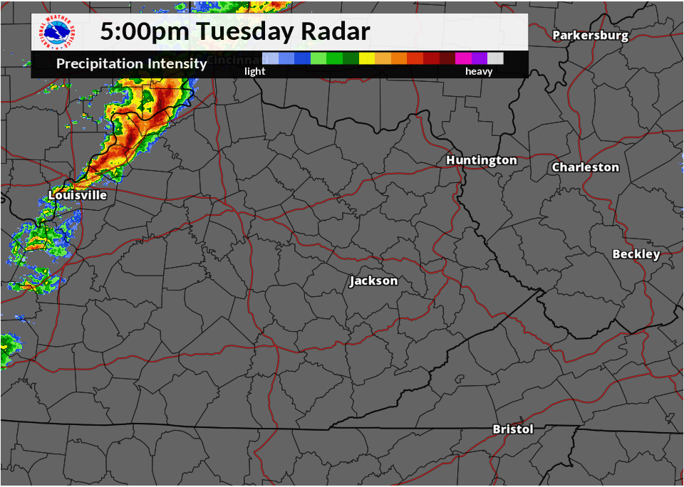
Radar
 |
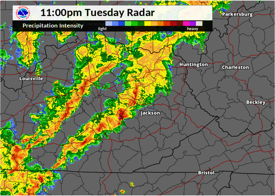 |
| 5 - 11 pm April 3rd Radar Loop | 11 pm April 3rd - 5 am April 4th Radar Loop |
Environment
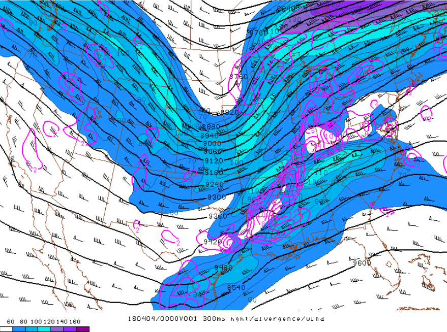
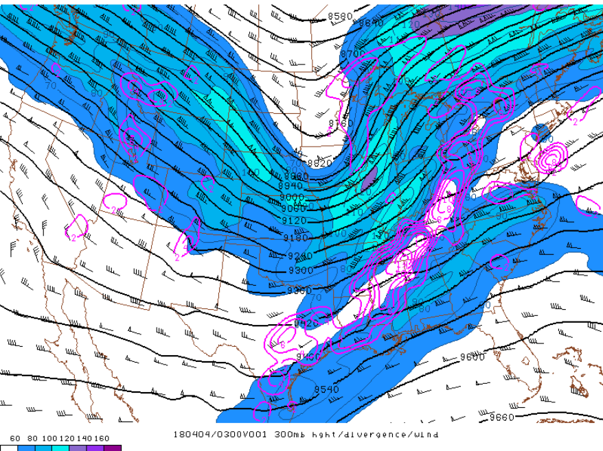
300 mb upper level charts:
 |
 |
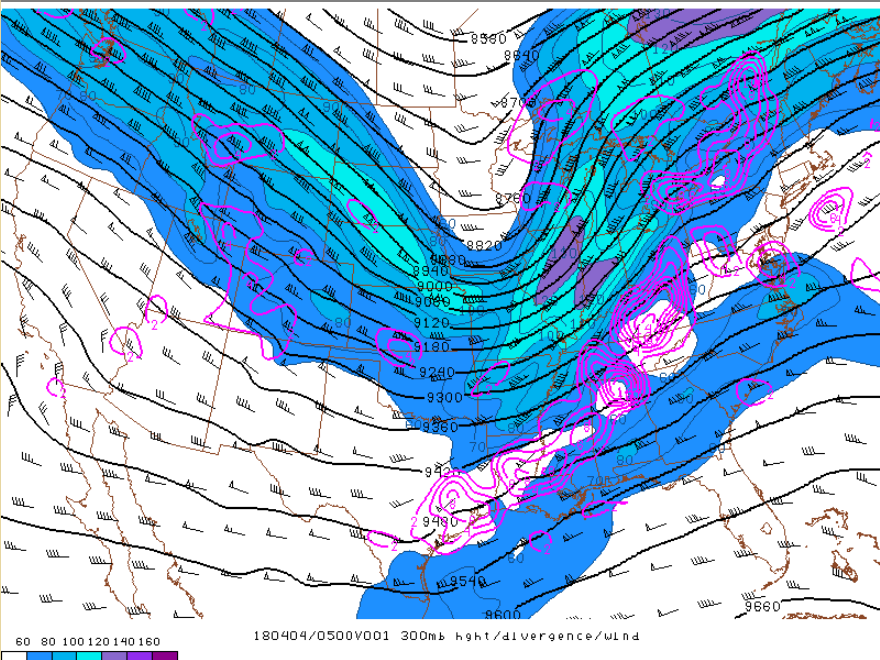 |
| 8 pm, April 3rd, 2018 | 11 pm, April 3rd, 2018 | 2 am, April 4th, 2018 |
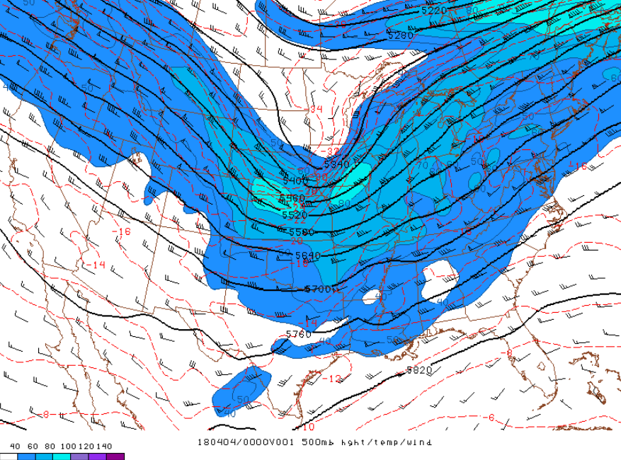
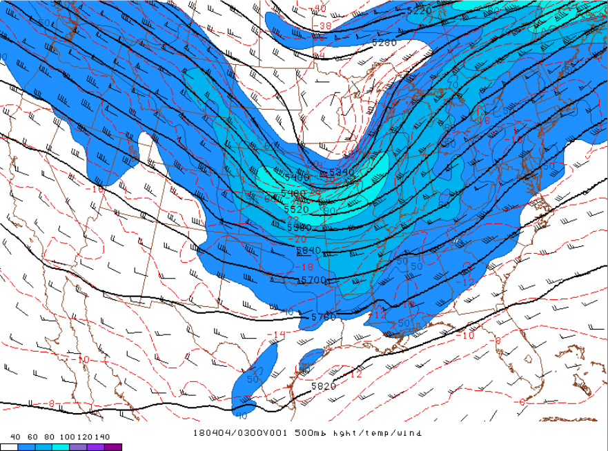
500 mb upper level charts:
 |
 |
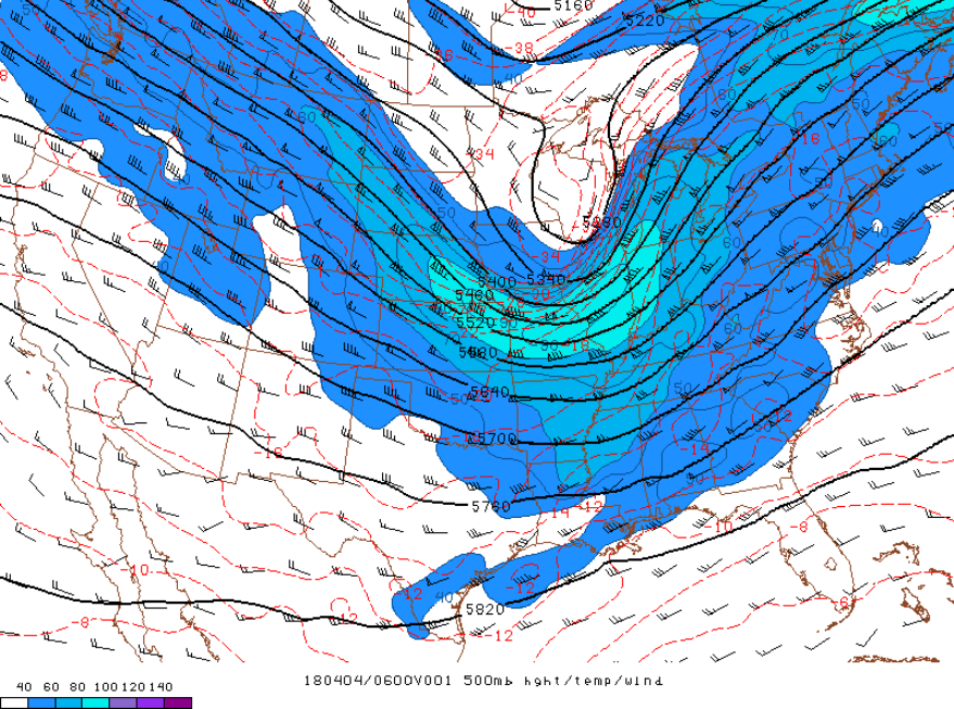 |
| 8 pm, April 3rd, 2018 | 11 pm, April 3rd, 2018 | 2 am, April 4th, 2018 |
850 mb upper level charts:
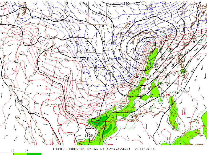
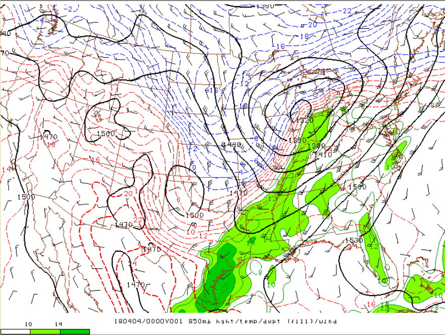 |
 |
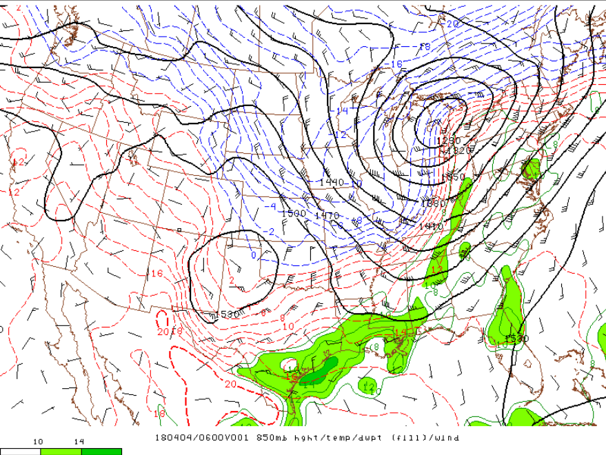 |
| 8 pm, April 3rd, 2018 | 11 pm, April 3rd, 2018 | 2 am, April 4th, 2018 |
Surface charts:
 |
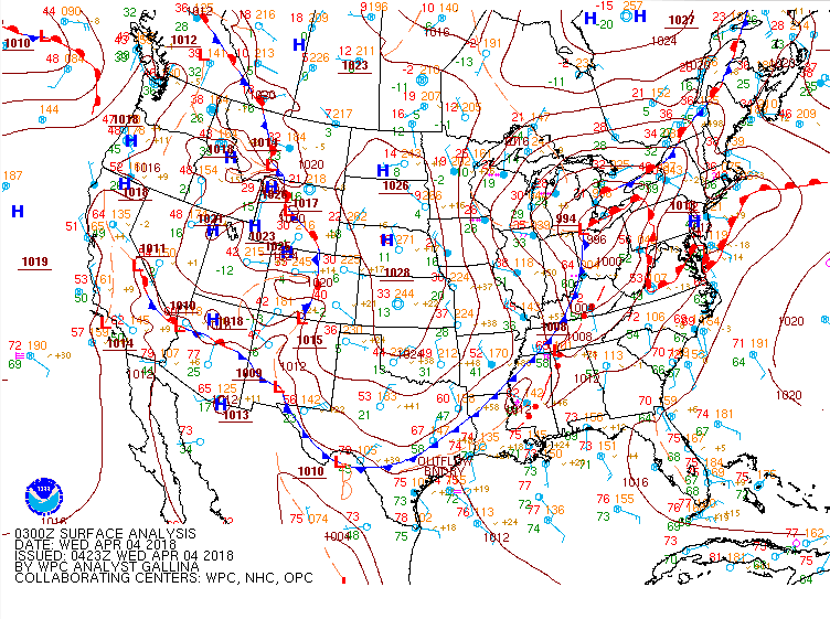 |
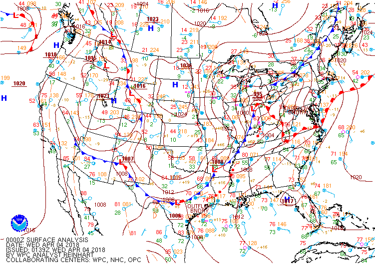
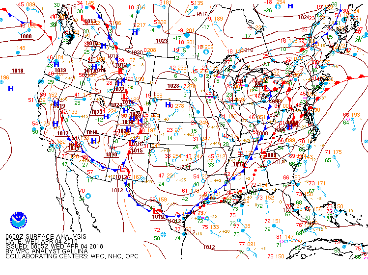 |
| 8 pm, April 3rd, 2018 | 11 pm, April 3rd, 2018 | 2 am, April 4th, 2018 |
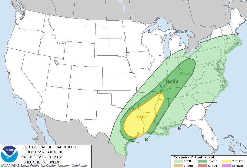
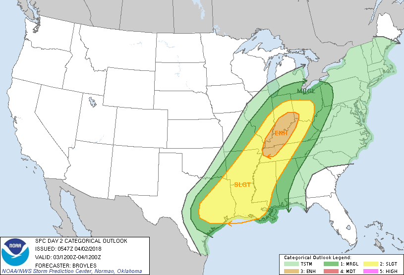
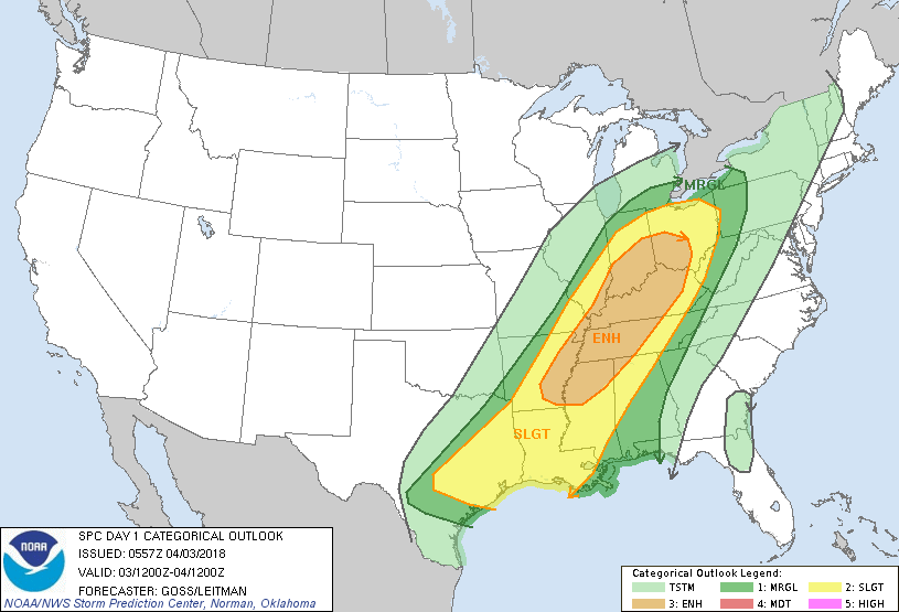
Severe Storm Prediction Center Outlooks:
 |
 |
 |
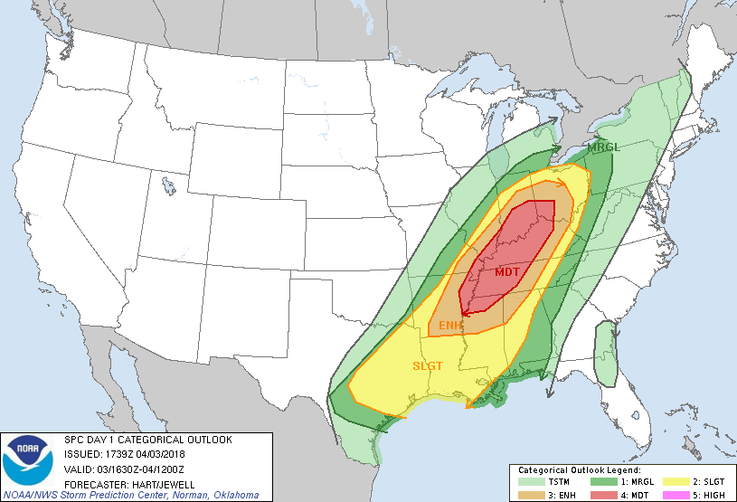 |
| Day 3 Outlook | Day 2 Outlook | Day 1 Outlook | Day 1 Outlook (Update) |
 |
 |
 |
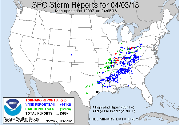 |
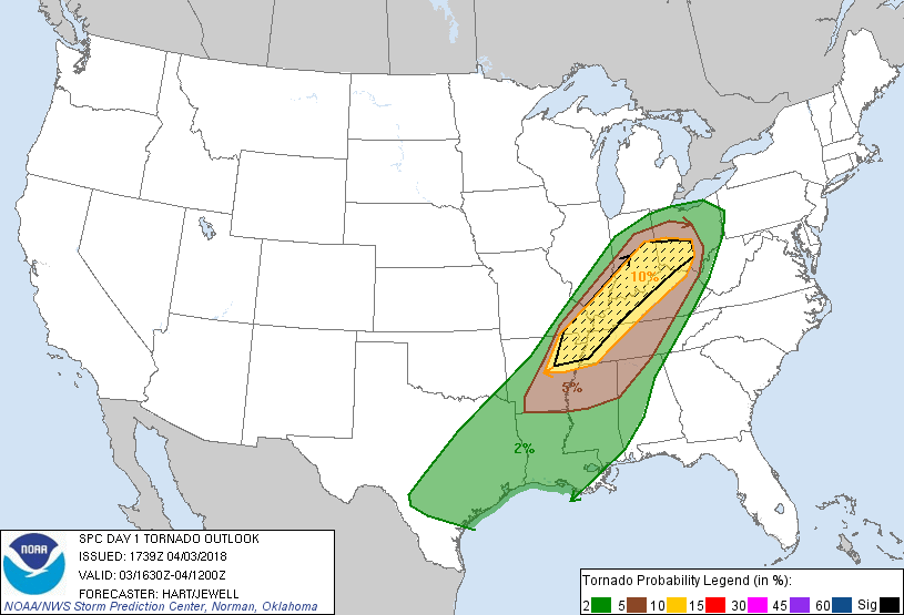
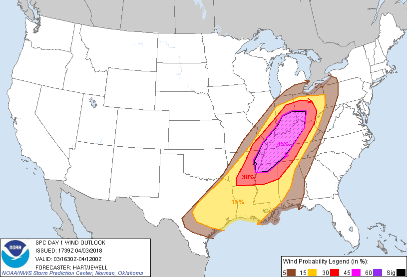
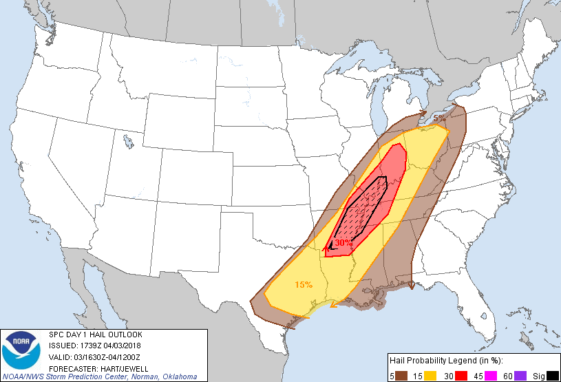
| Day 1 Tornado Outlook | Day 1 Severe Wind Outlook | Day 1 Severe Hail Outlook | All Storm Reports From Event |
 |
Media use of NWS Web News Stories is encouraged! Please acknowledge the NWS as the source of any news information accessed from this site. |
|