Gusty winds and dry conditions will continue to bring elevated to critical fire weather conditions to the southern Plains and Southeast early this week. A Pacific storm system will bring low elevation rain and heavy high elevation mountain snow to northern and central California through early week, expanding into the Pacific Northwest, Great Basin, and southern California on Tuesday. Read More >
A severe weather outbreak occurred during the late afternoon and evening hours of October 7th as supercell thunderstorms tracked southeastward across central and east Kentucky. Numerous reports of large hail and wind damage were received and some minor flooding occurred where the storms tracked across the same areas. The big story was the three confirmed tornadoes which occurred in Bath and Pike counties (2 in Bath and 1 in Pike). The twisters, while small and short lived, caused varying degrees of damage to trees, power lines, and various structures in both counties. Their occurrence also nearly met the combined total of all previous October tornadoes in east Kentucky. Only five tornadoes had been confirmed in the NWS Jackson, KY forecast and warning area during the month of October prior to 2014.
View the details of each tornado by clicking on the tabs below or visit our online tornado database at https://innovation.srh.noaa.gov/tors/index.php?cw=jkl for more information.
RATING: EF-1
ESTIMATED PEAK WIND: 90 MPH
PATH LENGTH /STATUTE/: 0.6 MILES
PATH WIDTH /MAXIMUM/: 50 YARDS
FATALITIES: 0
INJURIES: 0

START DATE: OCT 7 2014
START TIME: 435 PM EDT
START LOCATION: 0.6 MILES NW OF SHARPSBURG / BATH COUNTY / KY
START LAT/LON: 38.20590 / -83.93862

END DATE: OCT 7 2014
END TIME: 436 PM EDT
END LOCATION: 0.7 MILES N OF SHARPSBURG / BATH COUNTY / KY
END LAT/LON: 38.21156 / -83.93102

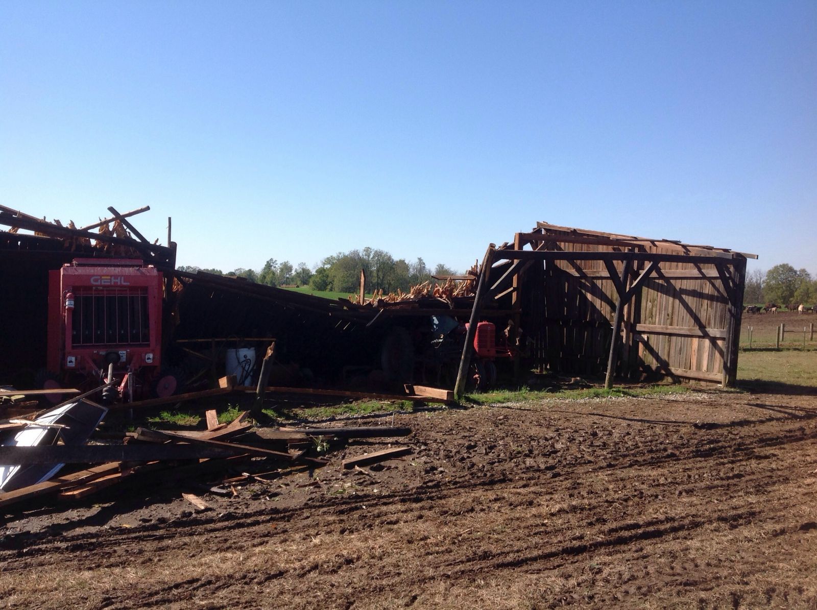
3 BARNS WERE DAMAGED. THERE WAS ALSO SPORADIC DAMAGE TO TREES.

EF SCALE: THE ENHANCED FUJITA SCALE CLASSIFIES TORNADOES INTO THE
FOLLOWING CATEGORIES.

EF0...WEAK......65 TO 85 MPH
EF1...WEAK......86 TO 110 MPH
EF2...STRONG....111 TO 135 MPH
EF3...STRONG....136 TO 165 MPH
EF4...VIOLENT...166 TO 200 MPH
EF5...VIOLENT...>200 MPH

NOTE:
THE INFORMATION IN THIS STATEMENT IS PRELIMINARY AND SUBJECT TO
CHANGE PENDING FINAL REVIEW OF THE EVENT AND PUBLICATION IN NWS STORM
DATA.
Path of tornado near Sharpsburg

Tornado damage near Sharpsburg
RATING: EF-1
ESTIMATED PEAK WIND: 90 MPH
PATH LENGTH /STATUTE/: 0.3 MILES
PATH WIDTH /MAXIMUM/: 35 YARDS
FATALITIES: 0
INJURIES: 0

START DATE: OCT 7 2014
START TIME: 453 PM EDT
START LOCATION: 0.9 NE OLYMPIA SPRINGS / BATH COUNTY / KY
START LAT/LON: 38.06962 / -83.65979

END DATE: OCT 7 2014
END TIME: 453 PM EDT
END LOCATION: 1.0 NNE OLYMPIA SPRINGS / BATH COUNTY / KY
END LAT/LON: 38.06843 / -83.65520

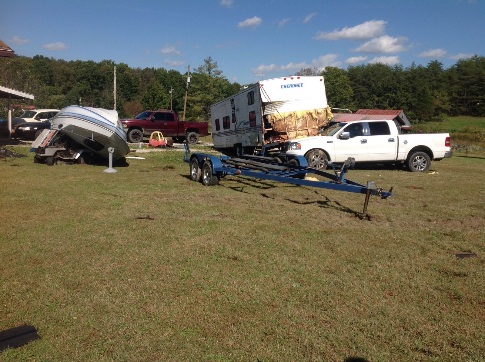
BOAT TRAILER WITH BOAT WAS OVERTURNED AND A CAMPING TRAILER WAS BLOWN
ONTO A TRUCK. NUMEROUS SHINGLES WERE BLOWN OFF A HOUSE. THERE WAS
ALSO SPORADIC TREE DAMAGE.

EF SCALE: THE ENHANCED FUJITA SCALE CLASSIFIES TORNADOES INTO THE
FOLLOWING CATEGORIES.

EF0...WEAK......65 TO 85 MPH
EF1...WEAK......86 TO 110 MPH
EF2...STRONG....111 TO 135 MPH
EF3...STRONG....136 TO 165 MPH
EF4...VIOLENT...166 TO 200 MPH
EF5...VIOLENT...>200 MPH

NOTE:
THE INFORMATION IN THIS STATEMENT IS PRELIMINARY AND SUBJECT TO
CHANGE PENDING FINAL REVIEW OF THE EVENT AND PUBLICATION IN NWS STORM
DATA.
Path of tornado near Olympia Springs

Tornado damage near Olympia Springs
RATING: EF-1
ESTIMATED PEAK WIND: 90 MPH
PATH LENGTH /STATUTE/: 0.1 MILES
PATH WIDTH /MAXIMUM/: 130 YARDS
FATALITIES: 0
INJURIES: 0

START DATE: OCT 7 2014
START TIME: 1044 PM EDT
START LOCATION: 2.6 MILES SW OF GULNARE / PIKE COUNTY / KY
START LAT/LON: 37.61271 / -82.59407

END DATE: OCT 7 2014
END TIME: 1045 PM EDT
END LOCATION: 2.6 MILES SW OF GULNARE / PIKE COUNTY / KY
END_LAT/LON: 37.61407 / -82.59480

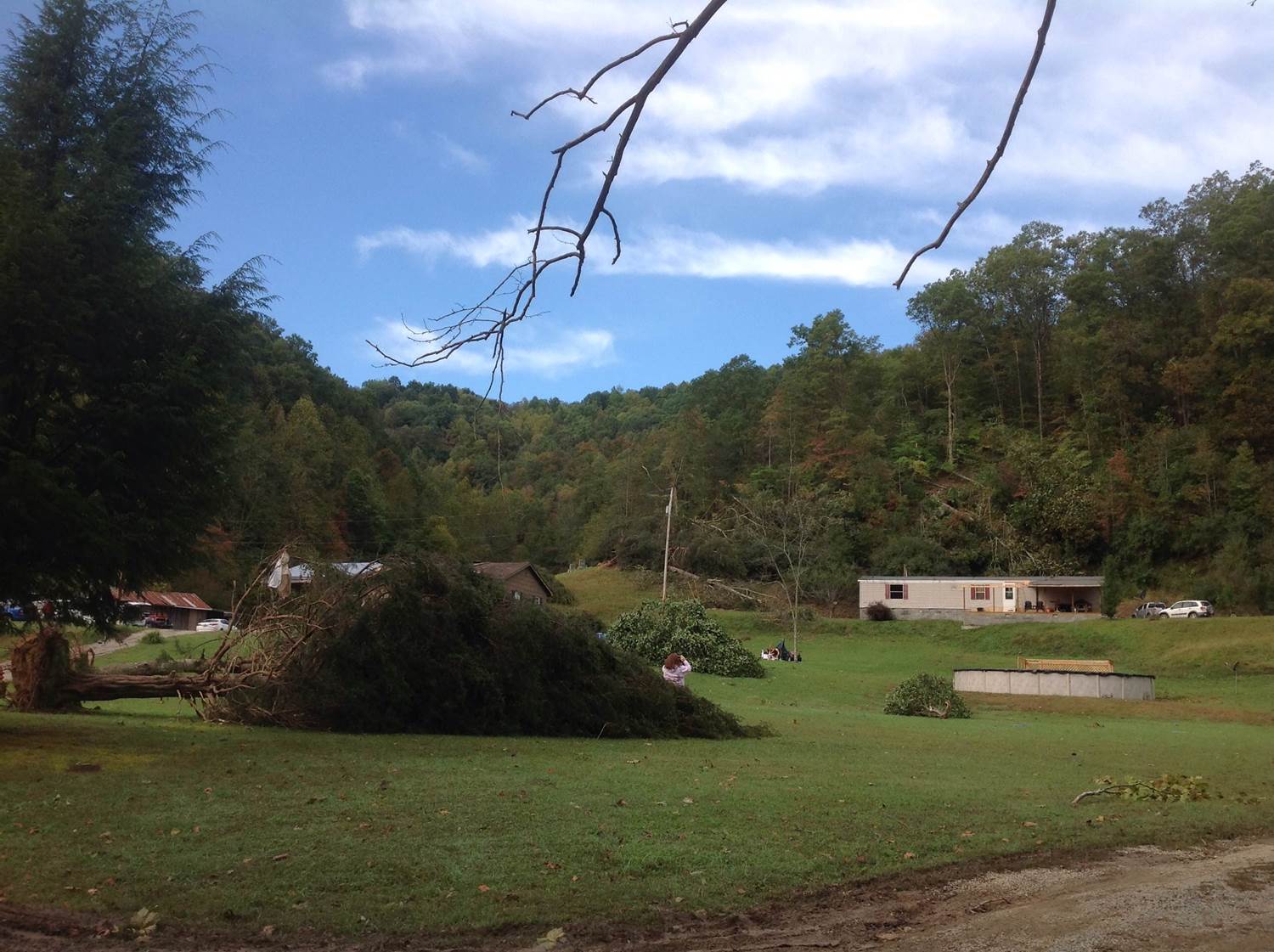
SEVERAL LARGE TREES WERE SNAPPED AND/OR UPROOTED. A LARGE SECTION
OF A ROOF WAS PEELED OFF A HOUSE. THERE WAS ALSO DAMAGE TO TWO
SEPARATE BARN ROOFS.

EF SCALE: THE ENHANCED FUJITA SCALE CLASSIFIES TORNADOES INTO THE
FOLLOWING CATEGORIES.

EF0...WEAK......65 TO 85 MPH
EF1...WEAK......86 TO 110 MPH
EF2...STRONG....111 TO 135 MPH
EF3...STRONG....136 TO 165 MPH
EF4...VIOLENT...166 TO 200 MPH
EF5...VIOLENT...>200 MPH

NOTE:
THE INFORMATION IN THIS STATEMENT IS PRELIMINARY AND SUBJECT TO
CHANGE PENDING FINAL REVIEW OF THE EVENT AND PUBLICATION IN NWS
STORM DATA.
Path of Pike County Tornado

Pike County Tornado Damage
Pike County Tornado Damage
Pike County Tornado Damage