
Heat expands across the Desert Southwest, Plains, Mississippi Valley and Midwest into Monday. Fire weather concerns continue for portions of the Intermountain West. Active monsoonal moisture fuels thunderstorms over the Southwest with possible flash flooding. Tropical cyclone Fausto in the Pacific, should weaken as it approaches Hawaii; Dangerous surf, swells and rip currents are expected. Read More >
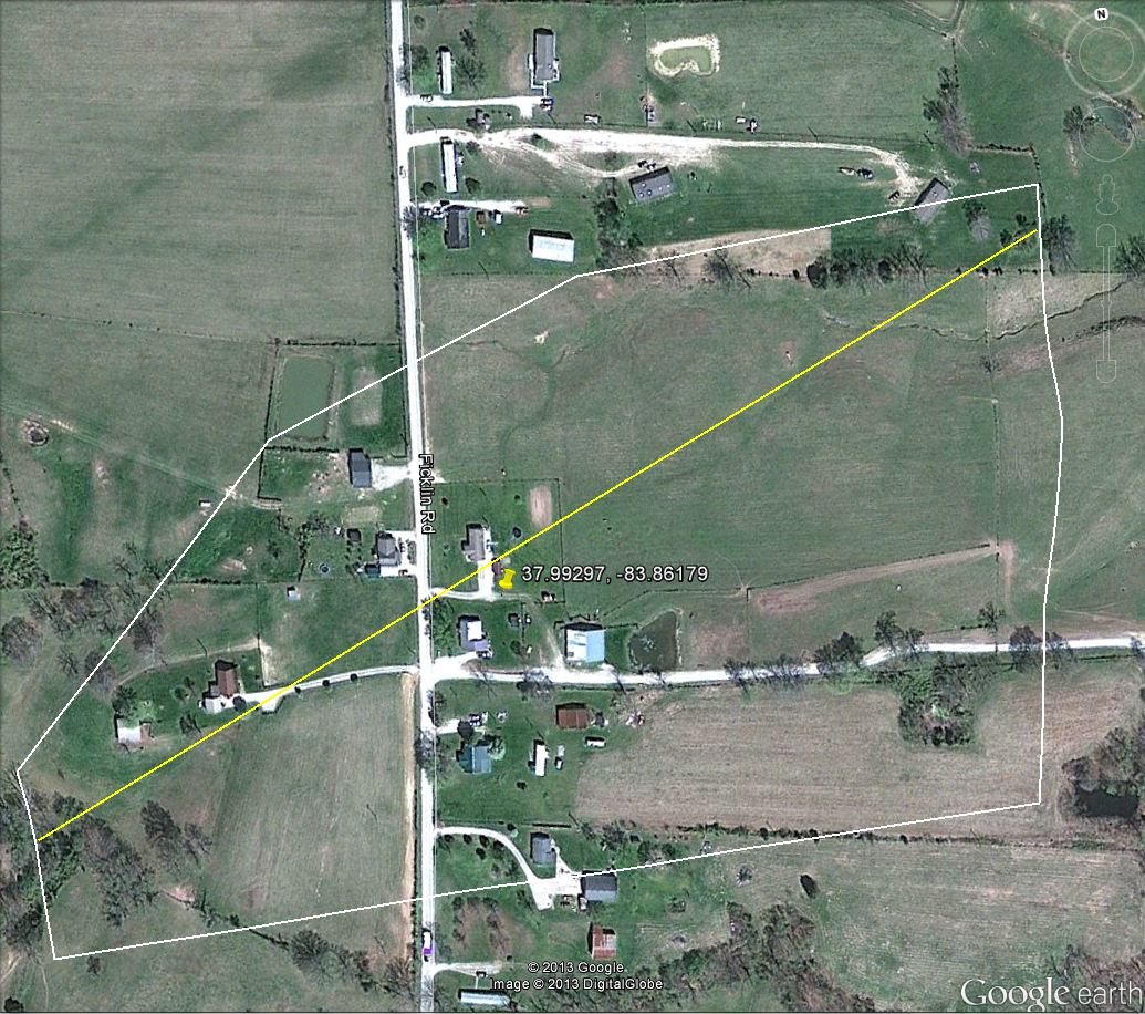
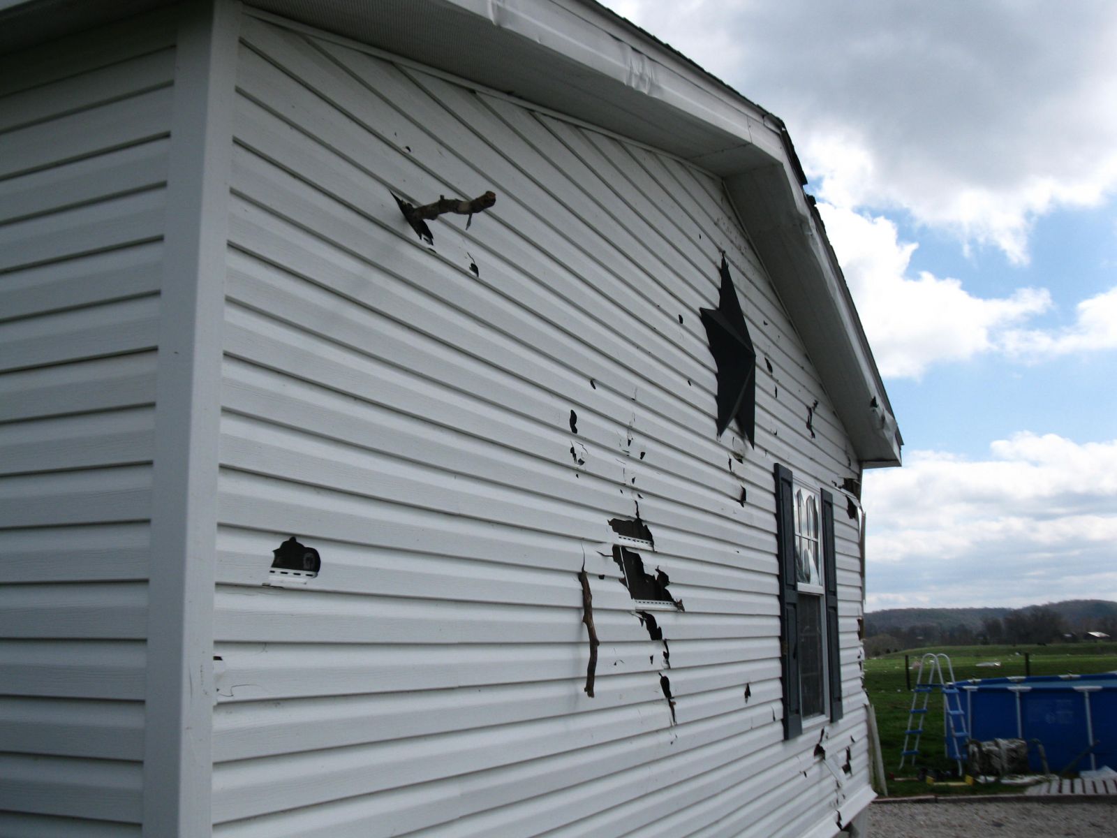
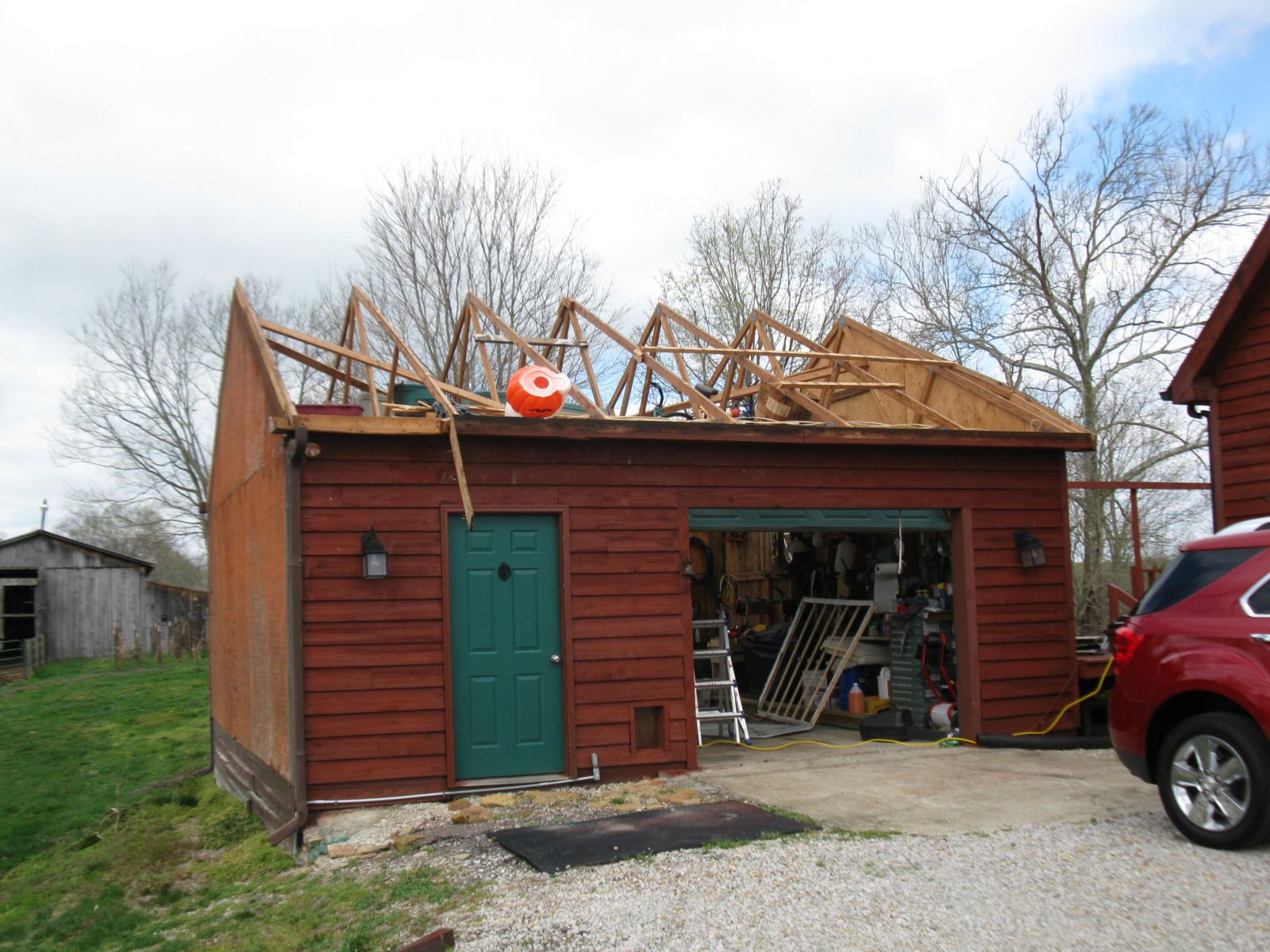
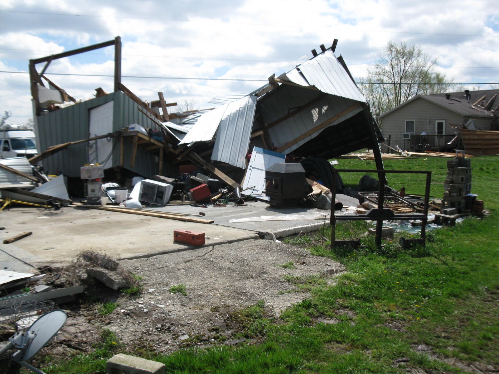
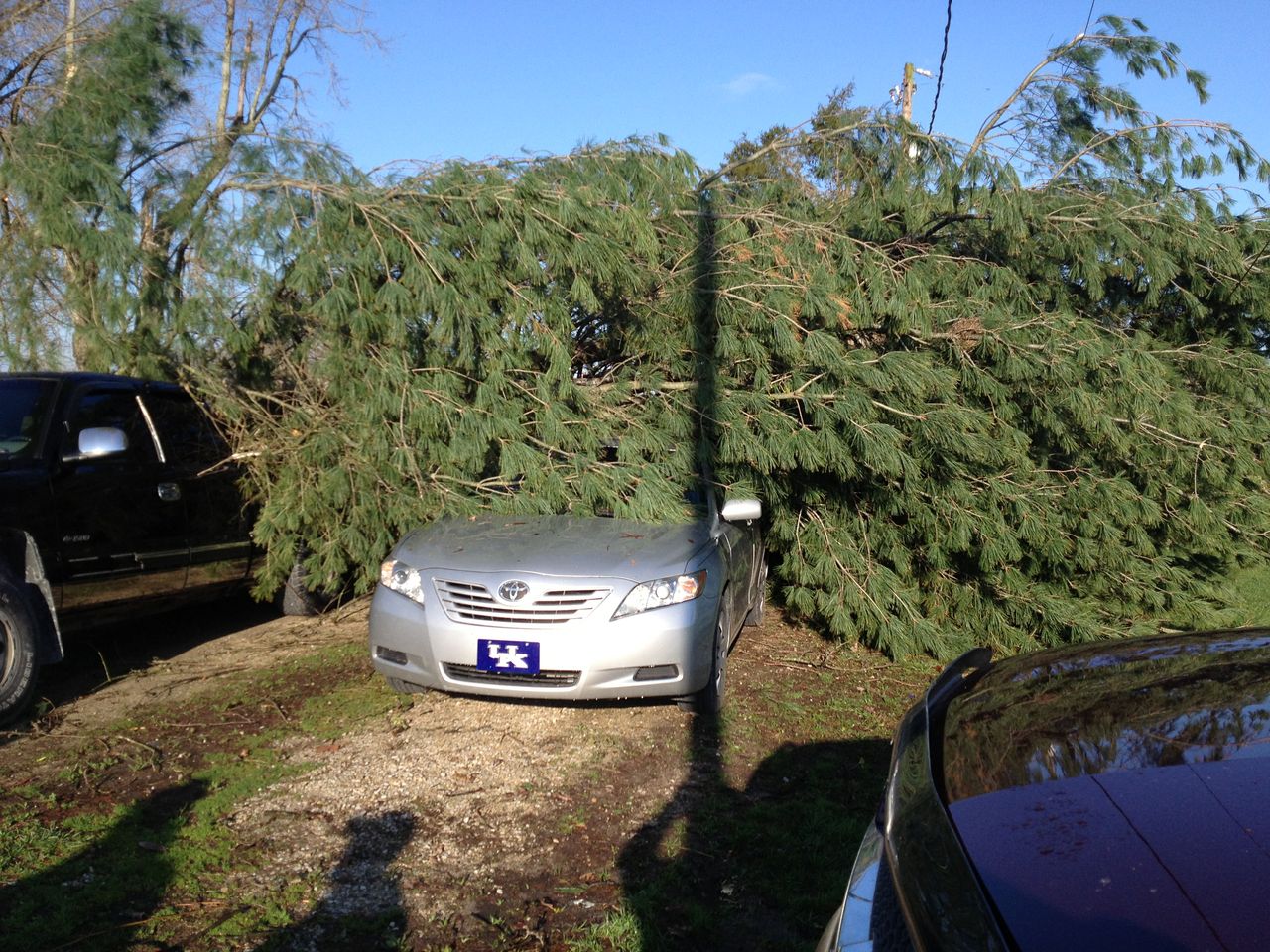
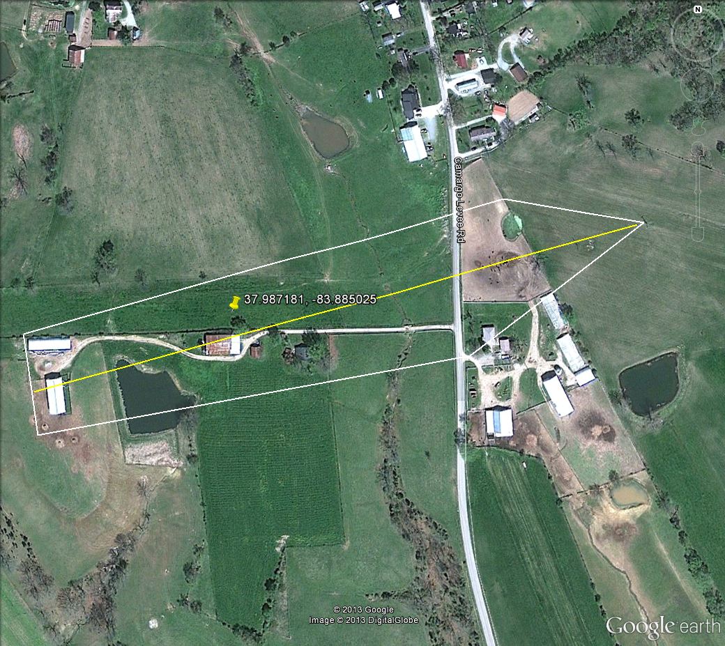
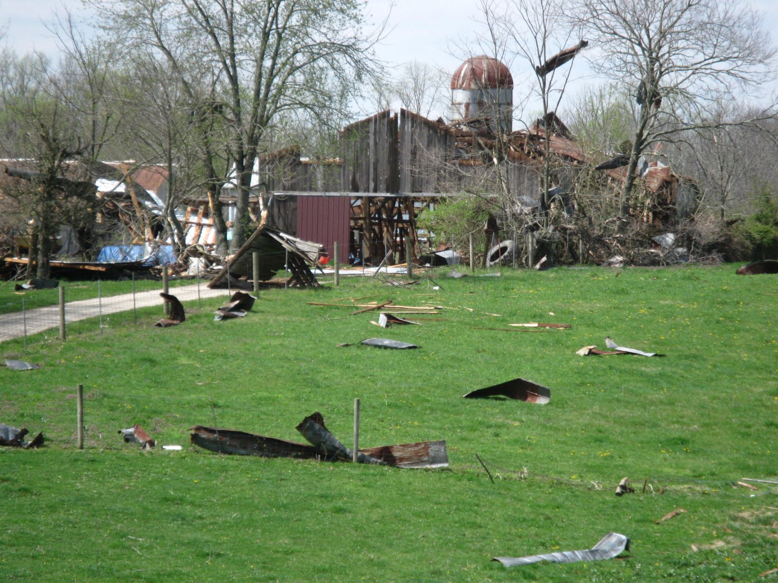
A line of strong showers and thunderstorms moved across eastern Kentucky during the late afternoon and early evening hours of April 11, 2013. A strong gust front developed just ahead of the main line of precipitation causing extensive wind damage to some communities located between Camargo and Jeffersonville in Mountgomery County, KY. More information from the damage survey is included below...
|
...STRAIGHT LINE WINDS CONFIRMED IN MONTGOMERY COUNTY ON APRIL 11TH... A STORM DAMAGE SURVEY TEAM FROM THE NATIONAL WEATHER SERVICE OFFICE EVENT: FICKLIN ROAD NWS JACKSON KY WOULD LIKE TO THANK THE MONTGOMERY COUNTY EMERGENCY |
The following images show the approximate extent of the debris fields from the high winds that struck the area between 6:55 and 7:05 PM EDT Thursday evening.
 |
||
 |
 |
 |
 |
 |
 |
 |

