
Gusty winds and dry conditions will continue to bring elevated to critical fire weather conditions to the southern Plains and Southeast early this week. A Pacific storm system will bring low elevation rain and heavy high elevation mountain snow to northern and central California through early week, expanding into the Pacific Northwest, Great Basin, and southern California on Tuesday. Read More >
A heat wave for the record books occurred across the Bluegrass State between June 28th and July 1st, 2012. The intensity of the heat rivaled the historic heat waves of the 1930s Dust Bowl.
After beginning the heat wave on Thursday June 28th, with most locations reaching near 100ºF, the mercury soared past 100 degrees across most of east Kentucky on Friday June 29th establishing new all-time record highs at both the National Weather Service in Jackson and at the London-Corbin Airport and several other locations (see table below). At Jackson, the temperature climbed to 104ºF on the 29th of June, establishing a new all-time record high for the station. The previous all-time record high at Jackson was 101ºF set last on August 18th, 1988. Climate records at NWS Jackson date back to 1981. At the London-Corbin Airport, where records began in 1954, the temperature climbed to 105ºF, also establishing a new all-time record high for the station. The previous all-time record high at London was 102ºF set on August 16th, 2007. Climate records at the London-Corbin Airport date back to 1954.
Friday's record heat was punctuated by severe thunderstorms across parts of northeast Kentucky, and damaging gust front winds for many locations.
For eastern Kentucky, many stations climbed to or exceeded 100ºF degrees for 4 straight days. Such a streak of heat hasn't happened since the 1930s. Below are maps of the observed high temperatures during the heat wave across east Kentucky and the entire state. Click on each graphic to enlarge the image...
| Highs Thursday June 28th | Highs Friday June 29th | Highs Saturday June 30th | Highs Sunday July 1st |
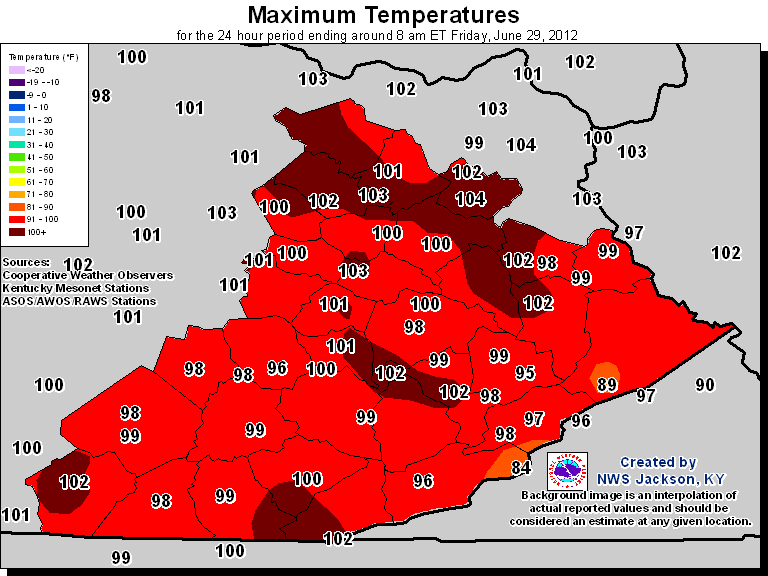 |
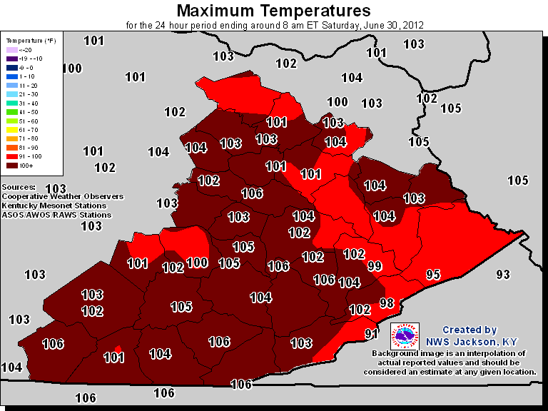 |
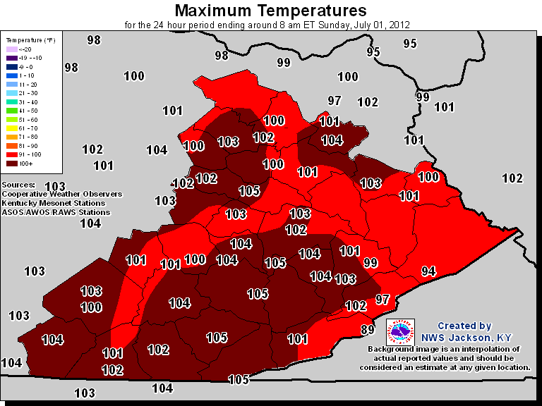 |
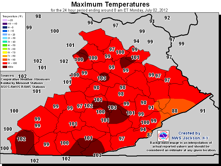 |
| Highs Thursday June 28th | Highs Friday June 29th |
Highs Saturday June 30th |
Highs Sunday July 1st |
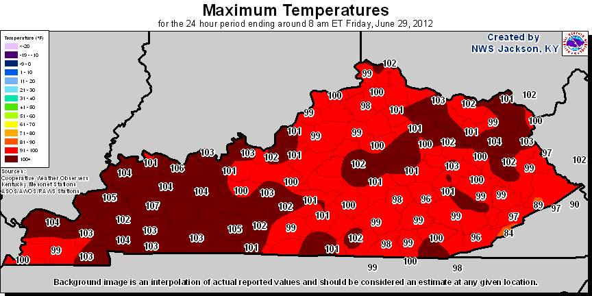 |
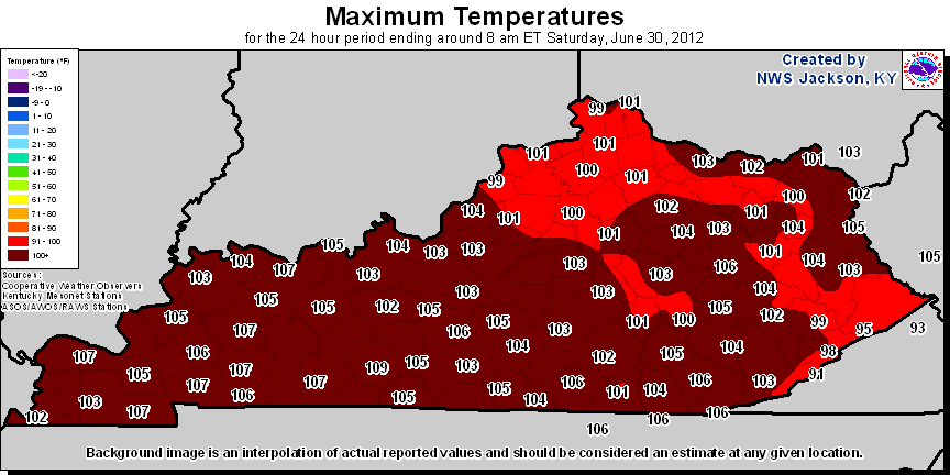 |
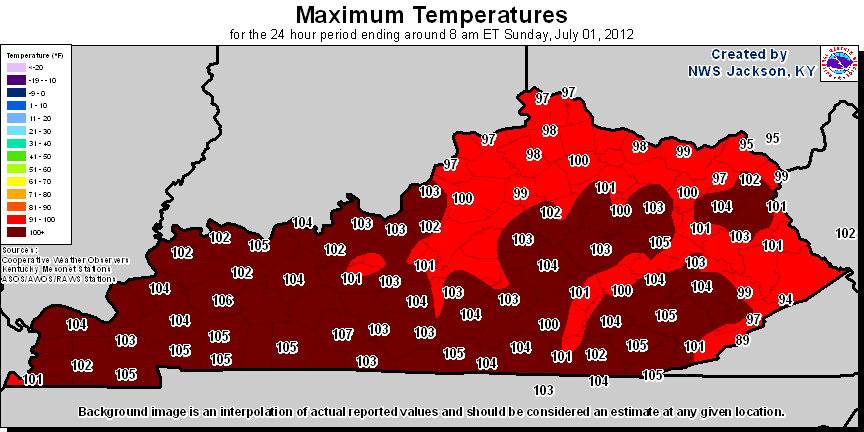 |
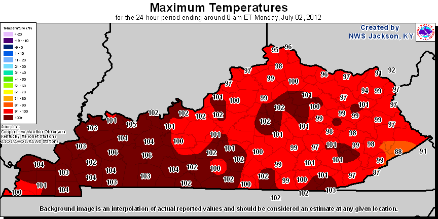 |
The following table shows the record highs for June, July, and August for several ASOS and Cooperative Observing Stations in eastern Kentucky. Items in red are new records established this year. Note that Cooperative Observing Stations report to the National Weather Service each morning, reporting their high temperature for the previous 24 hours. Several stations not only established new record highs for the month of June, but all time record highs as well.
| Location | Record High for June | Year(s) for June Record | Record High for July | Year(s) for July Record | Record High for August | Year(s) for August Record | Period of Record |
| Barbourville | 106 (all time record) | 2012 | 105 | 2012 | 102 | 1983, 1954 | 1950-2012 |
| Baxter | 103 (all time record) | 2012 | 101 | 2012 | 101 | 1983 | 1952-2012 |
| Farmers | 104 | 1936 | 105 | 1999, 1954,1936, 1930 | 106 | 1936 | 1904-2012 |
| Jackson | 104 (all time record) | 2012 | 101 | 1988 | 101 | 1988 | 1981-2012 |
| London | 105 (all time record) | 2012 | 101 | 2012,1999, 1988 | 102 | 2007 | 1954-2012 |
| Middlesboro | 108* | 2012* | 112 | 1930 | 109 | 1925 | 1892-2009 |
| Monticello | 105 (all time record) | 2012 | 104 | 2012 | 103 | 1988 | 1956-2012 |
| Mount Sterling | 104 | 2012 | 109 | 1930 | 105 | 1936 | 1892-2012 |
| Mount Vernon | 101 | 2012 | 102 | 1980 | 102 | 1983 | 1956-2012 |
| Somerset | 103 | 2012 | 103 | 2012, 1952 | 104 | 2007 | 1950-2012 |
| West Liberty | 107 | 1994 | 103 | 1999, 1988, 1952 | 103 | 1953 | 1905-1908, 1948-2012 |
| Williamsburg | 106 | 2012 | 107 | 1934 | 108 | 1936 | 1892-2012 |
* This is an unofficial temperature from the Middlesboro AWOS. The official cooperative weather observational record for Middlesboro ended in 2009. The Middlesboro AWOS reached 108 degrees on June 29, 2012, and the Yellow Creek RAWS station at Cumberland Gap National Park just outside Middlesboro reached 106 degrees. The official record high for June for Middlesboro (based on cooperative weather observations) continues to be 102 degrees from 1933.
Of special note are temperature records broken from the decade of the 1930s. During the Dust Bowl years of the 1930s Kentucky experienced it's greatest heat waves on record. Stations which have records going back to the 1930s include Williamsburg (this includes a station move in 2004), Middlesboro, Mount Sterling, and Farmers.
Williamsburg's record of 106 degrees from June 29 broke the old June monthly record of 105 degrees set in 1936. Mount Sterling's high temperature of 104 from June 29 broke the June monthly record of 103 set in 1934. Farmers reached 103 degrees on June 29, just missing their June record high of 104 degrees set in 1936.