
Gusty winds and dry conditions will continue to bring elevated to critical fire weather conditions to the southern Plains and Southeast early this week. A Pacific storm system will bring low elevation rain and heavy high elevation mountain snow to northern and central California through early week, expanding into the Pacific Northwest, Great Basin, and southern California on Tuesday. Read More >
Jackson, KY
Weather Forecast Office
Overview
|
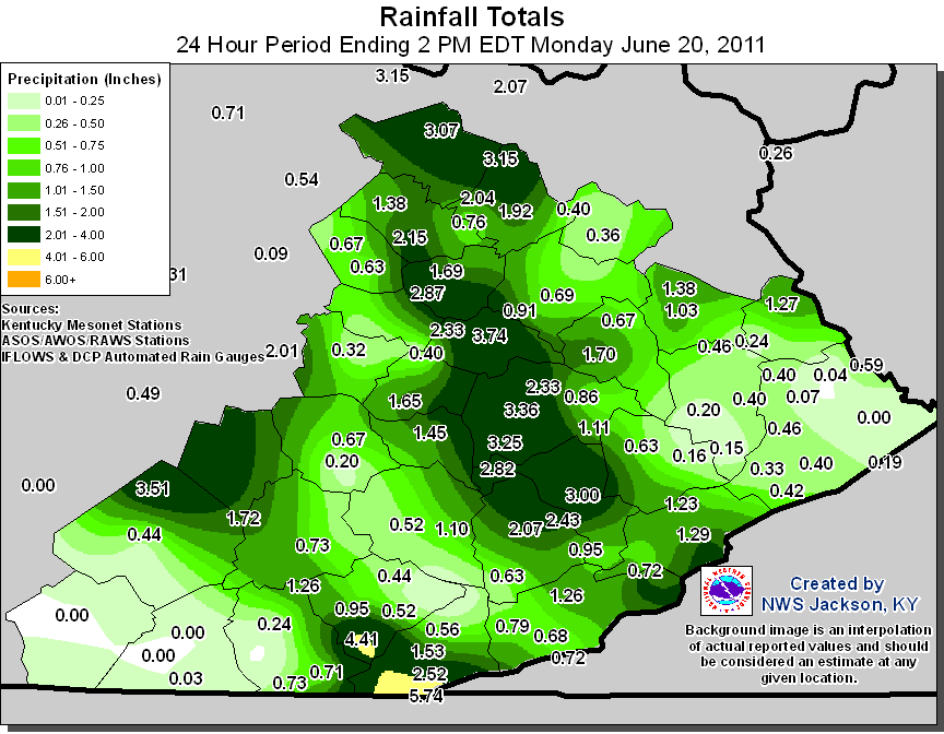
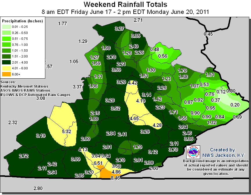
Prior to the morning of Monday June 20th, a series of rainy days had primed local creeks and streams, setting the stage for what would be one of the worst flash floods to impact eastern Kentucky, and the most significant event of 2011. A warm front lifting north through eastern Kentucky on the 19th triggered an outbreak of strong thunderstorms during the afternoon and evening, leaving an outflow boundary across a portion of southeastern Kentucky heading into the overnight hours. This boundary would provide the focus for another round of nocturnal thunderstorms which began training along this boundary. The 24 hours rainfall totals through 2 PM on Monday June 20th, combined with the rainfall totals over the previous weekend illustrates the amount of rainfall which led to the devastating flooding. |
|
 |
 |
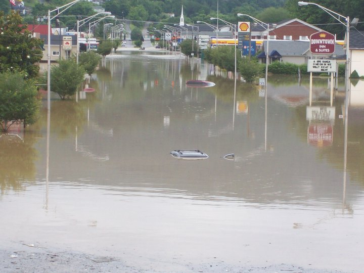
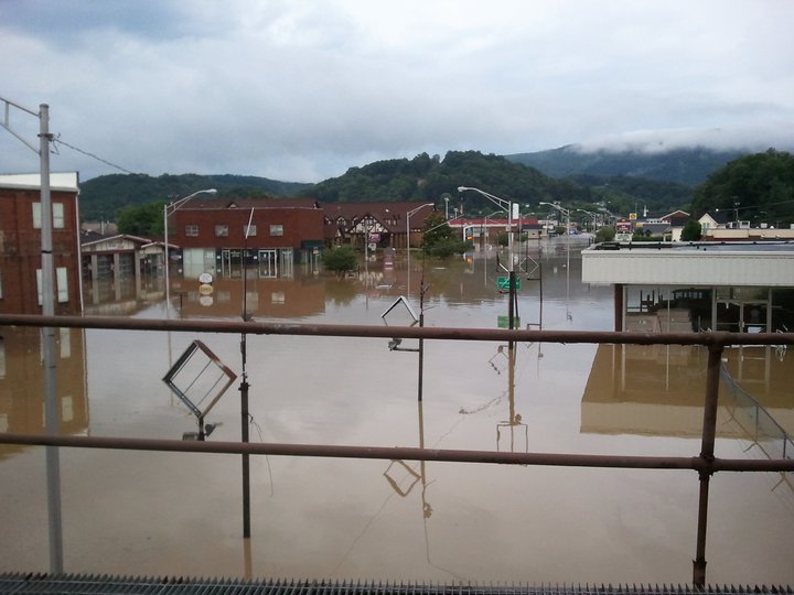
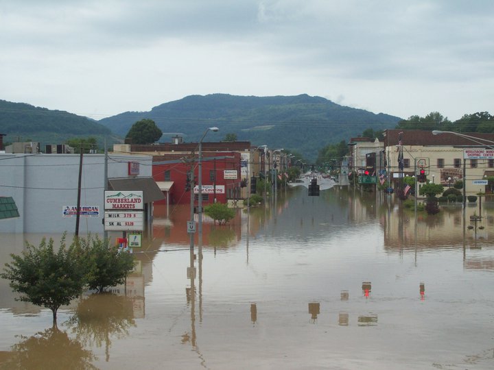
Among the hardest hit areas was the community of Kayjay in southern Knox County, where 1 death was attributed to the flooding when a trailer was swept off of its foundation. Middlesboro in Bell County was also among the areas which were severely impacted, in what many residents called the worst flooding in 20 years. Dozens of roads were inundated around eastern Kentucky, with numerous water rescues throughout Bell, Knox, Whitley and Perry counties during the early morning hours.
 |
 |
 |
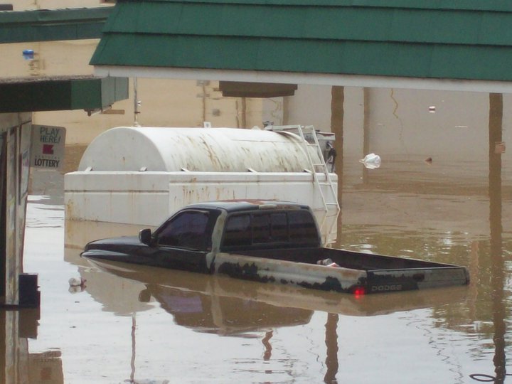 |
| Downtown Middlesboro (photos courtesy of Betty Jones) | |||
 |
Media use of NWS Web News Stories is encouraged! Please acknowledge the NWS as the source of any news information accessed from this site. |
 |
Warnings/Hazards
Decision Support - Outlooks
Current Weather Hazards
Hazards Criteria
Weather Story Graphic
Recent Storm Reports
Submit a Report
Forecasts
Decision Support - Forecast
Aviation Forecasts
Fire Weather Forecasts
Hourly Weather Forecast
Activity Planner
River Forecasts
Forecast Discussion
Current Conditions
Regional Radar
Decision Support - Current
Rivers and Lakes
Hourly Airport Weather
Local Radar
Satellite
Kentucky Mesonet
Past Weather
Local Climate Info
Temp/Precip Summary
How Much Rain Fell?
How Much Snow Fell?
Past Weather Events
Drought Information
Local Coop Observers
US Dept of Commerce
National Oceanic and Atmospheric Administration
National Weather Service
Jackson, KY
1329 Airport Road
Jackson, KY 41339
606-666-8000
Comments? Questions? Please Contact Us.

