Jackson, KY
Weather Forecast Office
Overview
|
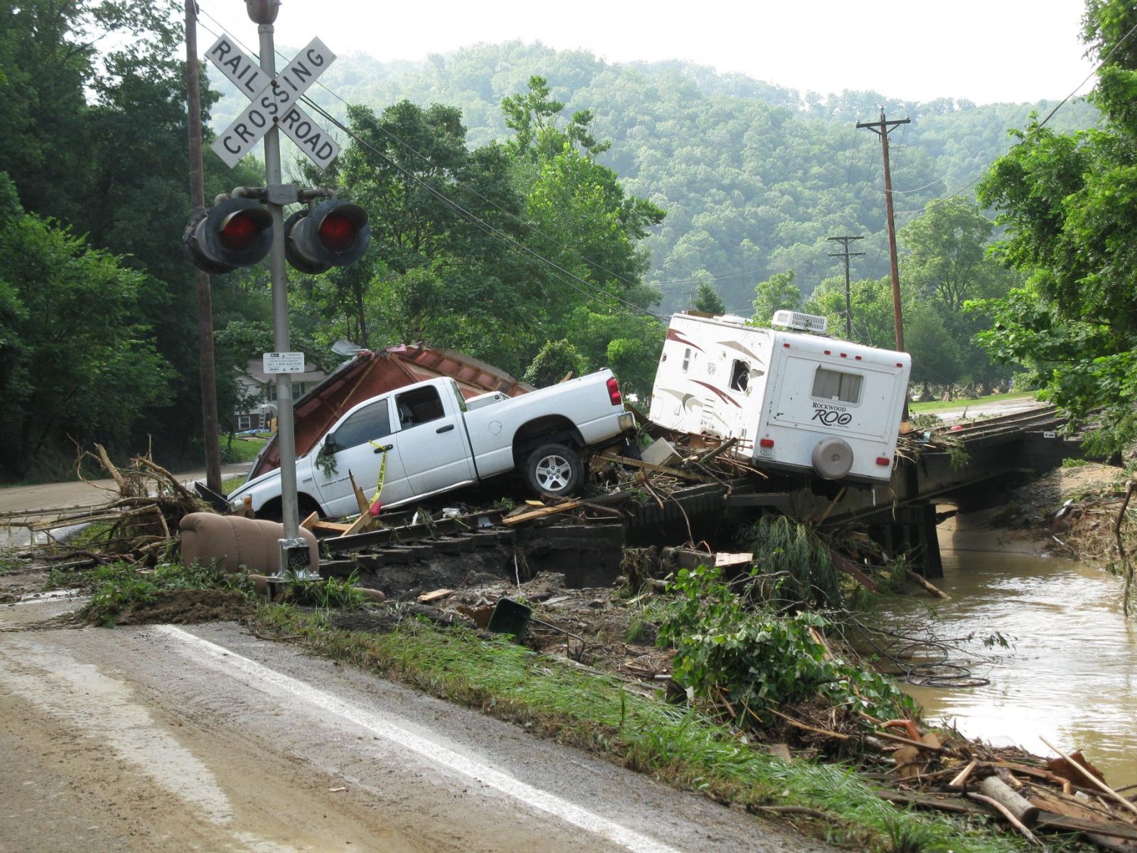
A series of thunderstorms caused widespread flash flooding across portions of Pike County on the evening of July 17, 2010. Initially, thunderstorms developed and moved into the area about 4 pm in the afternoon. Thereafter, thunderstorms redeveloped and moved repeatedly over the same locations, producing the flash flooding. The National Weather Service Office in Jackson, Kentucky issued it's first flash flood warning at 7:57 pm as thunderstorms producing very heavy rainfall continued to move through central Pike County. Tragically, the flash flooding was directly, or indirectly responsible for 2 fatalities. Best estimates indicate that between 3 and 7 inches of rain fell across central portions of Pike County between 4 pm Saturday afternoon and 1 am Sunday morning, with the bulk of the rainfall occurring between 5 pm and 10 pm Saturday. |
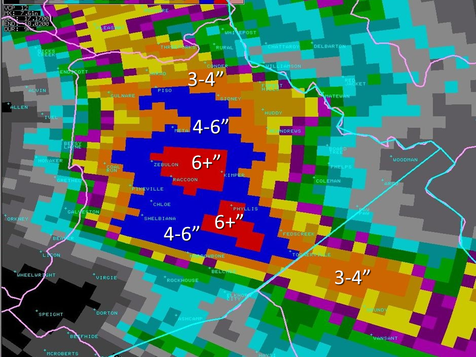 Radar estimated rainfall from 1 pm to 10 pm Saturday July 17, 2010 |
The greatest rainfall amount measured in a rain gauge during the event came from an observer on Lick Creek who measured 4.90" between 6:30 pm and 10 pm Saturday evening July 17th. A cooperative observer in Fedscreek reported 3.66 inches (24 hour amount as of 7am Sunday morning), and an IFLOWS gage at East Ridge High School recorded 4.36 inches over a three and a half hour period Saturday evening as well.
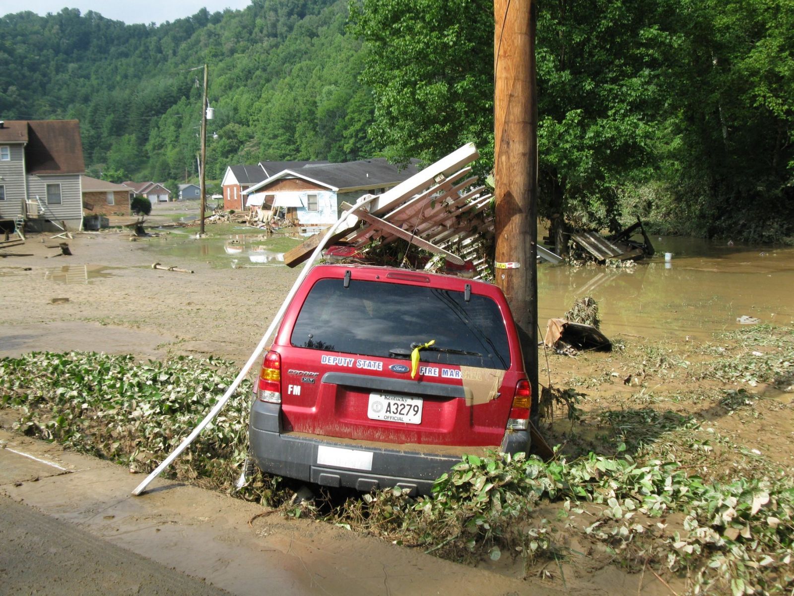
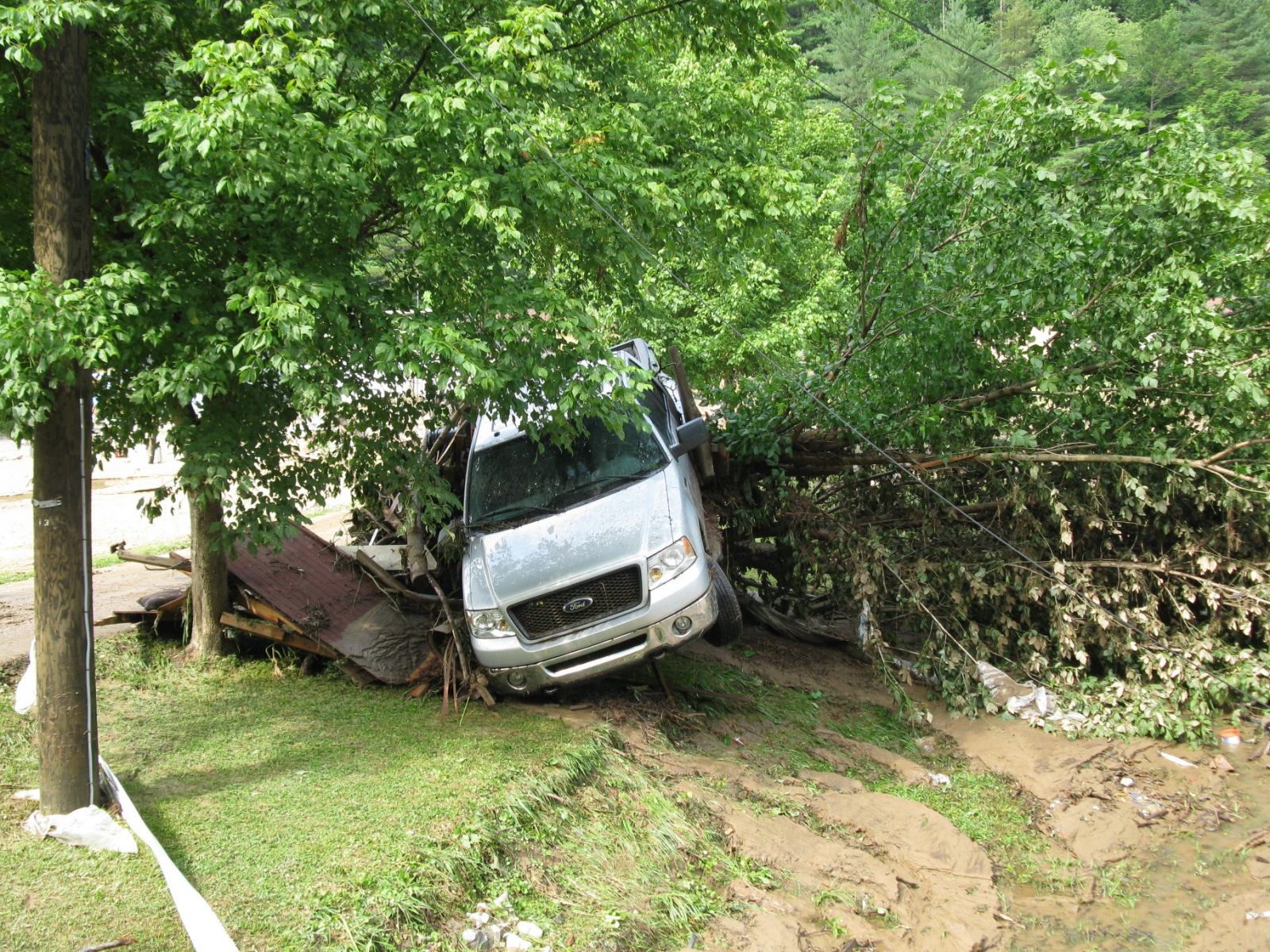
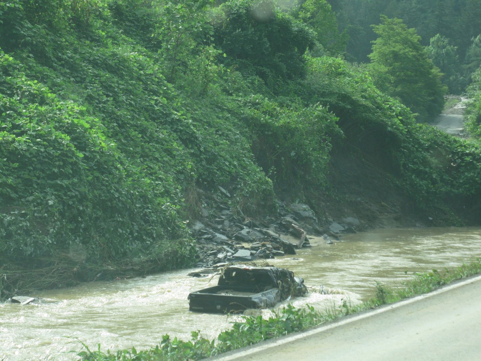
The pictures included below were taken from a NWS survey team and are all from the Racoon Community.
 |
 |
 |
 |
 |
 |
 |
Media use of NWS Web News Stories is encouraged! Please acknowledge the NWS as the source of any news information accessed from this site. |
|
Warnings/Hazards
Decision Support - Outlooks
Current Weather Hazards
Hazards Criteria
Weather Story Graphic
Recent Storm Reports
Submit a Report
Forecasts
Decision Support - Forecast
Aviation Forecasts
Fire Weather Forecasts
Hourly Weather Forecast
Activity Planner
River Forecasts
Forecast Discussion
Current Conditions
Regional Radar
Decision Support - Current
Rivers and Lakes
Hourly Airport Weather
Local Radar
Satellite
Kentucky Mesonet
Past Weather
Local Climate Info
Temp/Precip Summary
How Much Rain Fell?
How Much Snow Fell?
Past Weather Events
Drought Information
Local Coop Observers

US Dept of Commerce
National Oceanic and Atmospheric Administration
National Weather Service
Jackson, KY
1329 Airport Road
Jackson, KY 41339
606-666-8000
Comments? Questions? Please Contact Us.


 Follow us on X
 Follow us on Facebook
 Follow us on YouTube
 JKL RSS Feed