
Heat expands across the Desert Southwest, Plains, Mississippi Valley and Midwest into Monday. Fire weather concerns continue for portions of the Intermountain West. Active monsoonal moisture fuels thunderstorms over the Southwest with possible flash flooding. Tropical cyclone Fausto in the Pacific, should weaken as it approaches Hawaii; Dangerous surf, swells and rip currents are expected. Read More >
Overview
|
One of the strongest storms of the century and a rare true blizzard for eastern Kentucky, brought 6 to 30 inches of snow to eastern and southeastern Kentucky from March 12-14, 1993. Strong winds accompanied the snow, resulting in blizzard conditions and snow drifts of 6 to 10 feet. Interstate 75 was closed from Lexington to the Tennessee border and Interstate 64 was closed from Lexington to the West Virginia border, both for a period of two days. Between 3,000 and 4,000 motorists were stranded along both highways, causing emergency shelters to be set up in Ashland and London. In Whitley County, a man froze to death when he tried to walk from his home into Corbin as temperatures plummeted below zero behind the storm. Some of the heavier snowfall amounts were: Perry County - 30 inches, Pikeville - 24 inches, Ashland - 22 inches, and London - 22 inches. At the Jackson National Weather Service Office, 19.8 inches fell in 24 hours. At Hazard, the 24 hour snowfall record for the state of Kentucky was set as 25 inches fell. In the higher terrain of Harlan County, 4 to 5 feet of snow were reported around Mary Ellen. |
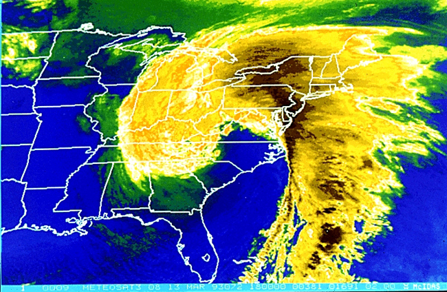 Satellite imagery from March 13, 1993 |
Snowfall
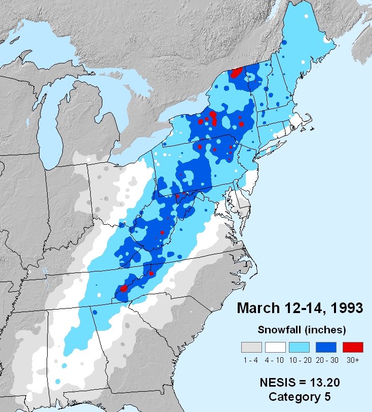 |
| Snowfall totals from March 12-14, 1993. |
Satellite Imagery
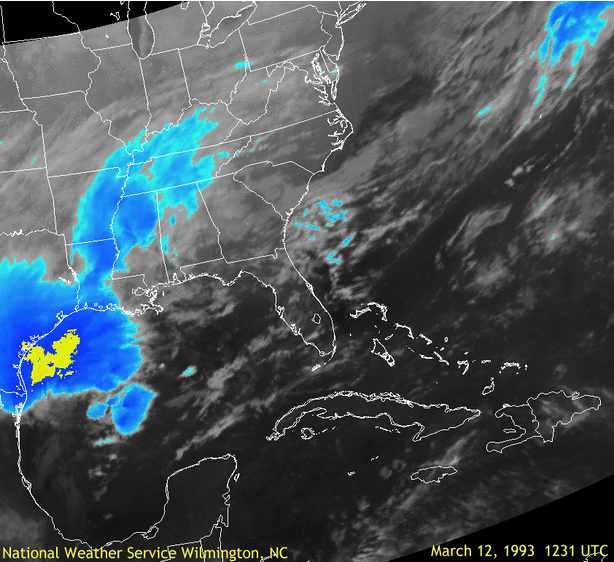 |
| Infrared satellite animation through the duration of the storm. |
Surface Map
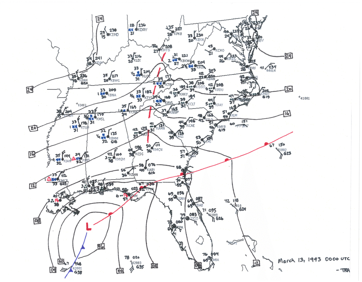 |
| Surface map animation through the duration of the storm. |
 |
Media use of NWS Web News Stories is encouraged! Please acknowledge the NWS as the source of any news information accessed from this site. |
|

