
Tropical Depression Two is expected to gradually strengthen and could bring tropical storm conditions to the Florida Panhandle beginning late Monday. Areas of flash flooding will be possible through Thursday along the eastern and central Gulf Coast. Severe thunderstorms will develop and move along a cold front crossing the Upper Midwest Monday, and through the Ohio Valley/Mid-Atlantic on Tuesday. Read More >
Overview
|
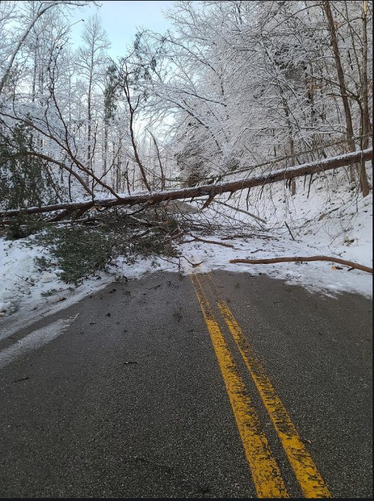
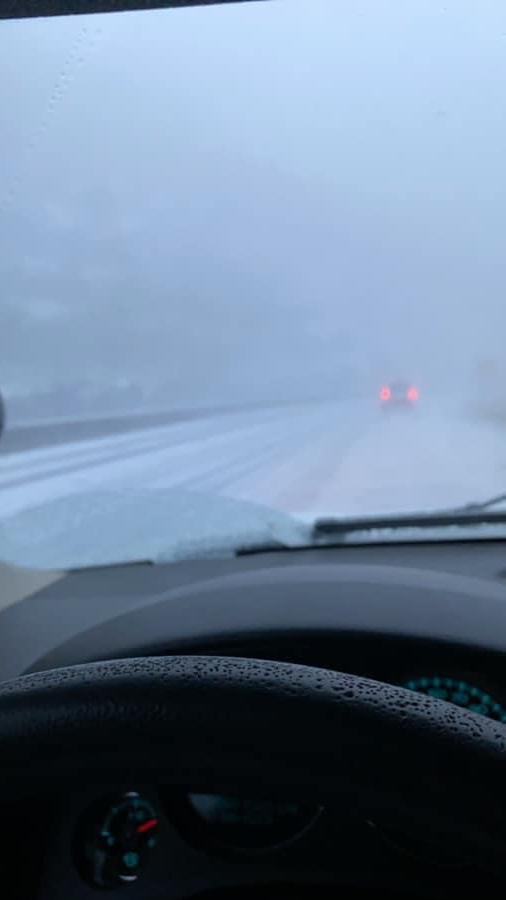
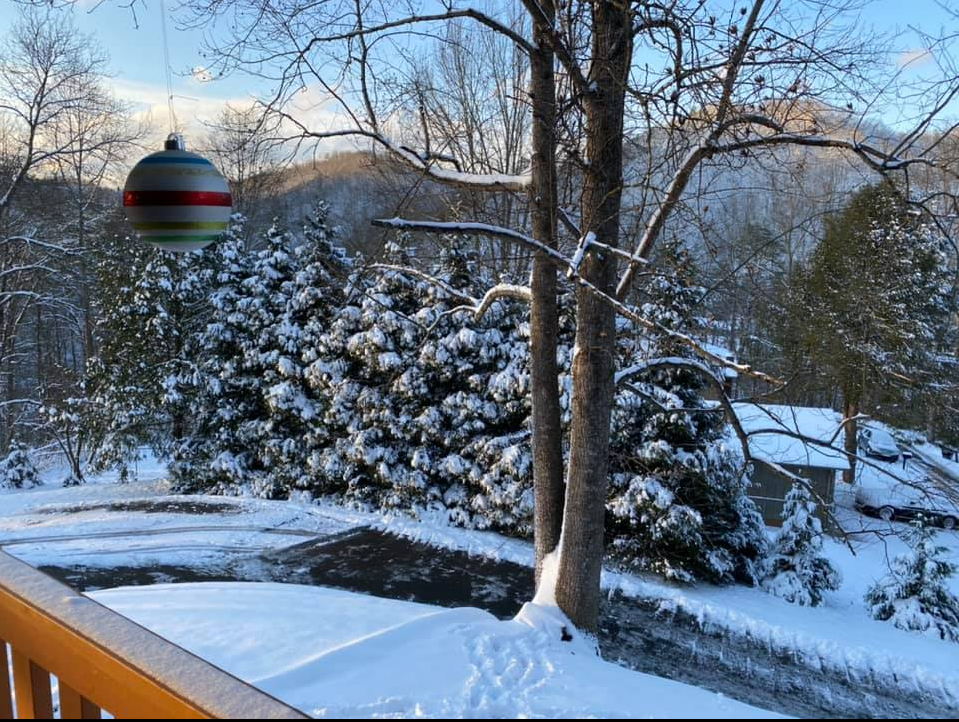
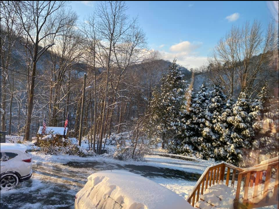
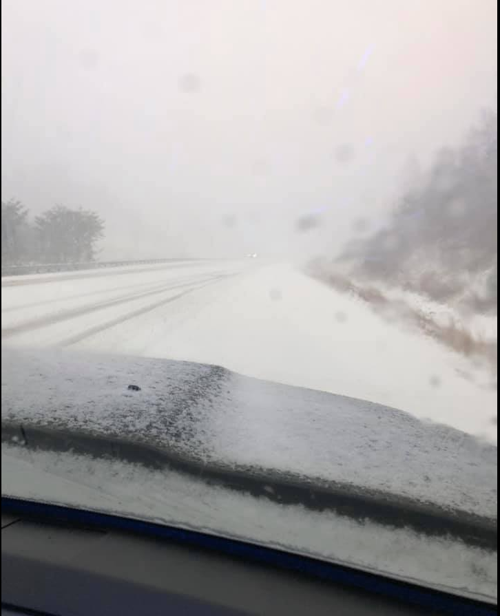
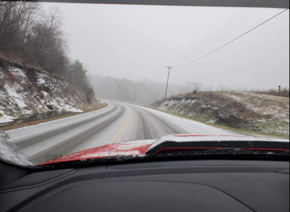
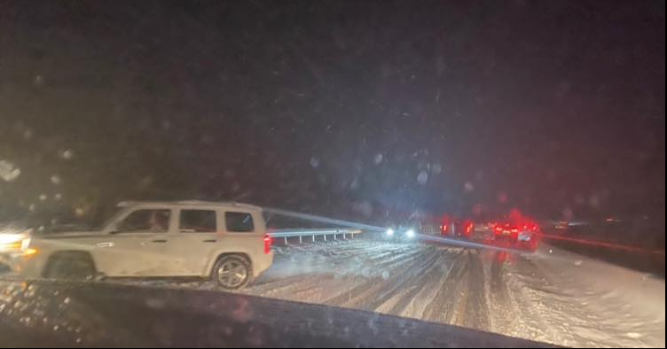
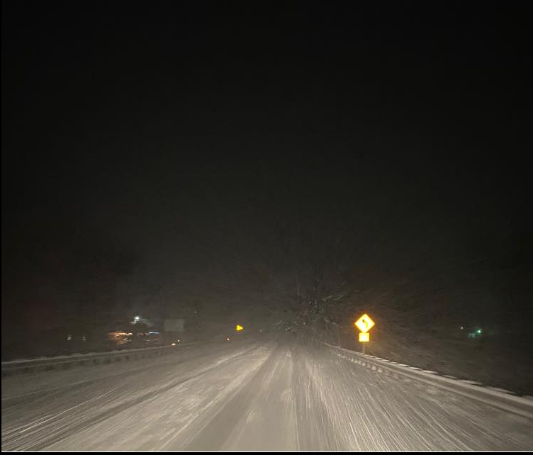
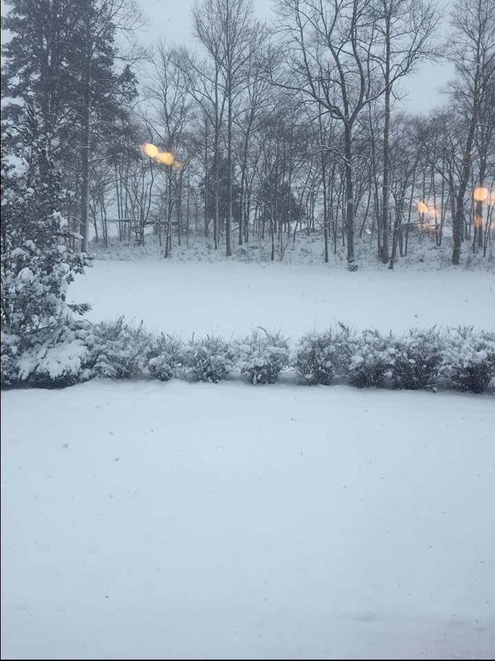
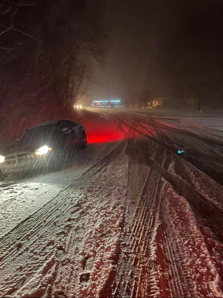
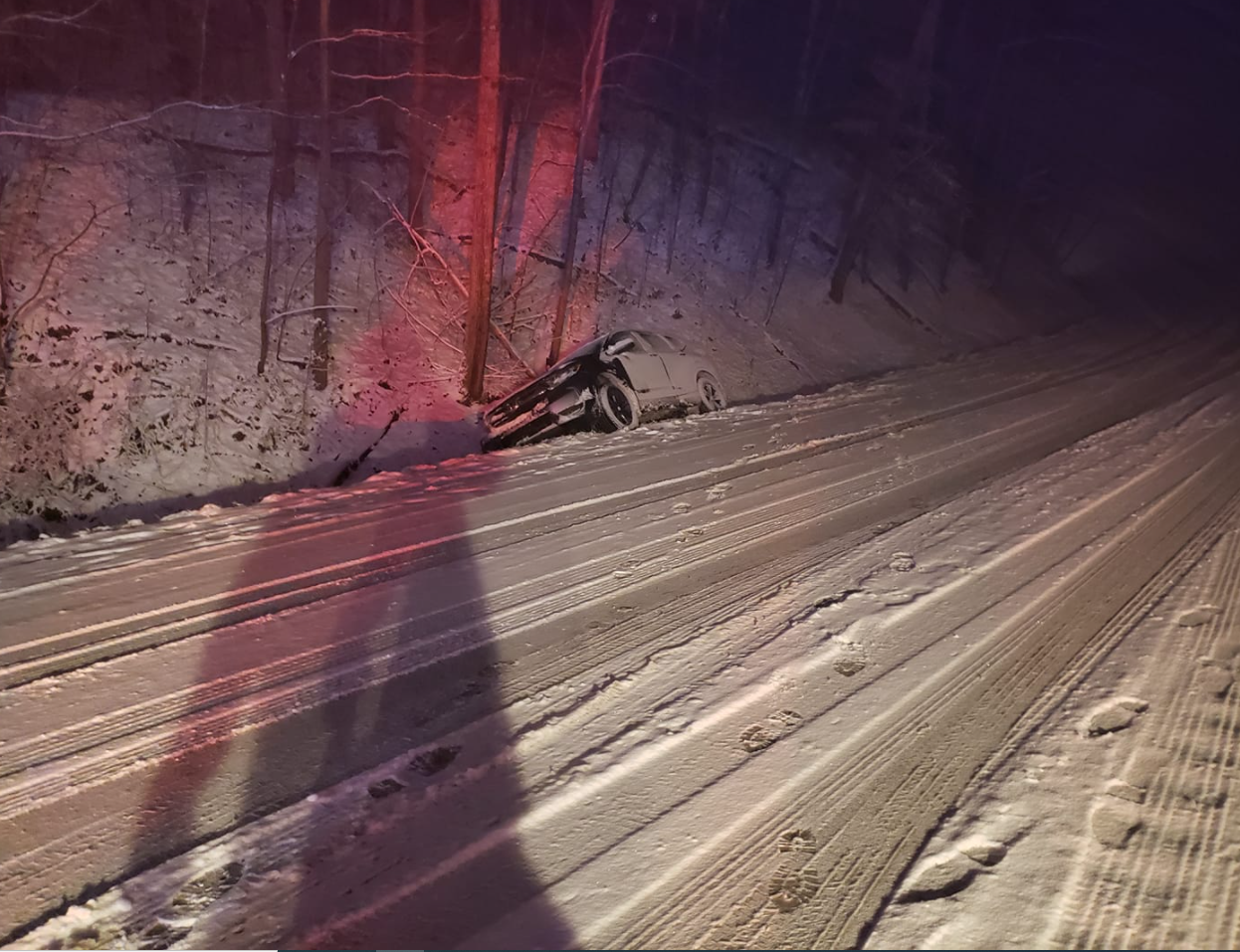
A strong cold front passed through east Kentucky on Christmas Eve. Widespread rain accompanied the cold front through early afternoon. However, as the cold air spread into east Kentucky, it interacted with increasing moisture from a weather disturbance aloft, to provide a changeover to snow that occurred between 2 pm and 8 pm. A short period of sleet was also observed during the changeover time. Snow became very heavy at times with snowfall rates between 1 and 2 inches per hour observed. The snow continued into the evening hours, before the widespread snow pulled out of the area. However, snow showers persisted from Christmas Eve Night through Christmas day, before finally winding down. As temperatures plummeted into the teens and 20s during the evening on Christmas Eve, icy conditions quickly developed areawide. These icy conditions continued through Christmas. The most notable impact was related to travel across east Kentucky. The heavy snow created treacherous road conditions across east Kentucky. The Hal Rogers Parkway was shut down between London and Manchester for a short time. There were also numerous reports of cars off the road and significant backups due to poor weather conditions. In addition, there were many reports of trees knocked down due to the heavy snow along with thousands of power outages. |
|
| Video of the new fallen snow on the evening of Christmas along Quicksand Creek in Breathitt County |
Photos
 |
 |
 |
 |
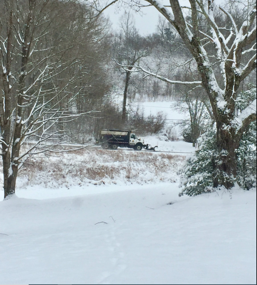
| Kentucky Transportation District 10 Plow (Courtesy of Kentucky Transportation District 11) |
Highway 1110 near Wolfcoal in Breathitt County (Courtesy of Johnny Ray Feltner) |
Christmas Eve Conditions near Jenkins, KY in Letcher County (Courtesy of Jenkins Police Department) |
Near Prestonsburg (Courtesy Jon Pelton) |
 |
 |
 |
 |
| Near Prestonsburg (Courtesy Jon Pelton) |
Near Grassy Hill in Morgan County (Courtesy of Morgan County Sheriff) |
Kentucky Highway 519 in Morgan County (Courtesy of Morgan County Sheriff) |
Mountain Parkway in Floyd County (Courtesy Floyd County Sheriff) |
 |
 |
 |
 |
| Mountain Parkway in Floyd County (Courtesy Floyd County Sheriff) |
Near War Creek in Breathitt County (Courtesy of Kevin Sullivan) |
Paintsville area (Courtesy of WR Castle Fire and Rescue) |
Paintsville area (Courtesy of WR Castle Fire and Rescue) |
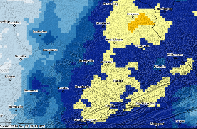 |
| Automated Snowfall Analysis from National Operational Hydrological Remote Sensing Center (NOHRSC) - 24 Hours Ending 7 am December 25, 2020 (Actual Analysis May Not Perfectly Match Observations) |
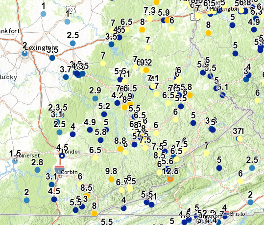 |
| Reports Received by the National Weather Service (These are listed below by county) |
CHRISTMAS EVE AND CHRISTMAS SNOWFALL REPORTS (SORTED BY COUNTY)

Location                     Amount    Time/Date       Lat/Lon

Bell County
1 S Beverly                  9.8 in    0600 PM 12/25   36.92N/83.53W
Middlesboro                  8.0 in    0927 AM 12/25   36.61N/83.72W
Frakes                       5.5 in    0826 PM 12/24   36.64N/83.93W
Chenoa                       5.3 in    0814 PM 12/24   36.67N/83.86W
1 ESE Middlesboro            4.0 in    0635 PM 12/24   36.61N/83.70W

Breathitt County
NWS Office/Julian Carroll    9.0 in    0100 PM 12/25   37.59N/83.32W
Jackson                      8.0 in    1102 AM 12/25   37.56N/83.38W
1 S Paxton                   7.6 in    0900 AM 12/25   37.66N/83.41W
1 W Jackson                  7.0 in    0926 PM 12/24   37.56N/83.39W
1 NNE Noctor                 6.0 in    0915 PM 12/24   37.57N/83.33W
1 N Wilhurst                 6.0 in    0816 PM 12/24   37.65N/83.41W
2 ENE Clayhole               5.5 in    1151 PM 12/24   37.48N/83.27W
Rock Lick                    5.5 in    1003 PM 12/24   37.66N/83.31W
Lawson                       4.2 in    0700 AM 12/25   37.60N/83.46W

Clay County
1 SSW Boho                   6.5 in    1116 PM 12/24   37.11N/83.71W
Oneida                       5.8 in    1020 AM 12/25   37.27N/83.65W

Elliott County
Sandy Hook                   7.0 in    1215 AM 12/25   38.09N/83.12W

Estill County
1 NNE Cressy                 3.7 in    0800 AM 12/25   37.83N/84.04W

Floyd County
1 W Endicott                 8.0 in    1122 PM 12/24   37.67N/82.65W
2 ENE Dotson                 7.5 in    1122 PM 12/24   37.66N/82.82W
David                        6.5 in    1016 PM 12/24   37.60N/82.89W
2 SW Cliff                   6.0 in    1040 PM 12/24   37.66N/82.81W
Emma                         6.0 in    1033 PM 12/24   37.63N/82.70W
Glo                          6.0 in    0859 PM 12/24   37.45N/82.81W
Martin                       5.5 in    0941 PM 12/24   37.57N/82.75W
Prestonsburg                 5.5 in    0915 PM 12/24   37.67N/82.77W
2 SSE Galveston              5.0 in    1018 PM 12/24   37.42N/82.61W

Harlan County
1 E Big Black Mountain      12.8 in    0630 PM 12/25   36.92N/82.87W
Tway                         7.5 in    0800 AM 12/25   36.83N/83.32W
Wallins Creek                6.5 in    1133 PM 12/24   36.82N/83.41W
1 SSW Cumberland             6.0 in    0954 PM 12/24   36.98N/82.99W
Baxter                       6.0 in    0902 PM 12/24   36.86N/83.33W
Coburn                       4.5 in    0730 PM 12/24   36.81N/83.31W

Jackson County
Annville                     4.0 in    0828 PM 12/24   37.32N/83.96W
Sandgap                      3.5 in    0845 PM 12/24   37.49N/84.09W
1 WSW Clover Bottom          2.5 in    0800 AM 12/25   37.49N/84.17W
2 NNW Loam                   2.5 in    1200 AM 12/25   37.43N/84.14W

Johnson County
Hagerhill                    6.0 in    0829 AM 12/25   37.79N/82.79W
Thealka                      5.0 in    0700 AM 12/25   37.82N/82.79W

Knott County
Carrie                       6.0 in    0857 PM 12/24   37.33N/83.03W

Knox County
1 S Trosper                  8.5 in    1150 PM 12/24   36.77N/83.81W
Barbourville                 6.0 in    0925 PM 12/24   36.87N/83.88W

Laurel County
London                       4.5 in    0150 AM 12/25   37.13N/84.08W
North Corbin                 3.0 in    0530 PM 12/24   36.97N/84.09W

Lee County
1 W Monica                   5.0 in    0550 PM 12/24   37.58N/83.62W
2 NE Mount Olive             2.9 in    0900 AM 12/25   37.64N/83.71W

Leslie County
Thousandsticks               8.8 in    0951 AM 12/25   37.19N/83.43W
Hyden                        6.0 in    0840 PM 12/24   37.16N/83.37W
Mozelle                      6.0 in    0750 PM 12/24   37.00N/83.40W

...Letcher County
Defeated Creek               8.5 in    0952 PM 12/24   37.06N/82.99W
Red Star                     7.5 in    0845 AM 12/25   37.14N/83.01W
Thornton                     7.5 in    0924 PM 12/24   37.16N/82.74W
1 SSW Ermine                 6.5 in    0700 AM 12/25   37.10N/82.80W
Fleming-Neon                 6.0 in    1013 PM 12/24   37.19N/82.71W
Partridge                    5.6 in    0849 PM 12/24   37.01N/82.90W
Jeremiah                     5.0 in    0951 PM 12/24   37.17N/82.93W
Whitesburg                   3.0 in    0846 PM 12/24   37.12N/82.83W

Magoffin County
Salyersville                 7.1 in    0949 PM 12/24   37.75N/83.06W
Royalton                     7.0 in    1036 PM 12/24   37.68N/83.02W

Martin County
2 E Inez                     5.9 in    0700 AM 12/25   37.87N/82.50W
1 NE Warfield                5.5 in    1009 PM 12/24   37.84N/82.42W

McCreary County
Whitley City                 2.0 in    0920 AM 12/25   36.73N/84.48W

Menifee County
Frenchburg                   7.0 in    1147 AM 12/25   37.95N/83.62W

Montgomery County
1 S Oggs Station             3.0 in    0719 PM 12/24   38.01N/83.82W
Judy                         2.5 in    0700 AM 12/25   38.13N/83.96W

Morgan County
2 ENE Florress               9.2 in    0907 PM 12/24   37.89N/83.14W
1 NNE West Liberty           7.0 in    1023 PM 12/24   37.92N/83.26W
Florress                     6.3 in    0835 PM 12/24   37.89N/83.18W
Cannel City                  4.0 in    0548 PM 12/24   37.79N/83.28W

Owsley County
1 N Lerose                   5.2 in    0700 AM 12/25   37.50N/83.61W
1 WSW Lucky Fork             5.0 in    0822 PM 12/24   37.36N/83.59W

Perry County
Bulan                        8.0 in    1022 PM 12/24   37.30N/83.17W
1 SW Jeff                    7.5 in    0650 AM 12/25   37.20N/83.15W
1 ESE Hazard                 7.5 in    0650 AM 12/25   37.25N/83.18W
Rowdy                        6.5 in    0911 PM 12/24   37.42N/83.21W
2 SW Dice                    6.5 in    0849 PM 12/24   37.34N/83.26W
1 SSW Ary                    6.0 in    0900 PM 12/24   37.37N/83.15W
2 WSW Bulan                  5.5 in    0958 PM 12/24   37.29N/83.20W
1 NE Avawam                  5.0 in    0852 PM 12/24   37.23N/83.27W
Hazard                       3.5 in    0756 PM 12/24   37.25N/83.20W

Pike County
Whitepost                    5.0 in    1202 AM 12/25   37.73N/82.35W
1 ESE Regina                 5.0 in    1148 PM 12/24   37.36N/82.39W
Zebulon                      2.5 in    0751 PM 12/24   37.52N/82.48W

Powell County
1 E Clay City                4.3 in    1035 PM 12/24   37.86N/83.91W
2 W Stanton                  3.6 in    0800 AM 12/25   37.85N/83.89W
Waltersville                 3.5 in    0700 AM 12/25   37.87N/83.93W
1 NNE Stanton                3.5 in    0959 PM 12/24   37.86N/83.85W
2 ESE Clay City              3.3 in    0821 PM 12/24   37.85N/83.90W
1 SE Clay City               3.2 in    0739 PM 12/24   37.85N/83.92W

Pulaski County
3 SE Mount Victory           2.8 in    0700 AM 12/25   37.00N/84.36W
Somerset                     1.5 in    0837 AM 12/25   37.08N/84.61W

Rowan County
Hilda                        7.0 in    1203 PM 12/25   38.24N/83.51W
1 N Gates                    6.5 in    0700 AM 12/25   38.25N/83.36W
1 SSE Morehead               4.5 in    1152 PM 12/24   38.18N/83.44W

Whitley County
Williamsburg                 4.5 in    1200 PM 12/25   36.74N/84.17W
1 S Deering                  3.1 in    0700 AM 12/25   36.87N/84.20W

Wolfe County
Daysboro                     7.1 in    0906 PM 12/24   37.79N/83.38W
Campton                      6.5 in    0749 PM 12/24   37.74N/83.55W
1 SSW Murphyfork             5.5 in    1111 AM 12/25   37.81N/83.43W
Environment
 |
Media use of NWS Web News Stories is encouraged! Please acknowledge the NWS as the source of any news information accessed from this site. |
|

