
Heat expands across the Desert Southwest, Plains, Mississippi Valley and Midwest into Monday. Fire weather concerns continue for portions of the Intermountain West. Active monsoonal moisture fuels thunderstorms over the Southwest with possible flash flooding. Tropical cyclone Fausto in the Pacific, should weaken as it approaches Hawaii; Dangerous surf, swells and rip currents are expected. Read More >
Jackson, KY
Weather Forecast Office
Overview
|
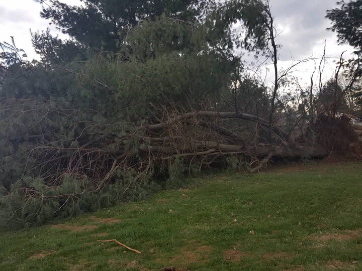
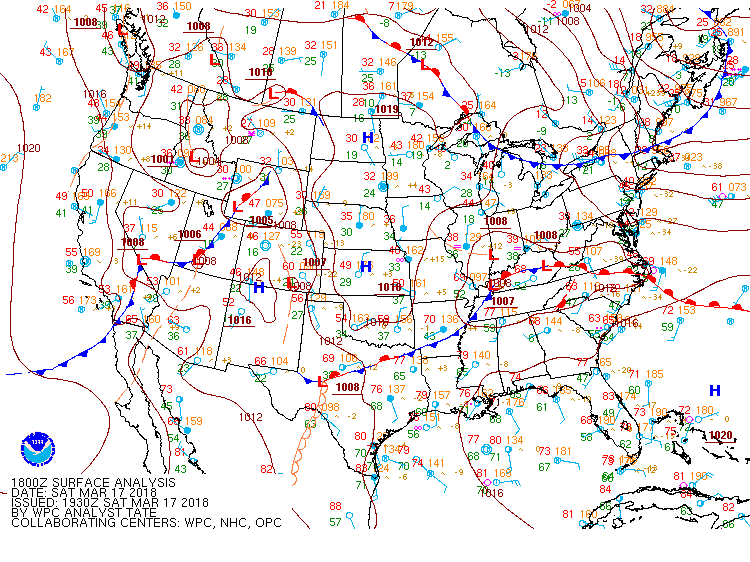
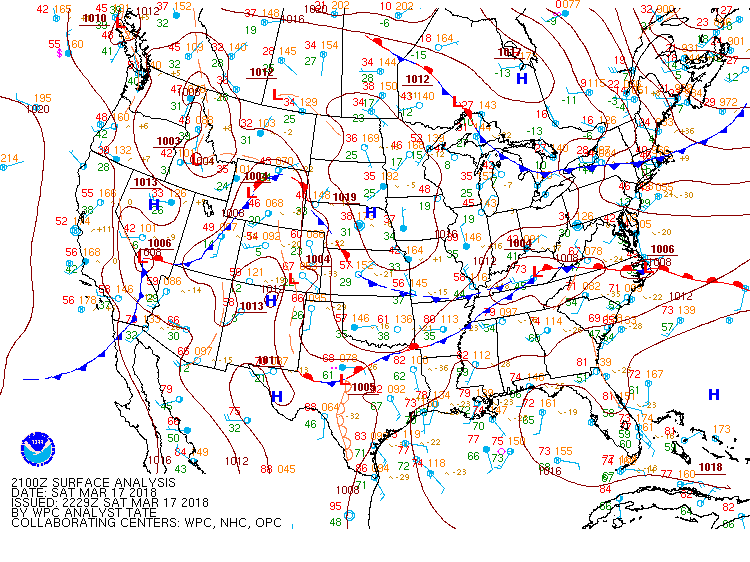
A disturbance passed across Kentucky on March 17th. Scattered thunderstorms developed and quickly turned severe during the evening hours. Storms were responsible for bringing down trees and causing minor structural damage. Some hail reports in excess of an inch were also reported. Severe weather was concentrated in areas south of the Mountain Parkway. |
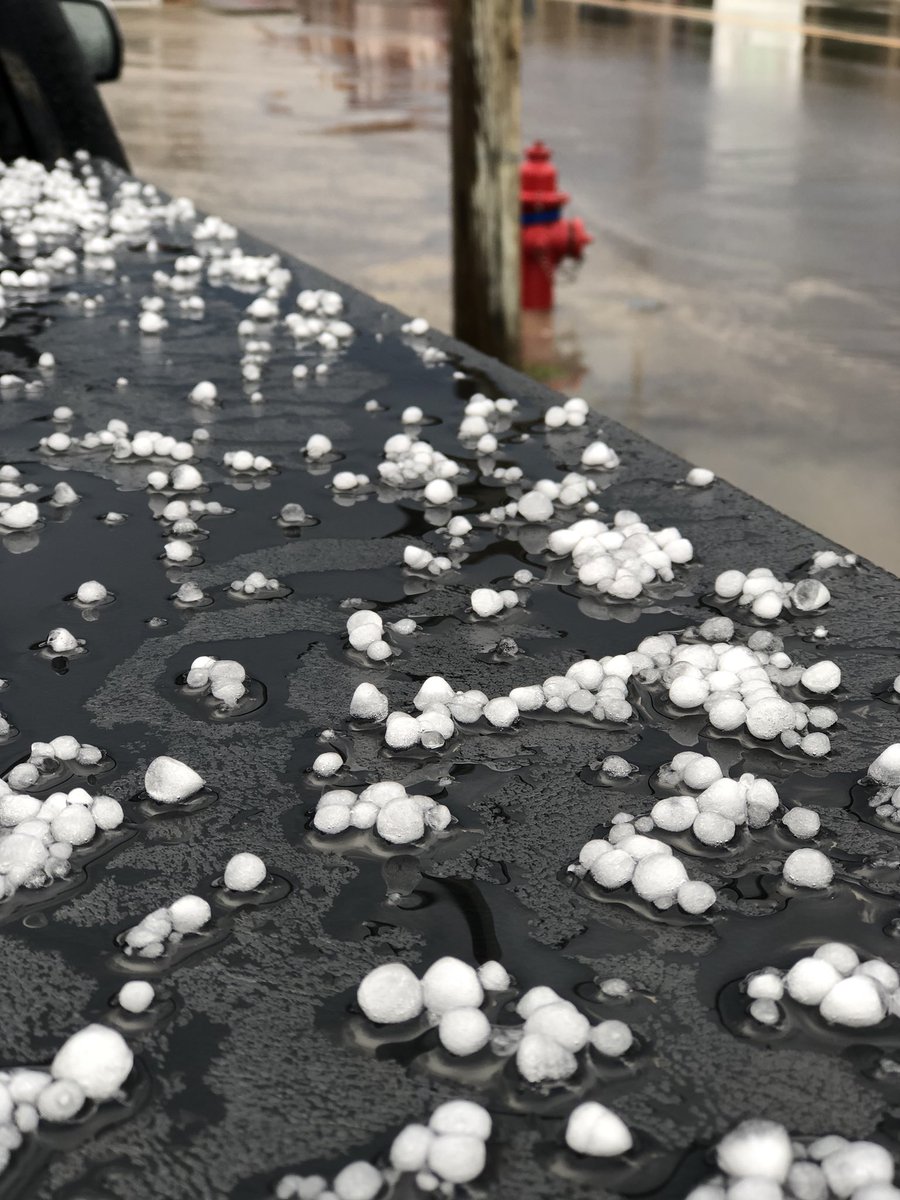 Picture Courtesy of Shawn Smith |
Photos & Video:
 |
 |
 |
| Rockcastle County (Picture Courtesy of Jordan Smith) | Rockcastle County (Picture Courtesy of Jordan Smith) | Rockcastle County (Picture Courtesy of Jordan Smith) |
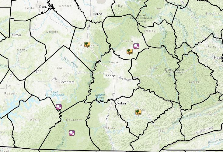
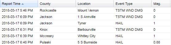
Storm Reports
Environment
 |
 |
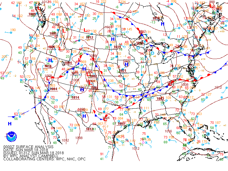 |
| 2 pm Surface Analysis | 5 pm Surface Analysis | 8 pm Surface Analysis |
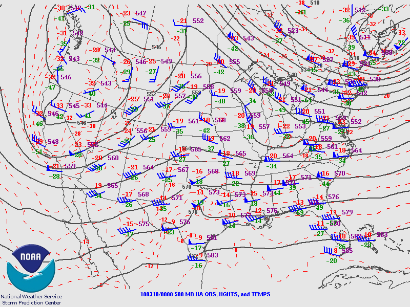 |
| 8 pm 500 mb Analysis |
 |
Media use of NWS Web News Stories is encouraged! Please acknowledge the NWS as the source of any news information accessed from this site. |
|
Warnings/Hazards
Decision Support - Outlooks
Current Weather Hazards
Hazards Criteria
Weather Story Graphic
Recent Storm Reports
Submit a Report
Forecasts
Decision Support - Forecast
Aviation Forecasts
Fire Weather Forecasts
Hourly Weather Forecast
Activity Planner
River Forecasts
Forecast Discussion
Current Conditions
Regional Radar
Decision Support - Current
Rivers and Lakes
Hourly Airport Weather
Local Radar
Satellite
Kentucky Mesonet
Past Weather
Local Climate Info
Temp/Precip Summary
How Much Rain Fell?
How Much Snow Fell?
Past Weather Events
Drought Information
Local Coop Observers
US Dept of Commerce
National Oceanic and Atmospheric Administration
National Weather Service
Jackson, KY
1329 Airport Road
Jackson, KY 41339
606-666-8000
Comments? Questions? Please Contact Us.

