Tropical Depression Two is expected to gradually strengthen and could bring tropical storm conditions to the Florida Panhandle beginning late Monday. Areas of flash flooding will be possible through Thursday along the eastern and central Gulf Coast. Severe thunderstorms will develop and move along a cold front crossing the Upper Midwest Monday, and through the Ohio Valley/Mid-Atlantic on Tuesday. Read More >
Overview
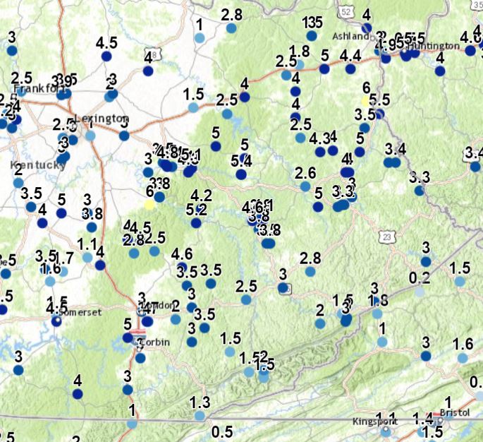
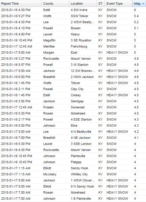
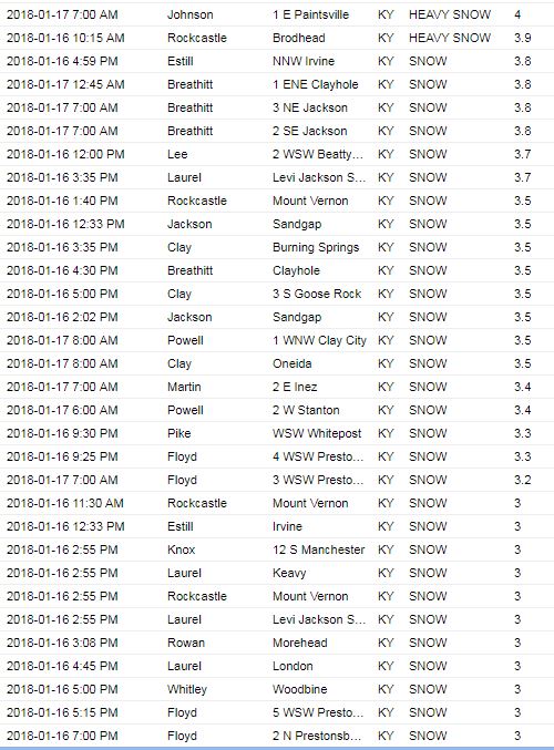
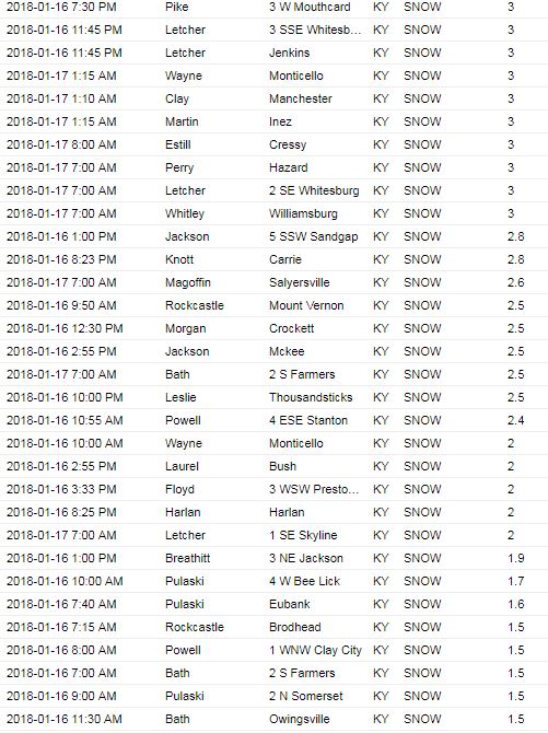
An arctic cold front and upper level disturbance slowly crossed Kentucky from late Monday, January 15th, through Tuesday, January 16th. Both the slow movement of this system along with the development of several heavier snow bands on the 16th brought widespread accumulating snow to eastern Kentucky, with snowfall totals ranging from 1 to 6 inches. With very cold air filtering in as the snow came to an end, roads continued to be hazardous into the morning of January 17th. This led to numerous vehicular accidents, including one on Interstate 75 near London which caused multiple lanes to be shut down for a couple of hours.
 |
 |
 |
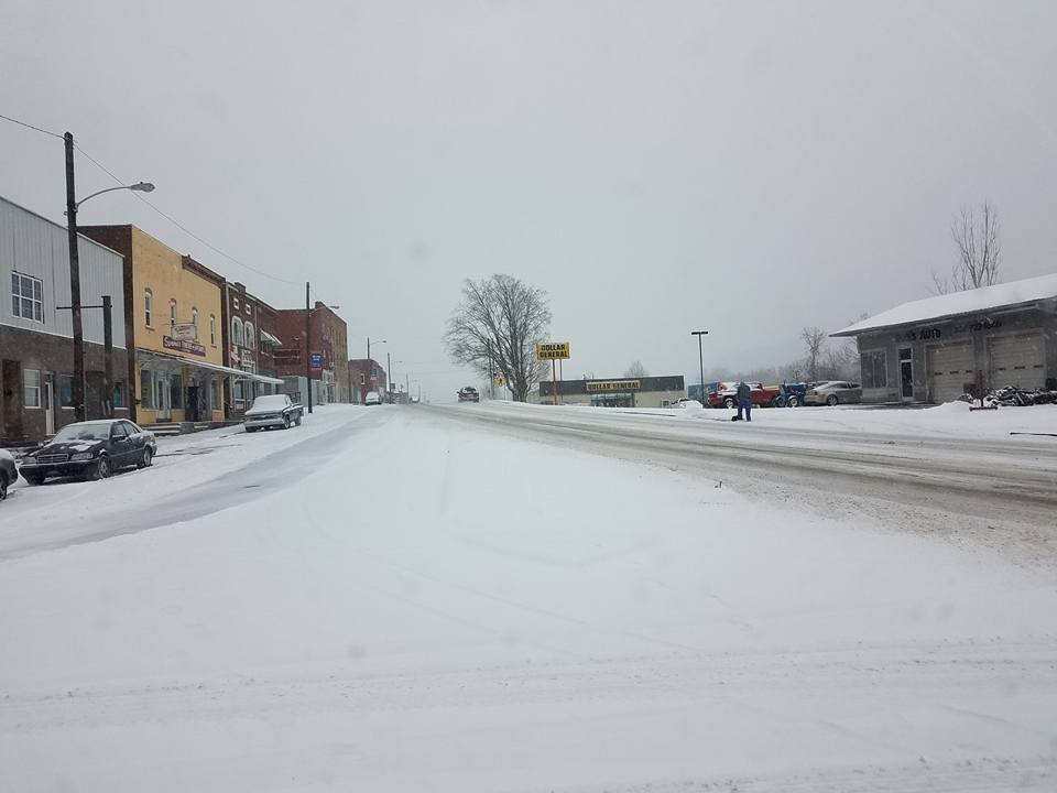
| Main Street in Ravenna (photo courtesy of Estill County Emergency Management) | Hwy 578 North of London (photo courtesy of Johnnie Nicholson) | Pike County (photo courtesy of Mary Reed Runyon) |
 |
 |
 |
|
Lakeshore Drive in Burnside (photo courtesy of Laura Wagner) |
Intersection of Hwy 914 and Hwy 27 in Somerset (photo courtesy of LaTonya Vernon) | Estill Ave in Irvine (photo courtesy of Estill County Emergency Management) |
Storm Reports
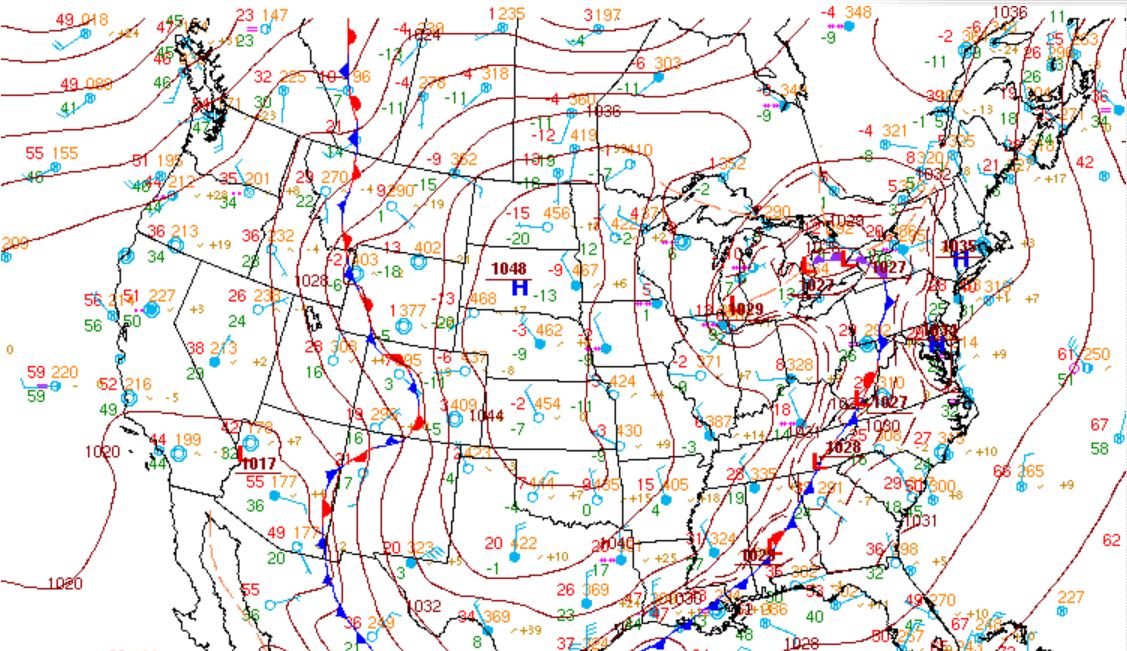
Environment
|
|
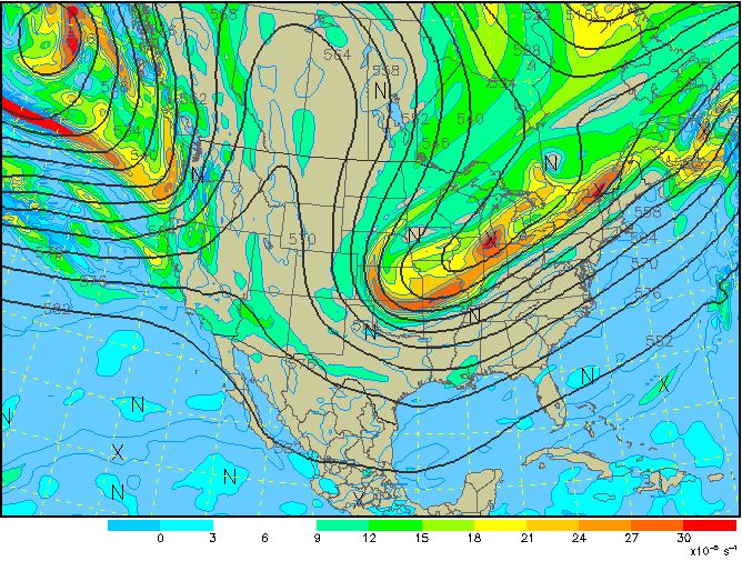 |
| Surface analysis depicting a strong arctic front that moved through during the morning of the 16th. | 500 mb analysis (about 15,000 - 18,000 feet aloft) showing a strong and prolonged period of upper level energy swinging through eastern KY. |
 |
Media use of NWS Web News Stories is encouraged! Please acknowledge the NWS as the source of any news information accessed from this site. |
|