Grand Forks, ND
Weather Forecast Office
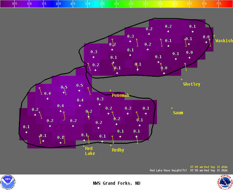
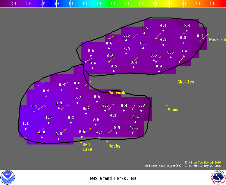
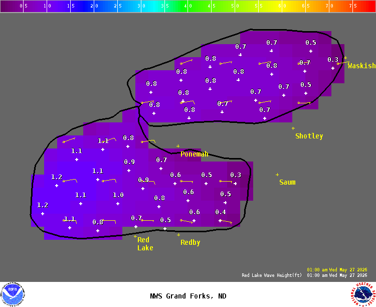
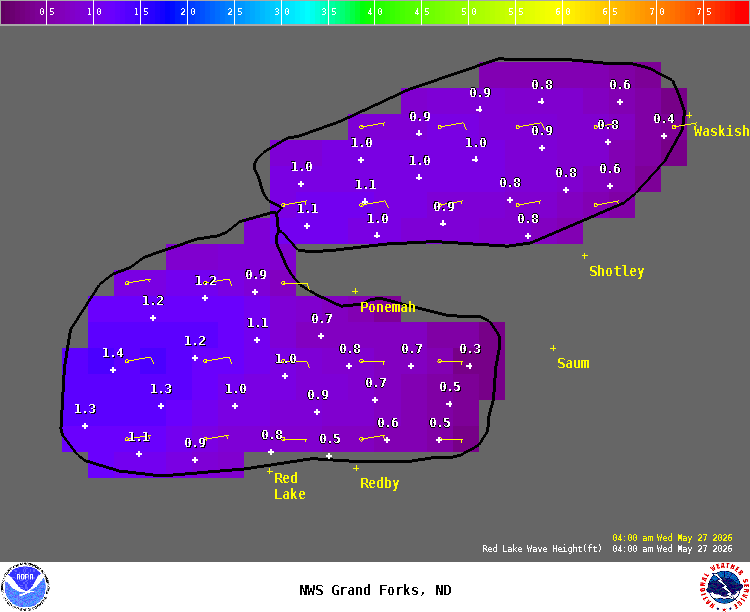
Red Lake Wave Forecast
Remaining ice may affect the wave height forecasts.
Notice: Wave height forecasts represent the average of the highest one-third (33%) of waves. Mariners should be aware that many individual waves will probably be higher.
Link Back to Main Wind-Wave Page
|
Hover over thumbnails below to view a larger image.
|
||||||||||||||||
US Dept of Commerce
National Oceanic and Atmospheric Administration
National Weather Service
Grand Forks, ND
4797 Technology Circle
Grand Forks, ND 58203-0600
701-772-0720
Comments? Questions? Please Contact Us.


