Overview
While most locations in eastern North Dakota and northwestern Minnesota received light snow, a swath of heavier snow fell along a line from south of Devils Lake, through Hillsboro and Halstad, to just north of Park Rapids. The heaviest snow occurred in the Northwood/Hatton ND region with reports of up to 9 inches of snowfall accumulation.Snow Reports
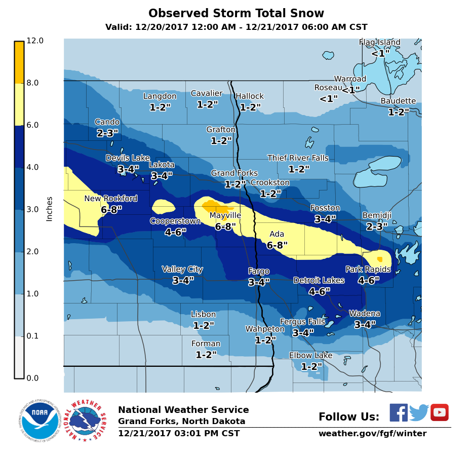
...Snowfall Reports From The Region...

Location                     Amount    Time/Date       Lat/Lon
Northwood ND                 9.0 in    0720 AM 12/21   47.74N/97.57W
Hatton ND 5 S                9.0 in    0730 AM 12/21   47.56N/97.46W
Nevis MN 12 NNW              8.5 in    0800 AM 12/21   47.13N/94.94W
Reynolds ND 1 E              8.0 in    0750 AM 12/21   47.67N/97.09W
Hillsboro ND                 8.0 in    0800 AM 12/21   47.40N/97.06W
Menahga MN 1 W               6.0 in    0700 AM 12/21   46.75N/95.14W
Mayville ND                  5.5 in    0700 AM 12/21   47.50N/97.35W
Ottertail Lake MN 1 N        4.5 in    0800 AM 12/21   46.43N/95.67W
New York Mills MN            4.5 in    0730 AM 12/21   46.51N/95.38W
Penn ND 6 SE                 4.5 in    0700 AM 12/21   48.18N/98.96W
Esmond ND 9 NNW              4.2 in    0600 AM 12/21   48.16N/99.83W
Ottertail MN 1 WNW           4.1 in    0615 AM 12/21   46.44N/95.59W
North River ND 1 SSE         4.0 in    0700 AM 12/21   46.93N/96.79W
Sebeka MN                    4.0 in    0700 AM 12/21   46.63N/95.08W
Blabon ND 4 SW               3.8 in    0700 AM 12/21   47.34N/97.83W
Fargo ND (APT)               3.6 in    0653 AM 12/21   46.92N/96.81W
Cormorant MN 5 NW            3.6 in    0700 AM 12/21   46.80N/96.12W
Oxbow ND  1 SSE              3.6 in    0700 AM 12/21   46.83N/96.80W
Michigan ND                  3.5 in    0700 AM 12/21   48.03N/98.13W
Dunvilla MN 4 W              3.5 in    0745 AM 12/21   46.66N/96.11W
Grand Forks ND 3 SSE         3.5 in    0700 AM 12/21   47.87N/97.05W
Ottertail MN                 3.5 in    0430 AM 12/21   46.42N/95.57W
Moorhead MN 1 NNE            3.4 in    0700 AM 12/21   46.89N/96.75W
Hendrum MN 2 W               3.4 in    0700 AM 12/21   47.27N/96.86W
Sabin MN                     3.4 in    0905 AM 12/21   46.78N/96.66W
West Fargo ND 3.8 SSE        3.2 in    0700 AM 12/21   46.83N/96.85W
North River ND 2 ESE         3.2 in    0800 AM 12/21   46.91N/96.78W
Red Lake Falls MN            3.1 in    0700 AM 12/21   47.88N/96.28W
Rothsay MN                   3.0 in    0730 AM 12/21   46.48N/96.27W
Westbury MN 3 ESE            2.6 in    0510 AM 12/21   46.89N/95.84W
Lake George                  2.5 in    0700 AM 12/21   47.21N/94.98W
Battle Lake MN 2 S           2.5 in    0700 AM 12/21   46.26N/95.71W
Starkweather ND              2.5 in    0700 AM 12/21   48.45N/98.89W
Grand Forks ND 4 SSW         2.2 in    0700 AM 12/21   47.85N/97.09W
Fergus Falls MN 6 SW         2.0 in    0800 AM 12/21   46.22N/96.18W
Grand Forks ND (NWS)         1.9 in    0611 AM 12/21   47.93N/97.08W
Langdon ND                   1.6 in    0800 AM 12/21   48.75N/98.33W
Grand Forks ND (APT)         1.5 in    0653 AM 12/21   47.95N/97.18W
Lankin ND 6 E                1.5 in    0700 AM 12/21   48.33N/97.80W
Crookston MN                 1.5 in    0700 AM 12/21   47.78N/96.59W
Mentor MN 2 SW               1.5 in    0600 AM 12/21   47.67N/96.17W
Abercrombie ND               1.5 in    0600 AM 12/21   46.45N/96.73W
March MN 4 NNE               1.4 in    0700 AM 12/21   48.26N/96.87W
Mavie MN 5 SSE               1.4 in    0700 AM 12/21   48.07N/95.92W
Crookston MN                 1.2 in    0800 AM 12/21   47.80N/96.62W
Lisbon ND                    1.2 in    0700 AM 12/21   46.43N/97.68W
Mcleod ND 3 E                1.2 in    0930 AM 12/21   46.40N/97.24W
Turtle River MN 3 E          1.0 in    0700 AM 12/21   47.58N/94.68W
Breckenridge MN 3 SE         0.9 in    0700 AM 12/21   46.30N/96.52W
Lancaster MN                 0.9 in    0700 AM 12/21   48.86N/96.80W
Backoo ND 3 WNW              0.8 in    0944 AM 12/21   48.85N/97.78W
Greenbush MN                 0.5 in    0700 AM 12/21   48.70N/96.18W
Lisbon ND                    0.5 in    0800 AM 12/21   46.44N/97.67W
Pembina ND                   0.5 in    0737 AM 12/21   48.97N/97.24W
Karlstad MN                  0.4 in    0730 AM 12/21   48.58N/96.52W
Cavalier ND 7 NW             0.3 in    0700 AM 12/21   48.86N/97.70W

Observations are collected from a variety of sources with varying
equipment and exposures. We thank all volunteer weather observers
for their dedication. Not all data listed are considered official.
Photos
Images collected from the region.
 |
 |
 |
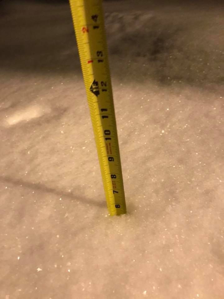 |
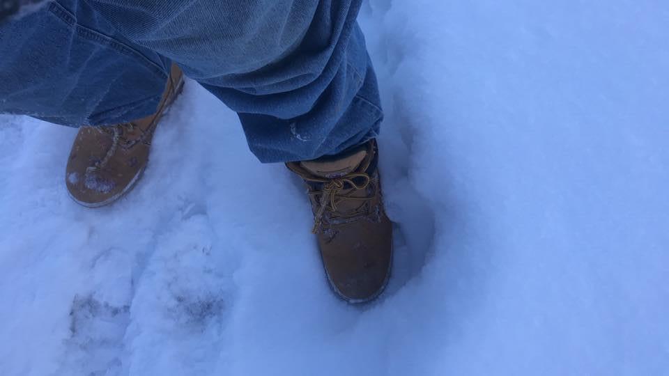
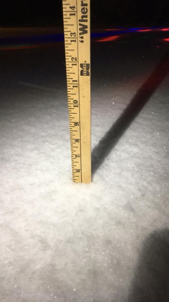
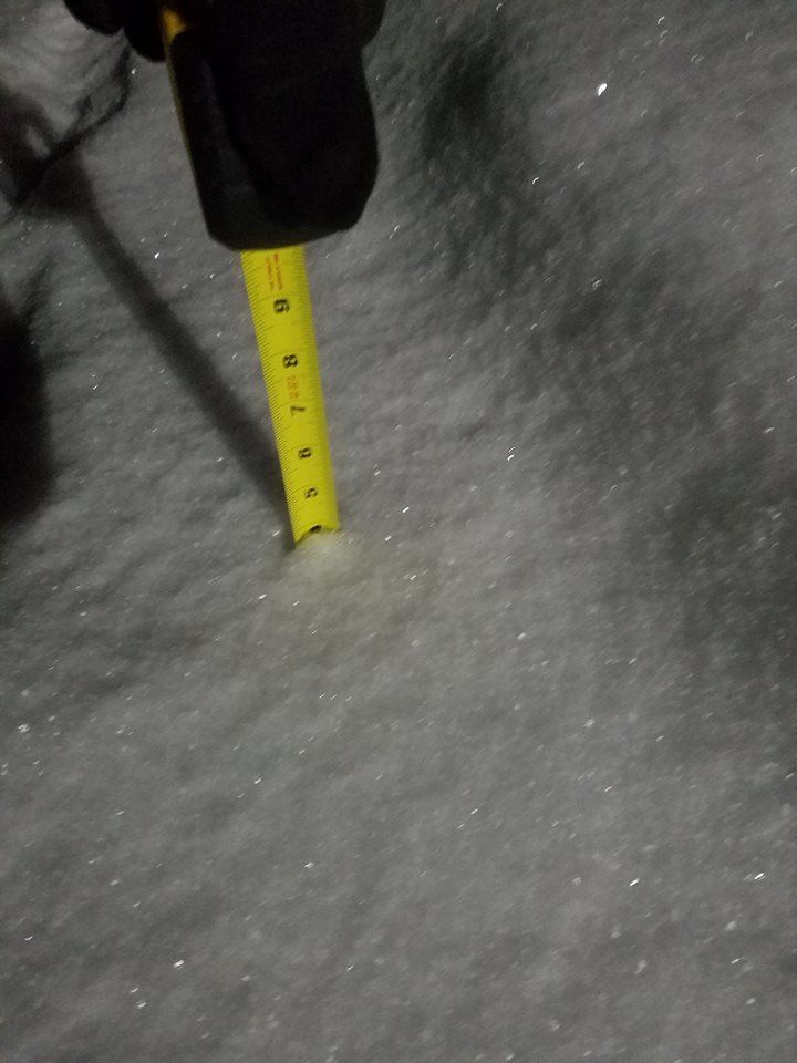
| Ankle deep snow accumulated by the morning of Dec 21, 2017 in Hillsboro, ND. | Just over 5 inches accumulated during the evening of Dec 20 northwest of Buxton, ND. | 4 inches at 4:45 pm would grow into nearly 8 inches of accumulated snow by the next morning in Northwood, ND. | Nearly 6 inches of accumulation had accumulated by 7:00 pm in McVille, ND. |
Radar:
| Radar Loop 1 | Radar Loop 2 | Radar Loop 3 | Radar Loop 4 |
 |
Media use of NWS Web News Stories is encouraged! Please acknowledge the NWS as the source of any news information accessed from this site. |
|

