
Record setting heat is expected over the next several days from the Intermountain West through the northern Plains. Furthermore, fire weather concerns increase with dry and breezy conditions. Meanwhile, heavy rainfall and severe thunderstorm threats for the Ohio/Tennessee Valleys, central Appalachians and Southeast today. The threat shifts to central Gulf Coast and across central Texas this week. Read More >
Event Summary: January 15th, 2018
|
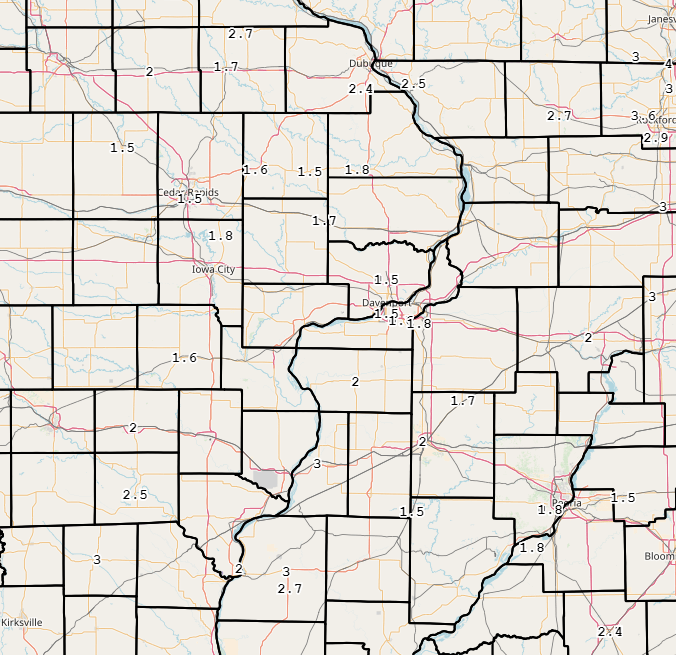
An Alberta clipper brought light snow to all of eastern Iowa, northwest Illinois and northeast Missouri Monday morning. Snowfall amounts ranged from around 1 to 3 inches, with higher amounts occurring over southeast Iowa, northwest Illinois and northeast Missouri. National Weather Service Official Observations (event totals):
|
|
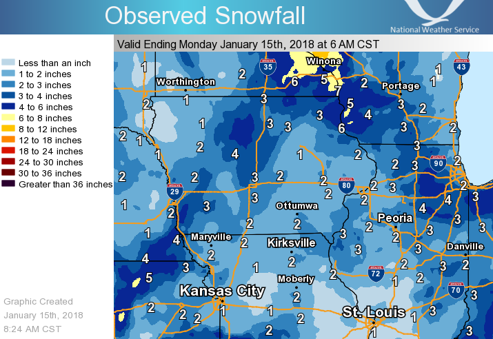 |
| Midwest Snowfall Analysis - Valid 6 AM January 15, 2018 |
.gif) |
|
Link to Radar Animation of Event Radar is courtesy of IEM |
| Interactive Map of Reports | |
 |
|
|
 |
Media use of NWS Web News Stories is encouraged! Please acknowledge the NWS as the source of any news information accessed from this site. |
|


.png)