Tropical Depression Two is expected to gradually strengthen and could bring tropical storm conditions to the Florida Panhandle beginning late Monday. Areas of flash flooding will be possible through Thursday along the eastern and central Gulf Coast. Severe thunderstorms will develop and move along a cold front crossing the Upper Midwest Monday, and through the Ohio Valley/Mid-Atlantic on Tuesday. Read More >
|
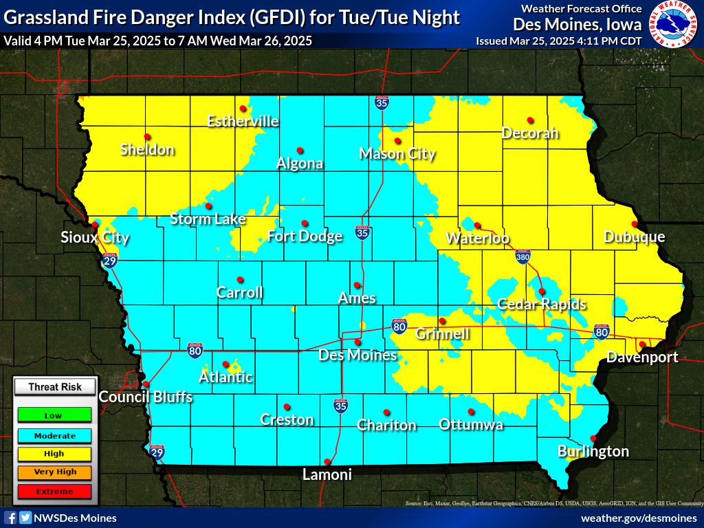
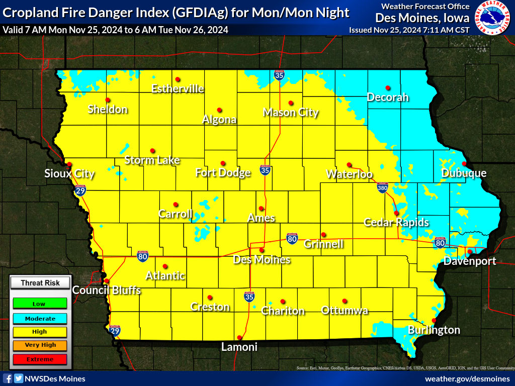
The National Weather Service in the Quad Cities is responsible for providing fire weather forecasts for eastern Iowa, northwest Illinois and northeast Missouri. The fire weather service program provides spot forecast services for the prevention, suppression, and management of forest and rangeland fires.
NWS Fire Weather Forecasts
National Fire Wx Forecast Information
Observations
Additional Fire Weather Information
Requesting a Spot Forecast (FOR OFFICIAL USE BY GOVERNMENT AGENCIES ONLY!) Note: When submitting a SPOT forecast, please request on the day of the burn (not the day prior) and include a proximity weather observation. |
|||||||||||||||||||||||||||||||||||||||||||||||||||||||||||||||||||||||||||||||||||||||||||||||||||||||||||||||||||||||||||||||||||||||||||||||||||||||||||||||||||||||||||||||||||||||||||||||||||||||||||||||||||||||||||