Office Overview
|
NWS Quad Cities Forecast and Warning Area
|
||||||
Each county has a unique FIPS code and zone code. The FIPS code is designated by the state and is used for dissemination of warnings and for programming the SAME Tone-Alert Weather Radios. The zone code is defined by the National Weather Service and is used for disseminating forecasts and other less urgent products and for selecting NOAA Weather Wire products.
|
|
|||||||||||||||||||||||||||||||||||||||||||||||||||||||||||||||||||||||||||||||||||||||||||||||||||||||||||||||||||||||||||||||||||||||||||||
|
|
||||||||||||||||||||||||||||||||||||||||||||||||||||||||||||||||||||||||||||||||||||||||||||||||||||||||||||||||||||||||||||||||||||||||||||||
|
||||
|
Climate The climate of eastern Iowa and northwest Illinois is continental in character, featuring strong seasonal contrasts and sharp daily changes. Winters are cold and generally dry while summers are warm and humid. The mean annual temperature is about 50 degrees ranging from normal highs and lows of upper 20s and around 10 in January, to mid-80s and mid-60s in July. Annual precipitation averages between 30 and 40 inches with much of it falling in the period from April through September. Seasonal snowfall averages about 30 inches, but in the past 30 years has ranged from as little as 12 inches to as much as 70 inches. The average growing season is around 170 days between late April and mid-October.
Recreation Cultural and recreational facilities of all types common to a community of this size are available. The Quad City Symphony Orchestra, oldest west of the Mississippi, performs in Centennial Hall seasonally. A number of theatrical, musical, and sport events are performed throughout the year at the "Vibrant Area at The MARK” with a 12,000 seat capacity. The QCA is home to the a minor league hockey team (Quad City Mallards) and an Arena Football League Team (Quad City Steamwheelers). The Quad Cities is also home to the Quad Cities River Bandits, an Advanced-A baseball team associated with the Kansas City Royals of Major League Baseball. The John Deere Classic Golf Tournament is held annually at TPC Deere Run in nearby Silvis, IL. There are numerous public and five private golf courses in the QCA. Big cities such as Chicago and Des Moines are 2 1⁄2 hours from the Quad Cities, and St. Louis is approximately a four hour drive. Each January, hundreds of Bald Eagles are visible along the Mississippi River in the QCA as they migrate through the region. Pheasant, duck, deer, and small game hunting are available nearby. Boating and fishing on the Mississippi River and nearby lakes and streams draw a sizable share of enthusiasts. Educational Facilities The QCA has two universities; St. Ambrose in Davenport; and, Western Illinois Regional Center in Moline, IL. Augustana College is located in Rock Island, the Palmer College of Chiropractic is in Davenport, Blackhawk College is in Moline, and Scott Community College is in Bettendorf, IA. Three state universities offering a meteorology degree are within a 2-4 hour drive: Northern Illinois University in DeKalb, IL; Western Illinois University in Macomb, IL; and, Iowa State University in Ames, IA. The University of Iowa, located in Iowa City, offers a program in Hydrology and is a one-hour drive from the WFO. For those who have kids in the K-12 range the area also has many choices of public and private schools.
Housing
Rental property is available. Housing is available in a wide range of prices depending on the location and age of the home. Prices are comparable to other similar Midwest cities. A wide range of lifestyles (urban, suburban, small town, and country) are available within a 20 minute drive of the office. The average commuting time is 10-15 minutes, but can range from 5 to 35+ minutes.
Transportation The Quad City International Airport, located in Moline, IL is the main airport serving the QCA and is 18 miles from the WFO. While bus service is available in the cities, none extends to the Davenport Municipal Airport making a car necessary to get to the WFO. Employee parking is free.
|
||||
Office History
|
|||||||||||||||||||||||||||||||||||||||||||||||||||||||||||||||||||||||||||||||||||||||||||||||||||||||||||||||||||||||||||||||||||||||||||||||||||||||||||||||||||||||||||||||||||||||||||||||||||||||||||||||||||||||||||||||||||||||||||||||||||||||||||||||||||||||||||||||||||||||
| May 24, 1871 | Office began on the third floor of the First National Bank Building at Second and Main Streets in Davenport. |  |
| April 1, 1890 | Office moved to the third floor of the Masonic Temple at Third and Main Streets in Davenport. Station elevation was 613 feet. | 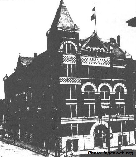 |
| November 3, 1896 | Office moved to the second floor of the Post Office Building at Fourth and Perry Streets in Davenport. Station elevation was 606 feet. (Official wind records made at Moline Airport January 1, 1929 to December 31, 1933.) | 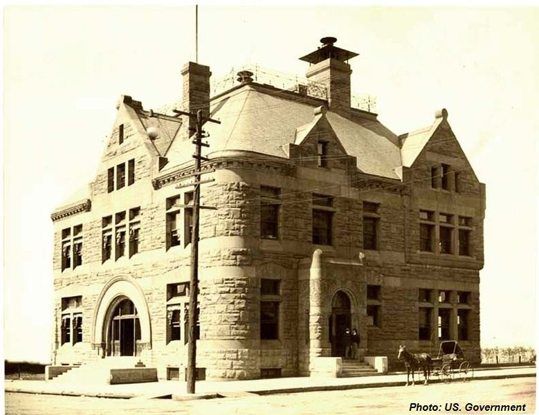 |
| September 4, 1931 | Moved to the sixth floor of the Union Bank Building at Third and Brady Streets in Davenport. Station elevation was 661 feet. |  |
| September 26, 1933 | Moved to the third floor of the Post Office Building at Fourth and Perry Streets in Davenport. Station elevation 619 feet. | 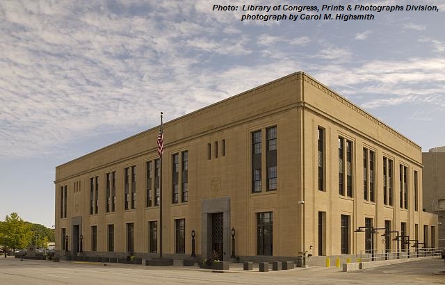 |
| October 1, 1936 | Opened new office on the northeast corner of the Moline Airport. | |
| December 27, 1939 | Moline office moved to the second floor of the Administration Building of the Moline Airport (renamed Quad City Airport in 1954). Station elevation 589 feet. | |
| February 28, 1953 | Davenport City Office closed. | |
| August 30, 1977 | The Weather Surveillance Radar (WSR 74C) was commissioned this date at the Quad City Airport in Moline, Illinois. It was later dedicated on September 13, 1977. | |
| April 4, 1961 | Moved to the second floor of the Terminal Building (renamed Airport Annex in 1986) of the Quad City Airport. Station elevation 589 feet. | |
| February 5, 1991 | The Weather Service was relocated to the south side of the Quad City Airport. 7501 68th ST, Milan, IL 61264-3266. Station elevation 589 (Ivory Tip 584.807 ft). Additional Note... The local warning RADAR was left behind at the old location until April of 1991. RADAR operations were conducted at the old location into April of 1991. From the last part of April into the month of May 1991, RADAR was relocated to its new location at the Rock Island county FEMA site. RADAR observations were conducted at the new location from that time forward. | |
| October 27, 1993 | A formal groundbreaking ceremony was conducted at the Davenport, Iowa Airport, to mark the beginning of construction of a new Weather Forecast Office (WFO). Meteorologist in Charge (MIC) James F. Meyer of Weather Service Office (WSO) Moline, Illinois, joined several local and state dignitaries in turning the symbolic first shovelsful of earth for the project. | |
| August 1, 1994 | New National Weather Service Office at the Davenport, Iowa Airport accepted. No staff on hand at this time with the actual physical move occurring at a later date. | 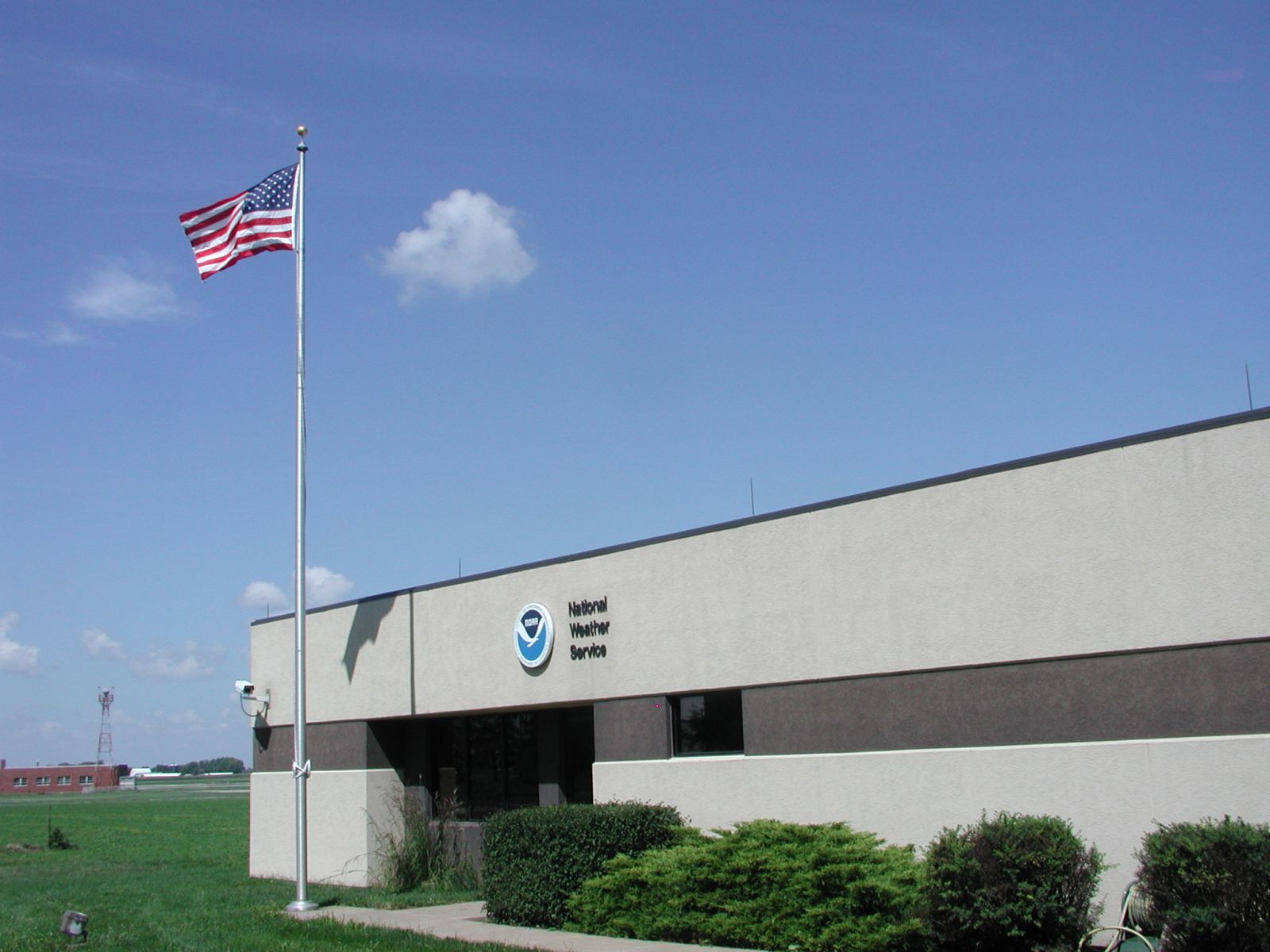 |
| September 1994 | Part time operations started at the new National Weather Service Office in Davenport, Iowa. Charles Fenley, the new MIC, arrived on September 6 and new office furniture arrived on September 12. Management staff working between the hours of 8 AM and 5 PM. Full time operations not expected until early 1995. | |
| November 2, 1994 | WSR-88D tower dome was raised and placed on the tower platform at 355 PM. South winds of 18 to 25 knots made this a tricky task. Martin Ray, UNISYS Field Engineer, said "It's all downhill from here." RDA, RPG, and PUP arrived on November 8. | 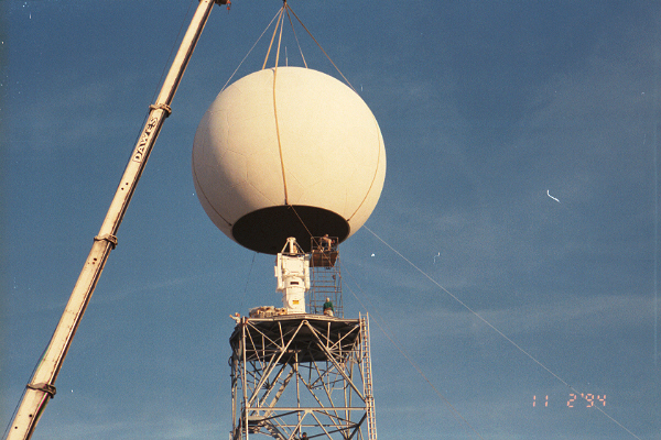 |
| January 13, 1995 | WSR-88D was accepted (handed over to the NWS) from Unisys. | |
| February 16, 1995 | Upper Air equipment was moved from Peoria, Illinois to the new Davenport, Iowa NWS location during the week of the 13th. The first flight was launched on February 16 at 5:00 p.m. LST (00Z 2/17/95). | 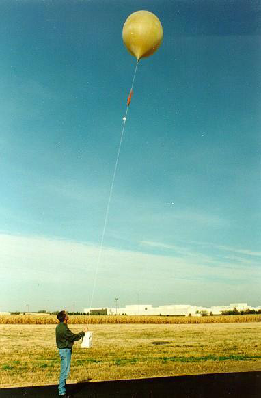 |
| February 20, 1995 | Full time warning and Short Term Forecast operations officially started at the new NWS facility at the Davenport Airport as of midnight LST. | |
| February 22, 1995 | All remaining equipment at the Moline, Illinois office was moved to the Davenport, Iowa office. This included the NOAA Weather Radio console which operated the Rock Island, Illinois transmitter. All surface observational equipment and several Interns and HMTs remained at the Moline office to take surface observations. This was required until ASOS was commissioned. | |
| February 23, 1995 | The NOAA Weather Radio console from Waterloo, Iowa was brought over to the Davenport, Iowa office and turned into the Cedar Rapids, Iowa console. (Des Moines, Iowa NWS office switched their Cedar Rapids NWR over to the Waterloo circuit). | |
| March 1, 1995 | The County Warning Area (CWA) for the new Quad Cities NWS office expanded from the 12 county CWA (from Moline, Illinois) to 34 counties. | |
| March 6, 1995 | The Dubuque, Iowa NOAA Weather Radio console was moved from Dubuque to the new Quad Cities NWS office. This brought our total NWR consoles up to a total of three. | |
| April 1, 1995 | Hydrologic responsibility was assumed on this date over the 34 county Hydrologic Service Area (HSA). | |
| July 1, 1995 | The Moline, Illinois Automated Surface Observing System (ASOS) unit was commissioned and taking the official surface weather readings at the Quad City Airport. All remaining NWS staffing at Moline office transferred to the new Quad Cities (Davenport) office. | |
| September 1, 1995 | Dubuque, Iowa ASOS commissioned on this date. National Weather Service staffing remained through October 15, 1995. No official NWS presence after October 15, 1995. | |
| September 7, 1995 | WSR-88D commissioned as the official National Weather Service radar. |  |
| November 1, 1995 | Terminal Aviation Forecast (FT) for Moline, Illinois assumed by the new Quad Cities NWS office | |
| December 1, 1995 | Terminal Aviation Forecasts for Dubuque, Cedar Rapids and Burlington assumed by the new Quad Cities NWS office. | |
| January 1, 1996 | Transcribed Weather Broadcast Text Products (CHITWB216, CHITWB217, CHITWB303 and DSMTWB305) assumed by the new Quad Cities NWS office. | |
| February 7, 1996 | The old WSR 74C radar located at old NWS location was decommissioned this date. All of the equipment (except the tower) was sold to private sources in June of 1996. | |
| August 1, 1998 | NOAA Weather Radio (NWR) "Console Replacement System" (CRS) was officially activated this day as of midnight LST. This ushered in new computer voice capabilities as the new voice of the NWS. | 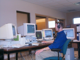 |
| October 1998 | The last of 5 new Senior Forecasters arrived on station to complete the forecast staff. | |
| February 17, 1999 | National Weather Service Quad Cities (Davenport, Iowa), began forecasting for 21 zones (counties) in eastern Iowa and 13 zones (counties) in northwest Illinois. The first official Area Forecast Discussion, Zone Forecast Product and CCF product were prepared by forecaster Mike McClure. | 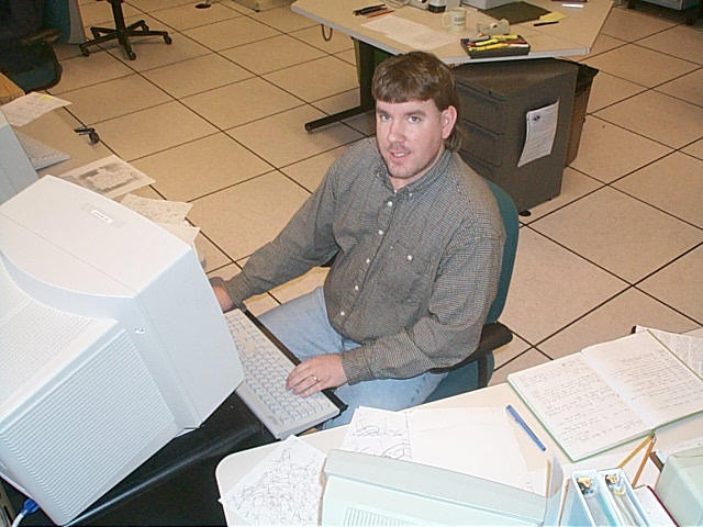 |
| March 1999 | During the week of March 15, the new Advanced Weather Interactive Processing System (AWIPS) was installed at National Weather Service Quad Cities. AWIPS was the next generation computer workstation for the NWS and replaced the Automation of Field Operations and Services (AFOS) computer work station. AFOS was not totally out of the picture until AWIPS was officially commissioned around the turn of the new century. | |
| November 17, 1999 | Warning and forecast responsibility for Scotland and Clark Counties in northeast Missouri transferred from NWS St. Louis to NWS Quad Cities, bringing the total number of counties covered by NWS Quad Cities to 36. | |
| January 27, 2000 | CRS commissioned. | |
| March 27, 2000 | AWIPS commissioned. | |
| February 8, 2000 | New NOAA Weather Radio Transmitter installed near Princeton, Illinois. Began broadcasting at 5:45 PM. This is the first of many expansion transmitters in our county warning area to be installed. | |
| March 10, 2000 | New NOAA Weather Radio Transmitter installed in West Burlington, Iowa. This transmitter is part of the Iowa Weather Radio expansion project. | |
| March 28, 2000 | New NOAA Weather Radio Transmitter installed near Fairfield, Iowa. This transmitter is part of the Iowa Weather Radio expansion project. | |
| March 29, 2000 | AFOS powered down for the last time. | |
| April 25, 2000 | New NOAA Weather Radio Transmitter installed near Medill, Missouri. This transmitter is part of the Iowa Weather Radio expansion project. | |
| June 1, 2000 | New NOAA Weather Radio Transmitter installed near Macomb, Illinois. This transmitter is part of the Iowa Weather Radio expansion project. | |
| November 16, 2000 | Zone Forecasts expanded from 5 days to 7 days. | |
| October 2, 2001 | New NOAA Weather Radio Transmitter installed near Maquoketa, Iowa. This transmitter is part of the Iowa Weather Radio expansion project. | 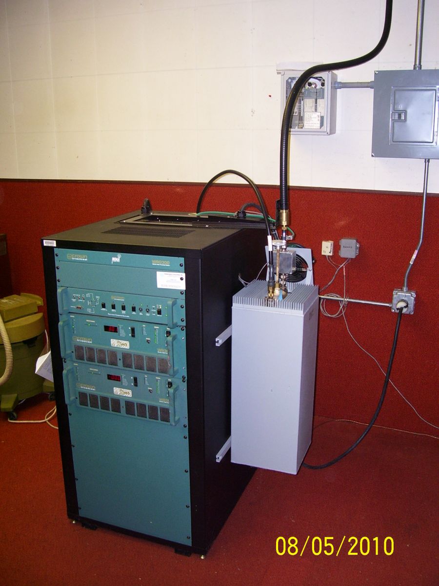 |
| October 4, 2001 | New NOAA Weather Radio Transmitter installed near Freeport, Illinois, bringing the office total to 10 transmitters and county warning area coverage to near 100%. | |
| January 1, 2002 | First Digital (Numerical) Forecast issued by this office. | |
| January 22, 2002 | First Fire Weather Spot Forecast issued from this office. | |
| May 1, 2002 | First Graphical Forecasts posted to the internet by this office. | |
| June 20, 2002 | New computer voice (known as "Craig") first aired on the 10 NOAA Weather Radio stations operated from this office. Craig broadcast the tone alert test. | |
| November 3, 2002 | State of Illinois Cooperative Observer Appreciation Day. NWS Offices in Chicago (LOT), Lincoln (ILX), and the Quad Cities (DVN) partnered with national, regional, and state officials to recognize the efforts and contributions of cooperative weather observers in Illinois. | |
| February 24, 2003 | Jim Belles begins as the new MIC of WFO Quad Cities. | |
| May 9, 2003 | First news conference hosted by WFO Quad Cities for tornado outbreak anticipated the next day. | |
| June 19, 2003 | Updated computer voice known as "Tom" first broadcast on 10 NOAA Weather Radio stations operated by NWS Quad Cities. | |
| August 20, 2003 | A 77 mph wind gust hit the northwest corner of the office at 7:01 PM, peeling back part of the roof. Service backup was initiated for about 18 hours. | 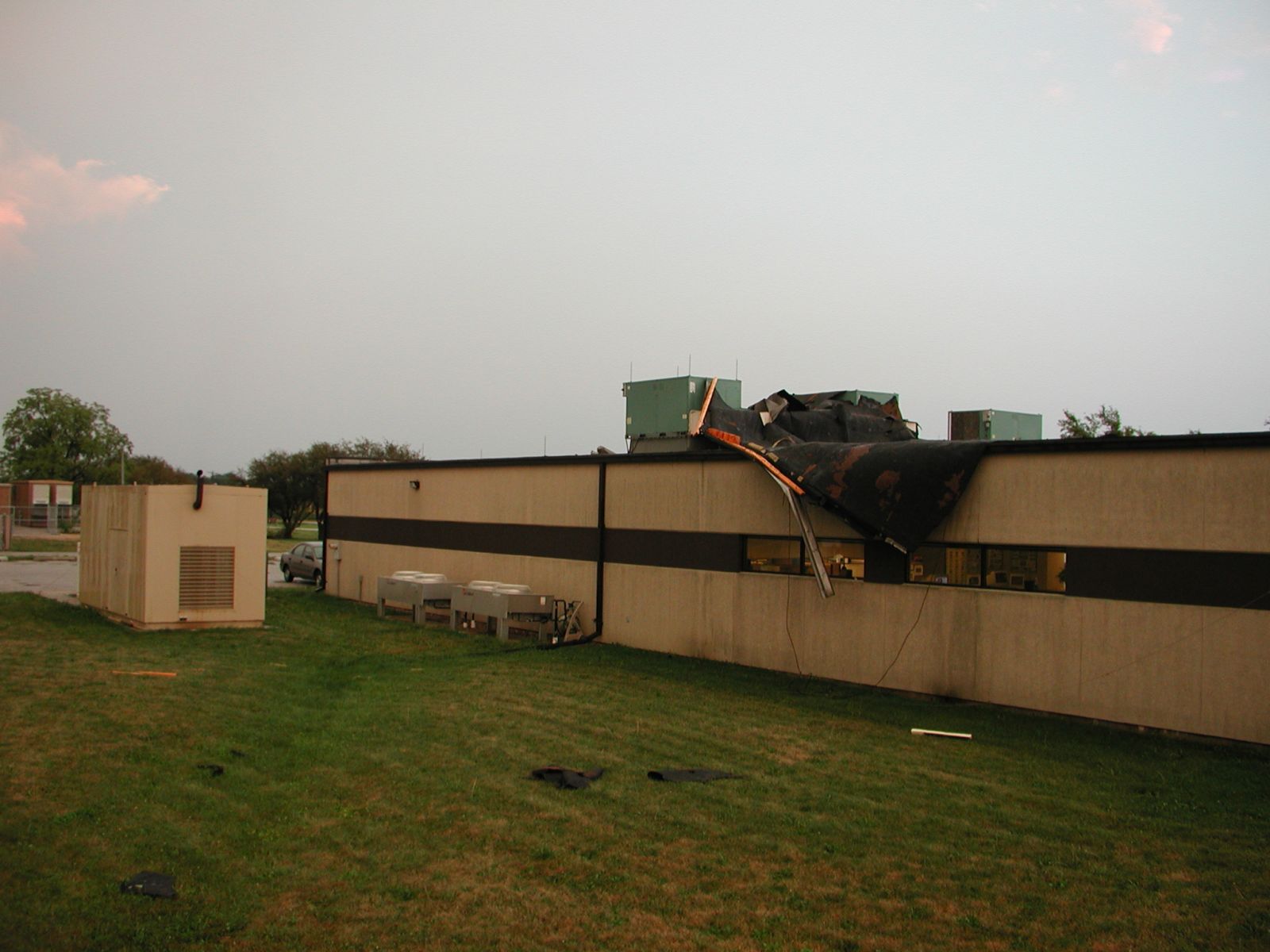 |
| November 12, 2003 | Inaugural meeting of Partners Committed to Excellence at the WFO. This group of individuals represent a cross section of WFO partners an customers who provide key feedback for operations, planning, and improvement. | |
| July 17, 2004 | NWS Quad Cities recognized the efforts and contributions of area cooperative weather observers during a Cooperative Observer Appreciation Day picnic. | 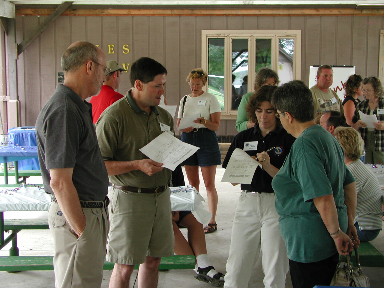 |
| February 2, 2005 | First Emergency Manager's Partner Workshop | |
| June 16, 2005 | Stephan Kuhl begins as the new MIC of WFO Quad Cities | |
| October 15, 2005 | First NWS Quad Cities Open House. 352 visitors signed in. | 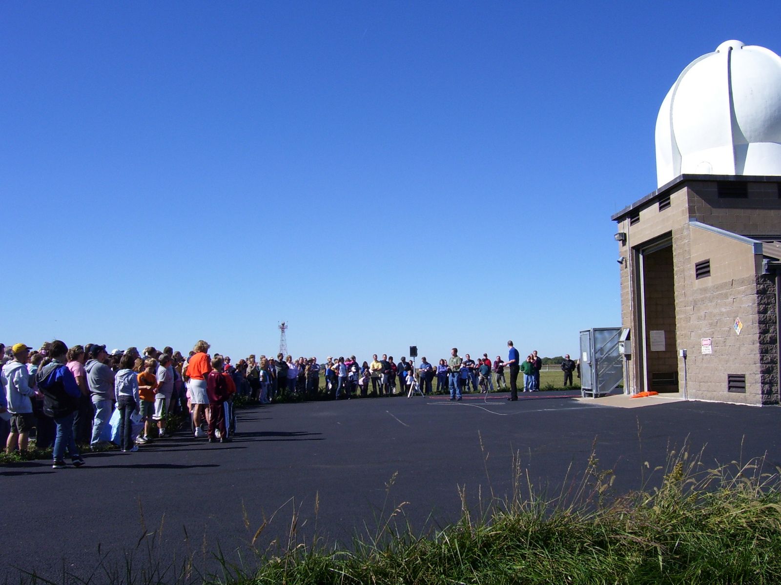 |
| January 25, 2006 | New NOAA Weather Radio Transmitter began broadcasting from Delaware County, Iowa. This site is part of the Iowa Weather Radio Expansion Project, and is the 11th station with programming from the NWS Quad Cities office. | 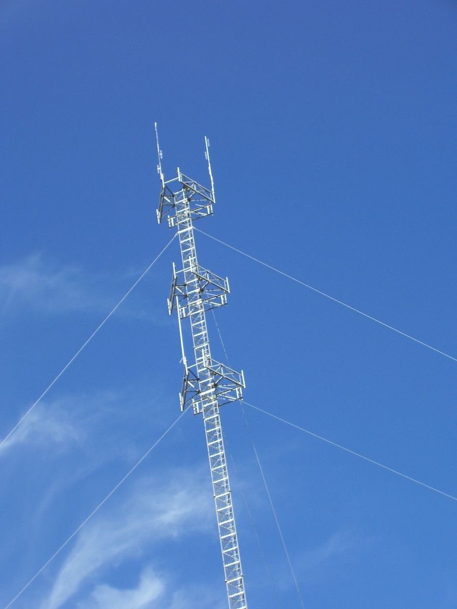 |
| January 4, 2007 | New Amateur Radio tower erected at our office, effectively doubling the range of direct ham radio communications from the office. | 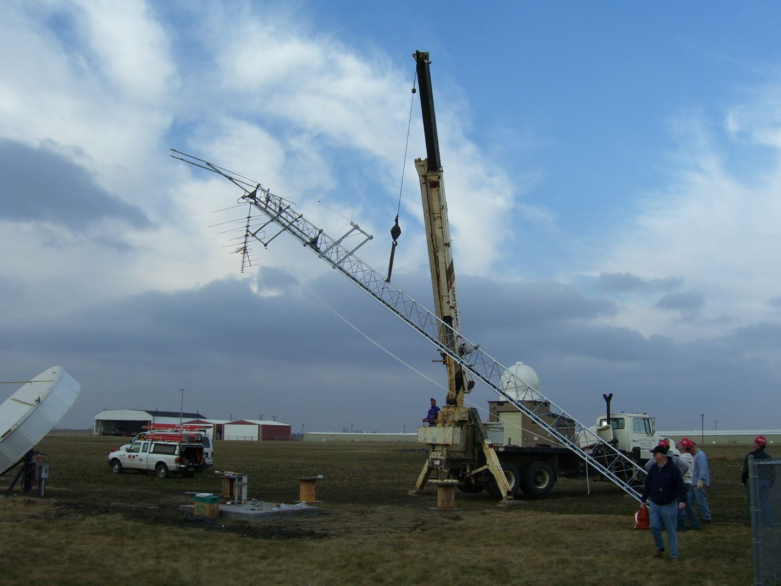 |
| March 7, 2007 | First Media Partners Workshop | |
| April 23, 2007 | NWS Quad Cites launched a local incident Support group to provide improved services to local incidents. | |
| June 25, 2007 | First Graphical Weather Story issued by NWS Quad Cities. | |
| September 29, 2007 | Transcribed Weather Broadcast (TWB) Text Products discontinued. | |
| October 1, 2007 | Warnings issued by the National Weather Service shift from county-based to storm-based. This means that the area warned is now defined by the individual storm rather than county or other political boundaries. NWS Quad Cities issued its first storm-based warnings on Oct. 2! | |
| November 5, 2007 | First official release of a weather balloon with a Global Positioning radiosonde at the office. (Radiosonde Replacement System (RRS) was installed to upgrade upper air observing equipment during the previous weeks.) | |
| February 21, 2008 | NWS Quad Cities received a Bronze Recognition for Performance Excellence at the Iowa Governor's Recognition of Performance Excellence Celebration in Des Moines. This award was approved by the Iowa Quality Center, and recognizes the office for successfully applying National Baldrige Quality Program Criteria to improve operations. | |
| April 2008 | NWS Quad Cities received the Department of Commerce Bronze Medal Award for Superior Federal Service during the Iowa City tornado outbreak of April 13, 2006. | |
| April 2008 | NWS Quad Cities received the Department of Commerce Bronze Medal Award for Superior Federal Service during the ice storm of Feb 23-25 and blizzard of March 1-2, 2007. | |
| June 12, 2008 | Through software upgrades, NWS Quad Cities Doppler radar (WSR88D) began providing Super Resolution radar data. | |
| April 1, 2009 | Severe thunderstorm warning criteria raised to quarter-sized hail (1 inch diameter). (Wind criteria of 58 mph remains unchanged.) | |
| May 10, 2011 | NWS Quad Cities Facebook page goes live. | |
| December 31, 2011 | First Multimedia (Video) Briefing posted by NWS Quad Cities | |
| March 24, 2012 | Dual Polarization Radar. The Quad Cities' "Dual-Pol" radar upgrade added the ability to view both horizontal and vertical shapes of objects it detects. | 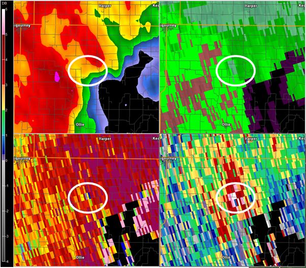 |
| Spring of 2012 | Fischer-Porter automated rain gauges installed. Accuracy improves from nearest 0.10 to 0.005 inches. Good-bye to paper tapes. | |
| August 7, 2012 | NWS Quad Cities Twitter feed goes live. | |
| October 21, 2014 | Forecast staff officially increased from 9 to 10 forecasters. | |
| May 11, 2016 | Transition to using mixed-case text in official messages began. | |
| June 15, 2016 | New weather radio hardware (Broadcast Message Handler) and voice launched. | |
| September 21, 2016 | Old weather radio system (CRS) removed. | |
| June 27-29, 2017 | NWS office relocated to new facility on the Davenport Municipal Airport. During the 3-day move, backup offices provided full forecast and warning services and not a single upper air flight was missed. | 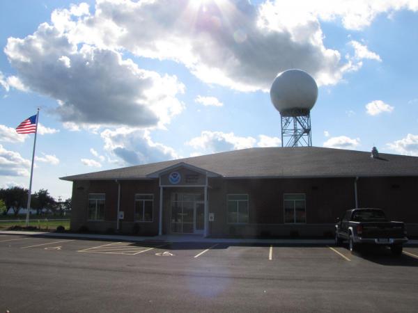 |
| June 28, 2017 | First weather balloon flight with a new upper air system (RRS 1680 to Transitional Radiosonde Observing System (TROS) 403) and from new facility. | |
| June 30, 2017 | NWS resumes full operations at the new facility. | |
| October 21, 2017 | NWS Quad Cities hosts an open house with approximately 350 attendees. It is the first open house for the new facility. | |
| August 10, 2020 | Strong derecho impacts much of eastern Iowa and northwest Illinois including NWS Quad Cities office. Winds were sustained around 80 MPH for about 30 minutes. Utility power was lost for several days, with the office and radar relying on generator backups. | |
| September 13, 2021 | NWS Quad Cities is awarded a joint NOAA Bronze Medal Award with the North Central River Forecast Center (NCRFC) for accurate warnings and service provided during the historic Mississippi River flooding in 2019. | |
| February 25, 2022 | MIC Stephan Kuhl retires after 17 years of service to WFO Quad Cities and a 30 year career with the NWS. | |
| April 18, 2022 | As part of the Service Life Extension Program (SLEP), NWS Quad Cities radar pedestal is replaced to ensure longer term operation of the WSR-88D radar system. The upgrade takes 2 weeks to complete. | |
| June 13, 2022 | NWS Quad Cities deploys the GRAW Manual Radiosonde Observing System (MROS) as part of a nationwide NWS upper air system upgrade. This replaces the TROS system installed in 2017. | |
| November 7, 2022 | Ed Holicky begins as the new MIC of NWS Quad Cities. | |
| March 5, 2024 | NWS Quad Cities receives a NWS Director's Award for life-saving forecasts, watches, warnings and exceptional Decision Support Services during the Historic Tornado Outbreak of 31 March 2023. | |
Contact Us
|
||||||||||
|
Schedule a Tour (October through March only) 2026: Tours are now paused through September. We will be accepting new tours starting October 1st.
If you have any additional questions, contact us at nws.quadcities@noaa.gov OR fill out this short form |
|
|
By E-Mail |
|
|
Arrange a Job Shadow NWS Quad Cities offers job shadow opportunities for students interested in learning more about the National Weather Service. Students typically spend 3-4 hours with a meteorologist, observing the forecast process and discussing NWS and related career opportunities. 2026: Job shadow opportunities are only offered for college level students, and will be considered on a case by case basis. |
To schedule a job shadow at NWS Quad Cities, please fill out this short form. If a college student, please also e-mail: cr.dvnstudents@noaa.gov |
|
College Student Opportunities |
|
|
Employment Opportunities
|
|