Record setting heat is expected over the next several days from the Intermountain West through the northern Plains. Furthermore, fire weather concerns increase with dry and breezy conditions. Meanwhile, heavy rainfall and severe thunderstorm threats for the Ohio/Tennessee Valleys, central Appalachians and Southeast today. The threat shifts to central Gulf Coast and across central Texas this week. Read More >
Overview
|
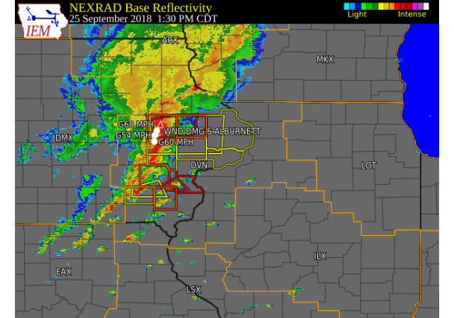
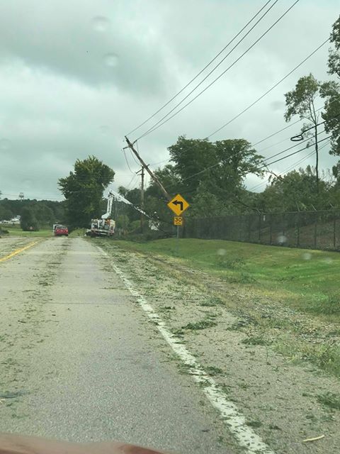
A line of strong storms tracked east across eastern Iowa, northwest Illinois, and northeast Missouri Tuesday afternoon, September 25. These storms produced several tornadoes (see tab below for additional info) and widespread 60 mph winds with isolated higher gusts to over 80 mph, which downed trees and power lines. They also produced frequent lightning and heavy rain. Another area that saw substantial wind damage was from in eastern Rock Island County; near East Moline, IL; to northern Henry and Bureau counties.
|
 Radar Image: Tuesday 9/25 1:30 pm |
Tornadoes:
|
Tornado #1 - Mechanicsville, IA
Track Map 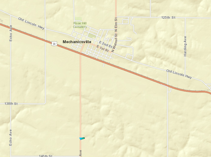 
|
||||||||||||||||
|
Tornado #2 - S Alburnett
Track Map .PNG)
Downloadable KMZ File |
||||||||||||||||
|
Tornado #3 - WNW Winfield Henry County
Track Map 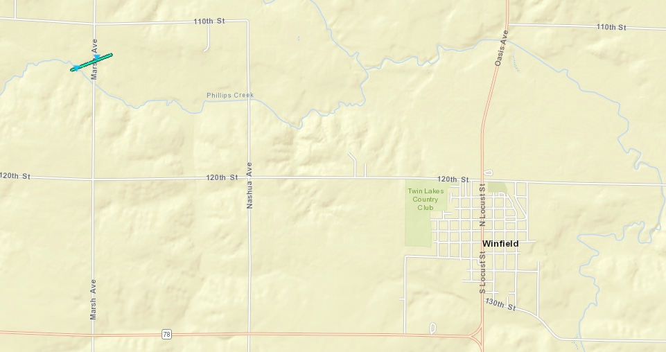
Downloadable KMZ File |
||||||||||||||||
|
Tornado #4 - N Winfield
Track Map 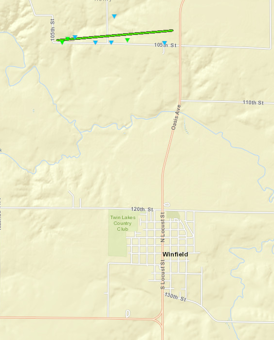
Downloadable KMZ File |
||||||||||||||||
The Enhanced Fujita (EF) Scale classifies tornadoes into the following categories:
| EF0 Weak 65-85 mph |
EF1 Moderate 86-110 mph |
EF2 Significant 111-135 mph |
EF3 Severe 136-165 mph |
EF4 Extreme 166-200 mph |
EF5 Catastrophic 200+ mph |
 |
|||||
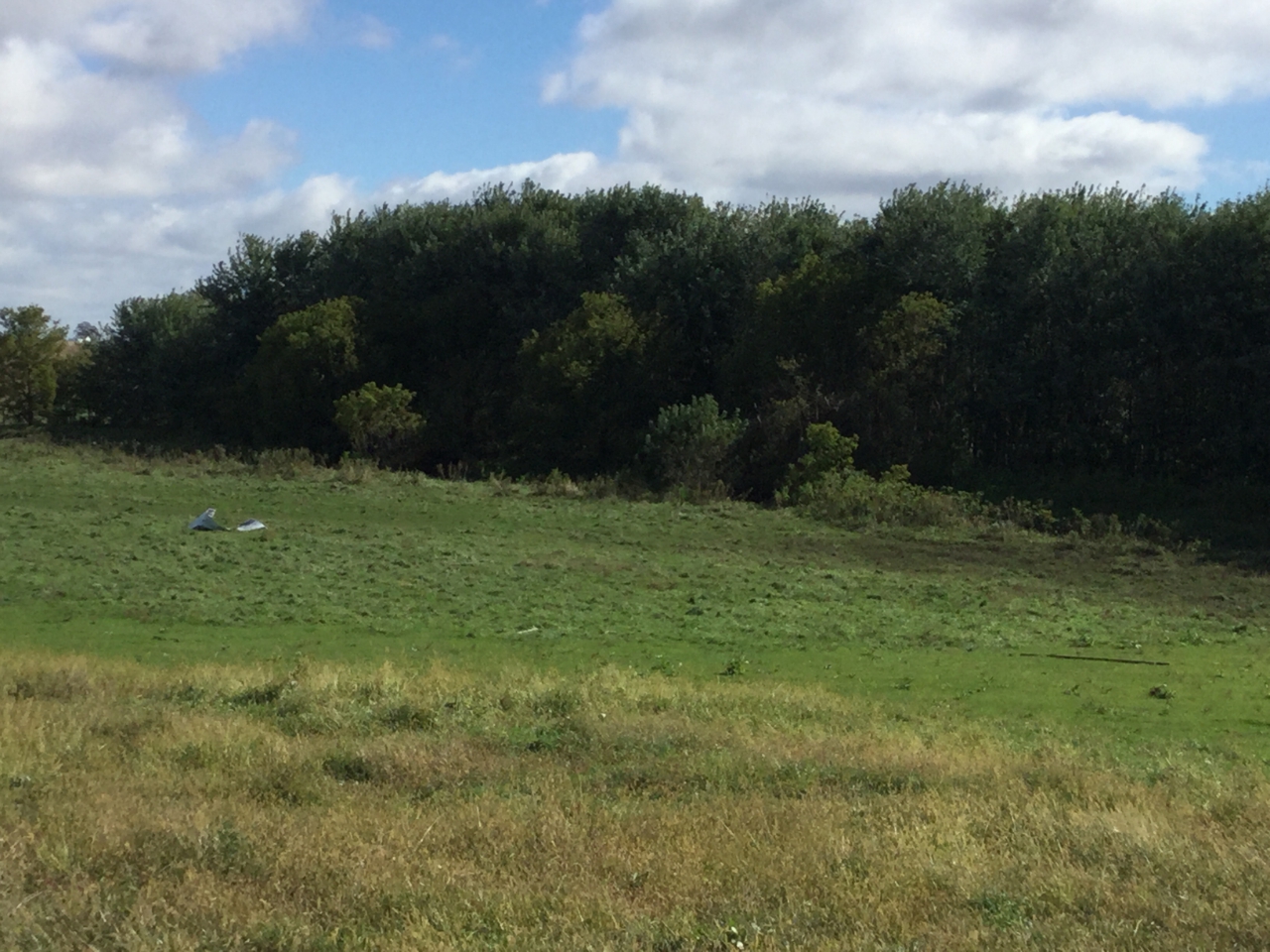
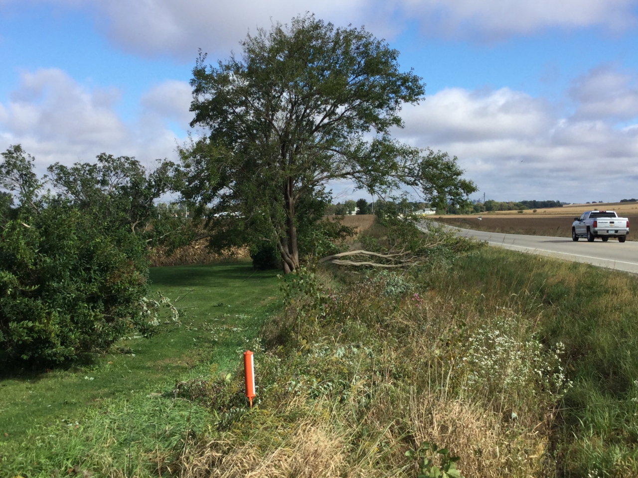
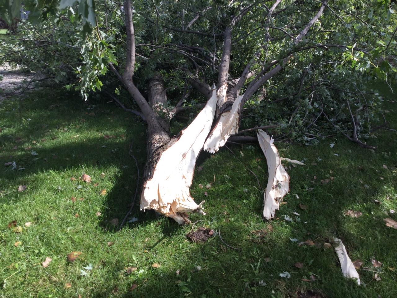
Photos & Video:
 |
 |
 |
 |
| Storm damage in Alburnett, IA (NWS Storm Survey) |
Tree damage in Alburnett, IA (NWS Storm Survey) |
Tree damage in Alburnett, IA (NWS Storm Survey) |
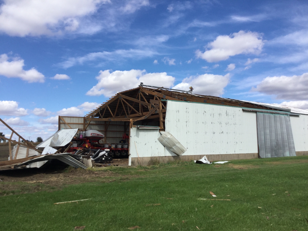
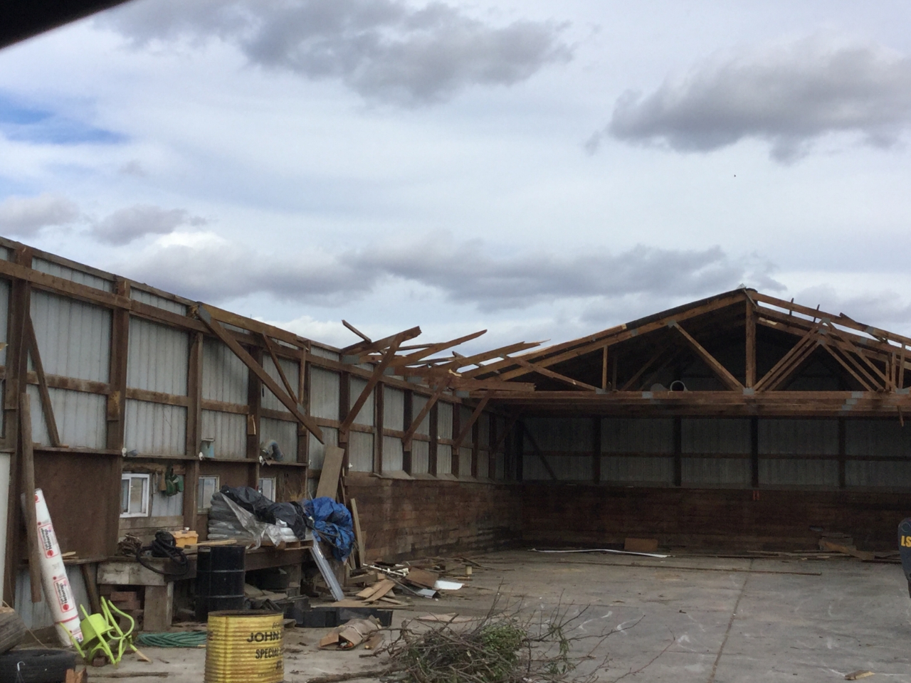
Barn damage from straight-line winds in Milledgeville,IL (NWS Storm Survey) |
 |
 |
 |
 |
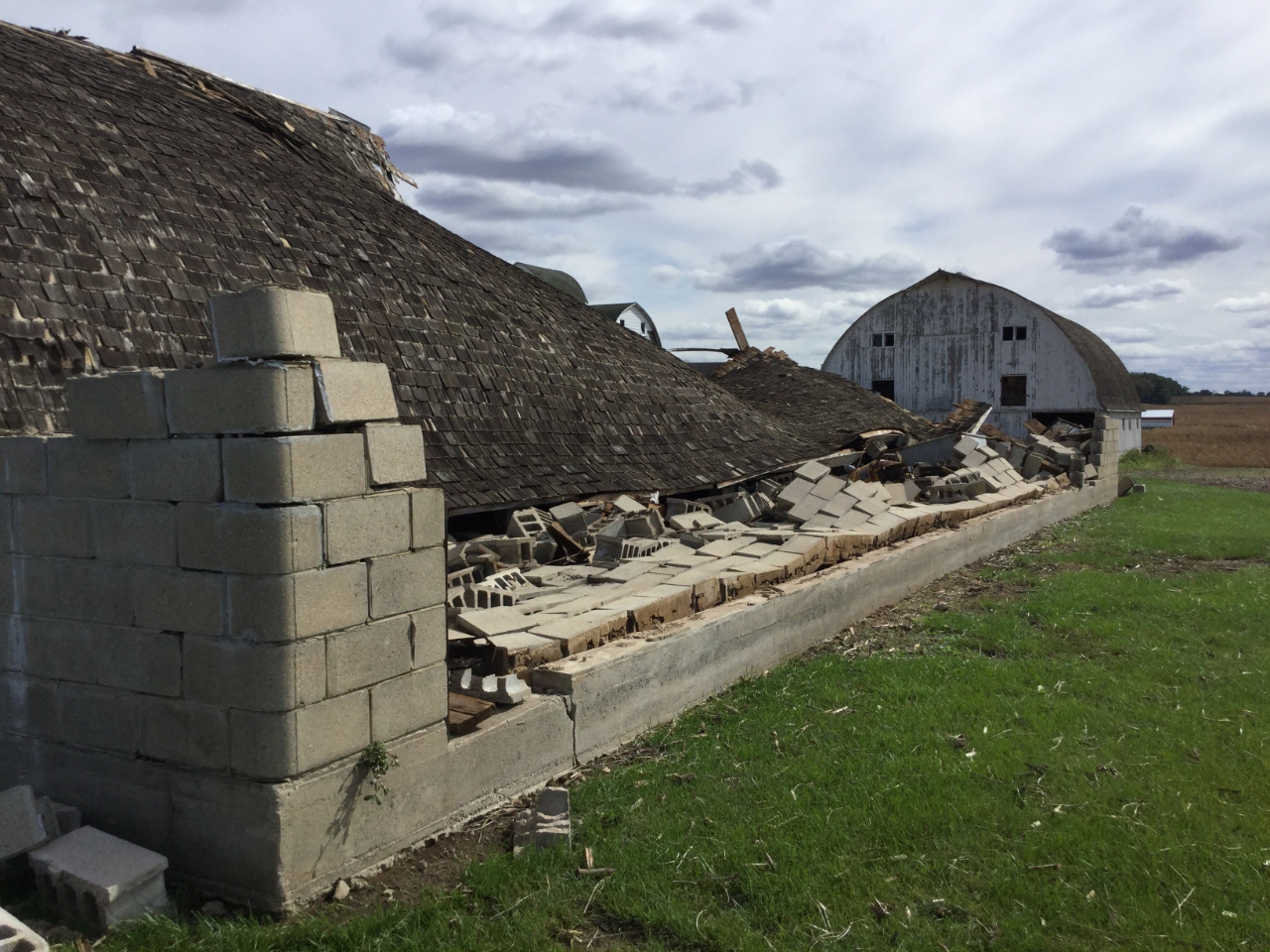
| Damage to brick wall from straight-line winds in Milledgeville,IL (NWS Storm Survey) |
Barn roof damage from straight-line winds in Milledgeville,IL (NWS Storm Survey) |
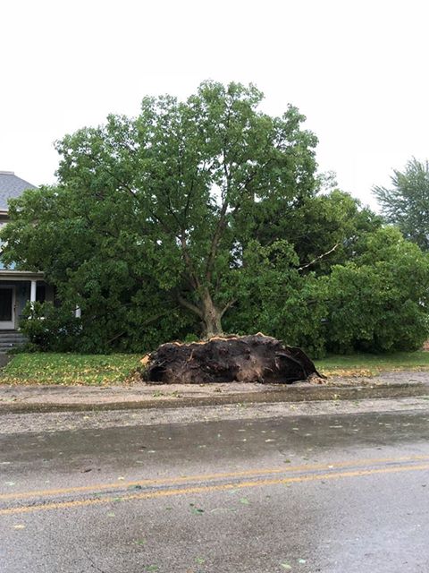
Uprooted Tree in Milledgeville, IL (photo courtesy Cheryl Neumann) |
Storm damage in East Moline, IL from stright-line winds (photo courtesy Christian Allen) |
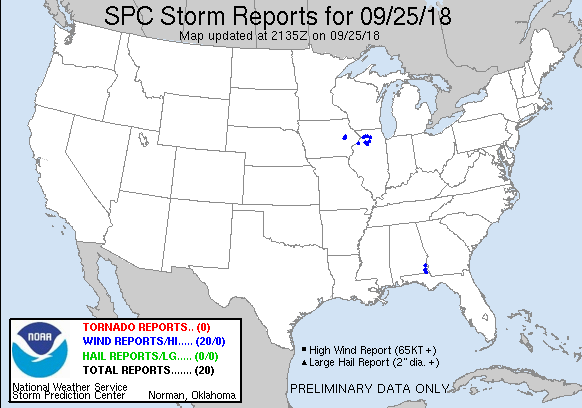
Storm Reports
| Interactive Storm Report Map | SPC Storm Reports |
 |
 |
PRELIMINARY LOCAL STORM REPORT...SUMMARY
NATIONAL WEATHER SERVICE QUAD CITIES IA IL
834 PM CDT TUE SEP 25 2018
..TIME... ...EVENT... ...CITY LOCATION... ...LAT.LON...
..DATE... ....MAG.... ..COUNTY LOCATION..ST.. ...SOURCE....
..REMARKS..
0122 PM TSTM WND GST CEDAR RAPIDS MUNICIPAL 41.88N 91.72W
09/25/2018 M54.00 MPH LINN IA ASOS
0124 PM TSTM WND GST HIAWATHA 42.05N 91.68W
09/25/2018 E60.00 MPH LINN IA TRAINED SPOTTER
0126 PM TSTM WND GST 2 W CEDAR RAPIDS 41.98N 91.71W
09/25/2018 E60.00 MPH LINN IA TRAINED SPOTTER
0136 PM TSTM WND DMG S ALBURNETT 42.15N 91.62W
09/25/2018 LINN IA TRAINED SPOTTER
SEVERAL HEALTHY LARGE TREE BRANCHES DOWN...TIME ESTIMATED
FROM RADAR.
0147 PM TSTM WND GST IOWA CITY MUNICIPAL AIR 41.63N 91.55W
09/25/2018 M44.00 MPH JOHNSON IA ASOS
0153 PM TORNADO 1 SSW MECHANICSVILLE 41.89N 91.26W
09/25/2018 CEDAR IA NWS STORM SURVEY
BRIEF TORNADO SOUTH OF TOWN. LOFTED 2 GRAIN BINS AND
CAUSED DAMAGE TO SOME CORN.
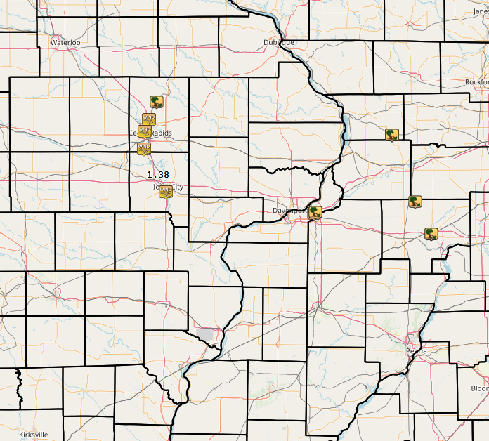
0200 PM HEAVY RAIN 1 SSW NORTH LIBERTY 41.73N 91.61W
09/25/2018 M1.38 INCH JOHNSON IA COCORAHS
STORM TOTAL...RAIN FELL IN PAST 45 MINUTES.
0255 PM TSTM WND DMG CARBON CLIFF 41.50N 90.39W
09/25/2018 ROCK ISLAND IL TRAINED SPOTTER
SEVERAL LARGE TREES UPROOTED ALONG WITH A SNAPPED POWER
POLE. TIME ESTIMATED BASED ON RADAR.
0306 PM TSTM WND DMG 2 SE EAST MOLINE 41.50N 90.40W
09/25/2018 ROCK ISLAND IL NWS STORM SURVEY
DETERMINED STRAIGHT LINE WINDS OF 90-100 MPH CAUSED
SIGNIFICANT DAMAGE FROM CARBON CLIFF IL TO BARSTOW IL.
DAMAGE INCLUDED LARGE TREES SNAPPED AND UPROOTED. SNAPPED
POWER POLES WERE ALSO FOUND.
0309 PM TSTM WND DMG 2 E EAST MOLINE 41.51N 90.38W
09/25/2018 ROCK ISLAND IL EMERGENCY MNGR
SEVERAL SNAPPED TREES, POWER POLES DOWN IN EASTERN ROCK
ISLAND COUNTY...TIME ESTIMATED FROM RADAR.
0320 PM TSTM WND DMG MILLEDGEVILLE 41.96N 89.78W
09/25/2018 CARROLL IL TRAINED SPOTTER
LARGE TREE UPROOTED IN TOWN
0325 PM TSTM WND DMG MILLEDGEVILLE 41.96N 89.78W
09/25/2018 CARROLL IL EMERGENCY MNGR
MULTIPLE LARGE TREES DOWN, EMPTY GRAIN BIN OVER RAILROAD
TRACKS, AND POWER LINES DOWN IN TOWN.
0327 PM TSTM WND GST MILLEDGEVILLE 41.96N 89.78W
09/25/2018 M60.00 MPH CARROLL IL TRAINED SPOTTER
0339 PM TSTM WND DMG MILLEDGEVILLE 41.96N 89.78W
09/25/2018 CARROLL IL EMERGENCY MNGR
SEVERAL LARGE TREES AND WIRES DOWN IN TOWN. ALSO REPORTED
WIND GUST OF 61 MPH.
0355 PM TSTM WND DMG 1 NW WALNUT 41.57N 89.60W
09/25/2018 BUREAU IL EMERGENCY MNGR
POWER LINES DOWN AND ARCING ON 1050 EAST ST, 1 MILE NORTH
OF HIGHWAY 92
0403 PM TSTM WND DMG N PRINCETON 41.38N 89.47W
09/25/2018 BUREAU IL EMERGENCY MNGR
LARGE TREE DOWN ON HIGHWAY 26 BLOCKING THE
NORTHBOUND/SOUTHBOUND LANES NORTH OF PRINCETON
0452 PM TSTM WND DMG MC NABB 41.18N 89.21W
09/25/2018 PUTNAM IL LAW ENFORCEMENT
SEVERAL TREES DOWN IN TOWN...TIME ESTIMATED FROM RADAR.
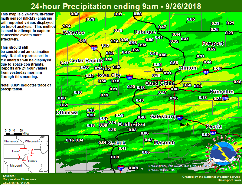
Rain Reports
| Local Rainfall Map | Regional Estimated Rainfall |
 |
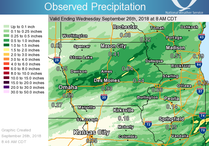 |
24 hour precipitation reports (in Inches),
for eastern Iowa, northwest and west central Illinois,
and northeast Missouri. Reported between Midnight and 9 AM,
Wednesday September 26, 2018.

....IOWA....
Center Point 0.6 NNW             1.67
Perry 0 W                        1.56
Ames US 30 2 SSE                 1.54
Solon 0.3 ESE                    1.35
Central City 6.7 W               1.22
Mount Auburn 2.2 NNW             1.15
Coggon                           1.14
Waterloo ASOS 5 NW               1.14
NWS Johnston* 5 NNW              1.13
Boone 1 SSW                      1.06
Tripoli 0 N                      0.98
Marshalltown 1 NW                0.96
Monticello 1 E                   0.96
Cascade                          0.93
Marshalltown ASOS 4 N            0.92
Iowa City Arpt                   0.91
Hopkinton 5.4 WSW                0.89
Manchester                       0.88
Bettendorf 2.2 SE                0.82
De Witt                          0.82
Elkader 6SSW                     0.81
Oelwein AWOS                     0.79
Brighton                         0.76
Salem 1S                         0.69
Delmar 2.3 NW                    0.68
Salem 3.1 ESE                    0.67
Davenport 0.9 SSW                0.66
Calamus 2.0 NE                   0.65
Ely 0.5 SE                       0.61
Ottumwa ASOS 6 NNW               0.61
Dubuque #3 7 SW                  0.60
Camanche 1.2 W                   0.59
New London 1.5 SW                0.59
Marion 1.7 NNW                   0.58
Guttenberg Dam 10                0.58
Grinnell AWOS 2 SSW              0.57
Marengo                          0.56
Center Junction 2.6 W            0.55
Goose Lake 6.4 SSW               0.55
Le Claire LD14                   0.55
Kalona 7.3 NNW                   0.50
Maquoketa 4W                     0.48
Dubuque LD11                     0.47
Belle Plaine                     0.44
Anamosa 3 SSW                    0.42
Bettendorf 1.6 WSW               0.42
Dubuque Arpt 7 SW                0.41
Keokuk LD19                      0.41
Cedar Rapids 2.7 NE              0.40
Hampton 1 N                      0.40
Cresco 1 NE                      0.36
Bellevue LD12                    0.35
Davenport 0.9 WNW                0.35
Cedar Rapids Arpt 5 SW           0.34
Fairfield 0.6 E                  0.33
Williamsburg                     0.32
Park View 0.2 WSW                0.31
Fairfield                        0.30
Mason City 1 NNE                 0.29
Eldridge 0.6 S                   0.29
Donnellson                       0.28
Eldridge 0.7 SSW                 0.26
Muscatine 2N                     0.25
Mason City ASOS 6 W              0.22
Ainsworth 7.4 N                  0.21
Mason City* 0 E                  0.20
Muscatine 1.4 N                  0.20
Rathbun Reservoir 2 N            0.19
Washington                       0.19
Pella 4 N                        0.18
Iowa City                        0.18
Keosauqua                        0.18
Oskaloosa 1 NNW                  0.17
West Point 7.5 NW                0.14
Davenport Arpt 5 N               0.13
Burlington Arpt 2 SW             0.12
Centerville 0 NE                 0.11
Pella AWOS 2 WSW                 0.11
Sigourney                        0.10
Burlington 2S                    0.08
Burlington 6.5 SSW               0.03
Beaconsfield 1 NNE               0.02
Oskaloosa AWOS 9 ESE             0.00
....ILLINOIS....
Moline 0.7 NNE                   1.19
Quad City Arpt 3 S               0.84
Geneseo 2.0 NW                   0.68
Bloomington Airport              0.66
Shannon 0.2 S                    0.62
Ottawa 4 SW                      0.58
Macomb 3.8 NW                    0.55
Atkinson 2.6 NNE                 0.53
Morrison 3.2 E                   0.52
Decatur Airport                  0.49
Gladstone LD18                   0.48
Mundelein                        0.46
Rock Falls                       0.45
Galena                           0.44
Coleta 1.4 SSW                   0.44
New Boston LD17                  0.43
Colchester 3.5 NE                0.43
Elizabeth                        0.41
Steward                          0.40
Rochelle                         0.37
Freeport                         0.33
Romeoville                       0.32
Freeport 2.0 NW                  0.32
Chadwick 2.7 WSW                 0.31
Davis 0.5 N                      0.29
St Anne                          0.28
Milan 8.8 SSW                    0.27
New Windsor 2.0 N                0.26
Orangeville 2.8 NW               0.25
Freeport 1.7 ESE                 0.22
Tiskilwa 2.1 N                   0.22
Streator 3 SE                    0.20
Princeton 1.1 SE                 0.19
Princeton                        0.19
Mendota 2 SE                     0.18
Ill. City LD16 3 WNW             0.18
Rockford ASOS                    0.15
Roscoe 2SE                       0.14
Kewanee 1 E                      0.13
La Harpe                         0.06
Augusta                          0.06
Peoria ASOS                      0.02
Quincy ASOS                      0.00
Lincoln NWS                      0.00
Rochelle AWOS                    0.00
Quincy Dam 21                    0.00
Joliet                           0.00
Coal Valley 1.9 SE               0.00
Galesburg Arpt 3 SW              0.00
Jacksonville AWOS                0.00
....MISSOURI....
Kahoka 0.6 S                     0.34
Columbia                         0.27
Memphis                          0.16
Memphis 0.1 S                    0.04
Canton LD20                      0.03
Kirksville ASOS                  0.00
Chillicothe 2 NW                 0.00
....WISCONSIN....
Steuben 4SE 3 NE                 1.08
Darlington                       0.85
Viroqua                          0.79
Madison-ASOS                     0.52
La Crosse WFO                    0.27
Monroe 1 W                       0.23
Beloit-College                   0.22
Brodhead 1 SW                    0.21
Delavan-1 W-WWTP 1 W             0.14
Watertown-AWOS                   0.00
Prairie du Chien AWOS            0.00
....MINNESOTA....
Preston                          0.10
Grand Meadow                     0.05
Environment
 |
 |
 |
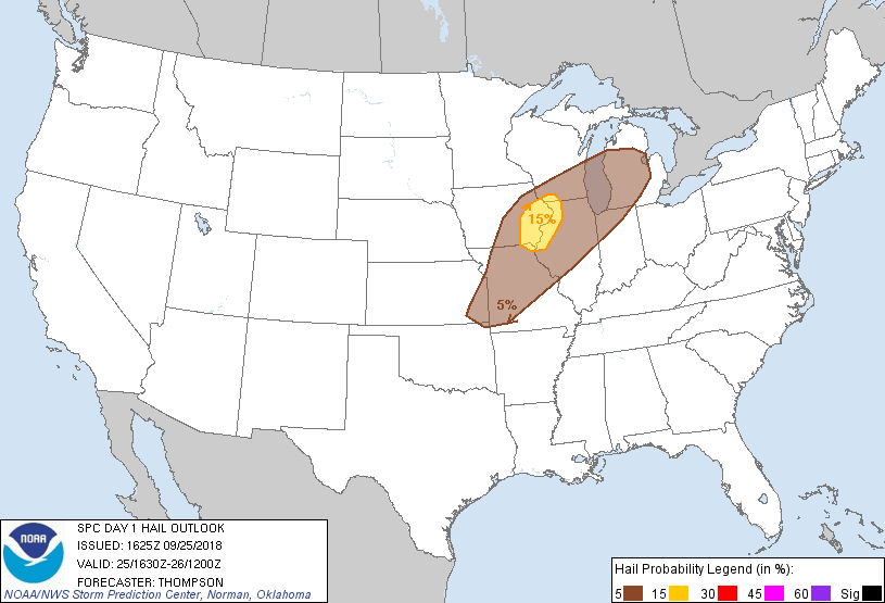 |
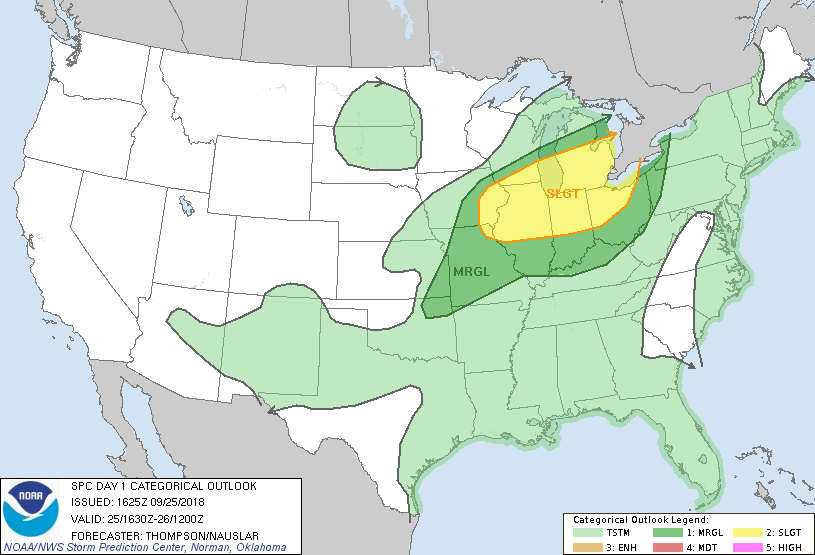
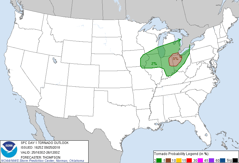
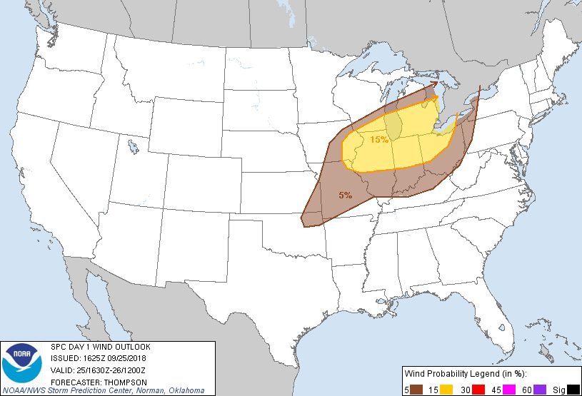
| Figure 1: SPC Day 1 Outlook (1630z) | Figure 2: SPC Day 1 Tornado Outlook (1630z) | Figure 3: SPC Day 1 Wind Outlook (1630z) | Figure 4: SPC Day 1 Hail Outlook (1630z) |
 |
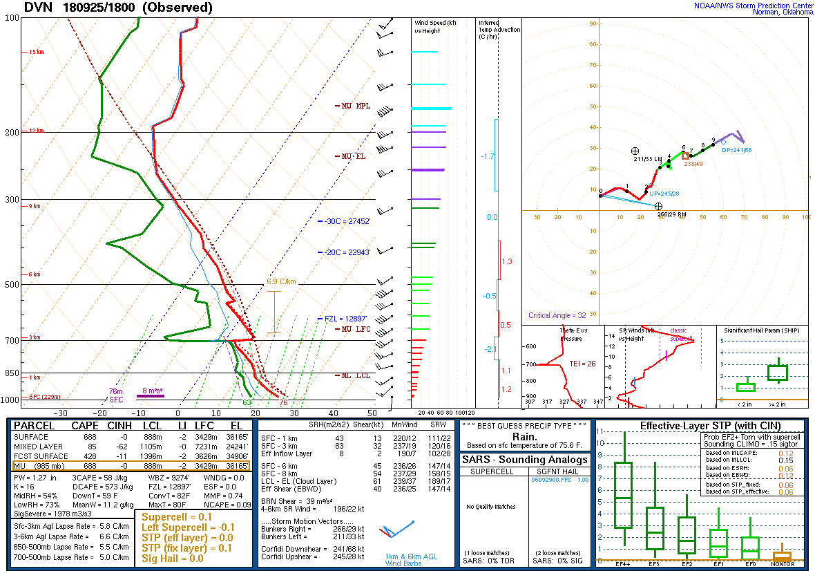 |
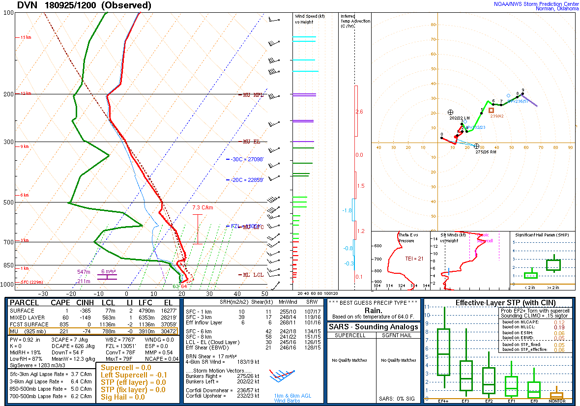
| Figure 5: DVN Sounding 9/25/18 12z | Figure 6: DVN Sounding 9/25/18 18z |
Additional environmental data.
 |
||
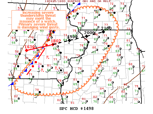
| Figure 7: SPC Mesoscale Discussion (see link for details) |
 |
Media use of NWS Web News Stories is encouraged! Please acknowledge the NWS as the source of any news information accessed from this site. |
|