Overview
|
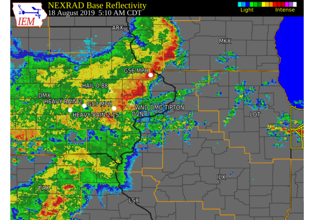
A line of thunderstorms moved east across the area during the early morning hours of Sunday, August 18. Small hail and downed trees were seen in the Cedar Rapids area and in Cedar county. A brief spin-up tornado occurred near Grand Mound, IA around 5:30 am as the storms rolled through the region. |
 Radar Loop - click to view |
Tornadoes
|
Tornado - 3 SSW Grand Mound IA
Track Map 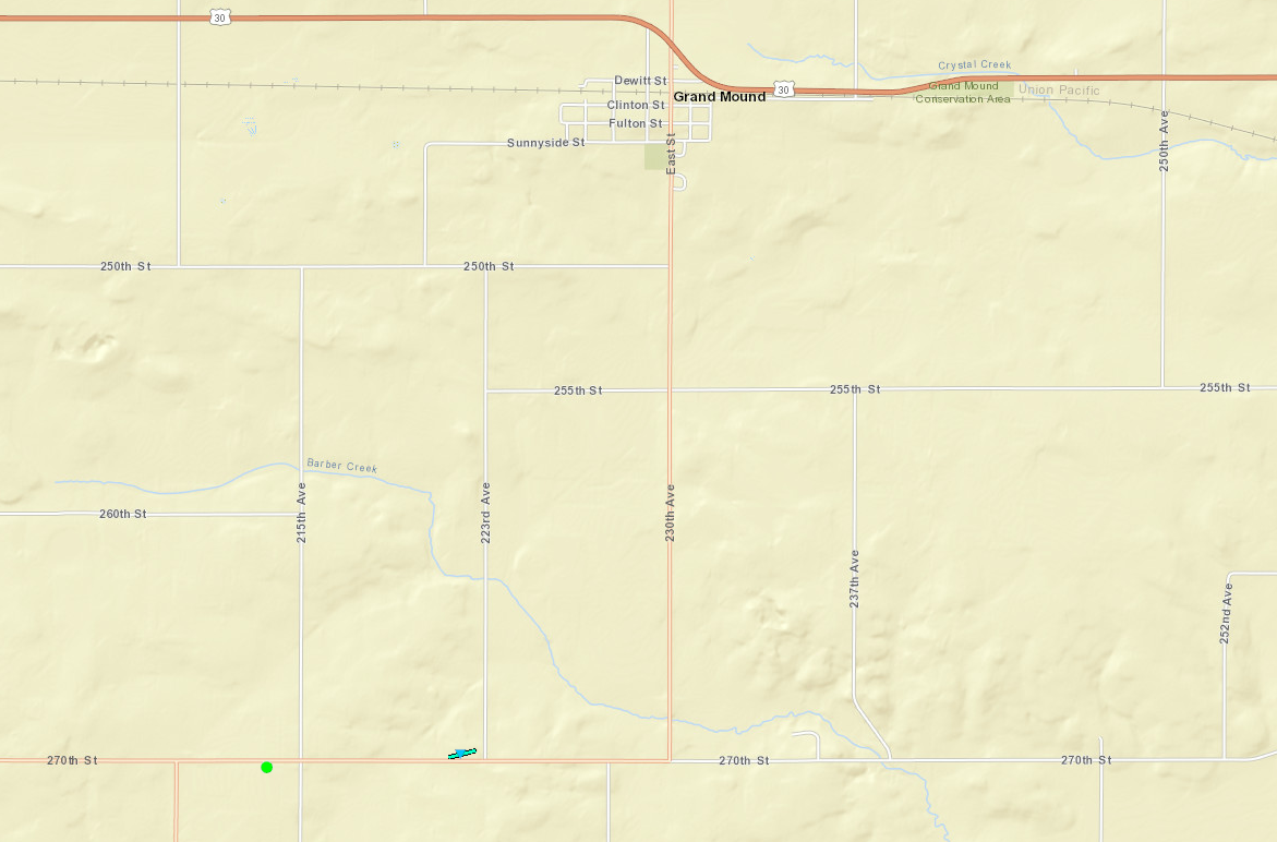 
|
||||||||||||||||
|
||||||||||||||||
The Enhanced Fujita (EF) Scale classifies tornadoes into the following categories:
| EF0 Weak 65-85 mph |
EF1 Moderate 86-110 mph |
EF2 Significant 111-135 mph |
EF3 Severe 136-165 mph |
EF4 Extreme 166-200 mph |
EF5 Catastrophic 200+ mph |
 |
|||||
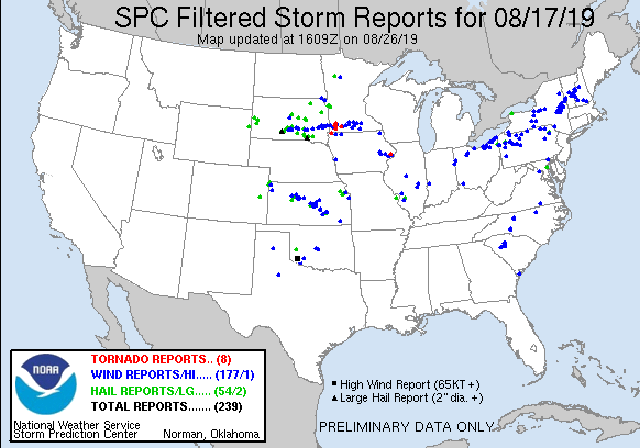
Storm Reports
| Interactive Storm Report Map | SPC Storm Reports |
 |
 |
PRELIMINARY LOCAL STORM REPORT...SUMMARY
NATIONAL WEATHER SERVICE QUAD CITIES IA IL
SUN AUG 18 2019

..TIME...   ...EVENT...      ...CITY LOCATION...     ...LAT.LON...
..DATE...   ....MAG....      ..COUNTY LOCATION..ST.. ...SOURCE....
            ..REMARKS..

0930 AM     HEAVY RAIN       BELLE PLAINE            41.90N 92.28W
08/18/2019  M1.25 INCH       BENTON             IA   TRAINED SPOTTER


0905 AM     HEAVY RAIN       2 NNE STONE CITY        42.14N 91.33W
08/18/2019  M1.20 INCH       JONES              IA   TRAINED SPOTTER


0741 AM     HEAVY RAIN       2 W GENOA BLUFF         41.71N 92.18W
08/18/2019  M2.50 INCH       IOWA               IA   TRAINED SPOTTER


0622 AM     HEAVY RAIN       1 NNW CENTER POINT      42.19N 91.78W
08/18/2019  E1.24 INCH       LINN               IA   TRAINED SPOTTER


0600 AM     TSTM WND DMG     2 NNE PARK VIEW         41.71N 90.53W
08/18/2019                   SCOTT              IA   PUBLIC

            VIA SOCIAL MEDIA, NUMEROUS LIMBS DOWN IN
            SCOTT COUNTY PARK BETWEEN 2 TO ALMOST INCHES
            IN DIAMETER. TIME OF THE EVENT WAS ESTIMATED
            USING RADAR.
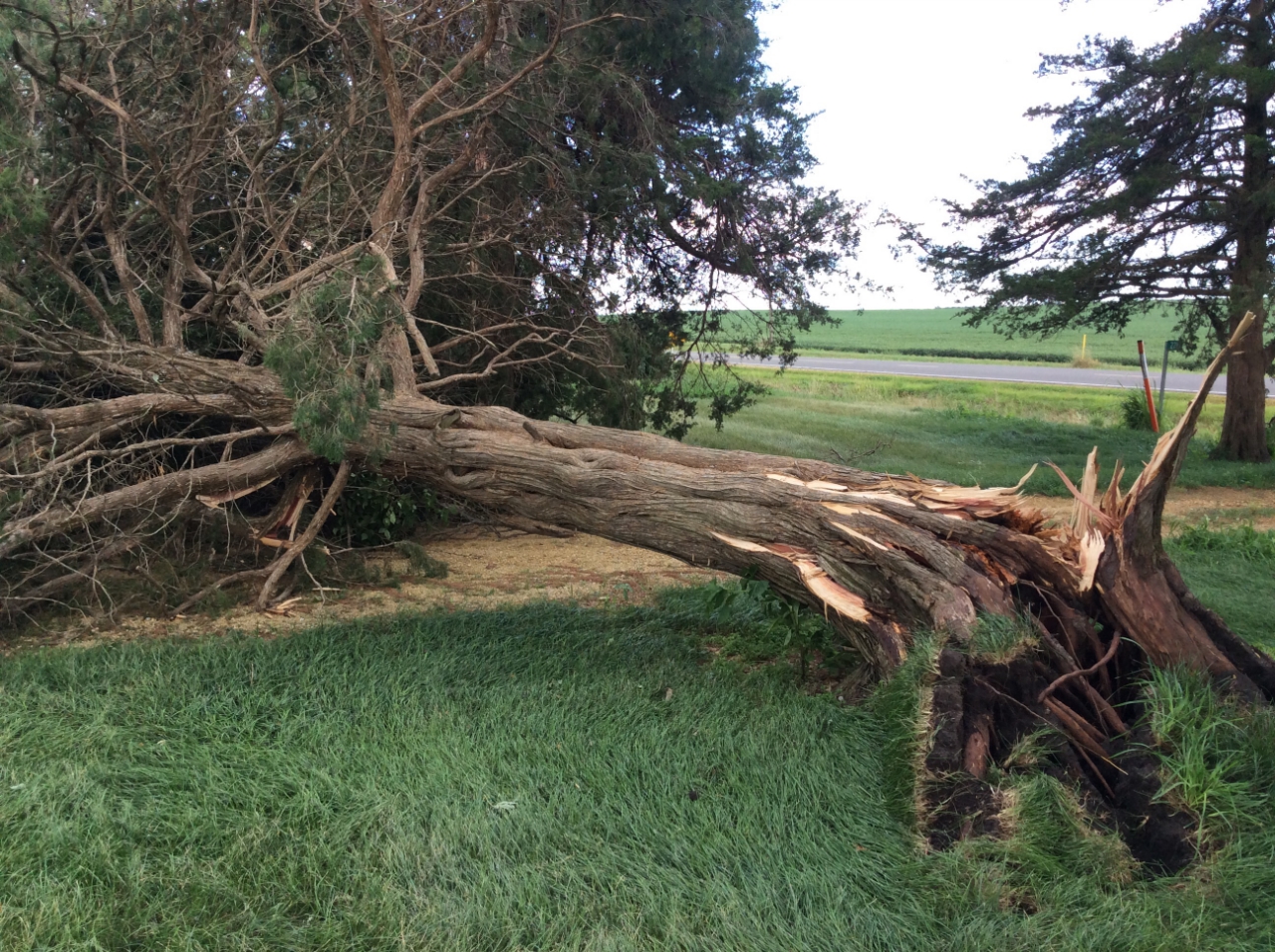
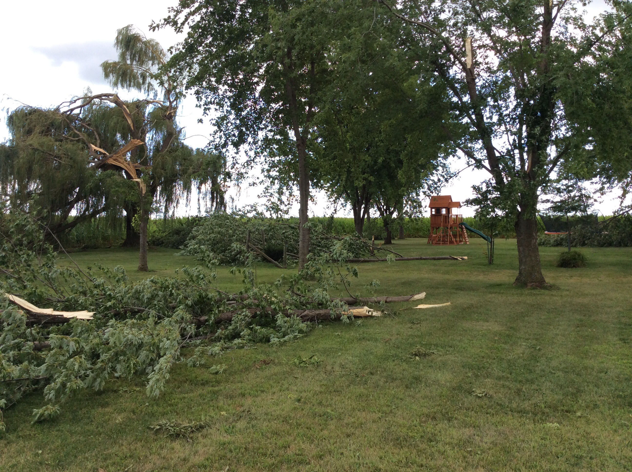
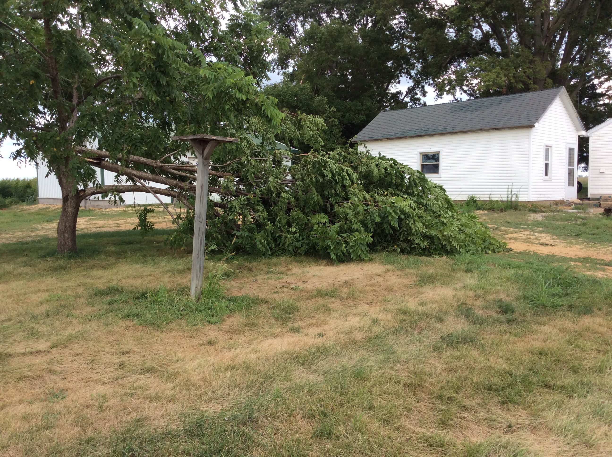
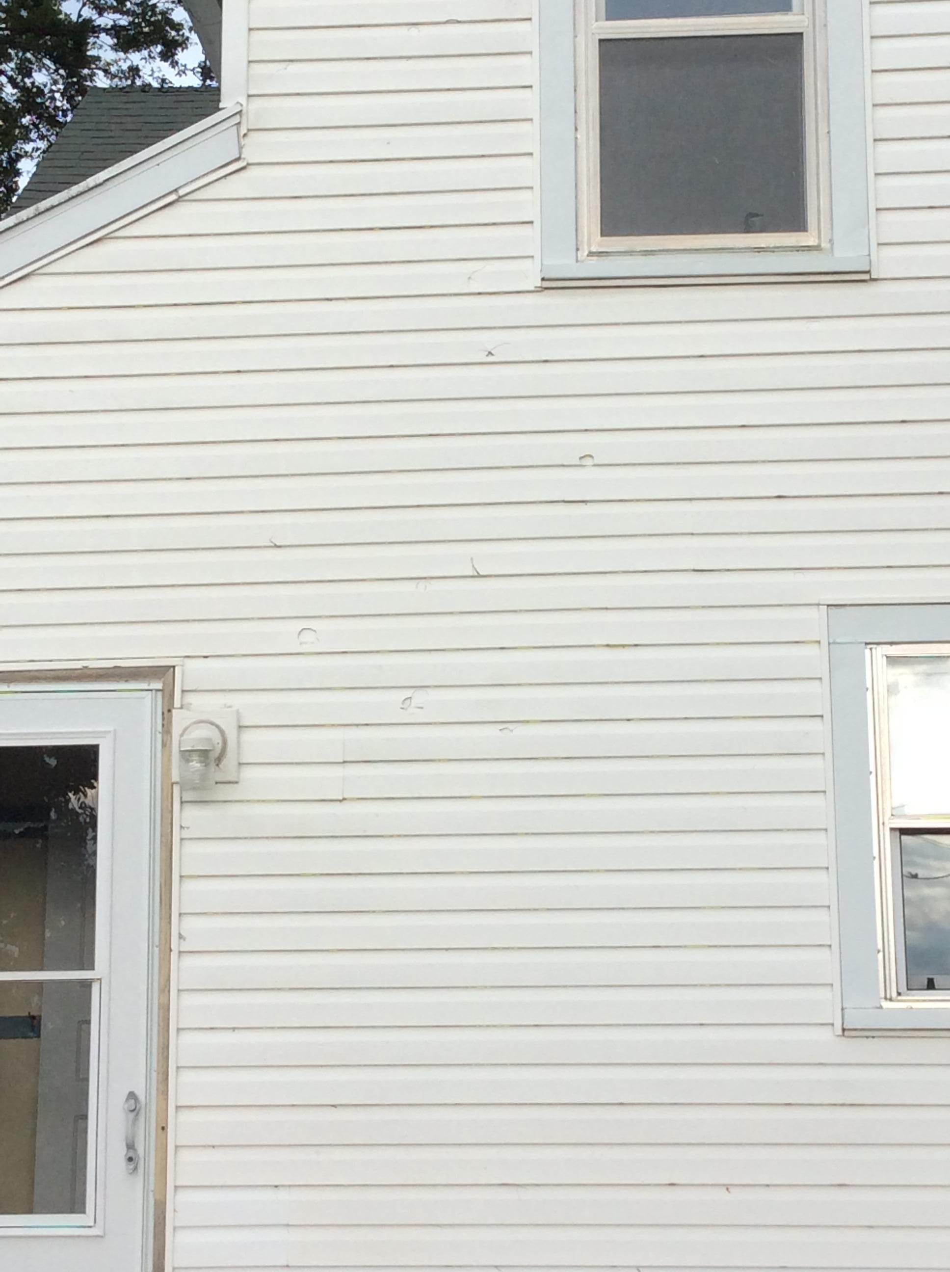
0540 AM     TORNADO          3 SSW GRAND MOUND       41.79N 90.66W
08/18/2019                   CLINTON            IA   NWS STORM SURVEY

            A CONVERGENT DOWNBURST OCCURRED ON WEST END
            OF FARMSTEAD THAT CAUSED BRIEF SPIN UP
            TORNADO ON EASTERN EDGE OF PROPERTY.
            NUMEROUS TREE BRANCHES WERE DOWN WITH ONE
            TREE UPROOTED. THE HOME HAD TRIM, SHINGLE
            DAMAGE, AND A WINDOW BROKEN. GRASS WAS
            SPLATTERED ON GARAGE AND WIND DRIVEN HAIL
            ALSO NOTED ON WEST SIDE OF HOME AND GARAGE.
0530 AM     HEAVY RAIN       3 NNE CEDAR RAPIDS      42.01N 91.66W
08/18/2019  M1.54 INCH       LINN               IA   TRAINED SPOTTER


0530 AM     TSTM WND DMG     2 WNW SUNBURY           41.67N 90.98W
08/18/2019                   CEDAR              IA   TRAINED SPOTTER

            SPOTTER REPORTED 1 TO 2 INCH DIAMETER TREE
            LIMBS DOWN BETWEEN DURANT AND BENNET. THE
            TIME AND LOCATION WERE ESTIMATED.


0529 AM     HEAVY RAIN       HIAWATHA                42.05N 91.68W
08/18/2019  M1.40 INCH       LINN               IA   TRAINED SPOTTER

            1 HOUR RAINFALL.


0523 AM     TSTM WND DMG     TIPTON                  41.77N 91.13W
08/18/2019                   CEDAR              IA   911 CALL CENTER

            SMALL TREES DOWN IN TIPTON.


0515 AM     HEAVY RAIN       4 WSW GENOA BLUFF       41.70N 92.23W
08/18/2019  E2.00 INCH       IOWA               IA   PUBLIC

            INTERSTATE 80 NEAR MILE MARKER 208. RAIN
            REPORT FROM A TOW TRUCK COMPANY. PASSED
            ALONG BY DOT.


0500 AM     TSTM WND GST     DUBUQUE REGIONAL ARPT   42.40N 90.72W
08/18/2019  M56 MPH          DUBUQUE            IA   ASOS


0459 AM     HAIL             2 SE ROBINS             42.06N 91.64W
08/18/2019  M0.88 INCH       LINN               IA   TRAINED SPOTTER


0459 AM     TSTM WND GST     IOWA CITY AIRPORT       41.64N 91.55W
08/18/2019  M53 MPH          JOHNSON            IA   ASOS


0440 AM     HAIL             2 NE CEDAR RAPIDS       42.00N 91.64W
08/18/2019  M0.25 INCH       LINN               IA   TRAINED SPOTTER

            TIME ESTIMATED. LESS THAN 50 MPH WIND GUSTS.


0438 AM     HAIL             2 ESE HIAWATHA          42.03N 91.64W
08/18/2019  U0.25 INCH       LINN               IA   TRAINED SPOTTER


0435 AM     HAIL             MARION                  42.04N 91.59W
08/18/2019  E0.70 INCH       LINN               IA   PUBLIC


0434 AM     HAIL             2 WNW MARION            42.04N 91.63W
08/18/2019  M0.88 INCH       LINN               IA   TRAINED SPOTTER

            DIME TO NICKEL SIZED HAIL.


0430 AM     HAIL             2 SE ROBINS             42.06N 91.64W
08/18/2019  E0.75 INCH       LINN               IA   TRAINED SPOTTER

            TIME ESTIMATED.


0420 AM     TSTM WND DMG     W CEDAR RAPIDS          41.99N 91.70W
08/18/2019                   LINN               IA   PUBLIC

            SEVERAL REPORTS OF TREE DAMAGE ON THE WEST
            SIDE OF CEDAR RAPIDS FROM BROADCAST MEDIA
            AND THE PUBLIC. TIME OF THE EVENT WAS
            ESTIMATED BASED ON RADAR.


0411 AM     HAIL             URBANA                  42.22N 91.88W
08/18/2019  E0.25 INCH       BENTON             IA   PUBLIC


0408 AM     HAIL             URBANA                  42.22N 91.88W
08/18/2019  E0.70 INCH       BENTON             IA   TRAINED SPOTTER
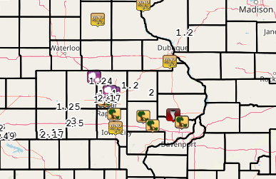
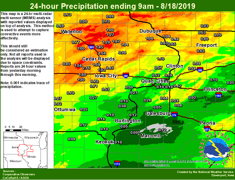
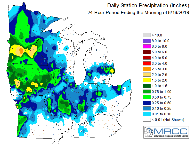
Rain Reports
| Local Rain Map | Regional Rainfall |
 |
 |
24 hour rainfall reports (in Inches),
Reported between Midnight and 9 AM,
Sunday August 18, 2019.

....IOWA....
Amana 4.7 W                      2.15
Newton 1 NE                      1.85
Central City 6.7 W               1.85
Fairfax 4.0 NW                   1.81
Hopkinton 5.4 WSW                1.67
Williamsburg                     1.60
Marion 1.7 NNW                   1.58
Marengo 3.6 N                    1.58
Cedar Rapids Arpt 5 SW           1.58
West Branch 2.0 NNW              1.55
Iowa City                        1.50
Cedar Rapids 2.7 NE              1.42
Grinnell AWOS 2 SSW              1.41
Pella 4 N                        1.35
Monticello 1 E                   1.34
Parnell 0.1 SSW                  1.30
NWS Johnston* 5 NNW              1.29
Coggon                           1.29
Manchester                       1.27
Center Point 0.6 NNW             1.24
Charlotte 1.9 WNW                1.10
Dubuque Arpt 7 SW                1.08
Iowa City Arpt                   1.04
North Liberty 0.7 SSW            1.02
Toledo 3 N                       1.01
Manchester 1.1 N                 1.00
Vinton                           1.00
Dubuque #3 7 SW                  1.00
Anamosa 1.9 SE                   0.98
Anamosa 3 SSW                    0.92
Dubuque 1.4 WSW                  0.90
Belle Plaine                     0.85
Marshalltown 1 NW                0.84
Rathbun Reservoir 2 N            0.83
Pella AWOS 2 WSW                 0.79
Ames US 30 2 SSE                 0.77
Mount Auburn 2.2 NNW             0.77
Kalona 7.3 NNW                   0.76
Allerton 2 S                     0.75
Mason City ASOS 6 W              0.74
Tripoli 0 N                      0.73
Perry 0 W                        0.72
Mason City 1 NNE                 0.72
Wellman 4.0 E                    0.71
Strawberry Point                 0.70
Sigourney                        0.70
Elkader 6SSW                     0.69
Dubuque LD11                     0.65
Marshalltown ASOS 4 N            0.64
Bellevue LD12                    0.63
Waterloo ASOS 5 NW               0.59
De Witt                          0.57
Hampton 1 N                      0.53
Ainsworth 7.4 N                  0.53
Eldridge 0.7 SSW                 0.52
Camanche 1.2 W                   0.50
Fayette 1 NW                     0.50
Coralville 1.3 SE                0.49
Davenport Arpt 5 N               0.48
Centerville 0 NE                 0.38
Albia 3 NNE                      0.38
Boone 1 SSW                      0.38
Beaconsfield 1 NNE               0.36
Fairfield                        0.35
Ottumwa ASOS 6 NNW               0.32
Cresco 1 NE                      0.30
Muscatine 1.4 N                  0.30
Davenport 0.9 WNW                0.27
Oskaloosa AWOS 9 ESE             0.27
Washington 5.8 SW                0.27
Brighton                         0.24
Le Claire 1.8 NNE                0.19
Keosauqua                        0.17
Salem 1S                         0.16
Davenport 0.9 SSW                0.12
Bettendorf 2.2 SE                0.11
Bettendorf 1.6 WSW               0.11
Wapello 0.2 S                    0.10
New London 1.5 SW                0.10
Donnellson                       0.10
Keokuk LD19                      0.10
Morning Sun 1.7 E                0.08
Burlington Arpt 2 SW             0.06
Burlington 6.5 SSW               0.05
Burlington 0.8 SSE               0.04
Oelwein AWOS                     0.00
....ILLINOIS....
Decatur Airport                  1.36
Peoria ASOS                      1.34
Galena                           1.04
Freeport 2.0 NW                  0.86
Fulton LD13                      0.73
Davis 0.5 N                      0.70
Lincoln NWS                      0.67
Hanover 0.2 NW                   0.65
Shannon 0.2 S                    0.65
New Windsor 2.0 N                0.64
Joliet                           0.62
Freeport 1.7 NW                  0.62
Windsor                          0.60
Freeport                         0.56
Minonk                           0.56
Romeoville                       0.55
Galesburg                        0.55
Winslow 4.3 ESE                  0.53
Elizabeth                        0.48
Tuscola                          0.45
Ottawa 4 SW                      0.44
Geneseo 2.0 NW                   0.42
Galesburg Arpt 3 SW              0.42
Morrison 3.2 E                   0.38
Coleta 1.4 SSW                   0.38
Woodhull 4.9 E                   0.28
Aledo                            0.26
Bloomington Airport              0.25
Ill. City LD16 3 WNW             0.25
Rochelle AWOS                    0.24
St Anne                          0.22
Illinois City 6.7 SW             0.21
Coal Valley 2.6 E                0.19
Jacksonville AWOS                0.16
Rockford ASOS                    0.12
Gladstone LD18                   0.12
Prairie City 2S                  0.12
Ogden                            0.11
Streator 3 SE                    0.11
Quincy ASOS                      0.11
Quad City Arpt 3 S               0.10
Walnut 5.3 ENE                   0.10
Moline 0.7 NNE                   0.09
Altona                           0.08
Tiskilwa 2.1 N                   0.05
Mendota 2 SE                     0.05
Alexis 1 SW                      0.05
Mundelein                        0.04
Princeton 1.1 SE                 0.03
Princeton                        0.03
Coal Valley 1.9 SE               0.03
Kewanee 1 E                      0.02
Roscoe 2SE                       0.02
Colchester 3.5 NE                0.01
La Harpe                         0.00
Steward                          0.00
....MISSOURI....
Kirksville ASOS                  0.47
Chillicothe 2 NW                 0.34
Memphis                          0.08
Columbia                         0.04
....WISCONSIN....
Prairie du Chien AWOS            0.51
Steuben 4SE 3 NE                 0.46
Viroqua                          0.43
Madison-ASOS                     0.15
La Crosse WFO                    0.14
Allenton-WWTP .6 NW              0.06
Monroe 1 W                       0.03
Beloit-College                   0.01
Whitewater                       0.01
Watertown-AWOS                   0.00
....MINNESOTA....
Theilman 1SSW                    0.37
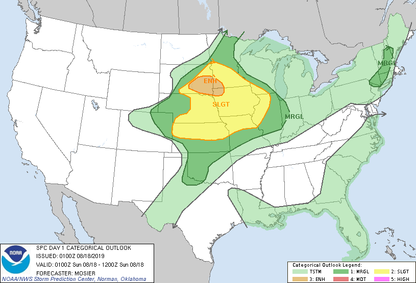
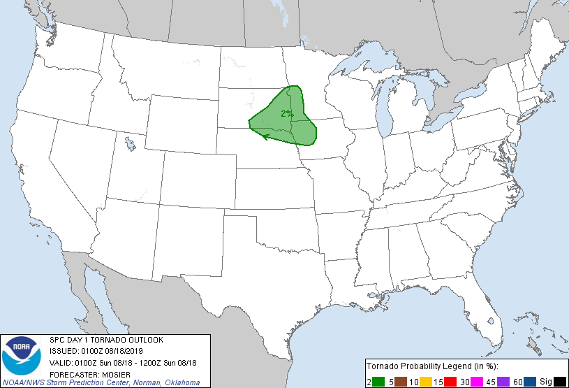
Environment
 |
 |
 |
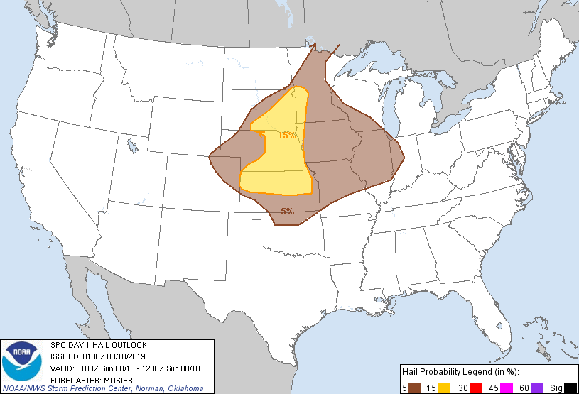 |
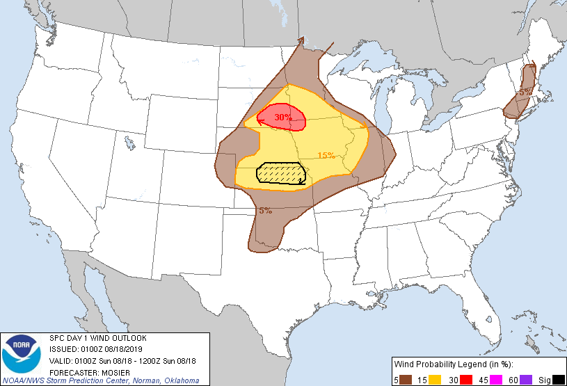
| Day 1 Outlook (0100z) | Day 1 Tornado Outlook (0100z) | Day 1 Wind Outlook (0100z) | Day 1 Hail Outlook (0100z) |
 |
Media use of NWS Web News Stories is encouraged! Please acknowledge the NWS as the source of any news information accessed from this site. |
|