Scattered severe thunderstorms capable of damaging wind gusts and some hail are expected this afternoon and evening from the Upper Ohio River Valley into the Northeast, and from the Appalachians into the Mid-Atlantic States. Excessive rainfall from heavy thunderstorms may produce areas of flash flooding from southern New Mexico into the western and northern Gulf Coast into Wednesday. Read More >
Overview
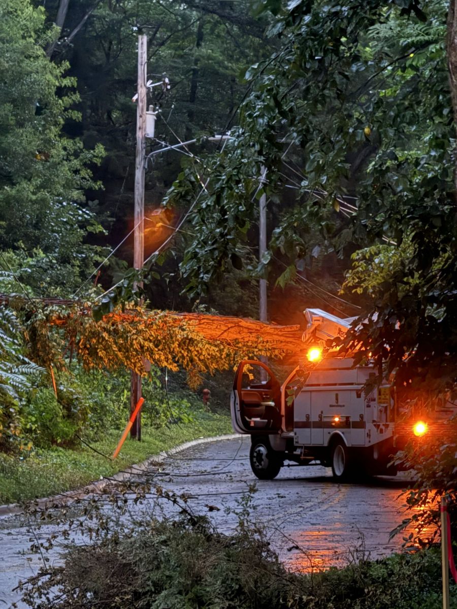
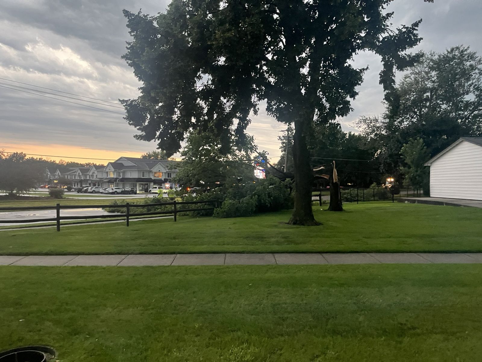
Photos
 |
 |
 |
|
Moline, IL Grant Dahlstrom |
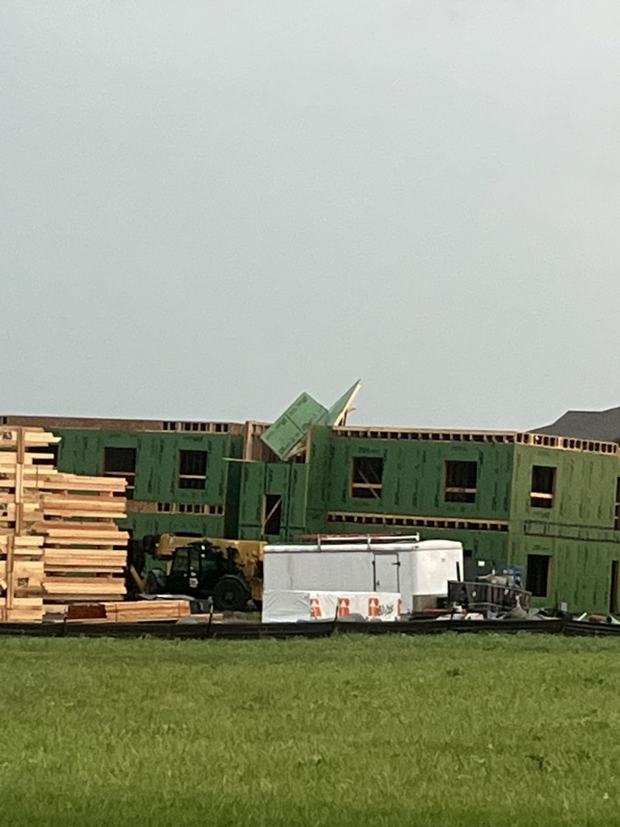
North Liberty, IA Sullivan Miller |
North Liberty, IA Sullivan Miller |
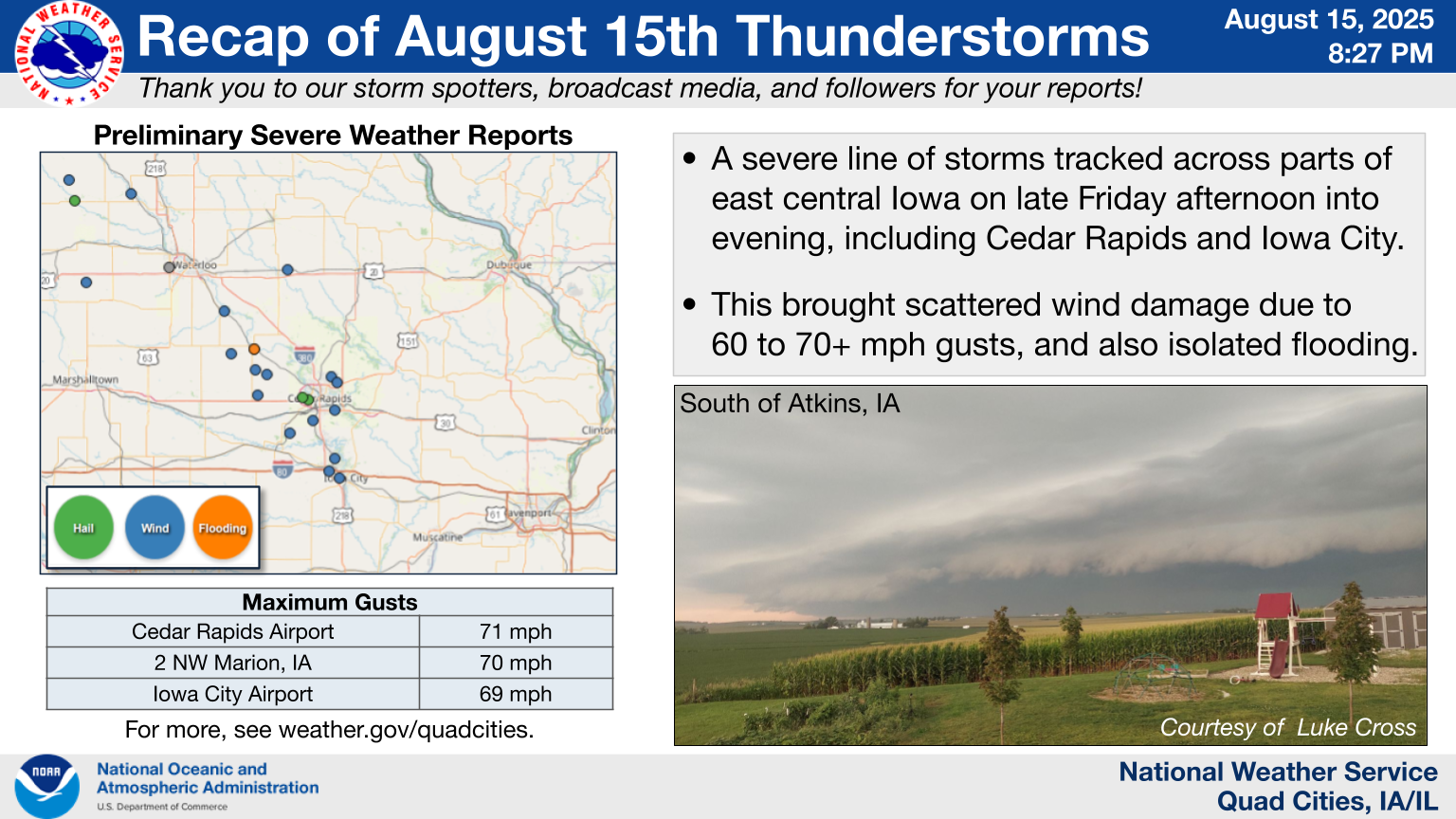
Storm Reports
|
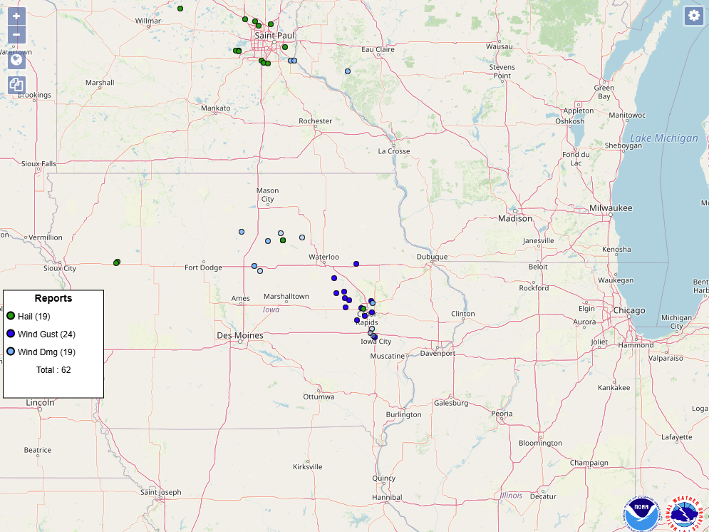
Regional Storm Report Map |
Local Storm Report Map |
 |
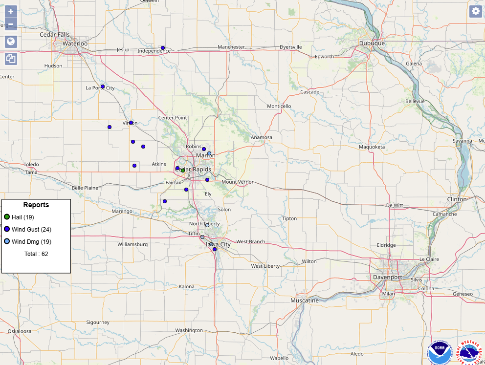 |
| Interactive Storm Report Map (SPC) Nationwide Storm Report Map Image (SPC) |
|
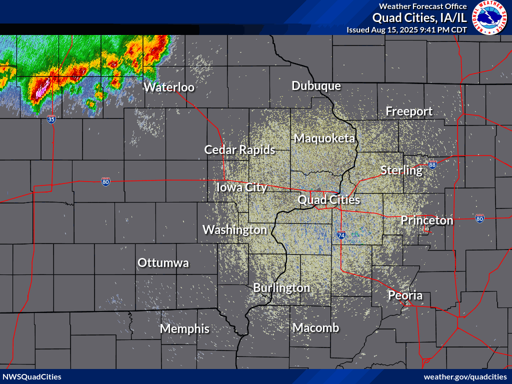
Preliminary Local Storm Report...Summary
National Weather Service Quad Cities IA IL
907 PM CDT Fri Aug 15 2025

..TIME...   ...EVENT...      ...CITY LOCATION...     ...LAT.LON...
..DATE...   ....MAG....      ..COUNTY LOCATION..ST.. ...SOURCE....
            ..REMARKS..

0530 PM     Tstm Wnd Gst     2 NNW Marion            42.06N 91.61W
08/15/2025  M70 MPH          Linn               IA   Trained Spotter

            PWS.

0537 PM     Tstm Wnd Gst     Eastern Iowa Airport    41.89N 91.71W
08/15/2025  M71 MPH          Linn               IA   ASOS


0540 PM     Hail             3 W Cedar Rapids        41.97N 91.73W
08/15/2025  M1.50 Inch       Linn               IA   Trained Spotter


0541 PM     Hail             4 N Fairfax             41.98N 91.76W
08/15/2025  M0.70 Inch       Linn               IA   Emergency Mngr


0541 PM     Tstm Wnd Gst     4 N Fairfax             41.98N 91.76W
08/15/2025  E60 MPH          Linn               IA   Emergency Mngr


0544 PM     Tstm Wnd Dmg     Marion                  42.04N 91.58W
08/15/2025                   Linn               IA   Trained Spotter

            Several large branches down. Dime size hail
            too.

0554 PM     Tstm Wnd Gst     4 N Ely                 41.93N 91.59W
08/15/2025  M65 MPH          Linn               IA   Mesonet

            PWS.

0700 PM     Rain             2 ENE Hiawatha          42.06N 91.65W
08/15/2025  M1.75 Inch       Linn               IA   Trained Spotter

            Since 5 P.M.

0559 PM     Tstm Wnd Gst     Iowa City Municipality  41.64N 91.55W
08/15/2025  M69 MPH          Johnson            IA   ASOS


0601 PM     Tstm Wnd Dmg     1 WNW Coralville        41.69N 91.62W
08/15/2025                   Johnson            IA   NWS Employee

            Large tree limbs down along nearby roadways.

0606 PM     Tstm Wnd Dmg     1 E North Liberty       41.74N 91.59W
08/15/2025                   Johnson            IA   Amateur Radio

            downed tree approx. 2-2.5 ft diameter
            across.

0628 PM     Tstm Wnd Dmg     1 W University Heights  41.66N 91.57W
08/15/2025                   Johnson            IA   Amateur Radio

            downed tree approx 1.5 ft diameter on
            Melrose Ave @ Mormon Trek, Iowa City.

0536 PM     Tstm Wnd Gst     2 NNE East Amana        41.84N 91.83W
08/15/2025  M72 MPH          Iowa               IA   Mesonet

            PWS.

0516 PM     Tstm Wnd Gst     2 NE Three Elms County  42.48N 91.84W
08/15/2025  M62 MPH          Buchanan           IA   Mesonet

            PWS.

0510 PM     Tstm Wnd Gst     Garrison                42.15N 92.14W
08/15/2025  E60 MPH          Benton             IA   Fire Dept/Rescue

            Report of 60+ mph winds. Time estimated by
            radar.

0515 PM     Tstm Wnd Gst     1 NE Vinton             42.17N 92.02W
08/15/2025  M59 MPH          Benton             IA   Mesonet

            PWS.

0515 PM     Rain             Vinton                  42.17N 92.02W
08/15/2025  M1.25 Inch       Benton             IA   Public

            1.25 inches in 15 minutes.

0517 PM     Tstm Wnd Gst     2 W Newhall             41.99N 92.00W
08/15/2025  M58 MPH          Benton             IA   Mesonet

            PWS.

0521 PM     Tstm Wnd Gst     5 S Vinton              42.09N 92.01W
08/15/2025  M59 MPH          Benton             IA   Mesonet

            PWS.

0522 PM     Tstm Wnd Gst     4 WSW Shellsburg        42.07N 91.95W
08/15/2025  M64 MPH          Benton             IA   Public

            PWS.

0530 PM     Rain             Vinton                  42.16N 92.03W
08/15/2025  M2.15 Inch       Benton             IA   Trained Spotter

            Fell within 30 mins.

0535 PM     Flash Flood      Vinton                  42.17N 92.02W
08/15/2025                   Benton             IA   Law Enforcement

            Car stalled on Iowa Highway 150 on north
            side of Vinton. Time estimated.
Outlooks and Environment
Storm Prediction Center Outlooks
 |
 |
 |
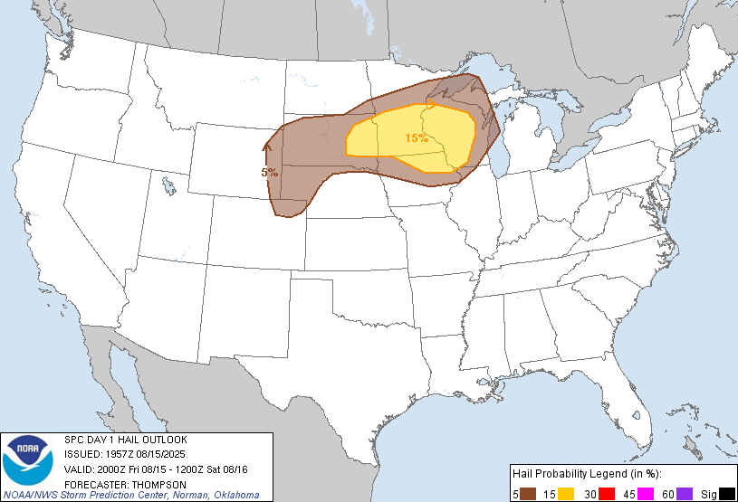 |
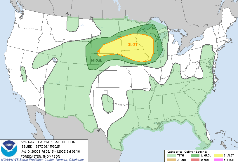
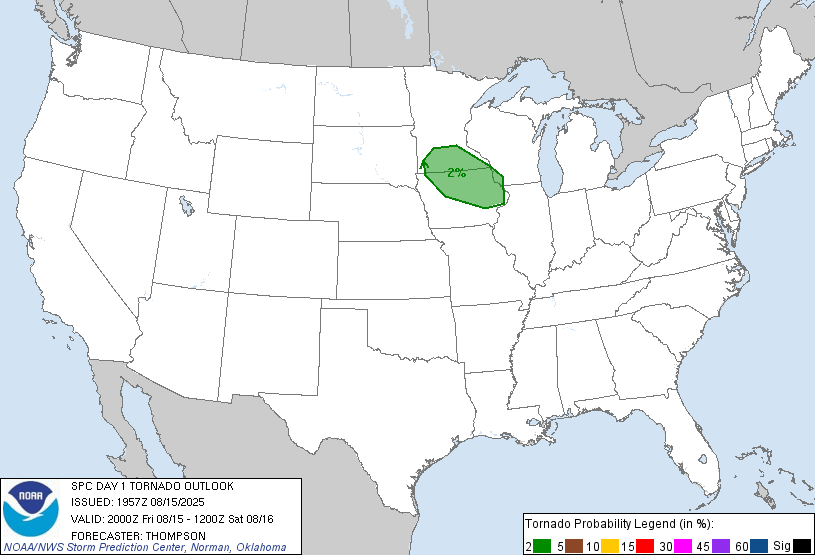
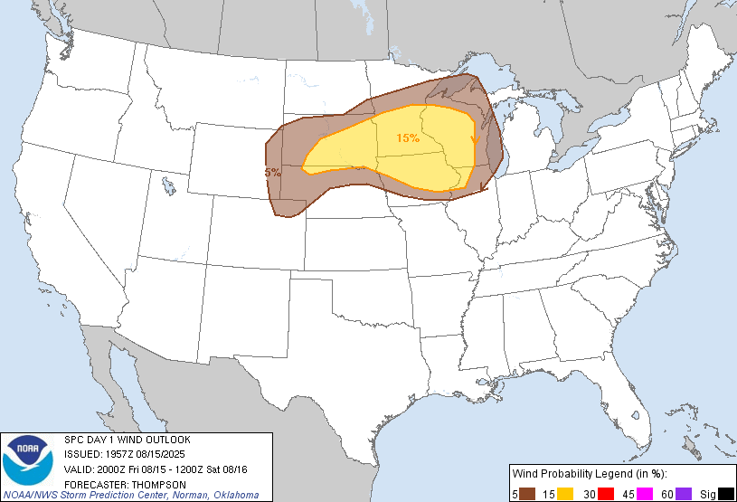
| SPC Day 1 2000z Outlook |
Tornado Risk Probabilities
|
Severe Wind Risk Probabilities |
Severe Hail Risk Probabilities
|
Watches and Mesoscale Discussions
 |
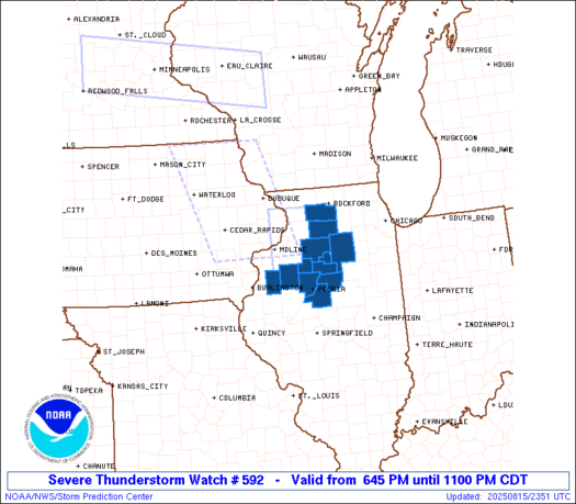 |
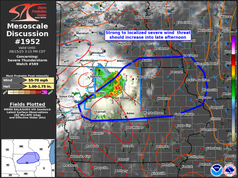 |
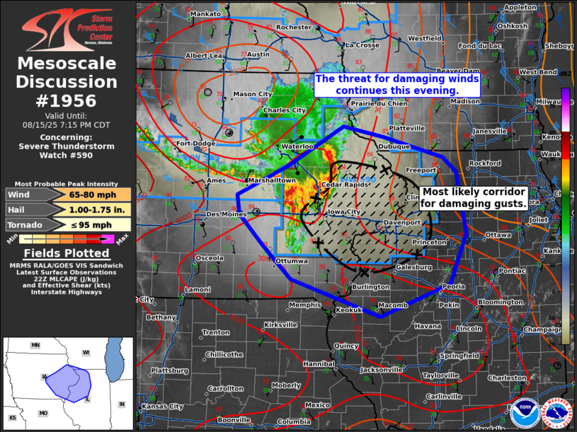 |
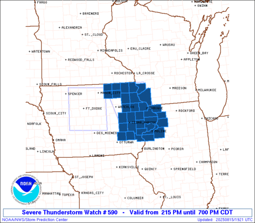
| Severe Thunderstorm Watch 590 | Mesoscale Discussion 1956 |
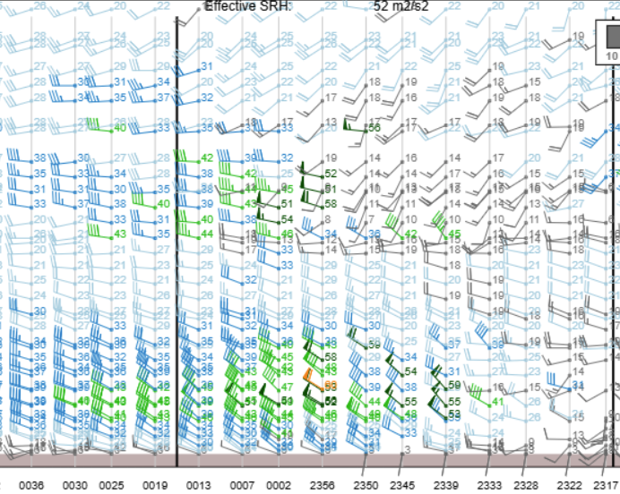
Local Soundings and Radar Profiler Data at DVN
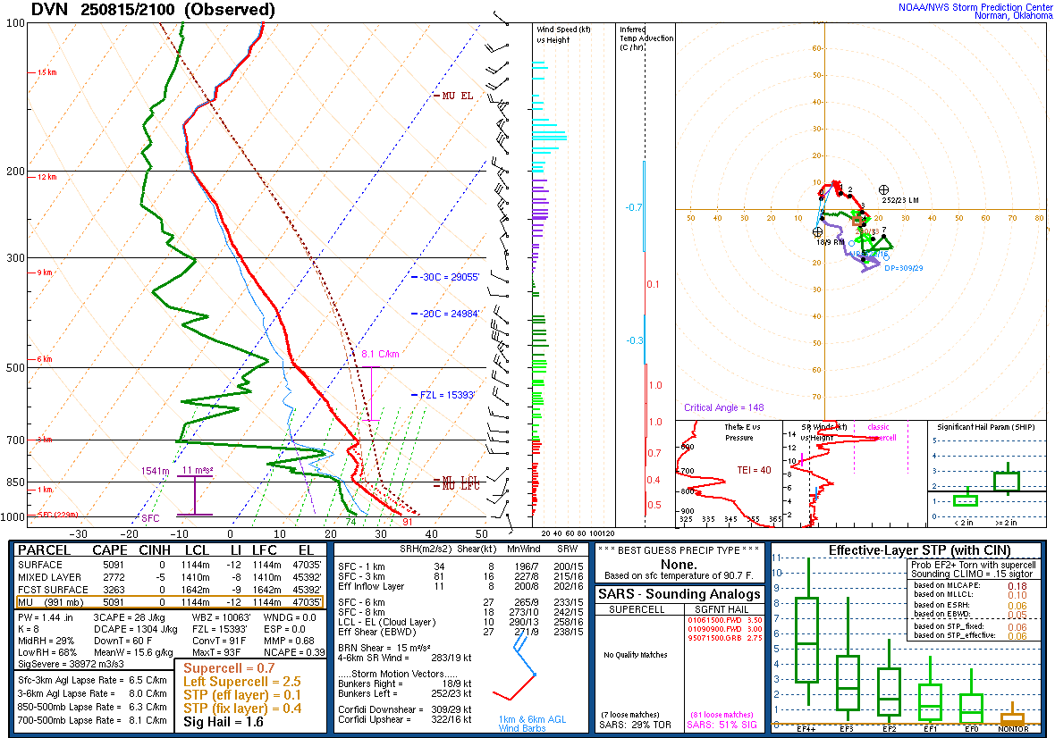 |
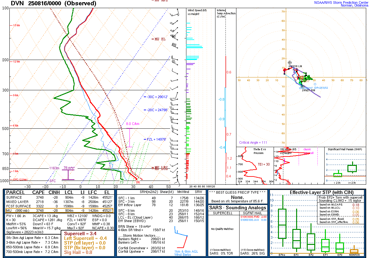 |
| 08/15/2025 - 4:00PM | 08/15/2025 - 7:00PM |
 |
|
KDVN VWP Data from 6:00 PM (right) to 8:00 PM (left) This is the NWS Quad Cities (DVN) Doppler Radar vertical wind profile data in the hour following the line of storm passage. This shows the well-defined rear-inflow jet that had developed within the long-lived line of storms. It likely had weakened at this point compared to the northwest of the Quad Cities. Often the rear-inflow jet is a factor in severe winds. |
Synoptic Environment
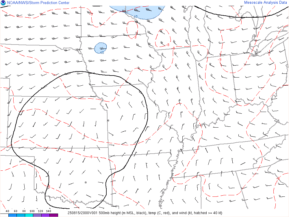 |
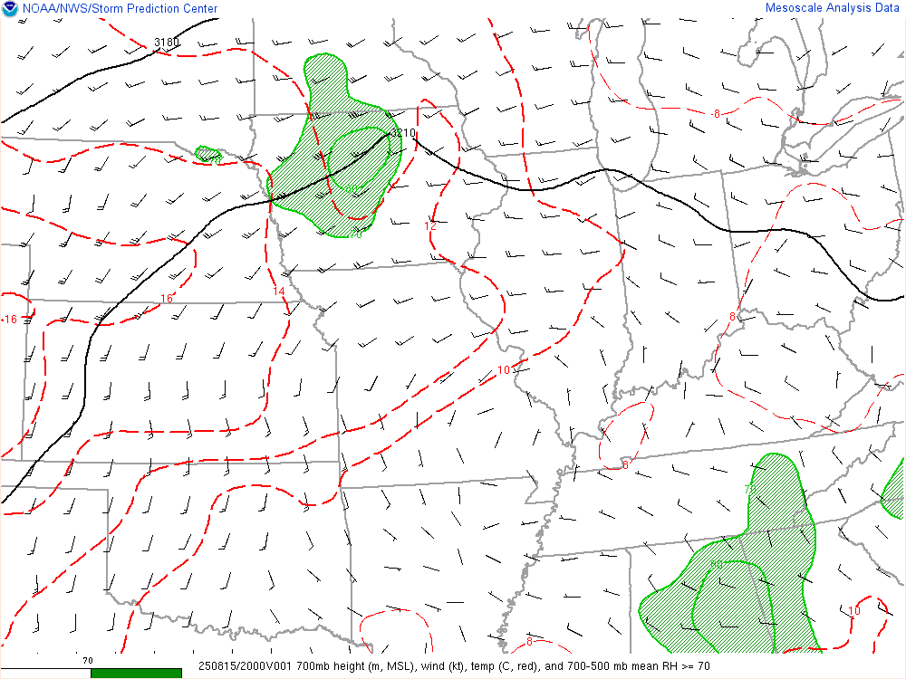 |
 |
 |
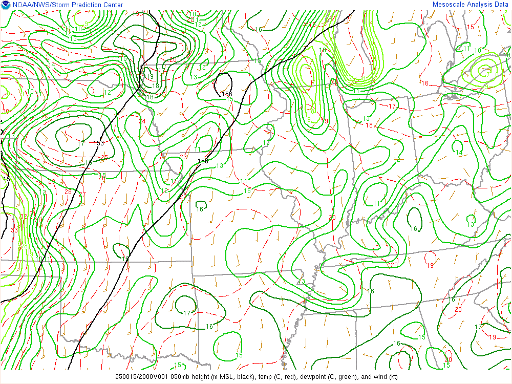
| 500 mb Chart at 3pm | 700 mb Chart at 3pm | 850 mb Chart at 3pm | Surface Chart at 4pm (WPC) |
Mesoscale Environment
 |
 |
 |
 |
|
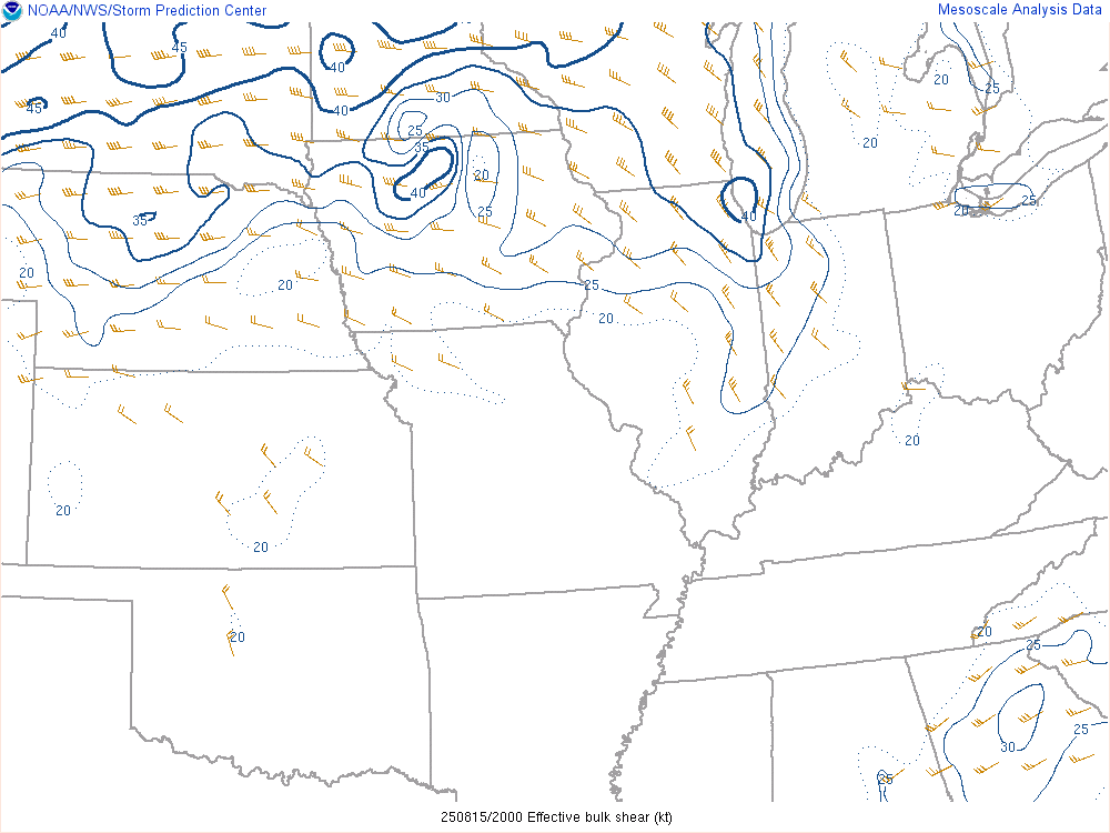
Wind Shear Favorable for Organized Convection |
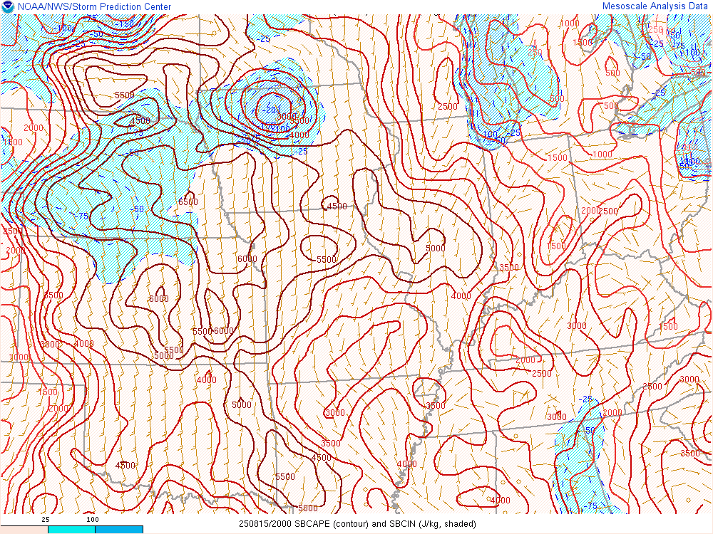
Instability Favorable for Organized Convection |
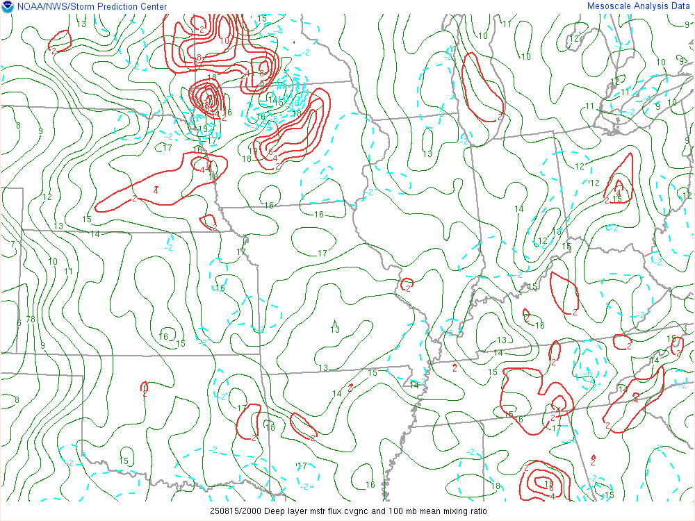
Deep Moist Convergence Favorable for Convective Initiation |
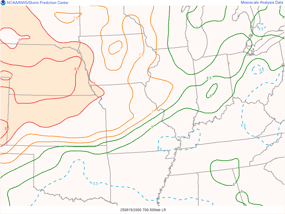
Mid Level Lapse Rates Favorable for Storm Maintenance |
 |
 |
 |
|
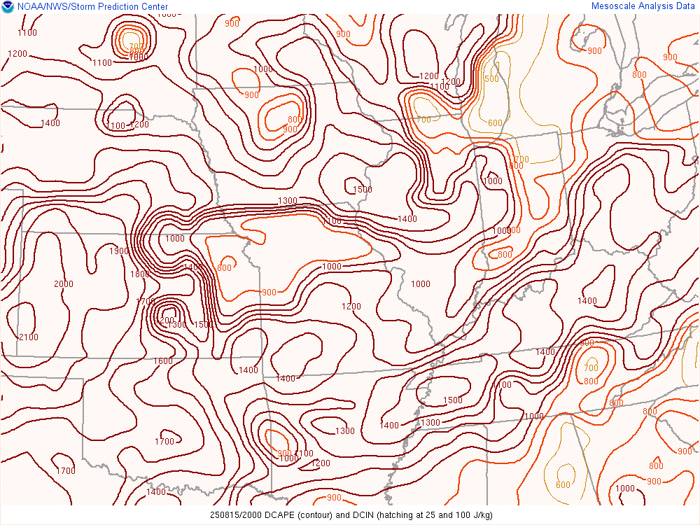
Downdraft CAPE Favorable for Strong Downdraft Winds |
MCS Maintenance Indicative of Storm Longevity |
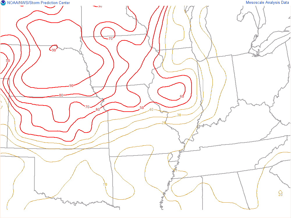
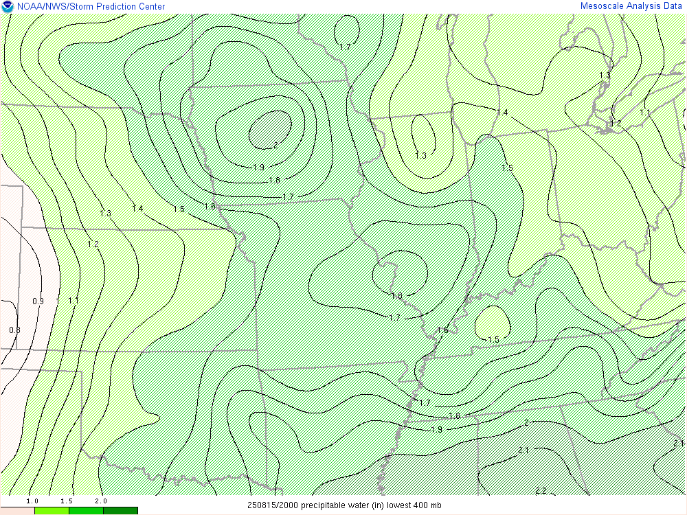
Precipitable Water Favorable for Heavy Rain |
 |
Media use of NWS Web News Stories is encouraged! |
|