Severe thunderstorms will be possible from the central Plains to the Mid-Atlantic and Northeast on Monday. Hazardous heat will linger across the southern U.S. and build across the West through mid-week. Hot and dry conditions will fuel fire weather concerns for Interior Alaska and the Four Corners region through Monday. Read More >
Overview
|
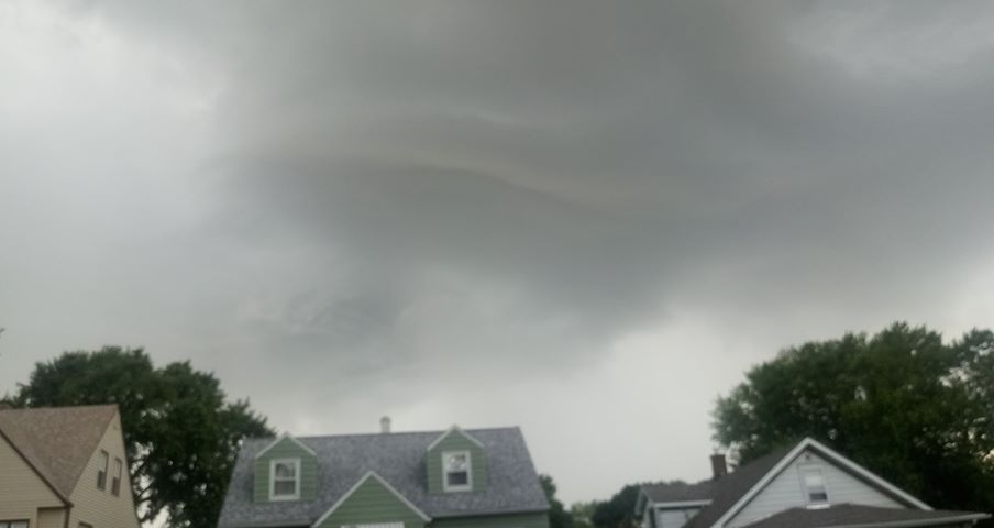
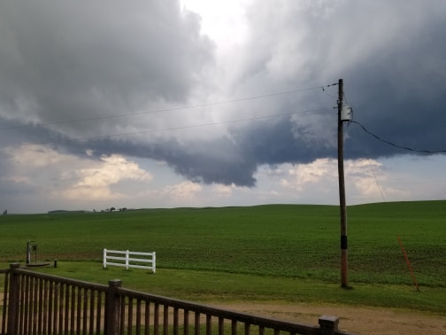
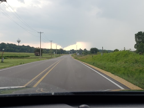
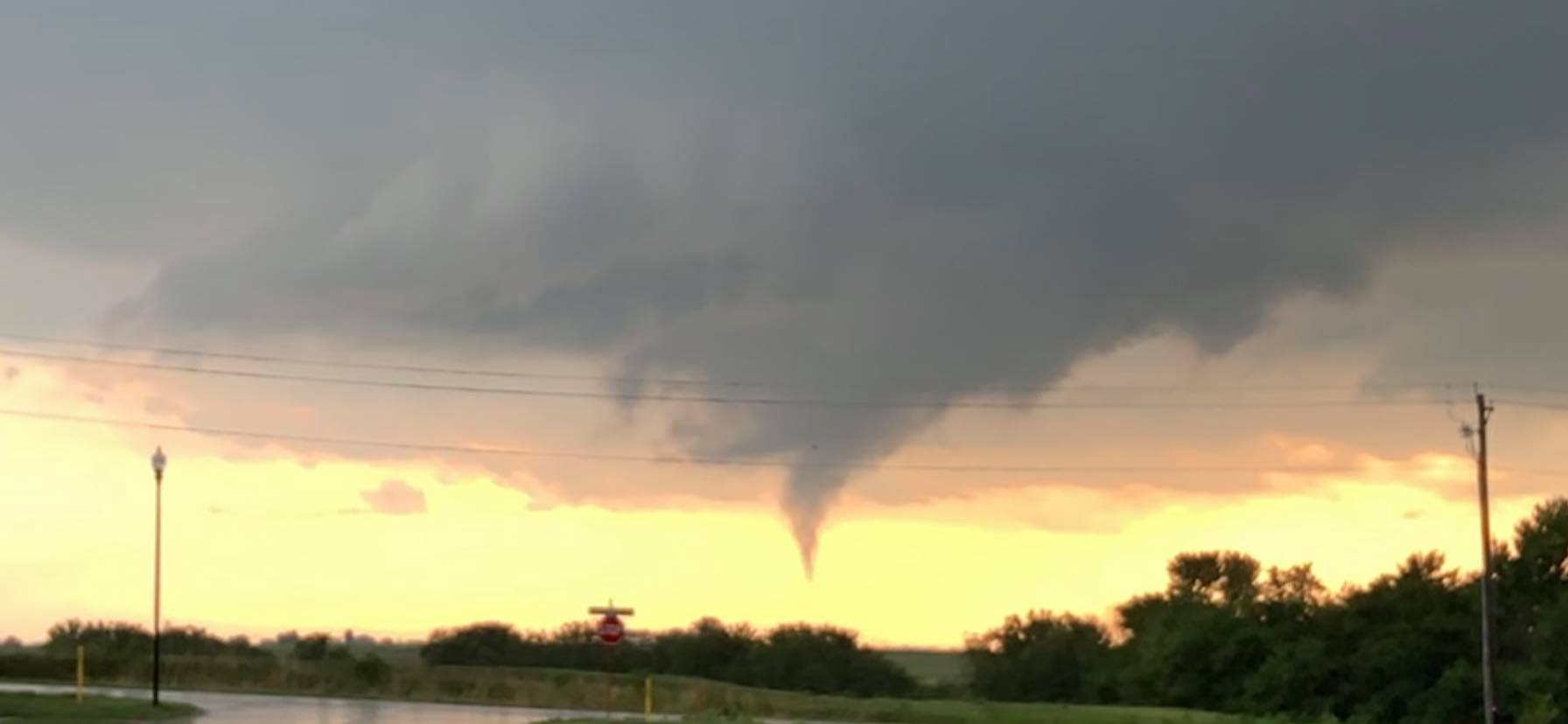
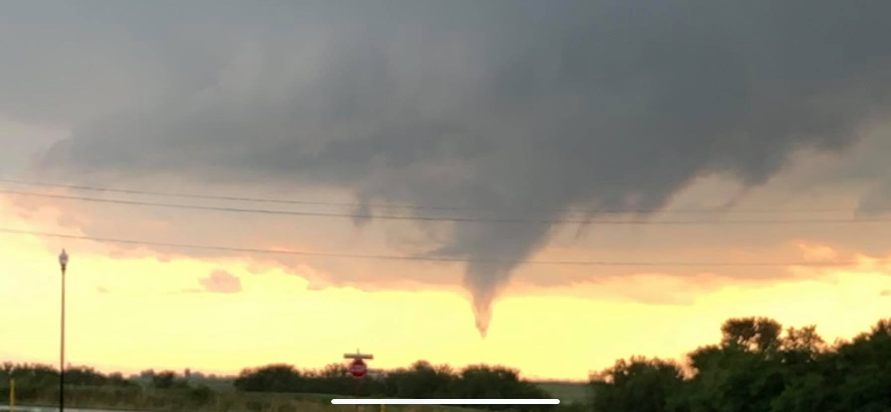
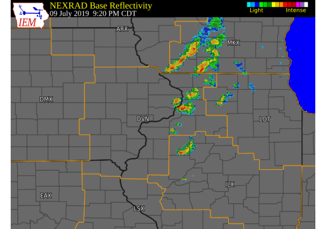
Severe thunderstorms moved across eastern Iowa and western Illinois during the late afternoon and evening. These low topped supercell thunderstorms produced funnel clouds and two brief tornado touchdowns near Walcott and Donahue. No damage was reported or seen with these touchdowns. |
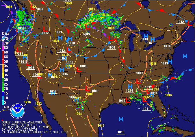 Fronts / Pressure Map 7 pm July 9th, 2019 |
Tornadoes:
|
Tornado - 1 NW Walcott, IA
Track Map 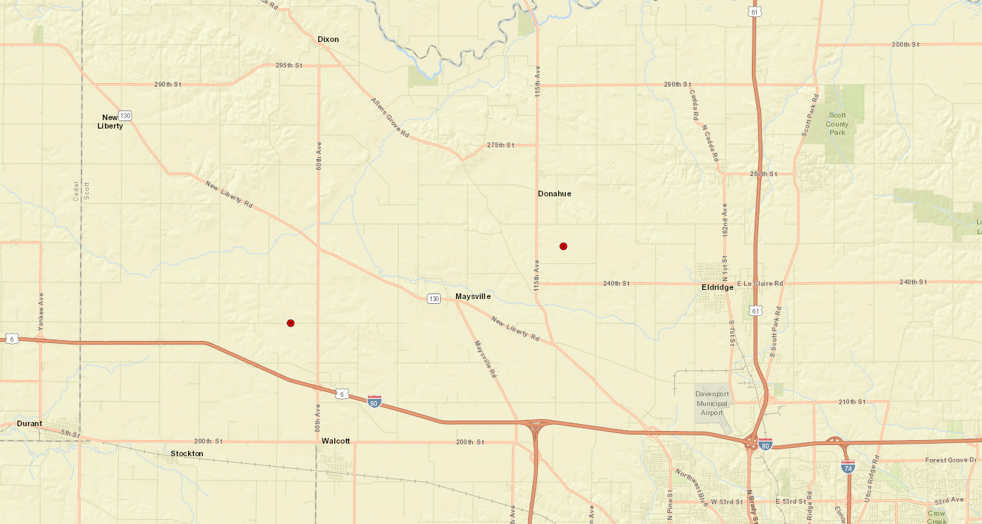 
|
||||||||||||||||
|
||||||||||||||||
|
Tornado - 2 S Donahue, IA
Track Map |
||||||||||||||||
|
||||||||||||||||
The Enhanced Fujita (EF) Scale classifies tornadoes into the following categories:
| EF0 Weak 65-85 mph |
EF1 Moderate 86-110 mph |
EF2 Significant 111-135 mph |
EF3 Severe 136-165 mph |
EF4 Extreme 166-200 mph |
EF5 Catastrophic 200+ mph |
 |
|||||
Storm Reports
| Interactive Storm Report Map | SPC Storm Reports |
 |
 |
PRELIMINARY LOCAL STORM REPORT...SUMMARY
NATIONAL WEATHER SERVICE QUAD CITIES IA IL
1222 AM CDT WED JUL 10 2019

..TIME...   ...EVENT...      ...CITY LOCATION...     ...LAT.LON...
..DATE...   ....MAG....      ..COUNTY LOCATION..ST.. ...SOURCE....
            ..REMARKS..
0741 PM     TORNADO          2 SSE DONAHUE           41.67N 90.66W
07/09/2019                   SCOTT              IA   TRAINED SPOTTER

            A TRAINED SPOTTER OBSERVED A BRIEF TORNADO
            IN AN OPEN FIELD. THE TORNADO CAUSED NO
            DAMAGE FROM WHICH THE NWS COULD ASSIGN AN
            EF-SCALE RATING.
0741 PM     FUNNEL CLOUD     3 SSE DONAHUE           41.65N 90.64W
07/09/2019                   SCOTT              IA   NWS EMPLOYEE

            BRIEF FUNNEL CLOUD SEEN TO NORTHWEST OF NWS
            OFFICE. LASTED LESS THAN 1 MINUTE. LOCATION
            APPROXIMATE.

0708 PM     FUNNEL CLOUD     2 S MASSILLON           41.89N 90.92W
07/09/2019                   CEDAR              IA   PUBLIC

            BRIEF FUNNEL.

0705 PM     TORNADO          1 W WALCOTT             41.62N 90.79W
07/09/2019                   SCOTT              IA   LAW ENFORCEMENT

            STATE TROOPERS REPORTED A BRIEF TORNADO
            TOUCHDOWN NEAR WALCOTT AT APPROXIMATELY 7:05
            PM. THE FEATURE HAD SINCE DISSIPATED, BUT
            ROTATION IN THE CLOUDS AS STILL SEEN TO THE
            NORTH OF WALCOTT.

0542 PM     FUNNEL CLOUD     CALAMUS                 41.83N 90.76W
07/09/2019                   CLINTON            IA   PUBLIC

            ROTATING WALL CLOUD WITH BRIEF FUNNEL
            EXTENDING HALF WAY TO THE GROUND EAST OF
            CALAMUS. FEATURE HAS SINCE DISSIPATED.
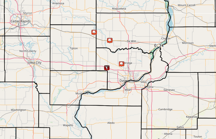
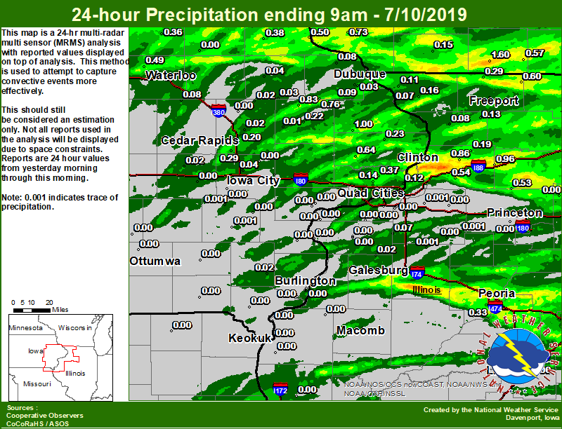
Rain Reports
| Local Rain Map | Regional Rain Map |
 |
 |
Environment
SPC EVENT REVIEW PAGE: 7/09/2019
 |
 |
 |
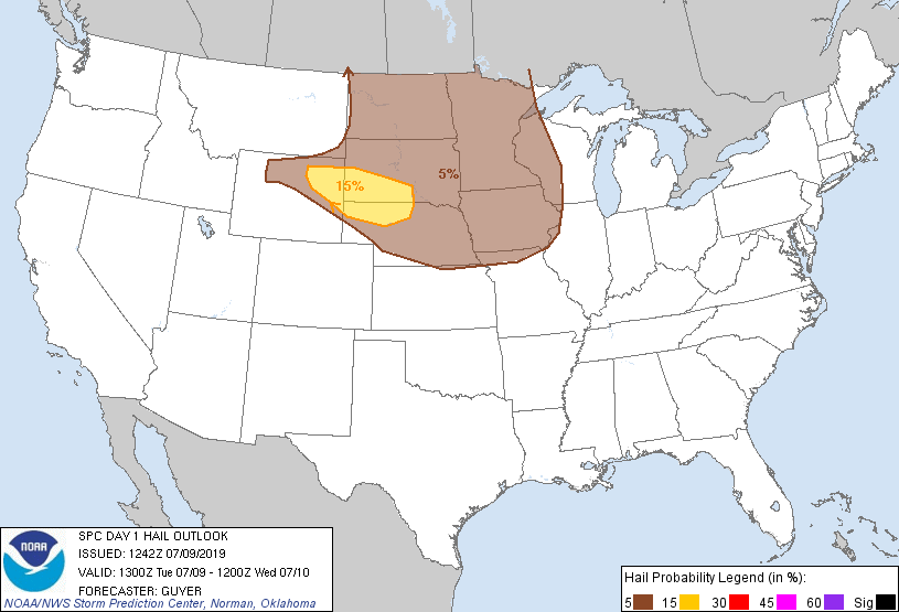 |
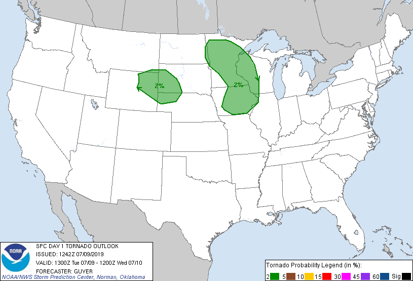
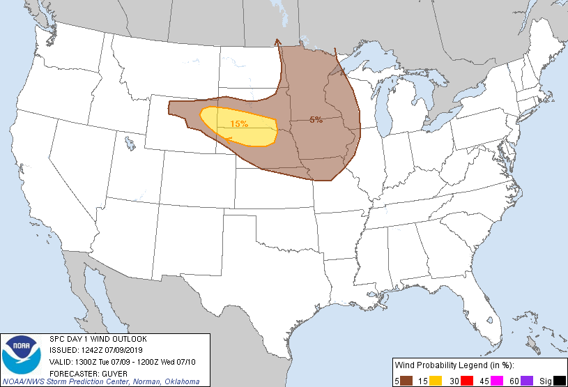
| 8 AM OUTLOOK | 8 AM TORNADO OUTLOOK | 8 AM WIND OUTLOOK | 8 AM HAIL OUTLOOK |
 |
||
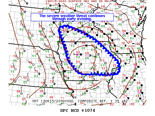
| MCD 1424 |
 |
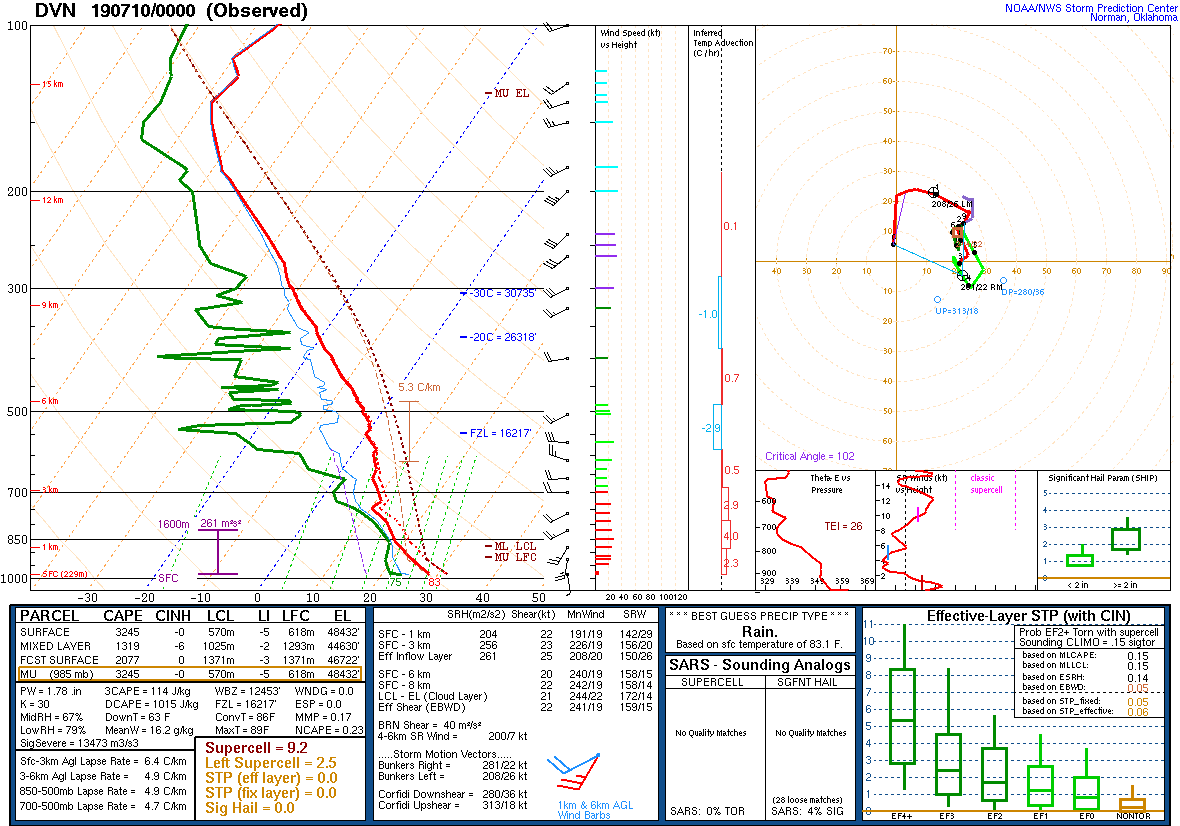 |
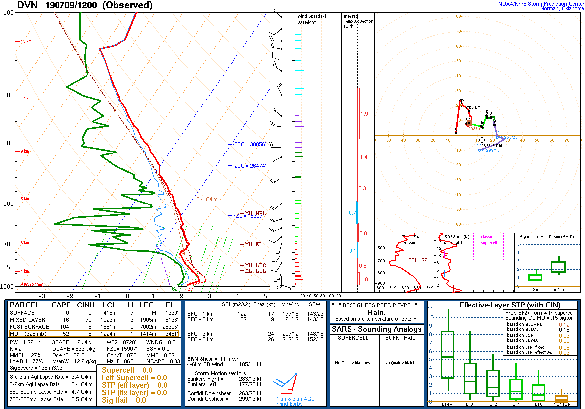
| 7 AM DAVENPORT, IA SOUNDING | 7 PM DAVENPORT, IA |
 |
Media use of NWS Web News Stories is encouraged! Please acknowledge the NWS as the source of any news information accessed from this site. |
|