Scattered severe thunderstorms capable of damaging wind gusts and some hail are expected this afternoon and evening from the Upper Ohio River Valley into the Northeast, and from the Appalachians into the Mid-Atlantic States. Excessive rainfall from heavy thunderstorms may produce areas of flash flooding from southern New Mexico into the western and northern Gulf Coast into Wednesday. Read More >
Overview
|
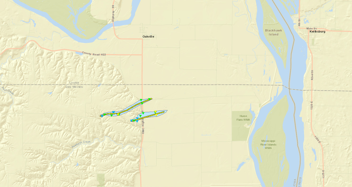
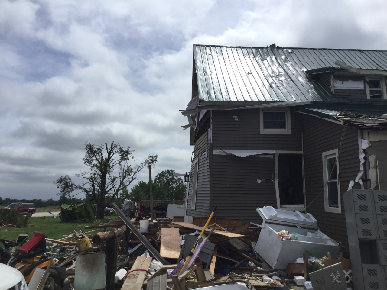
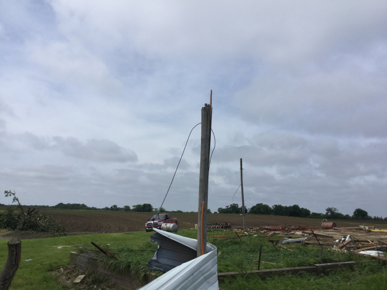
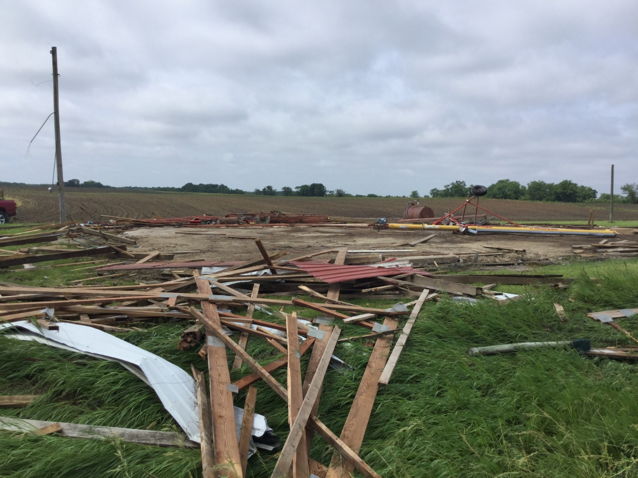
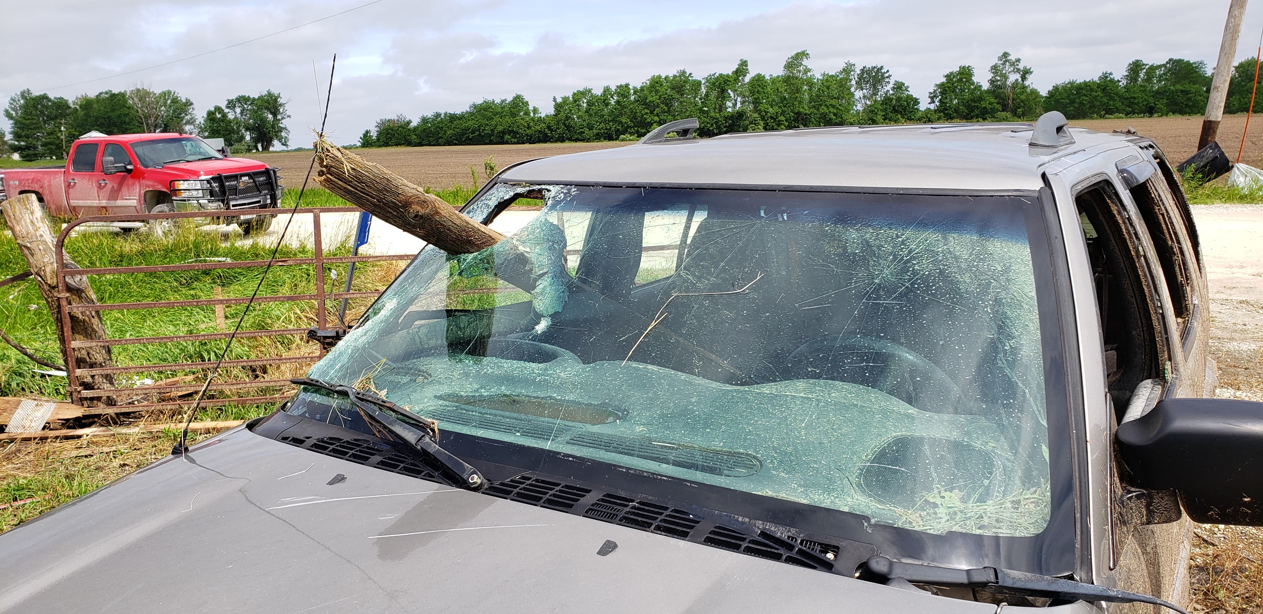
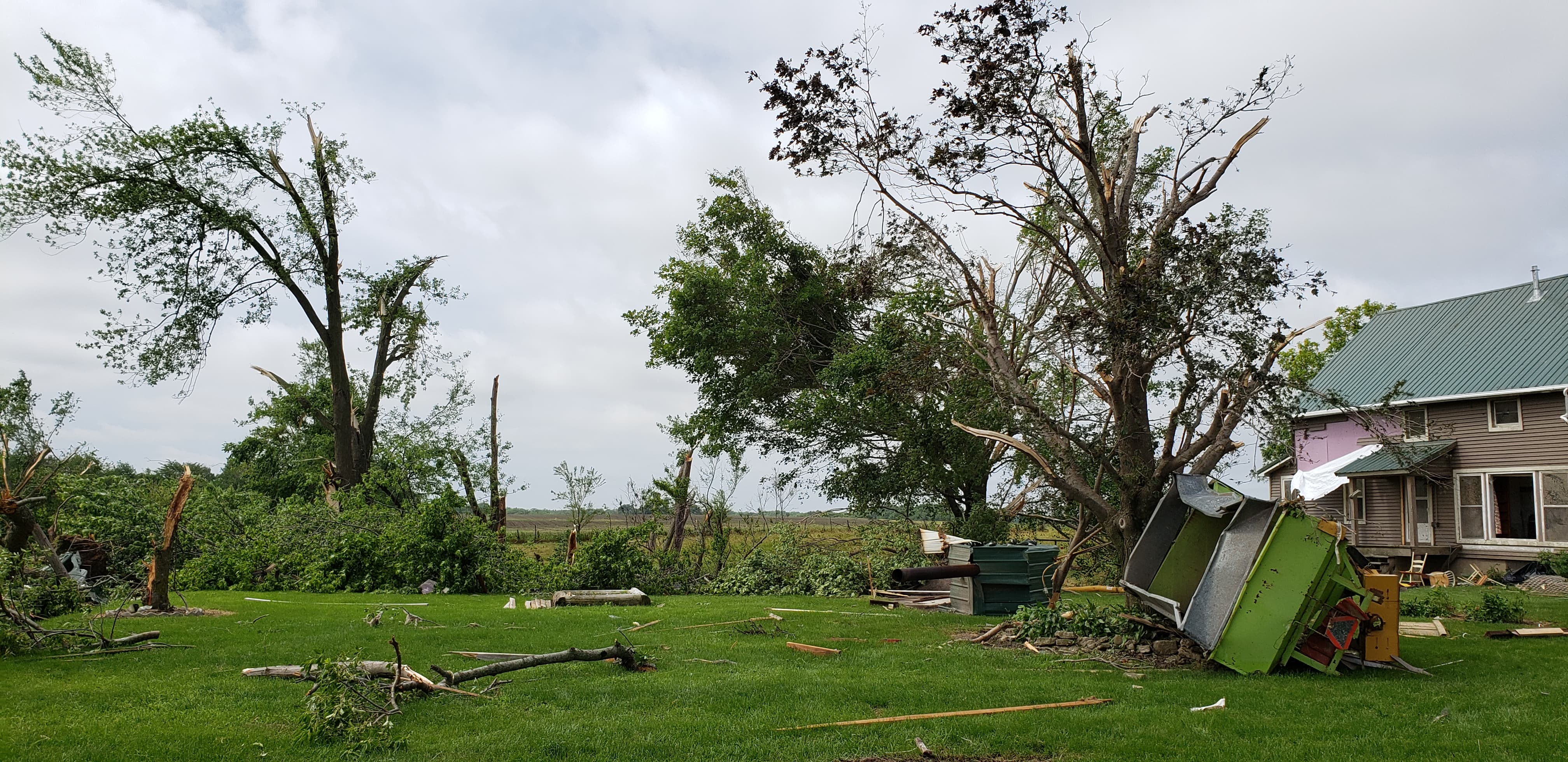
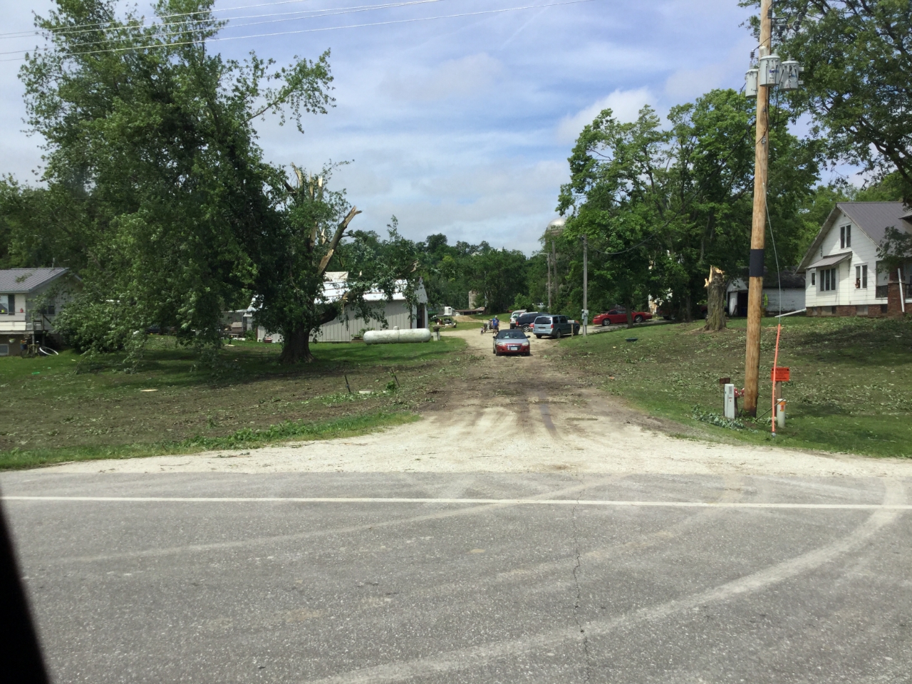
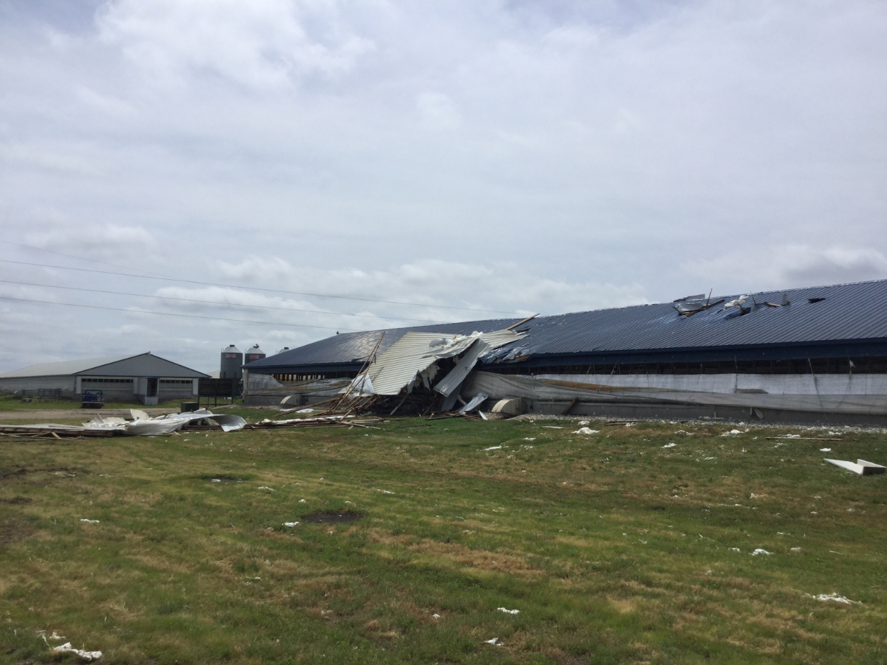
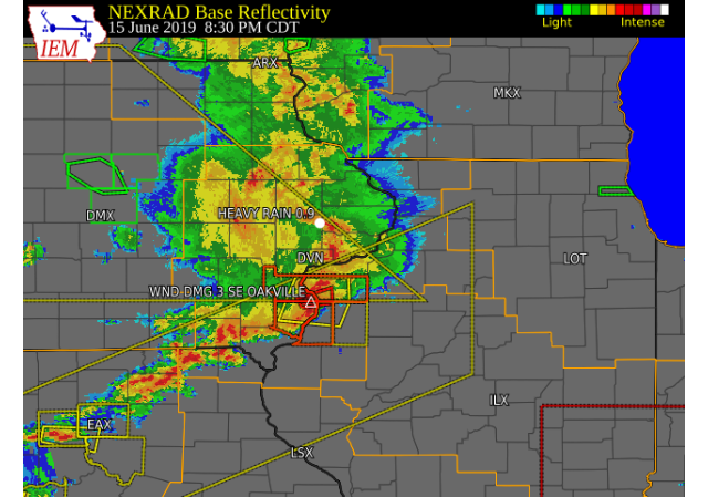
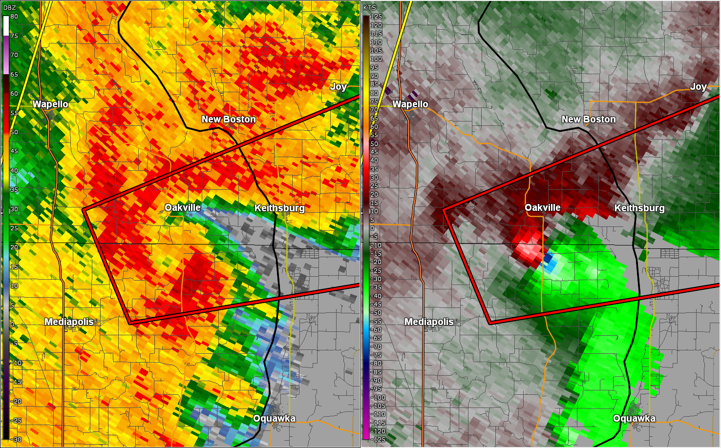
Severe thunderstorms tracked across portions of eastern Iowa, northeast Missouri, and northwest Illinois Saturday evening, June 15, bringing damaging winds, heavy downpours, frequent lightning, large hail, and a tornado. Many areas saw winds between 30-50 mph during the evening hours, with higher winds of 60-70 mph reported in Iowa and Benton counties in Iowa. The storms produced three tornadoes in Des Moines County (west of Mediapolis, IA and south of Oakville, IA) between 7:50 pm and 8:30 pm. |
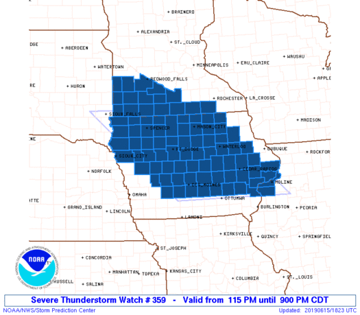 Watch Graphic |
Tornadoes:
|
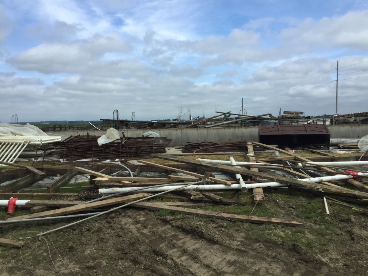
Tornado - 3 SW Oakville, IA
|
||||||||||||||||
|
||||||||||||||||
|
Tornado - 2.8 SSW Oakville, IA
|
||||||||||||||||
|
||||||||||||||||
|
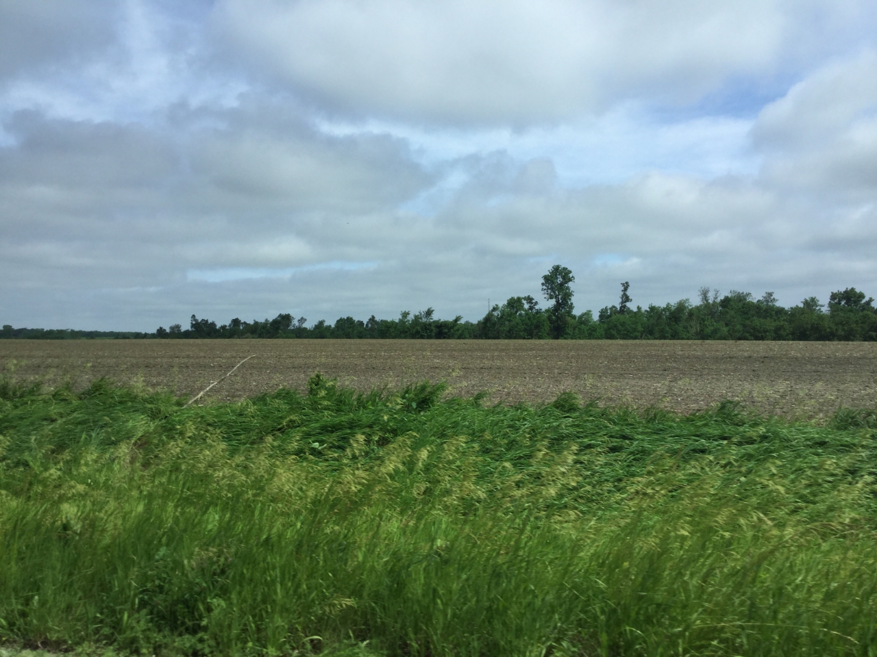
Tornado - 3 W Mediapolis, IA
Track Map 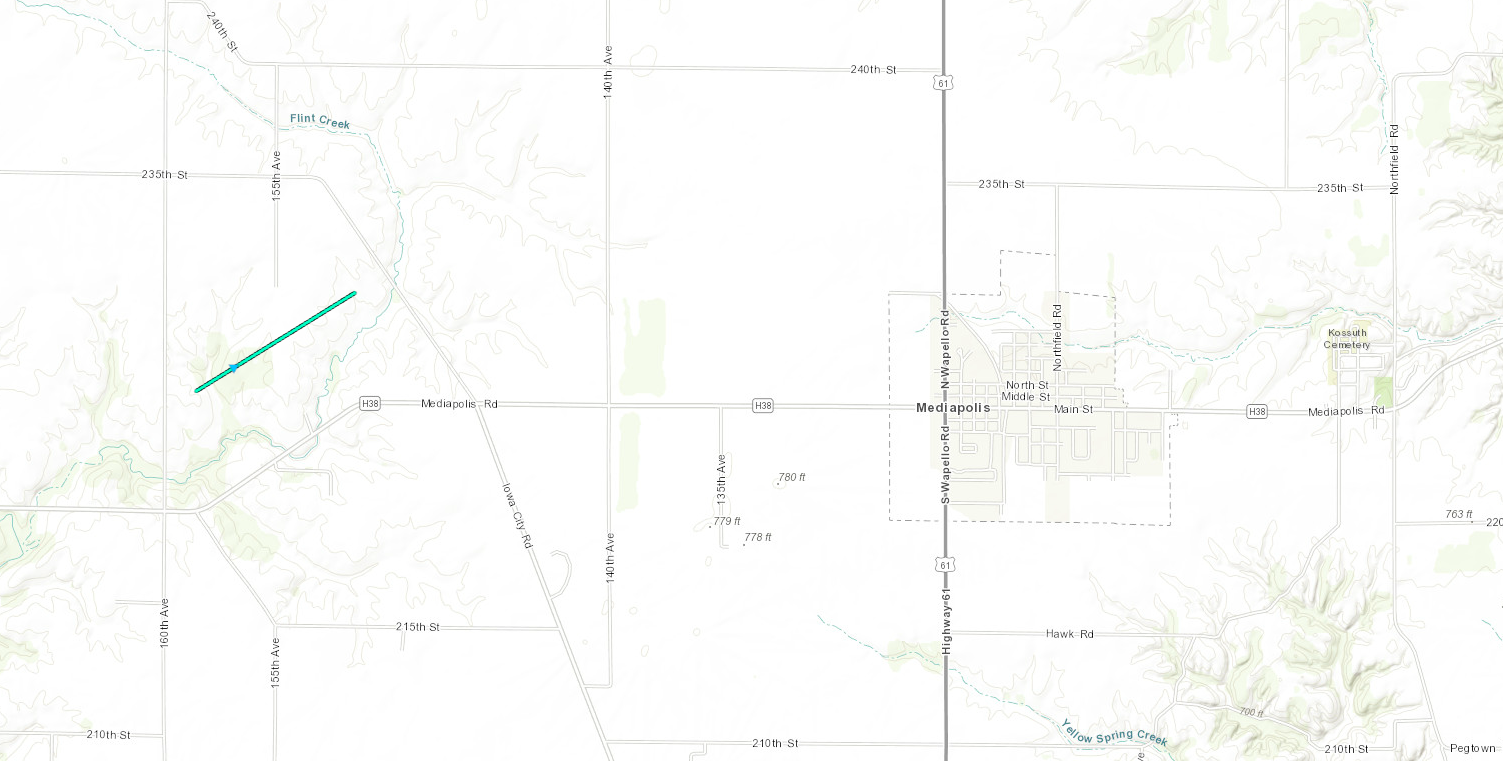 
|
||||||||||||||||
The Enhanced Fujita (EF) Scale classifies tornadoes into the following categories:
| EF0 Weak 65-85 mph |
EF1 Moderate 86-110 mph |
EF2 Significant 111-135 mph |
EF3 Severe 136-165 mph |
EF4 Extreme 166-200 mph |
EF5 Catastrophic 200+ mph |
 |
|||||
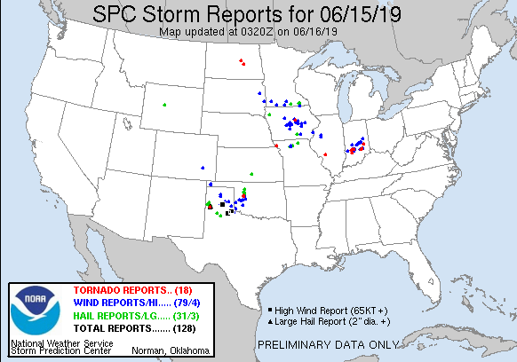
Storm Reports
| Interactive Storm Report Map | SPC Storm Reports |
 |
 |
PRELIMINARY LOCAL STORM REPORT...SUMMARY
NATIONAL WEATHER SERVICE QUAD CITIES IA IL
1027 PM CDT SAT JUN 15 2019

..TIME...   ...EVENT...      ...CITY LOCATION...     ...LAT.LON...
..DATE...   ....MAG....      ..COUNTY LOCATION..ST.. ...SOURCE....
            ..REMARKS..

0933 PM     HEAVY RAIN       CASCADE                 42.30N 91.01W
06/15/2019  M1.00 INCH       DUBUQUE            IA   TRAINED SPOTTER

            RAINFALL TOTAL SO FAR.

0905 PM     HEAVY RAIN       3 ENE CHARLIE HEATH MEM 40.61N 91.84W
06/15/2019  M1.20 INCH       CLARK              MO   TRAINED SPOTTER

            FELL OVER THE LAST 30 MINUTES; HEAVY RAIN
            CONTINUES TO FALL.

0834 PM     HEAVY RAIN       LOWDEN                  41.86N 90.92W
06/15/2019  M0.90 INCH       CEDAR              IA   CO-OP OBSERVER

            RAIN FELL IN 20 MIN.

0828 PM     TSTM WND DMG     3 SE OAKVILLE           41.07N 91.01W
06/15/2019                   DES MOINES         IA   EMERGENCY MNGR

            POWER LINES AND TREES DOWN. POSSIBLE TORNADO
            DAMAGE. TIME ESTIMATED FROM RADAR.

0755 PM     HEAVY RAIN       2 NNW SHELLSBURG        42.12N 91.89W
06/15/2019  M1.80 INCH       BENTON             IA   TRAINED SPOTTER

            RAIN FELL BETWEEN 715 AND 755 PM.

0709 PM     HAIL             2 W CEDAR RAPIDS        41.97N 91.71W
06/15/2019  E0.25 INCH       LINN               IA   TRAINED SPOTTER

            REPORTED NEAR EDGEWOOD RD AND JOHNSON AVE.

0654 PM     TSTM WND GST     ATKINS                  42.00N 91.86W
06/15/2019  E70 MPH          BENTON             IA   FIRE DEPT/RESCUE

            SUSTAINED 50-55 MPH, RELAYED BY EMERGENCY
            MANAGEMENT.

0631 PM     TSTM WND GST     3 SW KEYSTONE           41.96N 92.24W
06/15/2019  E60 MPH          BENTON             IA   BROADCAST MEDIA

            NEAR HWY 30 AND IA 131.

0617 PM     TSTM WND GST     VICTOR                  41.73N 92.29W
06/15/2019  E60 MPH          IOWA               IA   EMERGENCY MNGR

            TIME ESTIMATED FROM RADAR.
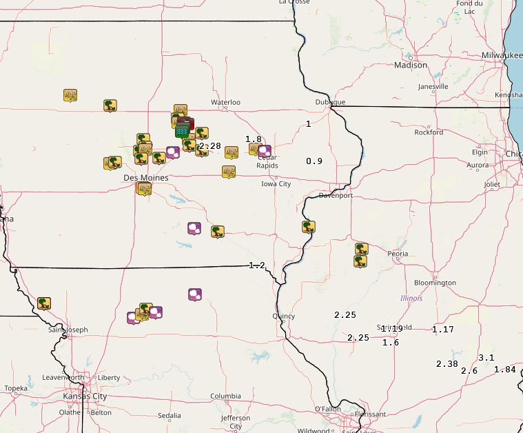
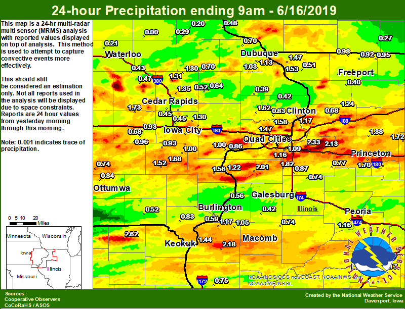
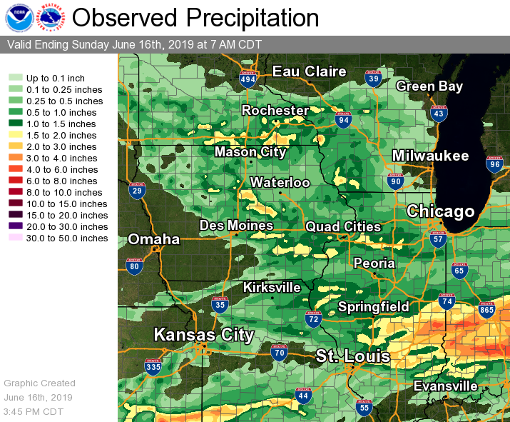
Rain Reports
| Local Rain Map | Regional Rain Map |
 |
 |
24 hour precipitation reports (in Inches),
for eastern Iowa, northwest and west central Illinois,
and northeast Missouri. Reported between Midnight and 9 AM,
Sunday June 16, 2019.

....IOWA....
Toledo 3 N                       2.28
Boone 1 SSW                      2.03
Marengo 3.6 N                    1.73
Washington                       1.68
Calamus 2.0 NE                   1.62
Cresco 1 NE                      1.58
Park View 0.2 WSW                1.58
Wapello 0.2 S                    1.56
Bellevue LD12                    1.53
Washington 5.8 SW                1.52
Muscatine 2N                     1.48
Davenport Arpt 5 N               1.47
Keokuk LD19                      1.44
Marshalltown ASOS 4 N            1.41
Fairfax 4.0 NW                   1.39
Iowa City Arpt                   1.39
Marshalltown 1 NW                1.38
Marion 1.7 NNW                   1.35
Central City 6.7 W               1.31
Iowa City 8.0 NE                 1.30
Coggon                           1.30
Palo 4.4 SSW                     1.26
Brighton                         1.25
West Branch 2.0 NNW              1.20
Davenport 0.9 WNW                1.18
Camanche 1.2 W                   1.17
Dubuque Arpt 7 SW                1.13
Iowa City                        1.07
Dubuque #3 7 SW                  1.03
Muscatine 1.4 N                  1.00
Ainsworth 7.4 N                  1.00
North English                    0.96
Wellman 4.0 E                    0.93
Williamsburg                     0.93
Davenport 0.9 SSW                0.85
Ottumwa ASOS 6 NNW               0.84
De Witt                          0.83
Donnellson                       0.83
Burlington 2.1 S                 0.80
Ames US 30 2 SSE                 0.78
Newton 1 NE                      0.76
Ely 0.5 SE                       0.74
Oskaloosa AWOS 9 ESE             0.74
Perry 0 W                        0.74
Bettendorf 2.2 SE                0.70
Hopkinton 5.4 WSW                0.70
Rickardsville 0.2 W              0.70
Parnell 0.1 SSW                  0.68
Dubuque LD11                     0.65
Anamosa 1.9 SE                   0.64
Solon 0.3 ESE                    0.64
Asbury 0.4 SW                    0.63
Mason City ASOS 6 W              0.60
Center Point 0.6 NNW             0.60
Burlington 0.8 SSE               0.60
Burlington 6.5 SSW               0.59
Rathbun Reservoir 2 N            0.56
Coralville 1.4 S                 0.55
Burlington Arpt 2 SW             0.53
Anamosa 3 SSW                    0.52
Keosauqua                        0.52
Guttenberg Dam 10                0.48
Vinton                           0.47
Mason City 1 NNE                 0.46
Cedar Rapids Arpt 5 SW           0.45
North Liberty 0.7 SSW            0.45
Cedar Rapids 2.7 NE              0.44
Mount Auburn 2.2 NNW             0.43
Charlotte 1.9 WNW                0.42
Grinnell AWOS 2 SSW              0.40
Maquoketa 4 W                    0.39
Strawberry Point                 0.29
Fayette 1 NW                     0.25
NWS Johnston* 5 NNW              0.23
Waterloo ASOS 5 NW               0.21
Elkader 6SSW                     0.20
Pella AWOS 2 WSW                 0.17
Allerton 2 S                     0.09
Centerville 0 NE                 0.04
Beaconsfield 1 NNE               0.00
Oelwein AWOS                     0.00
....ILLINOIS....
Geneseo 2.0 NW                   2.33
Bentley                          2.18
Atkinson 2.6 NNE                 2.13
Princeton 1.1 SE                 2.03
Princeton                        2.03
Aledo                            2.01
New Windsor 2.0 N                1.82
Ottawa 4 SW                      1.75
Mendota 2 SE                     1.72
Tiskilwa 2.1 N                   1.70
Tuscola                          1.55
Moline 0.7 NNE                   1.48
Galena                           1.47
Walnut 5.3 ENE                   1.38
Macomb                           1.37
Streator 3 SE                    1.28
Coleta 1.4 SSW                   1.24
New Boston LD17                  1.22
Dallas City 3.0 SSE              1.17
Lincoln NWS                      1.17
Peoria ASOS                      1.16
Coal Valley 1.9 SE               1.16
Colchester 3.5 NE                1.13
Coal Valley 2.6 E                1.09
La Harpe                         1.05
Paw Paw 1 E                      1.04
Decatur Airport                  1.02
Quad City Arpt 3 S               1.02
Freeport 2.0 NW                  1.01
Winslow 4.3 ESE                  0.98
Rochelle AWOS                    0.97
Davis 0.5 N                      0.95
Dakota 4.8 NW                    0.92
Freeport 1.7 NW                  0.91
Woodhull 0.3 ESE                 0.87
Ill. City LD16 3 WNW             0.86
Orangeville 2.8 NW               0.82
Steward                          0.80
Ogden                            0.80
Quincy Dam 21                    0.79
Kewanee 1 E                      0.77
St Anne                          0.76
Quincy ASOS                      0.75
Prairie City 2S                  0.74
Altona                           0.74
Romeoville                       0.70
Morrison 3.2 E                   0.68
Freeport                         0.67
Pearl City 0.4 SW                0.65
Minonk                           0.64
Gladstone LD18                   0.56
Freeport 2.9 WSW                 0.56
Ridott 0.1 NE                    0.55
Galesburg                        0.51
Joliet                           0.51
Elizabeth                        0.51
Bloomington Airport              0.46
Roseville 0.6 WNW                0.42
Shannon 0.2 S                    0.40
Rockford ASOS                    0.32
Galesburg Arpt 3 SW              0.31
Mundelein                        0.13
Jacksonville AWOS                0.00
....MISSOURI....
Memphis                          2.62
Kirksville ASOS                  0.27
Columbia                         0.15
Chillicothe 2 NW                 0.00
....WISCONSIN....
Steuben 4SE 3 NE                 0.90
La Crosse WFO                    0.84
Madison-ASOS                     0.34
Beloit-College                   0.28
Brodhead 1 SW                    0.27
Delavan-1 W-WWTP 1 W             0.07
Prairie du Chien AWOS            0.00
Watertown-AWOS                   0.00
....MINNESOTA....
Preston                          2.67
Theilman 1SSW                    0.53
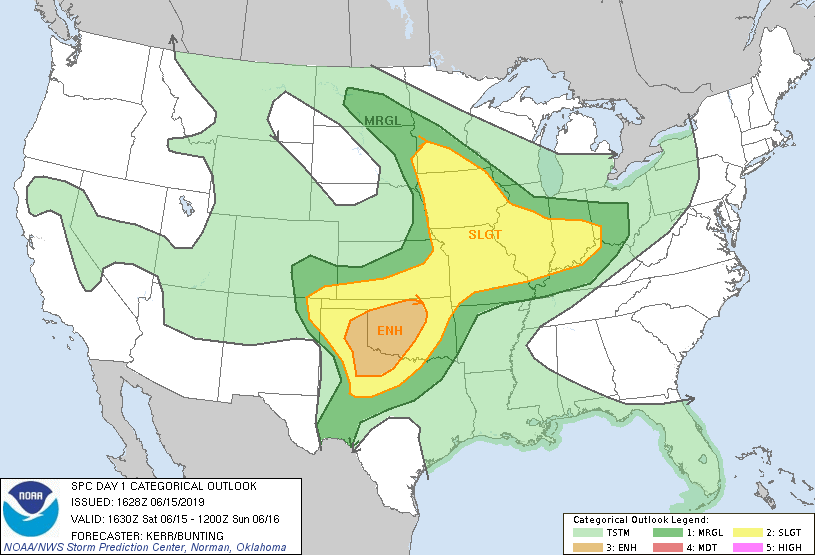
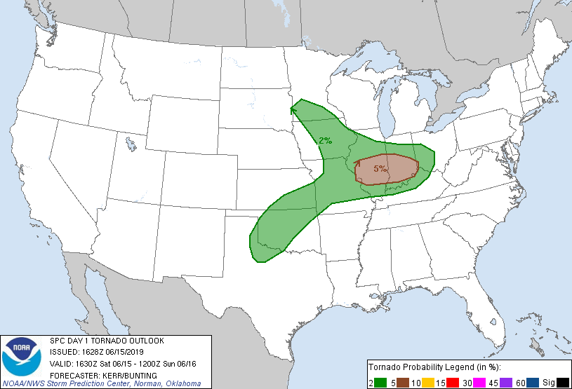
Environment
SPC EVENT REVIEW PAGE: 6/15/2019
 |
 |
 |
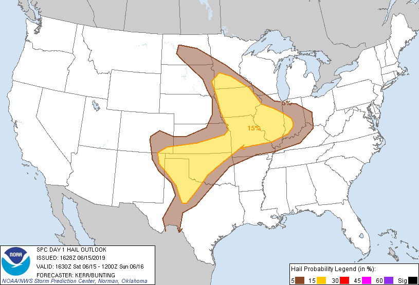 |
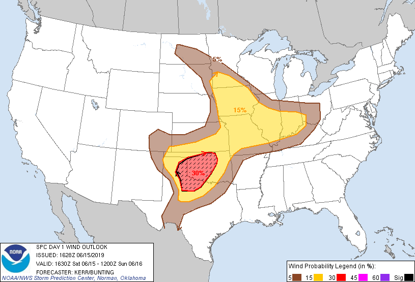
| 1130 AM OUTLOOK | 1130 AM TORNADO OUTLOOK | 1130 AM WIND OUTLOOK | 1130 AM HAIL OUTLOOK |
 |
 |
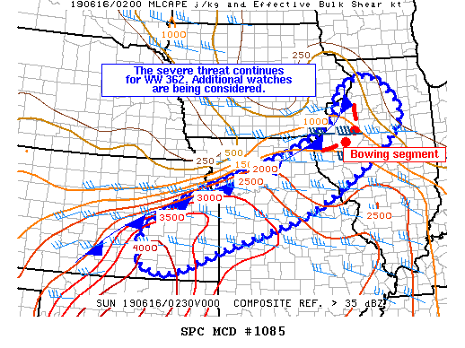 |
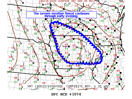
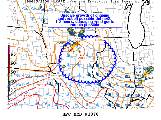
| MCD 1074 | MCD 1078 | MCD 1085 |
 |
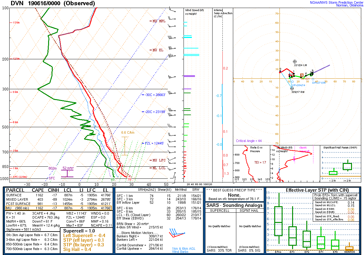 |
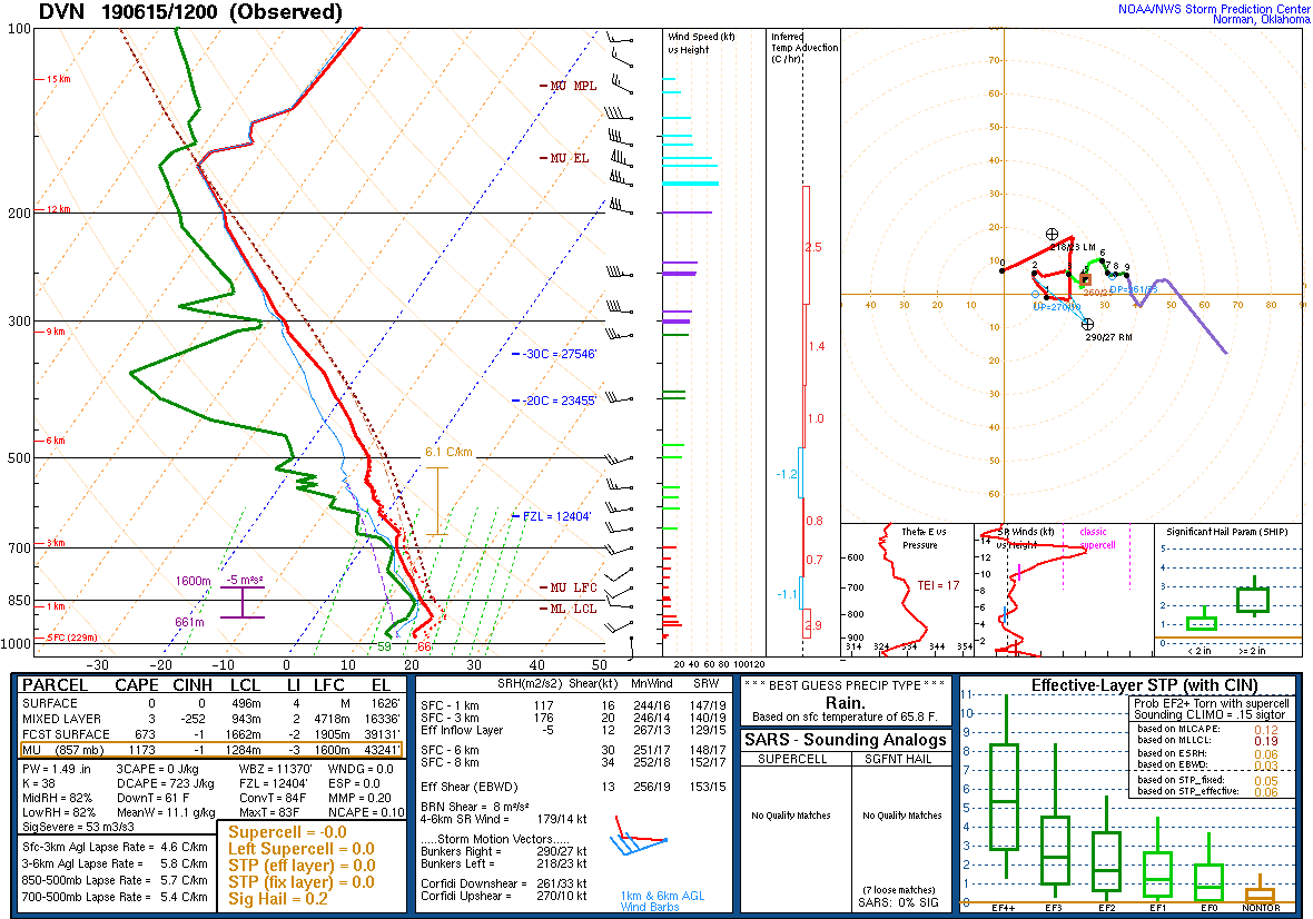
| 7 AM DAVENPORT, IA SOUNDING | 7 PM DAVENPORT, IA |
 |
Media use of NWS Web News Stories is encouraged! Please acknowledge the NWS as the source of any news information accessed from this site. |
|