Overview
|
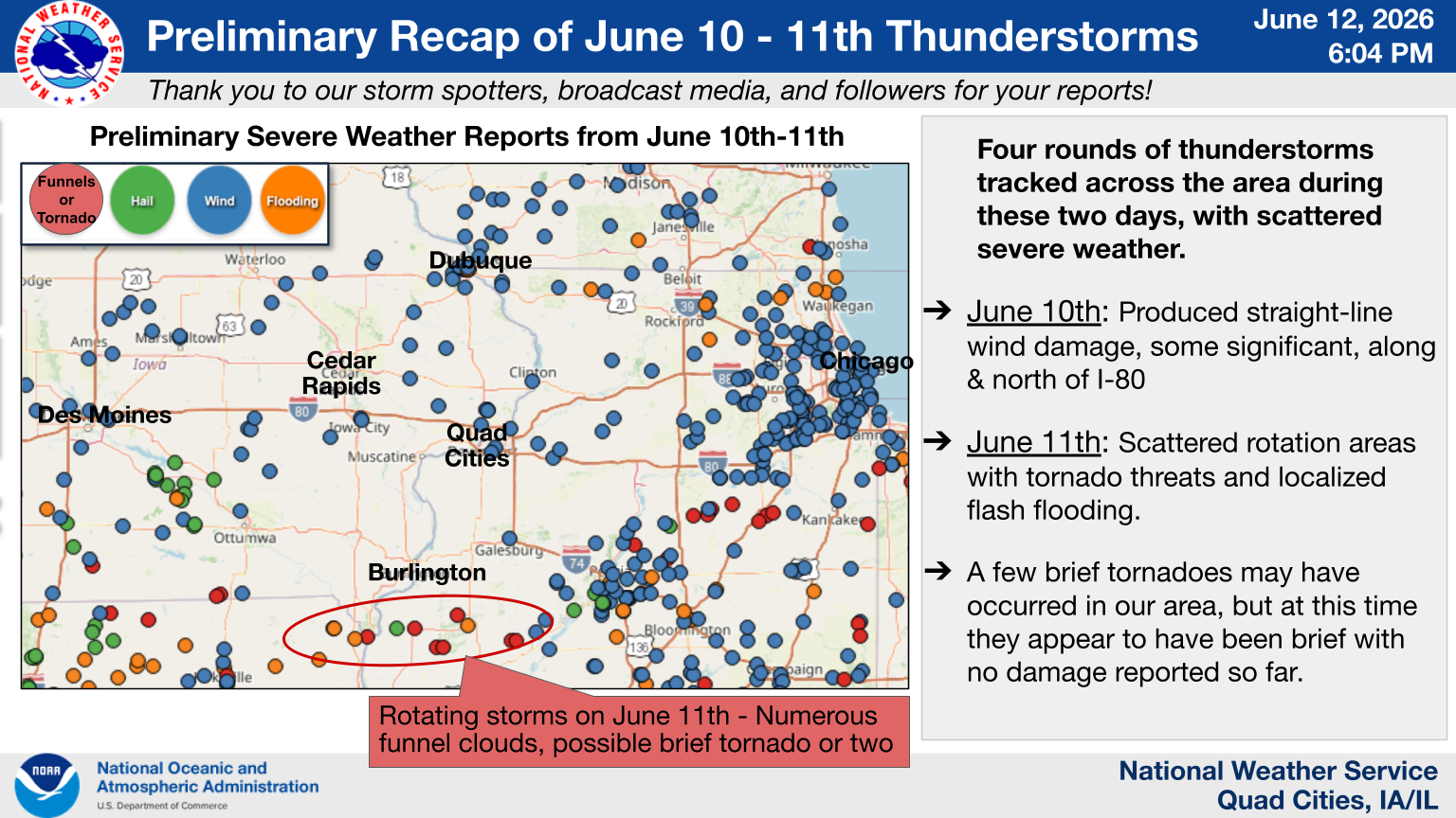
Several rounds of thunderstorms moved through the region Wednesday and Thursday that brought heavy rain, damaging wind, and several brief tornadoes to eastern IA, northwest IL, and northeast MO. The more widespread wind damage occurred Wednesday afternoon June 10th from a derecho that developed in eastern Iowa and moved east. This downed trees, power lines primarily along and north of I-80. The more significant winds between 70-80 mph winds were seen north of the Hwy 20 corridor. A second round of storms later on produced isolated wind damage, including some damage north of Geneseo, IL that was due to straight-line winds. Additional storms developed Thursday morning and again during the afternoon and evening hours with heavy rain and sporadic severe wind. Four brief tornadoes also were reported that did not cause any known damage and were each rated as an EF-U. |
 Tornado Infographic - June 11th |
 |
 |
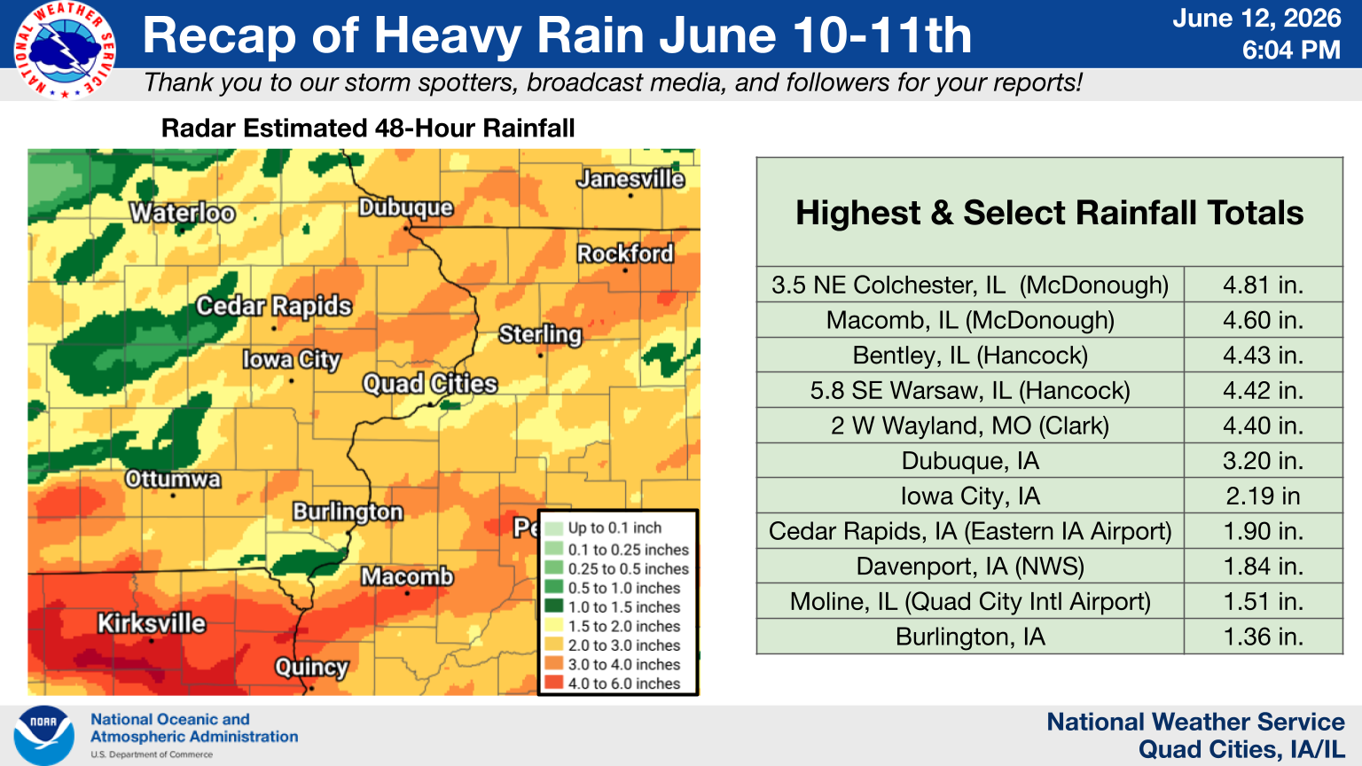 |
| Storm Report Infographic | Preliminary Classification of a Derecho on June 10th by the NWS Storms Prediction Center (SPC) | Heavy Rain Infographic Click here for list of highest reports |
| Surrounding NWS Web Summaries | ||
| NWS Chicago - June 10th June 11th | NWS Central Illinois - June 10th-11th | NWS Des Moines - June 11th |
Radar / Photos
 |
 |
 |
 |
| Wednesday June 10th IEM Radar Loop |
Thursday June 11th IEM Radar Loop |
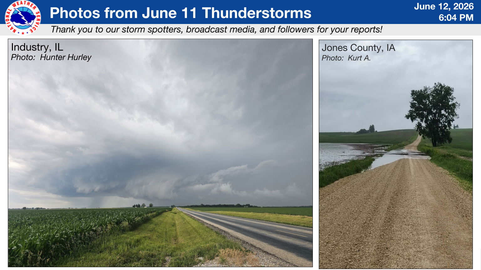
June 10th Photos | June 11th Photos |
Environment
 |
|
|
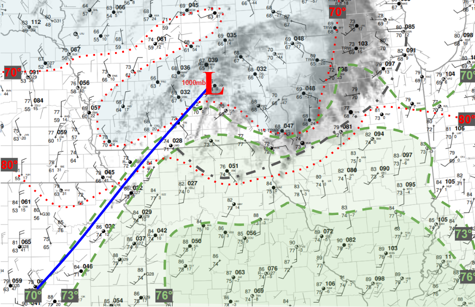
Thursday, June 11, 12 PM Surface Analysis |
Thursday, June 11, 4:35 PM KDVN Radar Vertical Wind Profile (VWP) |
 |
Media use of NWS Web News Stories is encouraged! Please acknowledge the NWS as the source of any news information accessed from this site. |
|


