Scattered severe thunderstorms capable of damaging wind gusts and some hail are expected this afternoon and evening from the Upper Ohio River Valley into the Northeast, and from the Appalachians into the Mid-Atlantic States. Excessive rainfall from heavy thunderstorms may produce areas of flash flooding from southern New Mexico into the western and northern Gulf Coast into Wednesday. Read More >
Overview
|
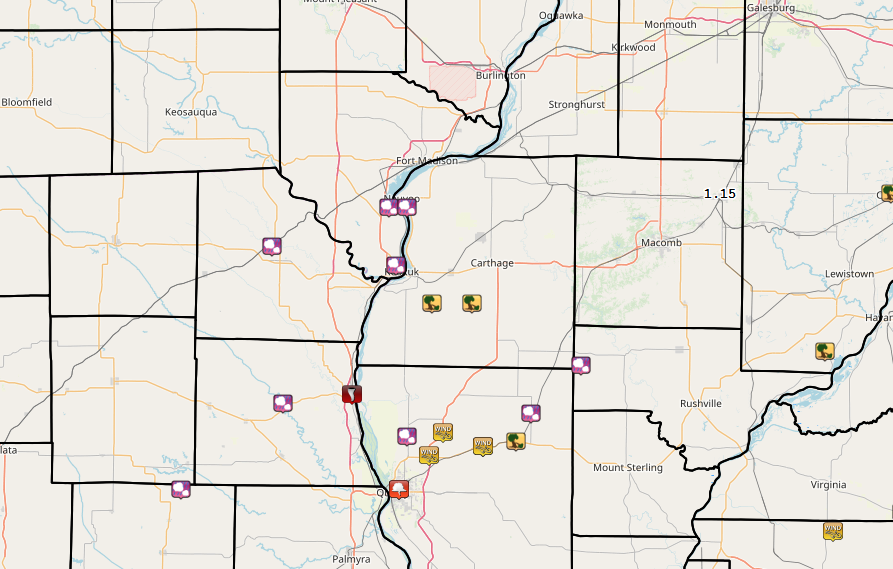
Showers and thunderstorms developed across northeast Missouri, west central Illinois, and extreme southeast Iowa between 4 and 11 PM, Wednesday, May 22. Storms quickly intensified after 6 PM, with many severe thunderstorm and tornado warnings issued. An EF-1 tornado was surveyed in Hancock county IL with these storms. During this event, the NWS Quad Cities Doppler Radar (KDVN) was not operational during much of the severe weather that occurred. Technicians worked quickly to replace a motor that had seized up, even as storms approached the Quad Cities and forced them to take shelter at times. The NWS plans and practices for these unexpected outages. Our team of meteorologists quickly switched to viewing NWS radars in St. Louis MO and Lincoln IL. These radars give meteorologists virtually the same view as the Quad Cities radar in the area that severe weather occurred last evening, across Clark county MO, Lee county IA and Hancock county IL. Our meteorologists excel in these situations, and provided more than 20 minutes of warning lead time for the brief tornado and damaging winds that occurred in Hancock county. Radar outages are rare, and if they do occur, the NWS is ready.
|
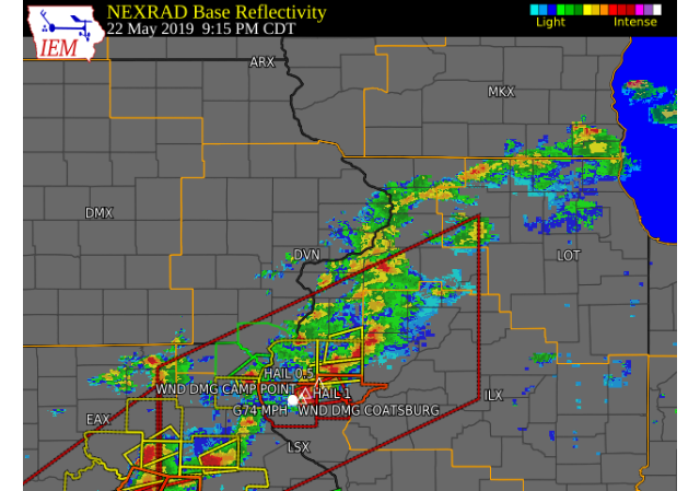 9:15 PM Radar Image |
Tornadoes:
|
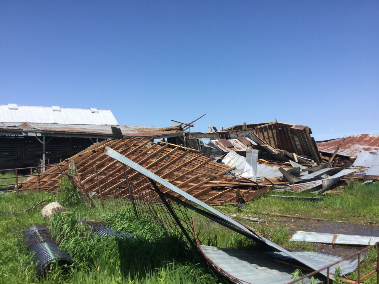
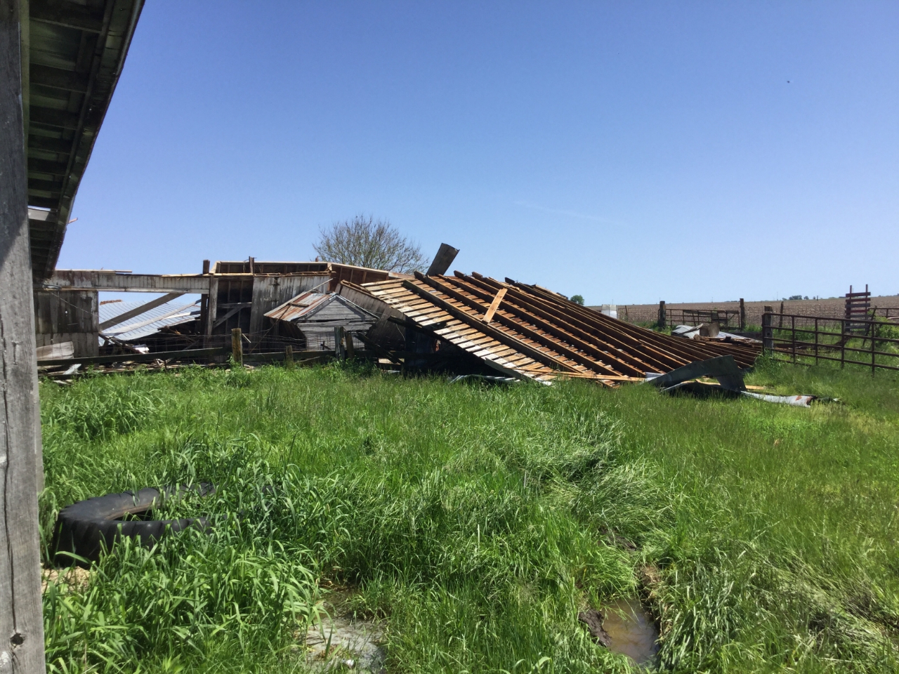
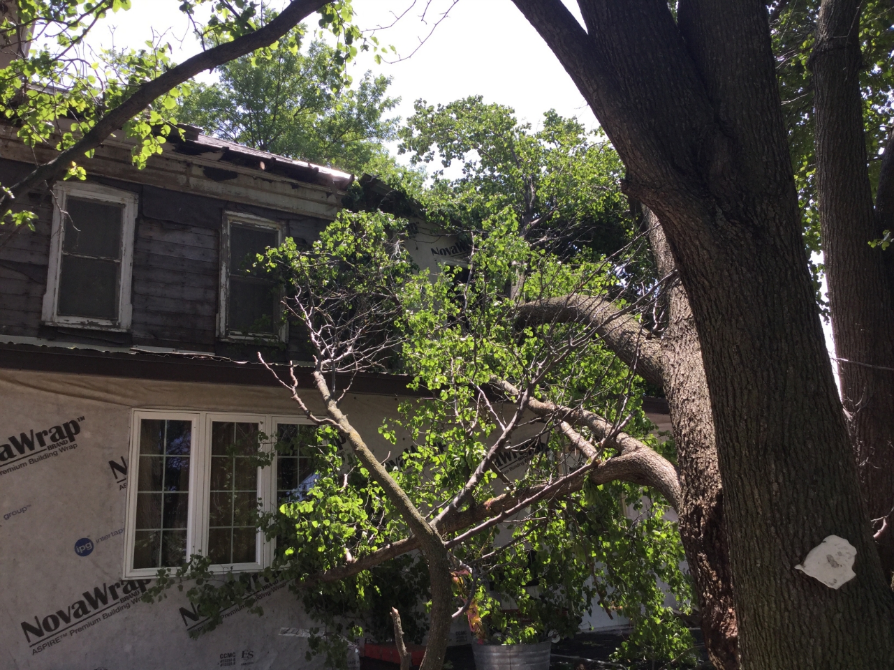
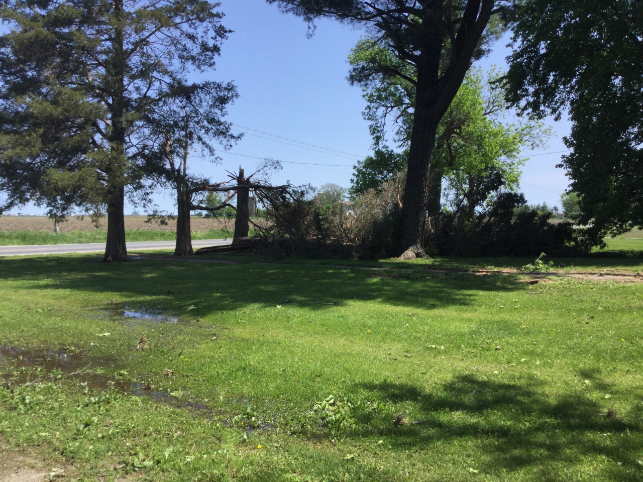
Tornado - 4 NE Sutter, IL
Track Map 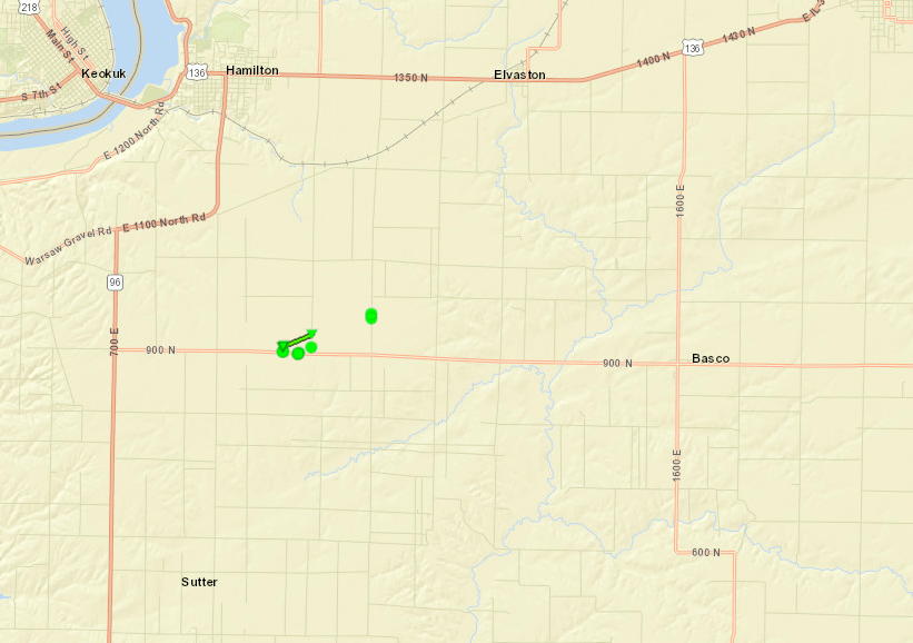 
|
||||||||||||||||||||||||
The Enhanced Fujita (EF) Scale classifies tornadoes into the following categories:
| EF0 Weak 65-85 mph |
EF1 Moderate 86-110 mph |
EF2 Significant 111-135 mph |
EF3 Severe 136-165 mph |
EF4 Extreme 166-200 mph |
EF5 Catastrophic 200+ mph |
 |
|||||
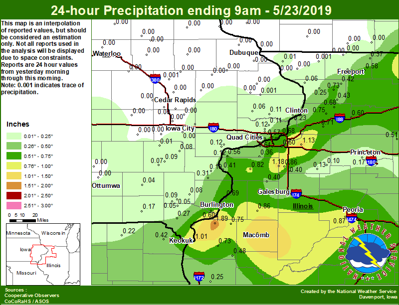
Rain Reports
 |
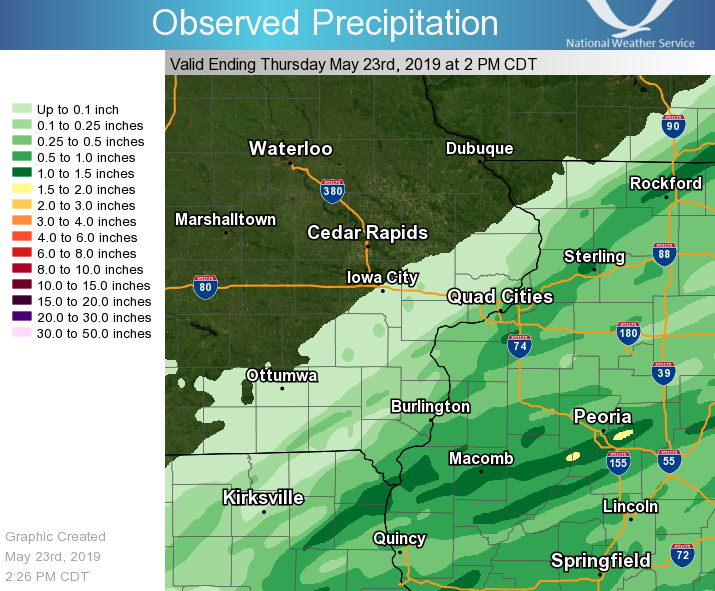 |
| Local Rainfall | Regional Rainfall |
Environment
 |
 |
 |
 |
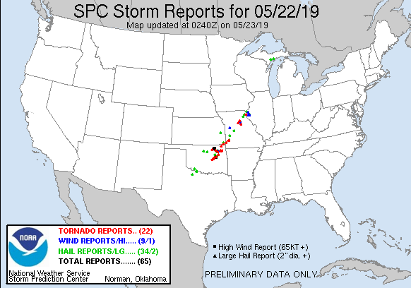
| Day 1 (1630z) | Day 1 Tornado | Day 1 Hail | Day 1 Wind |
 |
 |
 |
 |
| Watch #0213 | MCD #0738 | MCD #0742 | MPD #274 |
 |
 |
 |
 |
| Davenport 7 AM 5/22 Sounding | Davenport 2 PM 5/22 Special Sounding | Davenport 7 PM 5/22 Sounding | Lincoln, IL 7 PM 5/22 Sounding |
 |
Media use of NWS Web News Stories is encouraged! Please acknowledge the NWS as the source of any news information accessed from this site. |
|