
Scattered severe thunderstorms capable of damaging wind gusts and some hail are expected this afternoon and evening from the Upper Ohio River Valley into the Northeast, and from the Appalachians into the Mid-Atlantic States. Excessive rainfall from heavy thunderstorms may produce areas of flash flooding from southern New Mexico into the western and northern Gulf Coast into Wednesday. Read More >
Overview
|
A fast moving line of showers and thunderstorms tracked east over eastern Iowa late Thursday evening. A brief, weak tornado touched down just northwest of Olin, IA damaging a metal shed and displacing a fire hydrant.
|
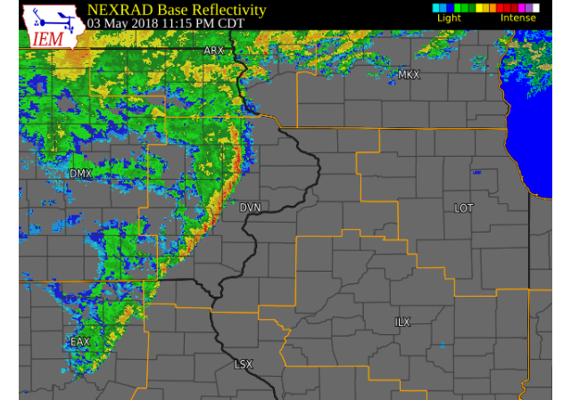 Radar Image (11:15 P.M.) (IEM) (Click to zoom) (Click here for Animation) |
Tornadoes:
|
Tornado - Olin, IA
Track Map 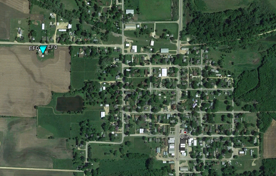 
Downloadable KMZ File |
||||||||||||||||
The Enhanced Fujita (EF) Scale classifies tornadoes into the following categories:
| EF0 Weak 65-85 mph |
EF1 Moderate 86-110 mph |
EF2 Significant 111-135 mph |
EF3 Severe 136-165 mph |
EF4 Extreme 166-200 mph |
EF5 Catastrophic 200+ mph |
 |
|||||
Photos & Video:
 |
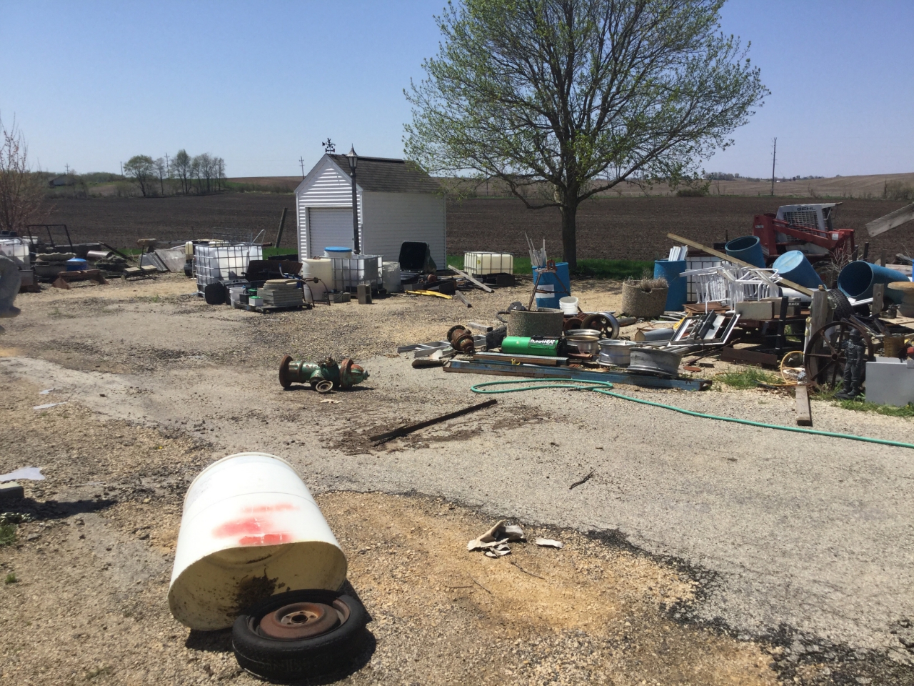 |
| Olin, IA (NWS Survey) |
Olin, IA (NWS Survey) |
Environment
 |
 |
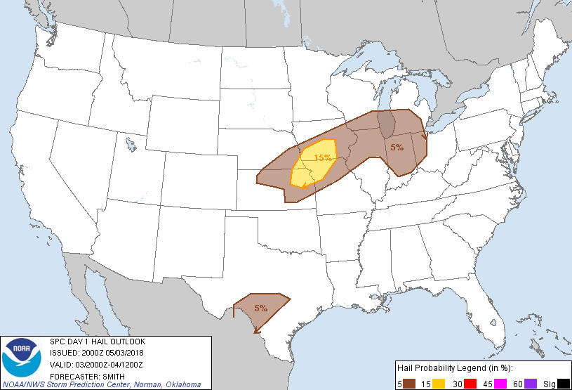 |
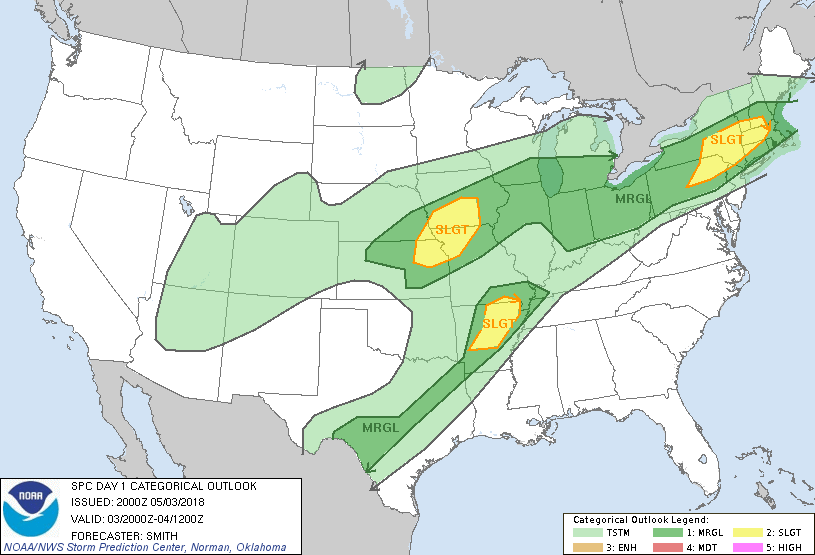
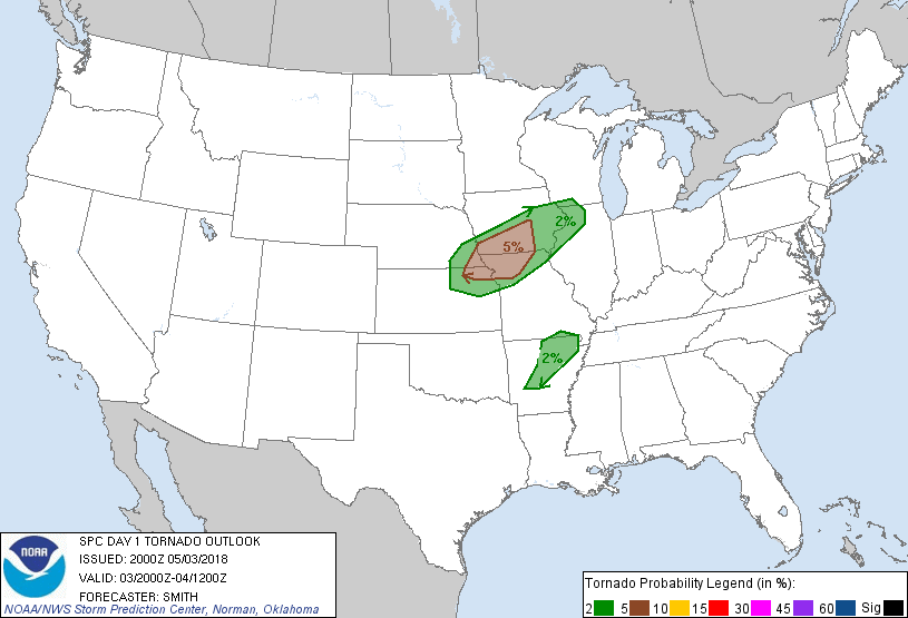
| Figure 1: SPC Day 1 Outlook (20:00 UTC) | Figure 2: SPC Day 1 Tornado Outlook (20:00 UTC) | Figure 3: SPC Day 1 Hail Outlook (20:00 UTC) |
 |
 |
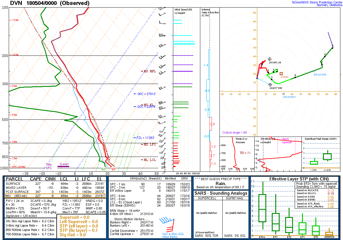 |
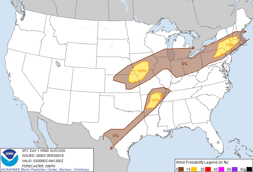
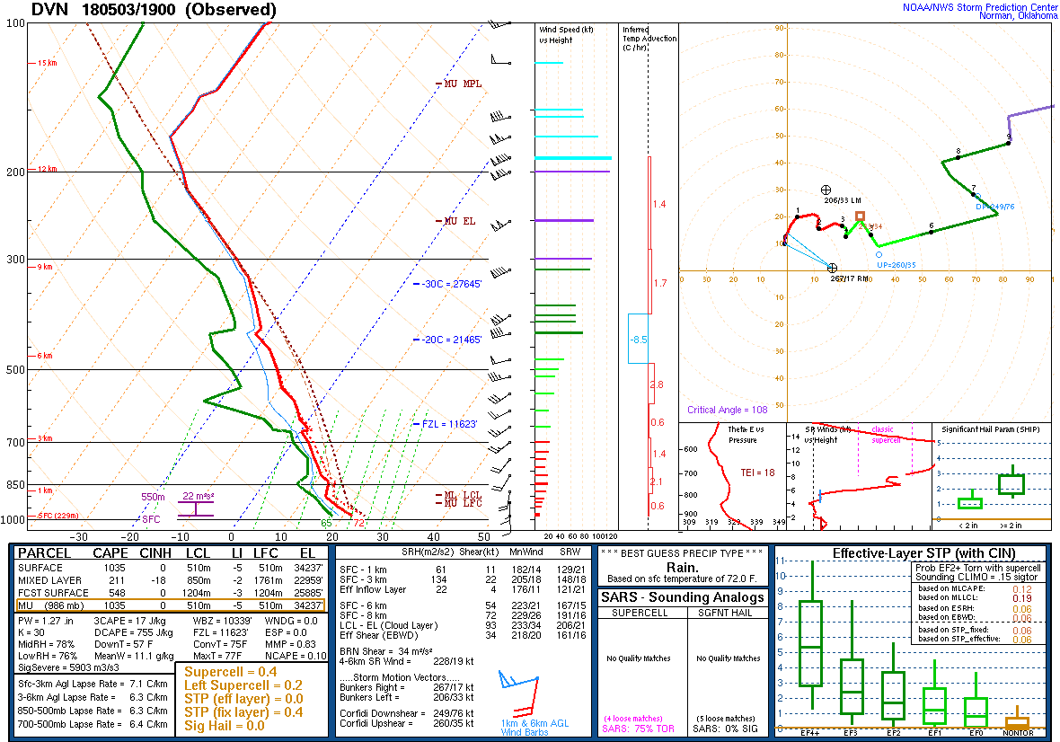
| Figure 4: SPC Day 1 Wind Outlook (20:00 UTC) | Figure 5: DVN Sounding: 5/3/18 19z | Figure 6: DVN Sounding: 5/4/18 00z |
 |
Media use of NWS Web News Stories is encouraged! Please acknowledge the NWS as the source of any news information accessed from this site. |
|

