
Scattered severe thunderstorms capable of damaging wind gusts and some hail are expected this afternoon and evening from the Upper Ohio River Valley into the Northeast, and from the Appalachians into the Mid-Atlantic States. Excessive rainfall from heavy thunderstorms may produce areas of flash flooding from southern New Mexico into the western and northern Gulf Coast into Wednesday. Read More >
Overview
|
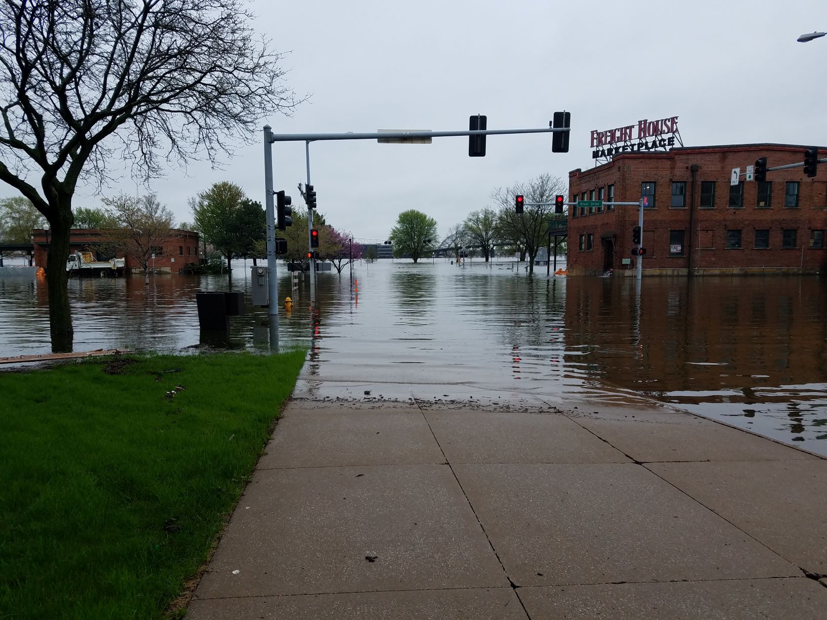
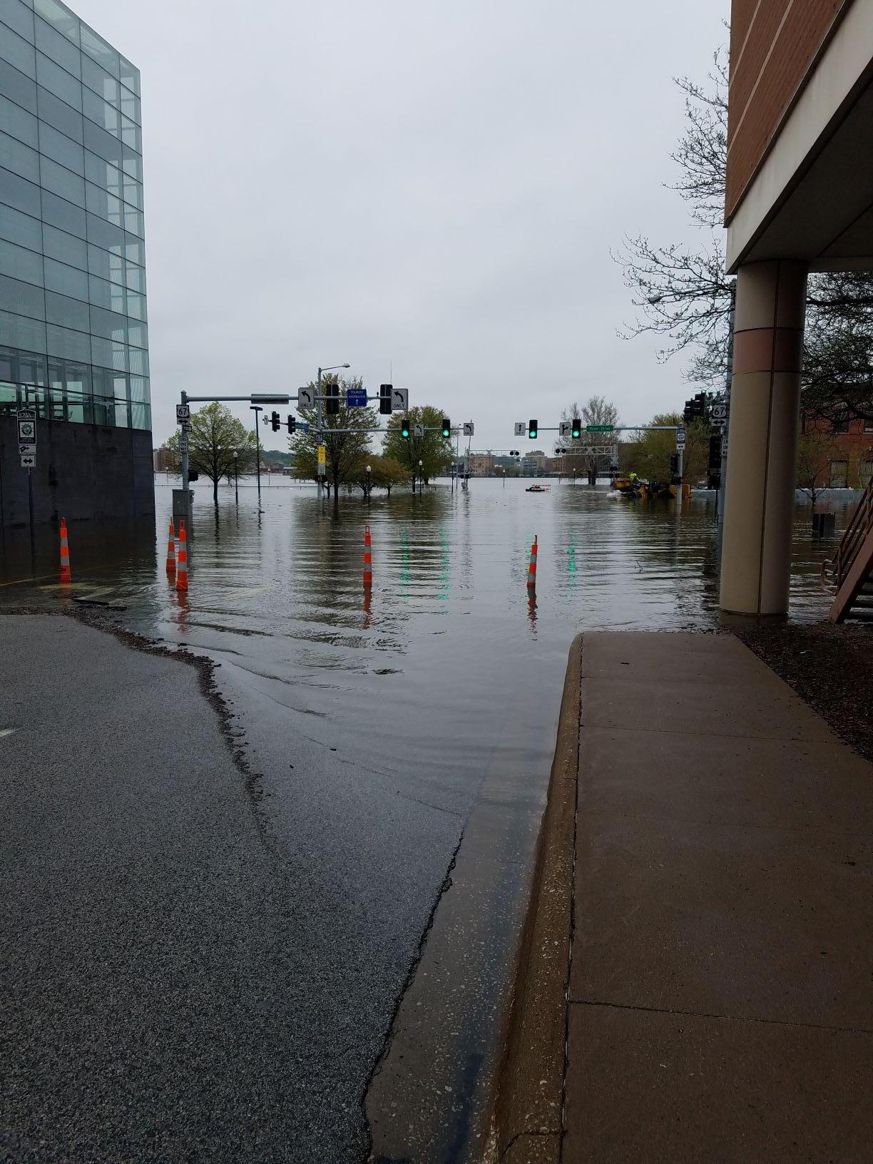
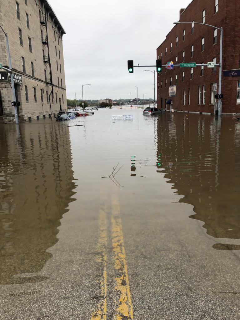
On Tuesday afternoon April 30th, flood protection on River Dr at Pershing Ave in Davenport failed. The area of Pershing Ave, Iowa St, and E 2nd St was inundated with water in a matter of minutes. Many businesses, parking lots, apartment complexes were quickly impacted by the rising water. Davenport city officials say the cause of the failure is unknown at this time. City officials are asking people not to be around the flood water in downtown Davenport unless absolutely necessary. A flash flood emergency was issued at 3:54 pm by the National Weather Service in the Quad Cities for this event.
|
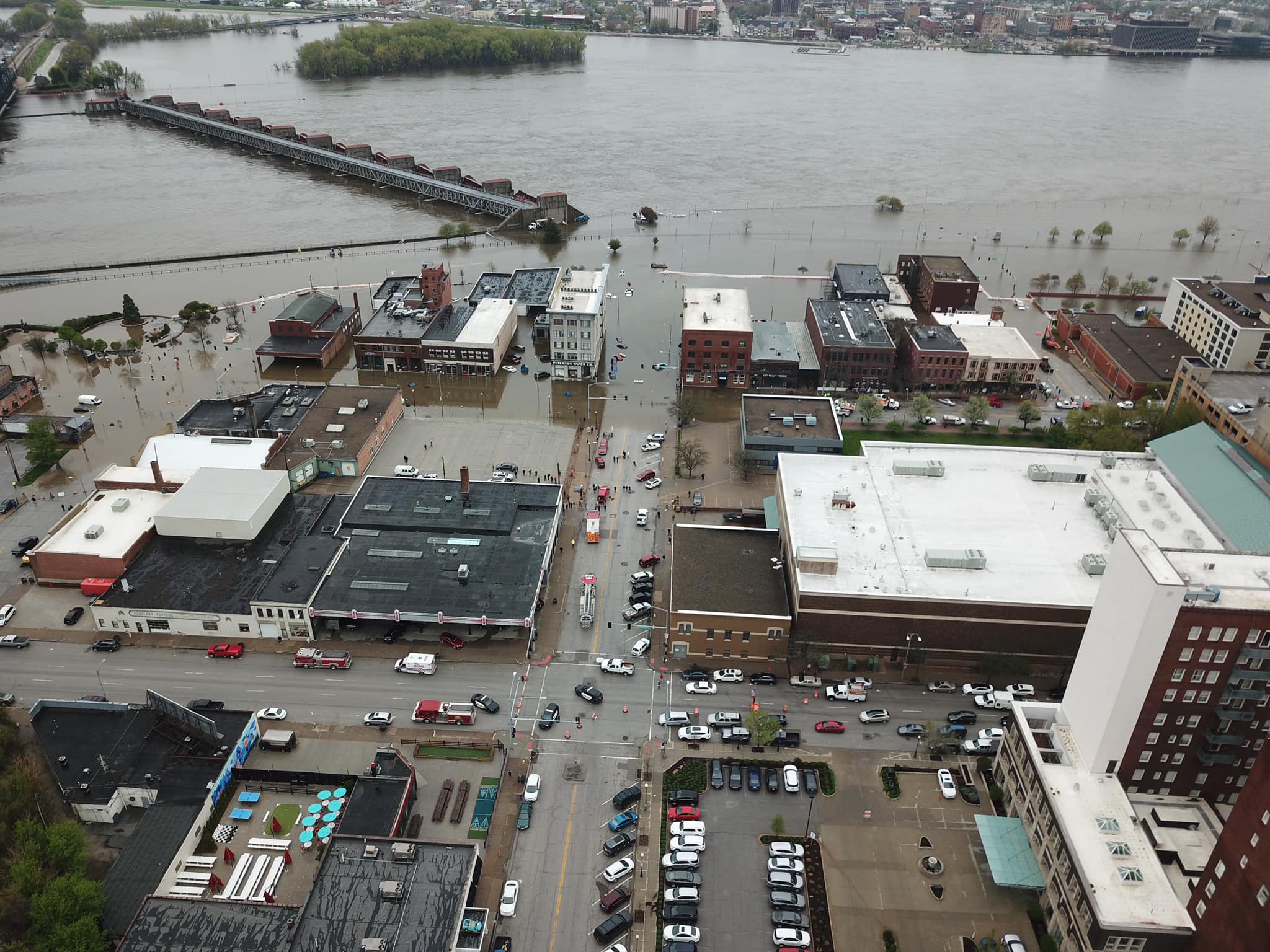 Photo Courtesy of Steve Toft (QC Drone) |
Davenport, IA Flash Flood April 30, 2019
 |
 |
 |
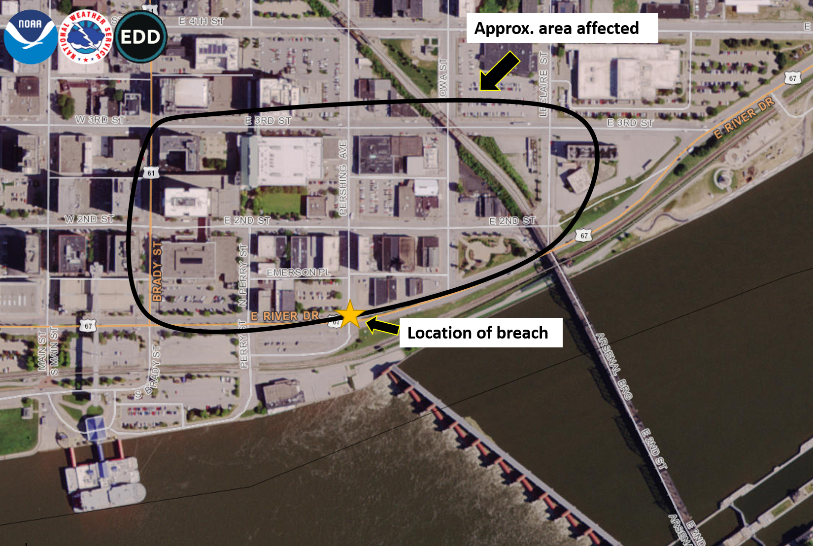 |
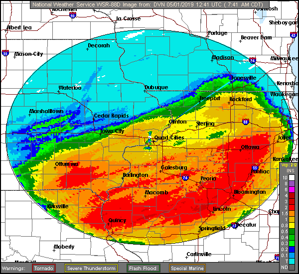
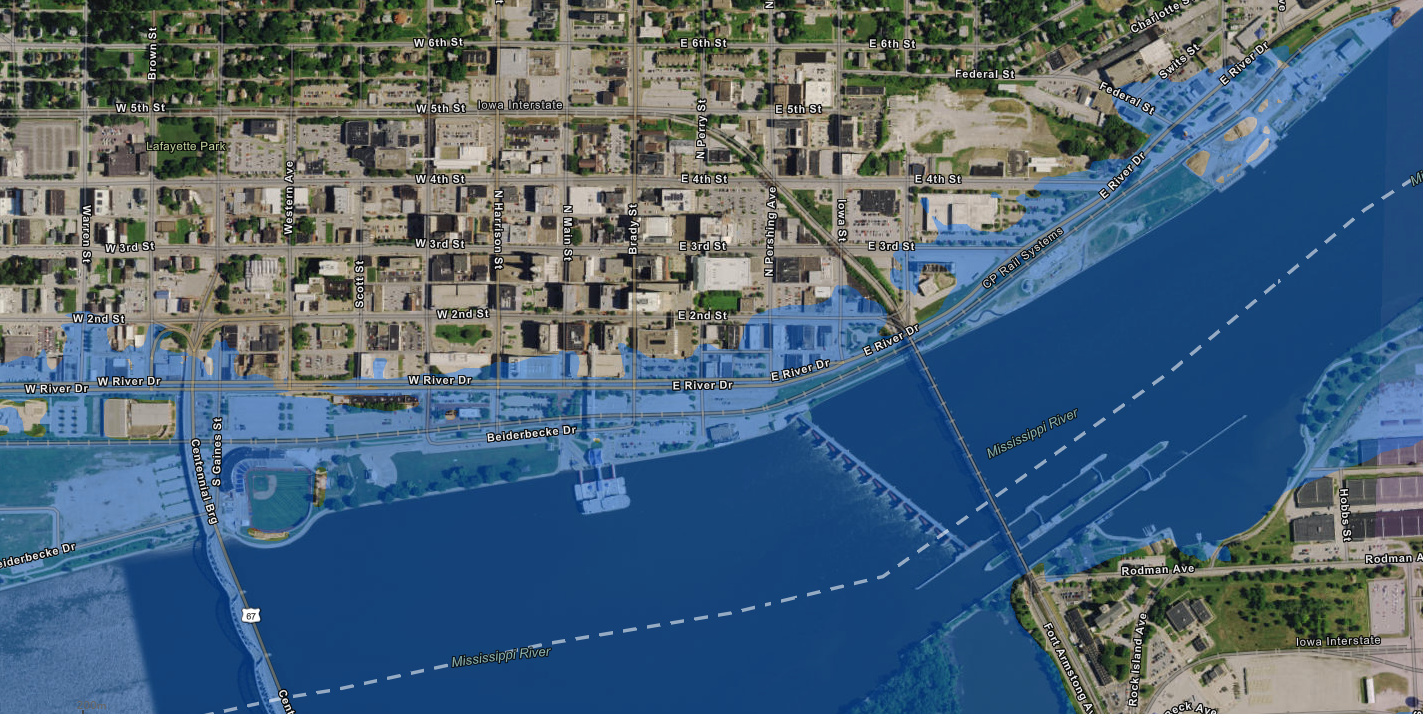
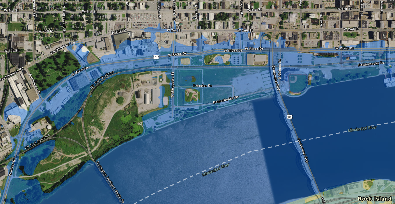
| Flash Flood Warning Area | Rock Island LD 15 Hydrograph | Radar Estimated Rainfall Monday Evening 4/29/19 - Wednesday Morning 5/1/19 | Approximate area affected by breach |
 |
 |
 |
 |
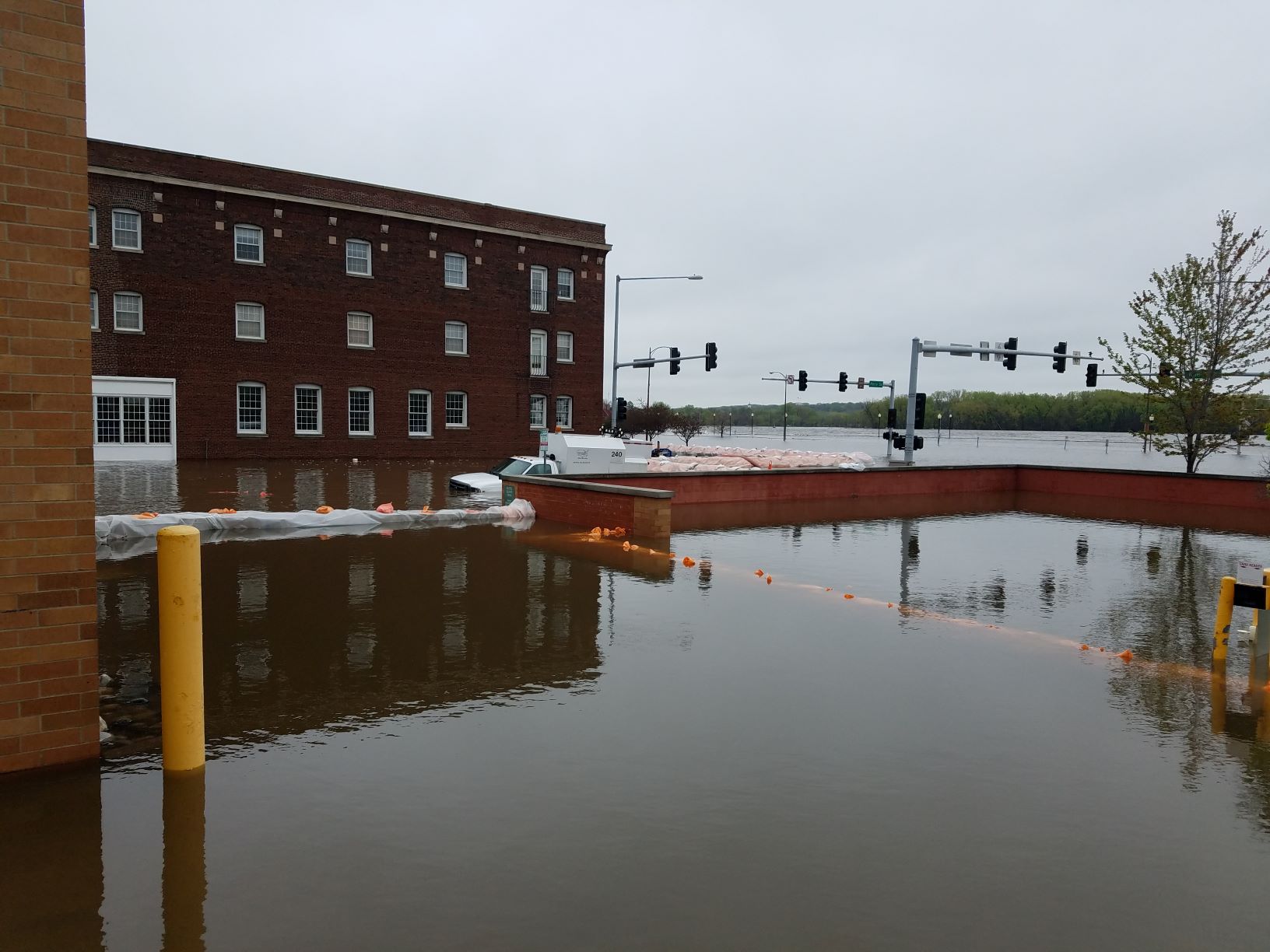
| Perry St and River Dr Davenport Photo Scott County GIS | River Dr and Ripley St Davenport Photo Scott County GIS | Harrison St and River Dr Davenport Photo Scott County GIS | Pershing and 2nd St Davenport IA Photo Scott County GIS |
 |
 |
||
| East Davenport Flood Inundation Map at 22ft - Courtesy Scott County GIS | West Davenport Flood Inundation Map at 22ft - Courtesy Scott County GIS | ||
427
WGUS53 KDVN 302054
FFWDVN
IAC163-010245-
/O.NEW.KDVN.FF.W.0005.190430T2054Z-190501T0245Z/
/00000.0.ER.000000T0000Z.000000T0000Z.000000T0000Z.OO/

BULLETIN - EAS ACTIVATION REQUESTED
Flash Flood Warning
National Weather Service Quad Cities IA/IL
354 PM CDT Tue Apr 30 2019

...FLASH FLOOD EMERGENCY FOR DOWNTOWN DAVENPORT...

The National Weather Service in the Quad Cities has issued a

* Flash Flood Warning for...
  South central Scott County in east central Iowa...

* Until 945 PM CDT.

* At 350 PM CDT, emergency management reported weaknesses in the
  temporary flood walls that are protecting the downtown area of
  Davenport, and failure of this temporary levee system is likely to
  occur soon.

  THIS IS A FLASH FLOOD EMERGENCY FOR DOWNTOWN DAVENPORT. This is a
PARTICULARLY DANGEROUS SITUATION. SEEK HIGHER GROUND NOW!

If the flood walls do breach, water from the Mississippi River will
move quickly into areas of downtown Davenport, near the river, that
have previously been protected.

PRECAUTIONARY/PREPAREDNESS ACTIONS...

Move to higher ground now. This is an extremely dangerous and life-
threatening situation. Take immediate action if you are in an area
subject to flooding or under an evacuation order.

&&

LAT...LON 4151 9060 4150 9060 4149 9061 4151 9061
      4154 9055 4153 9054

$$

Wolf/bROOKS
|
|||
691
WWUS83 KDVN 301803
SPSDVN

Special Weather Statement
National Weather Service Quad Cities IA IL
103 PM CDT Tue Apr 30 2019

IAZ068-ILZ015-302015-
Scott-Rock Island-
Including the cities of Davenport, Bettendorf, Moline,
and Rock Island
103 PM CDT Tue Apr 30 2019

...Heavy rain and Mississippi River backup...

The combination of heavy rain and flooding from the Mississippi is
causing minor ponding of water and backing up of storm drains in
some spots near the river.

Rain should gradually decrease in intensity and move out of the
area by 3 pm. However for the next hour or two, there will be a
lightning threat for any workers outdoors.

Stay tuned for the latest information as this storm system
progresses out of the area.

$$

wolf
|
 |
Media use of NWS Web News Stories is encouraged! Please acknowledge the NWS as the source of any news information accessed from this site. |
|

