
Scattered severe thunderstorms capable of damaging wind gusts and some hail are expected this afternoon and evening from the Upper Ohio River Valley into the Northeast, and from the Appalachians into the Mid-Atlantic States. Excessive rainfall from heavy thunderstorms may produce areas of flash flooding from southern New Mexico into the western and northern Gulf Coast into Wednesday. Read More >
Overview
|
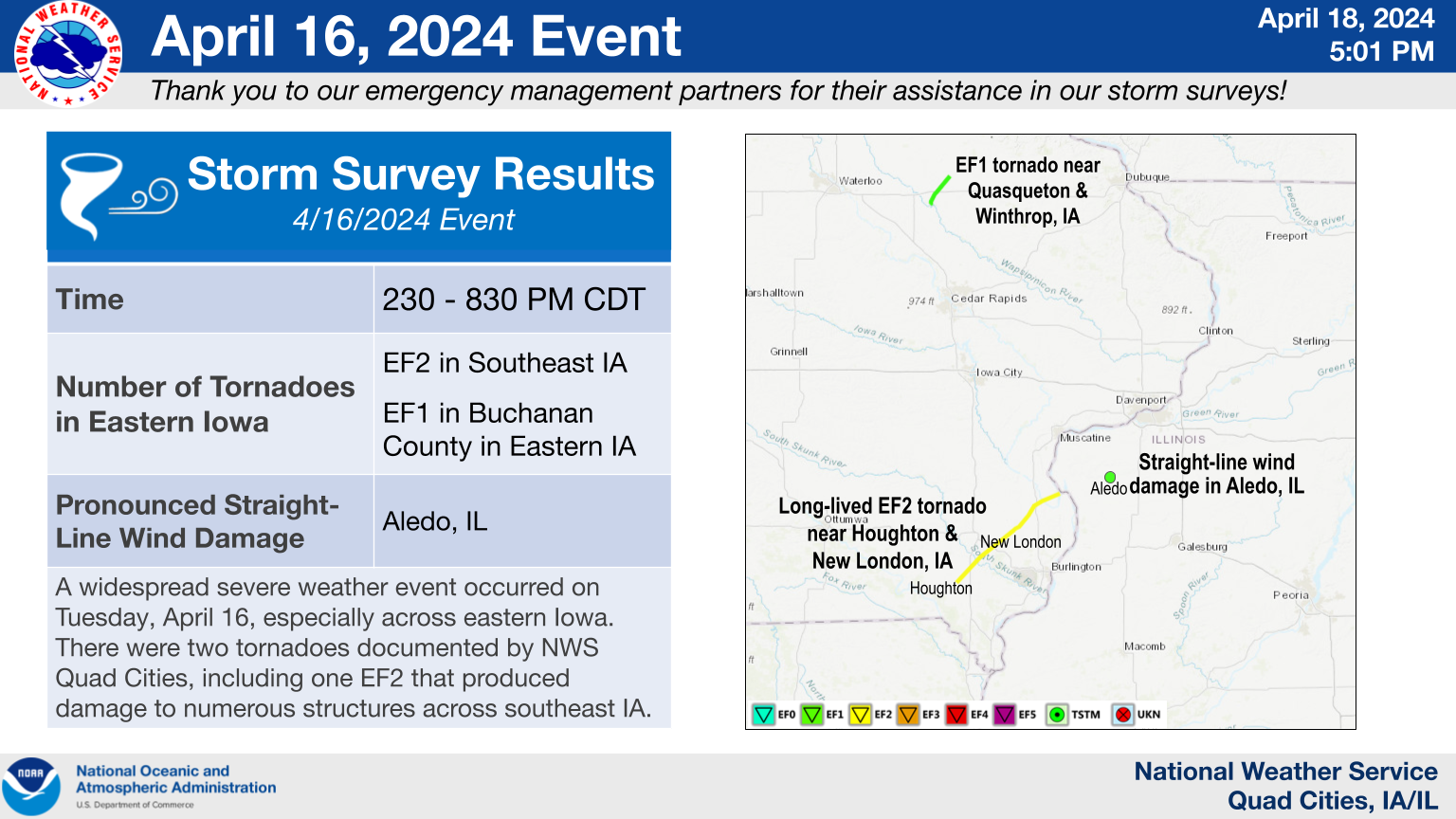
Numerous emergency managers provided valuable assistance to NWS Quad Cities during the survey, and their efforts are much appreciated. |
Tornadoes:
Check the Damage Assessment Toolkit (noaa.gov) for tornado damage survey information.
Also see the official Public Information Statement.
|
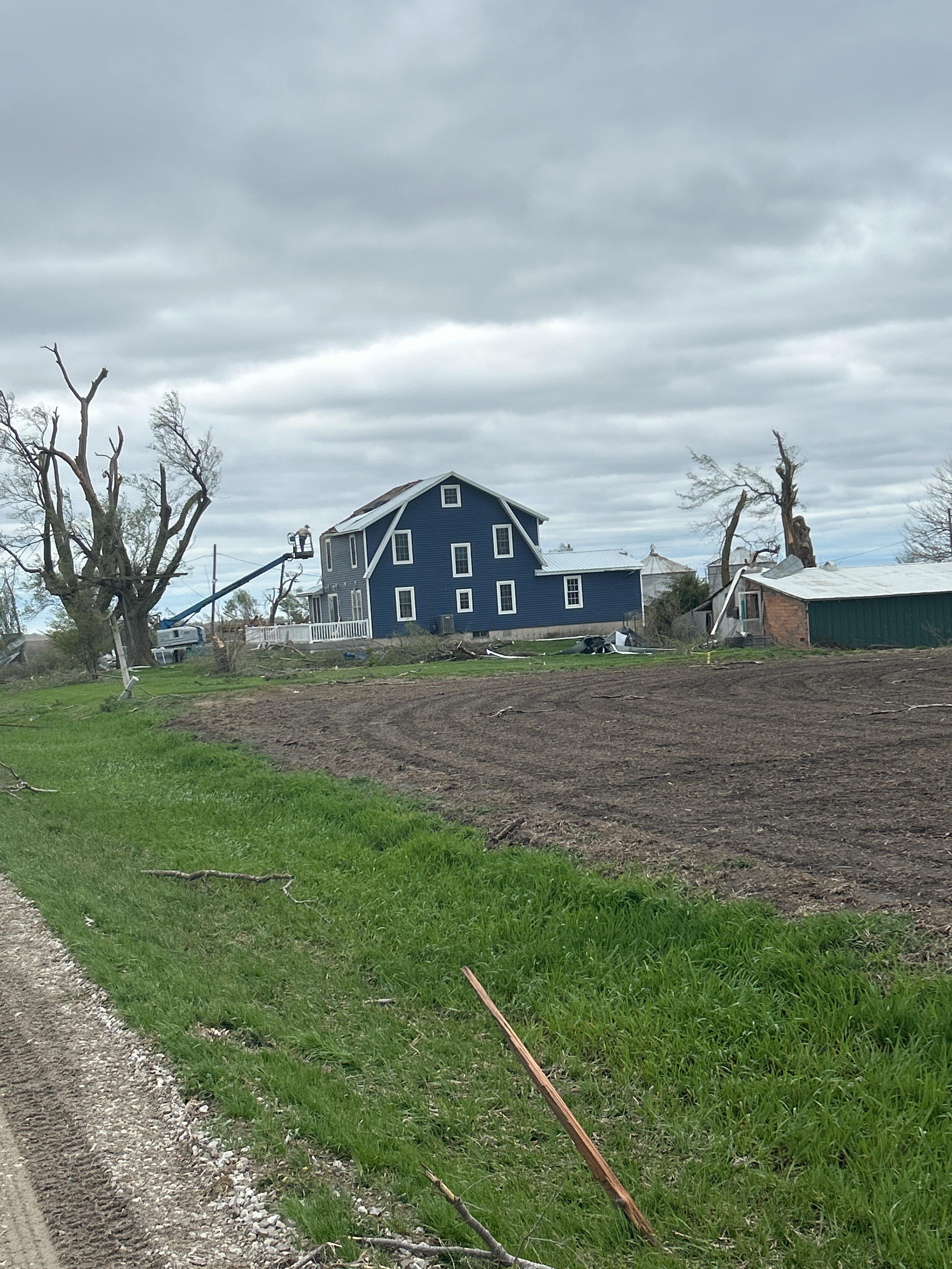
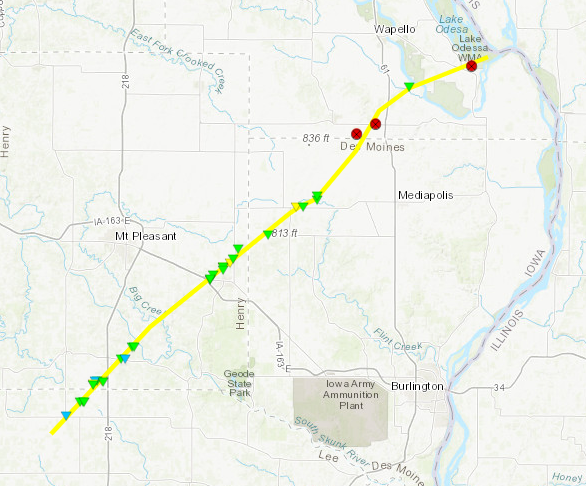
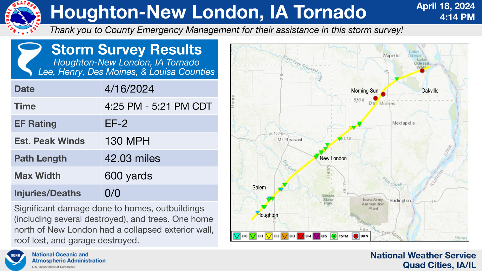
Tornado - Houghton - New London
|
||||||||||||||||
|
||||||||||||||||
|
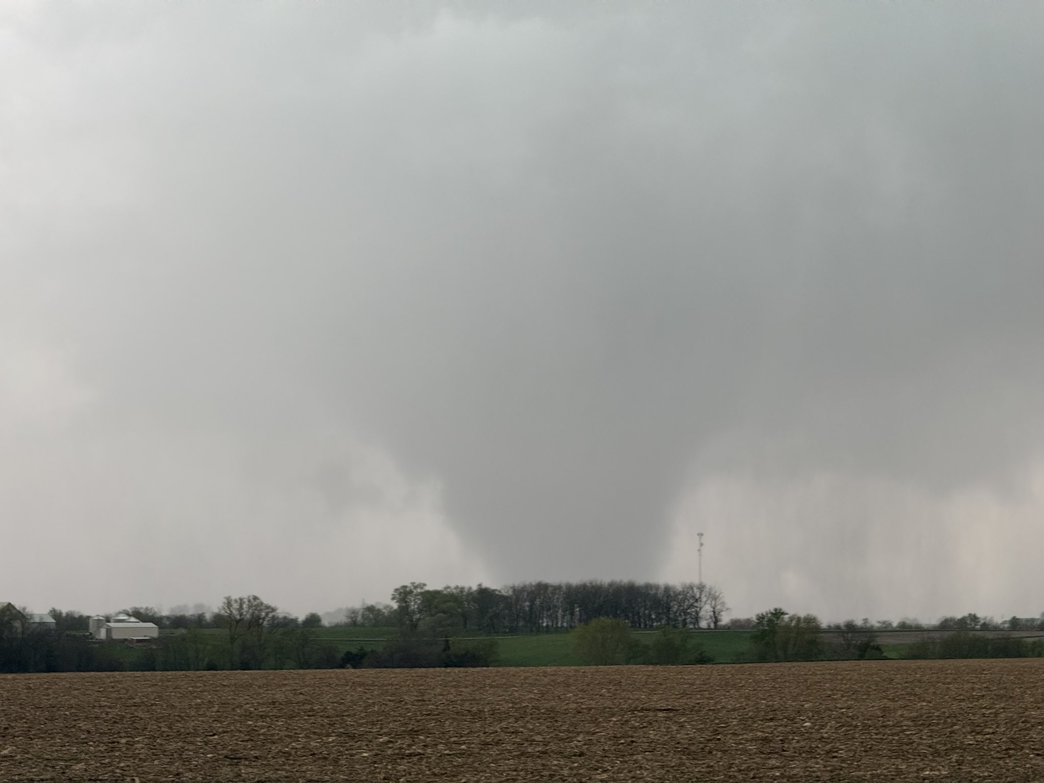
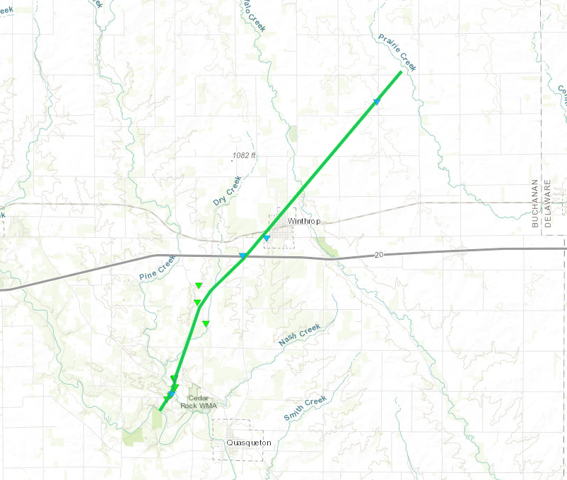
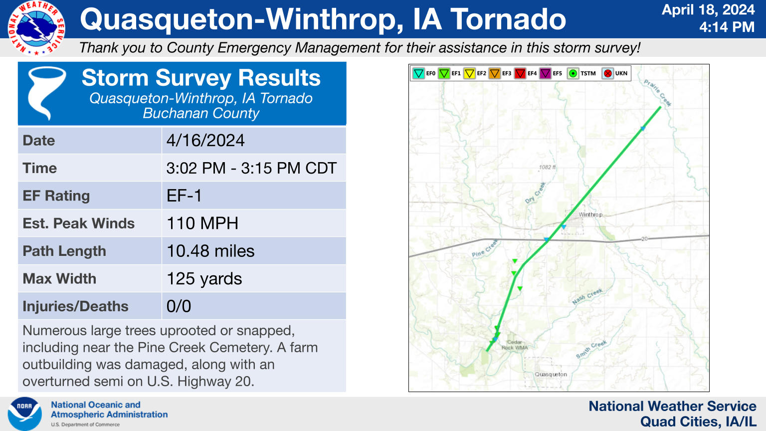
Tornado - Quasqueton-Winthrop Areas
|
||||||||||||||||
The Enhanced Fujita (EF) Scale classifies tornadoes into the following categories:
| EF0 Weak 65-85 mph |
EF1 Moderate 86-110 mph |
EF2 Significant 111-135 mph |
EF3 Severe 136-165 mph |
EF4 Extreme 166-200 mph |
EF5 Catastrophic 200+ mph |
 |
|||||
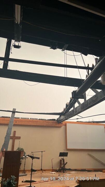
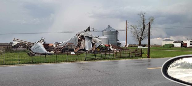
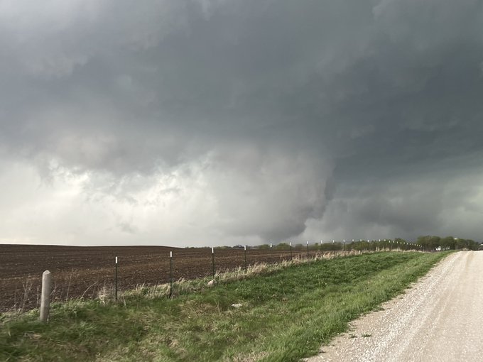
Photos
Check back later for some storm damage, hail, and tornado pictures!
 |
 |
 |
 |
| 3 SE Salem, IA (NWS Survey) |
Aledo, IL (Riddel Roofing Inc.) |
Mediapolis, IA (Rob Andrews) |
Houghton, IA (Sarah Lighthiser) |
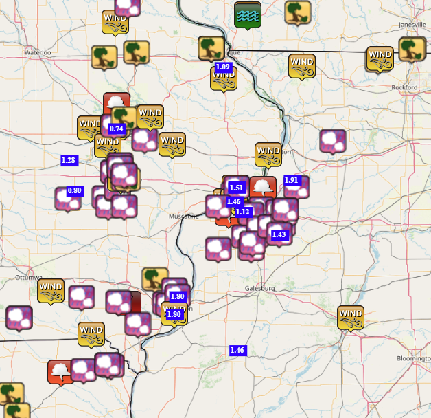
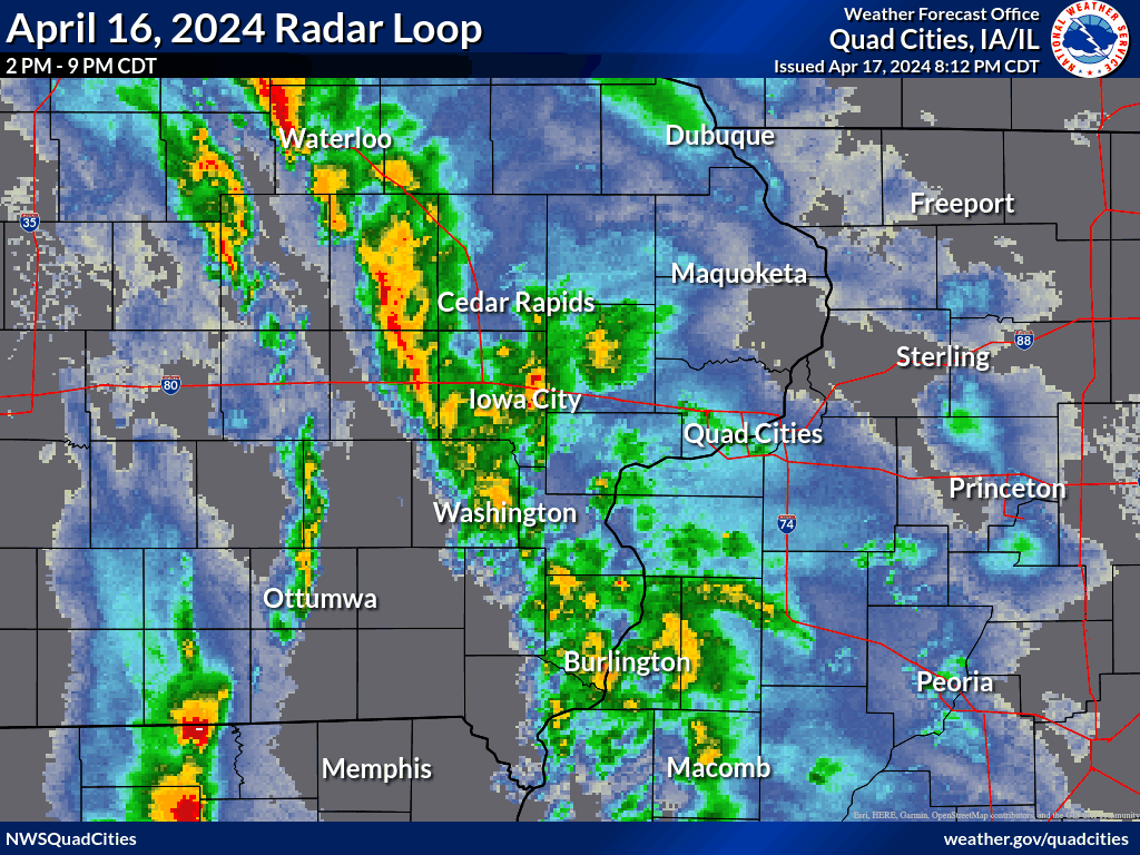
Storm Reports
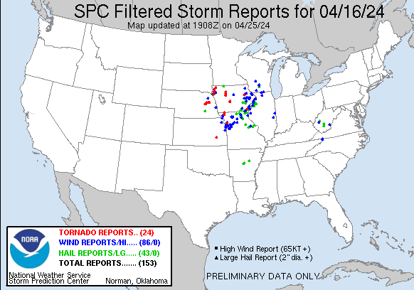
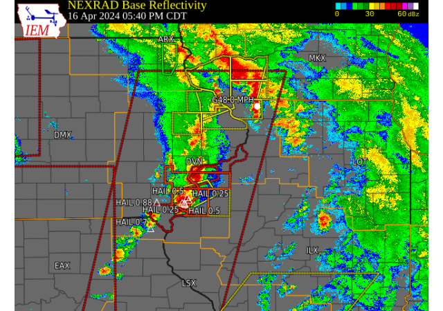
| Storm Reports | SPC Storm Reports: April 16, 2024 |
 |
 |
|
Preliminary Local Storm Report...Summary ..TIME... ...EVENT... ...CITY LOCATION... ...LAT.LON... 0245 PM Tstm Wnd Gst Atkins 42.00N 91.87W
0253 PM Tstm Wnd Gst 2 NNE Cedar Rapids 42.00N 91.66W Along with torrential rain and pea size 0253 PM Tstm Wnd Gst 3 NNE Cedar Rapids 42.01N 91.66W Also some hail but size unknown. 0256 PM Tstm Wnd Dmg 3 SW Marion 42.01N 91.63W Report from mPING: 1-inch tree limbs broken; 0308 PM Tstm Wnd Dmg 1 SW Winthrop 42.46N 91.75W semi blown over at milemarker 261. Highway 0327 PM Tstm Wnd Dmg 1 SE Viola 42.07N 91.37W Semi jackknifed in the median of Highway 151 0335 PM Tstm Wnd Gst 1 SSW Fairview 42.07N 91.34W IA DOT RWIS. 0339 PM Funnel Cloud 5 N Sand Hill 40.38N 92.13W Possible funnel cloud. Hard to tell given 0344 PM Hail 1 NE North English 41.53N 92.07W Occurring right now and lots of it. Also 0355 PM Hail Birmingham 40.88N 91.95W
0400 PM Hail 2 SSW Williamstown 41.54N 91.74W A lot of smaller hail. 0403 PM Hail 1 SW Kalona 41.48N 91.71W Report from mPING: Quarter (1.00 in.). 0408 PM Hail 3 NE Sharon Center 41.59N 91.63W Report from mPING: Dime (0.70 in.). 0409 PM Hail 1 E Tiffin 41.71N 91.66W
0409 PM Hail Tiffin 41.71N 91.67W Report from mPING: Quarter (1.00 in.). 0410 PM Tstm Wnd Gst 4 ENE Mount Sterling 40.63N 91.86W Straight line winds estimated at least 60 0410 PM Hail 1 NNE Oakdale 41.71N 91.60W
0413 PM Hail 3 NE Sharon Center 41.60N 91.63W Report from mPING: Dime (0.70 in.). 0414 PM Hail 2 S Coralville 41.67N 91.60W Report from mPING: Half-inch (0.50 in.). 0414 PM Hail 1 SE Coralville 41.69N 91.59W Report from mPING: Half-inch (0.50 in.). 0414 PM Tstm Wnd Gst Cedar Rapids Municipali 41.88N 91.72W ASOS. 0415 PM Tstm Wnd Gst 2 W University Heights 41.66N 91.60W IADOT RWIS. 0416 PM Hail 1 N North Liberty 41.76N 91.61W
0419 PM Hail North Liberty 41.74N 91.61W pea to dime sized hail. 0420 PM Hail Riverside 41.48N 91.57W dime sized hail right now. 0423 PM Hail 1 W University Heights 41.66N 91.57W
0423 PM Funnel Cloud 1 W Alburnett 42.15N 91.64W Just to the west of Alburnett, FD saw a 0424 PM Rain Parnell 41.59N 92.01W So far. 0424 PM Tstm Wnd Dmg Iowa City 41.66N 91.54W EM reporting multiple Multiple power lines 0425 PM Hail 3 NNE Cedar Rapids 42.01N 91.66W
0425 PM Hail Wyaconda 40.39N 91.93W Reported by Wyaconda Fire. 0427 PM Tstm Wnd Dmg 2 NE Marion 42.06N 91.57W Report from mPING: 1-inch tree limbs broken; 0431 PM Hail 1 E Coralville 41.69N 91.57W Pea size hail covering the ground. 0434 PM Tornado 4 E Salem 40.84N 91.54W Corrects previous tornado report from 4 E 0435 PM Hail Lisbon 41.92N 91.39W
0440 PM Tstm Wnd Gst 1 SSW Fairview 42.07N 91.34W IA DOT RWIS. 0445 PM Tstm Wnd Gst Lore 42.52N 90.80W
0445 PM Tstm Wnd Dmg Manchester 42.49N 91.46W 60 MPH gusts estimated Fence blown down Tree 0446 PM Tstm Wnd Dmg Lore 42.52N 90.80W Report from mPING: 3-inch tree limbs broken; 0449 PM Tstm Wnd Gst Stanwood 41.89N 91.15W
0451 PM Hail Kahoka 40.43N 91.72W
0452 PM Hail Clark City 40.42N 91.69W Dime to quarter hail right now. 0500 PM Rain 1 SE Marengo 41.79N 92.06W
0504 PM Tstm Wnd Dmg 2 SE Yarmouth 41.00N 91.30W Report from mPING: Trees uprooted or 0518 PM Hail 1 S West Point 40.70N 91.45W Report from mPING: Quarter (1.00 in.). 0545 PM Hail 1 SSE Beaverdale 40.84N 91.21W Beaverdale Rd near U.S. 34 becoming covered 0545 PM Hail 1 NW Kahoka 40.43N 91.72W Report from mPING: Dime (0.70 in.). 0546 PM Hail 2 SE Sperry 40.93N 91.13W Report from mPING: Half-inch (0.50 in.). 0548 PM Hail 1 E West Burlington 40.82N 91.16W Report from mPING: Half-inch (0.50 in.). 0549 PM Hail West Burlington 40.83N 91.18W
0550 PM Hail 5 SE Sperry 40.89N 91.10W
0551 PM Hail Salem 40.85N 91.62W Occurring right now. 0553 PM Tstm Wnd Gst 3 N Stockton 42.40N 90.00W Co-op report. 0605 PM Rain 3 NE Cedar Rapids 42.00N 91.64W
0605 PM Funnel Cloud 3 NNE Taylor Ridge 41.43N 90.65W RI 371 not at his home location Rotation and 0607 PM Rain 2 SE Scottsburg 40.53N 90.57W
0614 PM Tstm Wnd Gst 3 ENE Spring Lake 41.52N 90.67W Also half inch hail. 0615 PM Rain 5 SE Sperry 40.89N 91.10W
0618 PM Tstm Wnd Gst 1 WSW Davenport Municip 41.61N 90.59W DVN ASOS. 0620 PM Tstm Wnd Gst 1 N Zwingle 42.32N 90.69W 8 inch diameter red cedar tree snapped. 0623 PM Hail 1 N Davenport 41.57N 90.60W Report from mPING: Dime (0.70 in.). 0625 PM Hail 1 NE Aledo 41.20N 90.74W
0629 PM Hail Davenport Municipality 41.61N 90.58W
0629 PM Tstm Wnd Gst 2 NNE Credit Island 41.52N 90.60W Also pea sized hail. 0630 PM Hail 2 NW Buffalo 41.48N 90.74W
0637 PM Funnel Cloud 1 ENE Le Claire 41.60N 90.35W Emergency Manager reported that a resident 0650 PM Hail 1 S Coal Valley 41.43N 90.45W
0652 PM Hail 2 ESE Coal Valley 41.44N 90.42W
0655 PM Tstm Wnd Gst 2 SE Clinton Municipali 41.82N 90.30W Spotter reported 50 to 60 mph winds with at 0656 PM Hail 1 SSE Green Rock 41.47N 90.36W Off Duty NWS employee reported Dime size 0709 PM Tstm Wnd Gst 1 S Burlington Regional 40.77N 91.13W ASOS station KBRL Burlington Arpt. 0735 PM Hail Cable 41.28N 90.51W Report from mPING: Quarter (1.00 in.). 0737 PM Hail New Windsor 41.20N 90.45W
0745 PM Hail Orion 41.35N 90.38W Social media picture post. 0746 PM Hail Orion 41.35N 90.37W Nickel to quarter hail right now. 0749 PM Hail 1 S Coal Valley 41.43N 90.45W
0751 PM Hail 2 W Andover 41.30N 90.32W Report from mPING: Half-inch (0.50 in.). 0751 PM Hail 1 SW Orion 41.34N 90.38W Report from mPING: Quarter (1.00 in.). 0753 PM Hail 2 N New Windsor 41.24N 90.44W pea to nickel hail right now. 0758 PM Hail 1 S Spring Hill 41.61N 90.05W Report from mPING: Half-inch (0.50 in.). 0800 PM Hail 3 W Geneseo 41.45N 90.21W Right now. 0801 PM Hail Osco 41.35N 90.28W Occurring right now. 0801 PM Hail 4 NE Cambridge 41.36N 90.17W Report from mPING: Dime (0.70 in.). 0803 PM Hail 1 N Geneseo 41.46N 90.15W Report from mPING: Dime (0.70 in.). 0806 PM Hail 1 S Geneseo 41.43N 90.16W Report from mPING: Half-inch (0.50 in.). 0808 PM Hail 1 N Geneseo 41.46N 90.15W Report from mPING: Dime (0.70 in.). 0810 PM Hail 4 WNW Penrose 41.91N 89.73W 45 MPH Winds. 0819 PM Tstm Wnd Gst 3 N Stockton 42.40N 90.00W
0834 PM Hail 1 SSW Cambridge 41.30N 90.20W Occurring right now. 0838 PM Rain 5 SE Sperry 40.89N 91.10W
0855 PM Rain 2 NNE Credit Island 41.52N 90.60W Total from all 3 rounds of storms. 0904 PM Rain 1 SW Cambridge 41.30N 90.20W
$$ |
|
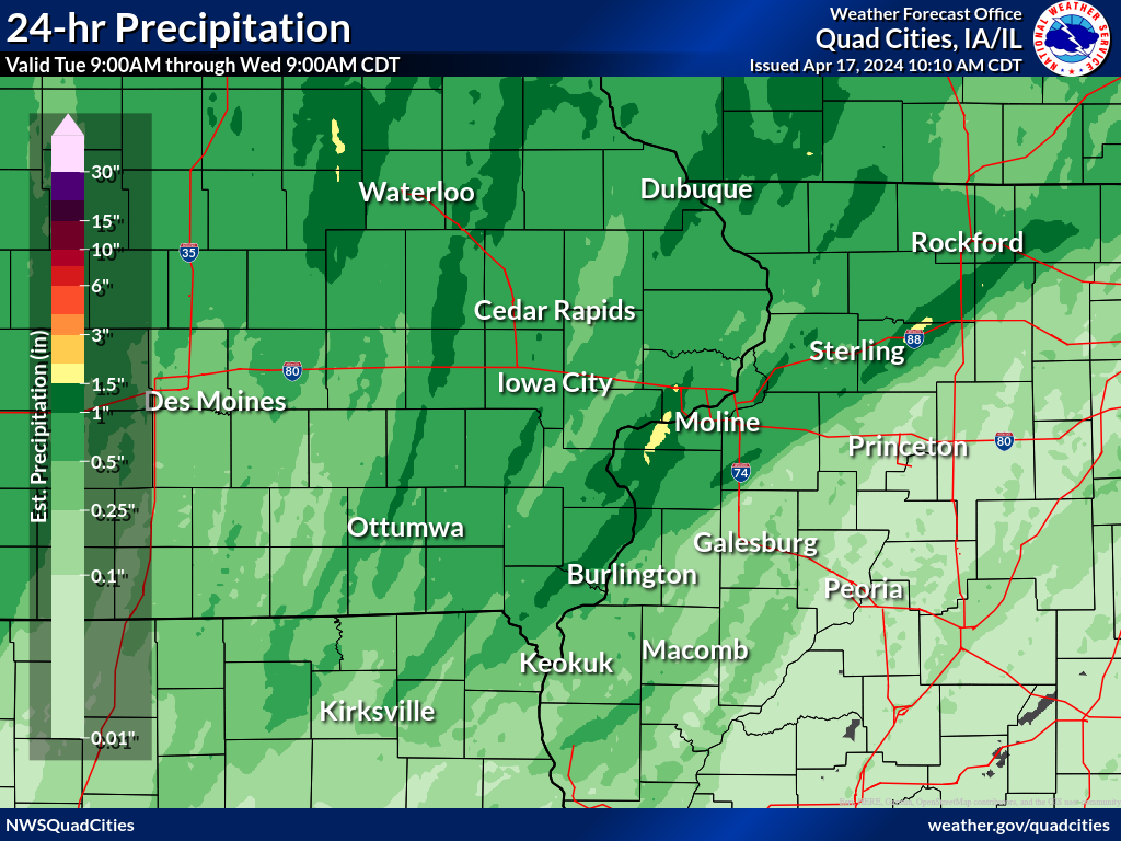
Rain Reports
 |
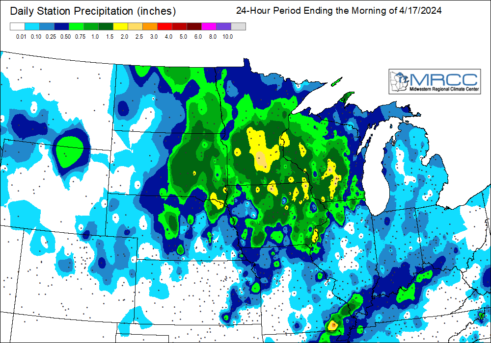 |
| Local Rain Map | Regional Rainfall Map Courtesy MRCC |
24 hour precipitation reports (in Inches), for eastern Iowa, northwest and west central Illinois, and northeast Missouri. Reported between Midnight and 9 AM, Wednesday April 17, 2024. ....IOWA.... Waukon 3N 2.07 Burlington 2S 1.84 Burlington Arpt 1.80 Elkader 6SSW 1.70 Hampton 1 N 1.50 Marengo 1.49 Strawberry Point 1.48 Davenport Arpt 1.43 Dubuque #3 7 SW 1.41 Dubuque LD11 1.40 Oelwein 1E 1.37 Dubuque Arpt 1.37 Donnellson 1.29 Marshalltown 1 NW 1.28 Boone 1 SSW 1.28 Salem 1S 1.26 Mason City ASOS 6 W 1.24 Bellevue LD12 1.21 Sigourney 1.20 Ames US 30 2 SSE 1.19 Marshalltown ASOS 4 N 1.17 Vinton 1.17 Fayette 1 NW 1.10 Washington 1.00 Oelwein AWOS 0.94 Iowa City 0.90 Lowden 0.87 Williamsburg 0.86 Manchester 0.81 Le Claire LD14 0.78 North English 0.78 Iowa City Arpt 0.76 De Witt 0.75 Muscatine 2N 0.73 Fairfield 0.70 Guttenberg Dam 10 0.65 Waterloo ASOS 5 NW 0.64 Keosauqua 0.62 Mt Pleasant 1 SSW 0.62 NWS Johnston* 5 NNW 0.60 Cedar Rapids Arpt 0.59 Anamosa 3 SSW 0.57 Ottumwa ASOS 6 NNW 0.49 Grinnell AWOS 2 SSW 0.48 Keokuk LD19 0.44 Belle Plaine 0.43 Pella AWOS 2 WSW 0.41 Columbus Jct 2 SSW 0.40 Monticello 1 E 0.27 Oskaloosa AWOS 9 ESE 0.26 Pella 4 N 0.18 Rathbun Reservoir 2 N 0.15 ....ILLINOIS.... New Boston LD17 1.70 Gladstone LD18 1.58 Aledo 1.27 Quad City Arpt 1.12 Elizabeth 1.01 Ill. City LD16 3 WNW 0.80 Rochelle Arpt 0.80 Stockton 3 NNE 0.73 Mount Carroll 0.63 Augusta 0.62 Bentley 0.56 Rockford Arpt 0.52 Freeport 0.48 Mundelein 0.37 La Harpe 0.35 Quincy Arpt 0.30 Fulton LD13 0.29 Ogden 0.24 St Anne 0.12 Windsor 0.10 Tuscola 0.10 Galesburg 0.07 Kewanee 1 E 0.06 |
|
Environment
SPC Severe Weather Event Link: April 16, 2024
 |
 |
 |
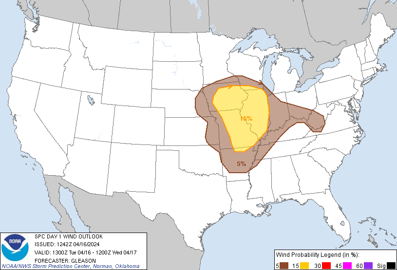 |
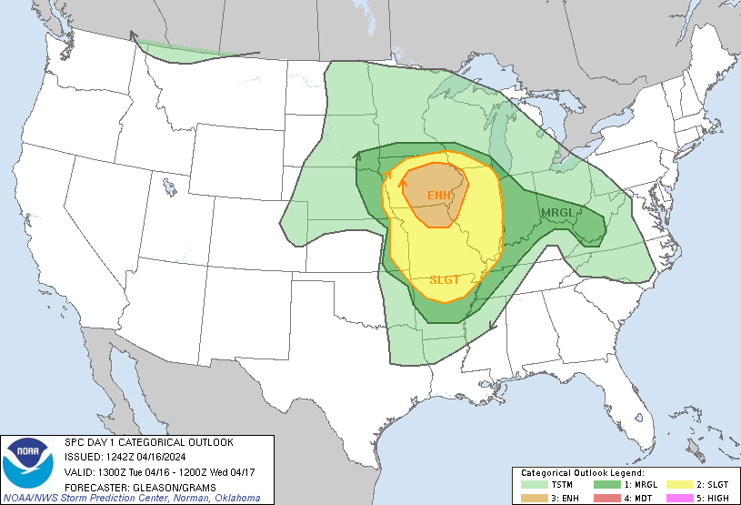
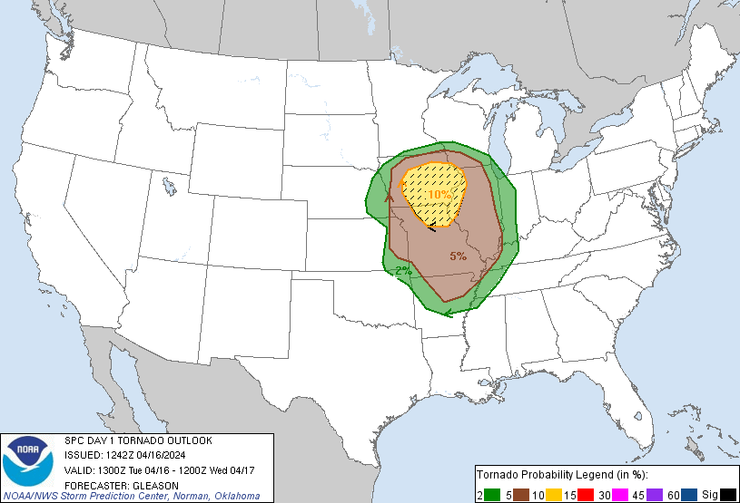
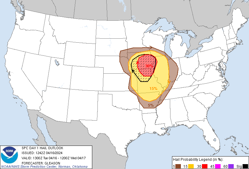
| 13Z Outlook | 13Z Tornado Outlook | 13Z Hail Outlook | 13Z Wind Outlook |
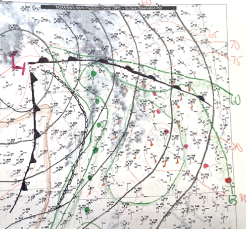 |
| April 16, 11 AM Surface Weather Map |
 |
 |
 |
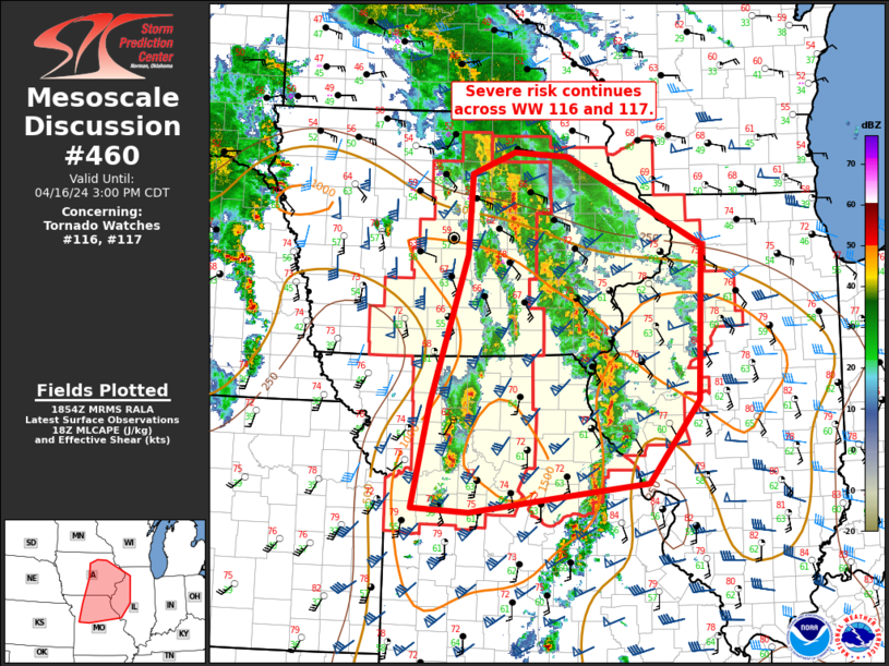 |
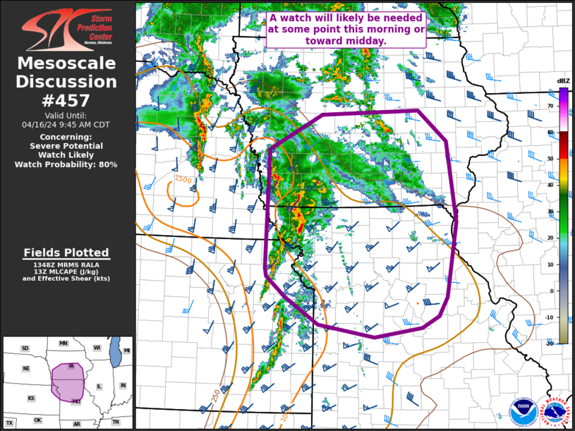
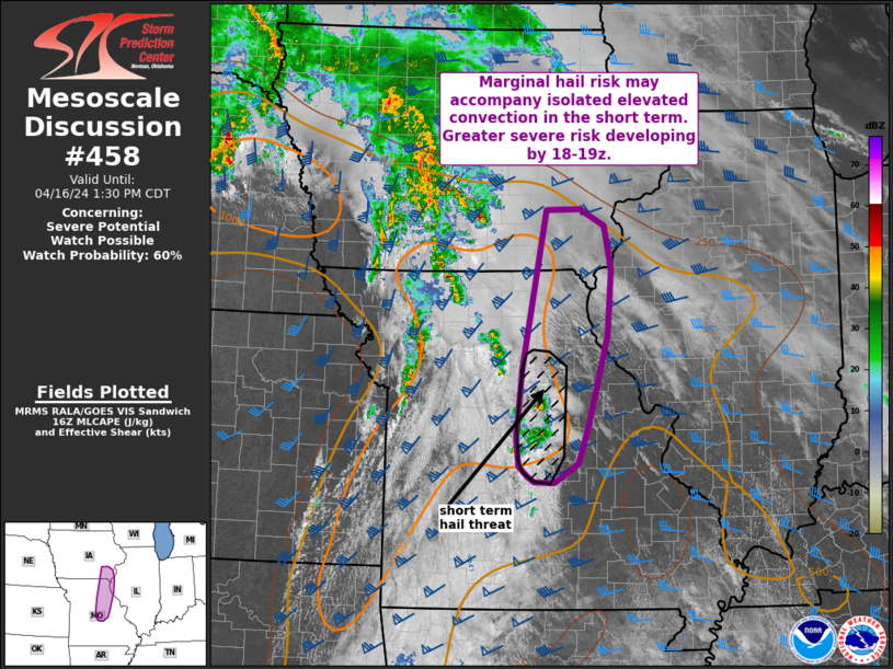
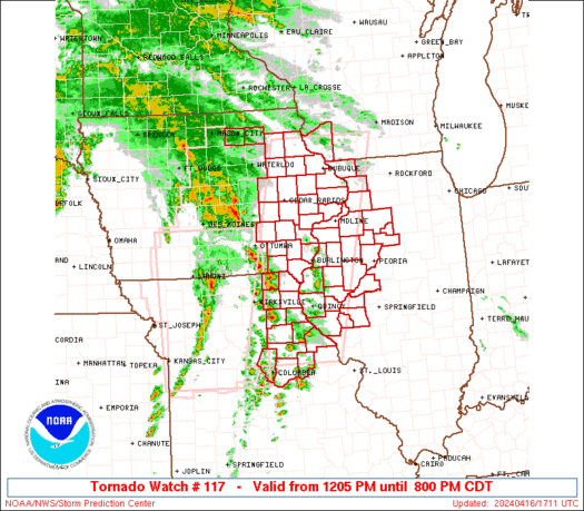
| Mesoscale Discussion 457 | Mesoscale Discussion 458 | TORNADO WATCH 117 | Mesoscale Discussion 460 |
 |
 |
 |
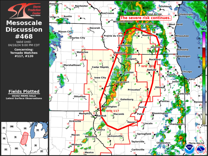 |
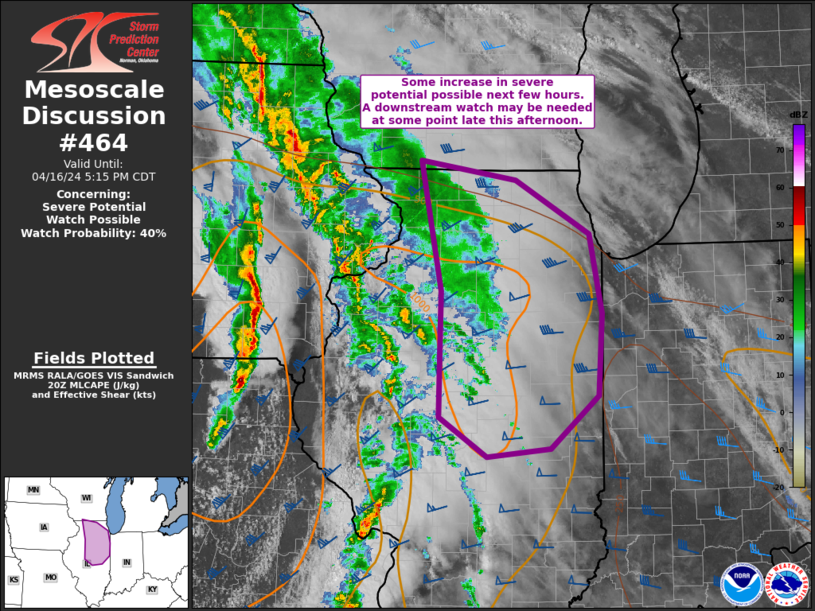
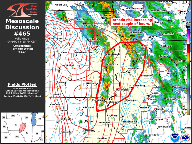
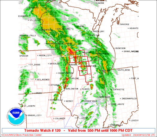
| Mesoscale Discussion 464 | Mesoscale Discussion 465 | TORNADO WATCH 210 | Mesoscale Discussion 468 |
 |
Media use of NWS Web News Stories is encouraged! Please acknowledge the NWS as the source of any news information accessed from this site. |
|


