Scattered severe thunderstorms capable of damaging wind gusts and some hail are expected this afternoon and evening from the Upper Ohio River Valley into the Northeast, and from the Appalachians into the Mid-Atlantic States. Excessive rainfall from heavy thunderstorms may produce areas of flash flooding from southern New Mexico into the western and northern Gulf Coast into Wednesday. Read More >
Overview
|
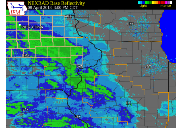
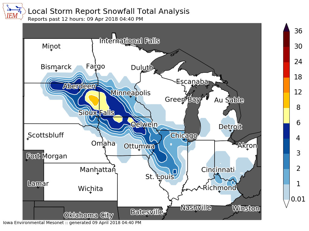
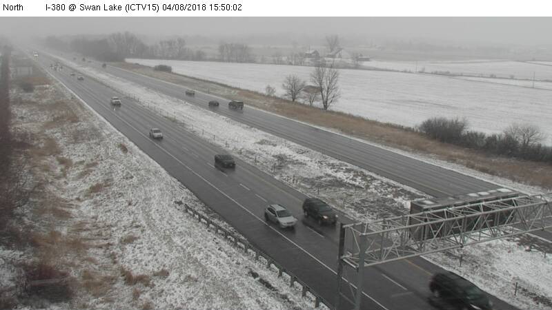
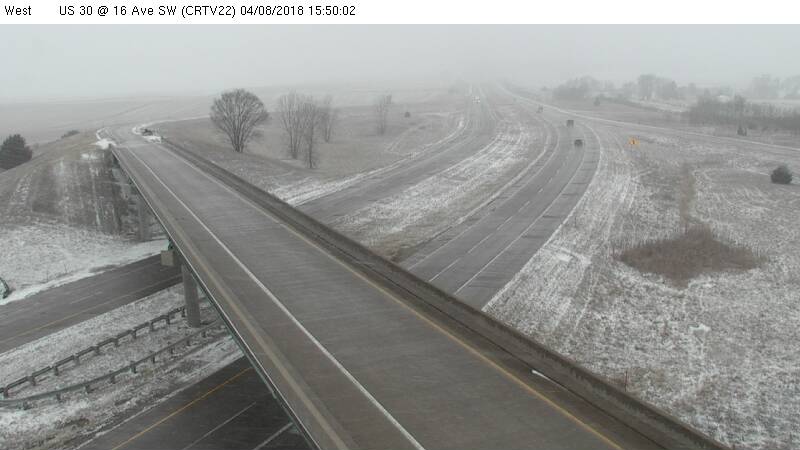
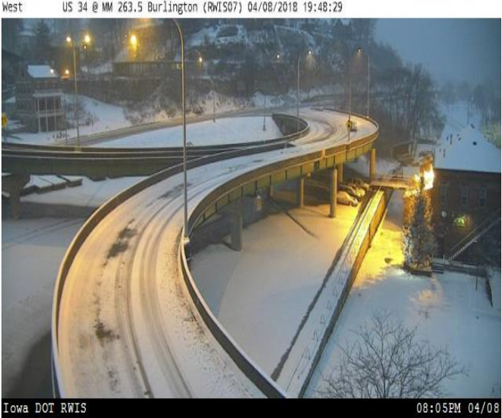
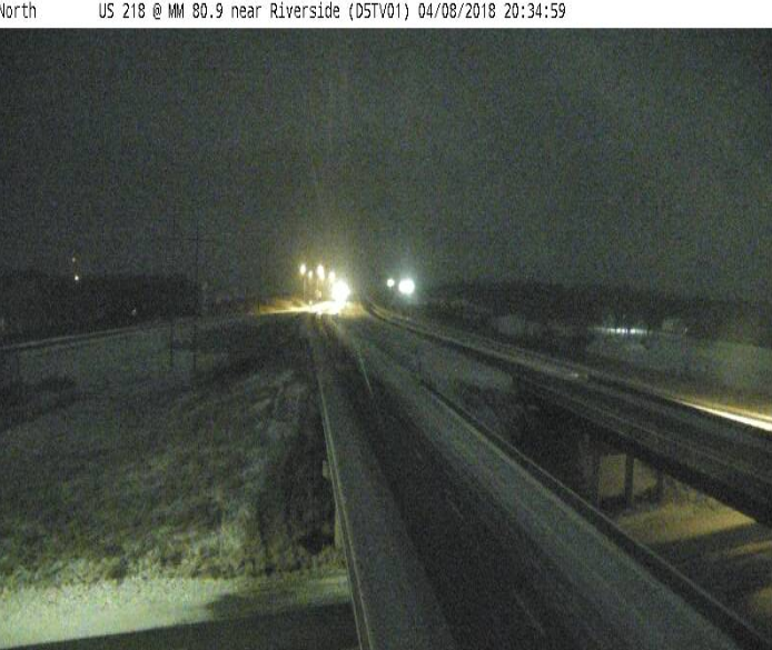
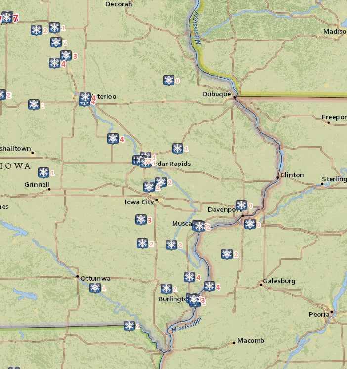
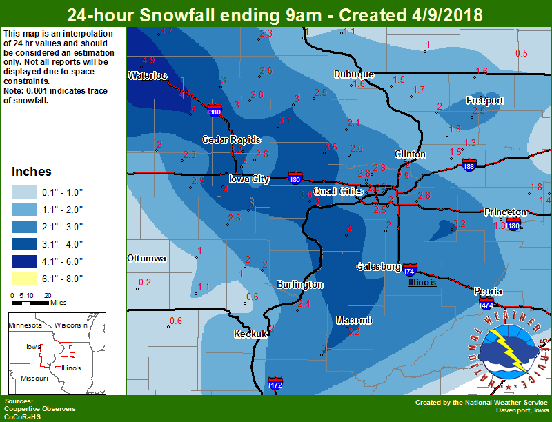
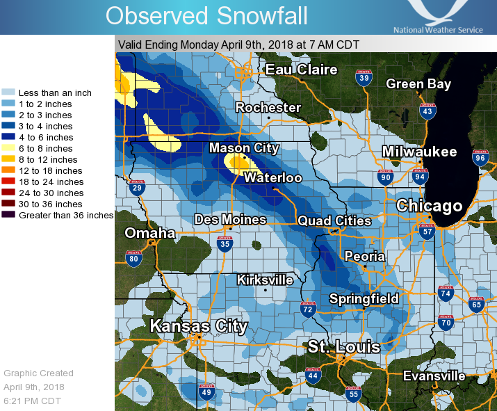
A spring storm brought snow to the area Sunday afternoon through early Monday morning. Much of the snow fell on elevated and grassy surfaces, with the highest totals between 3 and 5 inches falling from Vinton, to Washington and Burlington IA, through the Galesburg and Macomb IL areas.
|
 |
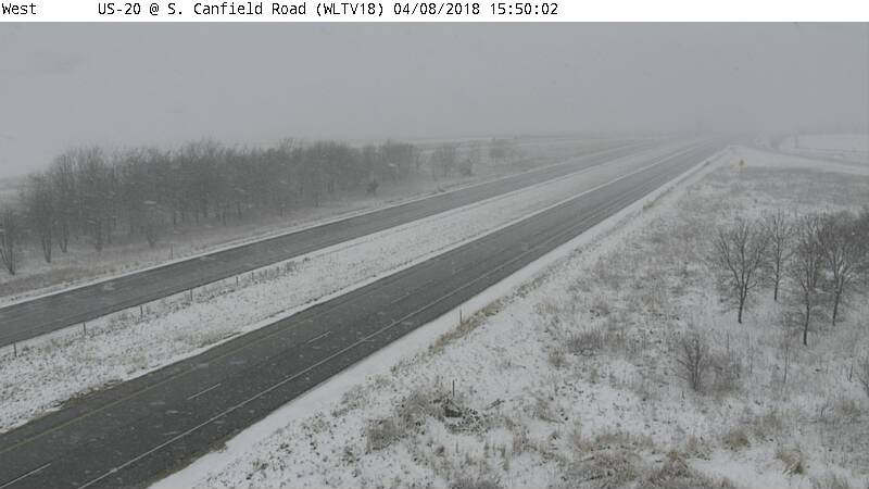
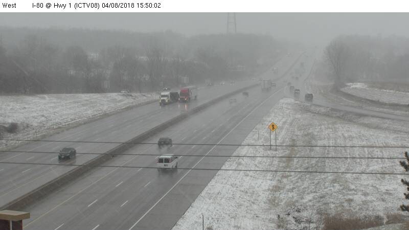
Iowa DOT Webcam/Plowcam Photos
| US 20 @ S. Canfield Road near Jesup, IA | I-80 @ Hwy 1 near Iowa City, IA | I-380 @ Swan Lake |
 |
 |
 |
| US 30 @ 16 Ave SW near Cedar Rapids, IA | US 34 @ MM 263 Burlington, IA | US 218 @ MM 81 near Riverside, IA |
 |
 |
 |
Storm Reports & Maps
| Interactive Storm Report Link | Local Snowfall | Regional Snowfall |
 |
 |
 |
| Iowa Snowfall | ||
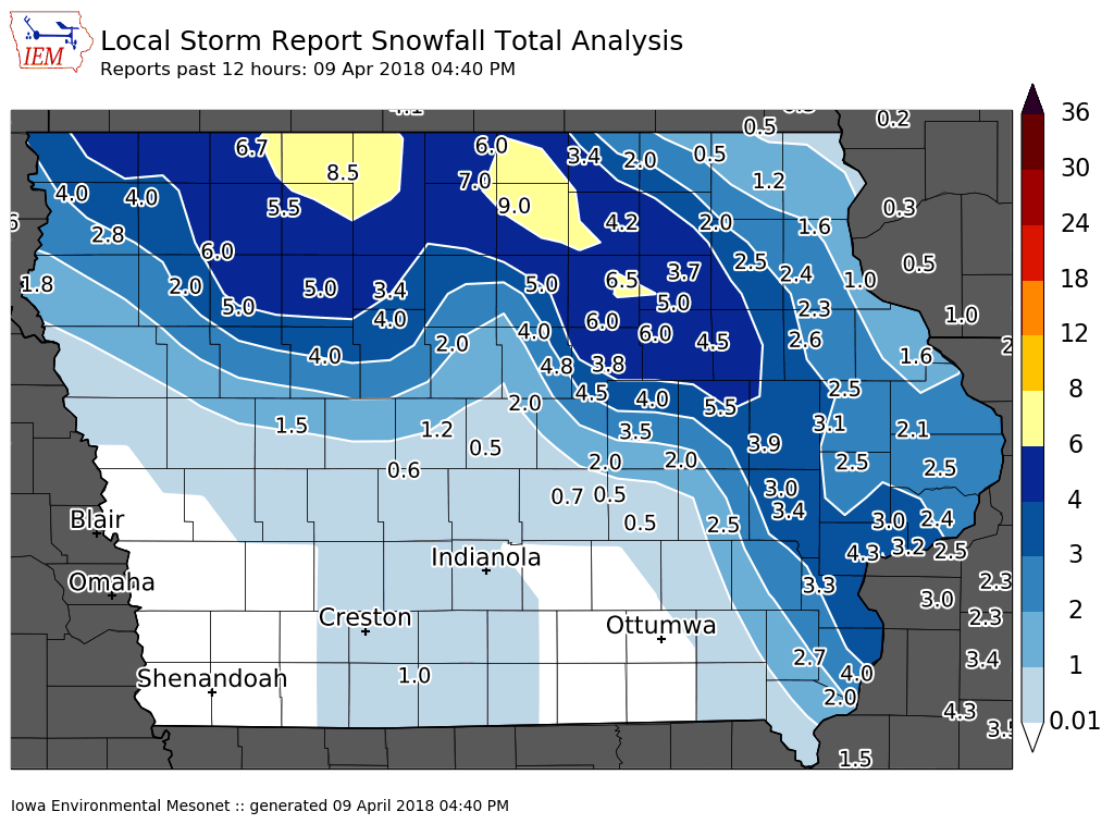 |
SNOW REPORTS LISTED BY AMOUNT

 INCHES  LOCATION                 ST  COUNTY           TIME
 ------  -----------------------  --  --------------   -------
  5.5    1 SE VINTON              IA  BENTON           0955 AM
  4.5    JESUP                    IA  BUCHANAN         0900 AM
  4.3    2 NNW MUSCATINE          IA  MUSCATINE        0745 AM
  4.0    2 N BURLINGTON           IA  DES MOINES       0910 AM
  3.9    3 W CEDAR RAPIDS         IA  LINN             0753 AM
  3.7    MARION                   IA  LINN             0700 AM
  3.6    2 W CEDAR RAPIDS         IA  LINN             0622 AM
  3.5    1 W SWAN CREEK           IL  WARREN           0509 AM
  3.5    2 NNW SHELLSBURG         IA  BENTON           0700 AM
  3.4    1 SW UNIVERSITY HEIGHTS  IA  JOHNSON          0848 AM
  3.3    COLUMBUS JUNCTION        IA  LOUISA           0614 AM
  3.3    1 SW NORTH LIBERTY       IA  JOHNSON          0900 AM
  3.2    2 NNE CEDAR RAPIDS       IA  LINN             0514 AM
  3.2    1 ENE MONTPELIER         IA  SCOTT            0831 AM
  3.1    2 ESE FAIRVIEW           IA  JONES            0603 AM
  3.0    VIOLA                    IL  MERCER           0642 AM
  3.0    2 NNW NORTH LIBERTY      IA  JOHNSON          0731 AM
  3.0    1 SSW NORTH LIBERTY      IA  JOHNSON          0748 AM
  3.0    DURANT                   IA  CEDAR            0756 AM
  3.0    2 NNW MARION             IA  LINN             0852 AM
  3.0    2 WSW HIAWATHA           IA  LINN             1005 AM
  2.9    SPRINGVILLE              IA  LINN             0630 AM
  2.8    NORA                     IL  JO DAVIESS       0804 AM
  2.8    UNIVERSITY HEIGHTS       IA  JOHNSON          1003 AM
  2.7    1 WSW NEW LONDON         IA  HENRY            0730 AM
  2.6    SOLON                    IA  JOHNSON          0618 AM
  2.6    MANCHESTER               IA  DELAWARE         0749 AM
  2.5    PARNELL                  IA  IOWA             0600 AM
  2.5    DEWITT                   IA  CLINTON          0628 AM
  2.5    MOLINE QUAD-CITY AIRPOR  IL  ROCK ISLAND      0700 AM
  2.5    1 NNW MONTICELLO         IA  JONES            0746 AM
  2.5    SHANNON                  IL  CARROLL          0845 AM
  2.5    3 SW WINNESHIEK          IL  STEPHENSON       0846 AM
  2.5    STANWOOD                 IA  CEDAR            0858 AM
  2.4    DAVENPORT AIRPORT        IA  SCOTT            0700 AM
  2.3    4 WNW FOUNTAIN SPRINGS   IA  DELAWARE         0529 AM
  2.3    1 W BETTENDORF           IA  SCOTT            0910 AM
  2.3    1 W CAMBRIDGE            IL  HENRY            0922 AM
  2.2    MOUNT CARROLL            IL  CARROLL          0908 AM
  2.1    1 W MAQUOKETA MUNICIPAL  IA  JACKSON          0651 AM
  2.1    2 SSE SCHAPVILLE         IL  JO DAVIESS       0719 AM
  2.0    BELLE PLAINE             IA  BENTON           0518 AM
  2.0    WEVER                    IA  LEE              0551 AM
  2.0    1 ESE LE CLAIRE          IA  SCOTT            0623 AM
  2.0    1 ENE HURSTVILLE         IA  JACKSON          0625 AM
  2.0    1 ENE MOUNT VERNON       IA  LINN             0700 AM
  2.0    STOCKTON                 IA  MUSCATINE        0717 AM
  2.0    WHEATLAND                IA  CLINTON          0735 AM
  2.0    1 SSW CORDOVA            IL  ROCK ISLAND      0824 AM
  2.0    2 NW MARION              IA  LINN             0834 AM
  2.0    1 E FREEPORT             IL  STEPHENSON       0847 AM
  1.6    1 NW DUBUQUE REGIONAL A  IA  DUBUQUE          0700 AM
  1.5    CARTHAGE                 IL  HANCOCK          0529 AM
  1.5    GALVA                    IL  HENRY            0556 AM
  1.4    3 E STERLING             IL  WHITESIDE        0835 AM
  1.3    1 E DUBUQUE              IA  DUBUQUE          0648 AM
  1.0    1 E SAINT DONATUS        IA  JACKSON          0345 AM
  1.0    1 NW CENTER GROVE        IA  DUBUQUE          0921 AM
  0.8    1 NE FORT MADISON        IA  LEE              0933 AM
Environment
| Davenport, IA Sounding 7 AM 4/8/2018 |
Davenport, IA Sounding ​7 PM 4/8/2018 |
Davenport, IA Sounding ​7 AM 4/9/2018 |
 |
 |
 |
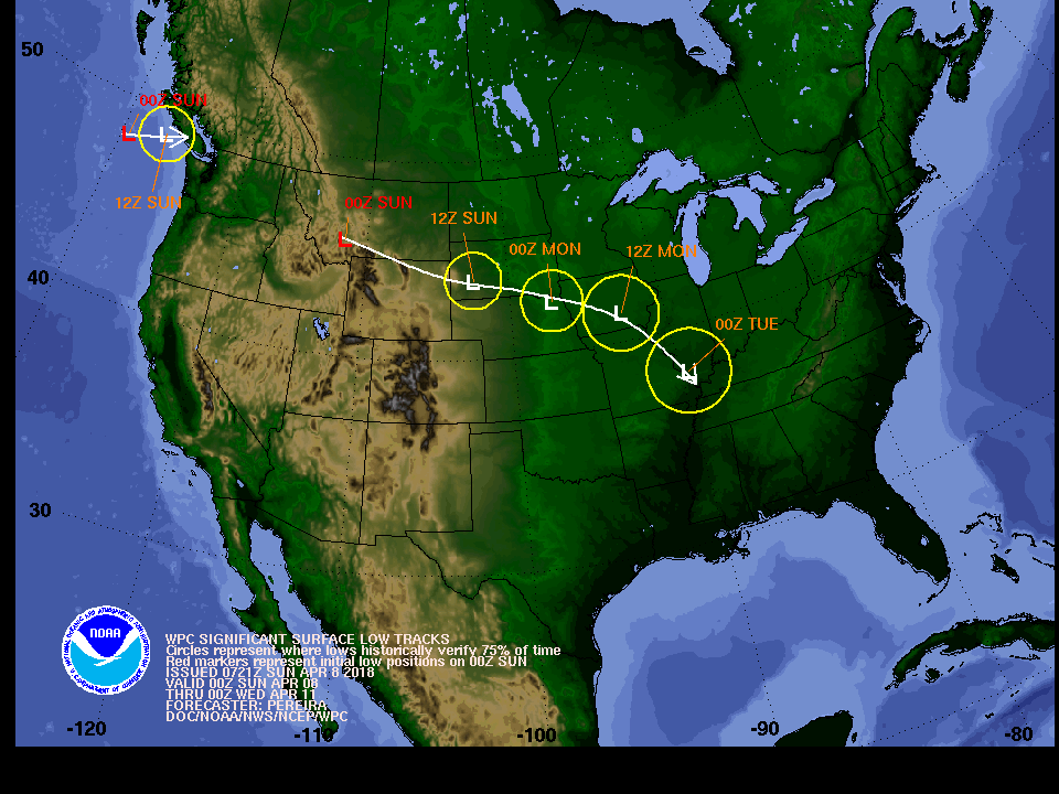
| WPC Surface Low Track | ||
 |
||
| Weather Prediction Center - Surface Low Tracks (with uncertainty circles) | ||
| Media use of NWS Web News Stories is encouraged! Please acknowledge the NWS as the source of any news information accessed from this site. |
 |