Scattered severe thunderstorms capable of damaging wind gusts and some hail are expected this afternoon and evening from the Upper Ohio River Valley into the Northeast, and from the Appalachians into the Mid-Atlantic States. Excessive rainfall from heavy thunderstorms may produce areas of flash flooding from southern New Mexico into the western and northern Gulf Coast into Wednesday. Read More >
Overview
|
|
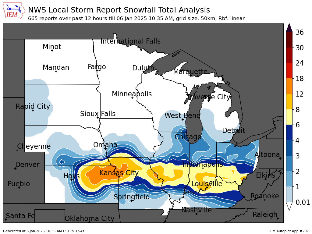
Storm Reports / Snowfall Map
| Snowfall Map | |
 |
 |
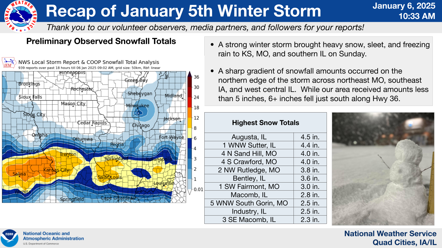
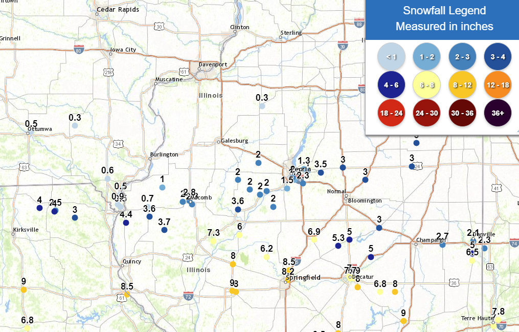
Snow Reports Listed By Amount INCHES LOCATION ST COUNTY TIME ------ ----------------------- -- -------------- ------- 4.5 Augusta IL Hancock 0443 AM 4.4 1 WNW Sutter IL Hancock 0700 AM 4.0 4 N Sand Hill MO Scotland 1003 AM 4.0 4 S Crawford MO Scotland 0842 AM 3.8 2 NW Rutledge MO Scotland 0807 PM 3.7 Augusta IL Hancock 0443 AM 3.6 Bentley IL Hancock 0630 AM 3.0 1 SW Fairmont MO Clark 1003 AM 2.8 Macomb IL Mcdonough 0813 AM 2.5 5 WNW South Gorin MO Scotland 1004 AM 2.5 Industry IL Mcdonough 0704 PM 2.3 3 SE Macomb IL Mcdonough 0910 AM 2.2 3 W Macomb IL Mcdonough 0700 AM 2.0 3 W Macomb IL Mcdonough 0700 AM 2.0 Colchester IL Mcdonough 0729 PM 2.0 Augusta IL Hancock 0331 PM 1.4 Macomb IL Mcdonough 0626 PM 1.0 La Harpe IL Hancock 0800 AM 1.0 Carthage IL Hancock 1000 PM 0.9 1 S Mooar IA Lee 0438 AM 0.7 Carthage IL Hancock 0746 AM 0.6 Donnellson IA Lee 0700 AM 0.5 1 S Montrose IA Lee 0908 AM 0.5 1 NW Keokuk IA Lee 0455 AM 0.3 1 E Kewanee IL Henry 0700 AM 0.3 1 SW Perlee IA Jefferson 0700 AM |
|
Additional Information
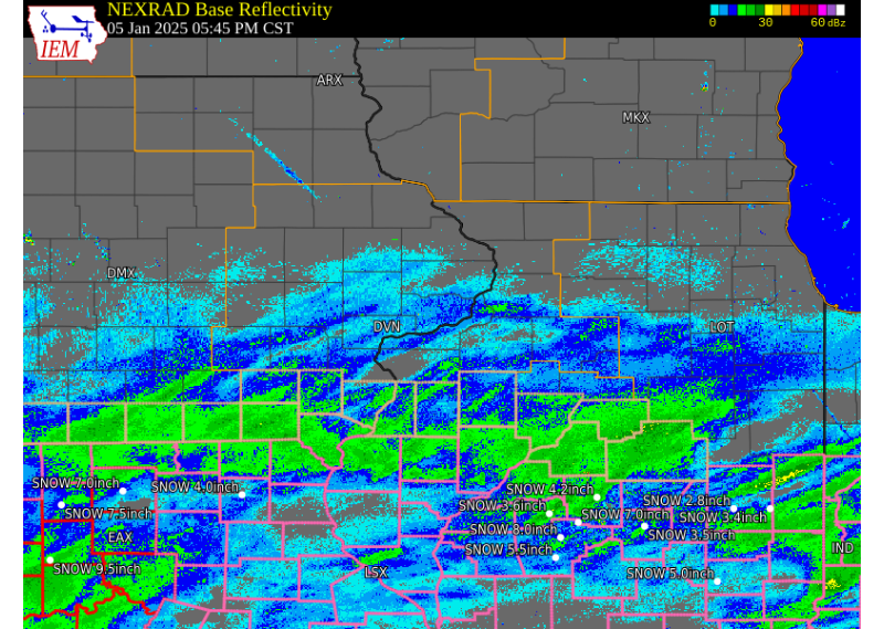
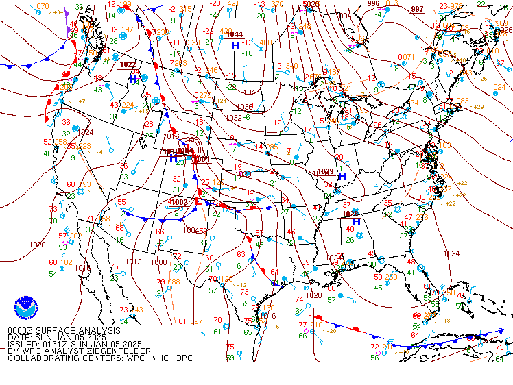
| RADAR | SURFACE MAP | WATER VAPOR SATELLITE |
| Courtesy: Iowa Environmental Mesonet (IEM) | WPC Surface Analysis | Courtesy: College of DuPage |
 |
 |
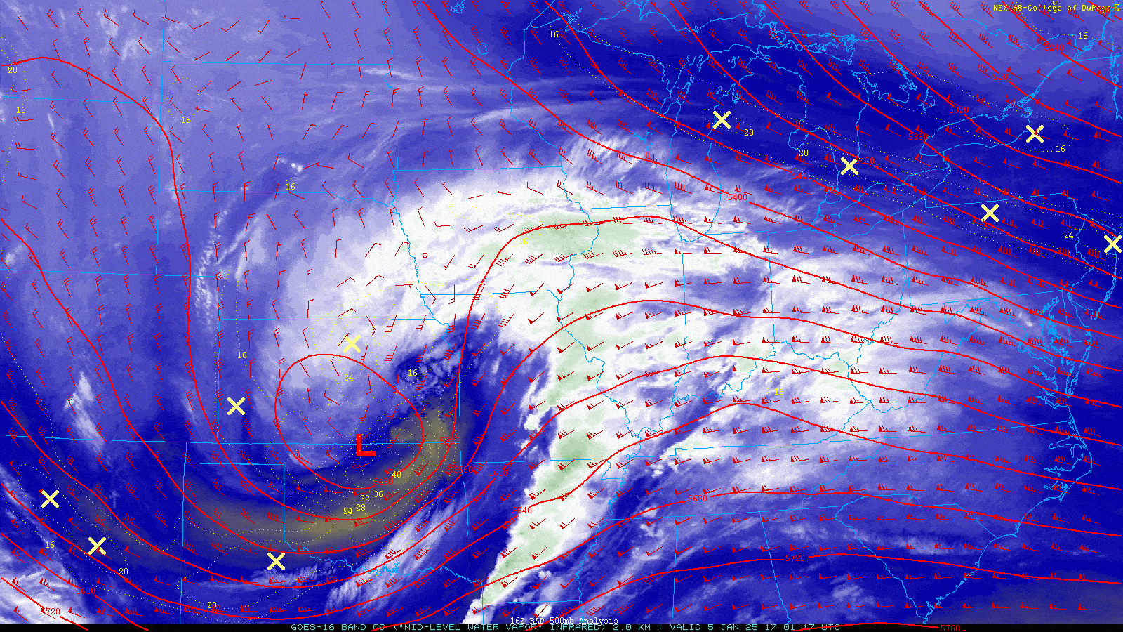 |
| Click for Interactive Loop | 00z 01/5/25 - 12z 01/06/25 | 17z 01/05/25 - 12z 01/06/25 |
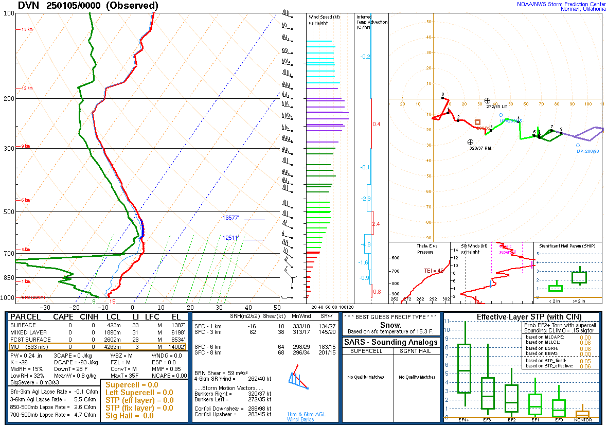
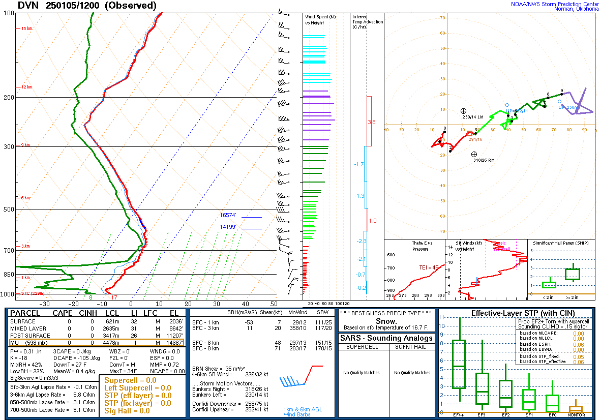
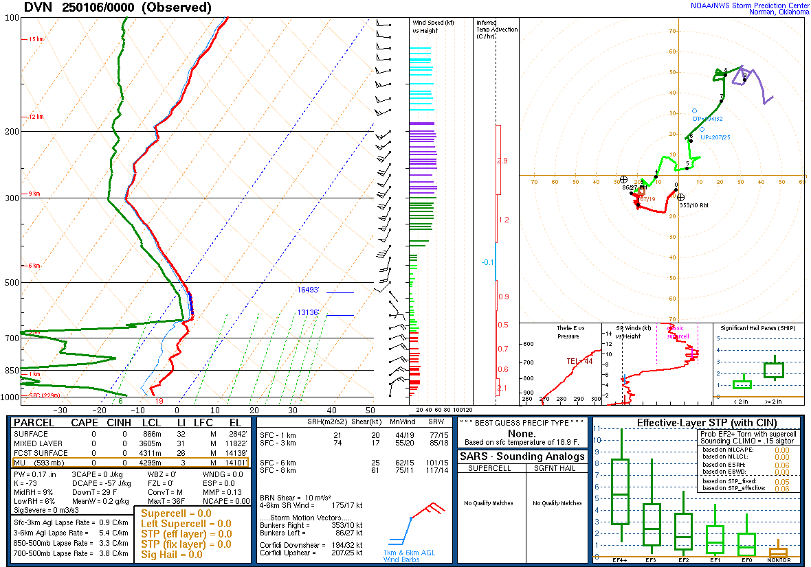
| 00z 01/05/25 DVN Sounding | 12z 01/05/25 DVN Sounding | 00z 01/06/25 DVN Sounding |
 |
 |
 |
| Other NWS Office Reviews | |
| Lincoln | St. Louis |
 |
Media use of NWS Web News Stories is encouraged! Please acknowledge the NWS as the source of any news information accessed from this site. |
|