Severe thunderstorms will be possible from the central Plains to the Mid-Atlantic and Northeast on Monday. Hazardous heat will linger across the southern U.S. and build across the West through mid-week. Hot and dry conditions will fuel fire weather concerns for Interior Alaska and the Four Corners region through Monday. Read More >
| Climate/Almanac Data - JUN Normals - JUN Records | ||||||||||||||||||||||||||||||||||||||||||||||||||||||
| JUNE | ||||||||||||||||||||||||||||||||||||||||||||||||||||||
| *(Values Now Compared With New Climate Normals (1991-2020))* | ||||||||||||||||||||||||||||||||||||||||||||||||||||||
|
||||||||||||||||||||||||||||||||||||||||||||||||||||||
| The ranking is listed in parentheses (__) when within the "Top 10". | ||||||||||||||||||||||||||||||||||||||||||||||||||||||
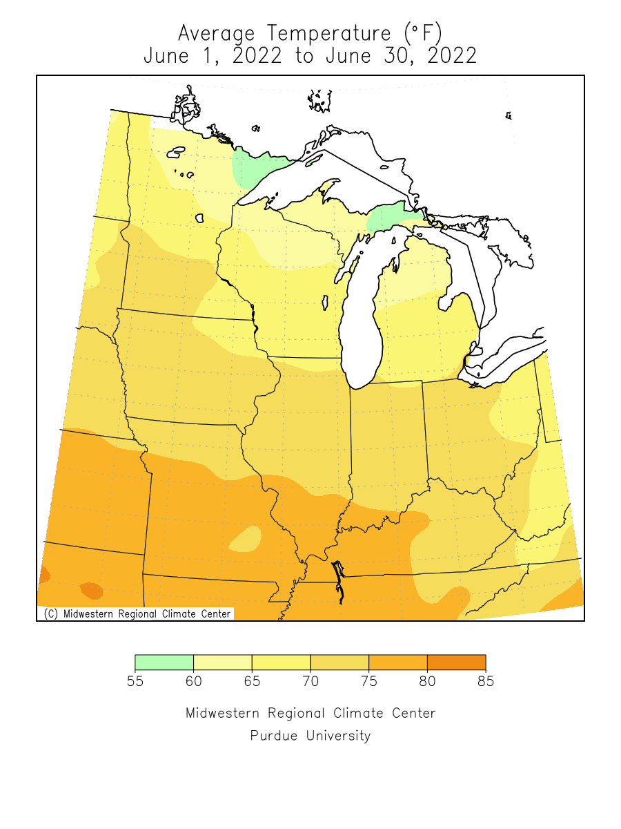
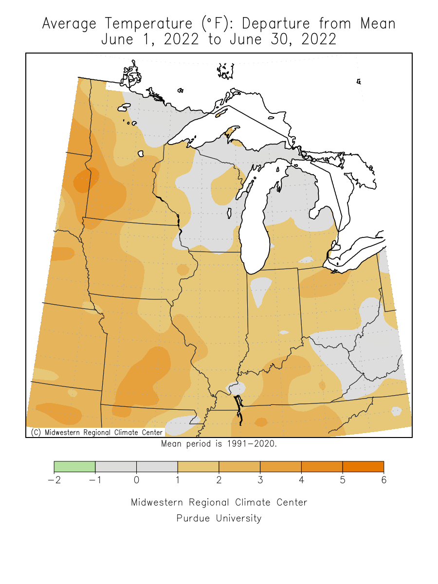
| June 2022 was around 1 to 2 degrees above normal. | ||||||||||||||||||||||||||||||||||||||||||||||||||||||
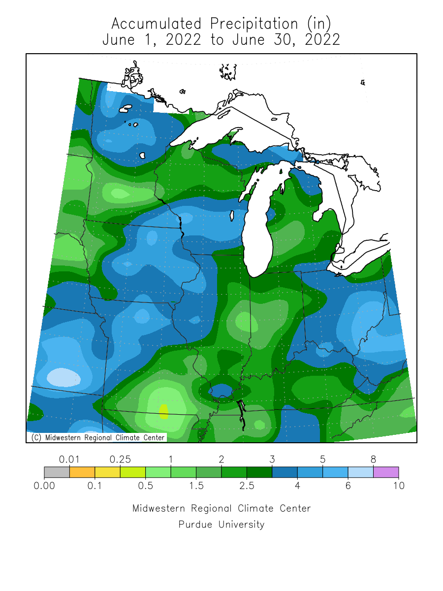
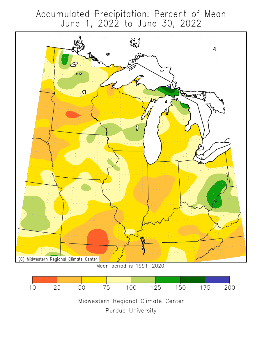
| Precipitation totals for June 2022 ranged from near normal to around two and a quarter inches below normal. | ||||||||||||||||||||||||||||||||||||||||||||||||||||||
| Please see JUN Records for monthly record information. | ||||||||||||||||||||||||||||||||||||||||||||||||||||||
| The climate maps below are courtesy of the Midwest Regional Climate Center. | ||||||||||||||||||||||||||||||||||||||||||||||||||||||
| These maps become available around 10am on the first of the month. | ||||||||||||||||||||||||||||||||||||||||||||||||||||||
|
||||||||||||||||||||||||||||||||||||||||||||||||||||||
| A LOOK AHEAD | ||||||||||||||||||||||||||||||||||||||||||||||||||||||
| Climate Prediction Center | ||||||||||||||||||||||||||||||||||||||||||||||||||||||
|
||||||||||||||||||||||||||||||||||||||||||||||||||||||