
Record setting heat is expected over the next several days from the Intermountain West through the northern Plains. Furthermore, fire weather concerns increase with dry and breezy conditions. Meanwhile, heavy rainfall and severe thunderstorm threats for the Ohio/Tennessee Valleys, central Appalachians and Southeast today. The threat shifts to central Gulf Coast and across central Texas this week. Read More >
Iowa Forecast Grassland Fire Danger Index |
|
d
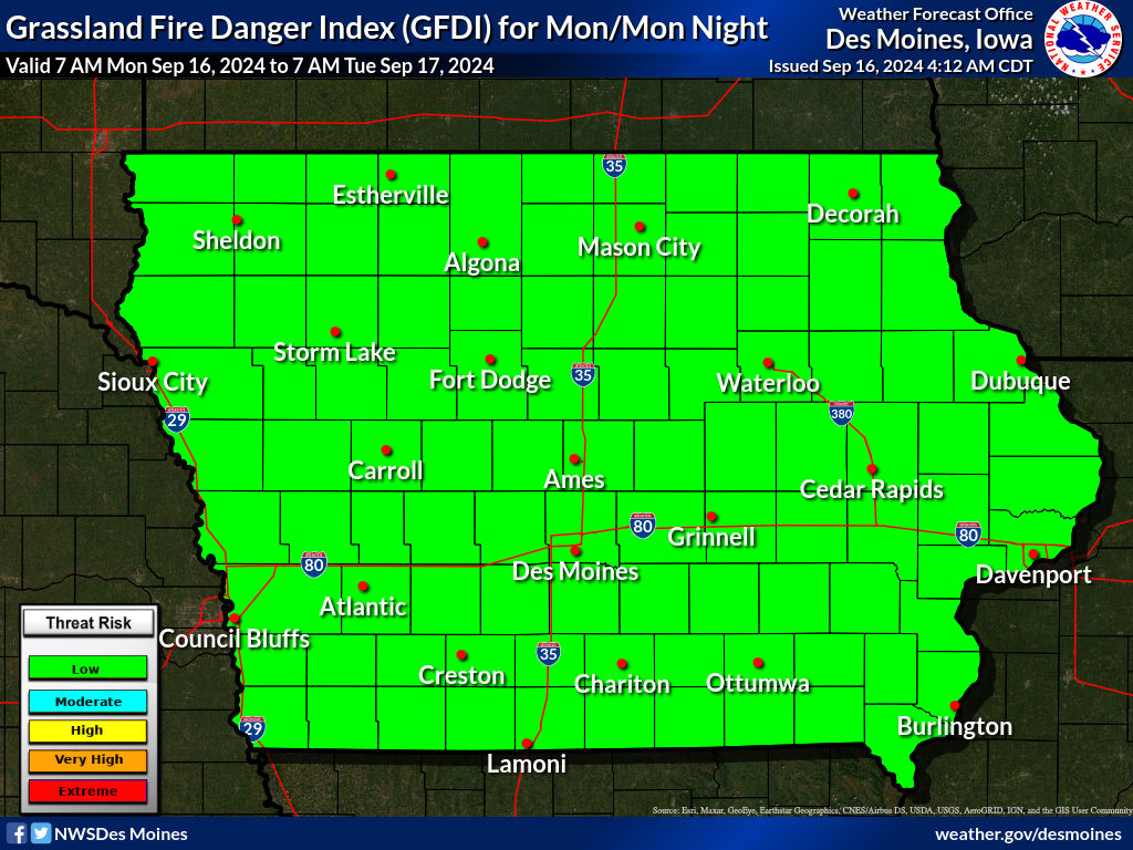 Click image above for a larger image
|
|
The Grassland Fire Danger Index indicates the potential for grassland fires to experience extreme fire behavior, which in turn, can lead to a potential threat to life and property. The GFDI accounts for the curing of the fuel (grasses), temperature, relative humidity and the average sustained wind. In addition, the State of Iowa Fire Marshal's Office provides the current list of burn bans by county (click here) |
|
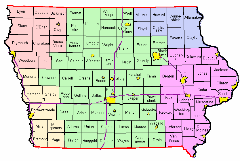
Click on the map below for that county's Fire Weather Forecast
From NWS Offices in Des Moines, Sioux Falls, Omaha, La Crosse, and Quad Cities
BACKUP LINKS TO FIRE WEATHER FORECASTS
| Des Moines | Sioux Falls | Omaha | La Crosse | Quad Cities |

