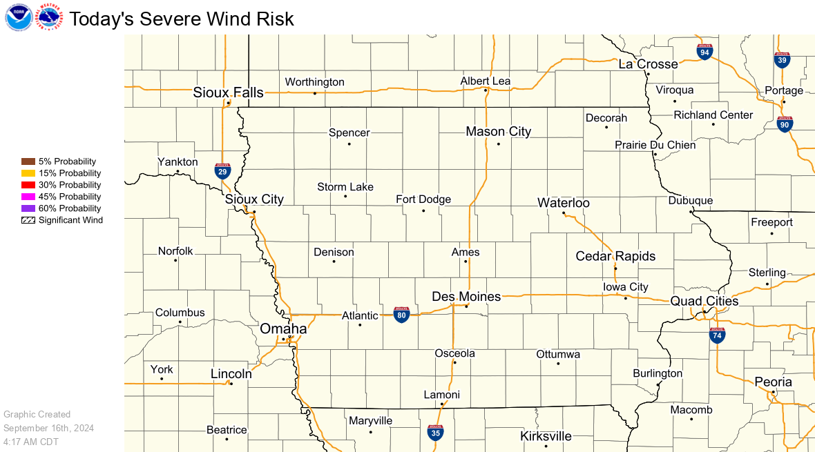
Severe thunderstorms, with a significant wind threat, will continue through tonight across the northern Plains. Wind gusts of 60 to 100 mph are possible. Heavy rainfall will continue through tonight from Oklahoma into Missouri, and in the Tennessee Valley through Monday. Critical fire weather conditions continue in the Southwest through Tuesday. Read More >
These images are updated once an hour between +15 and +25 after the hour.
Snow, Ice and Wind Chill Graphics
Snowfall
Snowfall accumulation measured in six hourly periods, starting at 12am, 6am, 12pm, and 6pm CST (+1 CDT).
|
12 Hour Snow Accumulation Forecast |
24 Hour Snowfall Accumulation Forecast |
|
48 Hour Snow Accumulation Forecast |
72 Hour Snow Accumulation Forecast |
Ice
Ice accumulation measured in six hourly periods, starting at 12am, 6am, 12pm, and 6pm CST (+1 CDT).
|
12 Hour Ice Accumulation Forecast |
24 Hour Ice Accumulation Forecast |
|
48 Hour Ice Accumulation Forecast |
72 Hour Ice Accumulation Forecast |
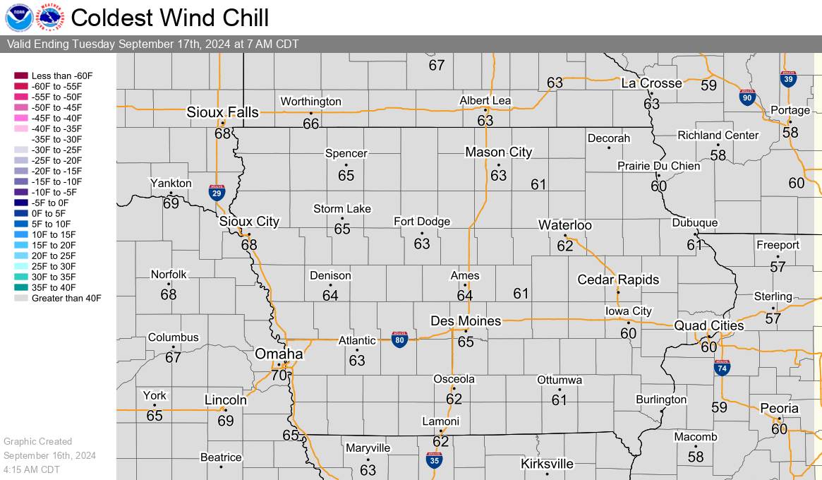
Wind Chill
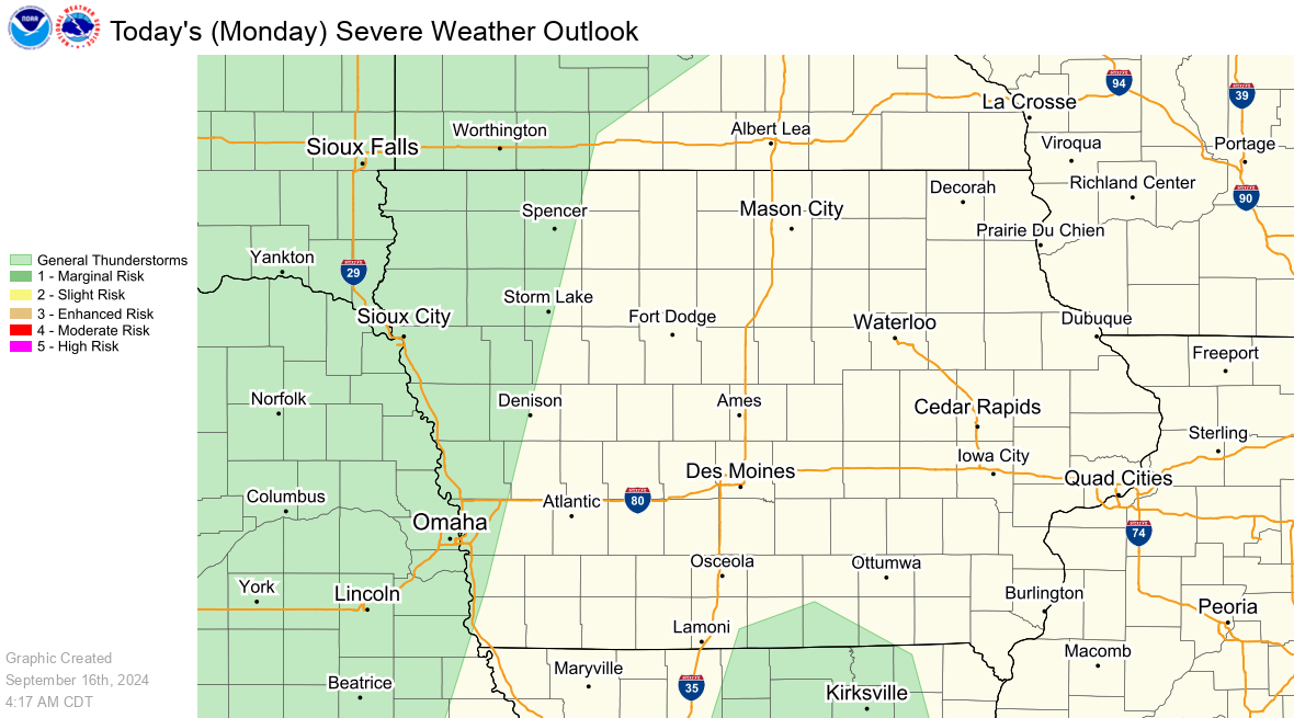
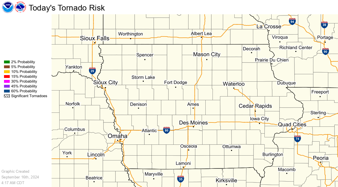
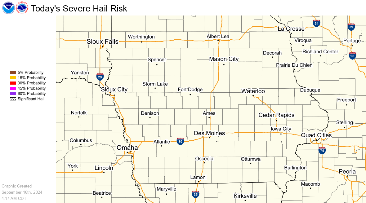
Severe Weather Graphics
SPC Day 1 Outlook
|
SPC Day 1 Severe Weather Outlook |
SPC Day 1 Tornado Outlook |
|
SPC Day 1 Hail Outlook |
SPC Day 1 Wind Outlook |
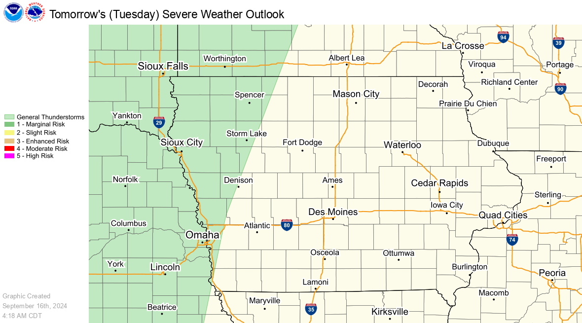
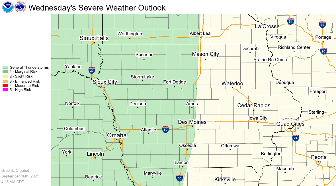
SPC Day 2 and 3 Outlooks
|
SPC Day 2 Severe Weather Outlook |
SPC Day 3 Severe Weather Outlook |
Precipitation Graphics
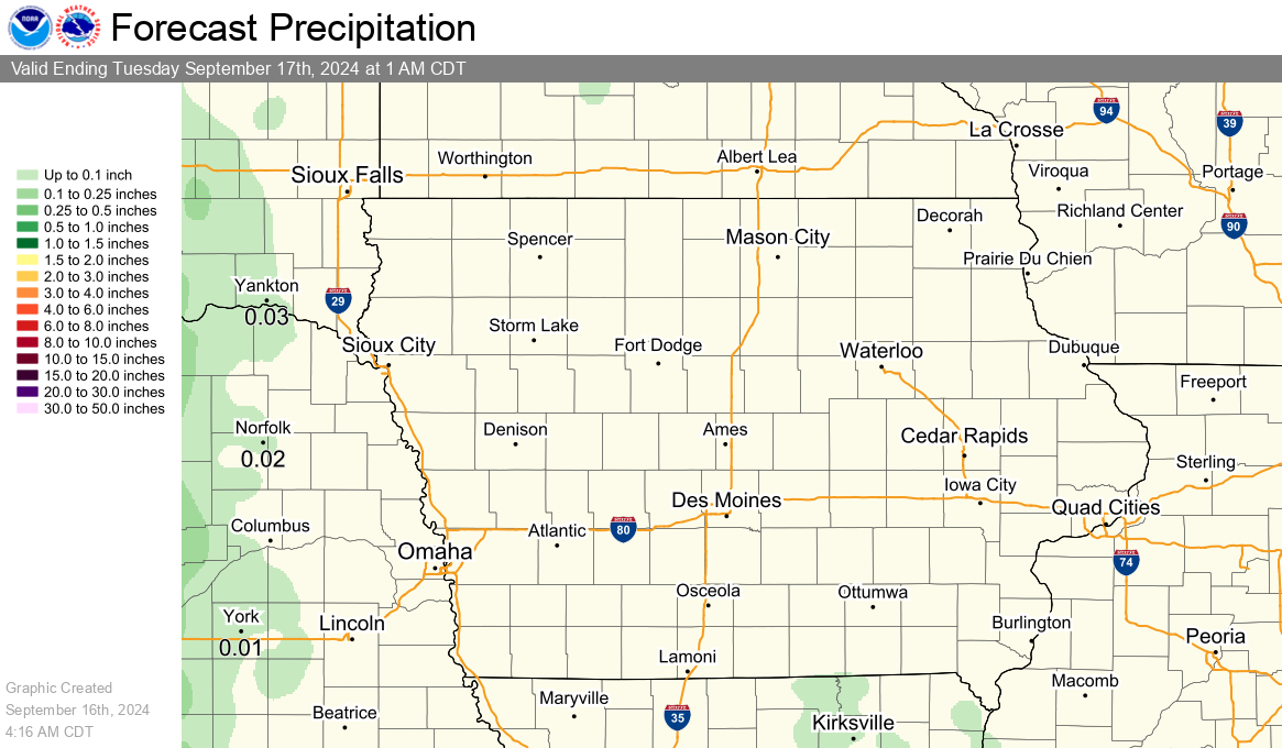
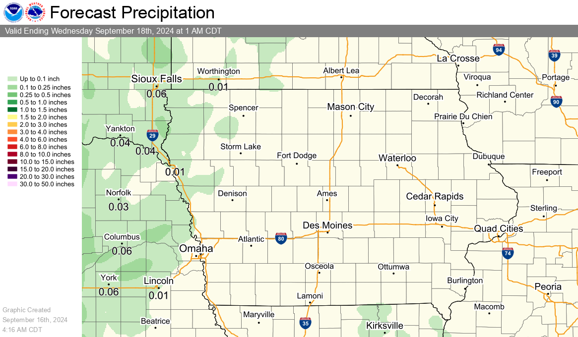
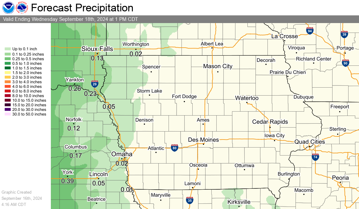
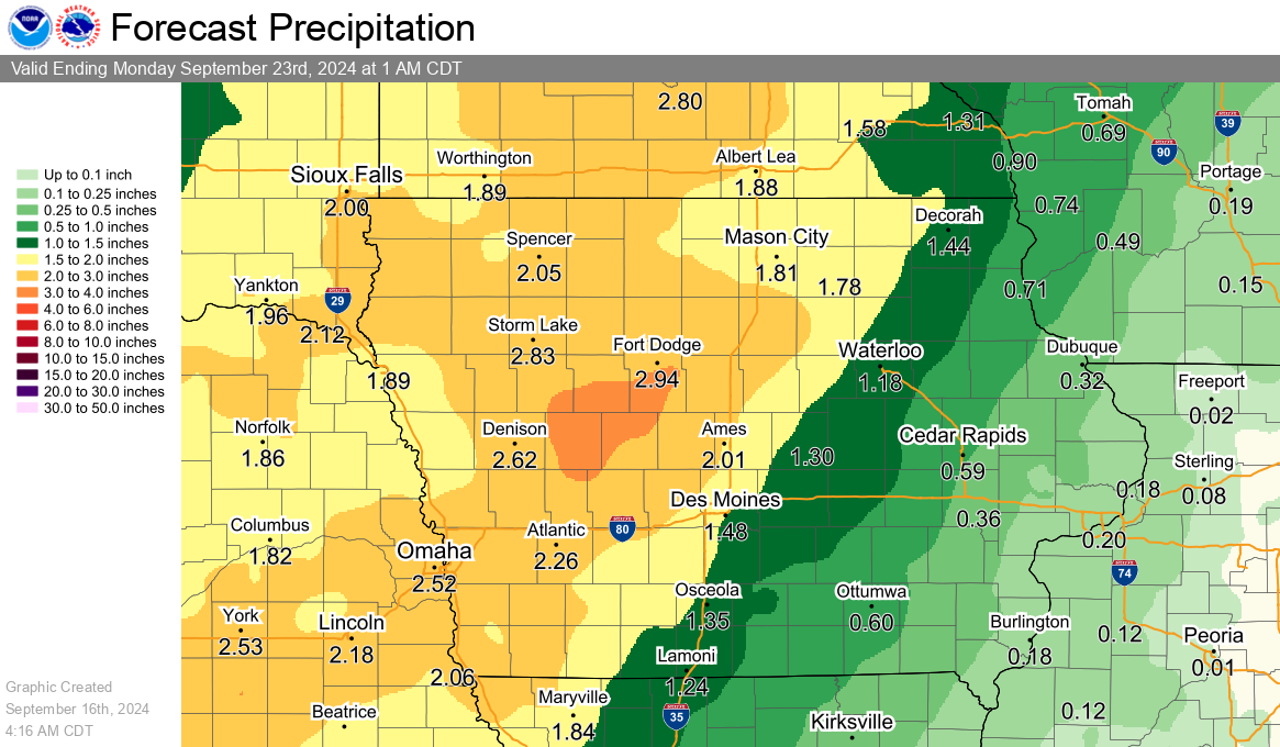
Rainfall Forecasts
Precipitation accumulation measured in six hourly periods, starting at 12am, 6am, 12pm, and 6pm CST (+1 CDT).
|
24 Hour Rainfall Forecast |
2 Day Rainfall Forecast |
|
3 Day Rainfall Forecast |
7 Day Rainfall Forecast |
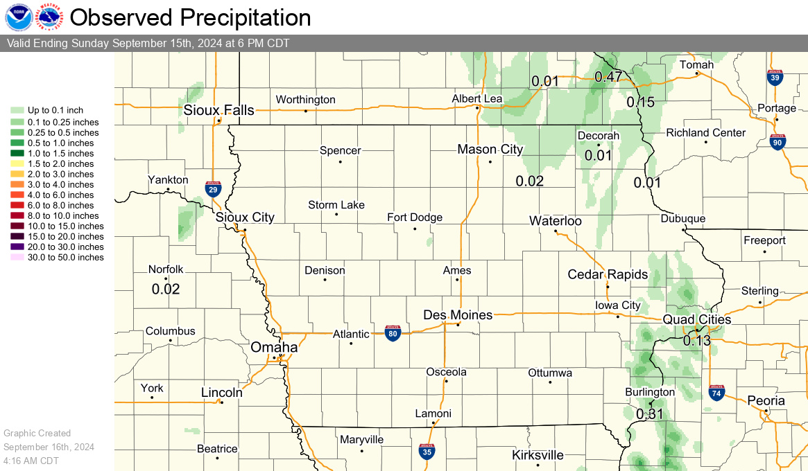
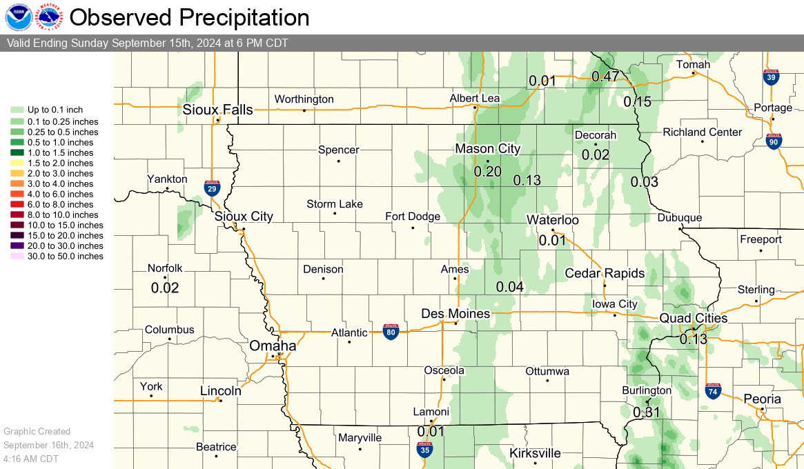
Observed Precipitation
|
Previous 24 Hours of Precipitation |
Previous 72 Hours of Precipitation |
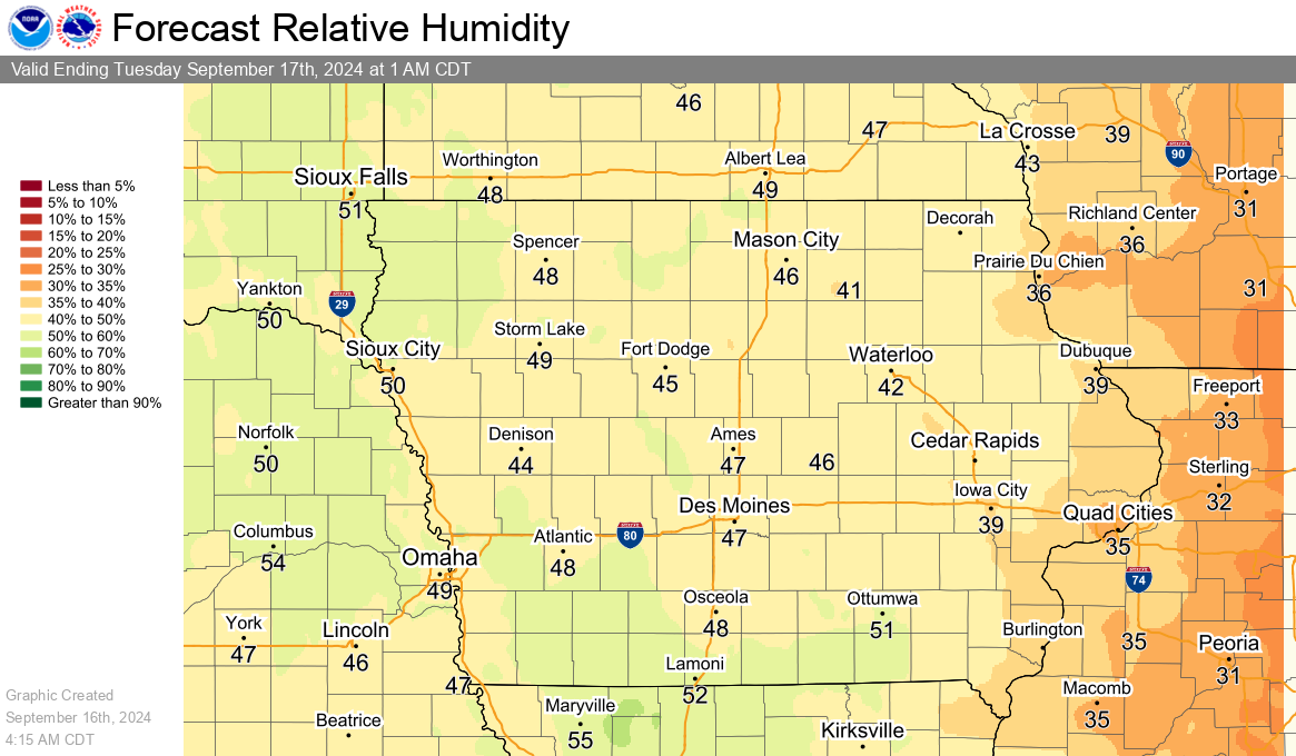
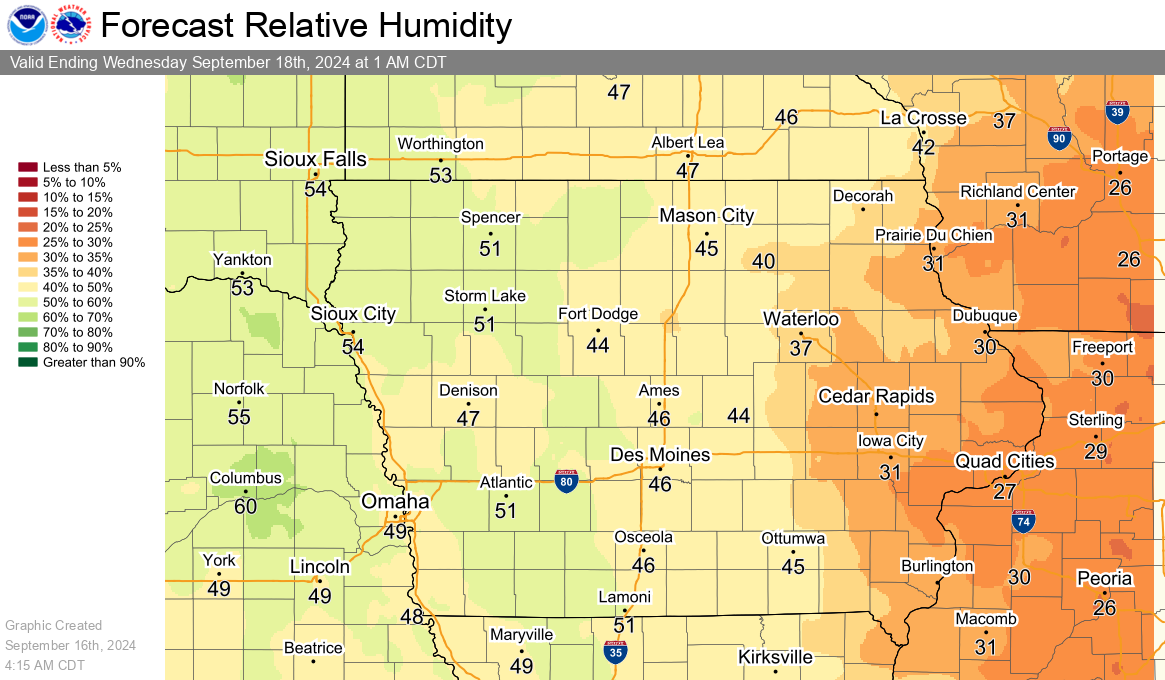
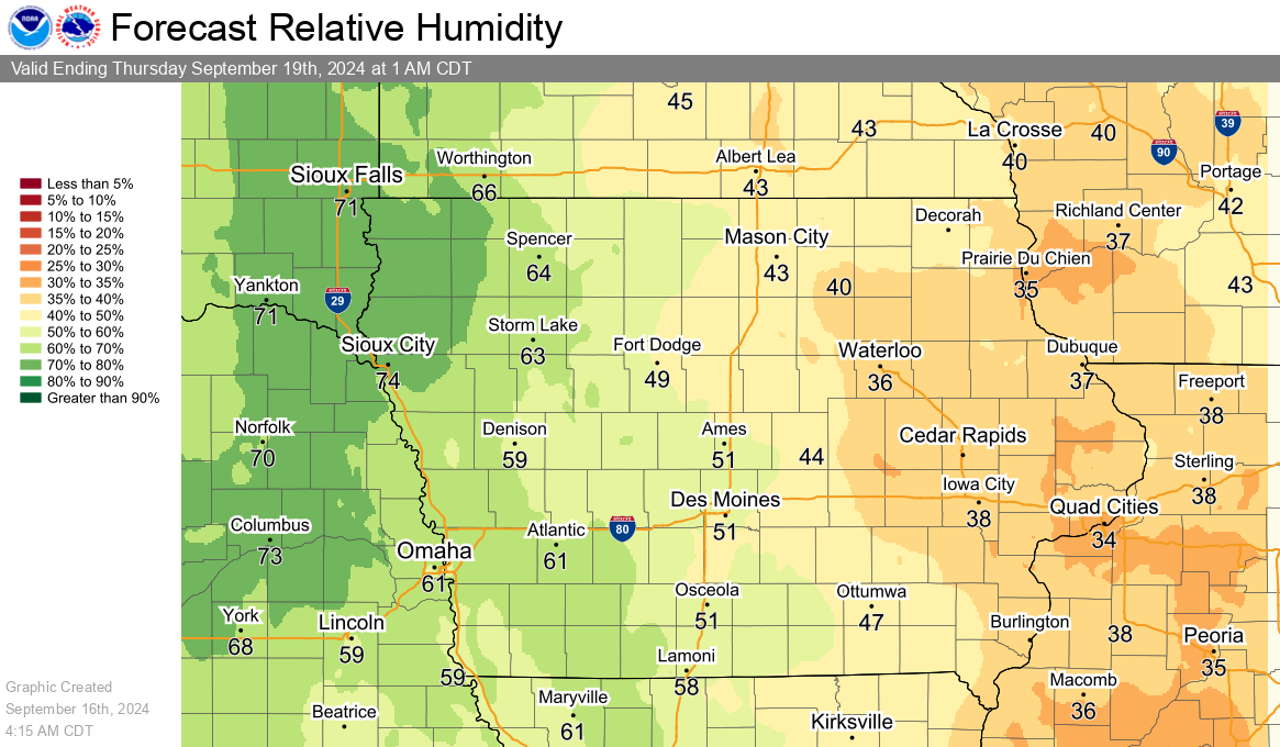
Humidity and Wind Graphics
Minimum Relative Humidity Forecasts
|
Today's Minimum Relative Humidity Forecast |
Tomorrow's Minimum Relative Humidity Forecast |
|
Day 3 Minimum Relative Humidity Forecast |
|
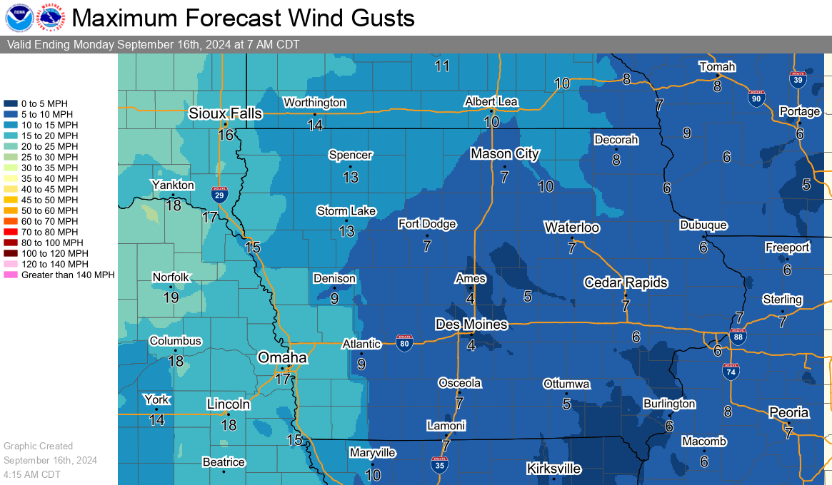
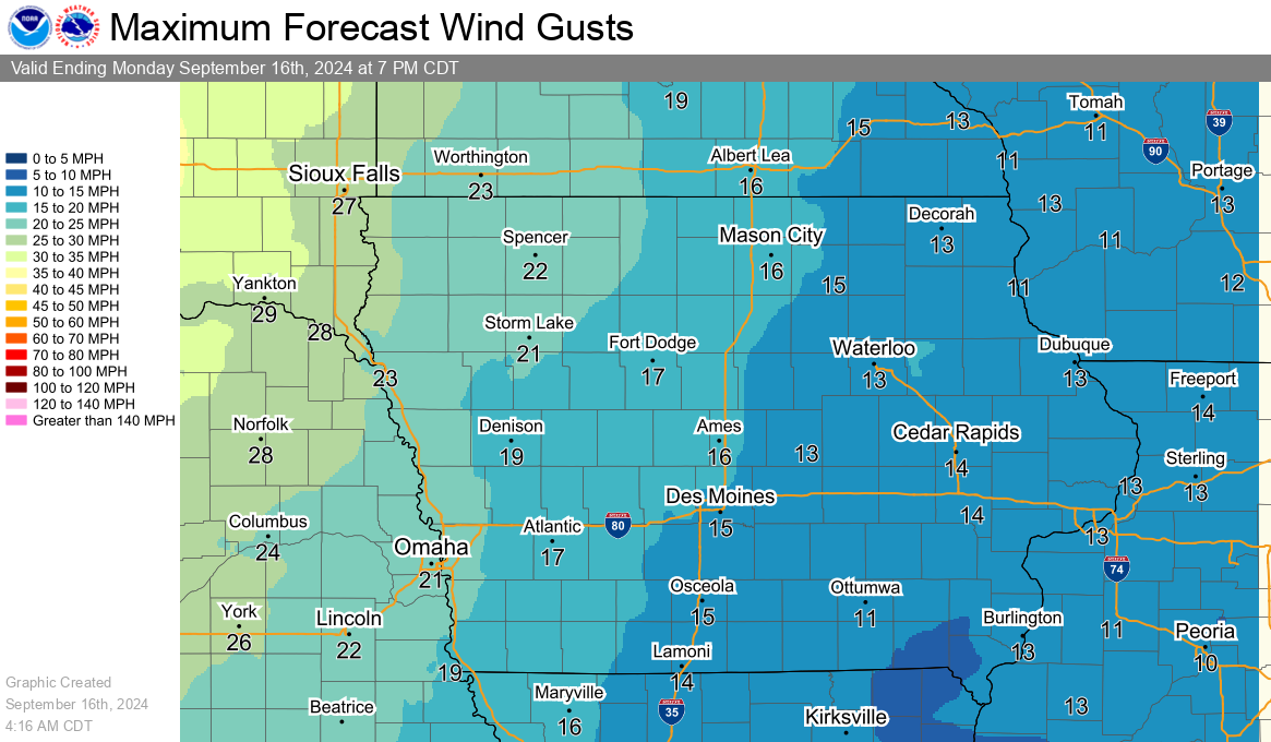
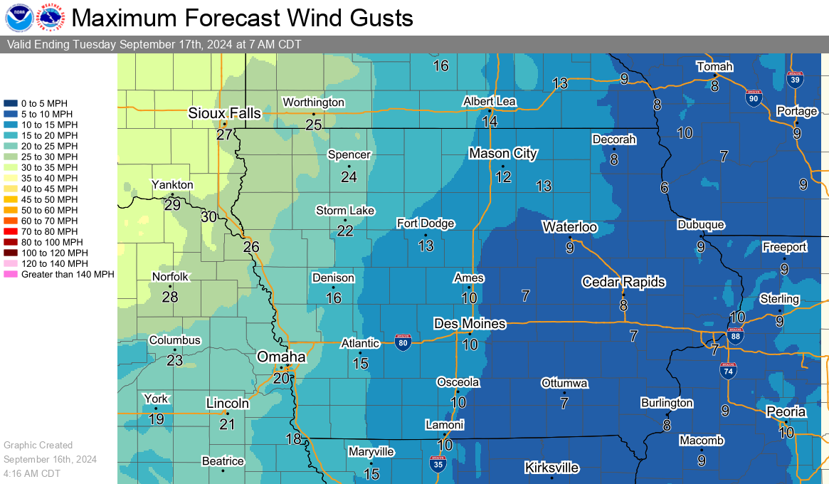
Maximum Wind Gust Forecasts
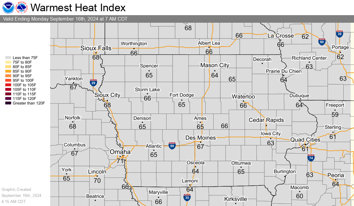
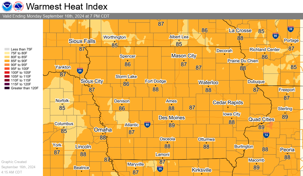
Heat Index Graphics