
A Nor'easter will create hazardous marine and coastal conditions along the Mid-Atlantic coast through mid-week, with significant coastal flooding and beach erosion possible. Meanwhile, another strong storm system is forecast to bring high winds and heavy precipitation to portions of southern Alaska. Elsewhere, relatively benign weather is expected through the first half of the work week. Read More >
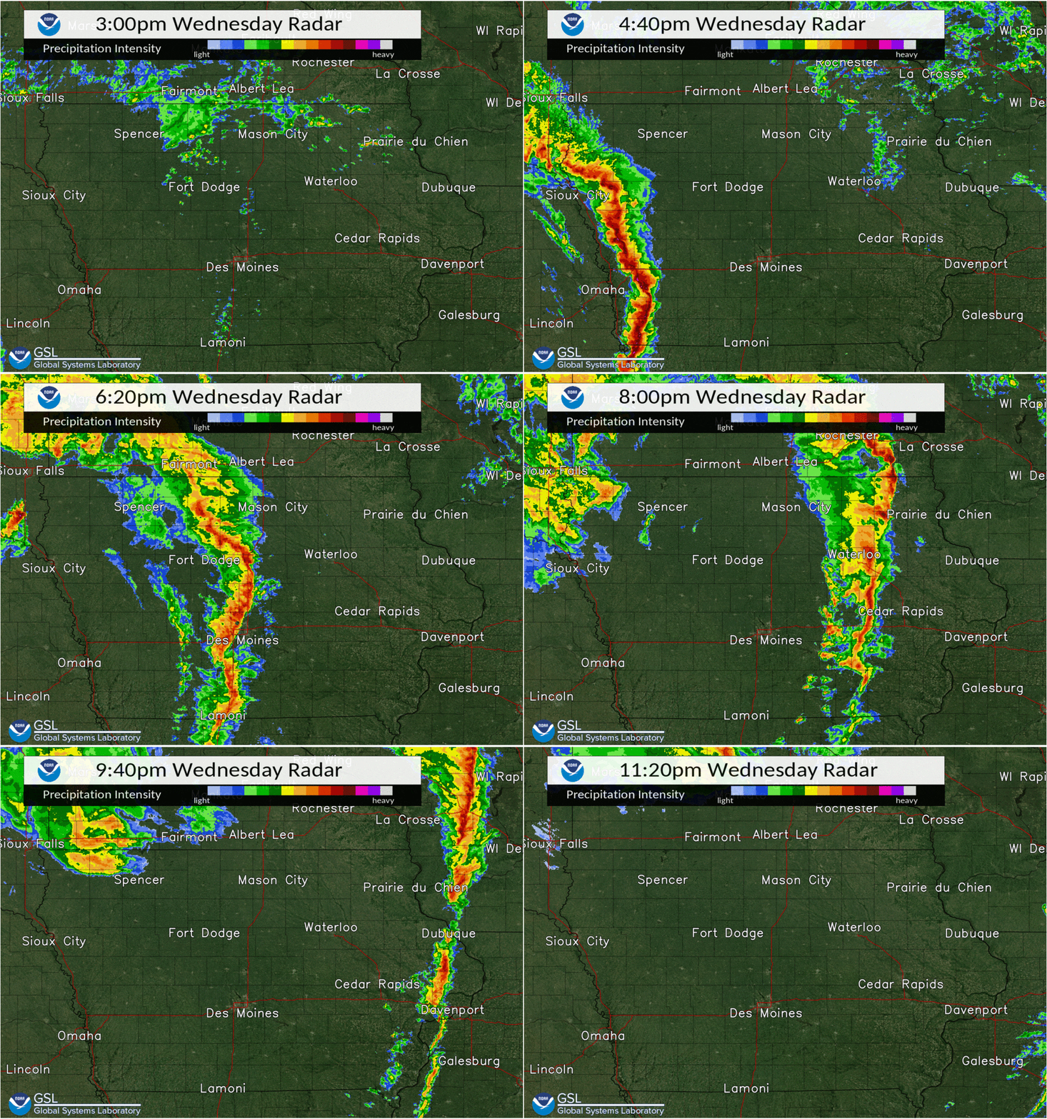
It's hard to believe that almost a year has passed (12/15) since the 2021 December Derecho struck the state of Iowa and adjacent states. Check out this link to the event review webpage and below are as some facts from this unprecedented and historic event.
Derecho FAQ's
What is a derecho?
A derecho is a widespread, long-lived wind storm associated with a band of rapidly moving showers and thunderstorms (squall line). Although a derecho can produce destruction similar to a tornado, the damage typically occurs in one direction along a relatively straight swath (sometimes referred to as "straight-line wind damage").
How strong are derecho winds?
A derecho must include wind gusts of at least 58 mph or greater along most of its length.
What is the criteria to be classified as a derecho?
A nearly continuous damage path over a swath of at least ~400 miles in length AND ~60 miles in width.
Where does the term DERECHO come from?
A Spanish word meaning "straight ahead" or "direct" coined in 1877 by Gustavus Hinrichs, University of Iowa physics professor. The term was created to discriminate in wind damage caused by tornadoes.
How often do DERECHOES impact Iowa?
On average, a derecho impacts a portion of Iowa every 1-2 years.
More Derecho Facts can be found on the Storm Prediction Center's Webpage HERE.
Interviews requests can be directed to the National Weather Service at nws.desmoines@noaa.gov or by phone at (515) 270-2614.


 Follow us on X
 Follow us on Facebook
 Follow us on YouTube
 DMX RSS Feed