Overview
|
Most images on this page can be expanded with a single left click and returned to original size with a second left click. Western Florida experienced one of its more significant tornado events during the evening of October 11th through the morning of October 12th. Six tornadoes affected the area, with 2 of them being significant (rated EF-2 or stronger) with maximum estimated winds of 115 and 125 mph. The first of the significant tornadoes moved across Pinellas County near Clearwater Beach and Dunedin, and the other near Crystal River in Citrus County. Elsewhere, EF-0 tornadoes affected Sarasota and Pasco counties, and another 2 hit parts of Pinellas County separate from the EF-2. The 6 total confirmed tornadoes represents the 8th most tornadoes in any single event for the area, and the event is tied for 15th when ranking events by total number of tornadoes. Fortunately, no fatalities or significant injuries were reported, which is especially remarkable given the strength of the tornadoes and the fact that most of them occurred during the overnight hours. |
||
|
Infrared Satellite
|
Radar Loop 10/11-12/2023
|
|
Tornadoes
|
Sarasota Tornado
|
||||||||||||||||||||||
|
|
||||||||||||||||||||||
|
Oldsmar Tornado
|
||||||||||||||||||||||
|
|
||||||||||||||||||||||
|
Clearwater Beach→Dunedin Tornado
|
||||||||||||||||||||||
|
|
||||||||||||||||||||||
|
Crystal River Tornado
|
||||||||||||||||||||||
|
|
||||||||||||||||||||||
|
Trinity Tornado
|
||||||||||||||||||||||
|
|
||||||||||||||||||||||
|
Belleair Tornado
|
The Enhanced Fujita (EF) Scale classifies tornadoes into the following categories:
| EF0 Weak 65-85 mph |
EF1 Moderate 86-110 mph |
EF2 Significant 111-135 mph |
EF3 Severe 136-165 mph |
EF4 Extreme 166-200 mph |
EF5 Catastrophic 200+ mph |
 |
|||||
Photos
Clearwater Beach → Dunedin EF-2 Tornado:
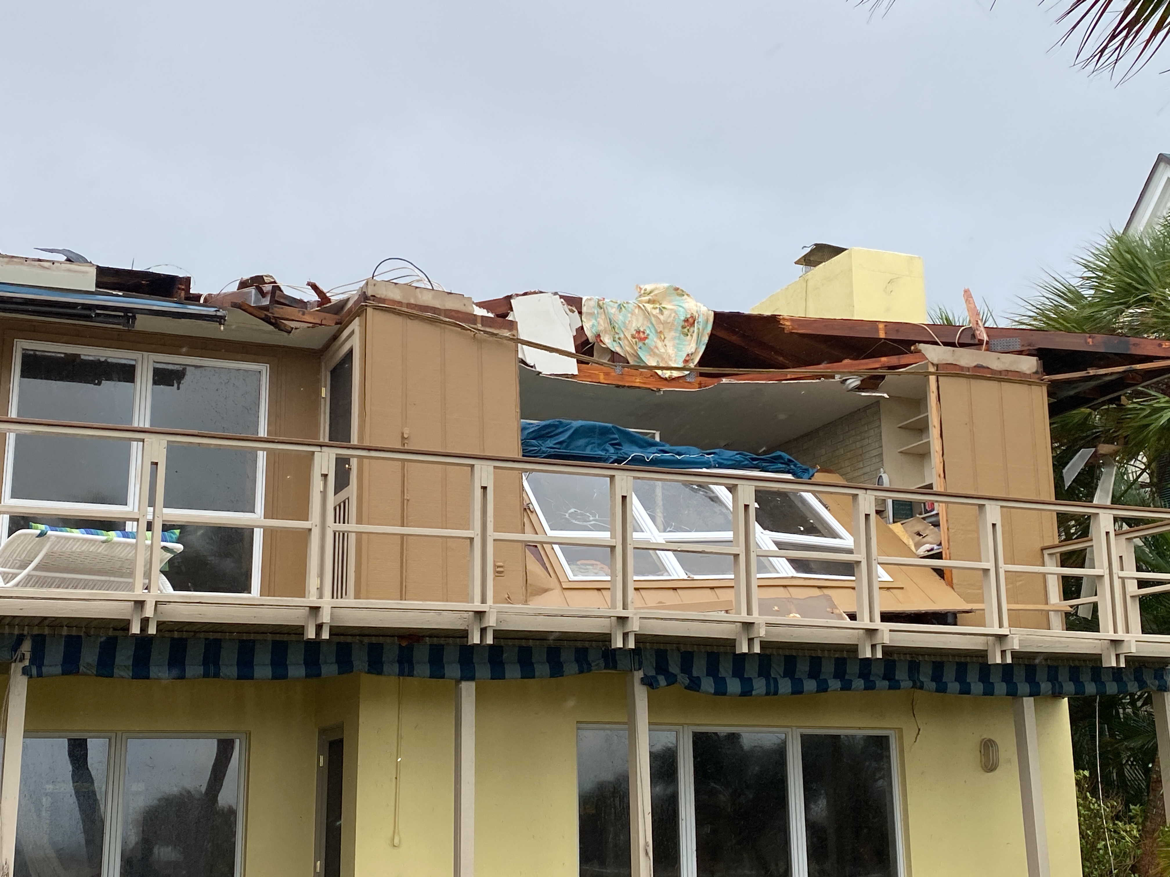 |
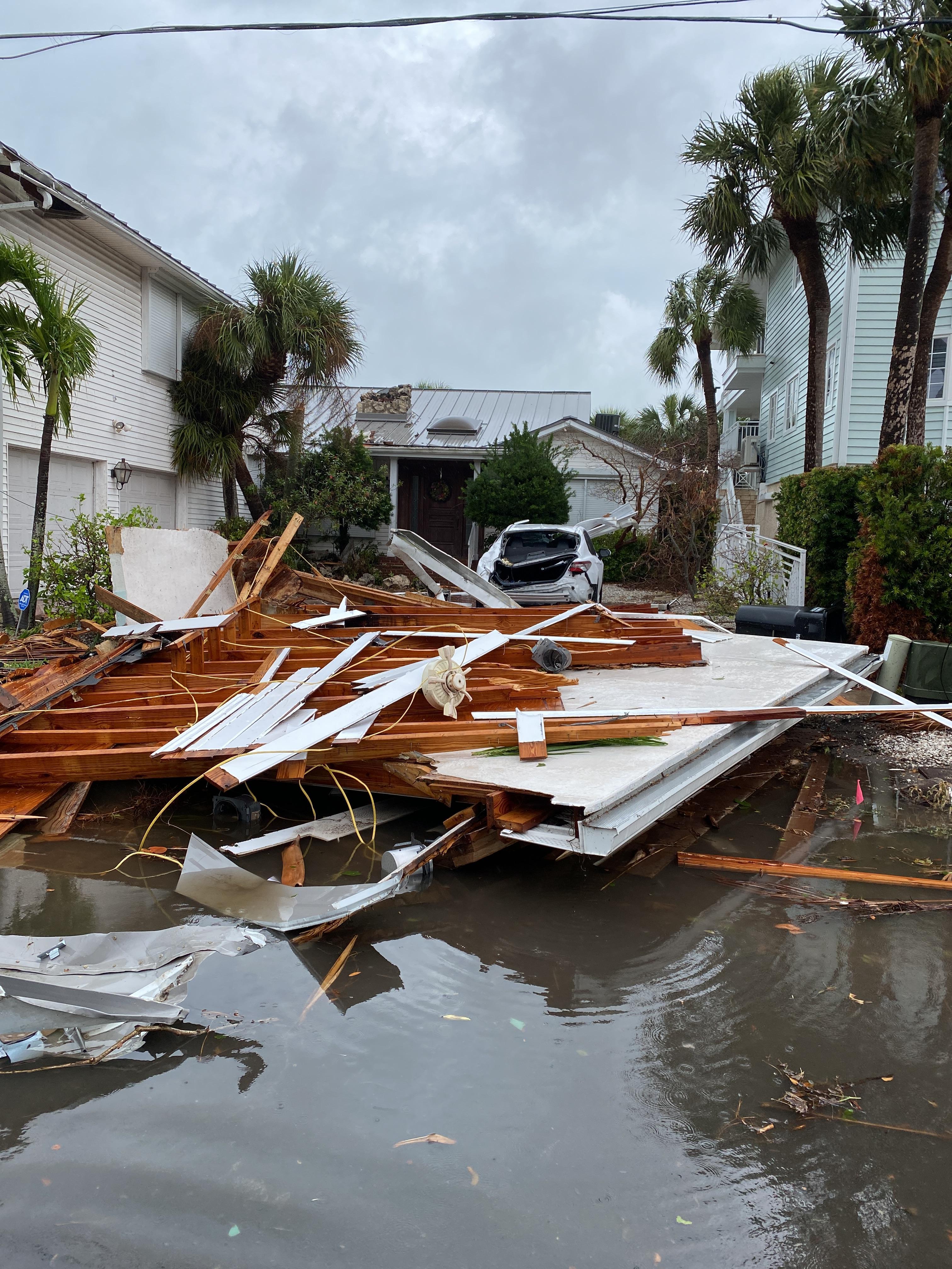 |
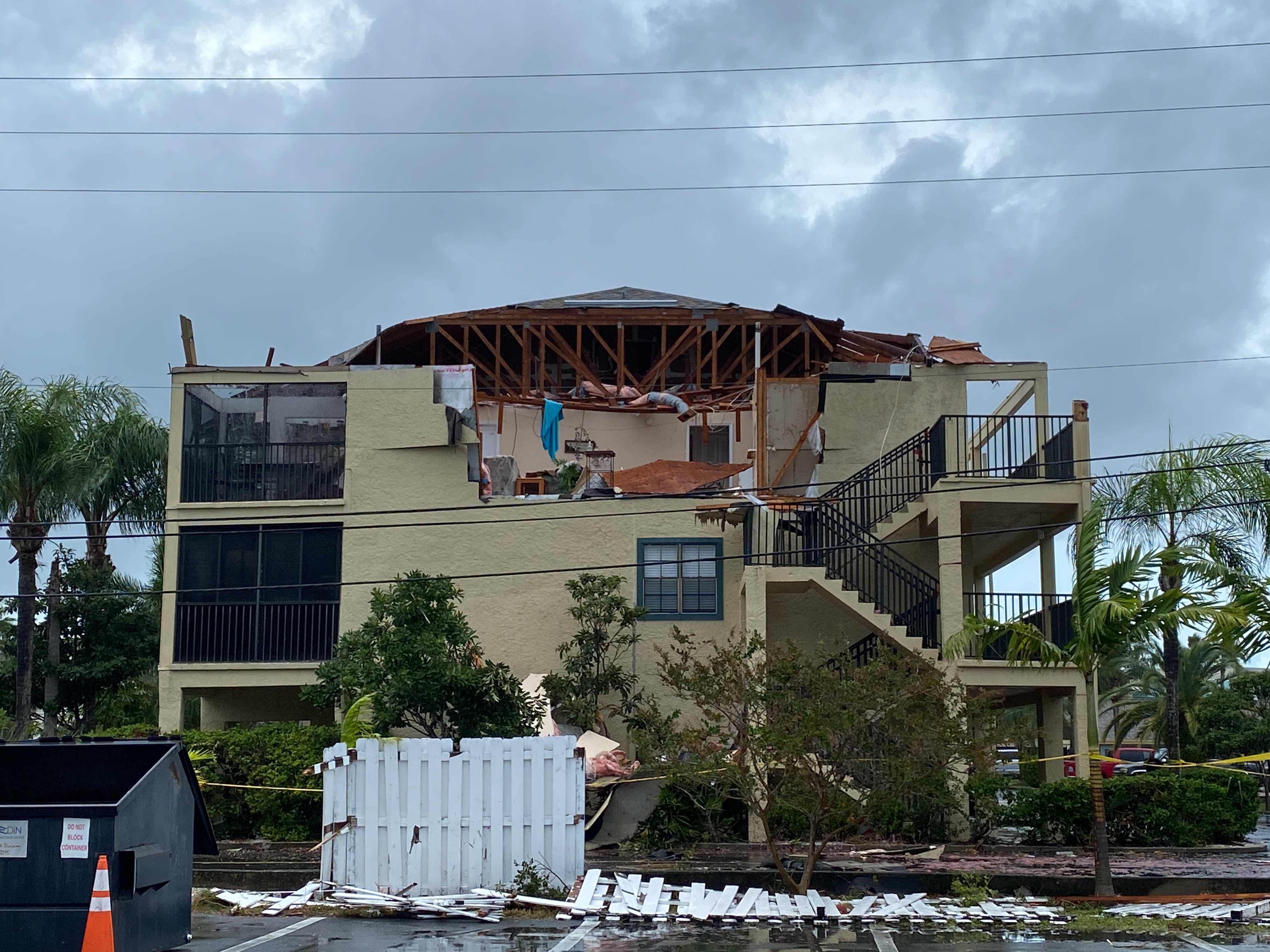 |
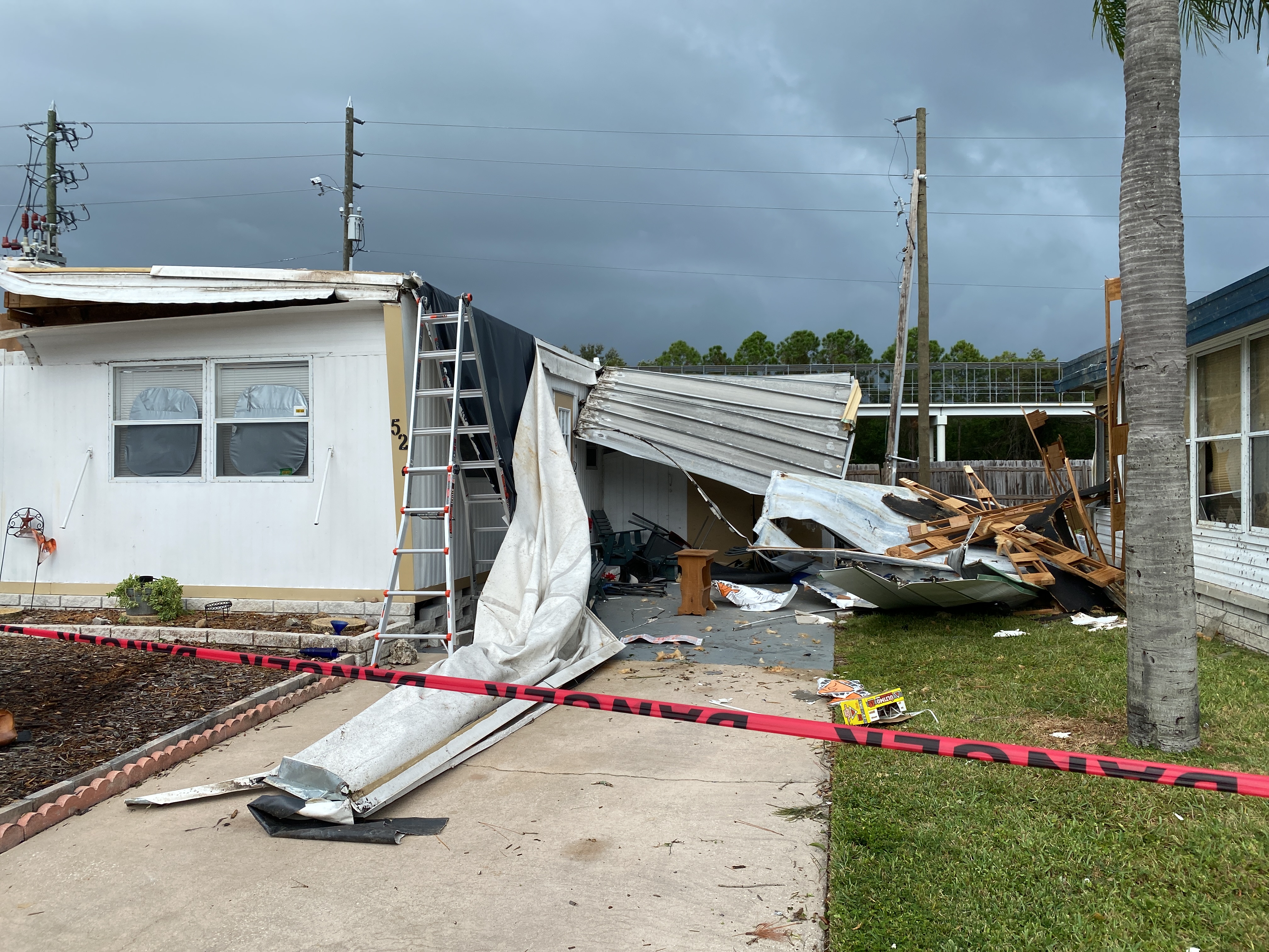 |
| Photo Credit: NWS Tampa Bay | Photo Credit: NWS Tampa Bay | Photo Credit: NWS Tampa Bay | Photo Credit: NWS Tampa Bay |
Crystal River EF-2 Tornado:
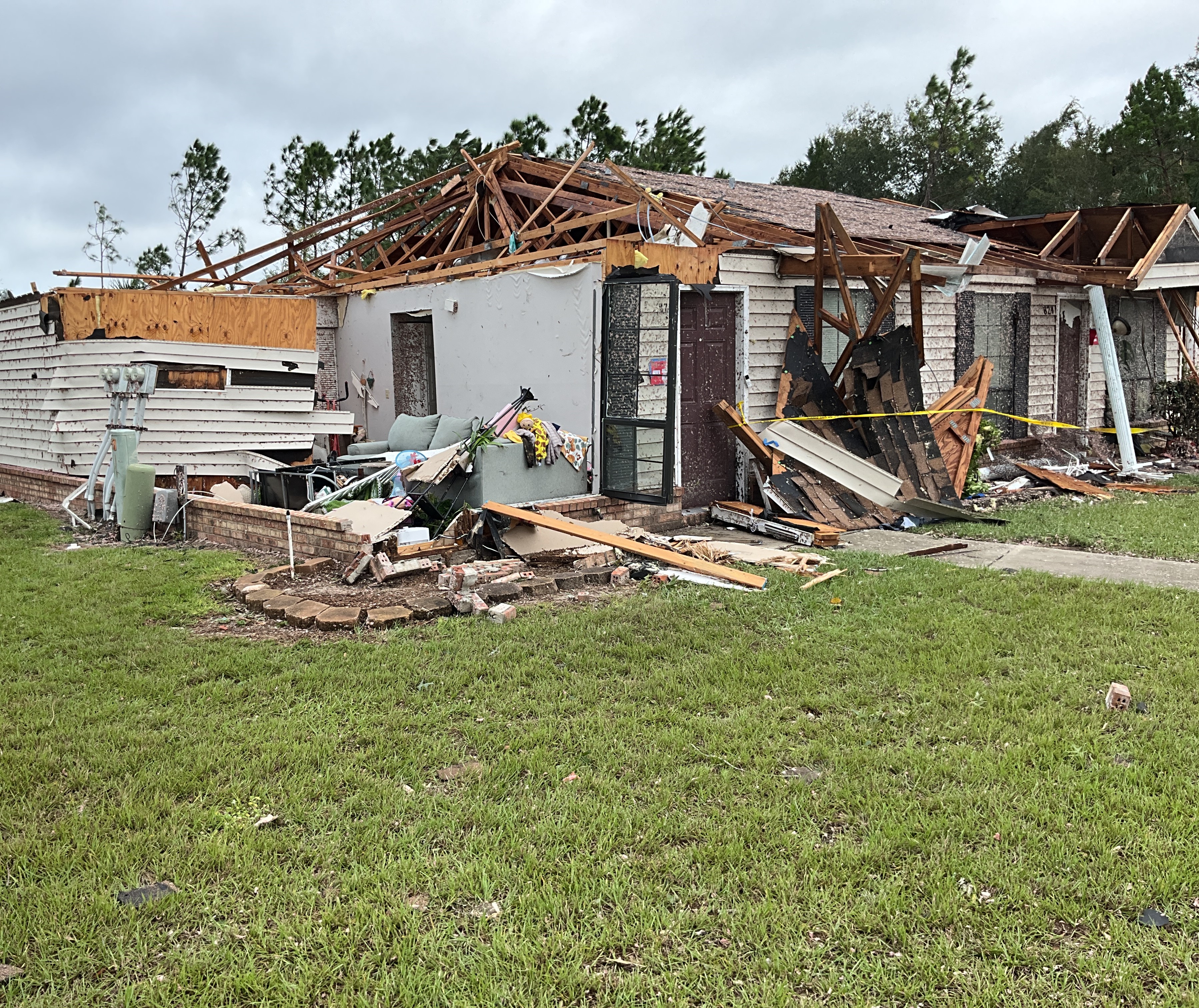 |
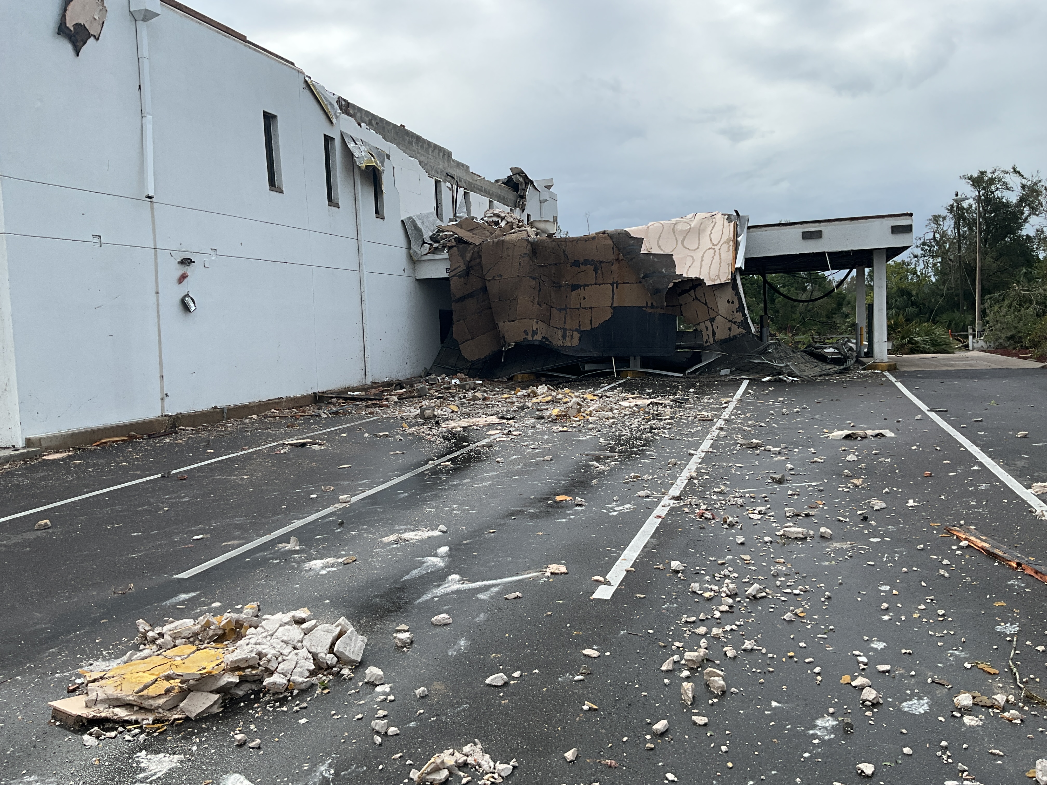 |
| Photo Credit: NWS Tampa Bay | Photo Credit: NWS Tampa Bay |
Radar:
Below is a radar loop from 8 PM EDT on October 11, 2023 to 4 AM EDT October 12, 2023, showing the Base Reflectivity and Velocity during the peak of the event.
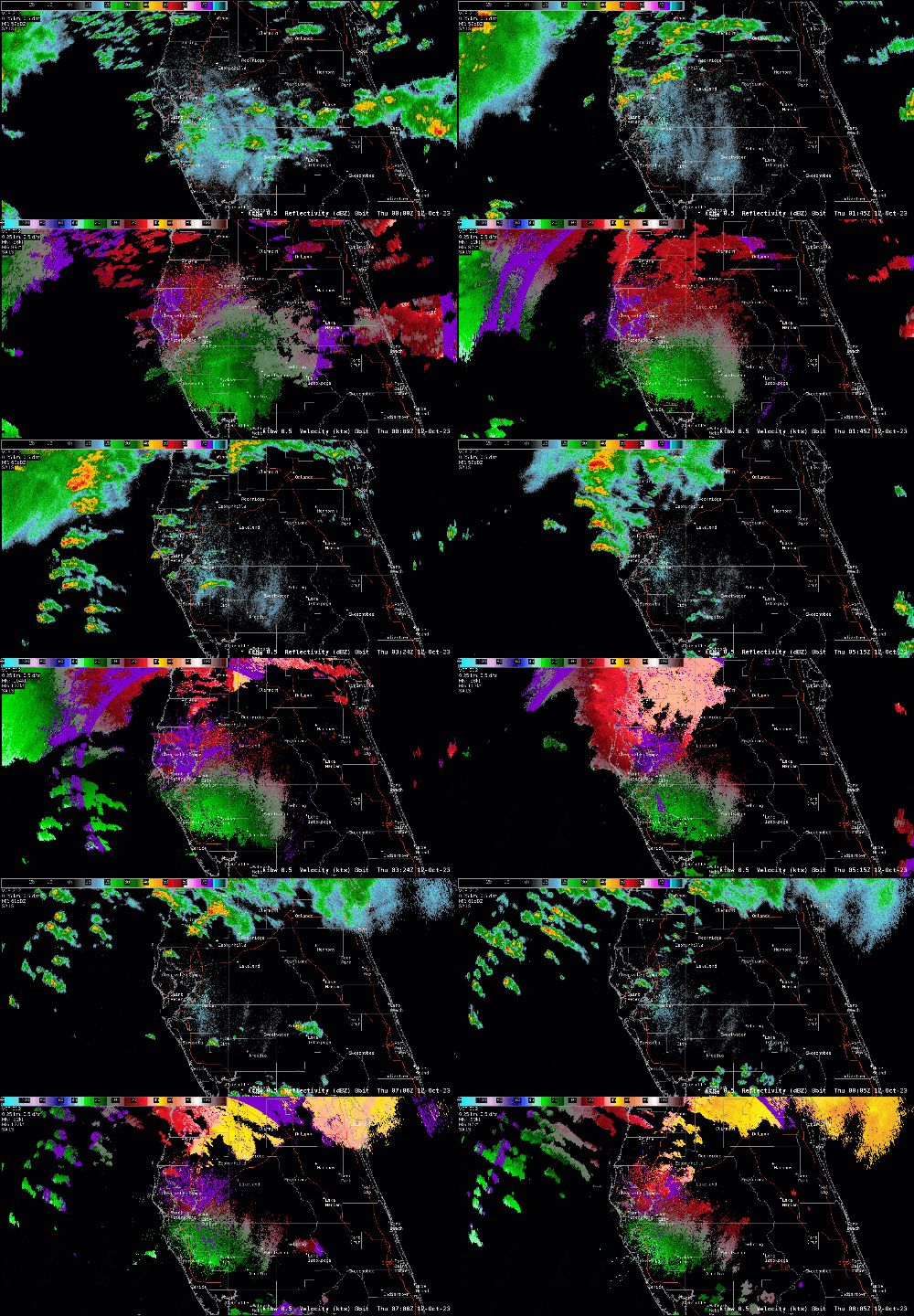 |
| KTBW WSR-88D Radar 0.5 degree elevation of Reflectivity and Velocity |
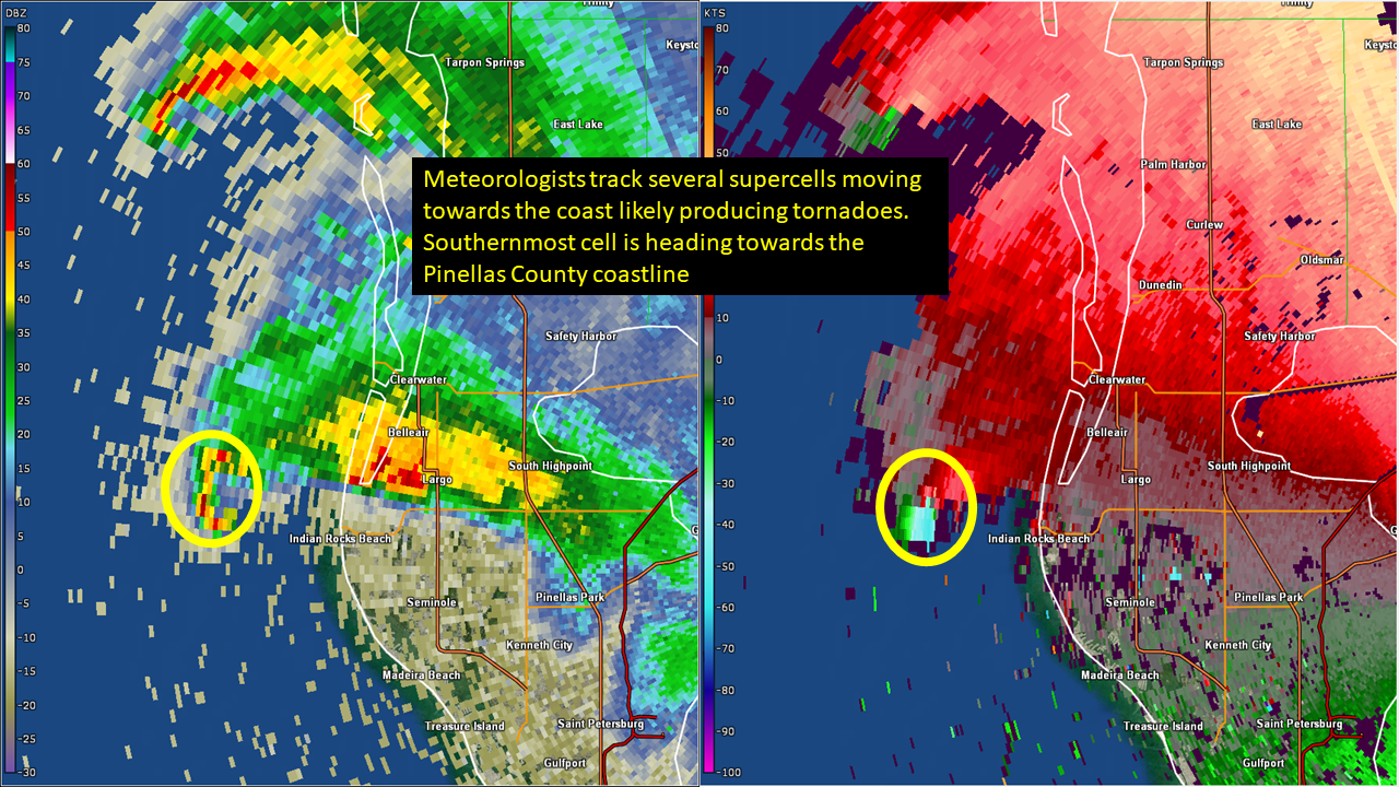
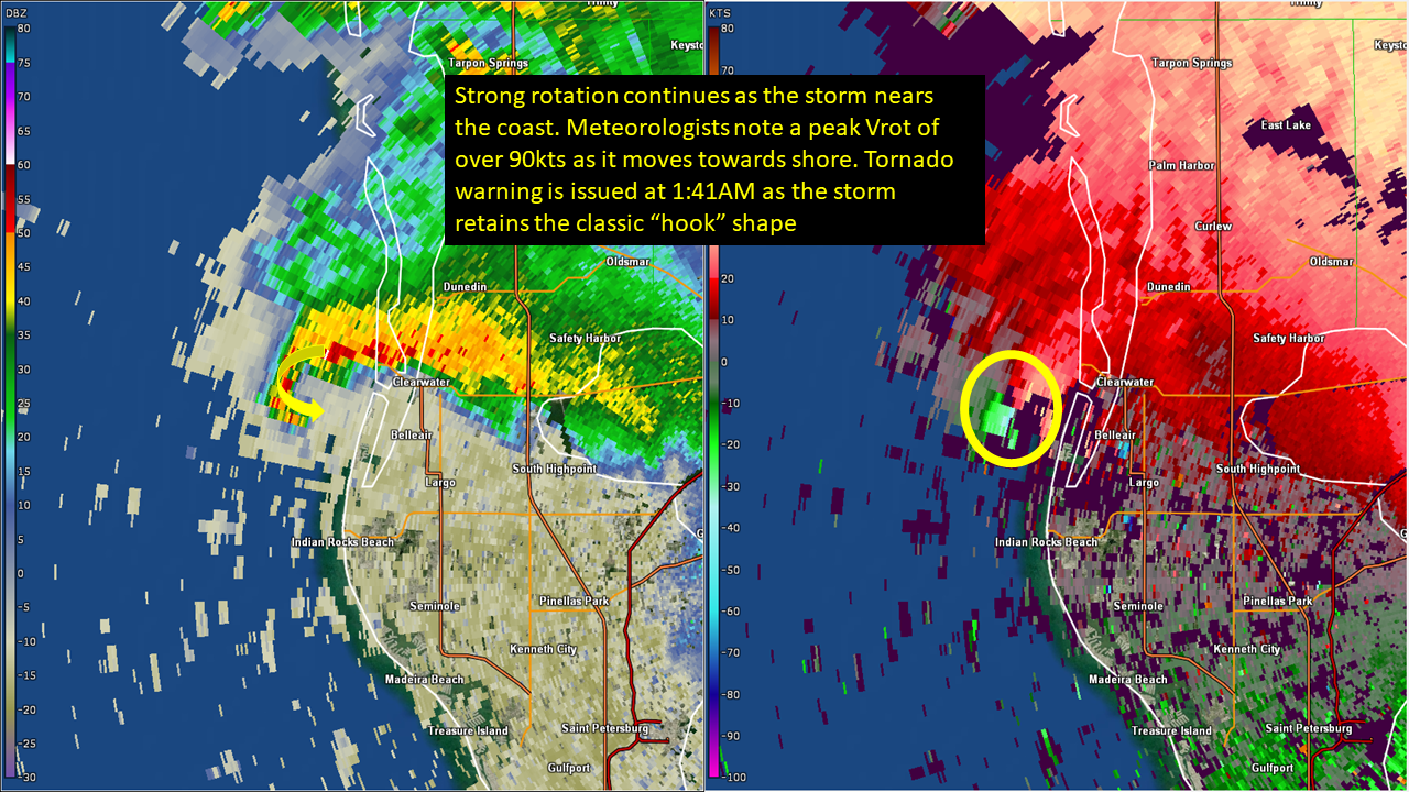
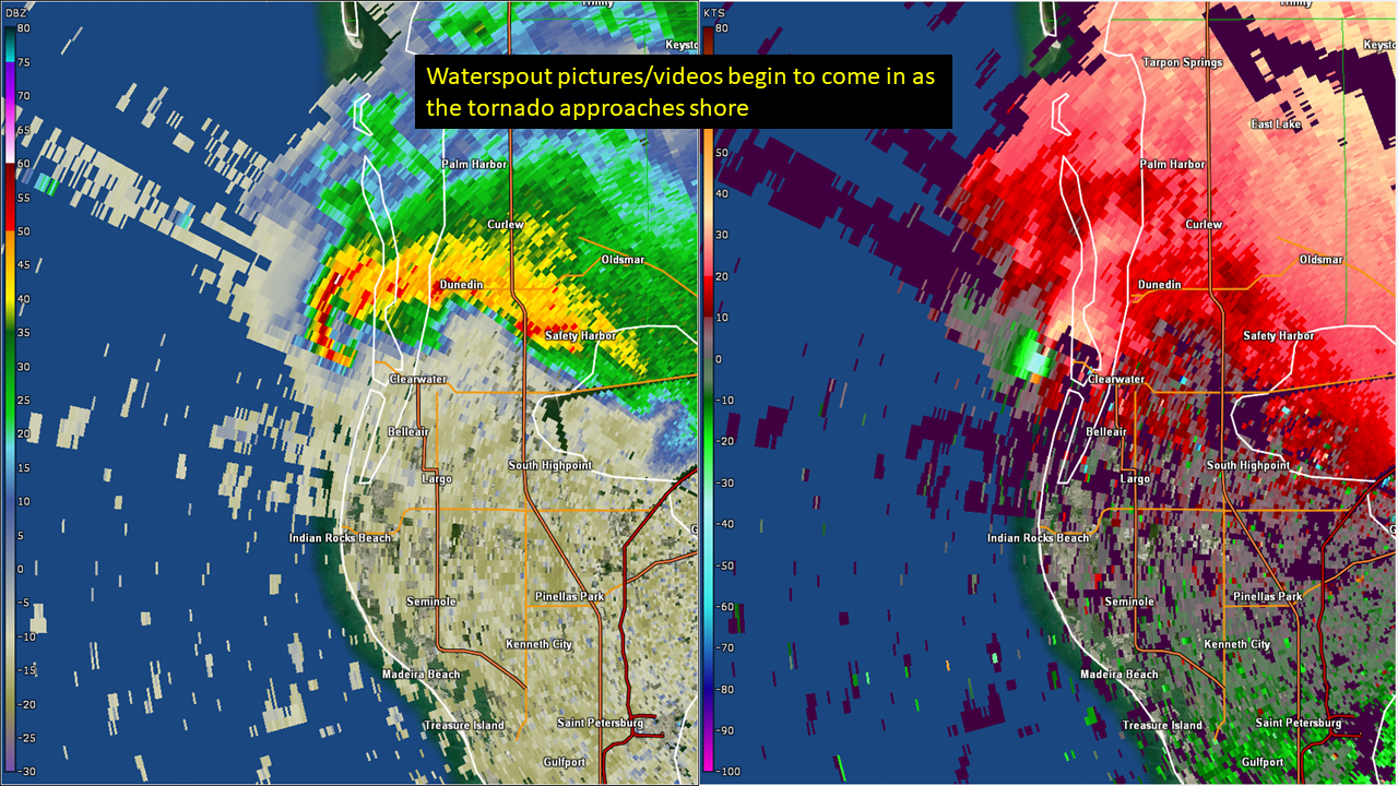
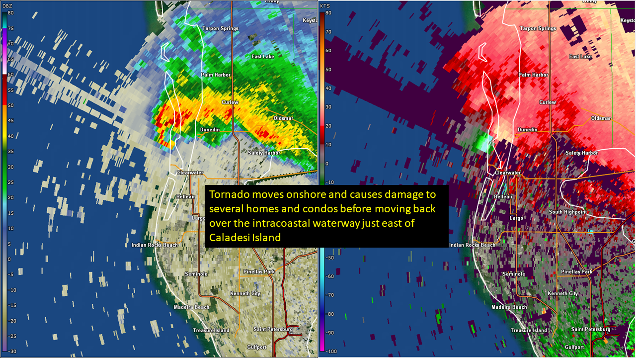
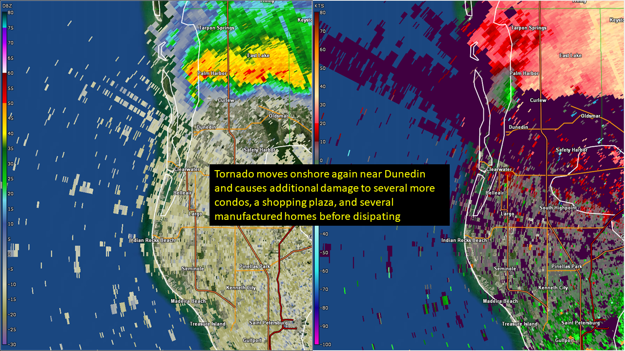
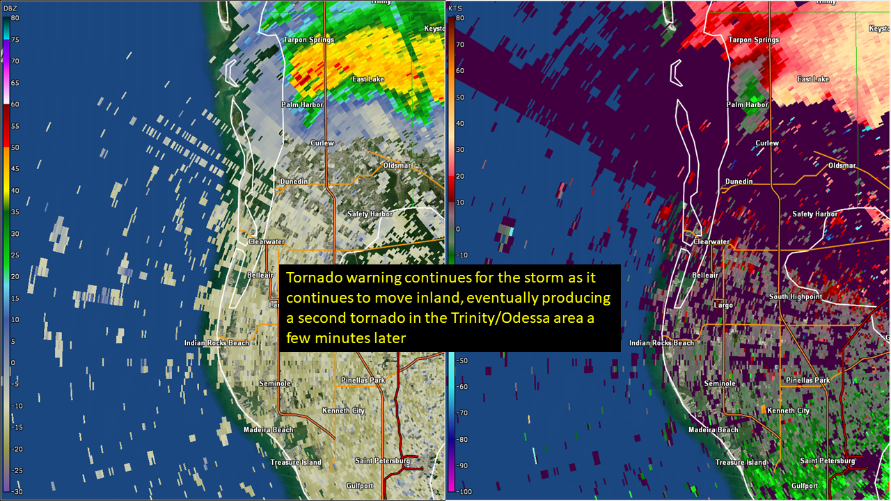
Clearwater Beach→Dunedin - Pinellas County - October 12, 2023:
 |
 |
 |
 |
 |
 |
|
TTPA Terminal Doppler Radar 0.3° elevation: Reflectivity & Storm Relative Velocity |
|||||
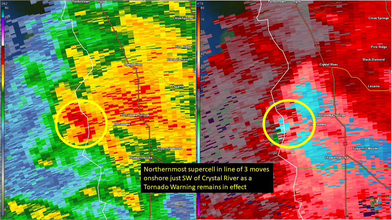
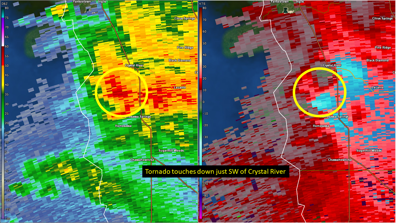
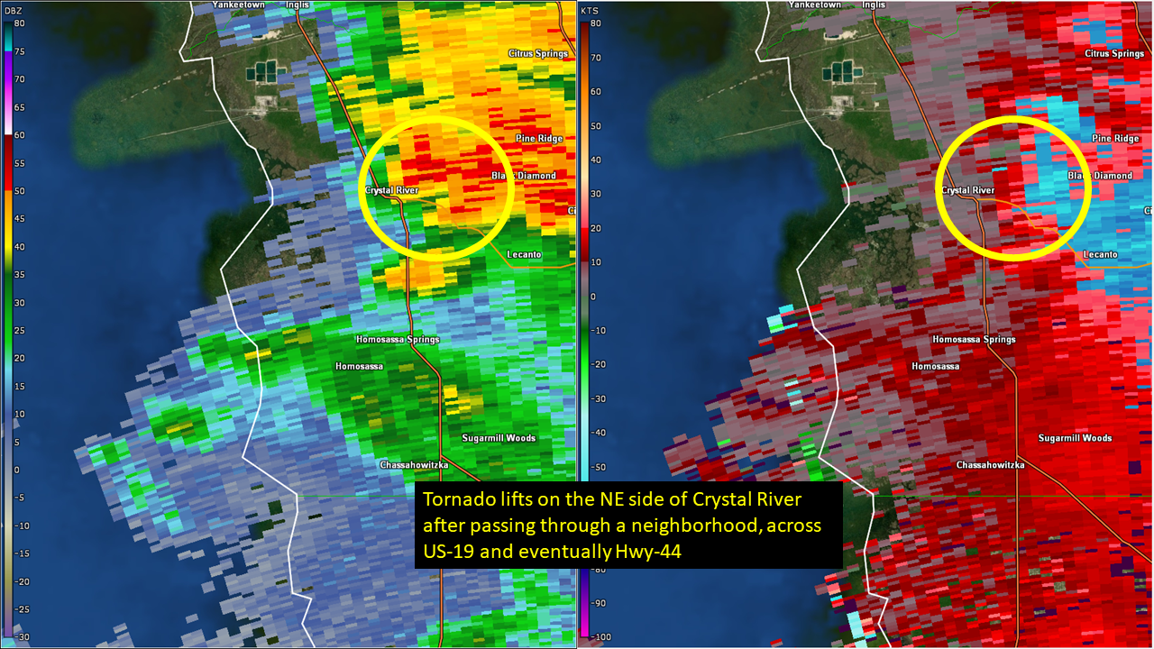
Crystal River - Citrus County - October 12, 2023:
 |
 |
 |
|
KTBW WSR-88D Radar 0.5° elevation: Reflectivity & Storm Relative Velocity |
||
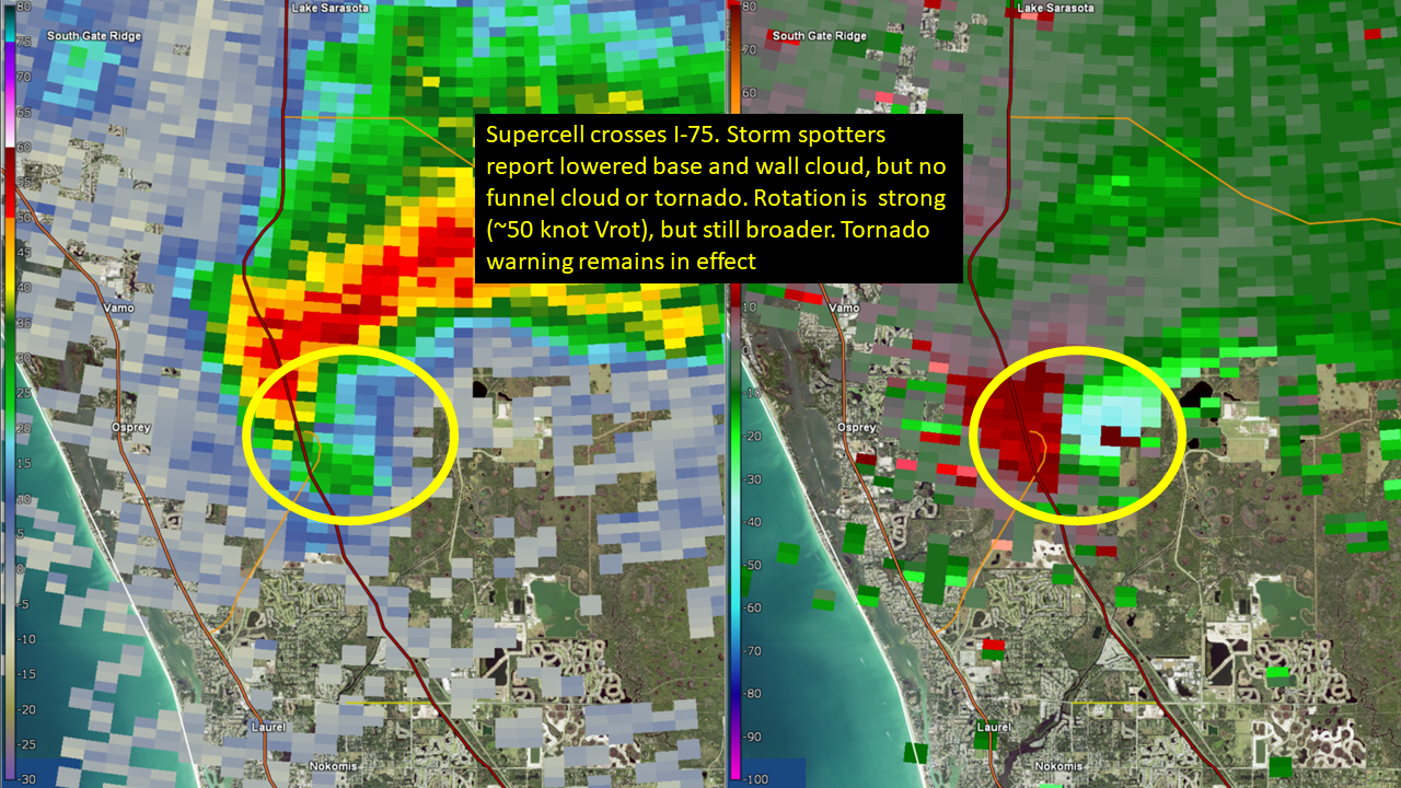
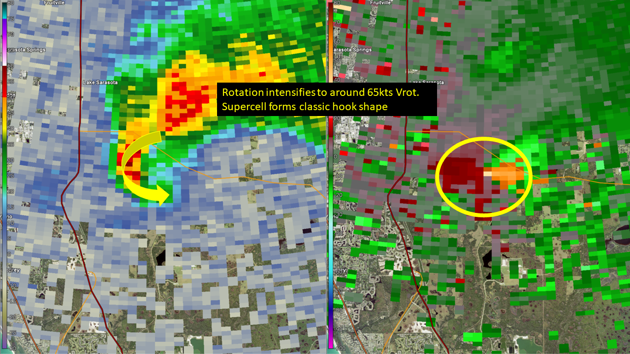
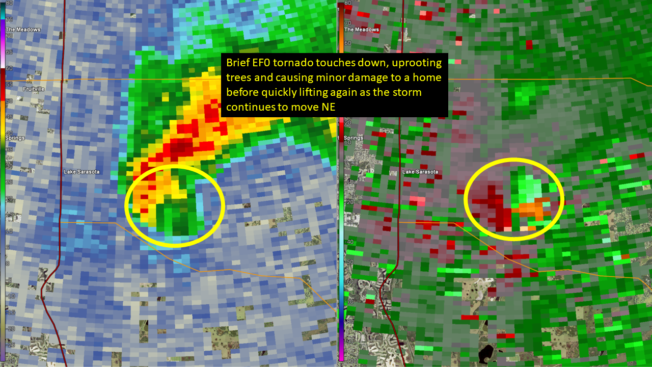
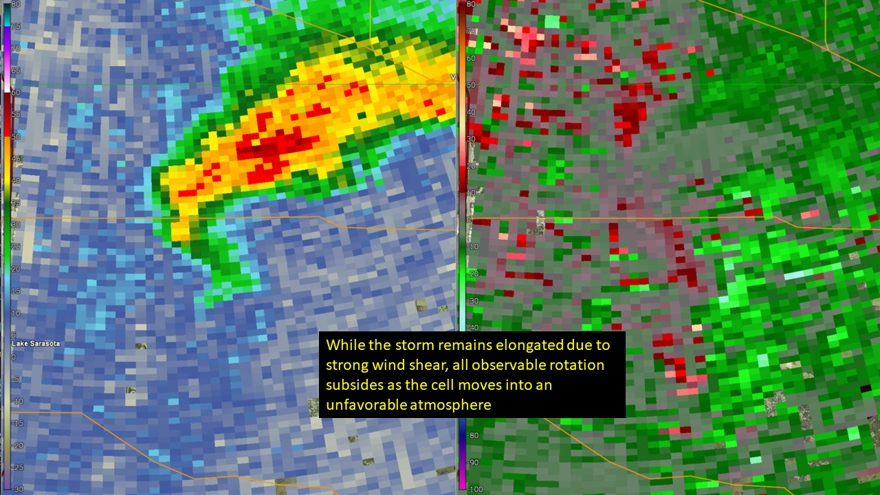
Sarasota - Sarasota County - October 11, 2023:
 |
 |
 |
 |
|
KTBW WSR-88D Radar 0.5° elevation: Reflectivity & Storm Relative Velocity |
|||
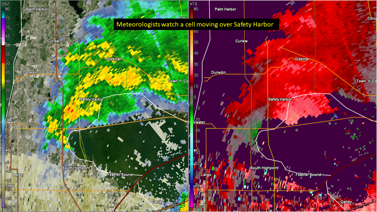
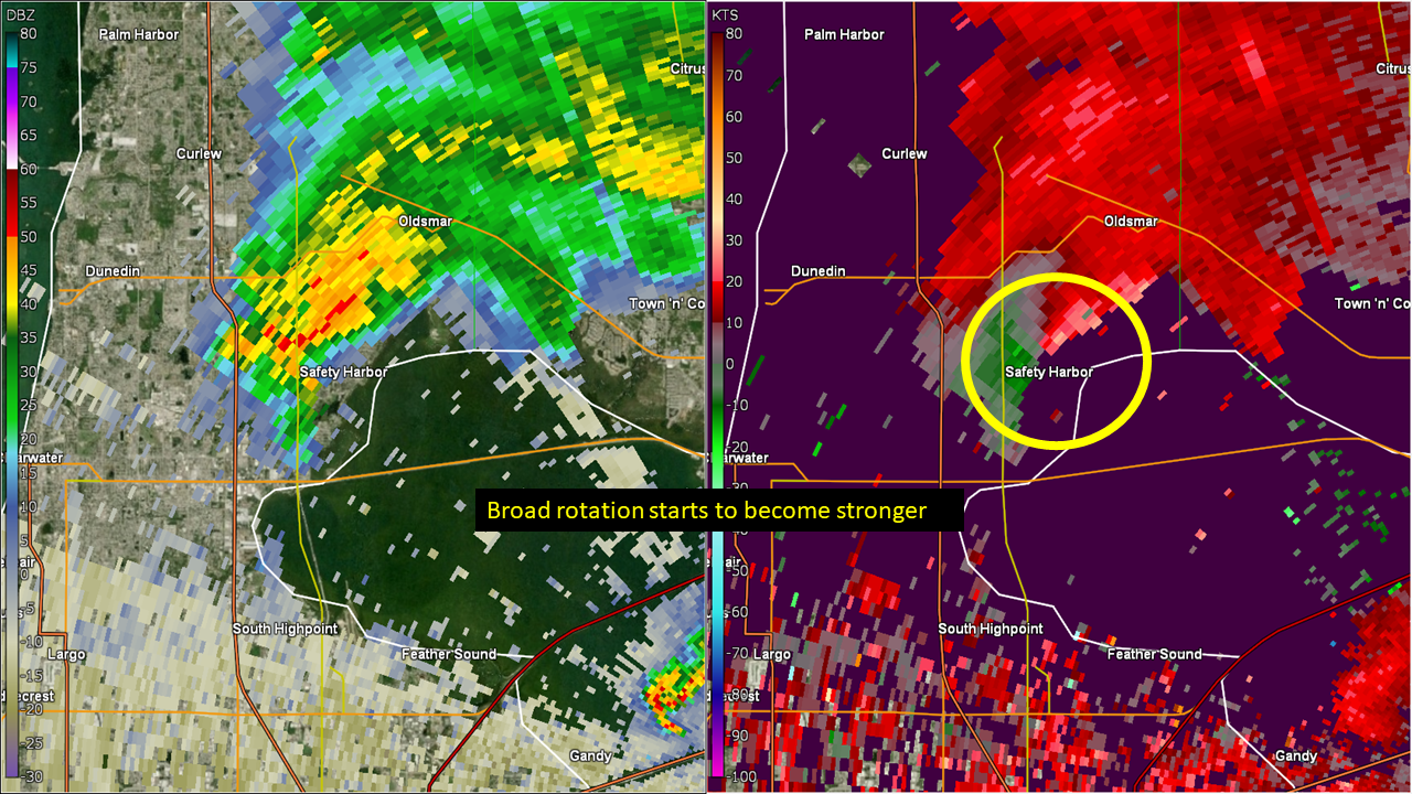
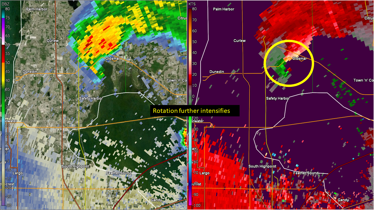
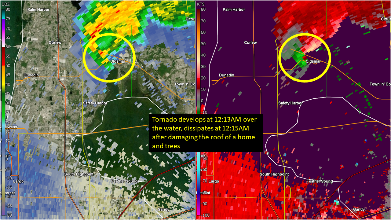
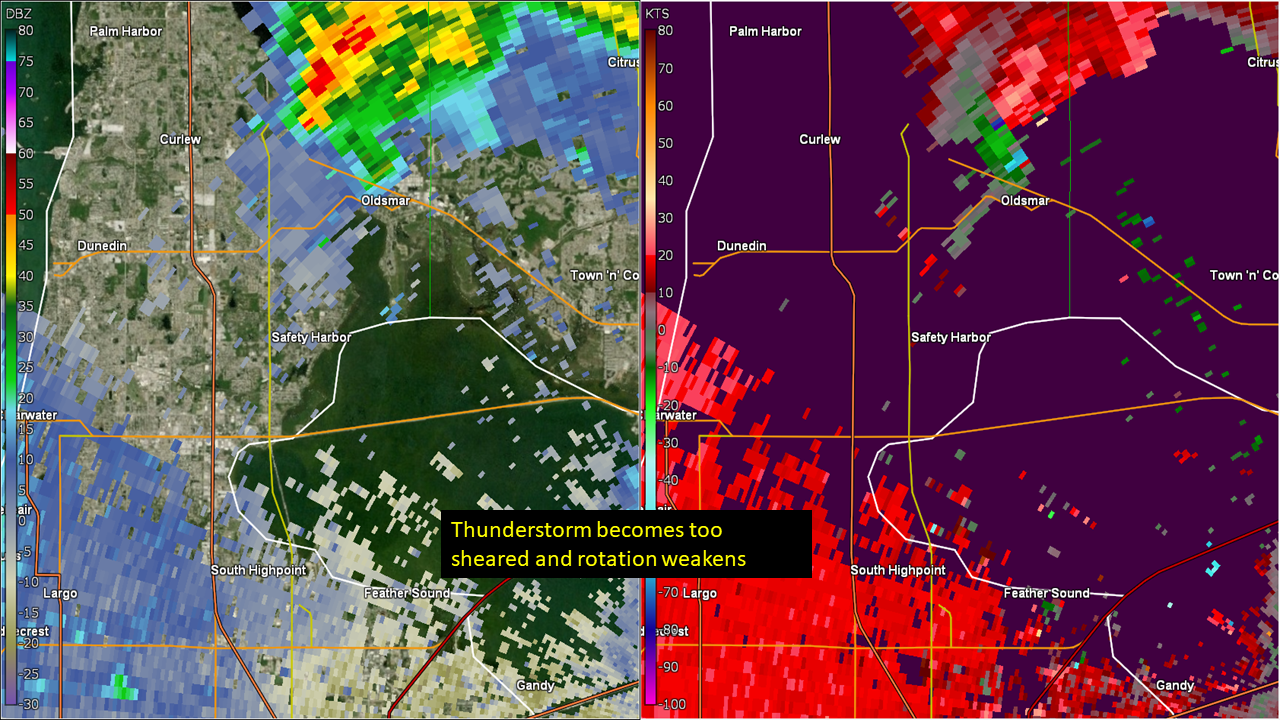
Oldsmar - Pinellas County - October 12, 2023:
 |
 |
 |
 |
 |
|
TTPA Terminal Doppler Radar 0.3° elevation: Reflectivity & Storm Relative Velocity |
||||
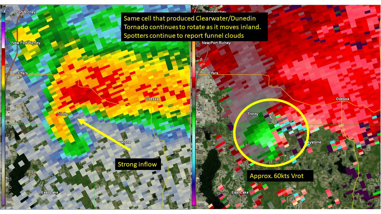
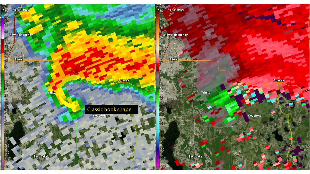
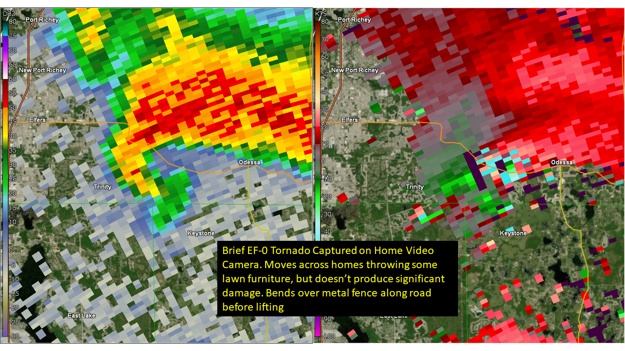
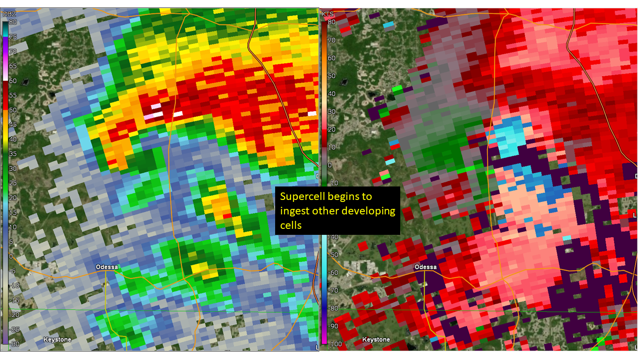
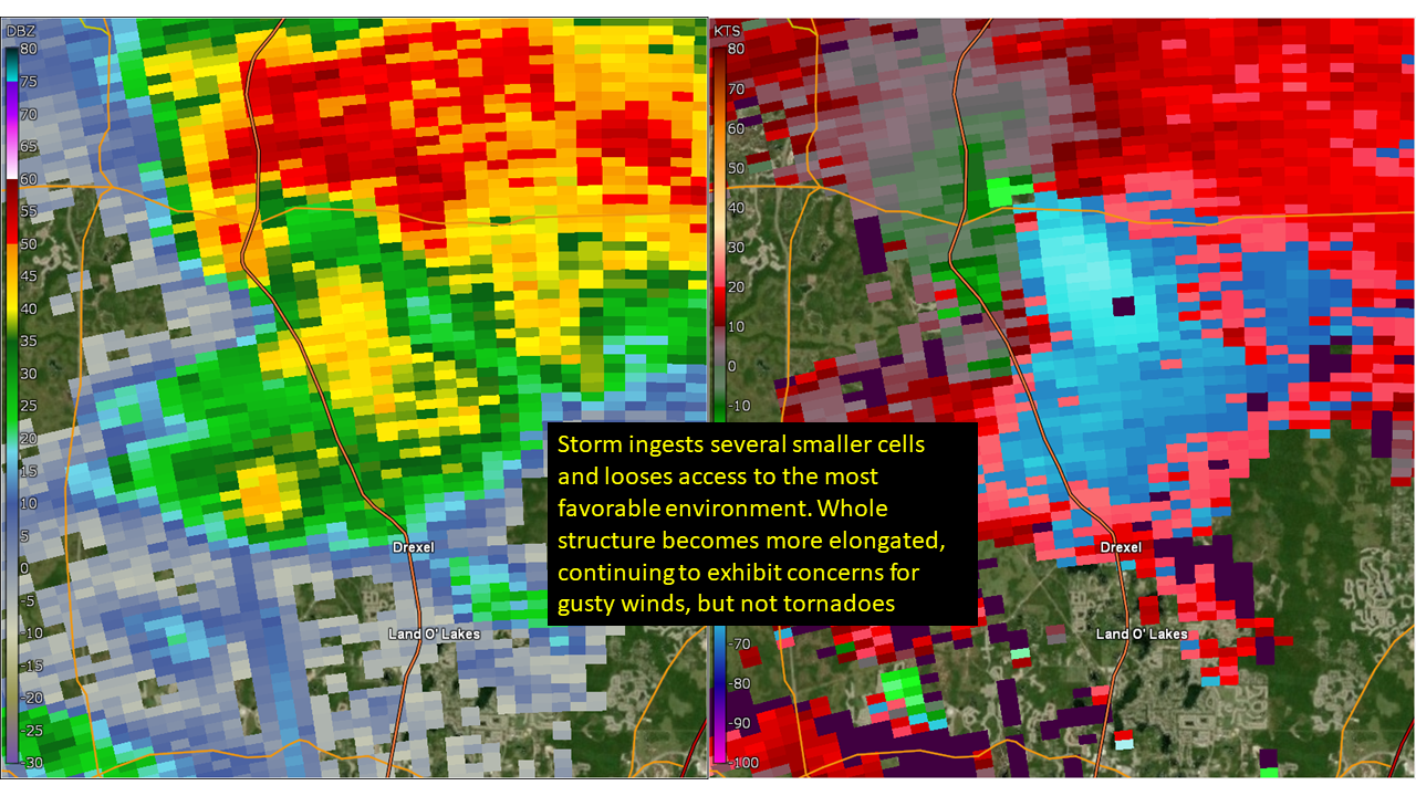
Trinity - Pasco County - October 12, 2023:
 |
 |
 |
 |
 |
|
KTBW WSR-88D Radar 0.5° elevation: Reflectivity & Storm Relative Velocity |
||||
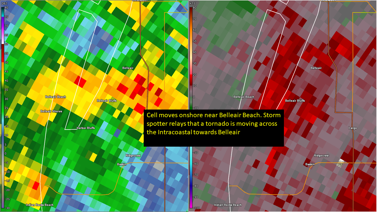
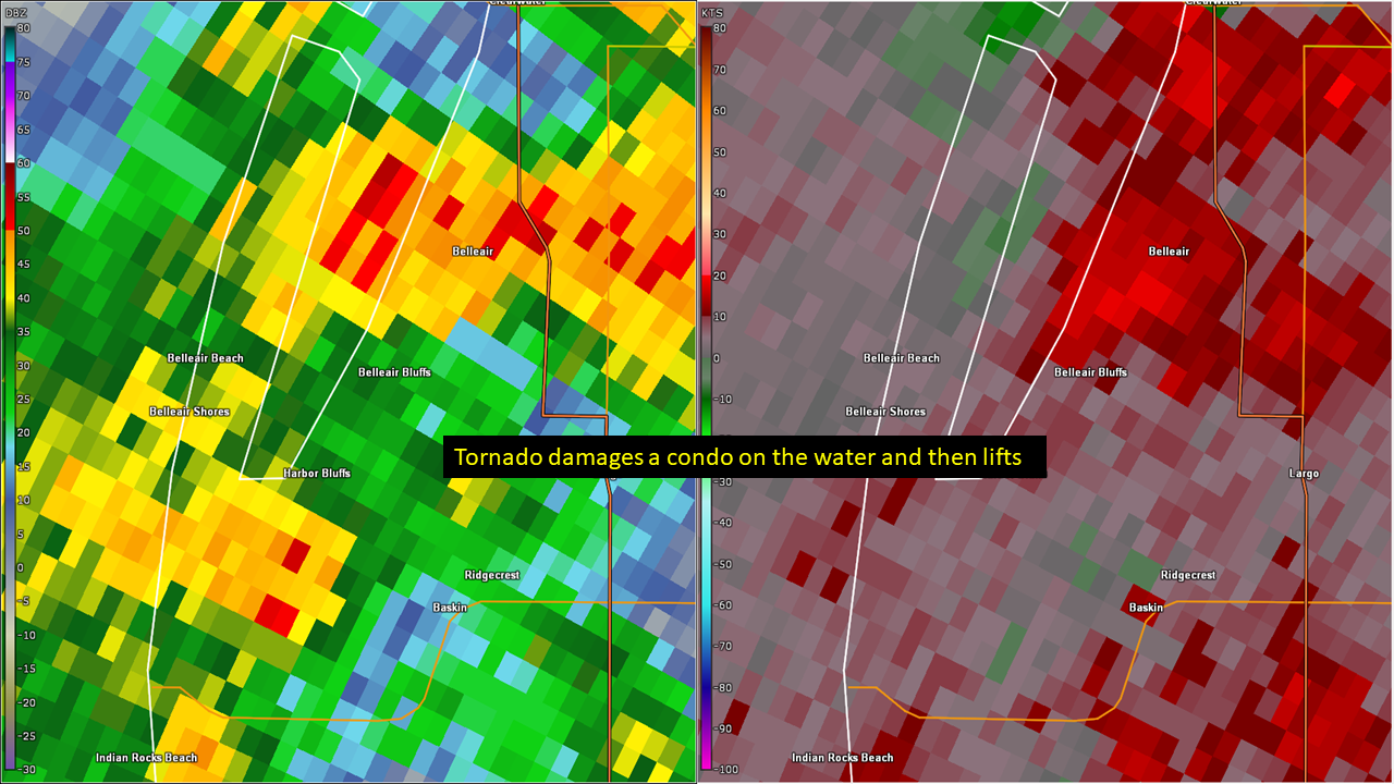
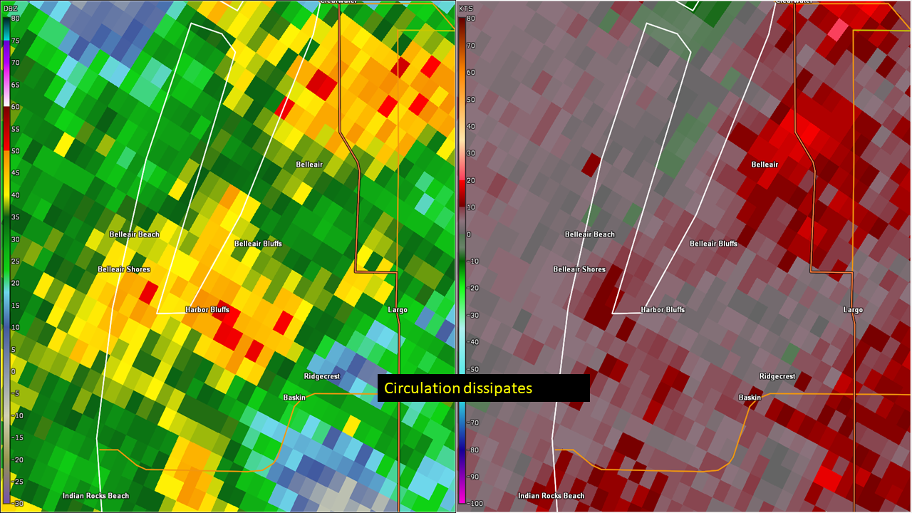
Belleair - Pinellas County - October 12, 2023:
 |
 |
 |
|
KTBW WSR-88D Radar 0.5° elevation: Reflectivity & Storm Relative Velocity |
||
Rainfall:
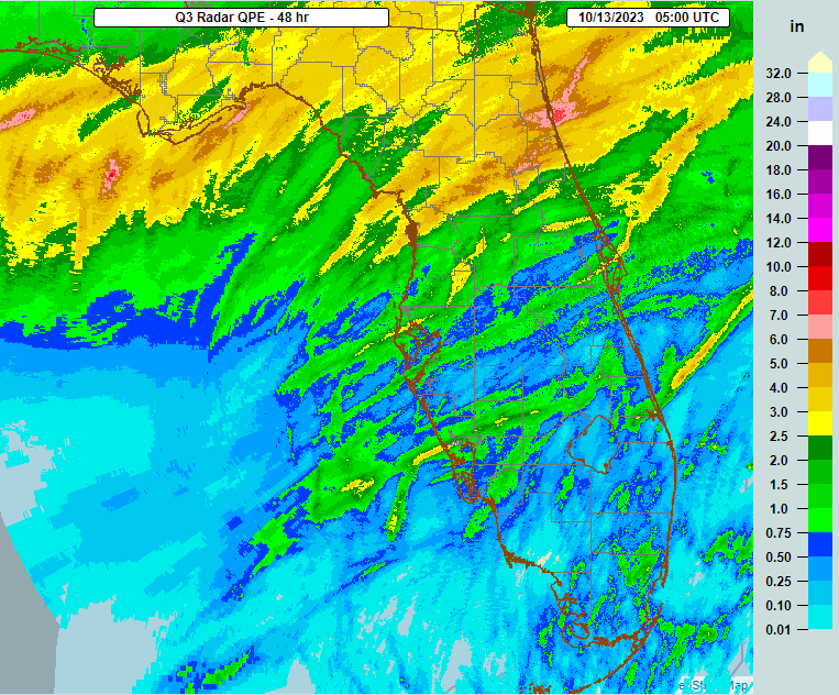
The entire region saw some rain as the storms moved through, with many areas from around Tampa Bay north across the Nature Coast receiving over 2 inches. Further south amounts were lower, but still generally between 0.50 and 1.50 inch.
 |
Environment
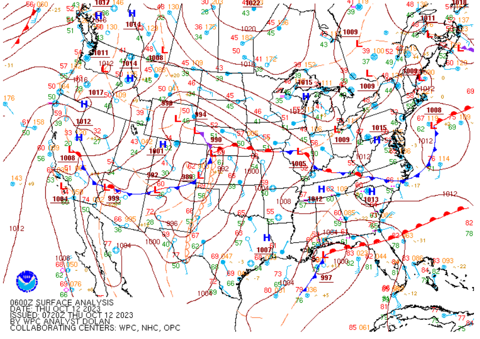
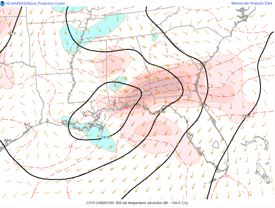
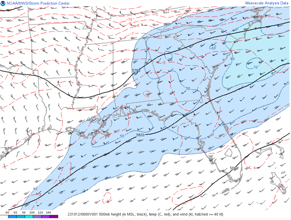
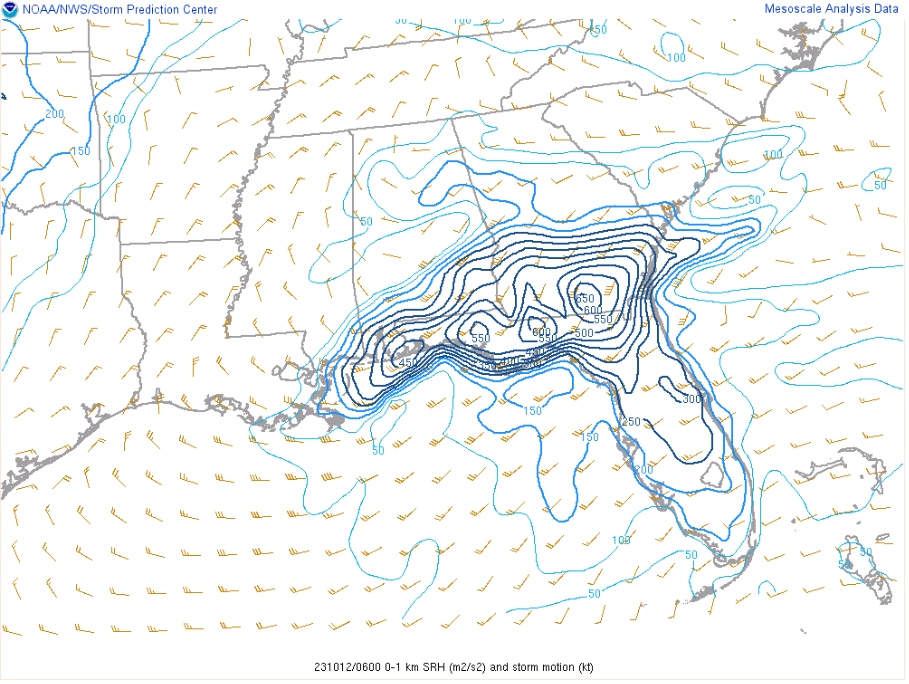
An environment characterized by strong low-level wind shear and moderate instability was supportive of a broken line of supercells forming over the eastern Gulf of America in the warm sector ahead of a surface low pressure system centered over the north-central Gulf of America.
 |
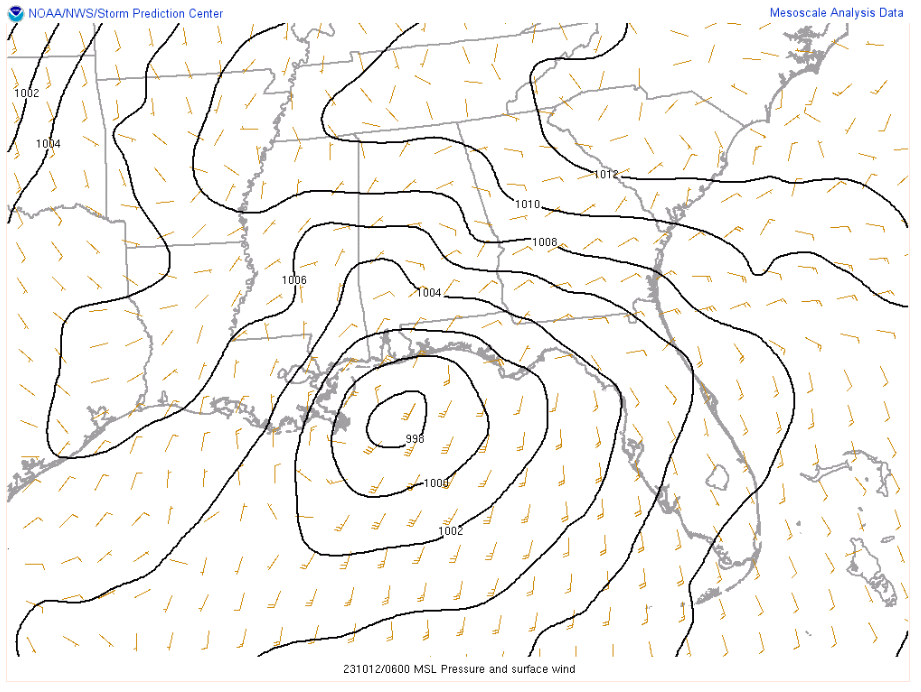
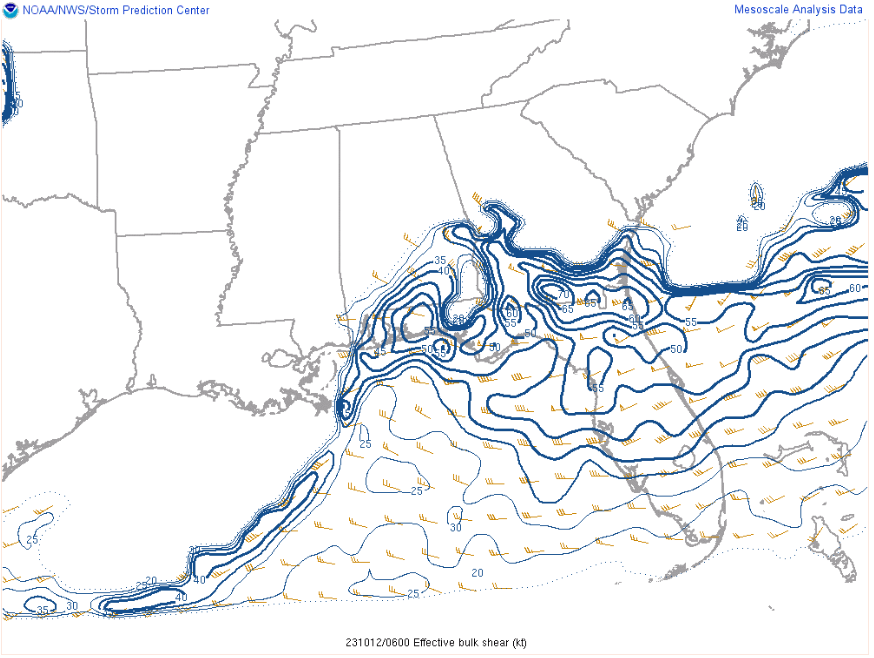
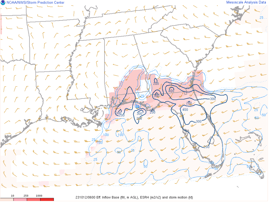
A strongly veered atmosphere existed within the warm sector as the line approached the west coast of Florida – with backed surface winds out of the south-southeast around 10-15 knots, a low-level jet at 850 mb out of the south-southwest around 30-35 knots, and 500 mb winds out of the southwest around 50-60 knots – leading to effective deep-layer shear of 45-55 knots and effective storm relative helicity of 200-300 m2/s2, both of which strongly supported supercell development. Furthermore, most of the storm relative helicity was focused over the lowest 1 km of the atmosphere, with available mesoanalysis depicting 150-200 m2/s2 of 0-1 km storm relative helicity over the west-central FL coast, and approaching 250 m2/s2 across the Nature Coast.
 |
 |
 |
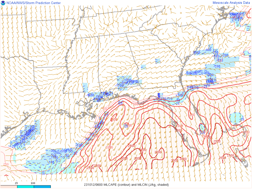
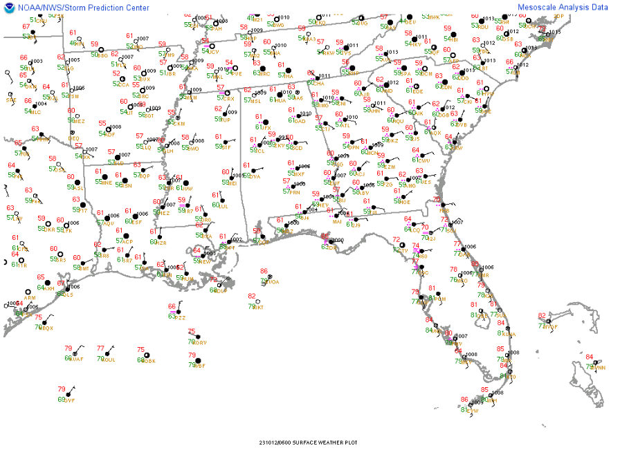
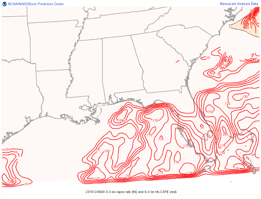
While moderate instability was present as indicated by MLCAPE values of 1500-2500 J/kg, warm moist advection via the low level jet helped offset the diurnal phase of the overnight hours that otherwise would have favored increased low-level stability and stymied storm development. Surface observations from around the time the supercells were approaching the coast suggested this as well, as temps hovered in the upper 70s to around 80 degrees while dew points climbed into the mid to upper 70s. Additionally, 3CAPE (CAPE over the lowest 3 km) values of 150-175 J/kg indicated the presence of strong low-level instability, which ultimately proved very efficient in assisting in the stretching and tilting process of the impressive low-level horizontal shear profile into the vertical as the supercell updrafts matured, thus aiding in tornadogenesis.
 |
 |
 |
This ACARS sounding was captured just a few minutes before the first tornado moved into Pinellas County. Aircraft arriving and departing from Tampa International Airport were able to provide Meteorologists with a powerful snapshot of the atmosphere just ahead of supercells moving onshore.
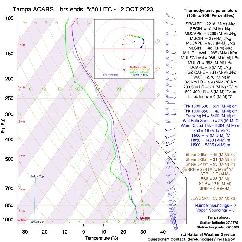 |
As the sounding above shows, the magnitude of shear combined with more than adequate instability provided a very favorable environment for rotating supercells to develop and produce waterspouts over the open gulf before subsequently moving ashore and becoming tornadoes, with a few tornadoes forming after the supercells moved ashore. The tornado threat diminished through the remainder of the morning of the 12th as the surface low moved east across the panhandle with low level flow becoming increasingly veered as the associated cold front approached the area from the west.
 |
 |
 |
Event Comparison
How Does this Event Compare to Past Events?
The events of October 11 and 12 rank in the top 20 for most tornadoes produced. The six confirmed tornadoes ties the event for 15th with several other events as noted below.
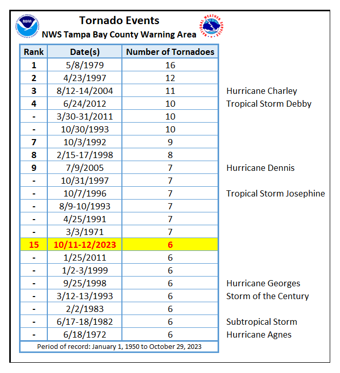 |
| Tornado Event Rankings |
Storm Reports
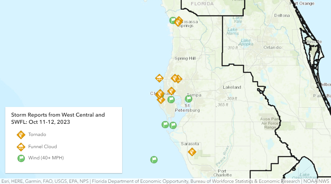
Map:
 |
Text Listing:
..TIME...   ...EVENT...      ...CITY LOCATION...     ...LAT.LON...
..DATE...   ....MAG....      ..COUNTY LOCATION..ST.. ...SOURCE....
            ..REMARKS..

1059 PM     Tornado          1 NNW Gator Creek Estat 27.27N 82.38W
10/11/2023                   Sarasota           FL   Public

            DELAYED REPORT: Loss of roof covering
            material (<20%), damage to gutters, awnings.
            Destroyed pool cage on back of house. Around
            10 miles southeast of downtown Sarasota.

1214 AM     Tornado          1 S Oldsmar             28.03N 82.67W
10/12/2023                   Pinellas           FL   Public

            DELAYED REPORT: Experienced partial roof
            removal along southward facing side, with
            the northern shore of Safety Harbor across
            the street to the south. Southward facing
            windows on both floors appeared intact
            following the storm. Likely along eastern
            fringe of circulation, per radar.

1225 AM     Funnel Cloud     4 E Holiday             28.19N 82.68W
10/12/2023                   Pasco              FL   Trained Spotter

            Corrects previous funnel cloud report from 4
            E Holiday. Funnel cloud spotted crossing SR
            54 at Little Road.

0145 AM     Waterspout       3 NNW Belleair          27.98N 82.84W
10/12/2023                   GMZ853             FL   Public

            Mutiple social media videos and pictures
            show a waterspout just off Clearwater Beach.
            Time estimated from radar.

0148 AM     Tstm Wnd Gst     3 NNW Belleair          27.98N 82.83W
10/12/2023  M41 MPH          GMZ853             FL   Buoy

            Buoy station CWBF1 Clearwater Beach Pier 60.

0148 AM     Tornado          3 WSW Dunedin           28.00N 82.83W
10/12/2023                   Pinellas           FL   Emergency Mngr

            FDEM reports damage in N Clearwater Beach
            from tornado. Time estimated by radar.

0159 AM     Tstm Wnd Gst     3 W Crystal River       28.90N 82.65W
10/12/2023  M42 MPH          Citrus             FL   Mesonet

            Mesonet station 0212W 2.9 W Crystal River
            (WEATHERSTEM).

0212 AM     Tornado          2 SE Crystal River      28.88N 82.58W
10/12/2023                   Citrus             FL   Emergency Mngr

            Emergency management reported a tornado at
            US-19 and W Ford Island Tr. Roof damage and
            powerlines have been reported down in the
            vicinity. Time estimated from radar.


0215 AM     Tornado          2 E Crystal River       28.90N 82.57W
10/12/2023                   Citrus             FL   Emergency Mngr

            Emergency management reports debris blocking
            the roadway on Hwy 44 in Citrus County. Time
            estimated from radar.


0217 AM     Tornado          2 WSW Odessa            28.19N 82.62W
10/12/2023                   Pasco              FL   Public

            DELAYED REPORT: Home camera captured tornado
            touchdown. lawn furniture thrown about, but
            no significant structural damage.

1053 AM     Tstm Wnd Gst     2 NW Feather Sound      27.92N 82.68W
10/12/2023  M40 MPH          GMZ830             FL   ASOS

            ASOS station KPIE St Pete-Clearwater Int'l.

1134 AM     Tornado          1 WSW Belleair Bluffs   27.92N 82.83W
10/12/2023                   Pinellas           FL   Public

            DELAYED REPORT: A very brief tornado was
            observed over the intracoastal waterway
            along the Belleair Beach causeway at
            11:34AM (15:34Z). At 11:35AM (15:35Z),
            the tornado moved onshore and damaged
            the roof of an apartment building
            before dissipating.

1139 AM     Funnel Cloud     1 SSE Odessa            28.18N 82.58W
10/12/2023                   Pasco              FL   Trained Spotter

            Brief funnel cloud reported with no damage
            observed.

1142 AM     Tstm Wnd Gst     3 W Palm River-Clair Me 27.93N 82.43W
10/12/2023  M42 MPH          GMZ830             FL   Mesonet

            Mesonet station TSHF1 East Bay Causeway, FL.

1236 PM     Tstm Wnd Gst     3 NNW Belleair          27.98N 82.83W
10/12/2023  M44 MPH          GMZ853             FL   Buoy

            Buoy station CWBF1 Clearwater Beach Pier 60.

0140 PM     Tstm Wnd Gst     7 NW Palmetto           27.60N 82.65W
10/12/2023  M46 MPH          GMZ830             FL   Mesonet

            Mesonet station XSKY Skyway Fishing Pier.

0235 PM     Tstm Wnd Gst     23 SW Longboat Key      27.17N 82.92W
10/12/2023  M45 MPH          GMZ873             FL   Mesonet

            Mesonet station 42013 22 SW Longboat Key.

0249 PM     Tstm Wnd Gst     6 NNW Anna Maria Island 27.61N 82.76W
10/12/2023  M46 MPH          GMZ853             FL   Mesonet

            Mesonet station XEGM Egmont Channel.


&&

$$