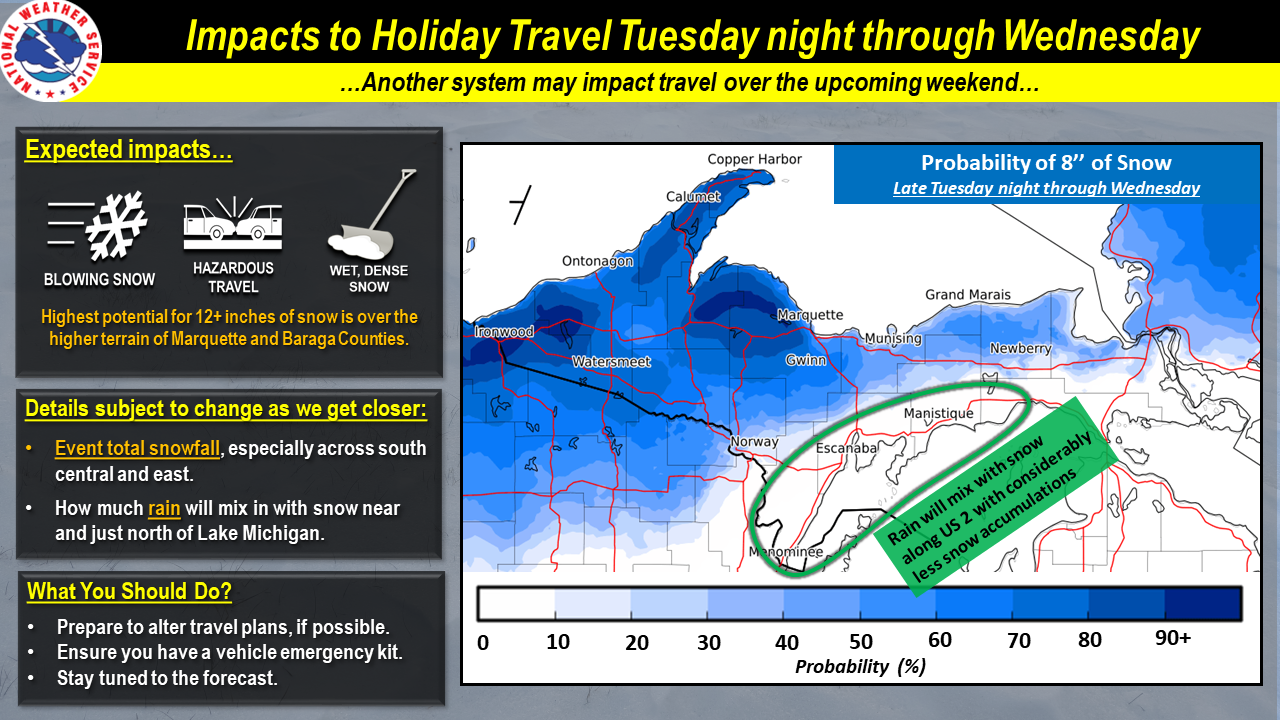
Overview
|
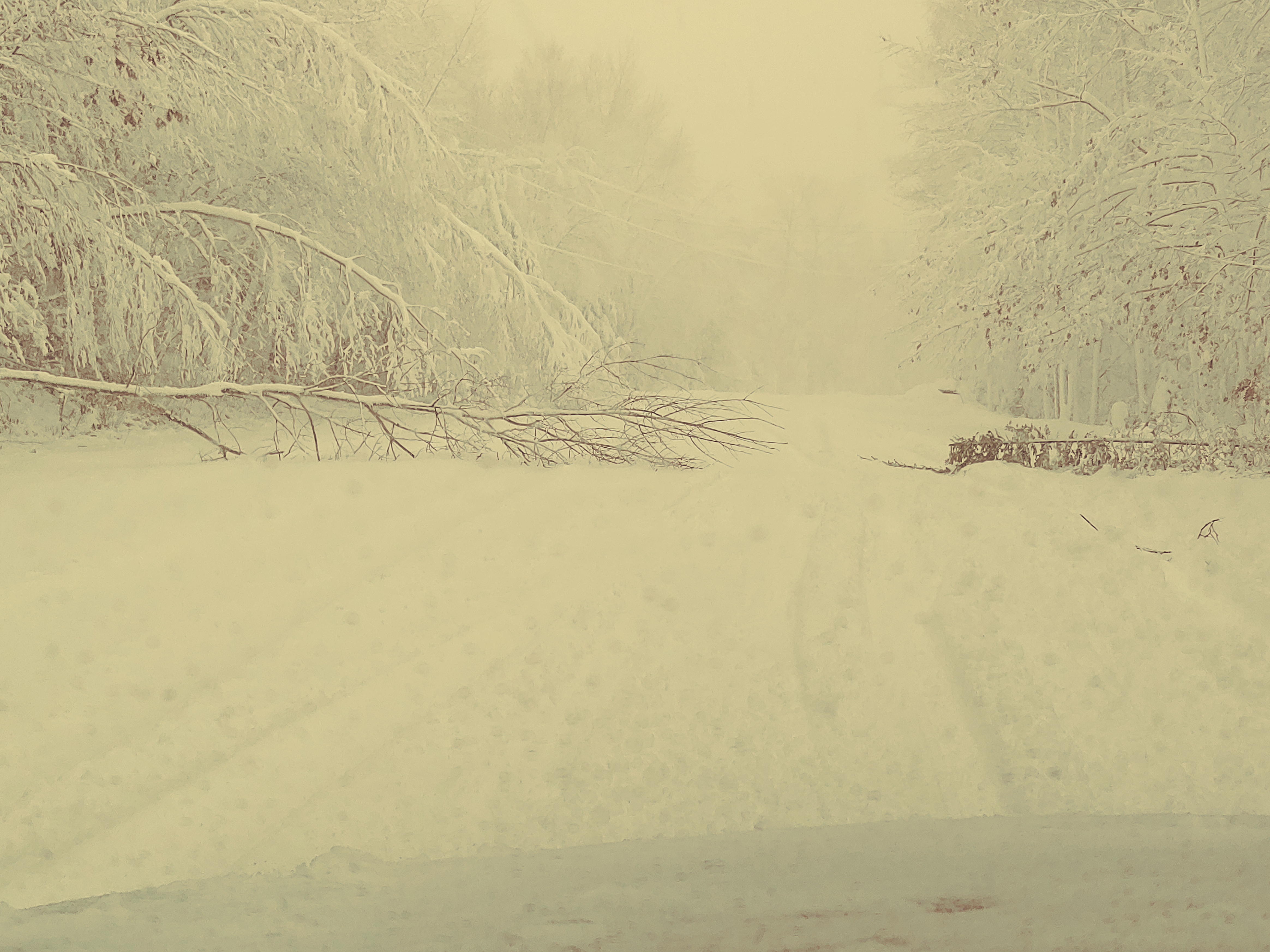
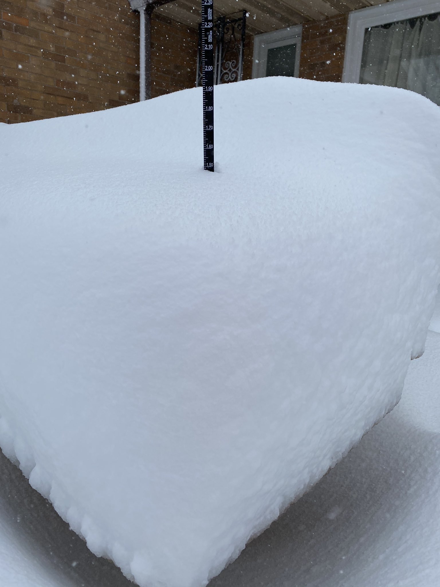
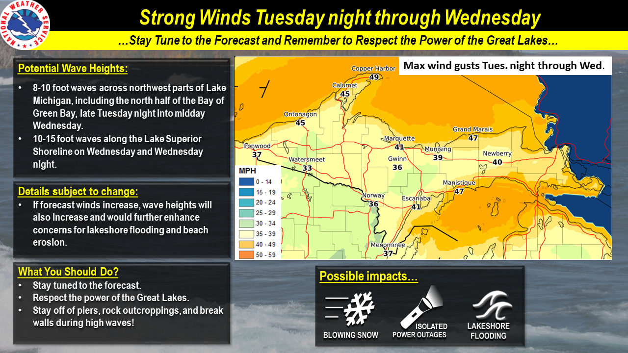
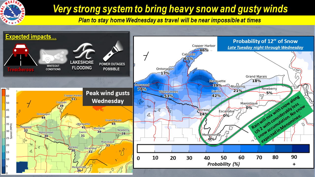
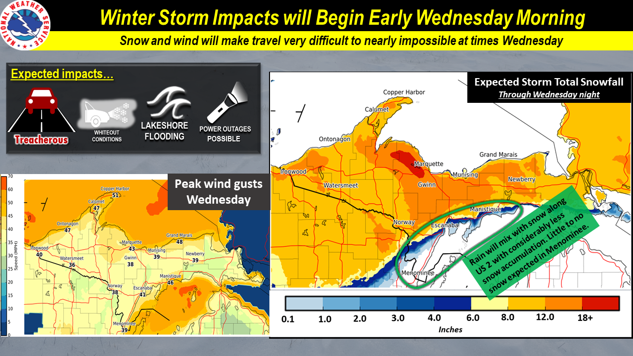
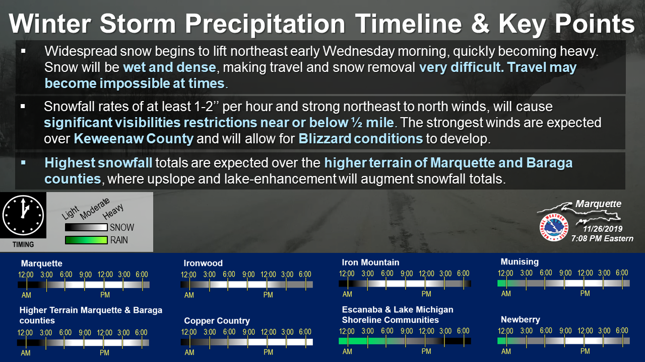
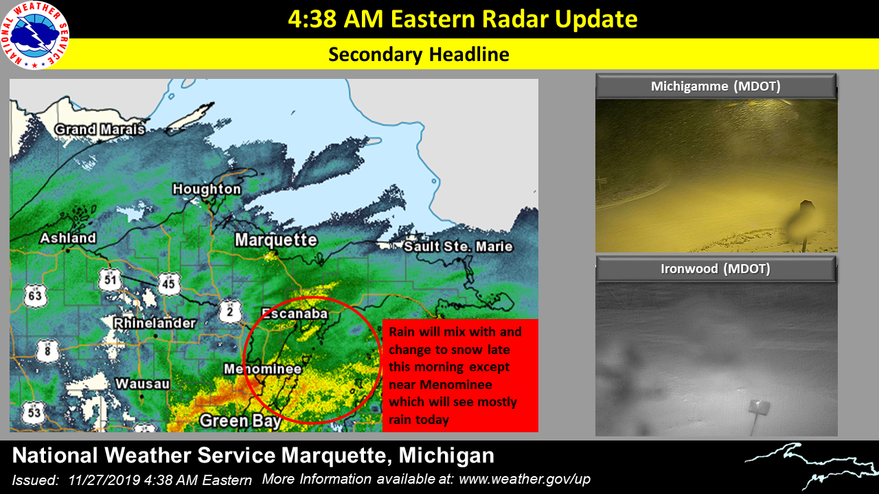
A significant winter storm tracked northeast across the western Great Lakes bringing with it a swath of heavy, very wet, dense snow during one of the busiest travel days of the year. Disrupting holiday travel, snow was wet and dense leading to very difficult, if not impossible travel conditions at times. In fact, the liquid equivalent within the snowpack was record breaking for the day of November 27th! The combination of high liquid water content and an overall "warmer" atmosphere aloft led to very wet snow, with snow-to-liquid ratios around 5-6:1 throughout the event. For comparison, the "fluffier" snow we typically see with lake-effect snow events are around or higher than 15-20:1. Due to the wet, dense snow another major impact was widespread power outages across the Upper Peninsula and sporadic tree damage. Strong northeast winds caused blowing snow, sharply reductions in visibilities, and drifting snow. These strong northeast winds also cuae waves to build along the Lake Superior and Lake Michigan shorelines, cause Lakeshore Flooding in some areas. |
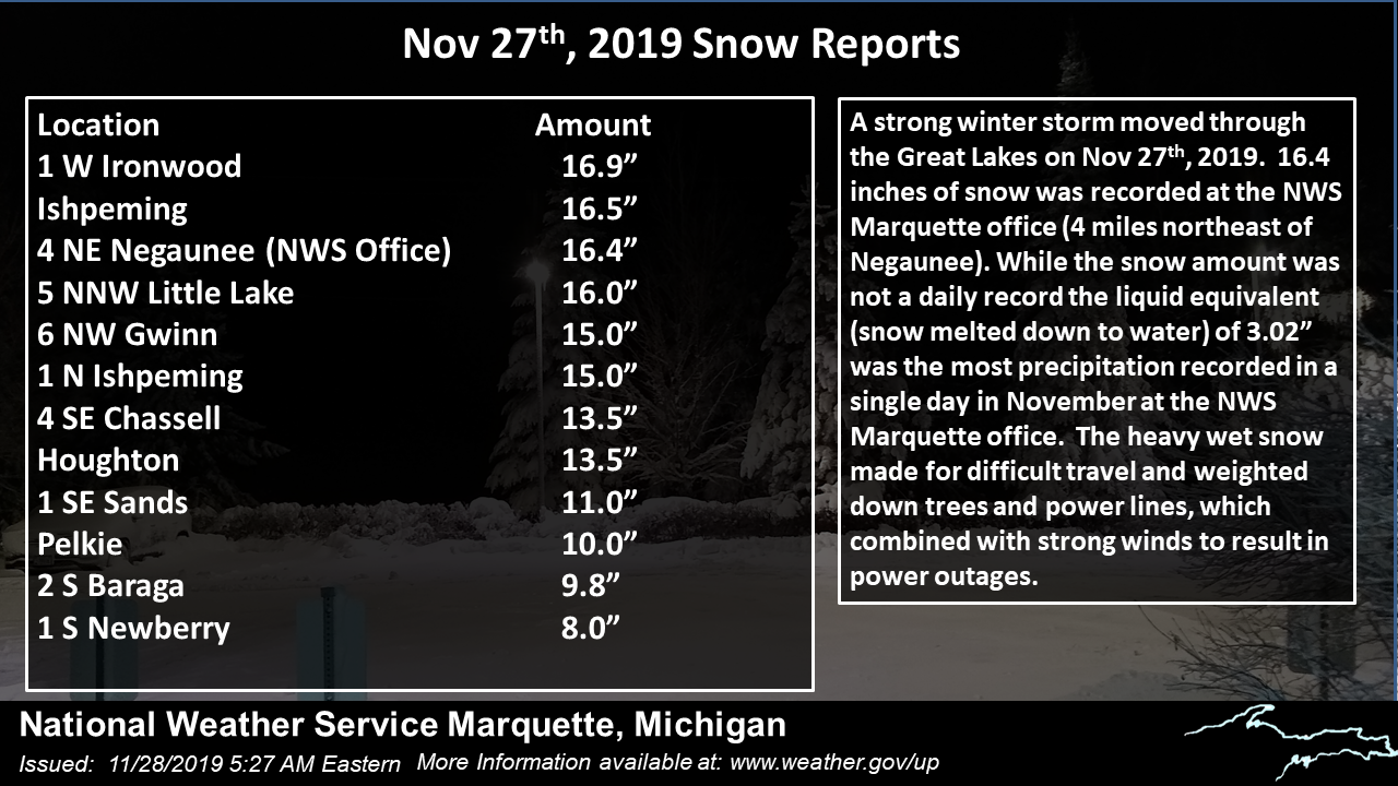 Not record snowfall, but a record amount of liquid equivalent for November 27th, from the wet, dense snow. |
Reports:
 |
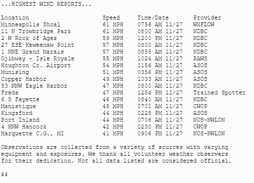 |
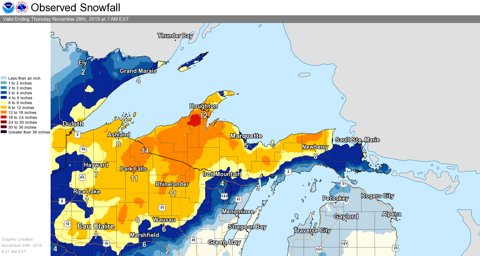
| Event Snowfall Total Map. Isolated higher amounts were reported across the north central. | PNS of Strongest Winds from the Event |
Impacts & Photos:
 |
 |
 |
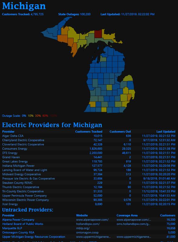
| Widespread Power Outages (Courtesy of PowerOutage.US) |
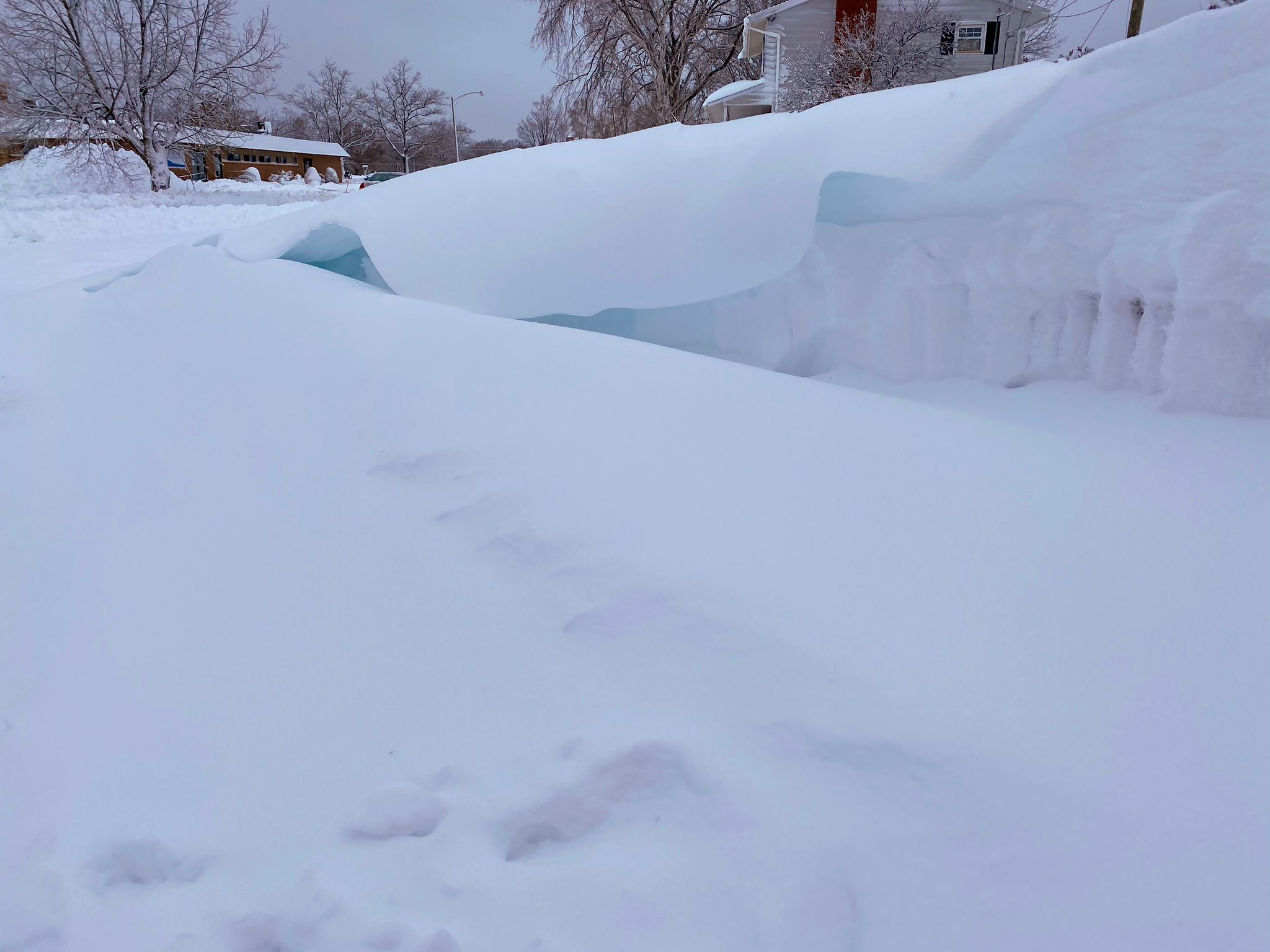
Tree Damage in West Ishpeming | High liquid content within the snowpack allows a "blue hue" to appear in some of the drifting snow. |
 |
.jpg) |
.jpg) |
| Snow and drifted snow on a bench in Ishpeming. | Baraga (Courtesy of Ann Lanala) |
Baraga (Courtesy of Ann Lanala) |
Social Media Messaging
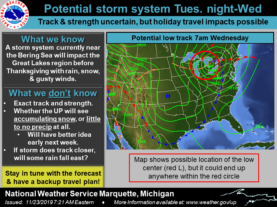
Messaging on social media began Saturday morning as confidence grew!
 |
 |
 |
 |
| Updated Saturday Morning | Update Saturday Evening | Update Sunday Morning | Update Sunday Evening |
 |
 |
 |
 |
| Update Monday Morning | Update Monday Evening | Update Monday Evening | Update Tuesday Morning |
 |
 |
 |
 |
| Update Tuesday Evening | Update Tuesday Evening | Update Tuesday Evening | Radar Update Wednesday Morning |
Messaging Timeline:
| Land Based: | Marine Based: |
| High uncertainty the week prior to the event, but mentions of the potential were in AFDs | Mentions of gale forecast winds in the HWO Saturday afternoon |
| Mentions in the Hazardous Weather Outlook began Saturday, November 23nd | Gale Watch issued for Lake Superior and nearshore of Lake Michigan issued Sunday Morning. |
| Winter Storm Watch issued morning of Monday, November 25th | Initial Situation Report sent to Marine Partners Monday morning for high-end gales. |
| Lakeshore Flood Advisories for Lake Superior shoreline issued evening of Monday, November 25th | Gale Watch updated to Storm Warning Tuesday morning. |
| Winter Storm Warnings, Advisories, and Blizzard Warning issued morning of Tuesday, November 26th | Updated Situation Report send to Marine Partners Tuesday Morning for upgrade highlights. |
| Lakeshore Flood Warnings upgraded for Lake Superior morning of Tuesday, November 26th | |
| Lakeshore Flood Advisory issued for NW Lake Michigan & Bay of Green Bay morning of Tuesday, November 26th | |
| Briefing packet sent to partners late Tuesday Morning. |
Environment
 |
 |
 |
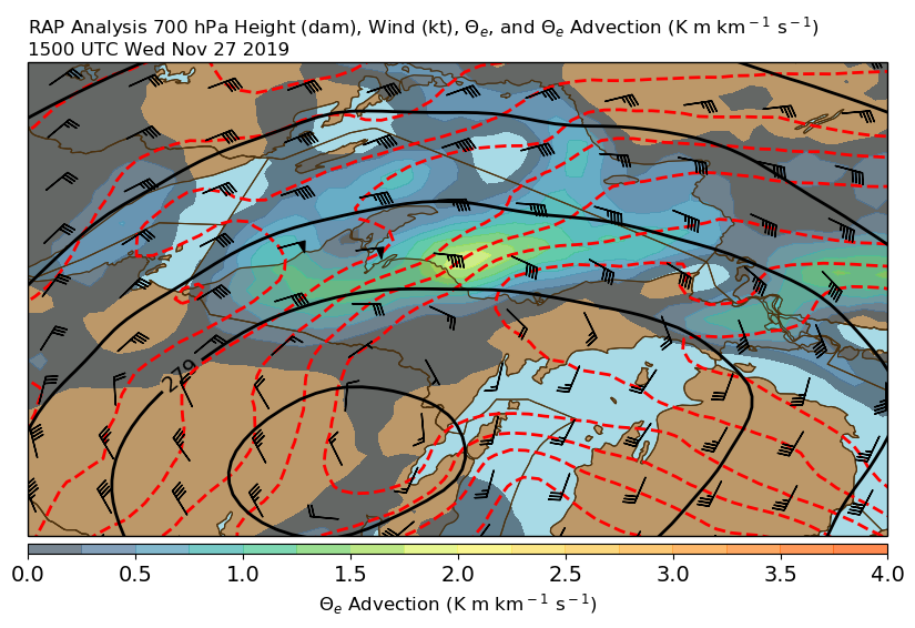 |
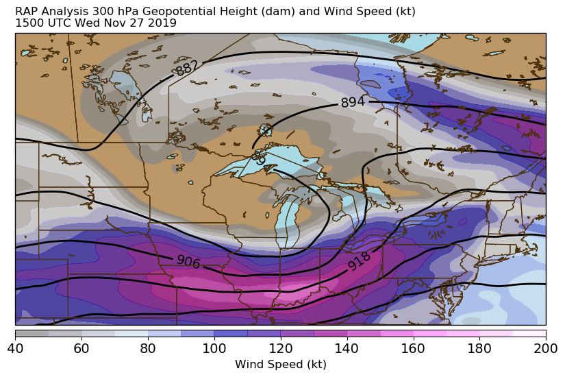
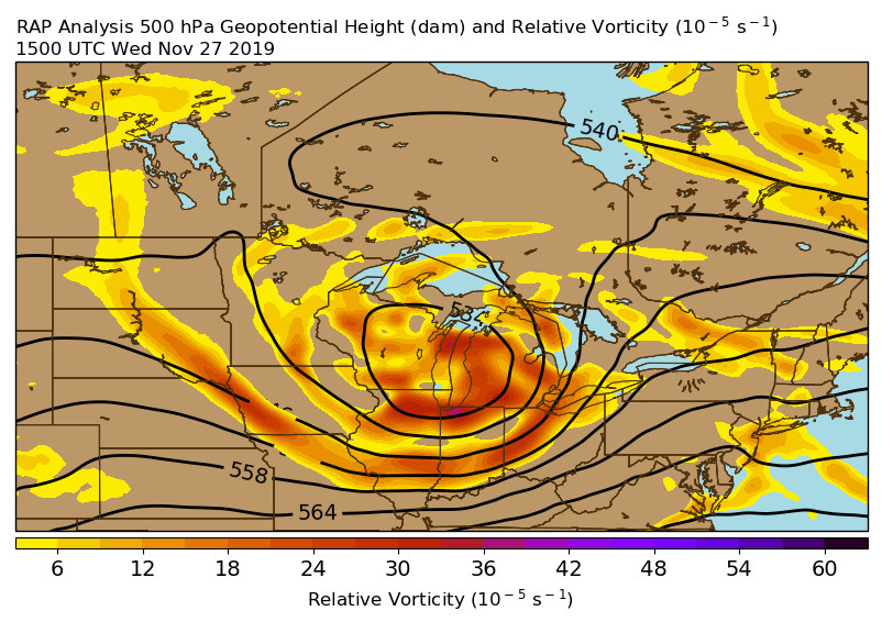
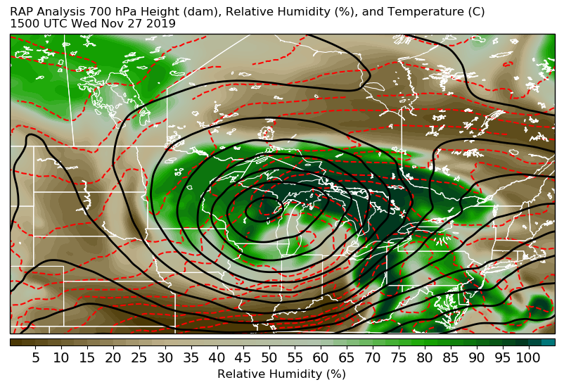
| 300 mb Height and Wind at 15z (10 am EST) Wednesday, November 27 | 500 mb Height and Vorticity at 15z (10 am EST) Wednesday, November 27 | 700 mb Height and Relative Humidity at 15z (10 am EST) Wednesday, November 27 | 700 mb Height, Wind, Theta-e, and Theta-e Advection at 15z (10 am EST) Wednesday, November 27 |
 |
 |
 |
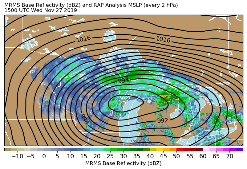 |
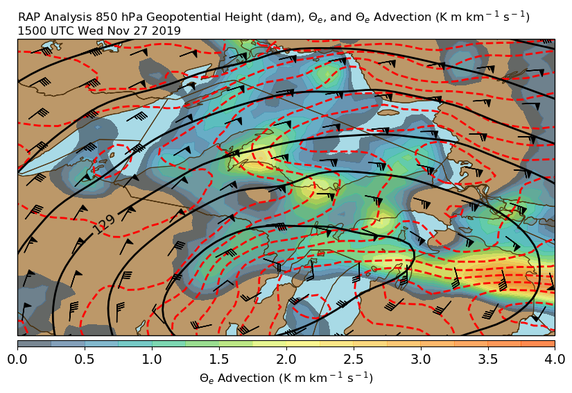
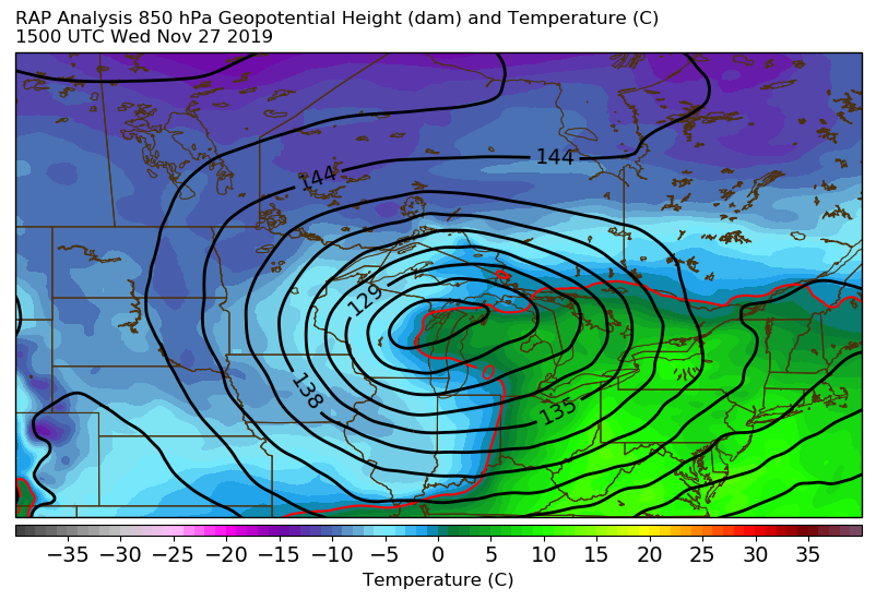
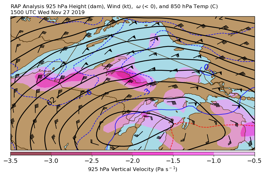
| 850 mb Height, Wind, Theta-e, and Theta-e Advection at 15z (10 am EST) Wednesday, November 27 | 850 mb Height and Temperature at 15z (10 am EST) Wednesday, November 27 | 925 mb Height and Wind, and 850 mb Temperature, at 15z (10 am EST) Wednesday, November 27 | Mean Sea Level Pressure and Regional Radar at 15z (10 am EST) Wednesday, November 27 |
 |
Media use of NWS Web News Stories is encouraged! Please acknowledge the NWS as the source of any news information accessed from this site. |
|

