Overview
|
A strong upper-level wave pivoted across the Upper Peninsula on Friday bringing widespread snow, with significant lake enhanced snow off of Lake Superior and Lake Michigan. Initially, the heavier lake enhanced snow was confined to areas north of Lake Michigan on Friday, then as a surface trough pushed south across the Upper Peninsula, heavy lake enhanced snow pushed across western Upper Michigan late in the day Friday, and then shifted over north central portions of Upper Michigan late Friday night into Saturday morning. As these heavier bands of snow pushed onshore late in the day Friday through Friday night, whiteout conditions were reported. Also behind the system, sporadic power outages and blowing/drifting snow occurred as wind gusted upward of 45 to 55 mph, especially over the Keweenaw Peninsula. Near the Lake Superior shoreline across western and north central Upper Michigan, high-end gales of 40 to 45 knots brought waves of 14-18 feet and concerns for minor lakeshore flooding and beach erosion Friday night through Saturday morning. |
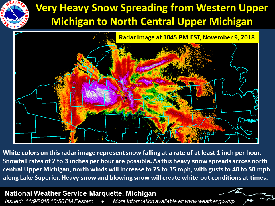
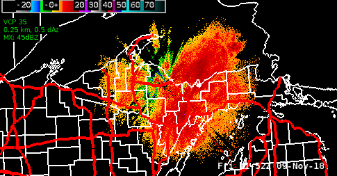 Radar from the early morning hours on Friday morning through Saturday morning. The areas where radar returns show up in white denote areas of enhanced snowfall rates, typically around or greater than 1'' per hour. |
Photos & Video:
 |
 |
|
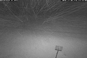
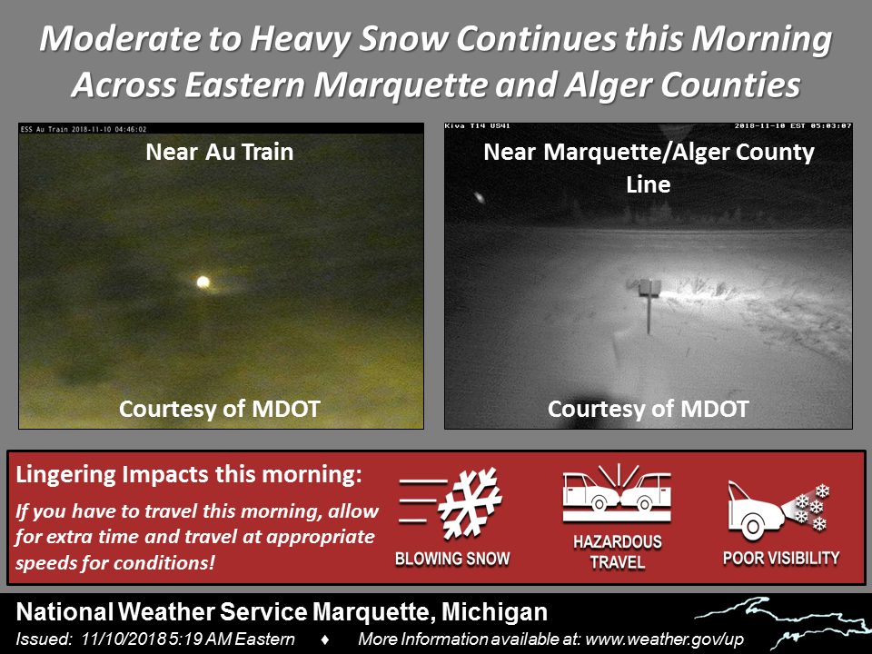
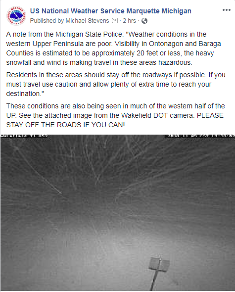
Webcam image showing near whiteout conditions Friday evening across western Upper Michigan (Michigan DOT) |
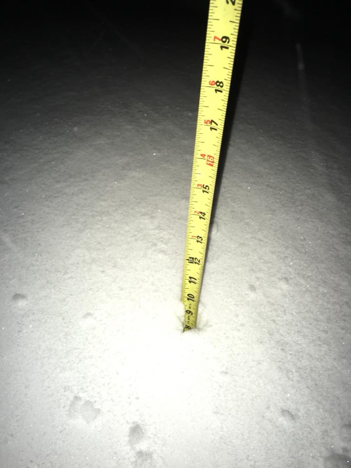
Snow Report near Houghton |
 |
 |
|
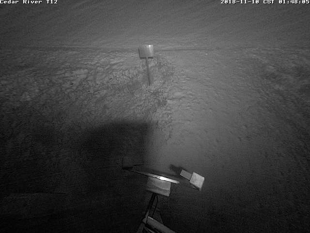
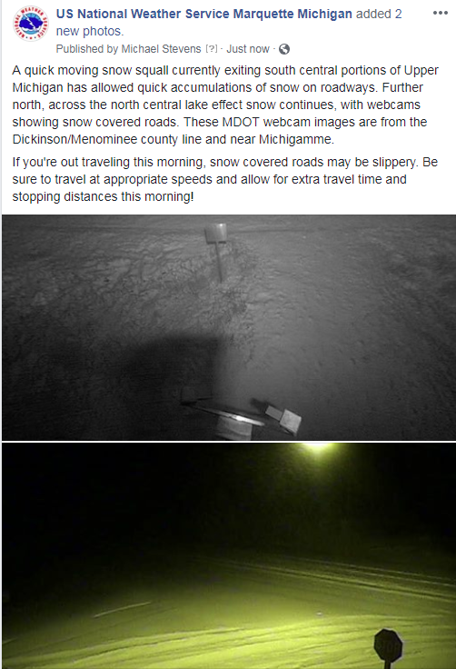
Webcam image showing roads quickly becoming snow covered across Dickinson and Menominee counties as the leading edge of a snow squall early Saturday morning. (Michigan DOT) |
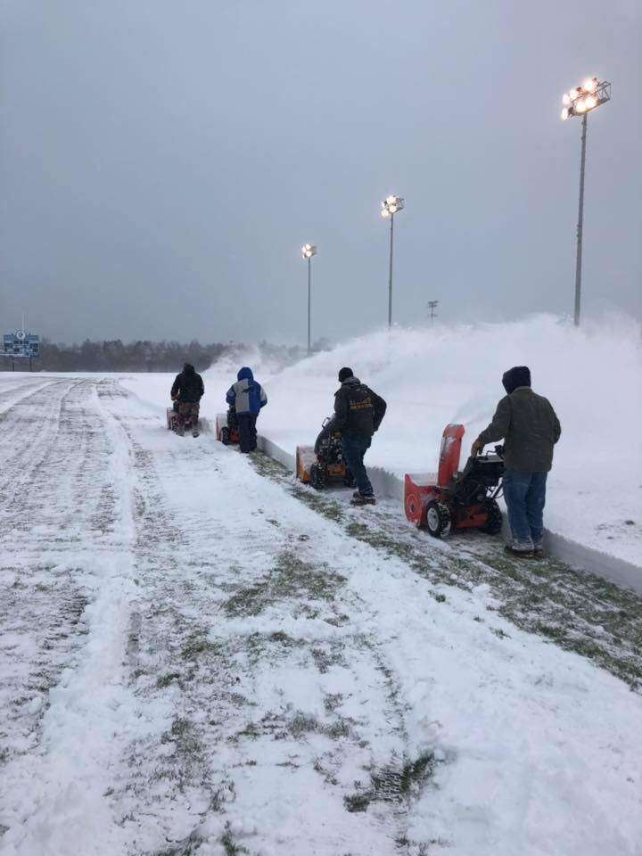
Volunteers clearing the football field in Ishpeming after heavy snow. (Diana Sundberg) |
Storm Reports:
 |
 |
|
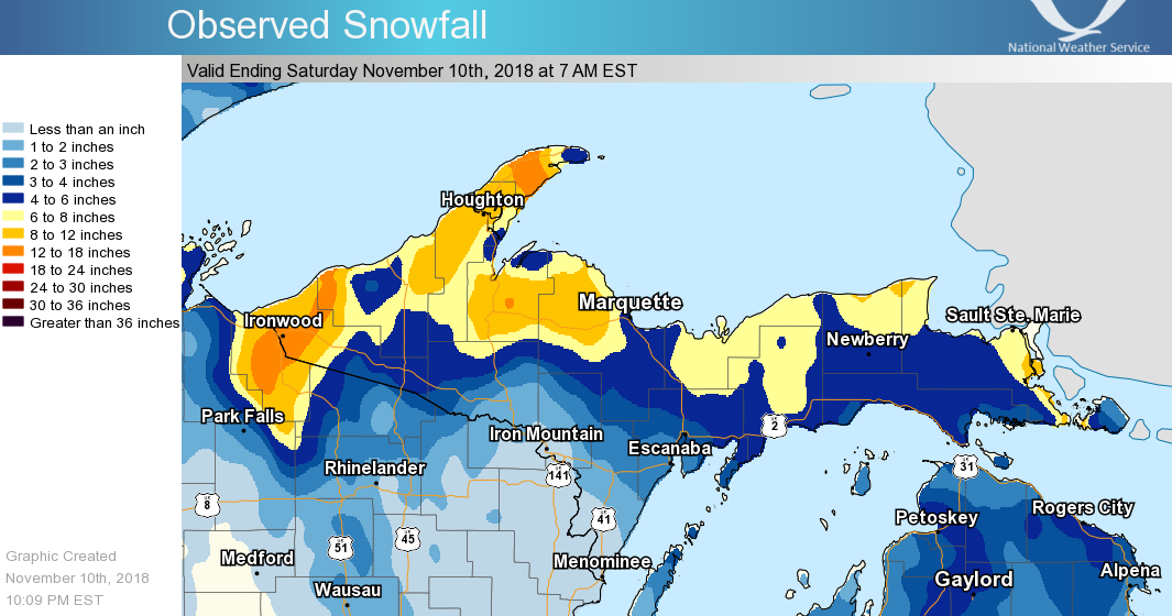
24-hour Observed Snowfall 7am EST November 9th through 7am EST November 10th |
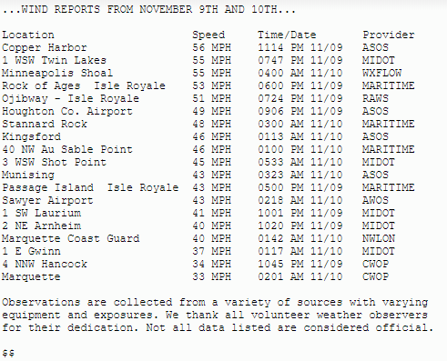
Highest Wind Gusts from November 9th and November 10th |
Environment:
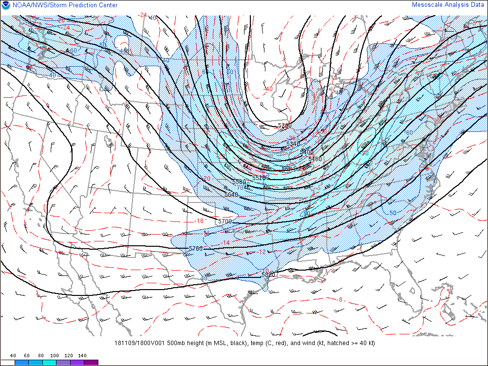
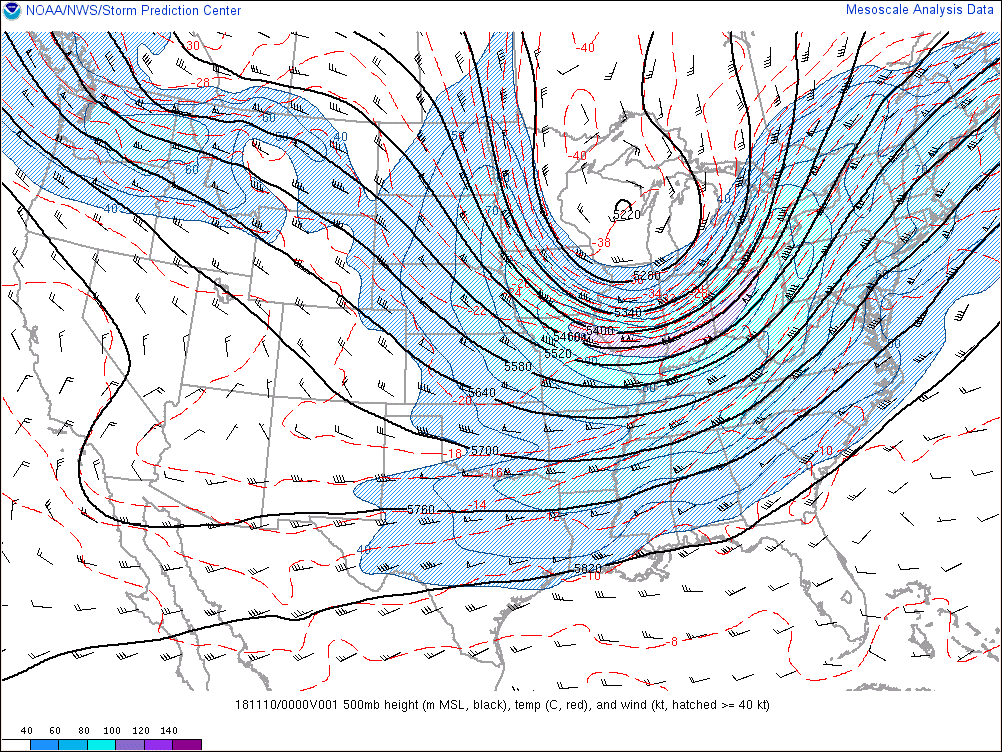
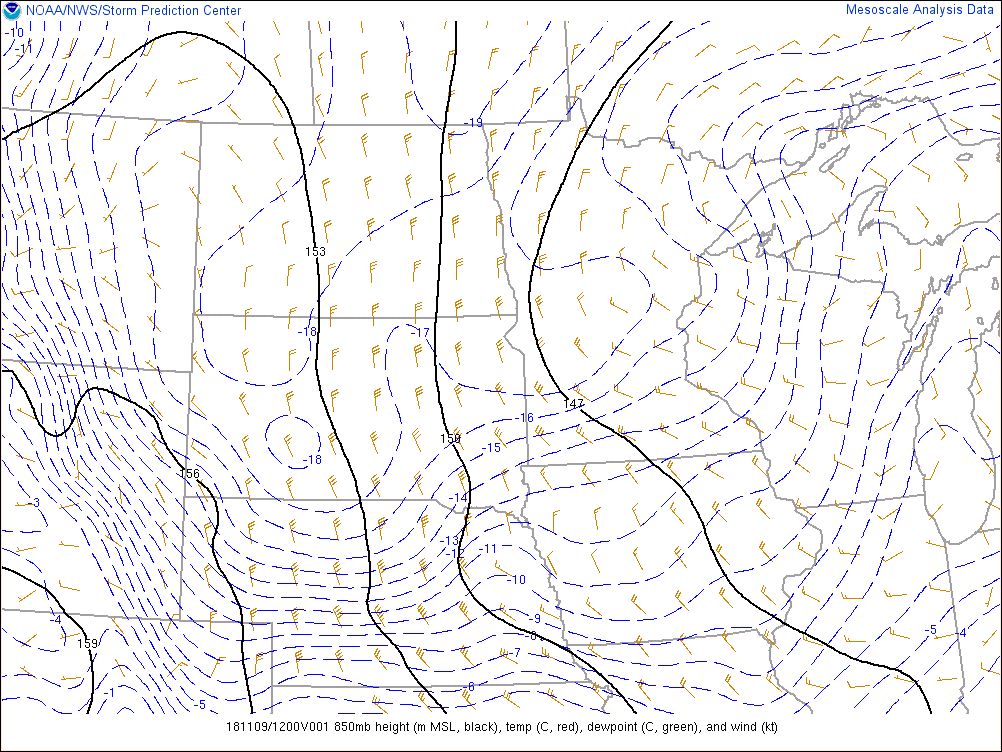
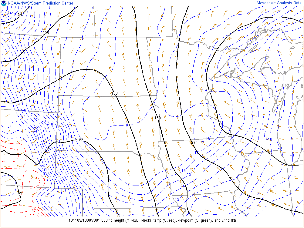
On November 9th through the early morning hours on November 10th, a disturbance pivoted across the Upper Great Lakes taking on a negative tilt. When upper-level waves take on a negative tilt, this allows the synpotic-scale forcing to line up and create strong large-scale lift for precipitation. The main 850mb low associated with the upper-level trough slowly moved east across the Upper Peninsula, leading to southerly flow off of Lake Michigan on November 9th and the development of persistent lake enhanced snow north of Lake Michigan. Throughout the day on November 9th and into the early morning hours on November 10th, the main axis of upper-level wave shifted across lower Michigan switching the 850mb winds around to the north and pushing a strong surface trough south across the Upper Peninsula. Strong forcing along this surface trough led to multiple snow squalls pushing onshore across western Upper Michigan late in the day on November 9th, and later that night across the north central. Within these snow squalls, significant forcing lead to snowfall rates of 2-3'' per hour and whiteout conditions at times. Also, accompanying the high snowfall rates where northerly winds, with gusts upwards of 35 to even 55 mph in spots, mostly due to the increasing cold air advection behind the main wave and the strengthening pressure gradient along the surface trough axis.
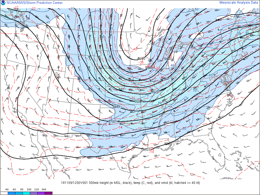
500mb Heights (thick black lines), temperature (dashed red lines), winds (wind barbs), and isotachs (wind speeds, color contoured)
 |
 |
 |
 |
| 1200Z, 7am EST Nov. 9th | 1800Z, 1pm EST Nov. 9th | 0000Z, 7pm EST Nov. 9th | 0600Z, 1am EST Nov. 10th |
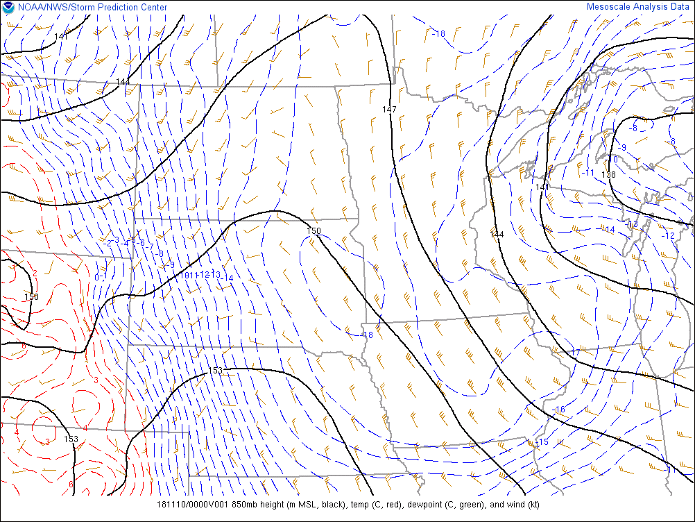
850mb Heights (thick black lines), temperature (dashed red/blue lines), and winds (wind barbs)
 |
 |
 |
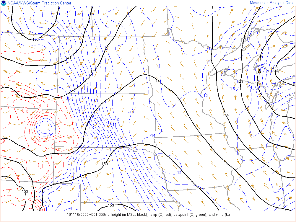 |
| 1200Z, 7am EST Nov. 9th | 1800Z, 1pm EST Nov. 9th | 0000Z, 7pm EST Nov. 9th | 0600Z, 1am EST Nov. 10th |
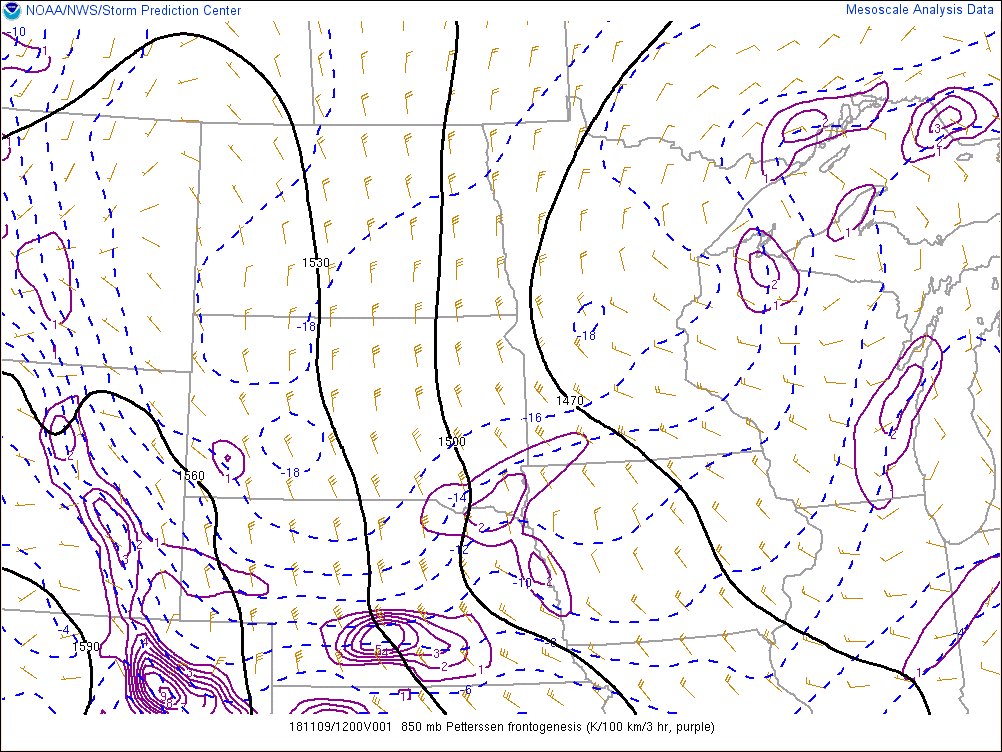
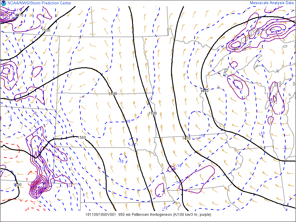
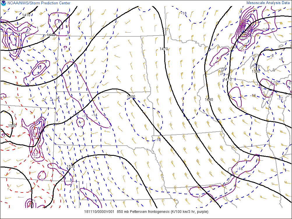
850mb Heights (thick black lines), temperature (dashed red/blue lines), winds (wind barbs), frontogenesis (solid purple lines)
 |
 |
 |
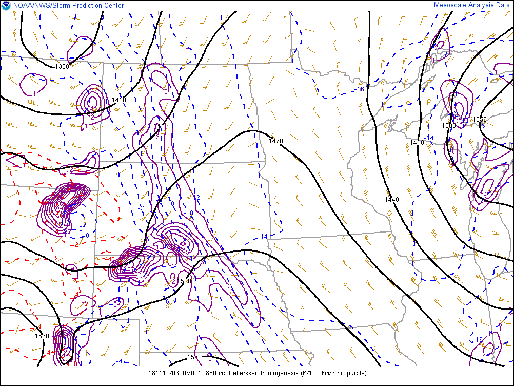 |
| 1200Z, 7am EST Nov. 9th | 1800Z, 1pm EST Nov. 9th | 0000Z, 7pm EST Nov. 9th | 0600Z, 1am EST Nov. 10th |
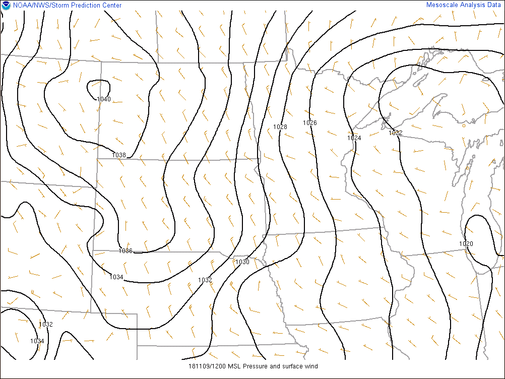
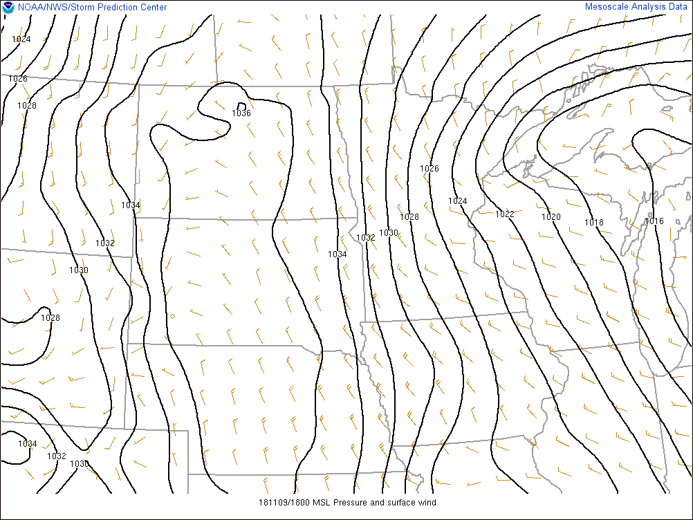
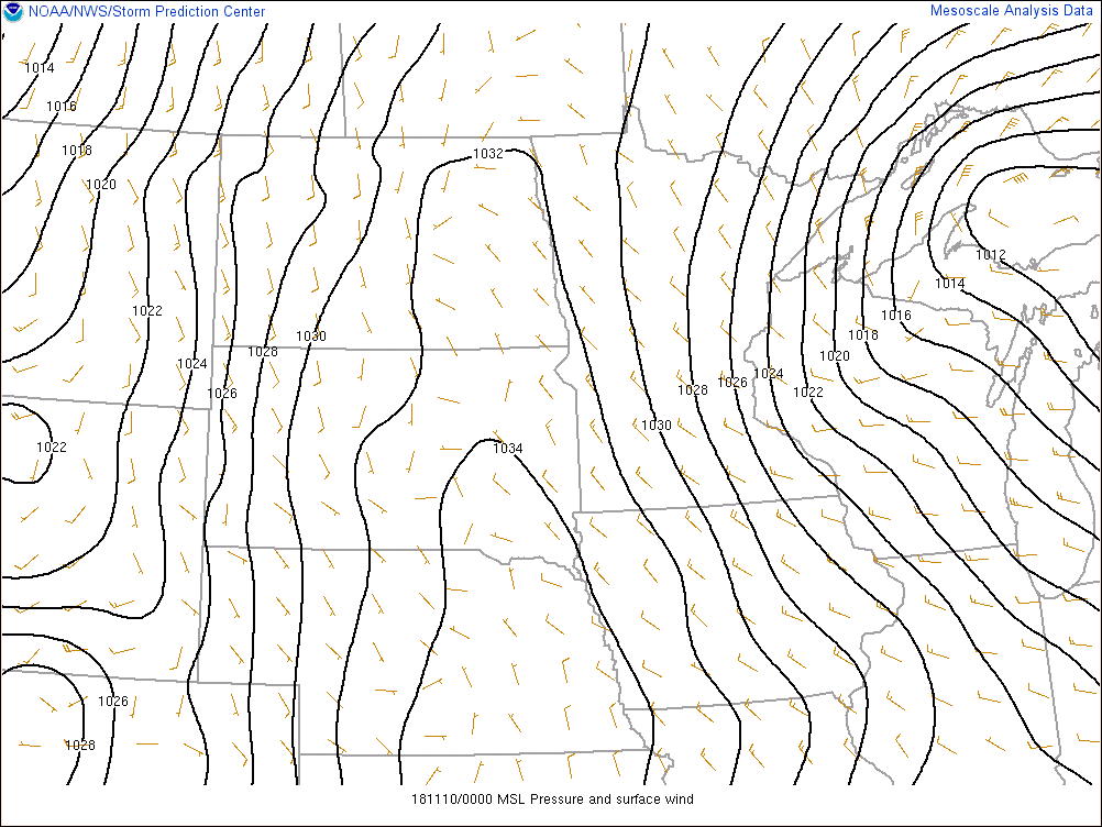
Mean sea level pressure (thick black lines) and surface winds (wind barbs)
 |
 |
 |
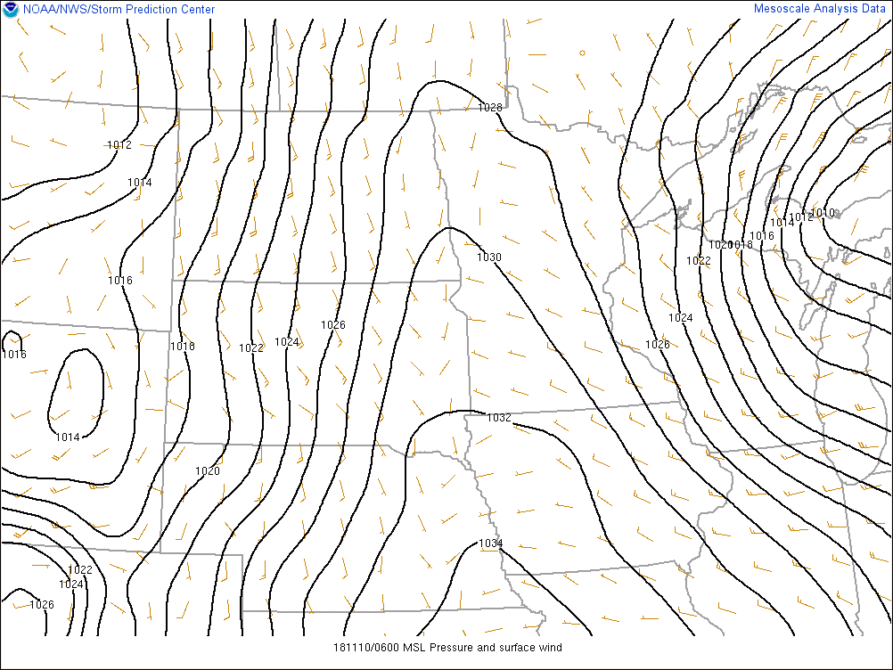 |
| 1200Z, 7am EST Nov. 9th | 1800Z, 1pm EST Nov. 9th | 0000Z, 7pm EST Nov. 9th | 0600Z, 1am EST Nov. 10th |
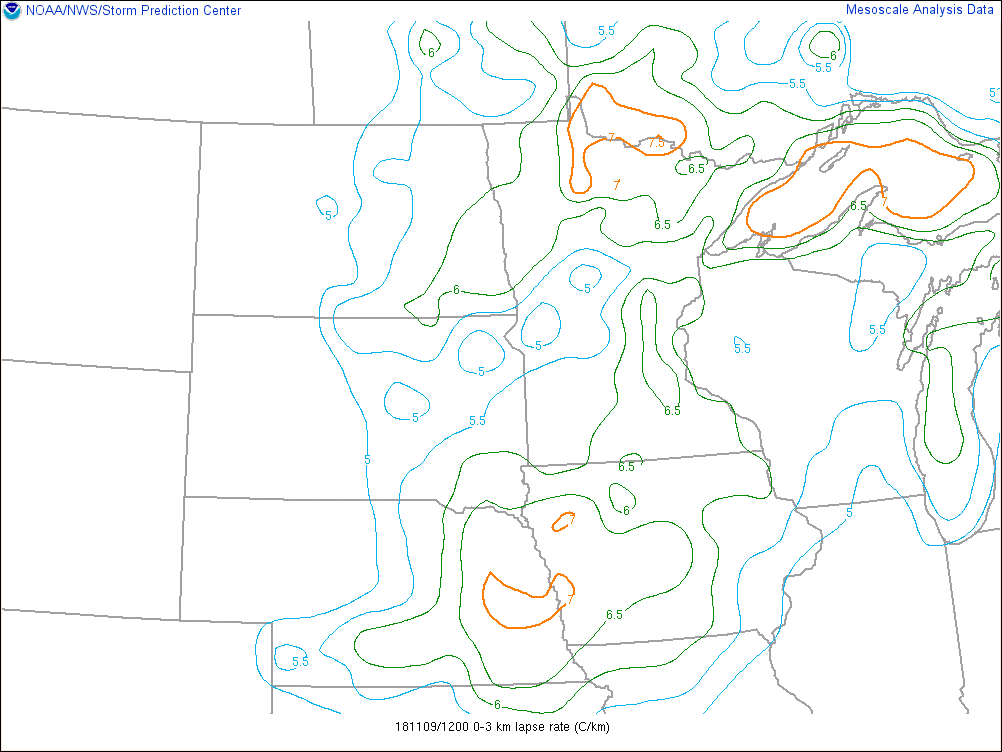
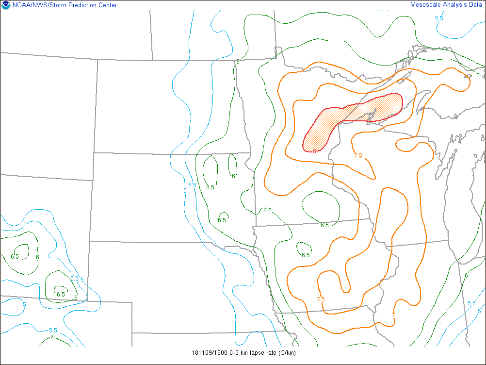
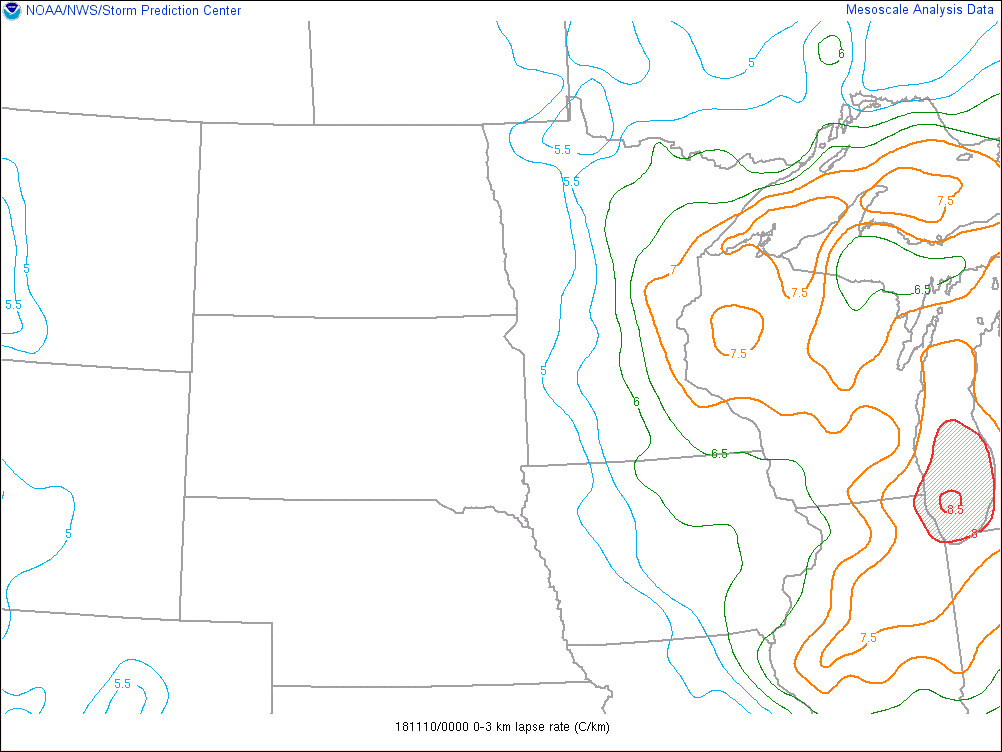
Low-Level Lapse Rates (0-3km), steeper lapse rates shown in orange and red contours
 |
 |
 |
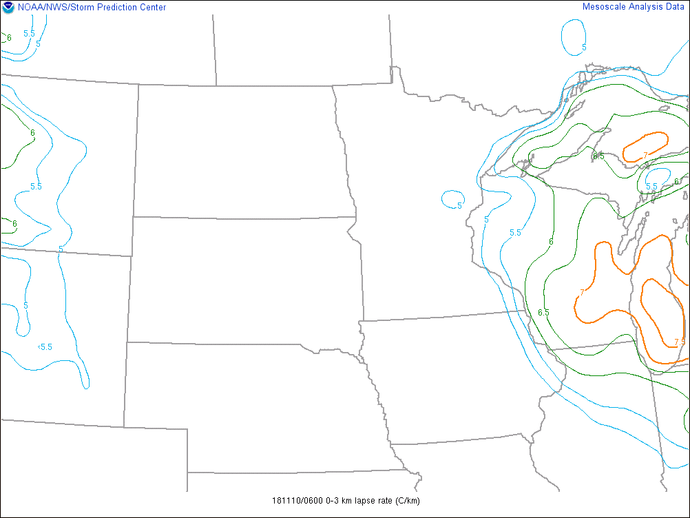 |
| 1200Z, 7am EST Nov. 9th | 1800Z, 1pm EST Nov. 9th | 0000Z, 7pm EST Nov. 9th | 0600Z, 1am EST Nov. 10th |
Satellite Data:
 |
 |
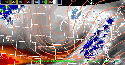 |
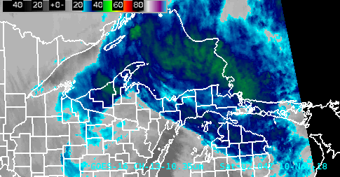
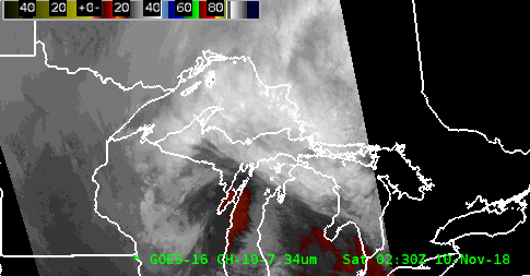
| 1-minute GOES-East IR imagery shows the colder cloud tops, shown in the dark blue to bright green colors, associated with the stronger bands of lake enhanced snow. | 1-minute GOES-East low-level water vapor imagery showing low-level moisture associated with heavy lake enhanced snow showers. | 5-minute GOES-East mid-level water vapor imagery, overlaid with GFS 500mb heights, shows the track of the shortwave across the Upper Great Lakes throughout the event. |
Radar Data:
 |
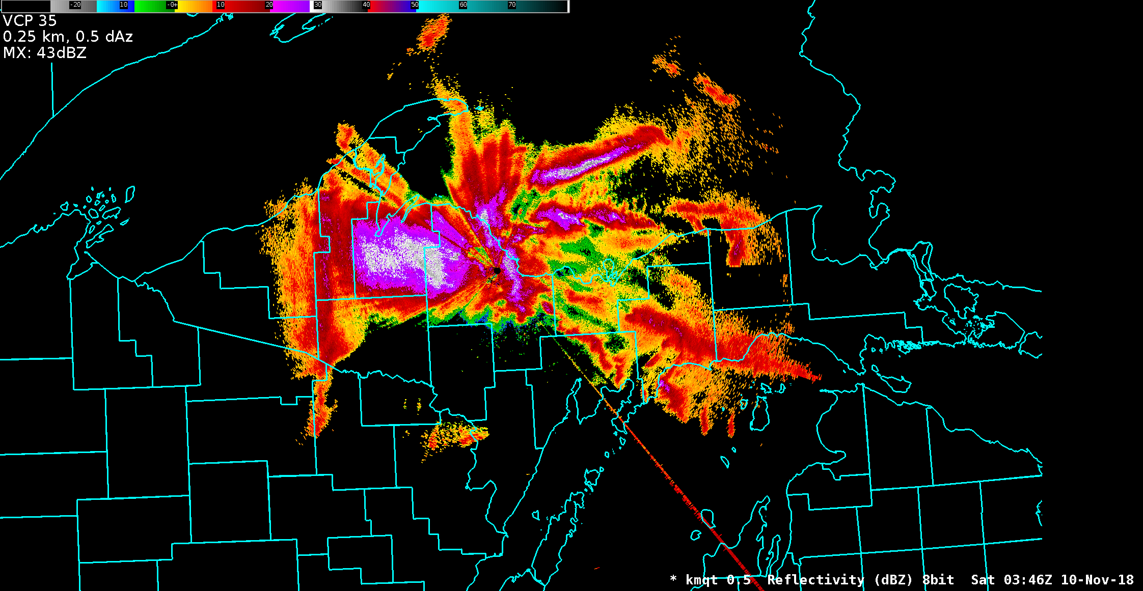 |
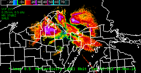
| Radar data shows the evolution of a snow squall along the leading edge of the surface trough as it pushed onshore across north central Upper Michigan and continued to push across south central Upper Michigan early Saturday morning. | Radar imagery from around 11pm EST shows strong returns across western Upper Michigan and impressive returns due to heavy snow across the north central. As is well known, radar coverage over western Upper Michigan during the winter months is sparse due to the shallow nature of lake effect snow. When we can see strong returns over western Upper Michigan, this is tell us that the convection associated with falling snow is deep and thus strong. |
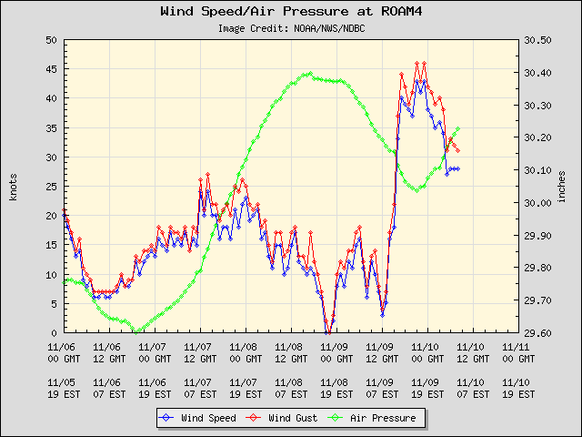
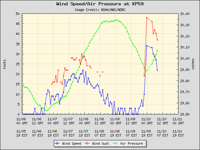
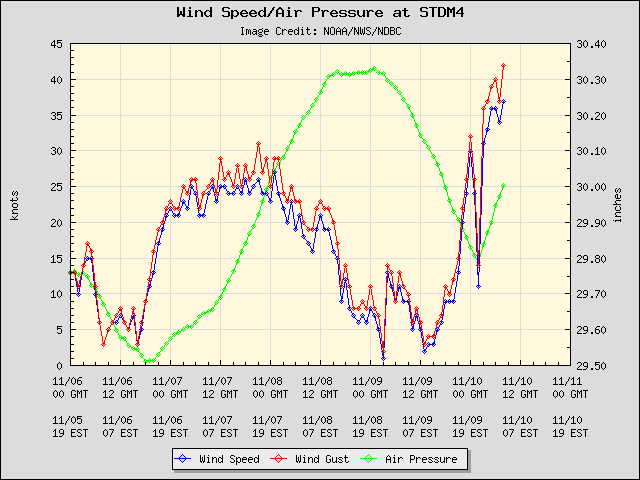
Rapid Onset of Gales on Lake Superior:
 |
 |
 |
|
Rock of Ages, along the south side of Isle Royale (Courtesy of NOAA/NWS/NDBC) |
Copper Harbor, along the top of the Keweenaw Peninsula (Courtesy of NOAA/NWS/NDBC) |
Stannard Rock, south central Lake Superior (Courtesy of NOAA/NWS/NDBC) |
Services:
 |
 |
 |
 |
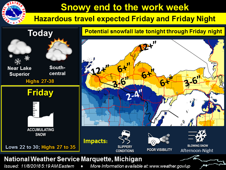
| Wed. Nov 7 - AM Weather Story | Wed. Nov 7 - PM Weather Story | Thur Nov 8 - AM Weather Story | Thur Nov 8 - PM Weather Story |
 |
 |
 |
 |
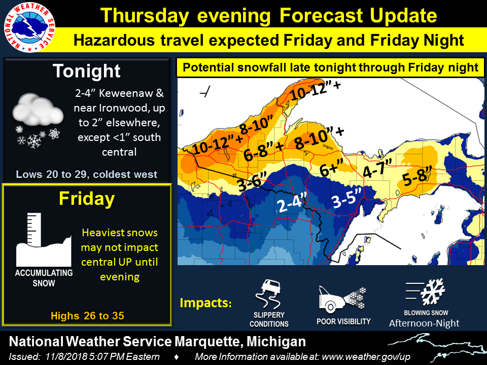
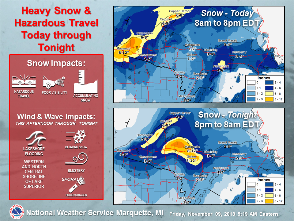
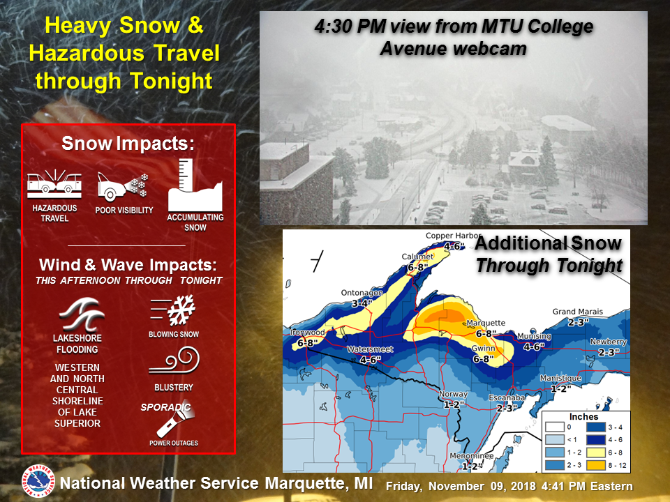
| Fri. Nov 9 - AM Weather Story | Fri. Nov 9 - PM Weather Story | Friday Nov 9 - PM Social Media Update | Friday Nov 10 - AM Social Media Update |
 |
 |
| Fri. Nov 9 - PM Webcam Update | Saturday Nov 10 - AM Social Media Update |
 |
Media use of NWS Web News Stories is encouraged! Please acknowledge the NWS as the source of any news information accessed from this site. |
|

