Overview of the Heavy Lake Effect Snow Event January 5-6, 2022
|
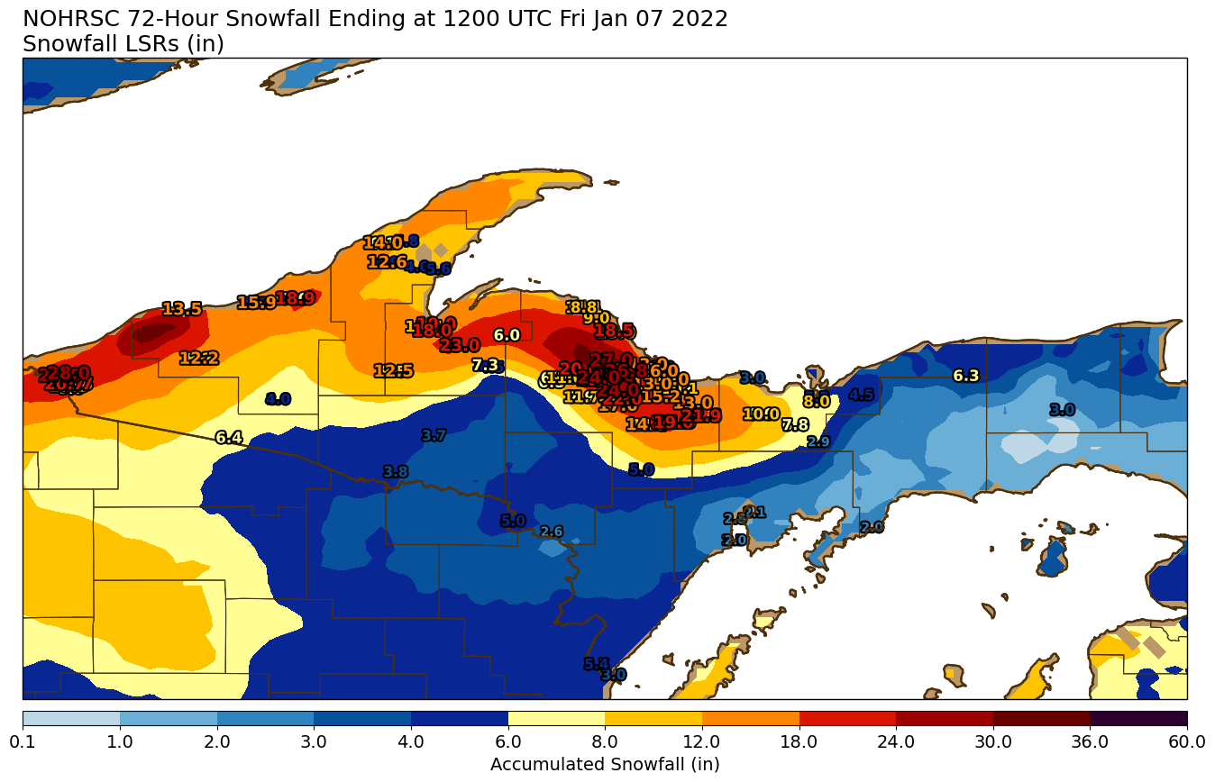
A "clipper" system moved from west to east across Minnesota, Wisconsin, and northern Lower Michigan Tuesday January 5 through Thursday January 7. The system dropped a couple inches of snow across Upper Michigan. However, the big story was the persistent moderate to heavy lake effect snow in western and northern Upper Michigan with this system. The system slowed down as it passed by to the south, and extended a trough back to its west across the U.P., which allowed north wind lake effect snow to persist for nearly 48 hours. This persistent lake effect snow resulted in impressive snowfall totals in parts of Marquette and Baraga Counties, as well as around Ironwood. This storm yielded the biggest 2-day snow total for the Marquette County highlands in nearly 3 years (Feb 2019). Snow totals of 24-28 inches were observed in the higher terrain of central Marquette County as well as just north of Ironwood. Meanwhile, some parts of the U.P. which did not see any lake effect snow from this system saw as little as 2 inches total. |
Click here for a complete list of snowfall reports from this storm |
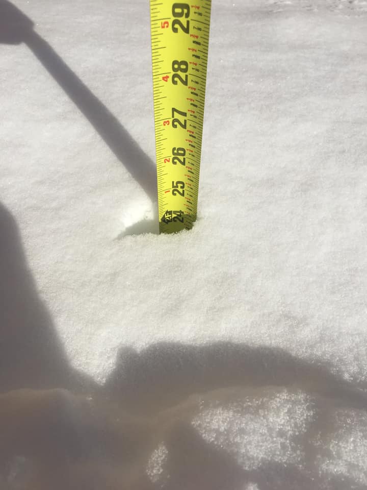
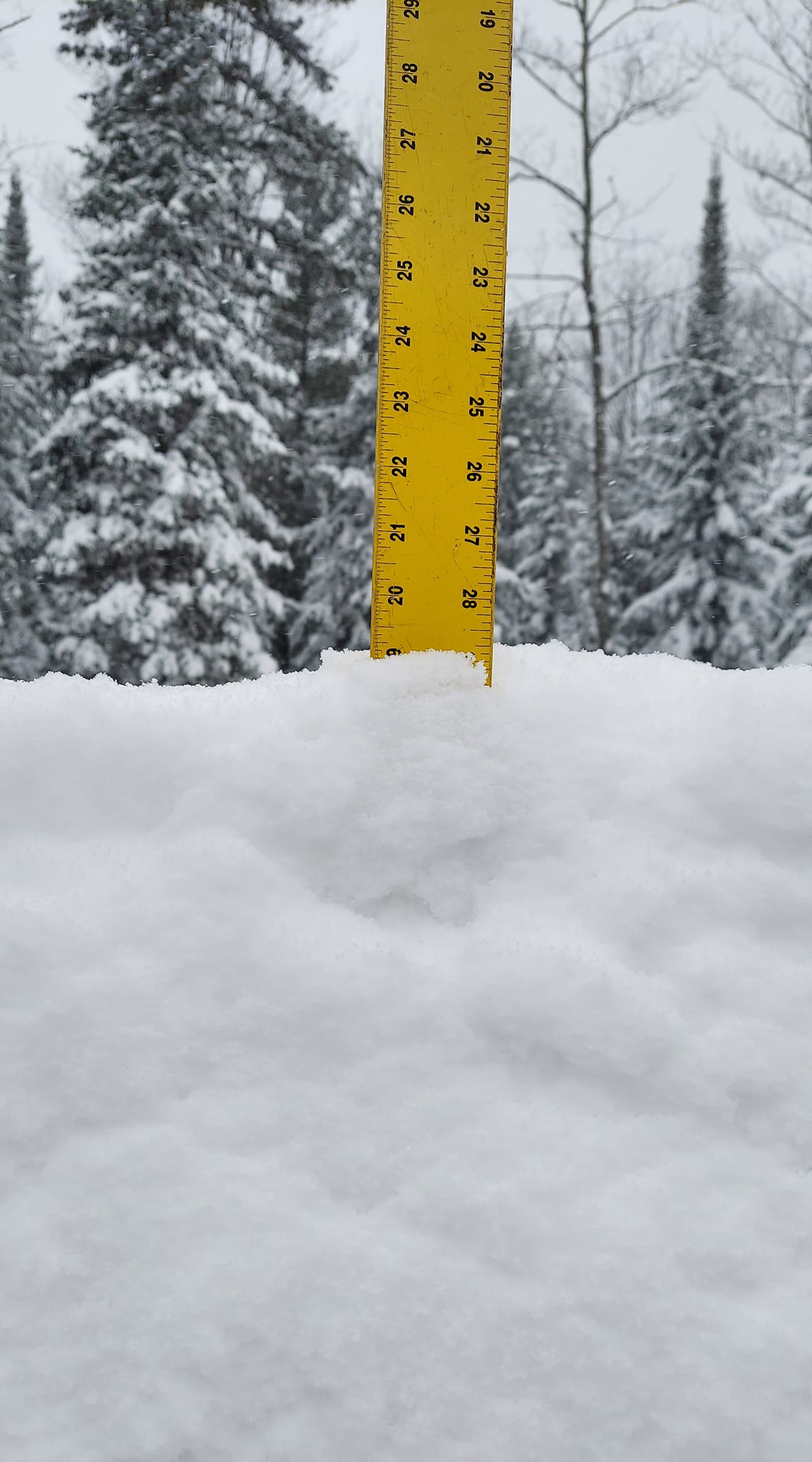
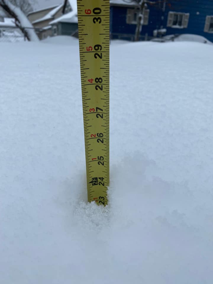
Photos
 |
 |
 |
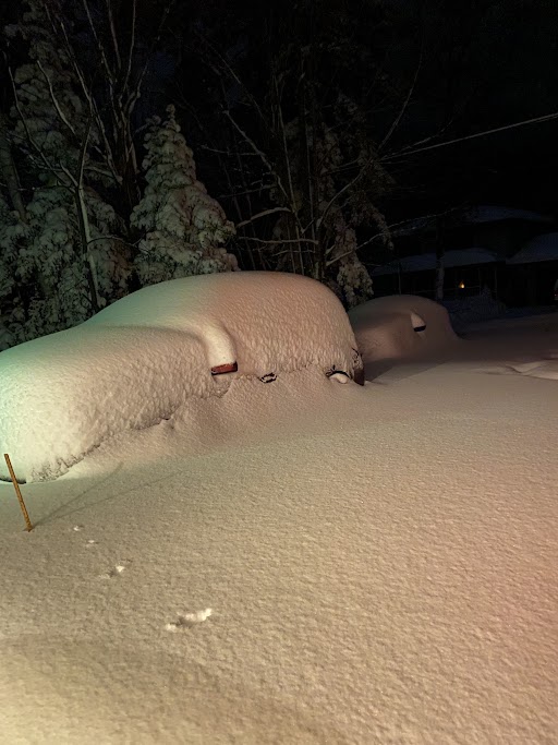 |
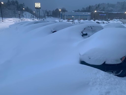
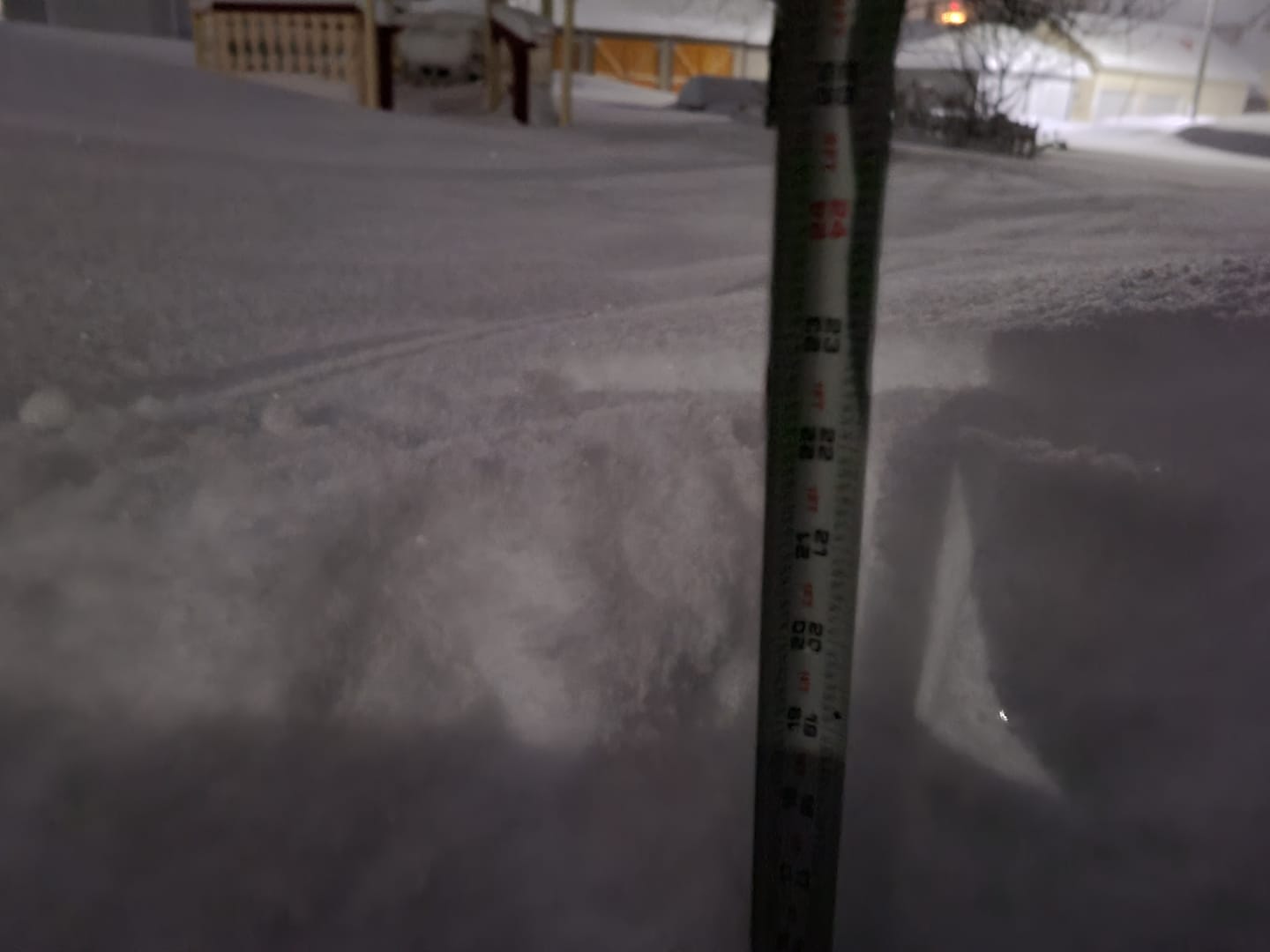
| Snowed-in cars at Fox Negaunee, courtesy of Jerry Taylor | Snow timelapse from Negaunee, courtesy of Holden Meyering | Deep snow in Negaunee, courtesy of Scott Bartle | Snowed-in cars in Negaunee from NWS Marquette WCM Matt Zika |
 |
 |
 |
 |
| Deep snow in Ishpeming, courtesy of Diane Schmitt | Deep snow in L'Anse Township, courtesy of Wayne Joki | Two feet of snow in Palmer, courtesy of Heidi Bray | This pup is doing his best braving the snow and cold! Photo courtesy of Amber Marie Pleaugh |
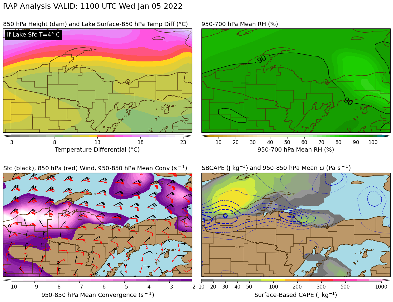
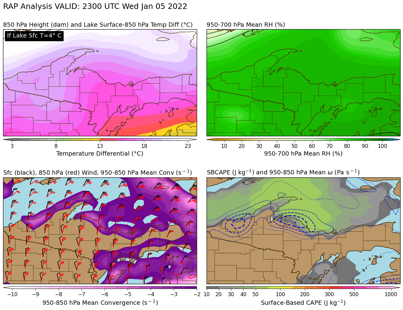
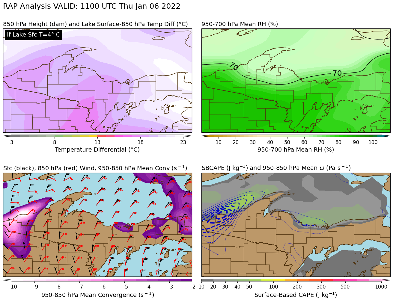
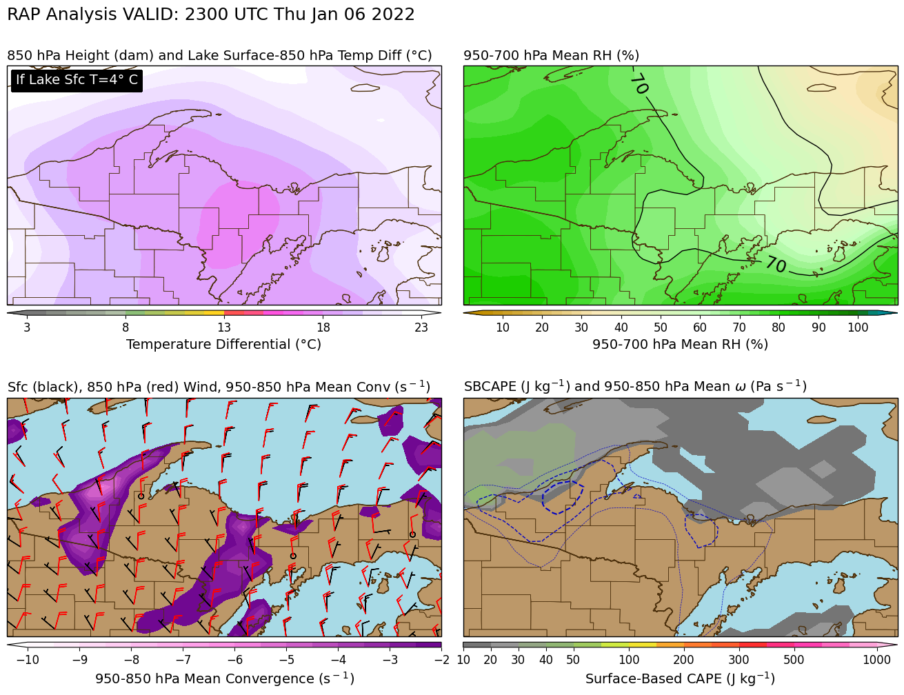
Meteorology of this Storm
Maps showing parameters that describe lake effect snow.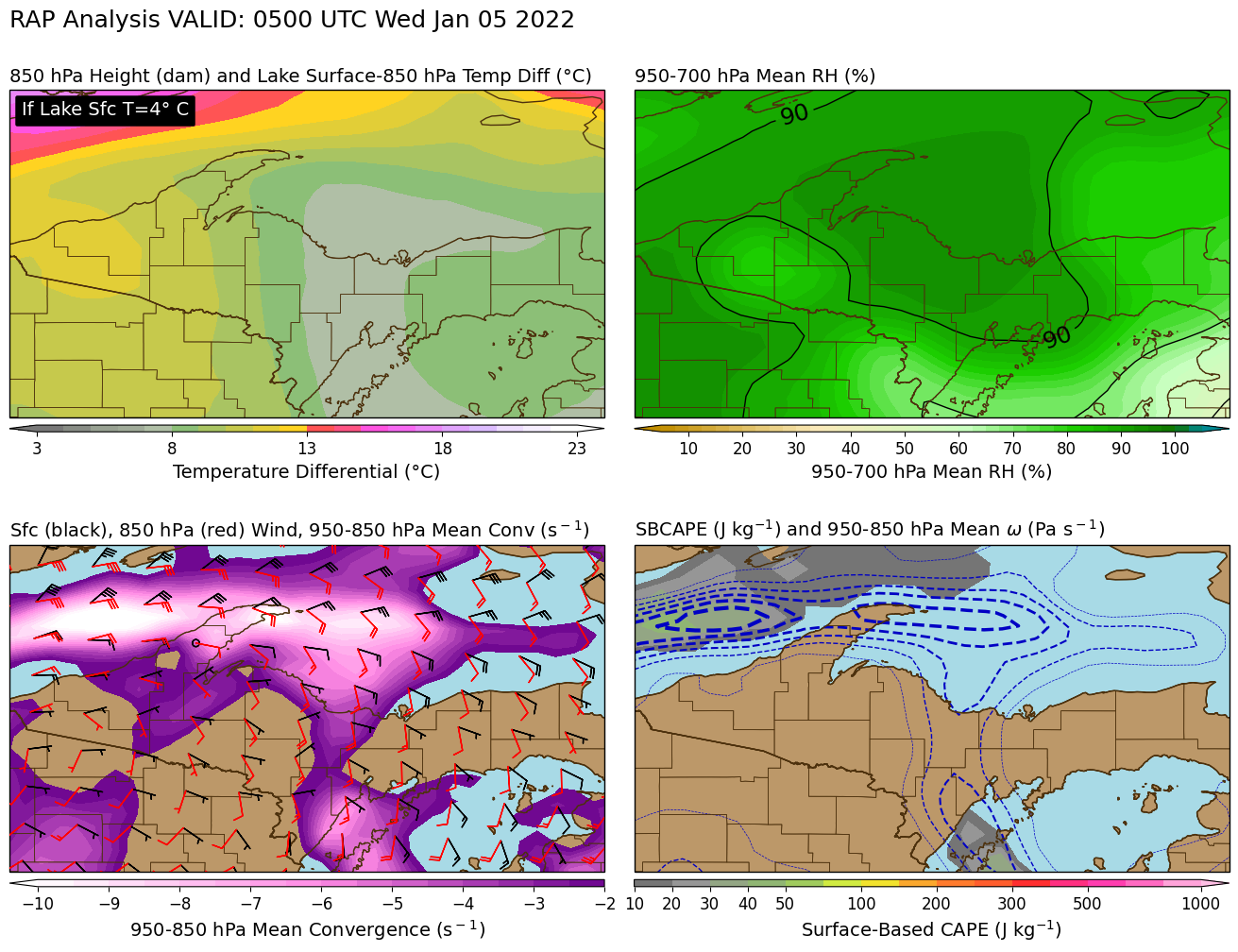 |
 |
 |
 |
 |
| 12 am EST Jan 5, 2022 | 6 am EST Jan 5, 2022 | 6 pm EST Jan 5, 2022 | 6 am EST Jan 6, 2022 | 6 pm EST Jan 6, 2022 |
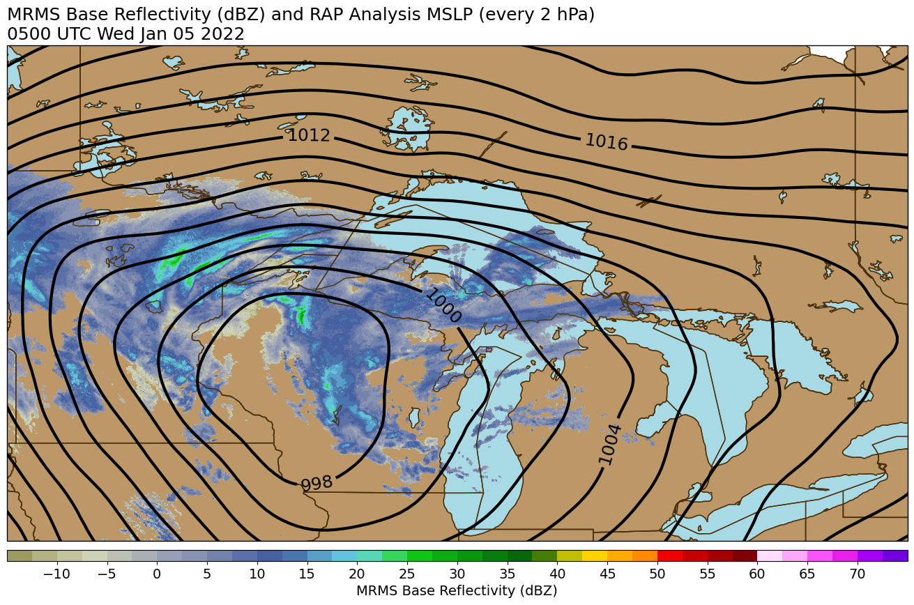
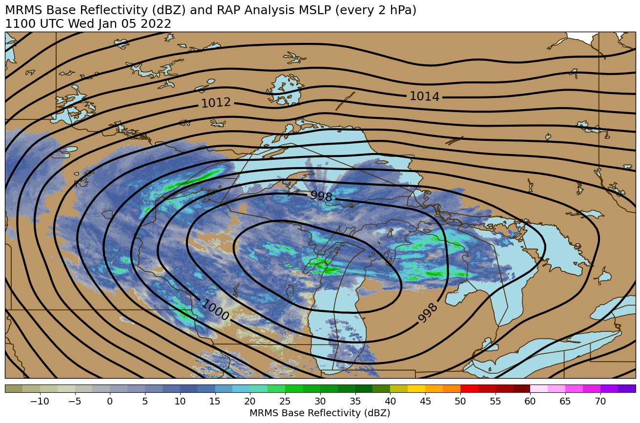
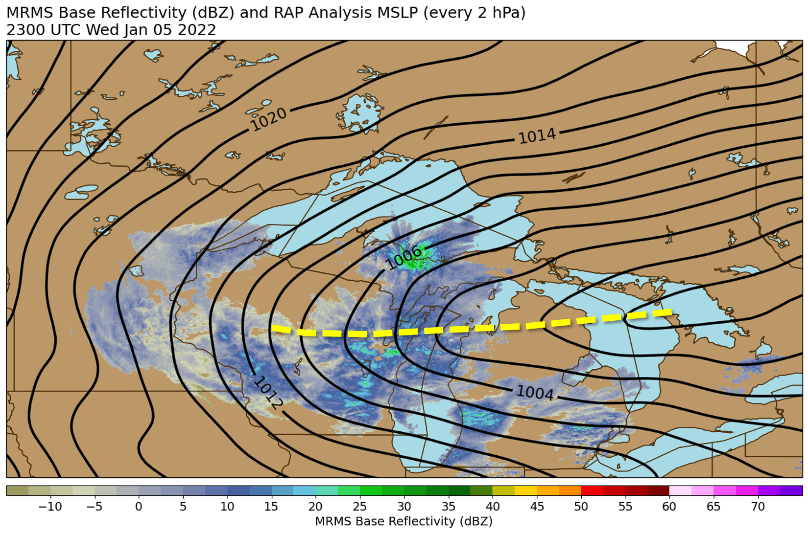
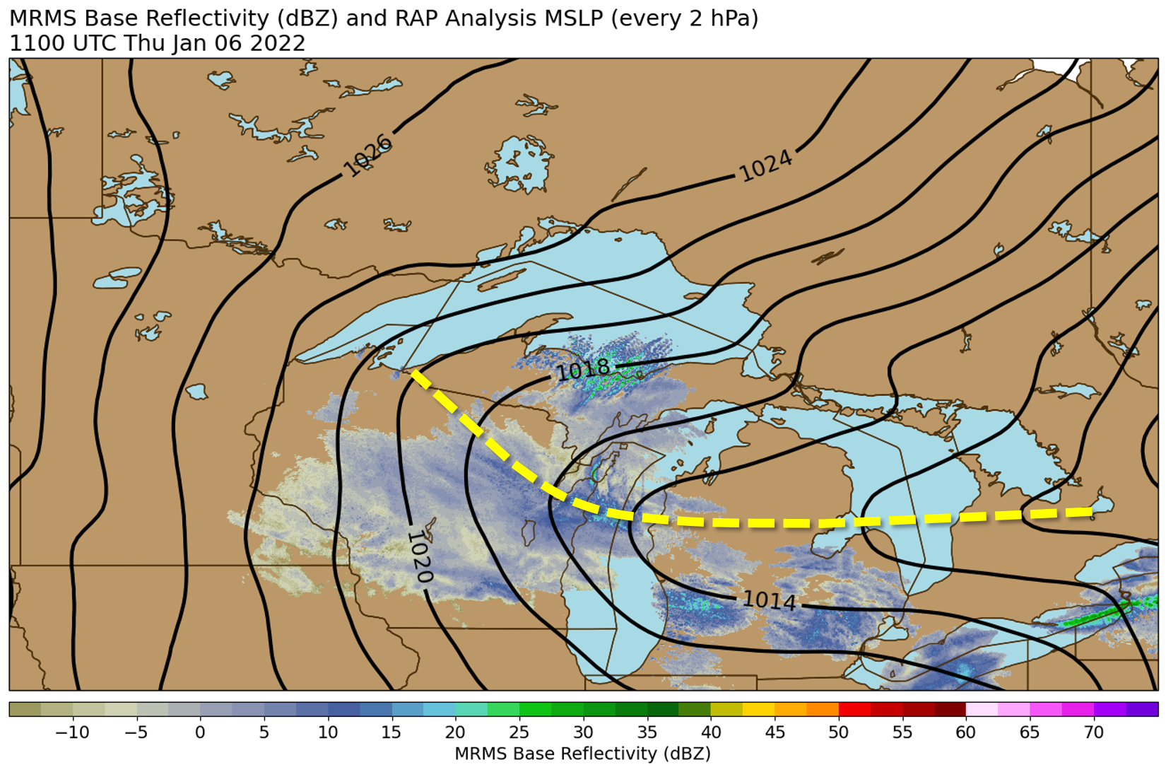
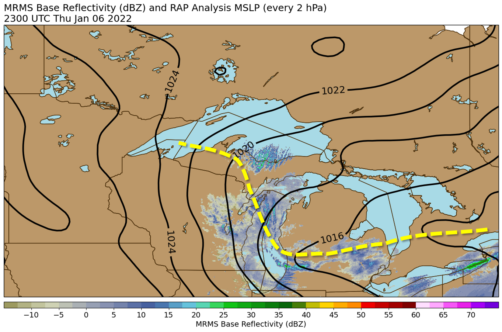
Maps showing mean sea level pressure in black contours and radar reflectivity in shades of blue and green.
Note the inverted trough that hangs back to the west after the initial low departs to the east. This inverted trough is what caused this to be such a long-duration lake effect snow event. It is denoted with a yellow dashed line in the last three images.
 |
 |
 |
 |
 |
| 12 am EST Jan 5, 2022 | 6 am EST Jan 5, 2022 | 6 pm EST Jan 5, 2022 | 6 am EST Jan 6, 2022 | 6 pm EST Jan 6, 2022 |
 |
Media use of NWS Web News Stories is encouraged! Please acknowledge the NWS as the source of any news information accessed from this site. |
|


Social Media Messaging