Overview
|
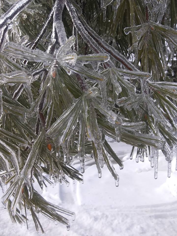
A system tracking northeast across the Upper Great Lakes brought with it anomalously warm temperatures aloft and record breaking precipitable water values, resulting in a significant, historic ice storm for this part of the county. Many locations saw moderate to heavy freezing rain, resulting in one-quarter to around or just greater than three-quarters of an inch of ice accretions. As the depth of the cold air began to increase as the system pulled out of the region, locations that saw primarily freezing rain did see precipitation switch over to or mix with sleet for a period of time. Across far south central and eastern Upper Michigan, especially near Lake Superior precipitation remained mostly rain, but a very cold rain. Across the northwest, especially over the Keweenaw Peninsula precipitation started out as freezing rain and sleet, but then quickly switched over to Monday morning.
Link below to a blog about this event written by the Cooperative Institution for Research in the Atmosphere (CIRA):
|
|
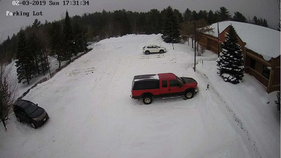
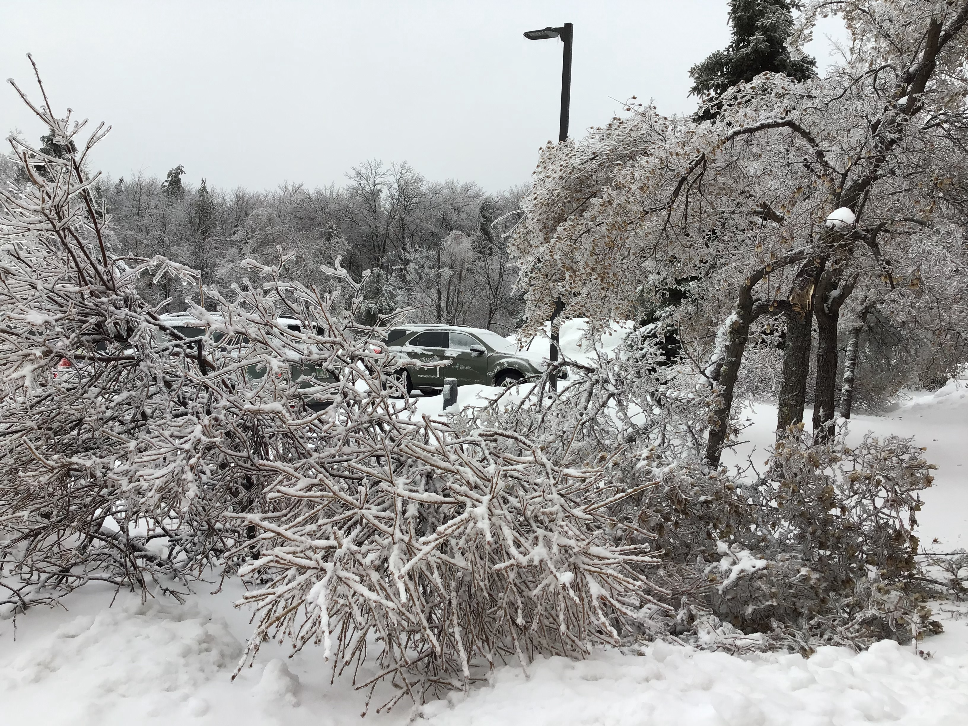
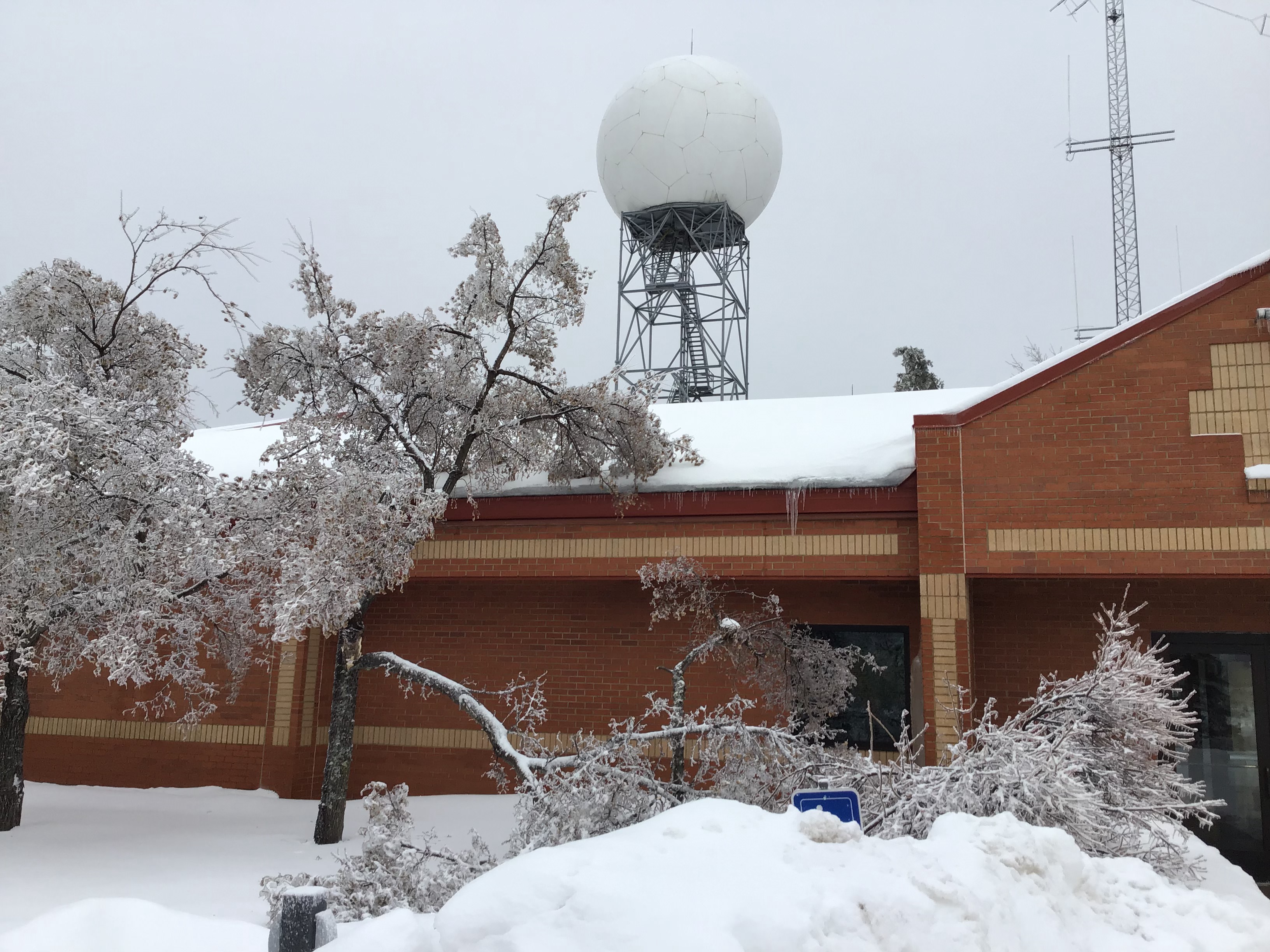
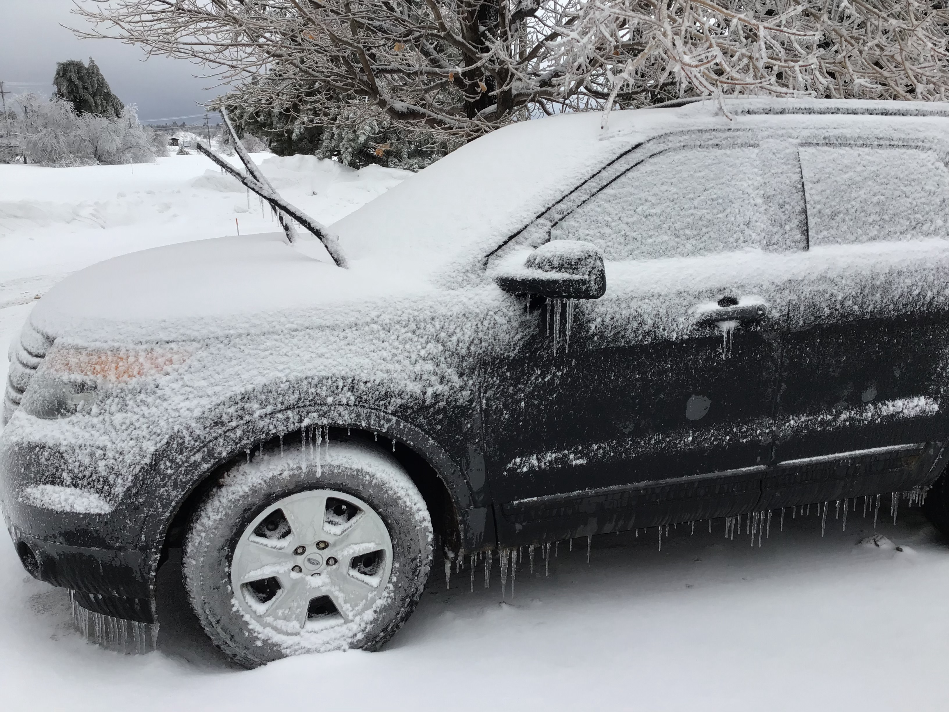
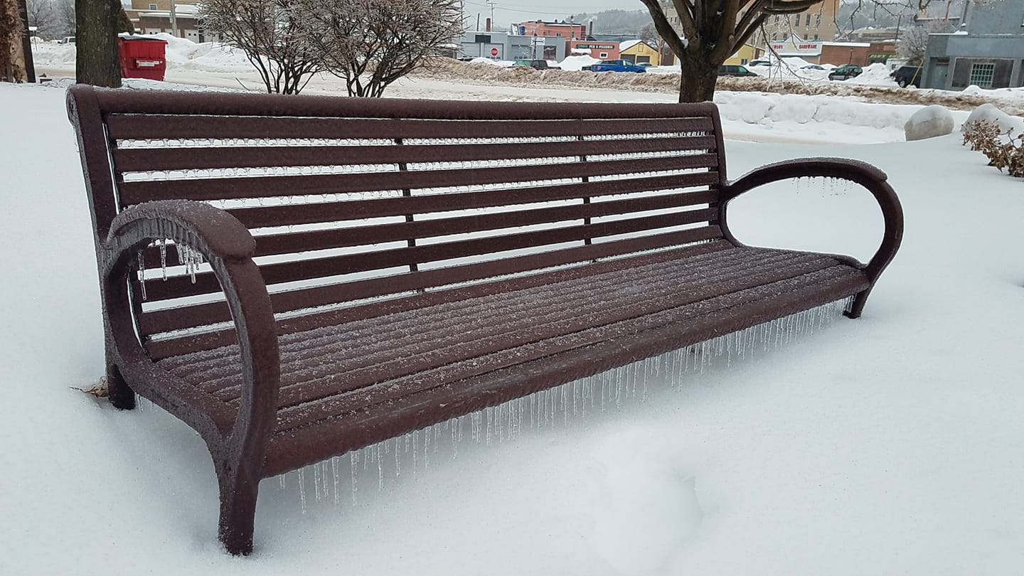
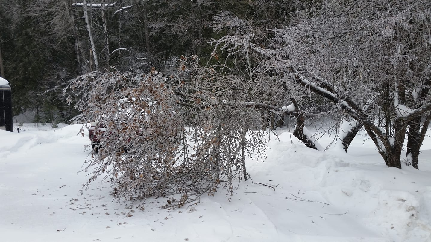
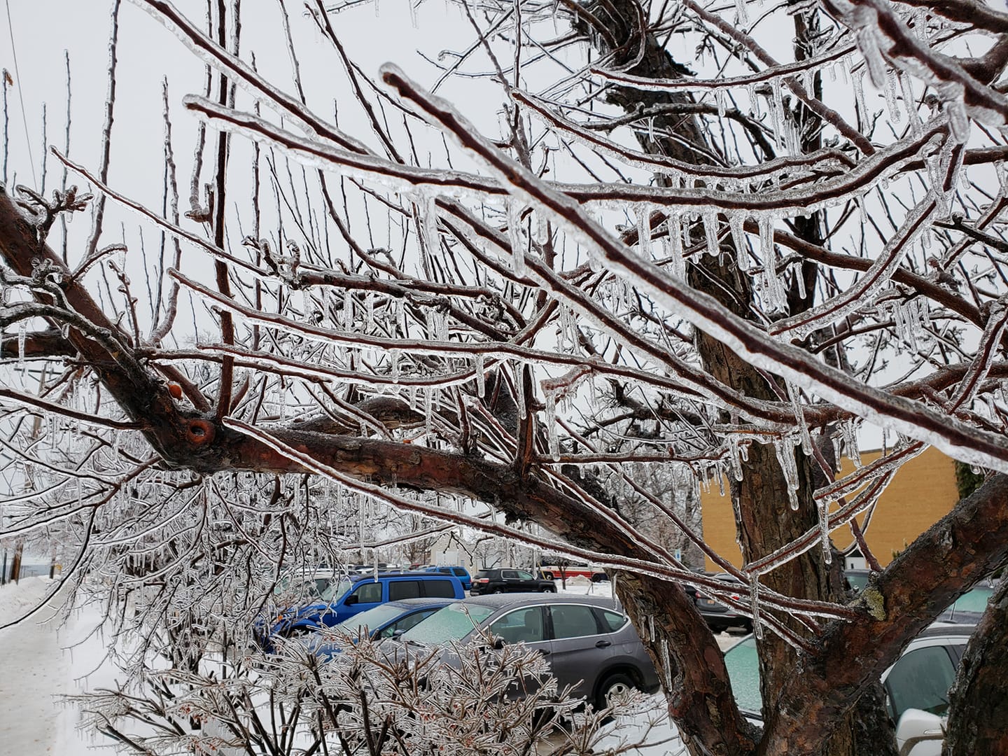
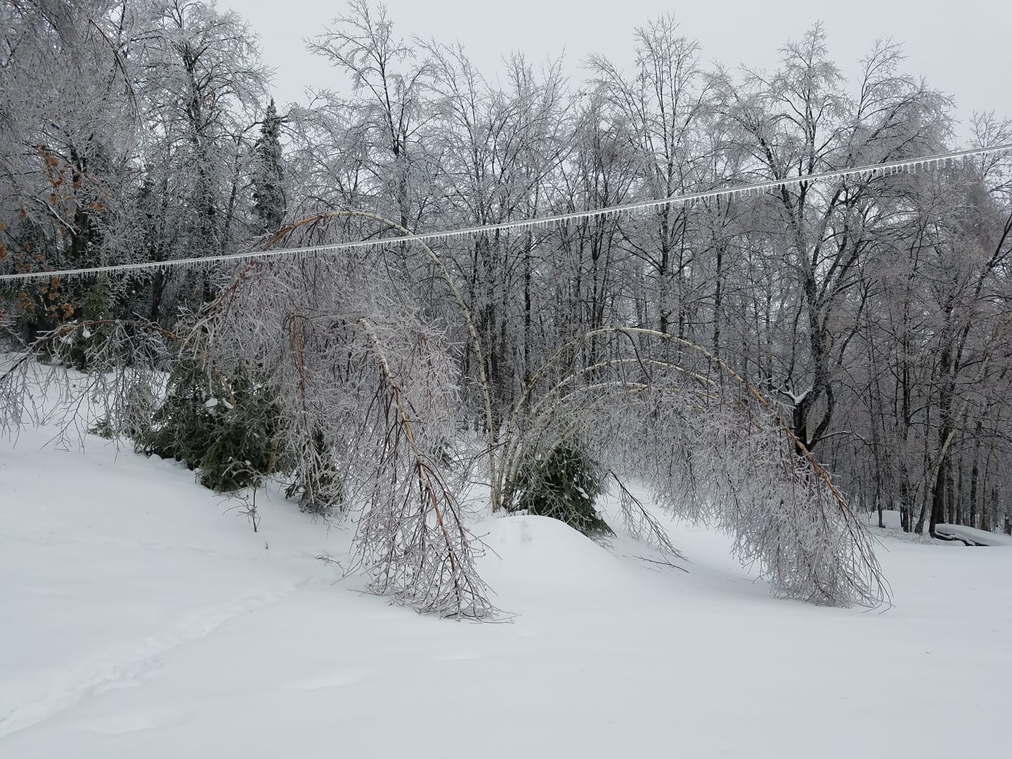
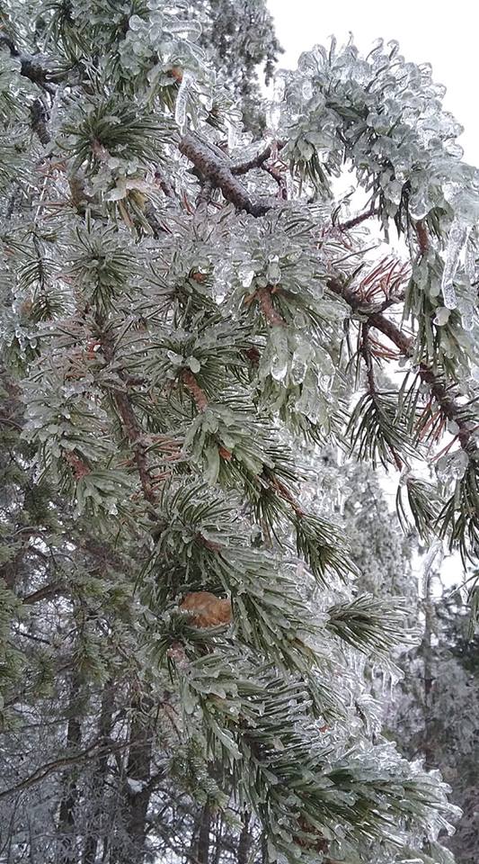
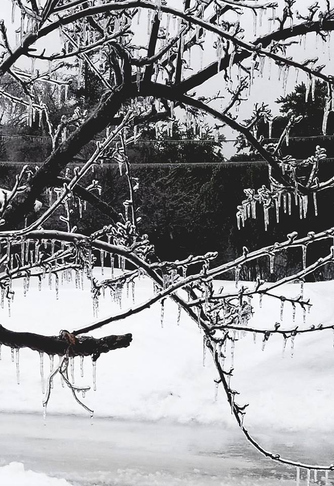
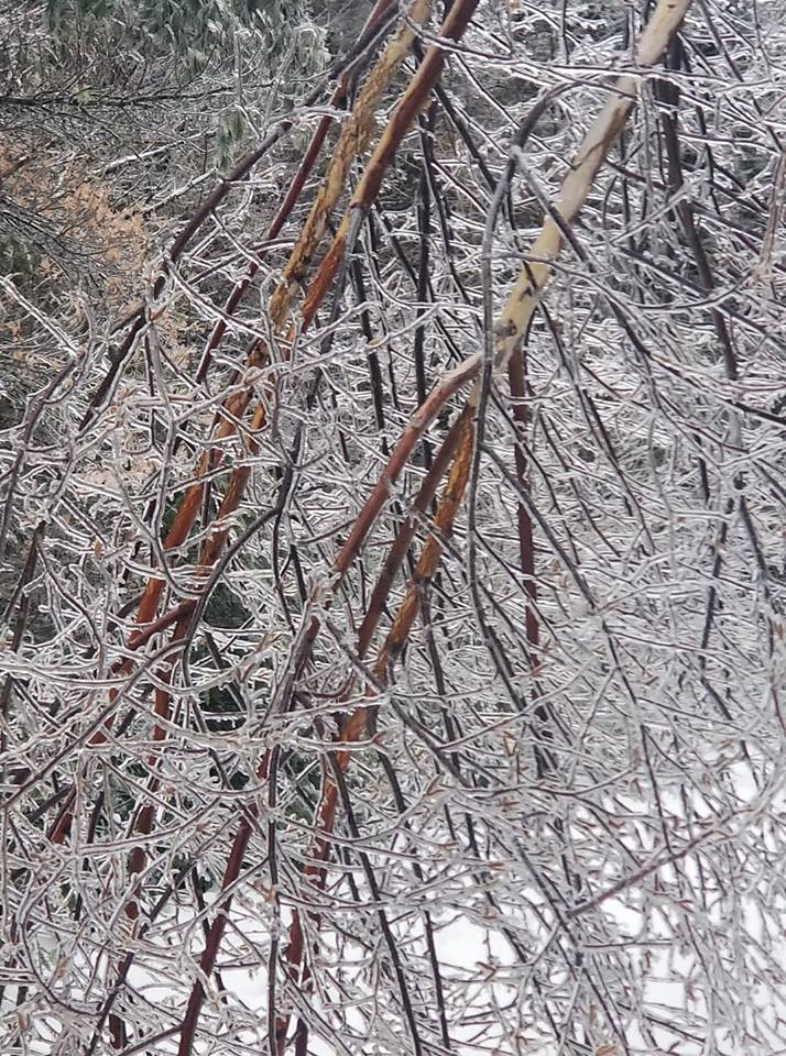
Photos & Video:
 |
 |
 |
 |
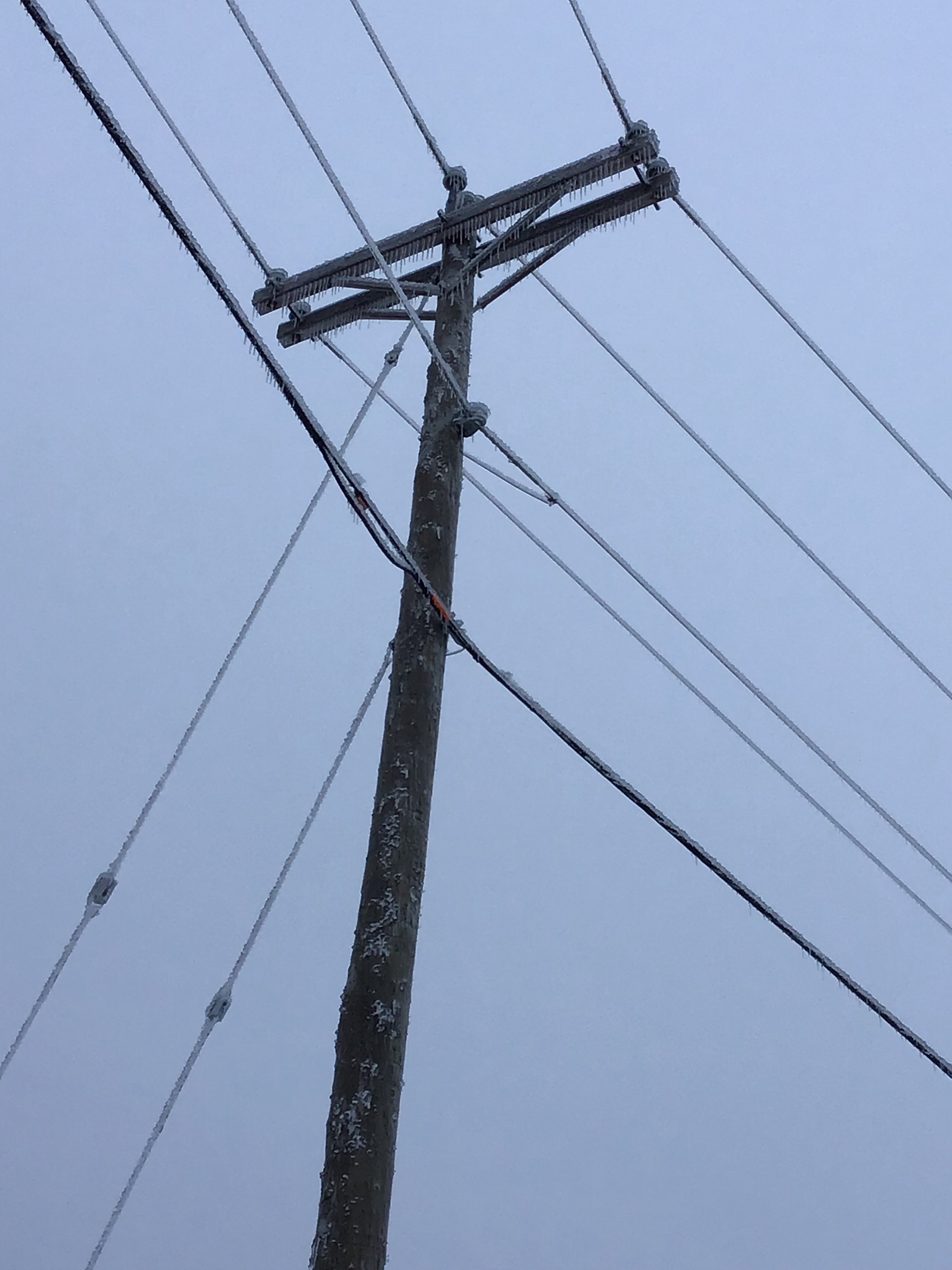
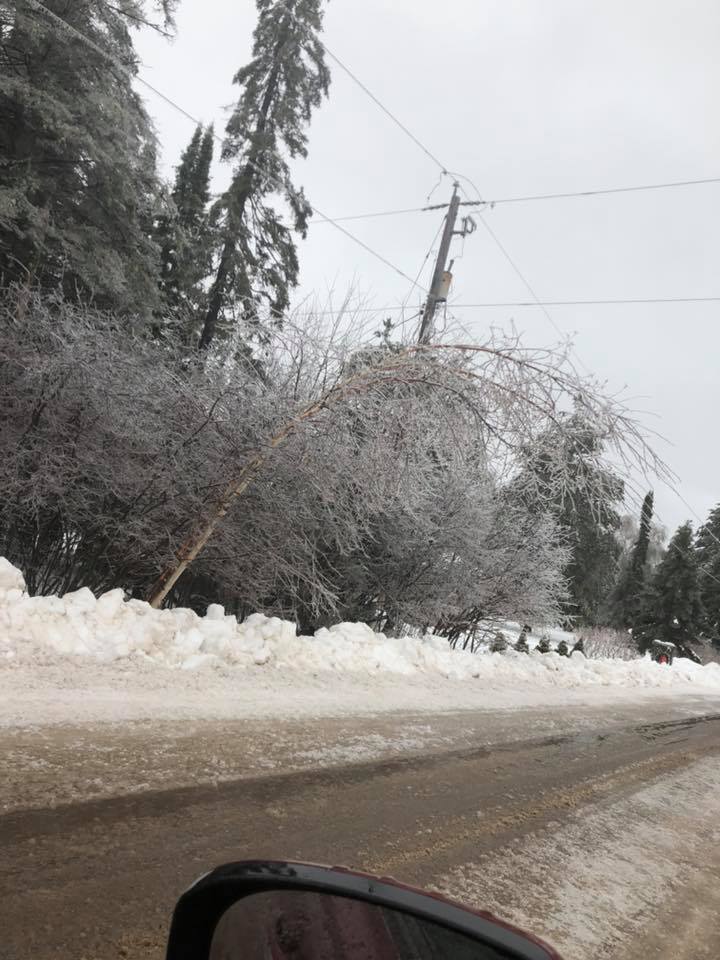
| A large tree limb collapsed in front of the NWS office due to the weight of ice accumulation. | A large tree limb collapsed in front of the NWS office due to the weight of ice accumulation. | A vehicle in the NWS office parking lot is encased in ice. | Ice accumulation on power poles and wires outside of the NWS office. |
 |
 |
 |
 |
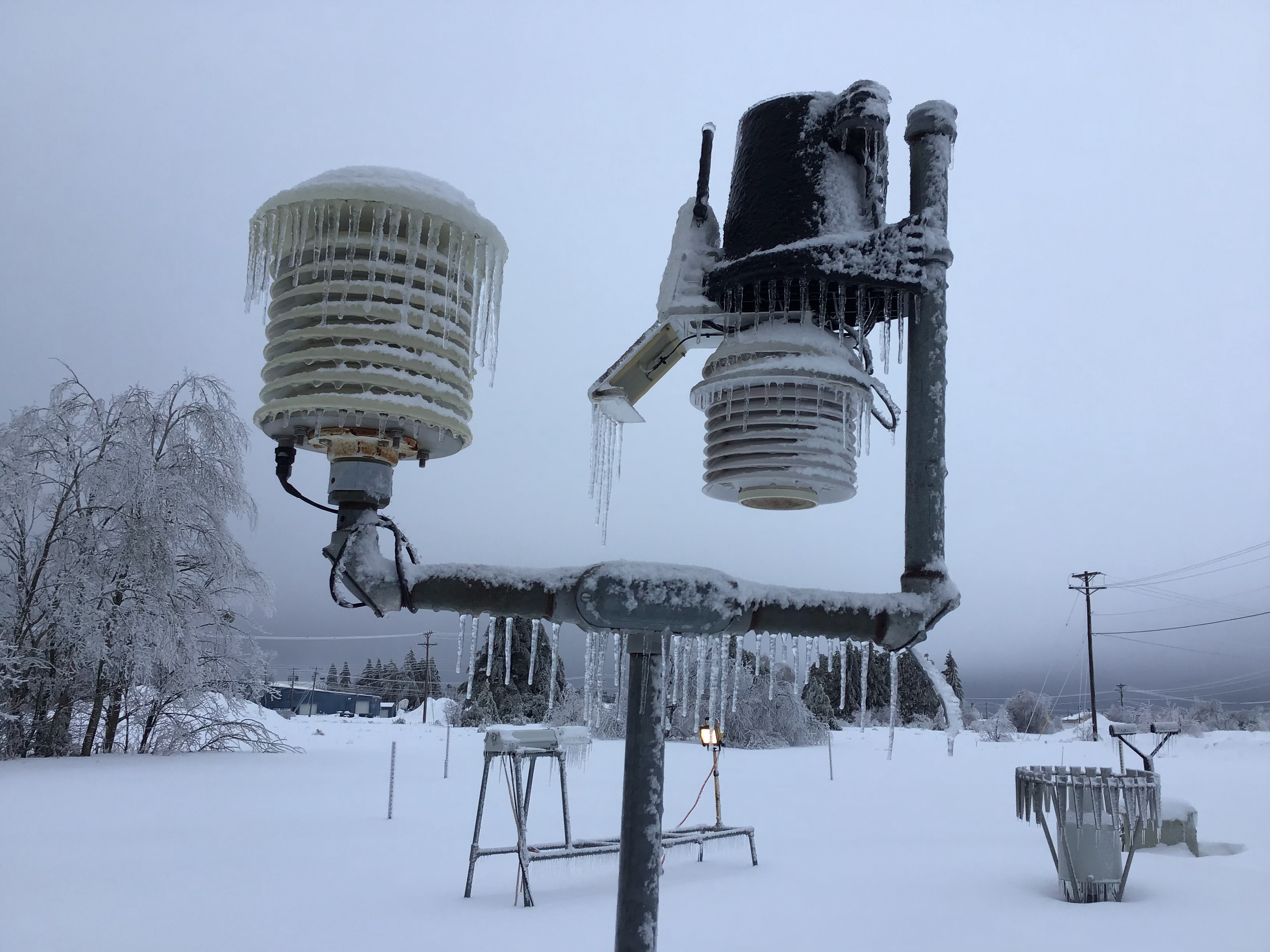
| Frozen instruments at the NWS office. | Trees sag under the weight of about 3/4" of ice accumulation at the NWS office. | Al Quaal (Ashley Geist) |
Beechwood, Iron County (Lynn Aho) |
 |
 |
 |
 |
| Channing (Kayla Denecke) |
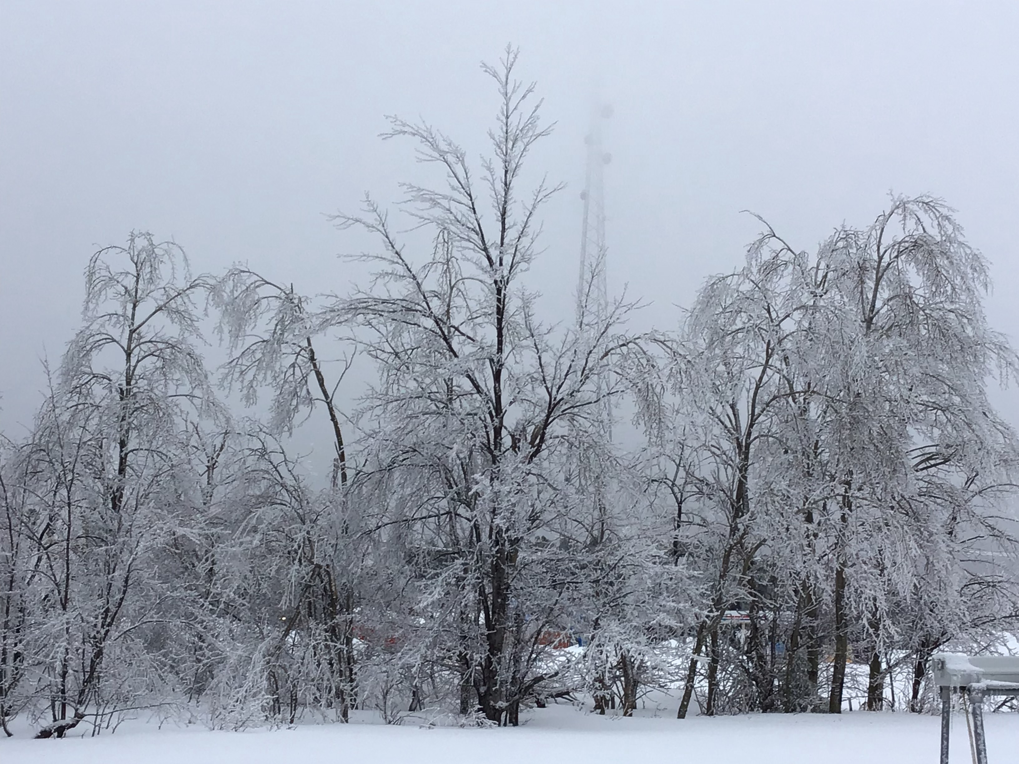
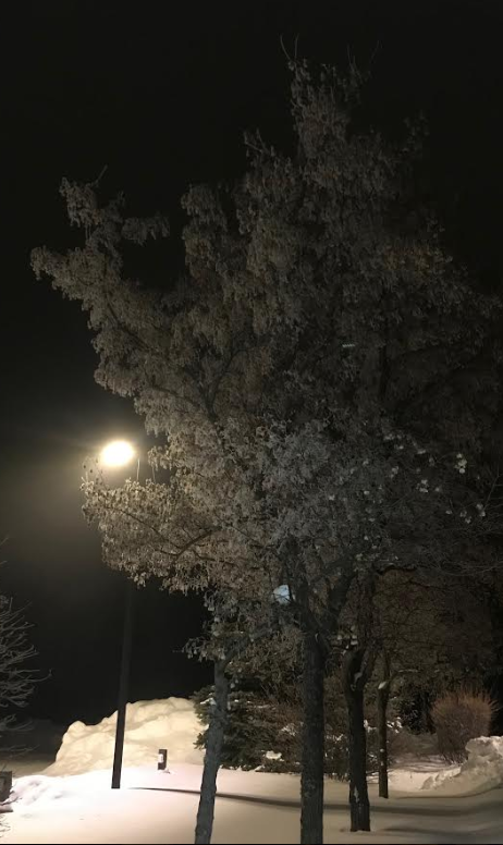
Freezing fog Sunday night into Monday morning allows for hoar frost to develop on tree branches and bushes at the NWS office. | Ice accumulation on power poles and wires outside of the NWS office. | Channing (Taylor Eva) |
 |
 |
 |
 |
| Ishpeming (Lyndi Bell) |
Ishpeming (Michael Walt) |
Marquette (Jacqui Stephens) |
Negaunee (Heather Leigh) |
 |
 |
 |
 |
| Ishpeming (Jody Talbacka Champion) |
Gwinn (Janet Vincent) |
Republic (Becca Lynn McCole) |
Randville (Rita Martin) |
 |
 |
 |
 |
| Negaunee (Megan Elizabeth) |
Quinnesec Lake (Katie Fleming) |
West Ishpeming (Karol Powell-Cardoni) |
Marquette Township (Eric Beckman) |
Reports:
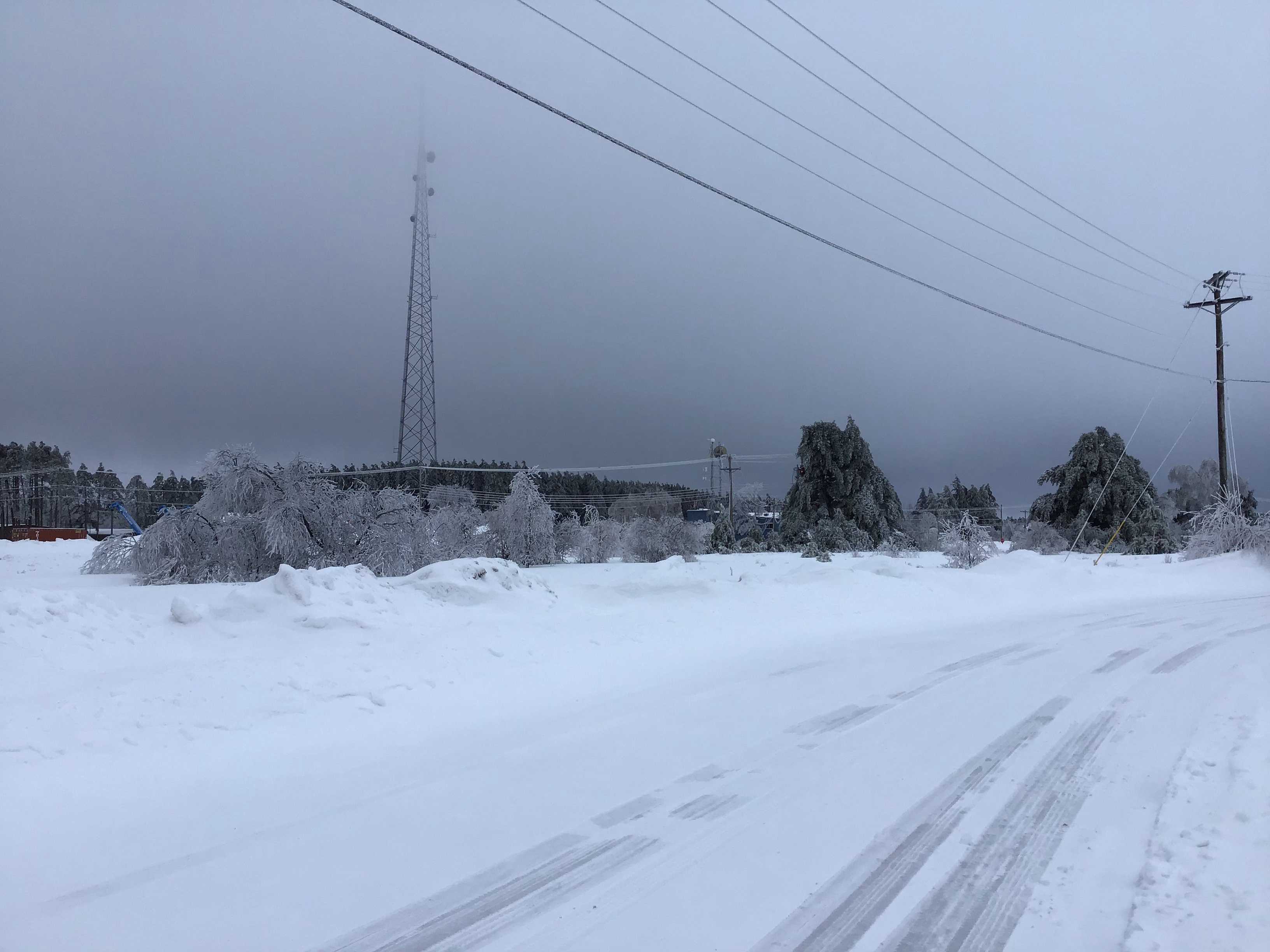
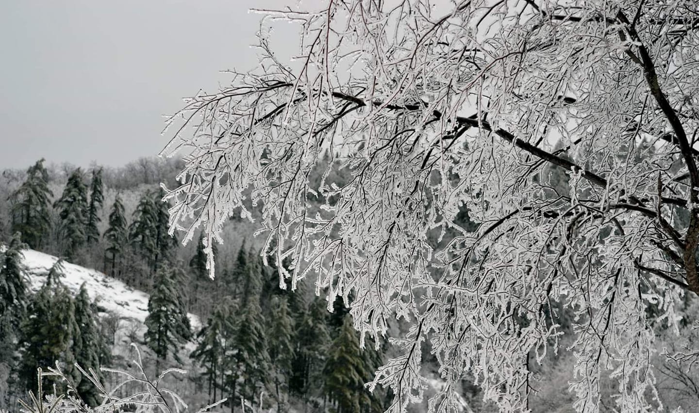
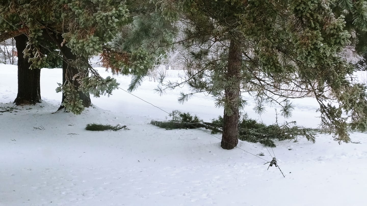
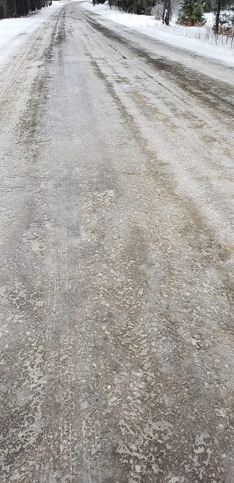
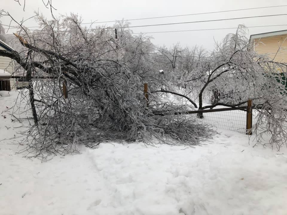
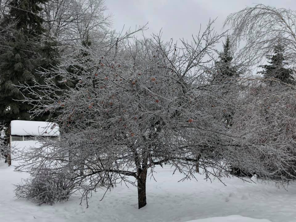
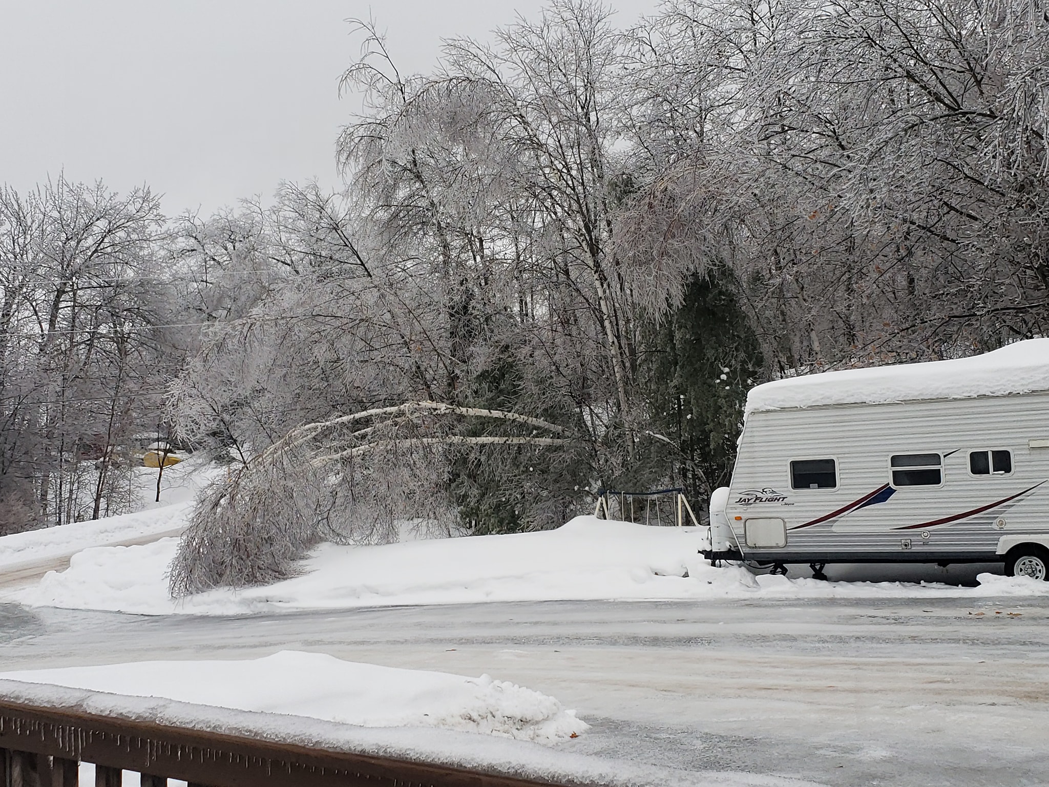
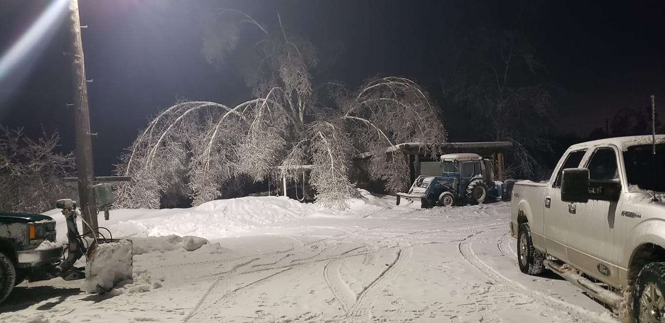
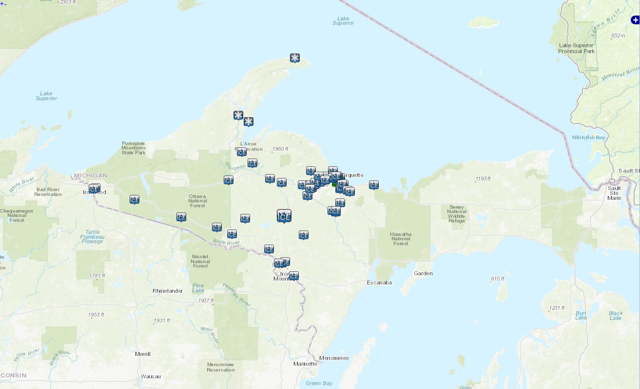
Due to the significant ice accumulations, many roads across portions of western and much of central Upper Michigan became ice-covered and nearly impossible to travel on during the ice storm. Ice accretions of one-quarter to nearly one inch in spots did result in widespread tree damage, downed power lines and sporadic power outages.
 |
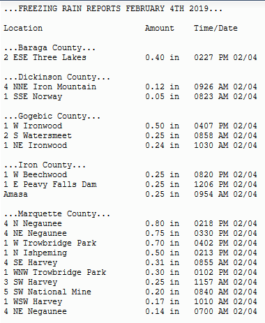 |
| This map shows the swath of ice storm reports along the Wisconsin border and up across north central Upper Michigan, and snowfall reports where higher amounts were observed across the northwest. | Reports showing the magnitude of ice accretions due to freezing rain across portions of western and central Upper Michigan. |
Environment:
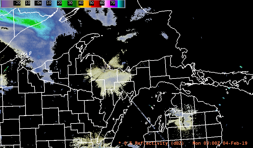
Radar imagery below shows the quick development of moderate to heavy freezing rain early Monday morning across western and central Upper Michigan, which continues to focus across central Upper Michigan through mid-day as it continues to shift eastward.
 |
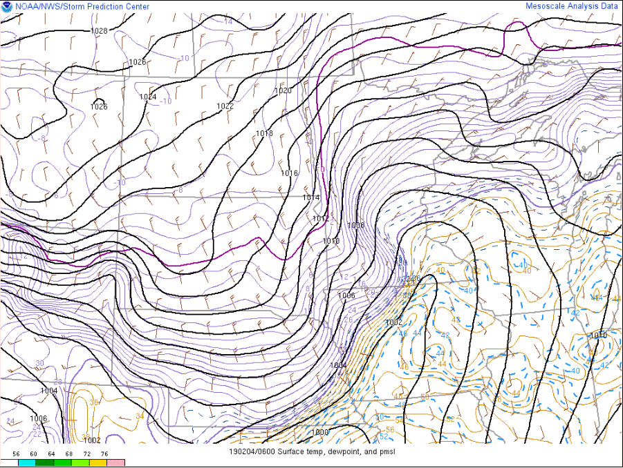
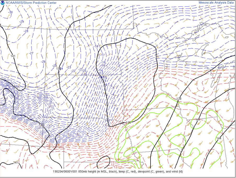
Low pressure associated with shortwave energy lifting northeast across the Upper Great Lakes brought with it a wintry mix of precipitation across the Upper Peninsula, from moderate snowfall to significant ice accumulations in spots across portions of western and central Upper Michigan. A strong and well pronounced warm nose aloft lead to the development of moderate to heavy freezing rain, which at times was mixed with sleet in spots due to the deep cold layer still in place at the surface after the arctic blast the week prior.
 |
 |
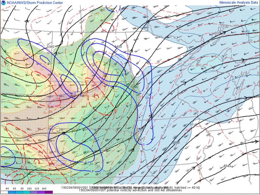 |
| Track of the surface low early Monday morning into Monday afternoon. | Track of the 850 mb low and warm air advection. | Track of shortwave as it lifted over the Upper Great Lakes. The bright, vibrant colors represent the track of 400-250 mb potential vorticity overlaid on top of the 500 mb flow. Potential vorticity advection is showed in blue for positive and red dashed for negative. |
 |
 |
|
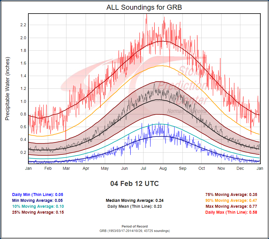
| Sounding Climatology for Green Bay, Wisconsin showing the record max for PWAT on Feb. 4th at 1200Z being 0.58 inches. | 1200Z sounding from Green Bay showing record breaking PWAT values with 0.79 inches observed. | |
 |
 |
|
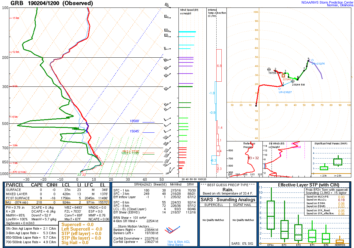
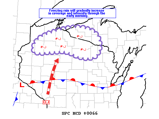
| Mesoscale Discussion issued by the Storm Prediction Center early Monday morning highlighting the expected freezing rain potential. Details: https://www.spc.noaa.gov/products/md/md0066.html | Mesoscale Discussion issued by the Storm Prediction Center Monday morning highlighting the ongoing freezing rain. Details: https://www.spc.noaa.gov/products/md/md0067.html |
Forecast soundings shown below demonstrate the strong warm nose overspreading much of Upper Michigan throughout the event. Some locations showed a deeper cold layer near the surface resulting in more sleet then freezing rain as hydrometeors were able to refreeze before reaching the surface.
| Location & details from soundings | 7am EST, 1200Z Monday, Feb. 4th | 1pm EST, 1800Z Monday, Feb. 4th |
|
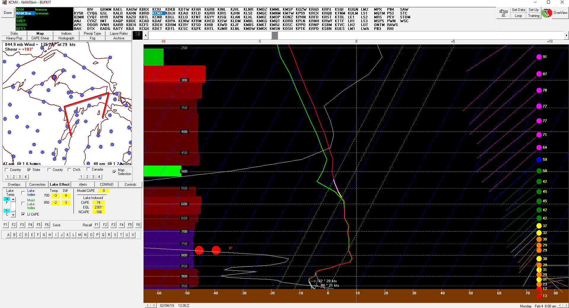
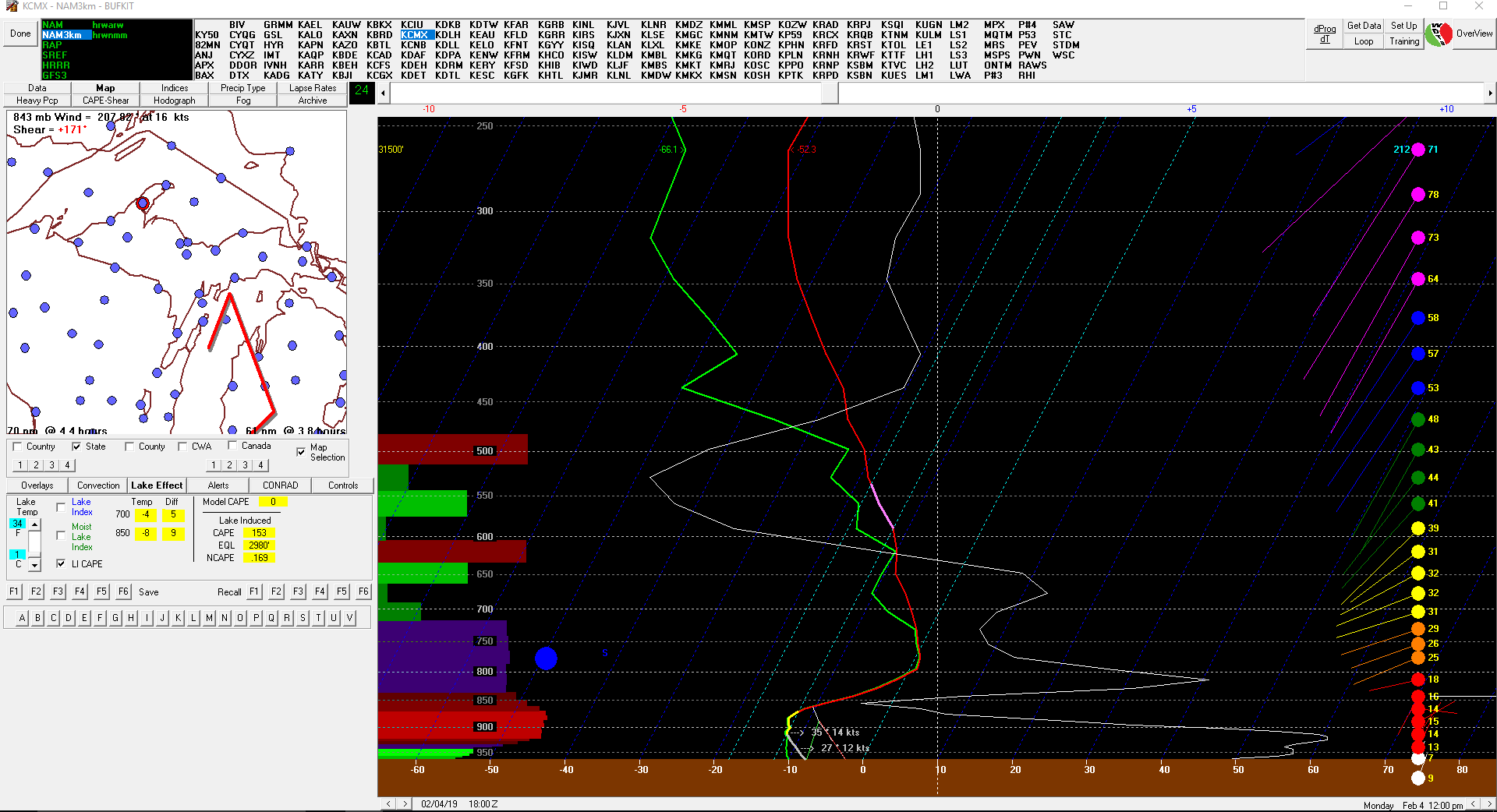
Houghton (KCMX)
Forecast soundings show the initial precipitation type starting off as a sleet/freezing rain mixture, before transitioning over to snow throughout the morning hours. |
 |
 |
|
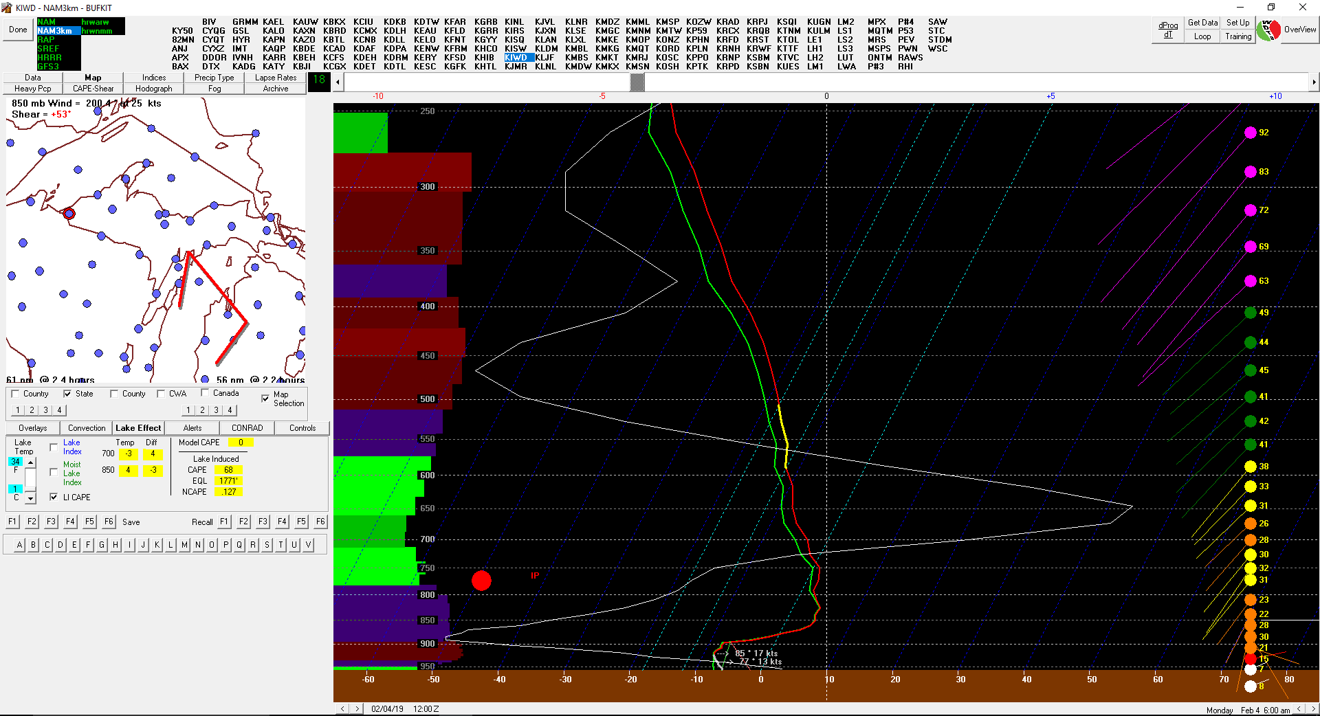
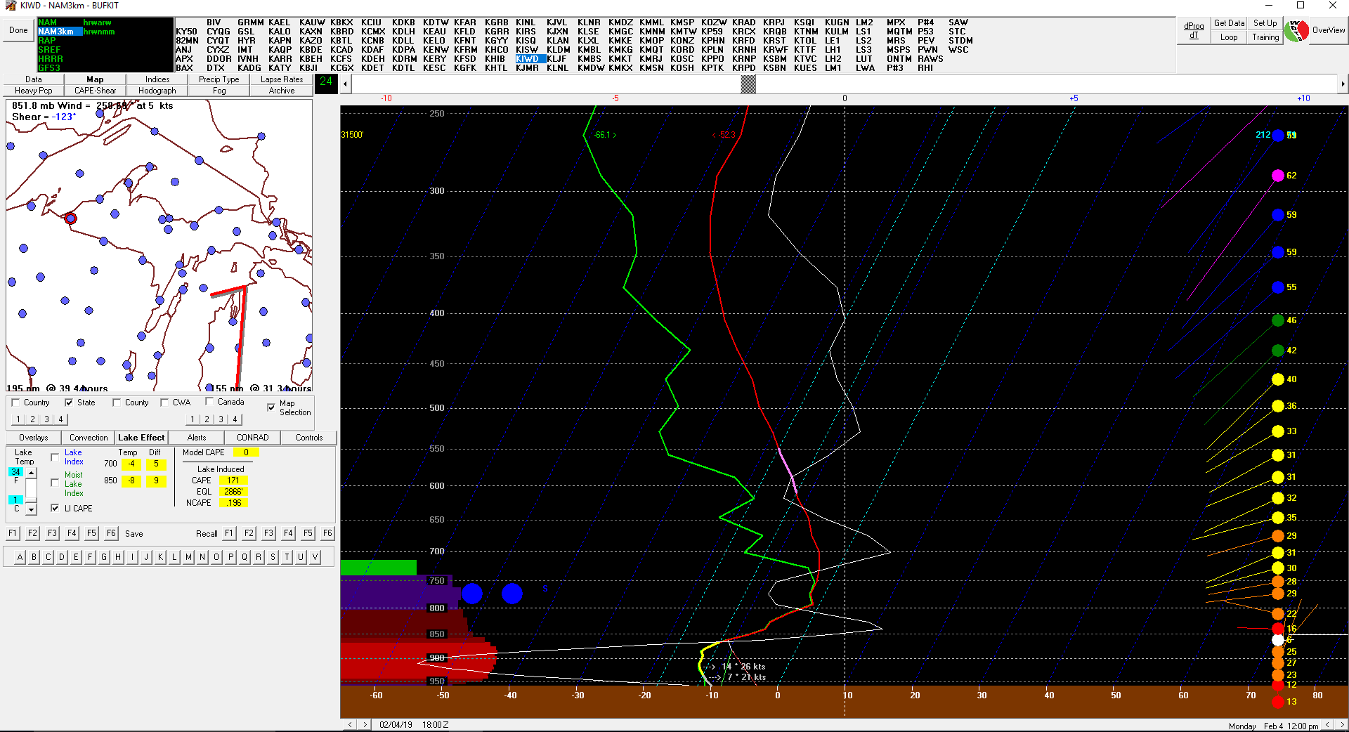
Ironwood (KIWD)
Forecast soundings show the initial precipitation type starting off as a sleet/freezing rain mixture, before transitioning over to snow throughout the morning hours. |
 |
 |
|
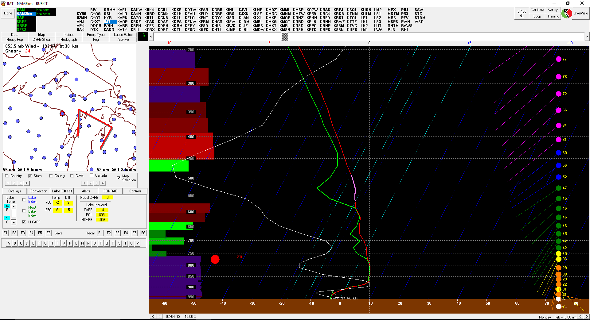
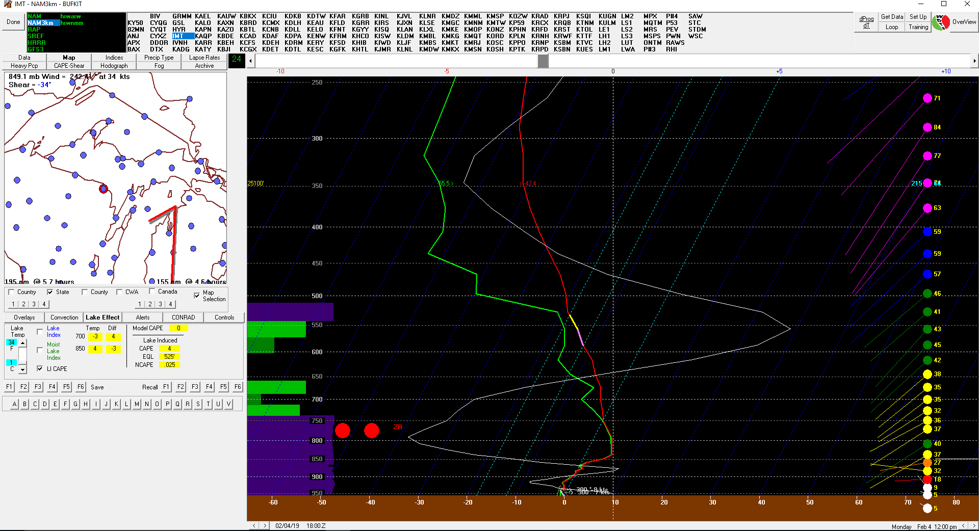
Iron Mountain (KIMT)
Forecast soundings show precipitation starting off as freezing rain, and likely remaining freezing rain during the entire event. |
 |
 |
|
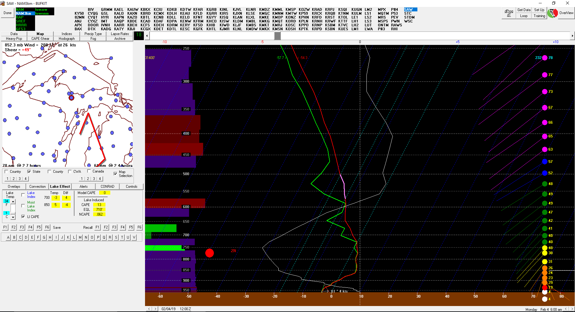
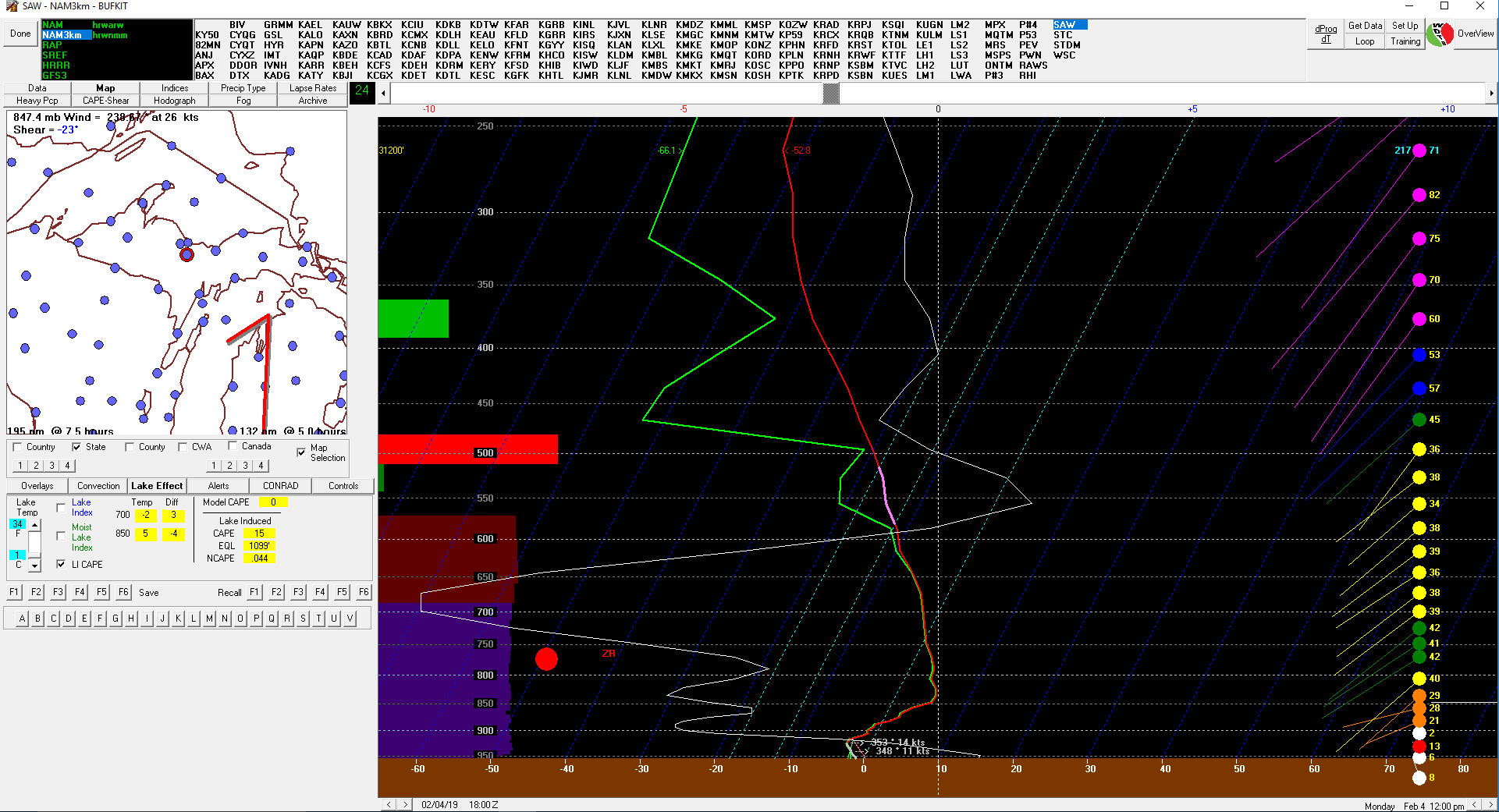
Sawyer (KSAW)
Forecast soundings show precipitation starting off as freezing rain, and likely remaining freezing rain during the entire event. |
 |
 |
|
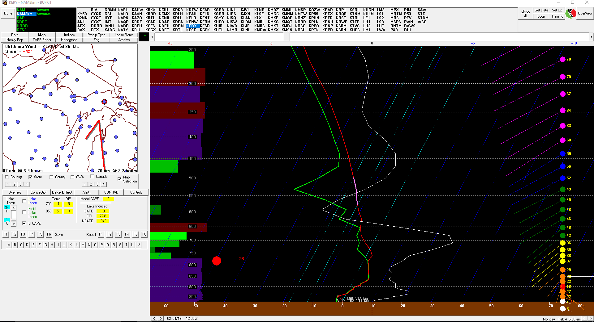
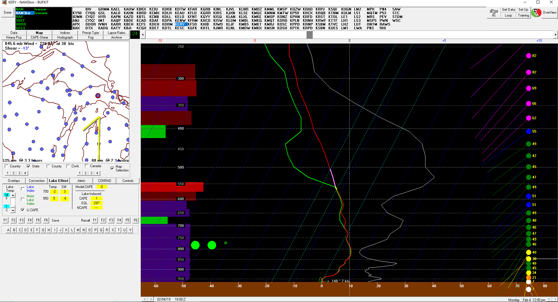
Newberry (KERY)
Forecast soundings show precipitation starting off as freezing rain, and transitioning over to rain during the event. |
 |
 |
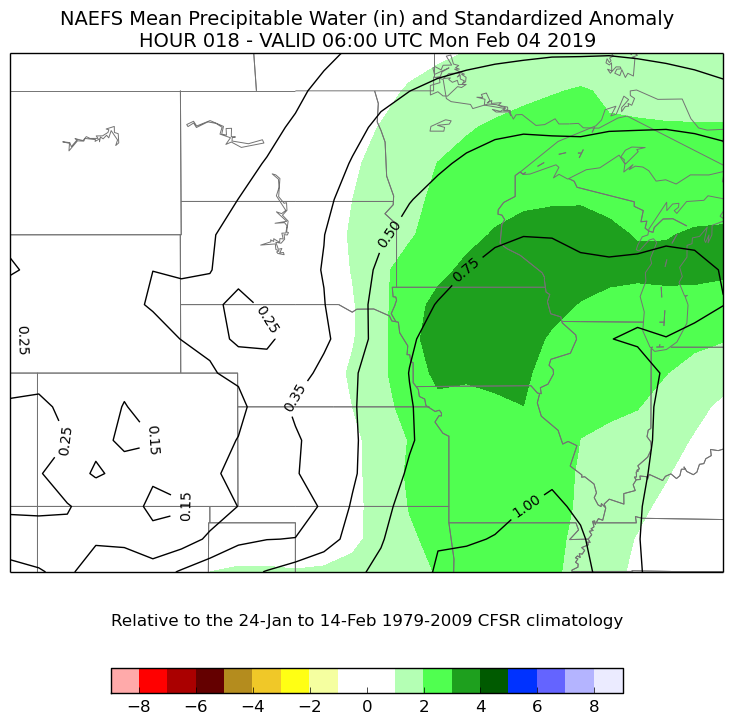
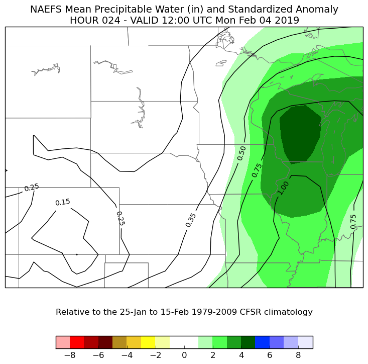
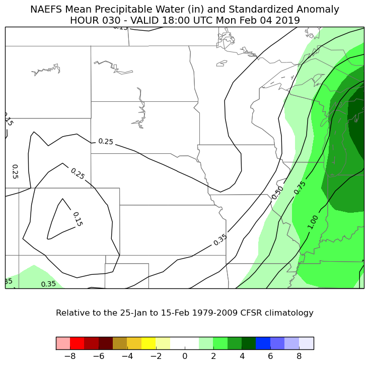
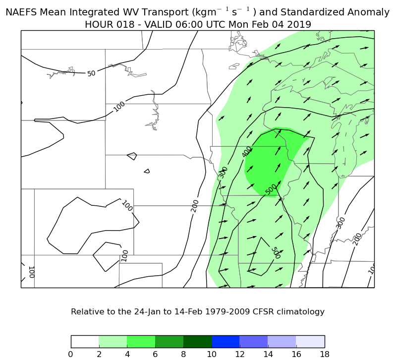
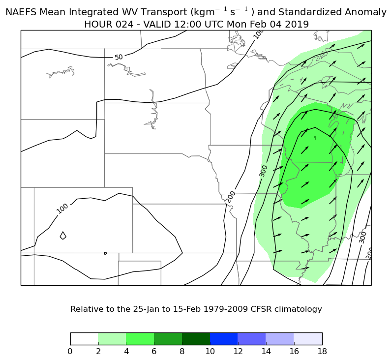
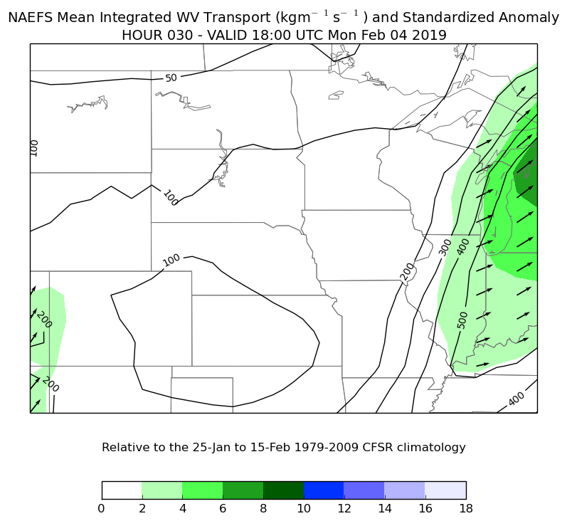
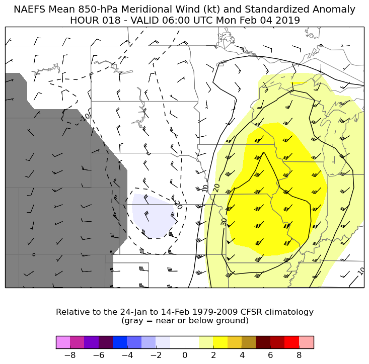
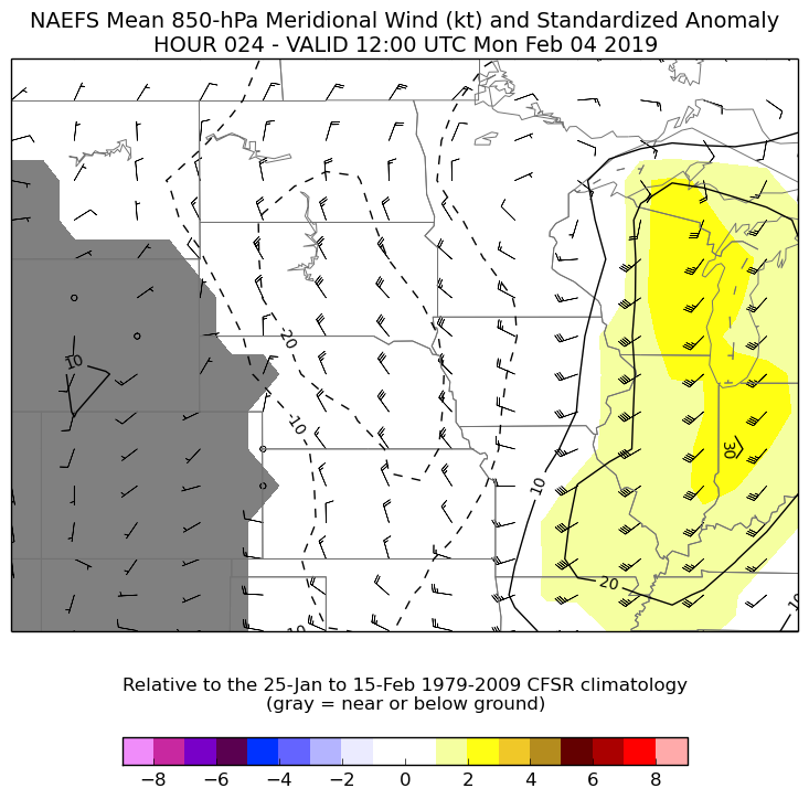
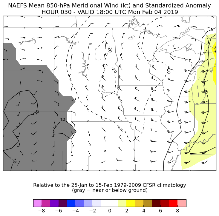
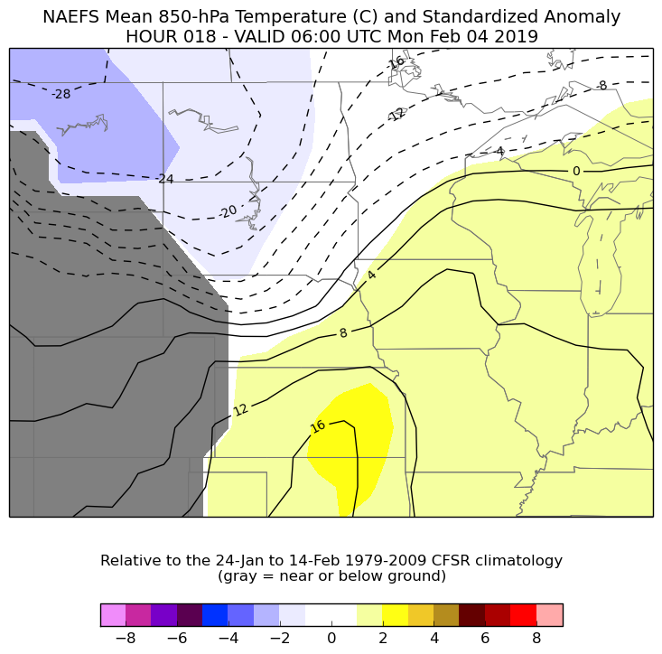
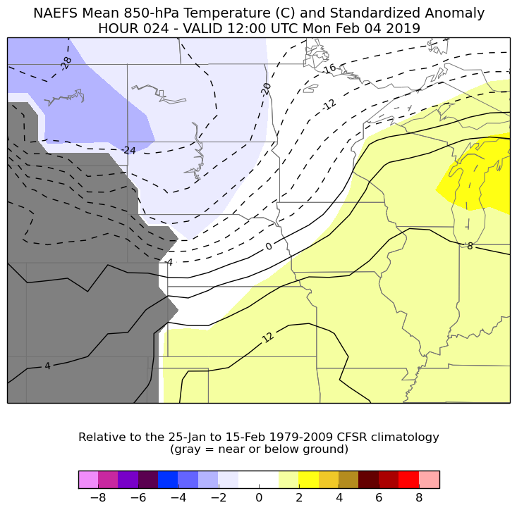
Using the NOAA/NWS Ensemble Situational Awareness Table and Displays, we can use climatology and what was forecast to look at how anomalous this winter storm was. Moisture certainly was not lacking during this event as standard deviations in both moisture transport and precipitatable water were rather impressive throughout the event.
| Data & Details | 1am EST, 0600Z Monday, Feb. 4th | 7am EST, 1200Z Monday, Feb. 4th | 1pm EST, 1800Z Monday, Feb. 4th |
|
Precipitable Water (PWAT) +3-5 Standard Deviations |
 |
 |
 |
|
Mean integrated water vapor transport +4-8 Standard Deviations |
 |
 |
 |
|
Meridional Component of the wind (southerly component) +2-4 Standard Deviations |
 |
 |
 |
|
850 mb Temperatures +2-4 Standard Deviations |
 |
 |
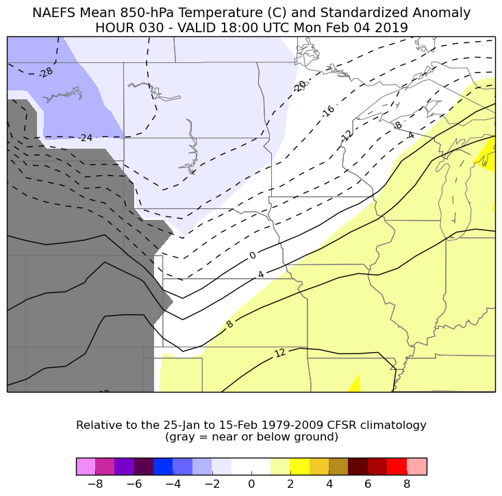 |
Additional Information:
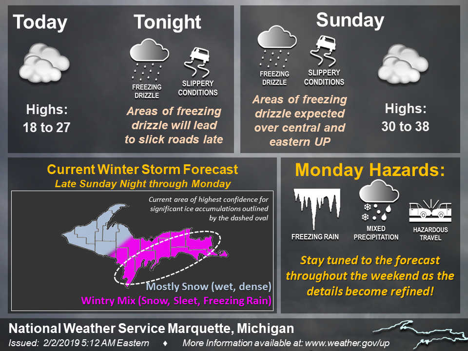
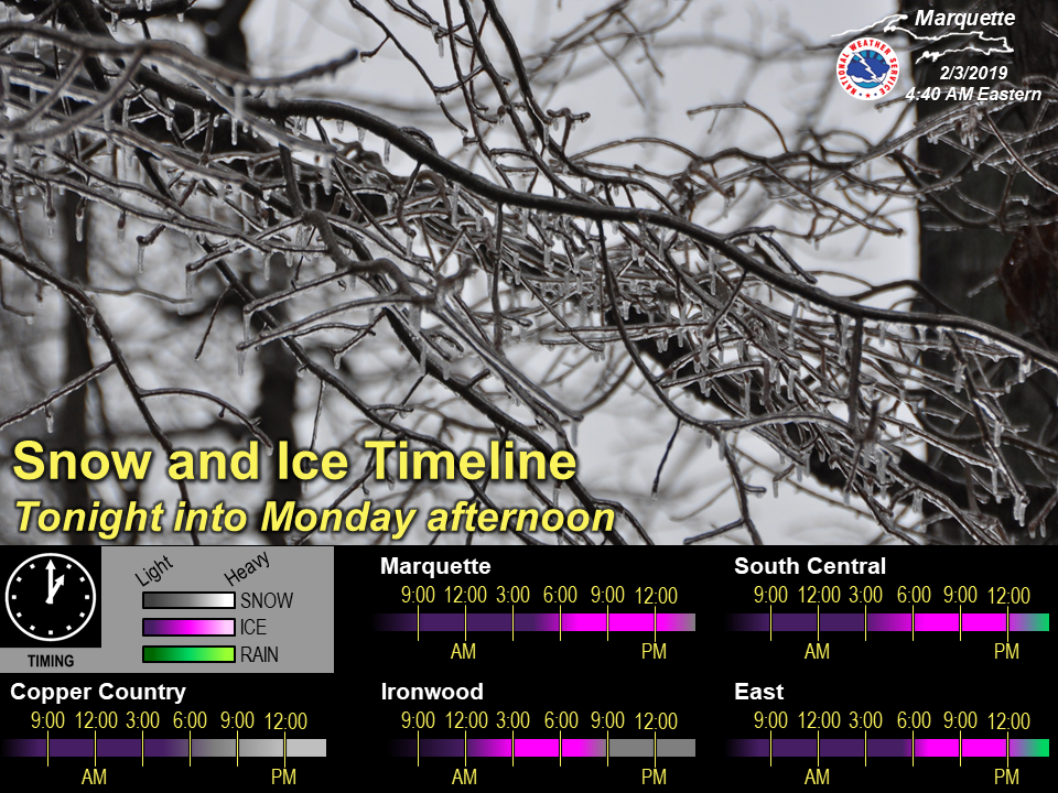
Social Media:
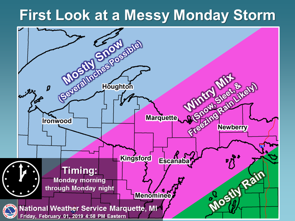 |
 |
 |
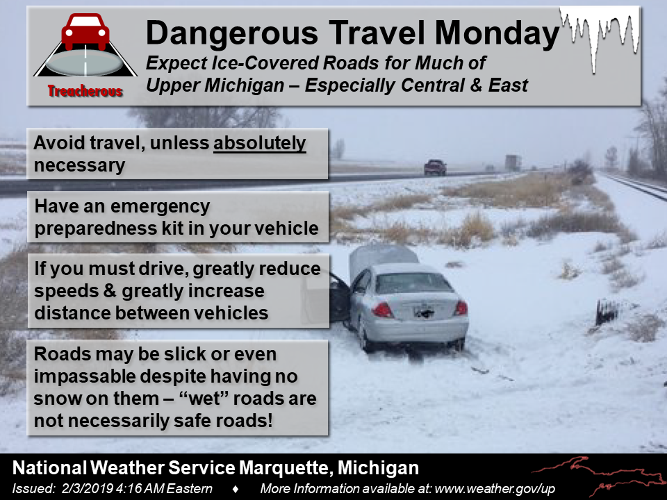 |
| First look at Winter Storm with an emphasis on precipitation types. | Continued to refine the overall precipitation types expected across the Upper Peninsula. | As confidence grew, we started to highlight timing of snow, ice and rain, along with starting to pinpoint when precipitation types would be changing. | With major travel impacts expected, we began to talk up the dangerous travel conditions expected. |
 |
 |
 |
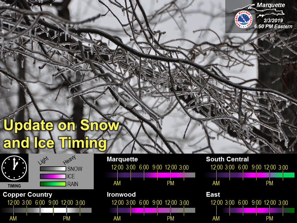 |
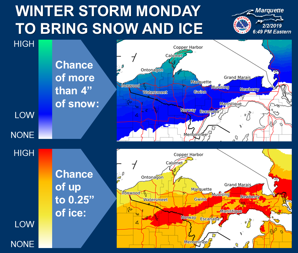
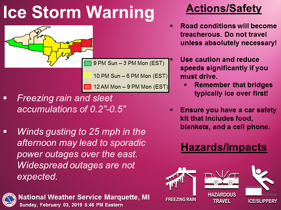
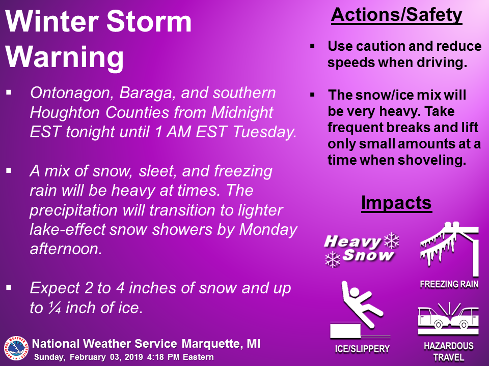
| Graphic highlighting confidence in snow and ice amounts. | Graphic highlighting the rare ice storm warning for Monday as the details continued to become refined ahead of the event. | Graphic highlighting the winter storm warning for Monday as the details continued to become refined ahead of the event. | Updated timeline graphic for expected precipitation on Monday with the winter storm. |
 |
 |
 |
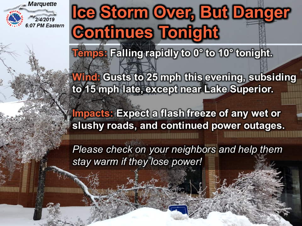 |
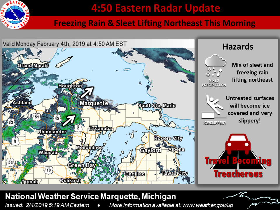
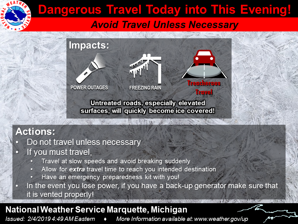
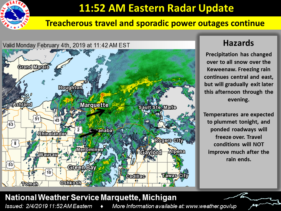
| 4:40am EST Radar update highlighting the incoming sleet and freezing rain, along with highlighting the deteriorating conditions expected. | Graphic issued the morning of the event to highlight the expected impacts and recommended actions during the dangerous winter weather. | 11:50am EST Radar update highlighting the ongoing winter weather, along with treacherous travel and power outages possibilities. Also noted the plummeting temperatures tonight, leading to more hazardous travel. | As ice event winded down, graphic highlights the potential for lingering impacts and the flash freeze expected overnight. |
 |
Media use of NWS Web News Stories is encouraged! Please acknowledge the NWS as the source of any news information accessed from this site. |
|