Overview
|
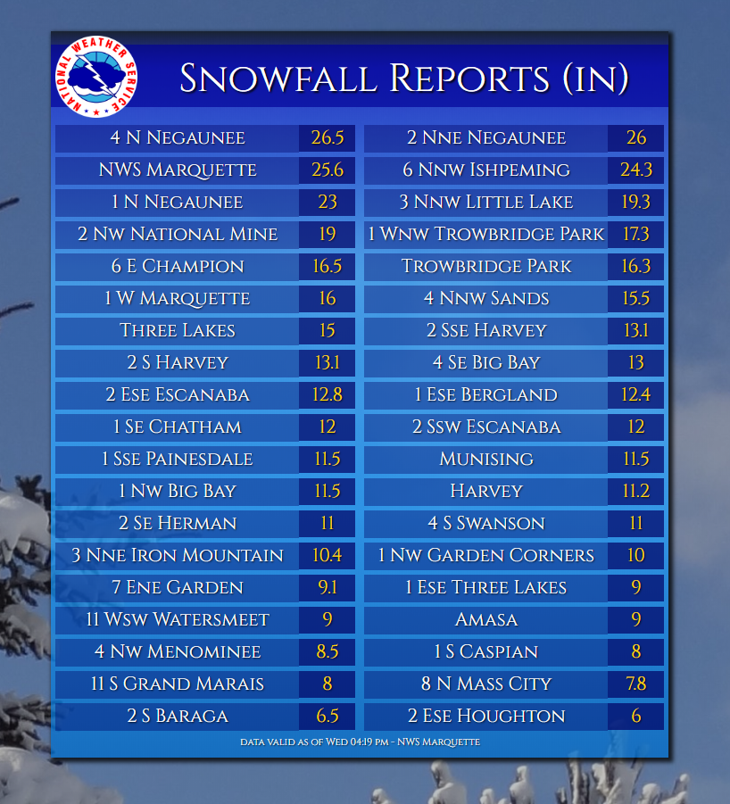
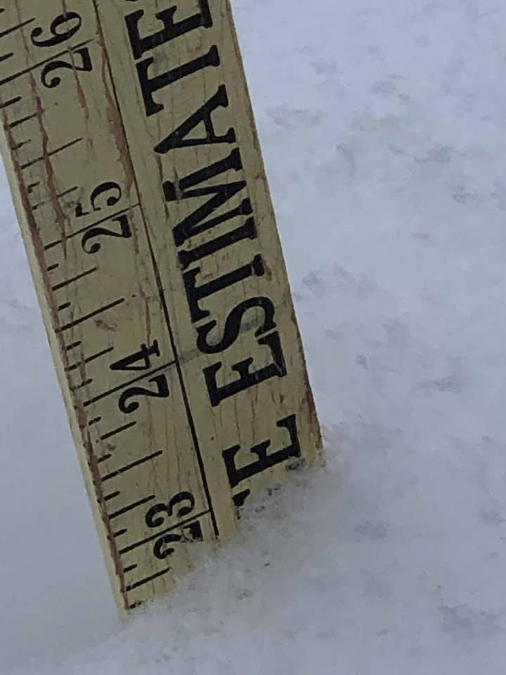
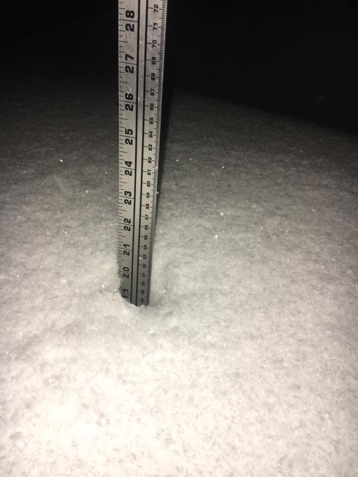
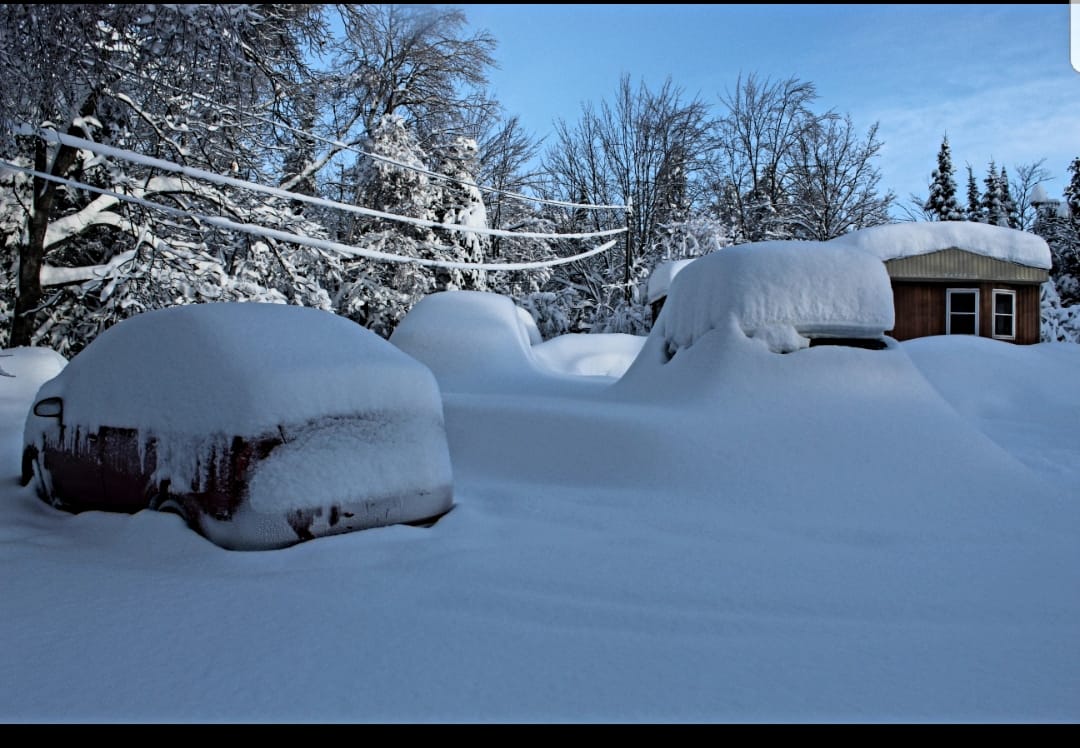
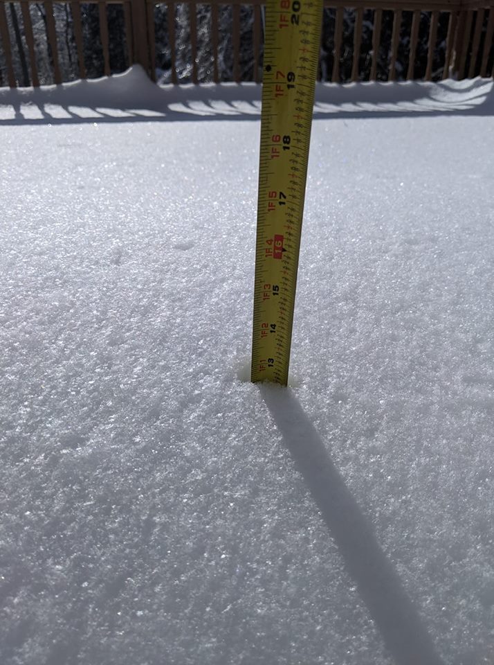
A significant winter storm passed through Upper Michigan, dropping around a foot of snow over most of the area and over two feet of snow over parts of Marquette County where lake enhancement significantly increased totals. At the NWS office in Negaunee Township: The two-day snowfall total of 25.6 inches is the second highest two-day snowfall total for the month of February, behind 26.4 inches on Feb 2-3, 1983. The two-day precipitation total of 1.58 inches is the 7th highest two-day precipitation total for the month of February. Summaries from other NWS Offices |
|
Social Media and DSS
 |
 |
 |
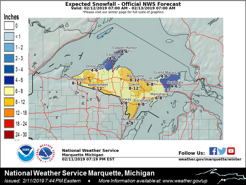 |
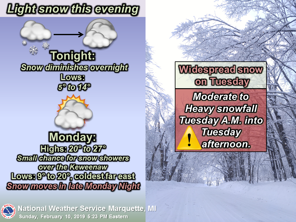
| The first mention of a significant storm came with Sunday evening's weather story. | Messaging continued Monday morning. | Specifics on the timing of heavy snow were shown Monday afternoon. | And amounts with Monday evening's weather story. |
 |
 |
 |
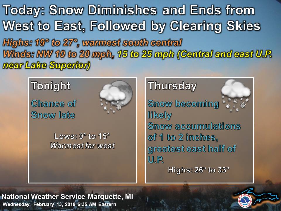 |
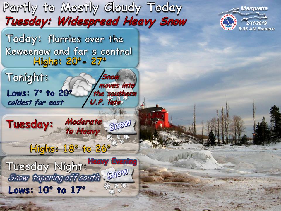
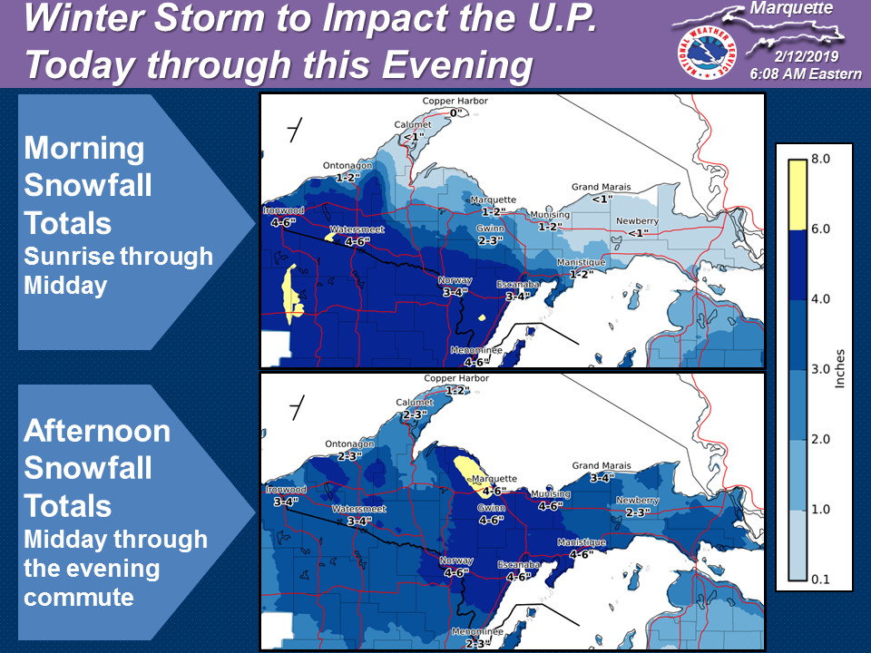
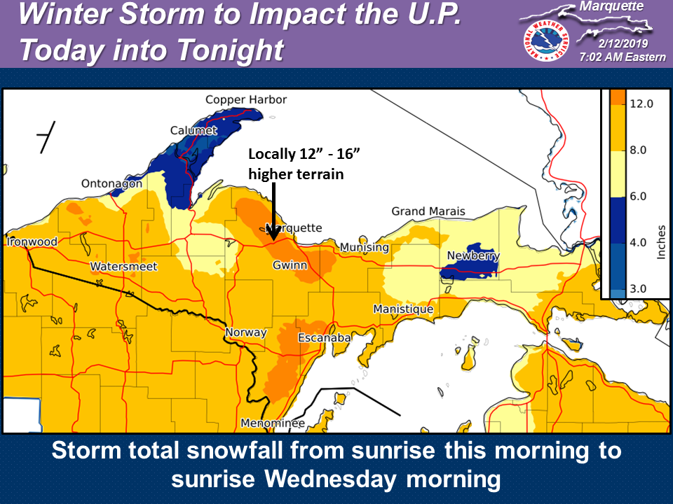
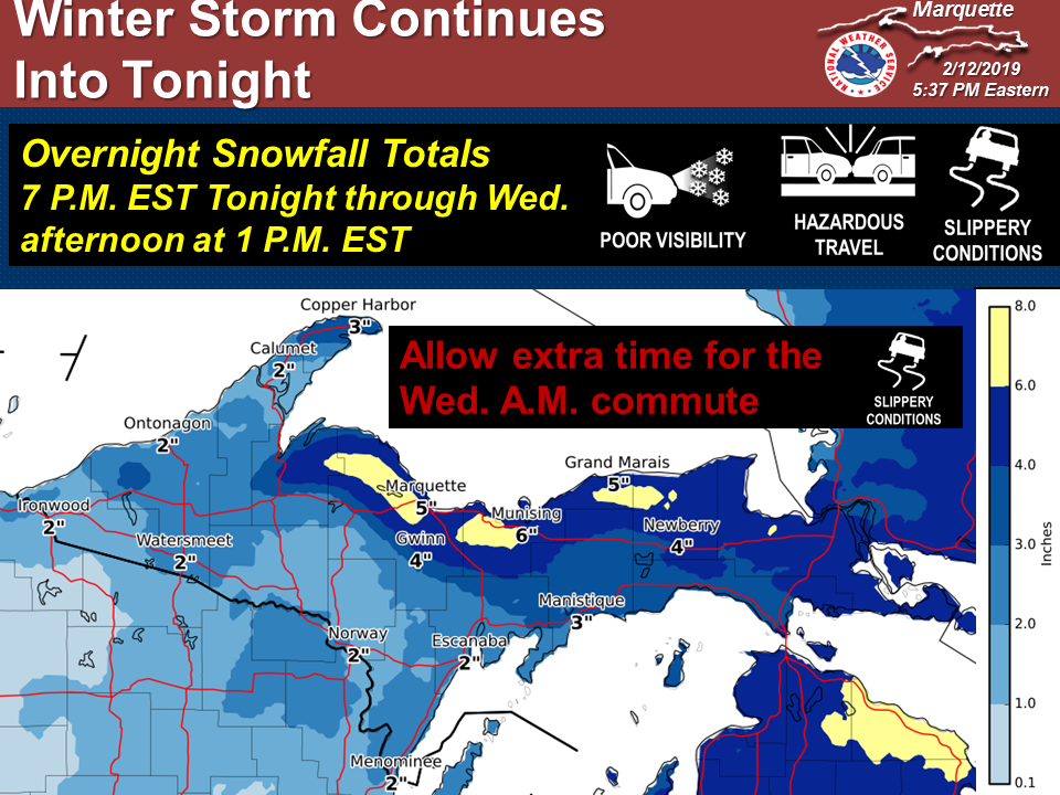
| The Tuesday morning weather story emphasized that only light snow would fall before noon. | But later that morning an updated map was shown, depicting higher totals than the previous evening. | The Tuesday evening update showed how much more snow was still to come as synoptic scale snow transitioned into lake-effect. | Wednesday morning, snow diminishes. |
Photos & Video
Header
 |
 |
 |
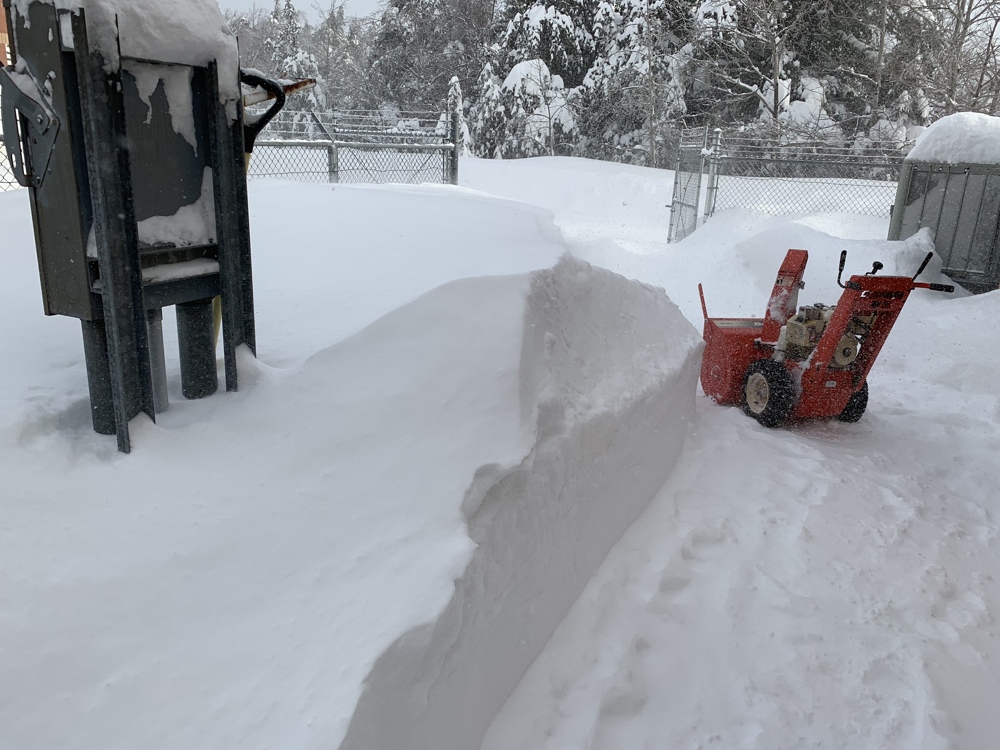 |
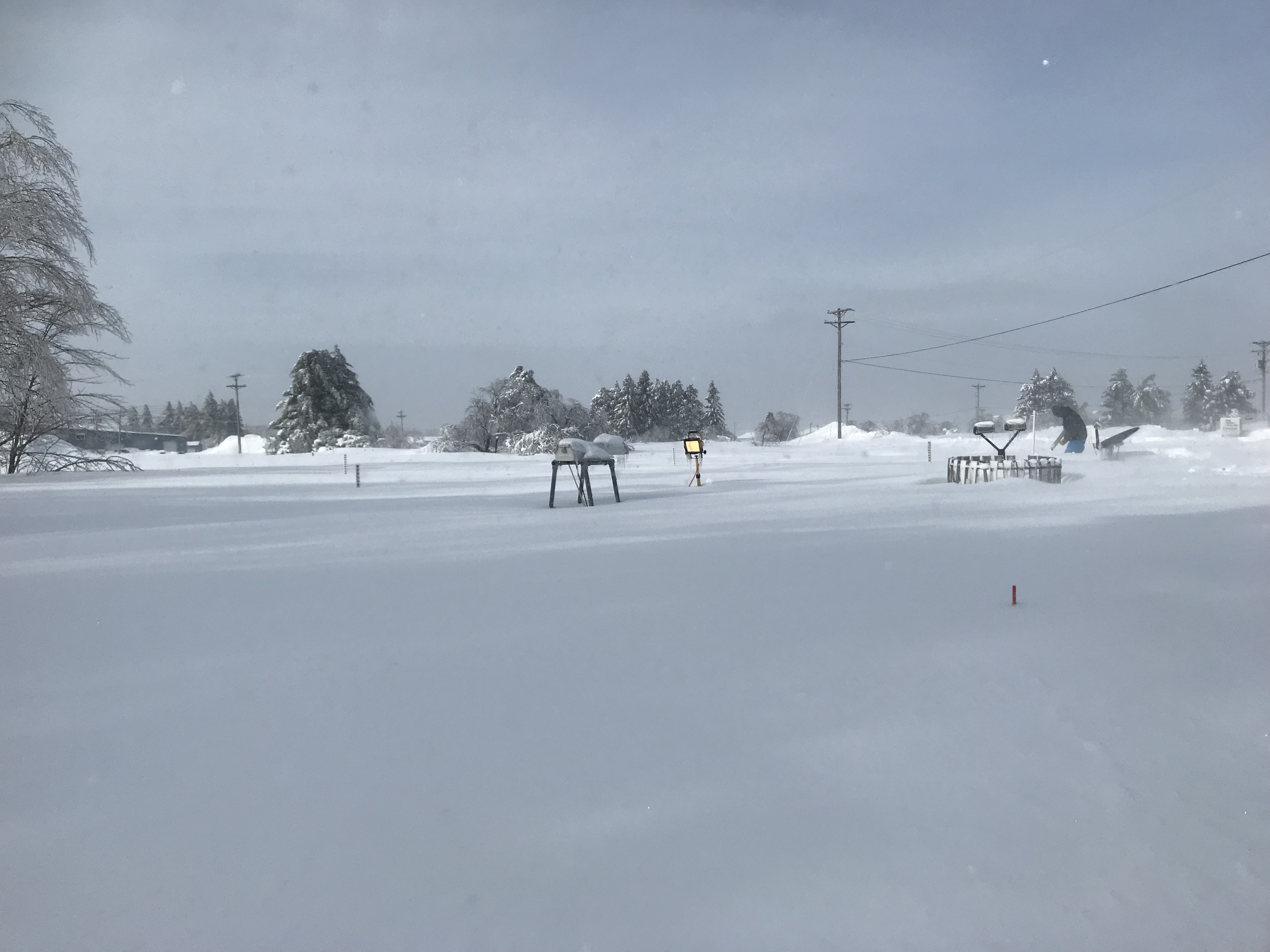
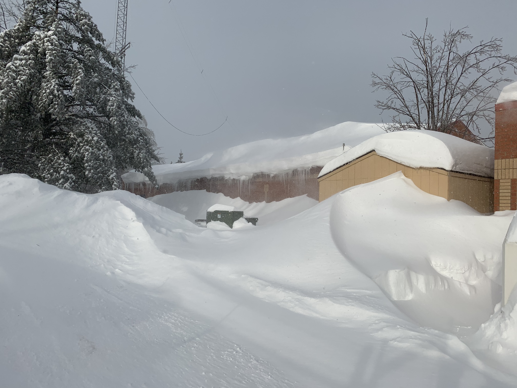
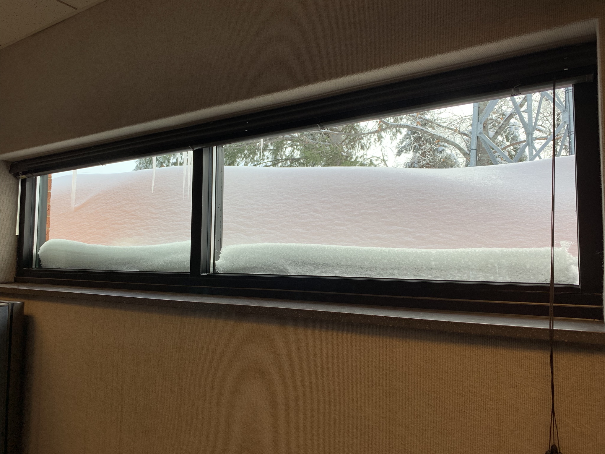
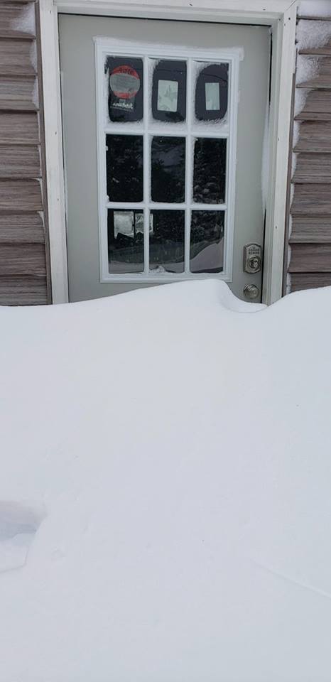
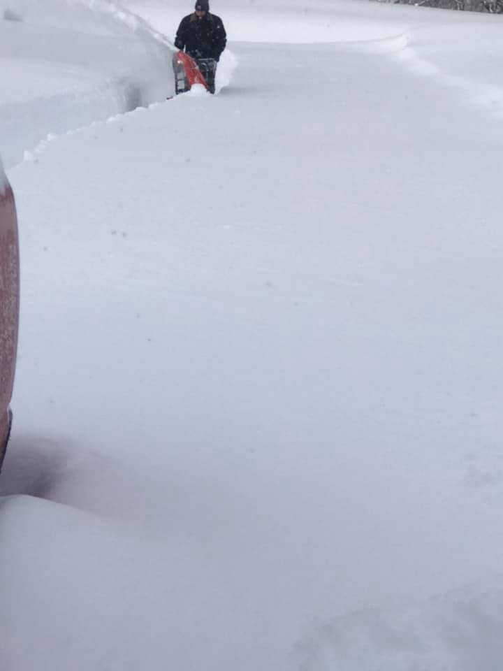
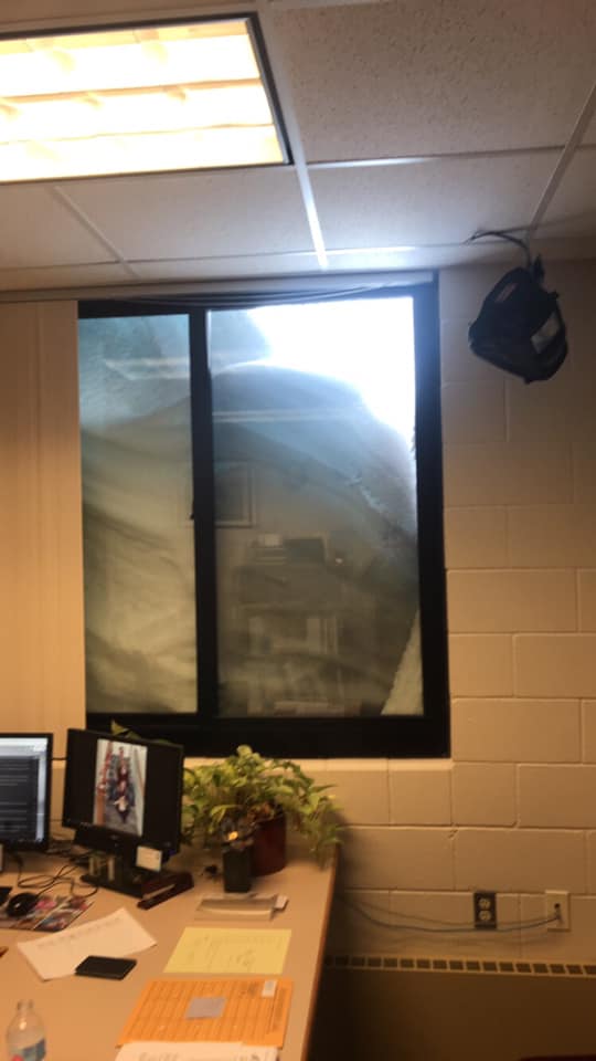
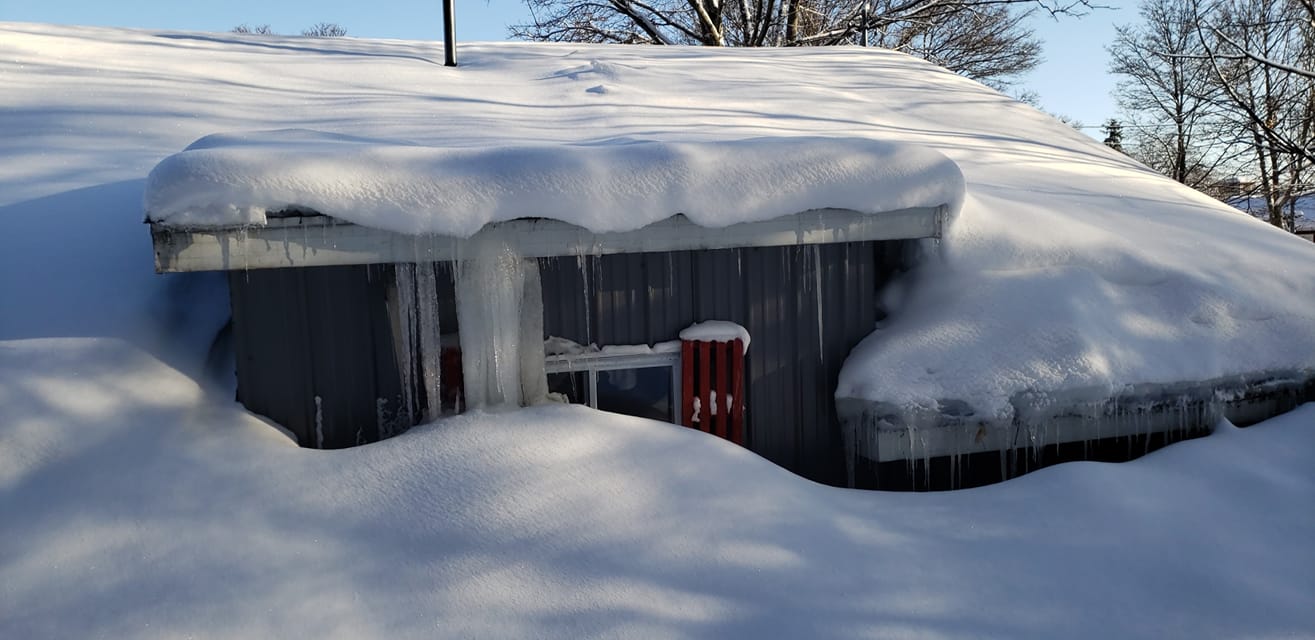
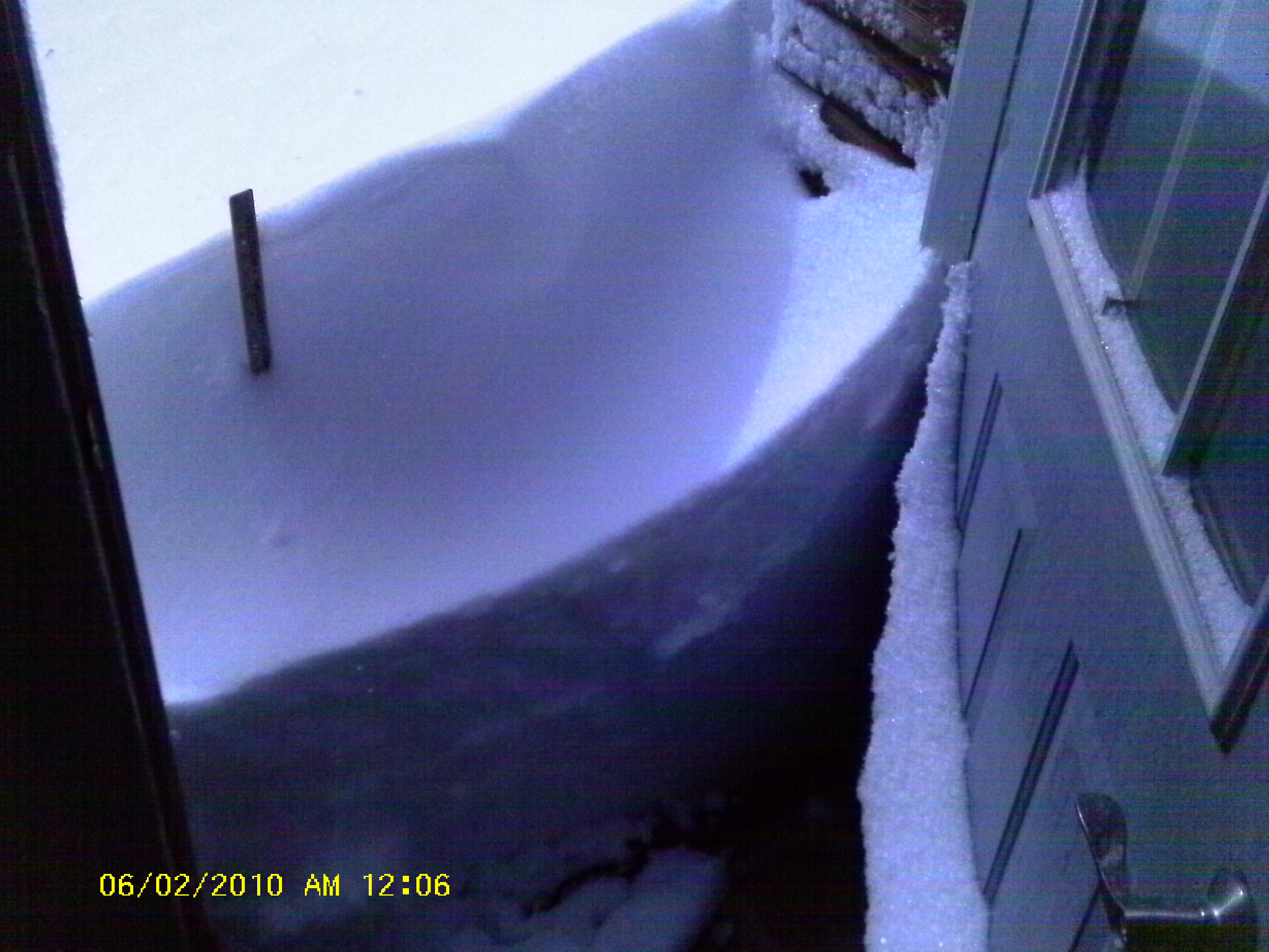
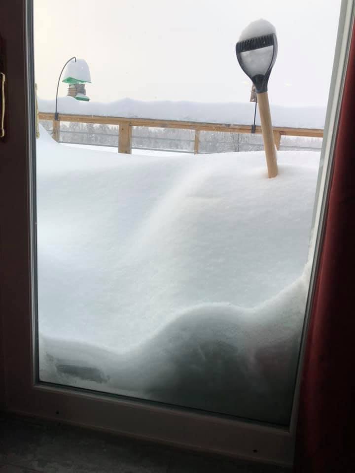
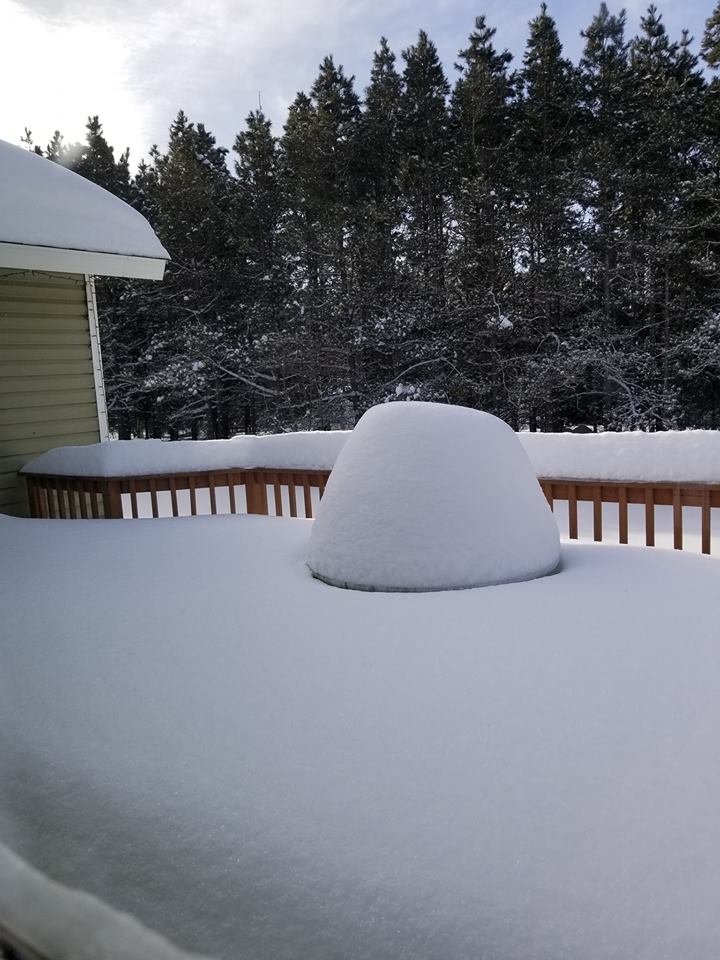
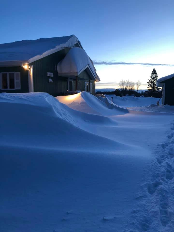
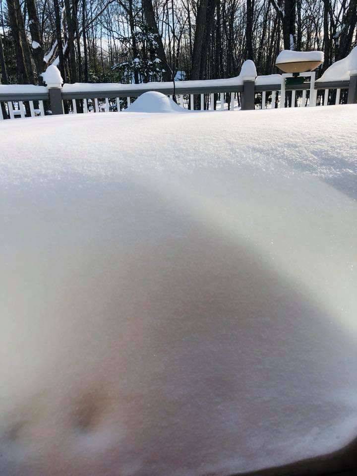
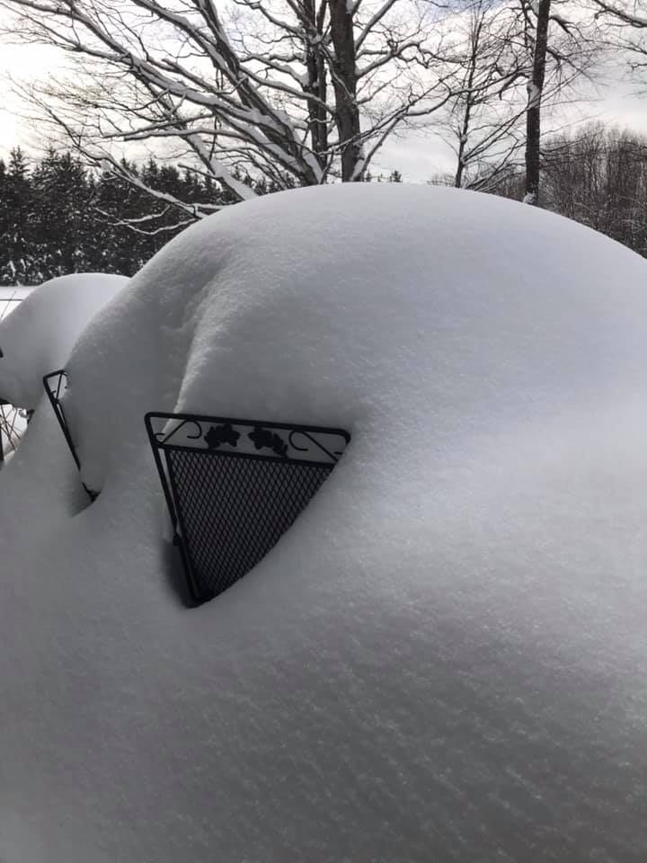
| The snow depth at the NWS office after this storm reached 46 inches, the most since March 4, 2012. | Deep snow drifts on the south side of the NWS office. | A snow drift on the south side of the NWS office reaches about 9 feet deep, partially blocking the window. | Clearing out the area around the radar. |
 |
 |
 |
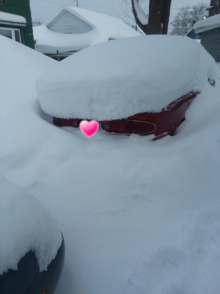 |
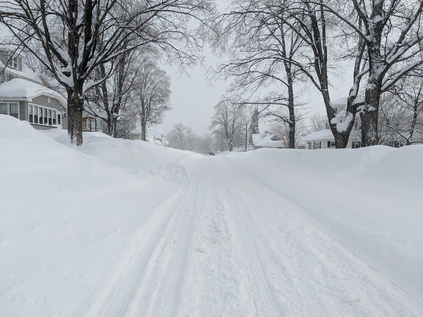
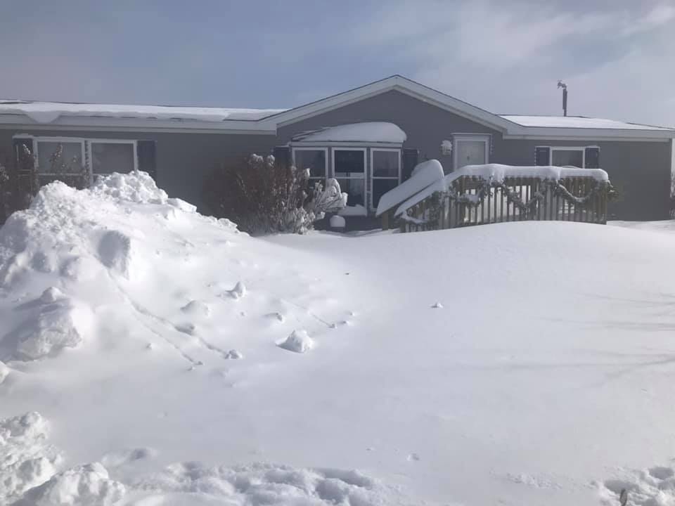
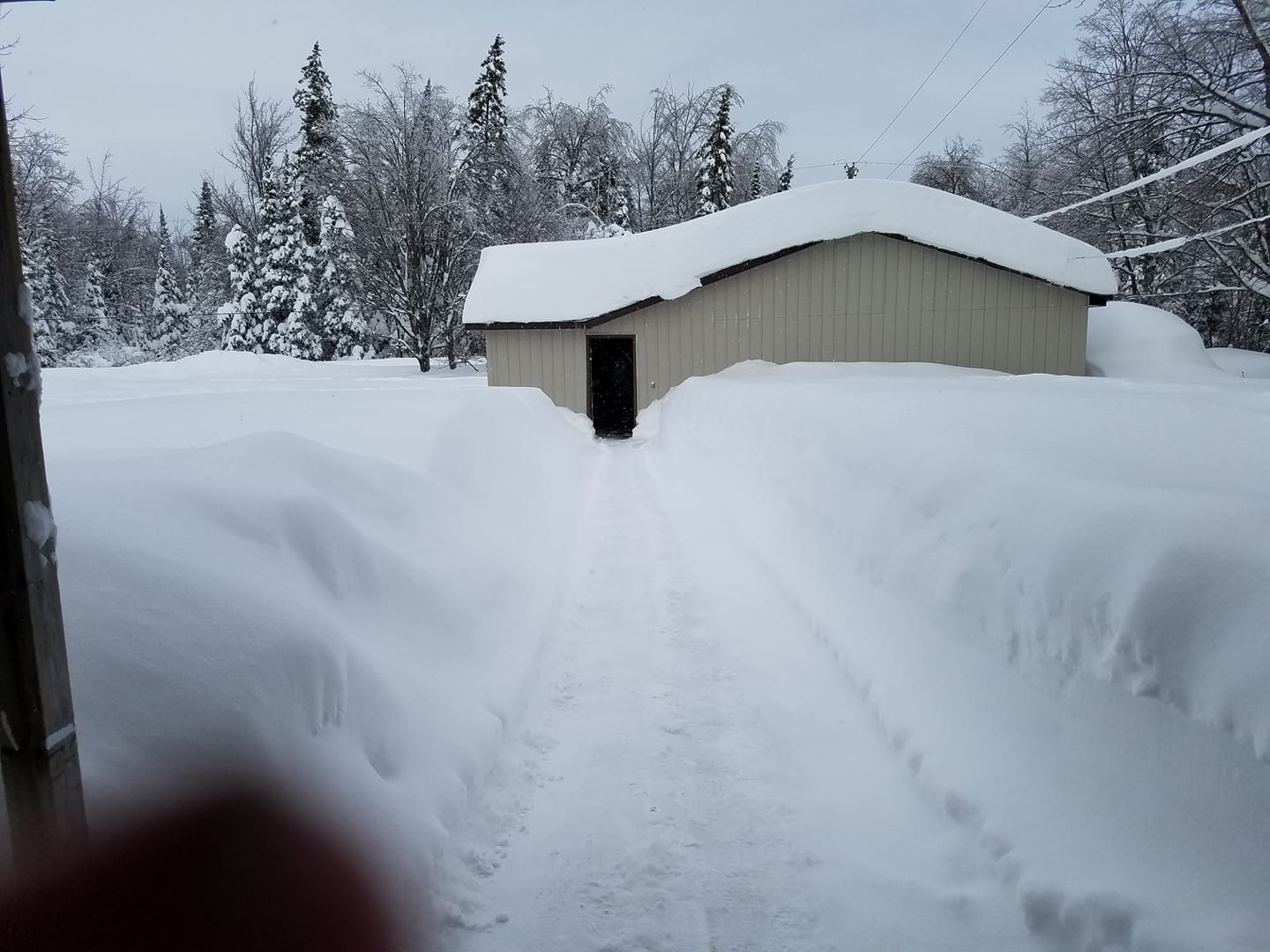
| 1 N Negaunee (NWS Employee) |
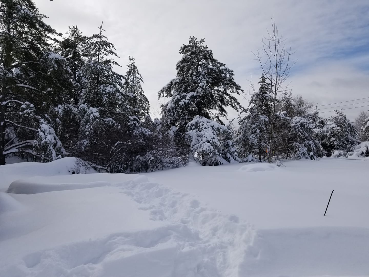
AuTrain (Becky McCollum Cain) |
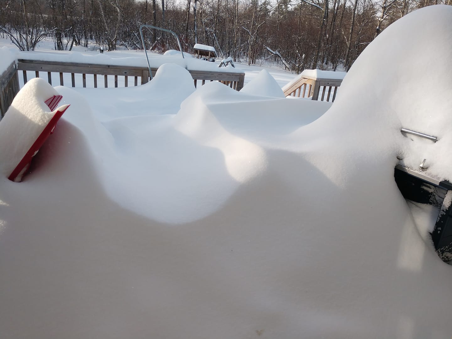
Chatham (Karen Schaeffer) |
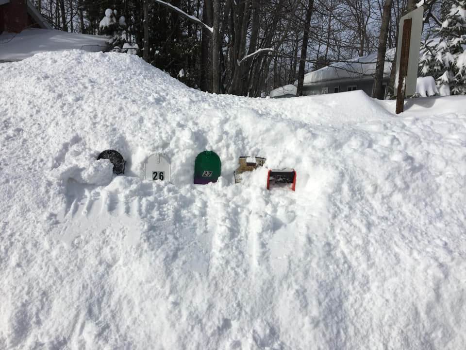
Newberry (Catherine Freese) |
 |
 |
 |
 |
| Gwinn (Brenda Keni) |
Harvey (Anne Lund) |
Marquette (Lori Nemancheck Appleton) |
Bergland (Tina Maki Cook) |
 |
 |
 |
 |
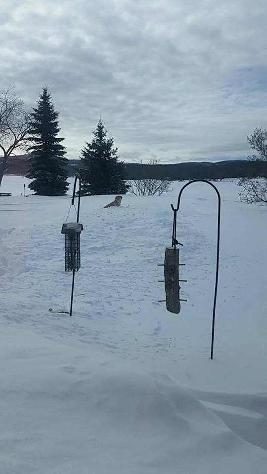
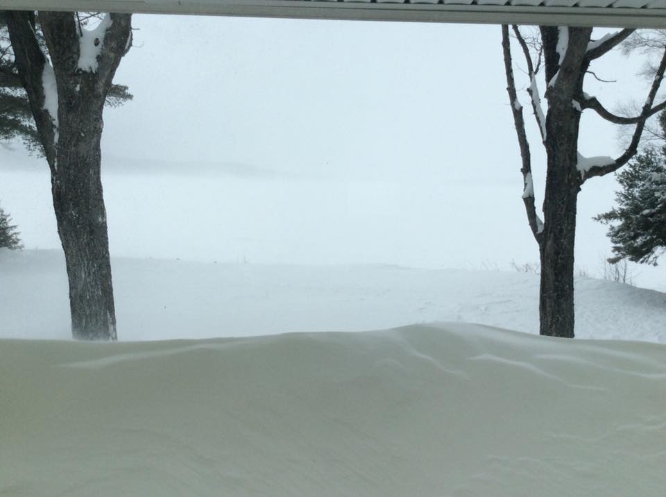
| Lake Independence, Big Bay (Craig Frank) |
Negaunee (Tina McCorkle) |
Marquette (Emma Goebel) |
Escanaba (Trenton Bellingar) |
 |
 |
 |
 |
| Negaunee (Abbie Kapper Tireman) |
Munising Bay from Sand Point (Diane Rantz) |
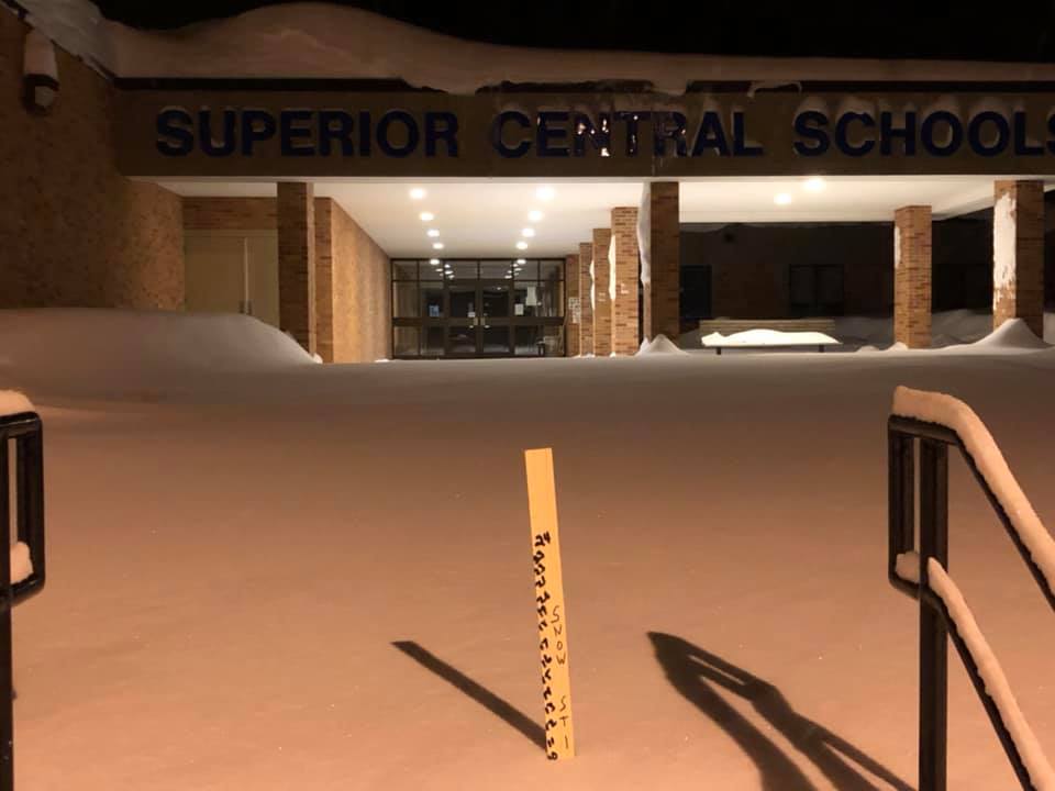
Superior Central School District (Bill Valima) |
Grand Marais (Sara Secrest) |
 |
 |
 |
 |
| Eben Junction (Jeff Cady) |
Fayette (Carrie Farley) |
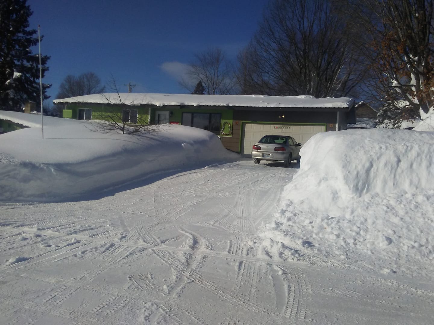
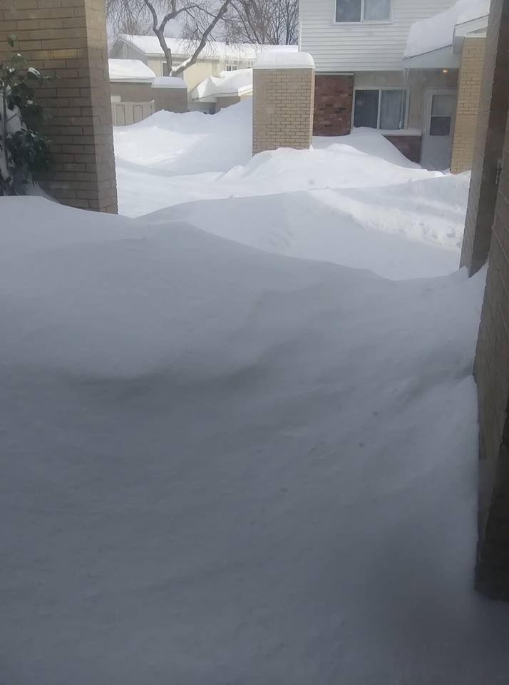
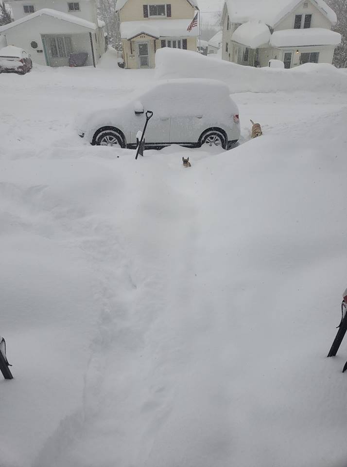
Negaunee Township (Brad Werling) |
Sands Township (Kathy Carter Wirkula) |
 |
 |
 |
 |
| Diorite (Cassie Spence Dobson) |
Garden (Paula Winter LeFevre) |
Ironwood (April Fabbri) |
Marquette (Lily Cheryl Anne Morrin) |
 |
 |
 |
 |
| Iron River (Sarah Barker) |
Munising (Samantha Hoffman Meyer) |
Gladstone (Linda Madalinski) |
Limestone (Patricia Maki Tyner) |
Environment
 |
 |
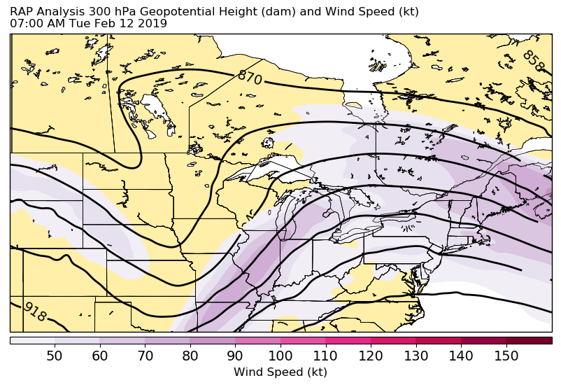 |
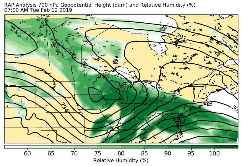
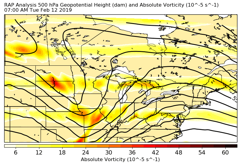
| Figure 1: 700-mb and color-shaded RH | Figure 2: 500-mb with Absolute Vorticity | Figure 3: 300-mb and Wind Speeds (kts) |
 |
Media use of NWS Web News Stories is encouraged! Please acknowledge the NWS as the source of any news information accessed from this site. |
|