
Extremely critical fire weather concerns for portions of the southern High Plans as strong wind and very dry conditions could result in rapid spread of any fires. Meanwhile, severe thunderstorms are expected once again across areas of the Central and Southern Plains, then spreading in the Mississippi Valley regions on Monday. Damaging winds, very large hail and strong tornadoes are possible. Read More >
Winter Storm of April 13 - 16
|
A very large and prolonged winter storm impacted the Northern Plains through the Upper Great Lakes Friday, April 13th through Monday, April 16th. There were two waves of heavy snow that impacted Upper Michigan--the first occurred late Friday into Saturday morning across far southern Menominee county and the second Sunday into Sunday evening across all of Upper Michigan. Storm total accumulations varied across the area through the weekend, generally from 6 to 12 inches, with most of that occurring Sunday and Sunday night. However, a few locations over the Michigamme Highlands of eastern Baraga and northern Marquette county and also across southern Menominee county (thanks to the first wave of snow that occurred there earlier in the weekend) saw storm totals over 20 inches. The observer on the Hoist Basin north of Ishpeming reported a storm total of 2 feet. The storm also produced strong northeast winds on Lake Superior and Lake Michigan with wind speeds of 40 kts to 50 kts (46 mph to 58 mph) observed through the entire weekend. These strong winds resulted in high waves over 14 feet and some minor lakeshore flooding. We certainly weren't the only ones to experience this wide reaching storm. Blizzard conditions occurred over portions of the Dakotas and Minnesota, storm total snow accumulations reached a whopping 30 inches or more in some locations of northeast Wisconsin, and significant ice and snow occurred in portions of lower Michigan. We will provide links to neighboring NWS office stories on this storm.
|
Here are storm summaries created other NWS offices in the Great Lakes:
|
Storm-Total Snow Reports:
Here is a list of the 3-day highest snowfall totals received across the U.P. with an map showing regional snowfall totals. The highest snow totals locally were found across the Huron Mountains in Marquette and Baraga counties, and across the Wisconsin state border. The highest snow total in the U.P. was a staggering 32.7" at Ishpeming Hoist Basin.
|
 ...Highest Snow Totals from 4/13 - 4/16 Event...


    Location                 Amount

Ishpeming Hoist Basin        32.7 in
6 NNW Ishpeming              26.5 in
NWS Marquette                25.9 in
1 S Painesdale               25.6 in
1 SE Menominee               24.5 in*
1 N Negaunee                 23.5 in
3 W Ishpeming                20.0 in
1 SSW Herman                 20.0 in
2 E Redridge                 20.0 in
Marquette WTP                18.6 in
1 SSW Keweenaw Bay           18.0 in
Ironwood                     18.0 in
1 SW Allouez                 18.0 in

*Record Snowfall

To see a full list of reports, click here.
|
(click on the map to view a larger version) |
The storm was historic in snowfall amounts across the Great Lakes. Here are some local statistics:
Friday - Saturday Snow
Snow Reports
              ...Snow Reports from 4/13 to 4/14...

Location                     Amount    Time/Date

Menominee                    10.0 in


Observations are collected from a variety of sources with varying
equipment and exposures. We thank all volunteer weather observers
for their dedication. Not all data listed are considered official.

$$
|
(click on the map to view a larger version) |
Meteorology
The first wave of snow that affected the region developed well to the east ahead of the main surface low over the Plains late Friday night into Saturday morning. Though a strong surface warm front was present over northern Illinois to northern Ohio, the swath of heavy snow developed well to the north of that surface front, more over northern Wisconsin into south central Upper Michigan where a mid-level warm front was located. Due to a large area of high pressure over northern Ontario, very dry air was filtering into Upper Michigan on northeast winds. The dry air resulted in a very sharp northern gradient to the heavy snow. While there was around a foot of snow that occurred in the city of Menominee, there was only around 1 inch of snow 20 miles to the north at Stephenson and hardly any snow fell at Iron Mountain and Escanaba. The heaviest snow with this first wave of snow occurred overnight Friday night into Saturday morning with snowfall rates of 1 to 2 inches per hour. Heavy snow also shifted into northern Lower Michigan through the rest of Saturday. In addition to the heavy snow there were also snow drifts up to 6 feet observed along the Bay of Green Bay in Menominee as northeast winds gusted as high as 40 mph at times.
Note--this overview is a bit technical!
|
|
|
|
Surface temperature (F), dew point (shaded, F), wind (barbs), and pressure (black lines, mb) at 7:00 PM EDT 4/13. At 7 PM EDT on 4/13, the main surface low was developing over Colorado and Kansas while a sharp warm front extended east toward northern Illinois and northern Ohio. Note the impressive temperature gradient across the front with temperatures near 80 over central Illinois and temperatures only in the 30s over most of Wisconsin. Warm air advection north of the surface front became the focus for the heavy snow over south central Upper Michigan late on 4/13 into the morning hours of 4/14. |
Surface temperature (F), dew point (shaded, F), wind (barbs), and pressure (black lines, mb) at 4:00 AM EDT 4/14. At 4 AM EDT on 4/14, the main surface low moved to northern Missouri but the warm front moved very little to the north. The large area of high pressure over northern Ontario resulted in very dry air persisting over much of Upper Michigan so the heavy snow was not able to extend much into Menominee county early on 4/14. |
 |
 |
|
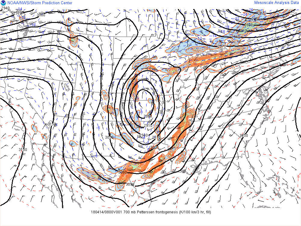
Mean Petterson frontogenesis (shaded), geopotential height (black lines, m), wind (barbs), and temperature (dashed lines, F) at 700 mb (appoximately 10kft above surface) at 4:00 AM EDT 4/14. By 4 AM EDT on 4/14, the strong warm air advection focusing along the mid-level warm front (e.g. frontogenetically-forced band) supported a narrow band of heavy snow across northeast Wisconsin and far south central Upper Michigan. The band of heavy snow also extended east over northern Lower Michigan. |
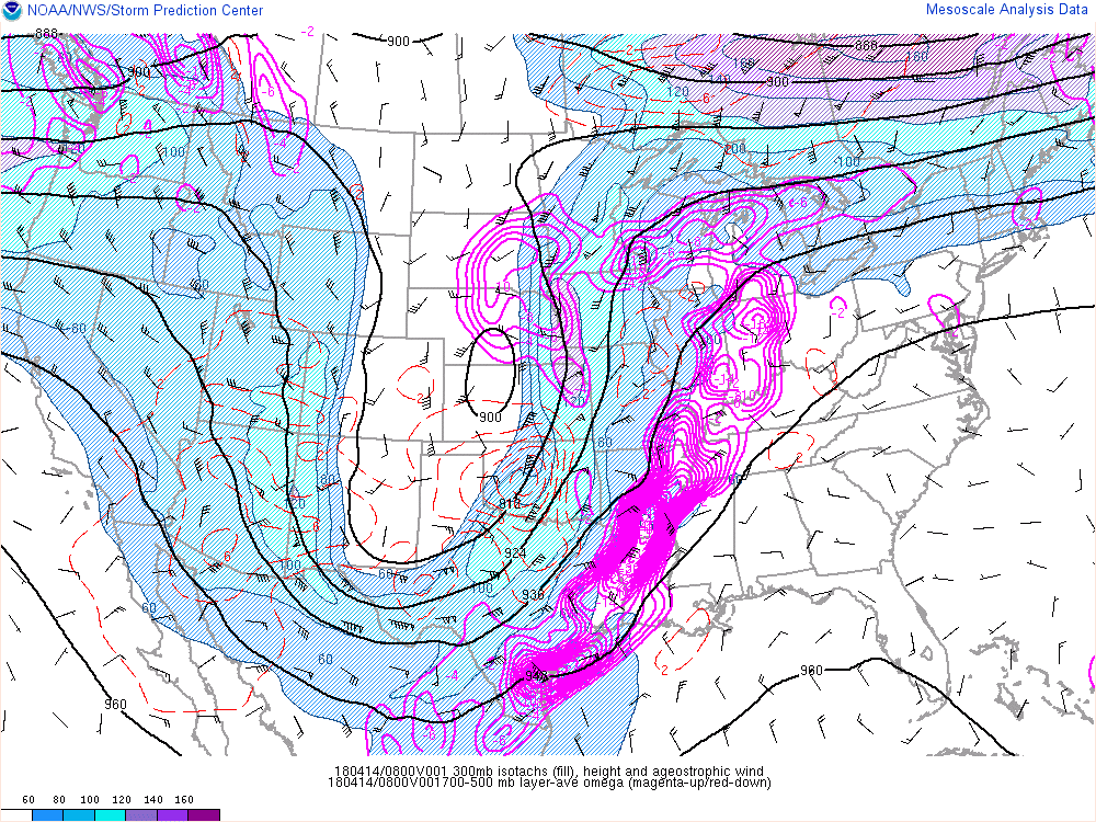
300 mb (near 30,000 ft above the surface) wind speeds (shaded), 300 mb geopotential height (black lines, m), wind (barbs), and temperature (dashed lines, F) at 4:00 AM EDT 4/14. By 4 AM EDT, the upper level trough over the central United States featured a strong jet stream lifting up from the central Plains and another strong jet stream across northern Ontario and Quebec. These two jet streams further enhanced the lift along the mid-level front which led a narrow band of heavy snow over far south central Upper Michigan. |
 \
\
United States composite radar loop from 8 pm EDT 4/13 (listed as 20180414/0025 in image above) through 11 am EDT 4/14. Notice the sharp band of echoes on the radar that developed into south central Upper Michigan but did not extend far into the rest of Upper Michigan. This increase in radar echoes is when 1-2 inch per hour snowfall rates were occurring in far southern Menominee county.
Sunday - Monday Snow:
Snow Reports
|
...Snow Reports from Sunday and Monday... Location Amount ...Alger County... 10 S Grand Marais 16.0 in 3 E Forest Lake 14.9 in Munising 14.5 in MSU Experimental Farm 13.0 in ...Baraga County... 1 SSW Herman 20.0 in 1 SSW Keweenaw Bay 18.0 in 18 SE LAnse 15.5 in 1 NE Watton 11.3 in ...Delta County... 1 N Gladstone 14.5 in 1 NW Garden Corners 12.6 in 4 SSE Rapid River 12.6 in 5 E Round Lake 12.0 in 5 NNE Stonington 10.0 in 1 W Bark River 8.0 in 4 SSW Brampton 7.5 in 1 SW Gladstone 7.4 in Escanaba 4.6 in ...Dickinson County... 5 NNW Iron Mountain 11.3 in 1 SSE Norway 4.9 in ...Gogebic County... Ironwood 18.0 in 12 WSW Watersmeet 13.2 in 5 SE Watersmeet 9.7 in ...Houghton County... 1 S Painesdale 25.6 in 2 E Redridge 20.0 in 1 SW Allouez 18.0 in 1 ENE Hancock 15.7 in 1 W Calumet 15.6 in 3 SSW Houghton 14.3 in 2 ESE Houghton 13.5 in Dollar Bay 9.4 in ...Iron County... 3 NE Gaastra 9.0 in Amasa 6.5 in |
(click on the map to view a larger version)
...Marquette County...
Ishpeming Hoist Basin        31.8 in
6 NNW Ishpeming              26.5 in
NWS Marquette                25.9 in
1 N Negaunee                 23.5 in
3 W Ishpeming                20.0 in
Marquette WTP                18.6 in
1 SSW Marquette              17.7 in
7 SSE Marquette              17.3 in
Harvey                       16.0 in
K.I. Sawyer WWTF             15.8 in

...Ontonagon County...
Paulding                     17.5 in
1 ESE Bergland               15.1 in
8 N Mass City                10.0 in
Ontonagon                     8.0 in

...Schoolcraft County...
1 S Manistique               12.0 in
8 ENE Garden                 11.0 in
2 E Cooks                    10.7 in
|
Meteorology
The second round of snow that affected Upper Michigan late Saturday night into Sunday evening was much more widespread than the preceding snow that occurred to start the weekend. As the main upper level system and surface low lifted closer to the region, a feed of abundant moisture with a source region off the Gulf of America surged into the Upper Great Lakes. As this moisture lifted toward Upper Michigan the colder air locked in over the region switched all precipitation to snow by the time it reached Upper Michigan. Though there was enough warm air aloft to result in a brief mix of rain/sleet and snow over far southeast and eastern Upper Michigan, snow was the main precipitation type observed until the heavy precipitation tapered off Sunday night. The most widespread heavy snow occurred over all of Upper Michigan late Saturday night through Sunday evening with the bulk of the widespread snow accumulations with this system occurring during the daylight hours on Sunday. Snowfall rates during the height of the storm late Sunday morning through early Sunday evening were 1 to 2 inches per hour over much of Upper Michigan with even isolated 2-3 inch per hour rates over the higher terrain of north central Upper Michigan on Sunday afternoon as northeast winds enhanced the snow there. The snow tapered off to freezing drizzle over much of central and eastern Upper Michigan on Sunday night before additional snow moved back over much of northern and eastern Upper Michigan Monday afternoon through Monday night. Lake enhanced snow that developed near Lake Superior late Monday into Monday night did fall heavy at times before finally diminishing on Tuesday. The other aspect of the storm was persistent strong and gusty northeast winds that resulted in considerable blowing and drifting snow. The combination of the heavy snow, blowing and drifting snow resulted in sharply reduced visibility and occasional white-out conditions.
Note--this overview is a bit technical!
|
|
|
|
Surface wind (barbs) and pressure (black lines, mb) at 8:00 AM EDT 4/15. At 8 AM EDT 4/15, the plains surface low had moved to central Indiana. Typically a low tracking this far south would not produce heavy snow over Upper Michigan. For this event though, there were other factors that contributed to heavy snow over Upper Michigan. However, since the surface low was farther south, cold air remained firmly entrenched over Upper Michigan so the precipitation stayed mostly snow. |
Geopotential height (black lines,m), wind (barbs), and temperature (dashed lines) at 500 mb (15 kft above surface) at 8 AM EDT on 4/15. At 8 AM EDT 4/15, even though the surface low was farther south over Indiana, the primary upper low was centered closer to Upper Michigan, over Iowa. Deep moisture lifting northward ahead of the upper low resulted in a swath of very heavy snow over all of Upper Michigan on Sunday 4/15. |
 |
 |
|
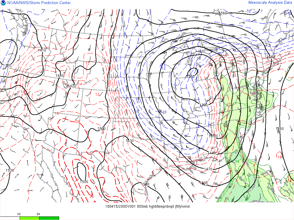
Dew point (shaded, F), temperature (dashed lines, F), wind (barbs), and geopotential height (black lines, m) at 850 mb (4000 feet above surface) at 4:00 PM EDT 4/15. At 4 PM EDT 4/15, the low pressure at 850mb (4000 feet above surface) was located over southern Lake Michigan, placing Upper Michigan in an ideal location for heavy snow. Since the surface and 850mb low pressure systems tracked to south of Upper Michigan, the air over Upper Michigan stayed cold enough for snow to remain the primary precipitation type as the strongest surge of warm air stayed over lower Michigan. Due to the warm air over aloft lower Michigan with surface temperatures staying below freezing, there were areas in lower Michigan that experienced significant freezing rain and icing. |
GOES east satellite loop (channel 13, clean channel IR) from 8 PM EDT on 4/14 through 2 AM EDT on 4/15. IR satellite loop shows strong moisture advection occurring off Gulf of America into the strong system. When the higher cloud tops (brighter green and yellow colors) lifted across Upper Michigan, snowfall rates were reaching up to 2 inches per hour. Near the end of the loop, the main moisture lifted north of Upper Michigan and this is when the snow diminished to freezing drizzle. |

United States composite radar loop from 8 pm EDT 4/14 (listed as 20180415/0025 in image above) through 7 am EDT 4/16. Notice the widespread heavy echoes that lifted into Upper Michigan. During this time snowfall rates of up to 2 inches per hour were occurring over much of Upper Michigan. As the widespread radar echoes lifted north of Upper Michigan the heavier snow tapered off freezing drizzle.
Marine Hazards:
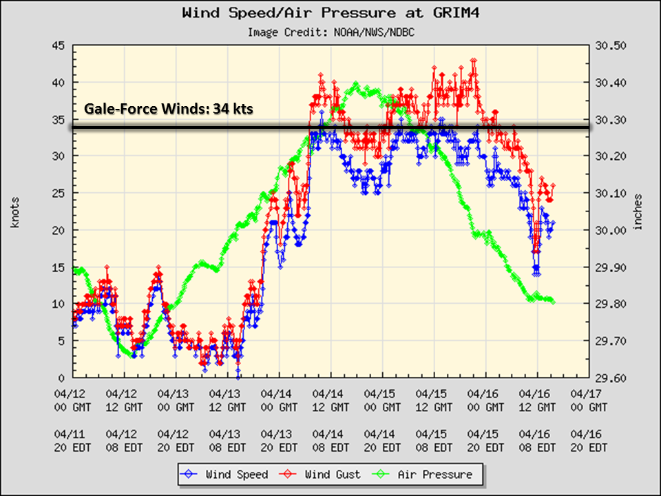
An extended period of gale-force winds occurred from Friday evening (4/13) through early Monday morning (4/16). Max winds occurred on Sunday (4/15) where a few storm-force gusts over 50 knots were observed over the far western portions of Lake Superior. Combined with below freezing temperatures, heavy freezing spray was observed over portions of Lake Superior during the extended period of gale-force winds. The hazardous conditions shut down shipping operations on Lake Superior for much of the weekend. Additionally, large waves led to minor beach flooding and erosion around Lake Superior, especially across the west. More significant lake shore flooding and beach erosion occurred along the western and southern shores of Lake Michigan.
.PNG) |
.PNG) |
|
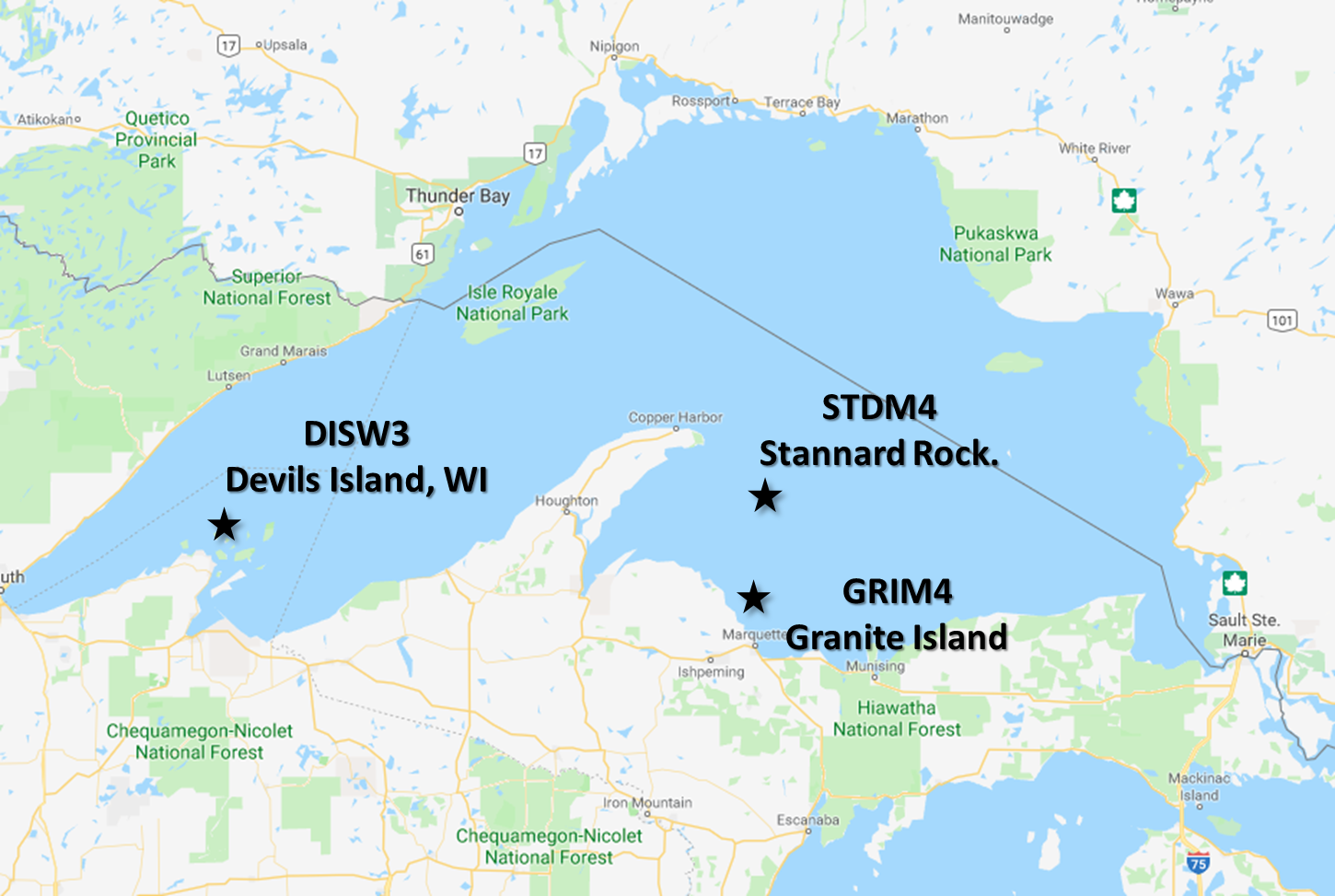
Wind speed (blue, kts), wind gust (red, kts) and air pressure (green, in) from 4/11 to 4/16 at Devils Island, WI. The black link denotes 34 knots, or gale force winds. (click on image to see a larger version) |
Wind speed (blue, kts), wind gust (red, kts) and air pressure (green, in) from 4/11 to 4/16 atStannard Rock. The black link denotes 34 knots, or gale force winds. (click on image to see a larger version)
|
 |
 |
|
Wind speed (blue, kts), wind gust (red, kts) and air pressure (green, in) from 4/11 to 4/16 at Granite Island. The black link denotes 34 knots, or gale force winds. (click on image to see a larger version)
|
Regional map showing the locations of Devils Island, Stannard Rock, and Granite Island. (click on image to see a larger version)
|
Social Media Service:
Here's a look at a few of our social media posts leading up to and during the event. Note that clicking on any image will pop-up a larger version. Additionally, not every image has a description.
 |
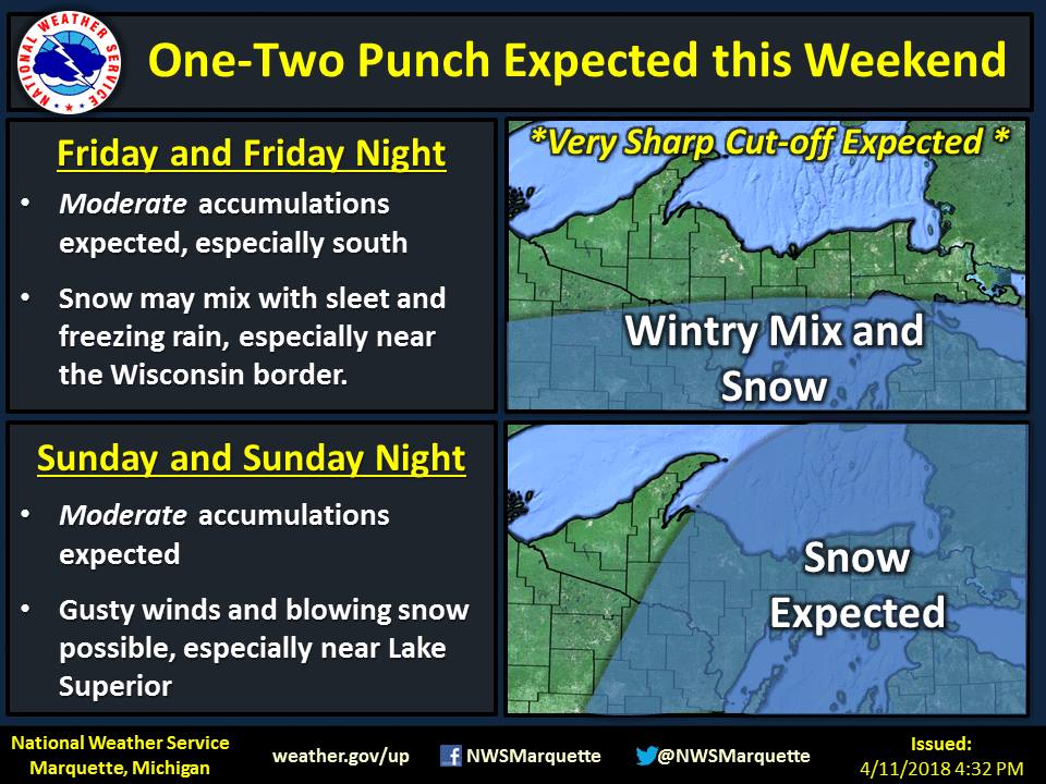 |
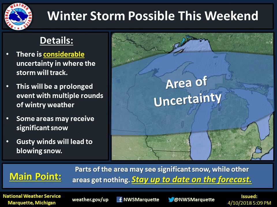
| Several days before the storm hit, we were confident that a significant storm would occur but where was much more uncertain. This graphic went viral for its lack of "specificity," but in reality, mostly everyone in the blue shaded area saw significant winter weather! | By 4/11, we were confident in two separate rounds of winter weather. We were quite confident that the first round would stay primarily south of the area and the second round on Sunday would be much more impactful. |
 |
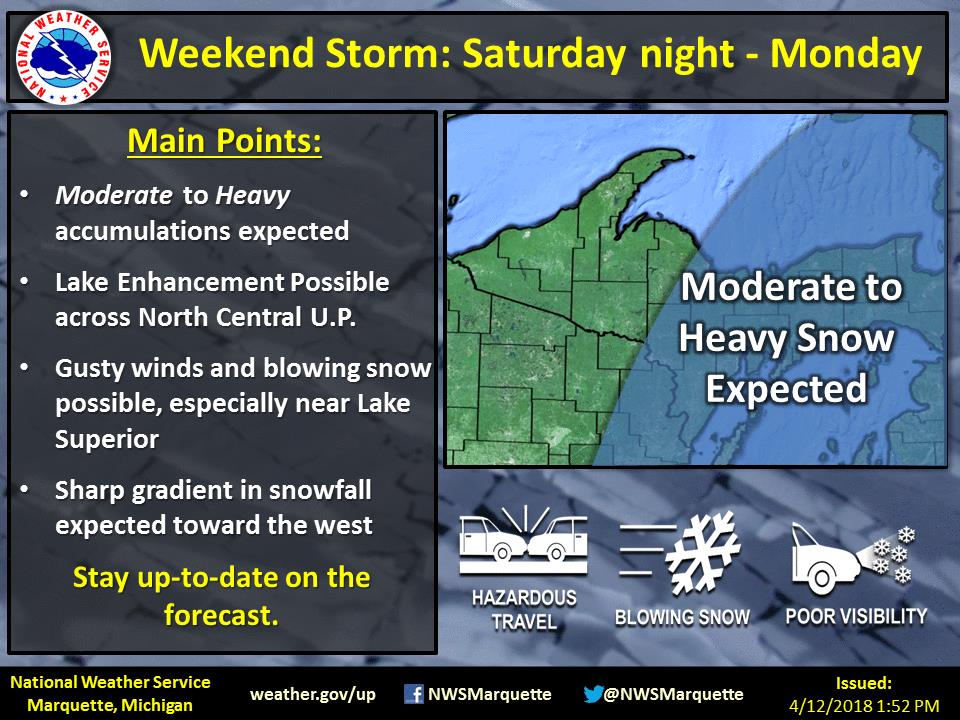 |
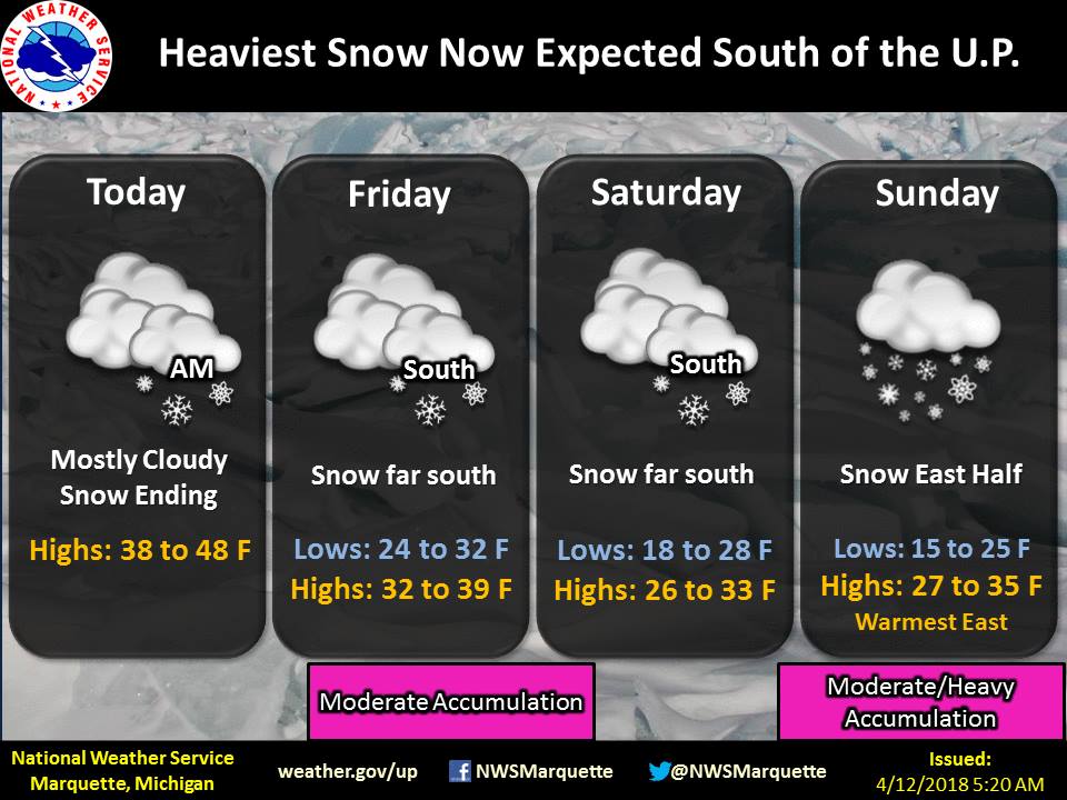
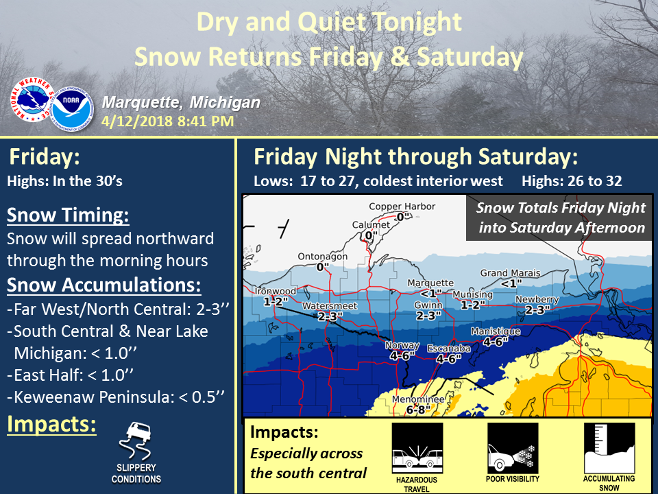
| We continued to advertise two rounds of snow on the 12th | We started to focus our attention on the 2nd round of winter weather on the12th, again anticipating considerable impacts. Our greatest uncertainty was across the west. |
 |
 |
|
We posted our first snowfall map roughly 24 hours before the snow began. This post focused on the first round, primarily south of Upper Michigan. |
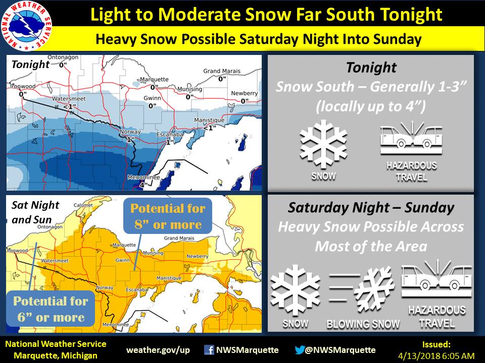
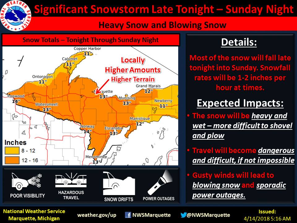
We maintained similar messaging the morning of the event, at this point posting a snowfall map for the end round. |
 |
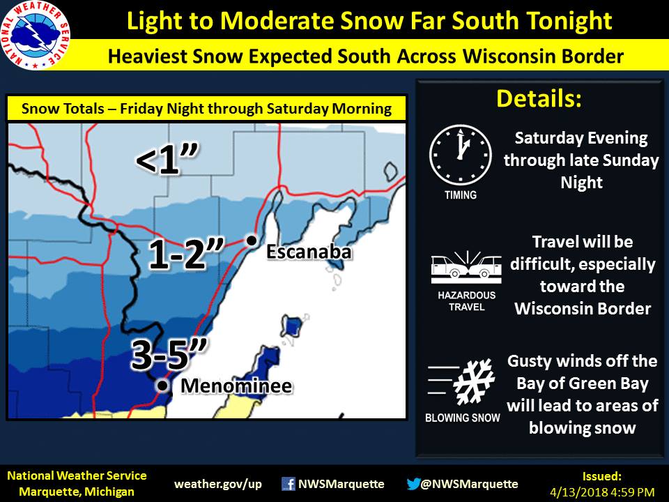 |
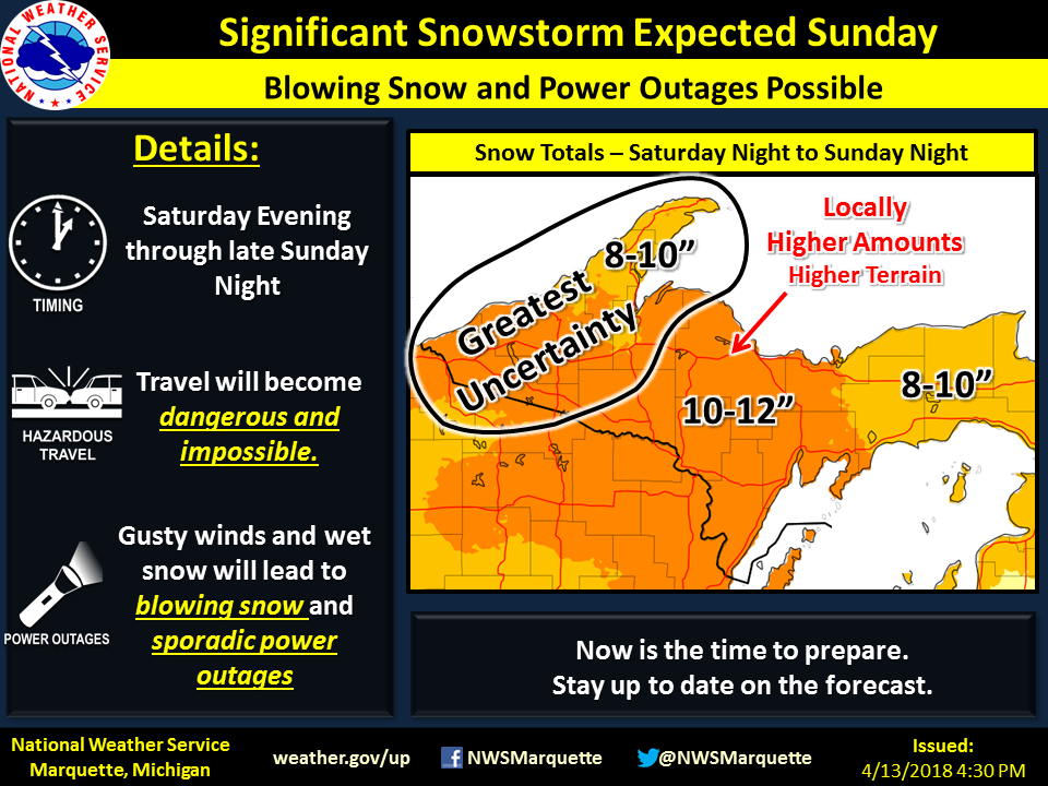
| We started to up our snowfall amounts on the 13th as confidence grew in a significant snowfall event. Our greatest uncertainty remained across the west. | This was our final snowfall forecast for the south for the first round. Menominee ended up getting 12" of snow due to a surprisingly heavy band of snow. For more detail on the first event, see the corresponding tab above. |
 |
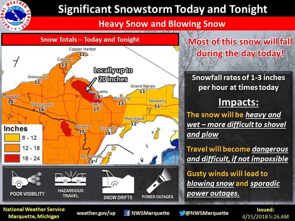 |
| The day before the event, we continued messaging significant snowfall amounts. | Finally, as the event unfolded, we continued consistent messaging for impacts and amounts. |
Photos:
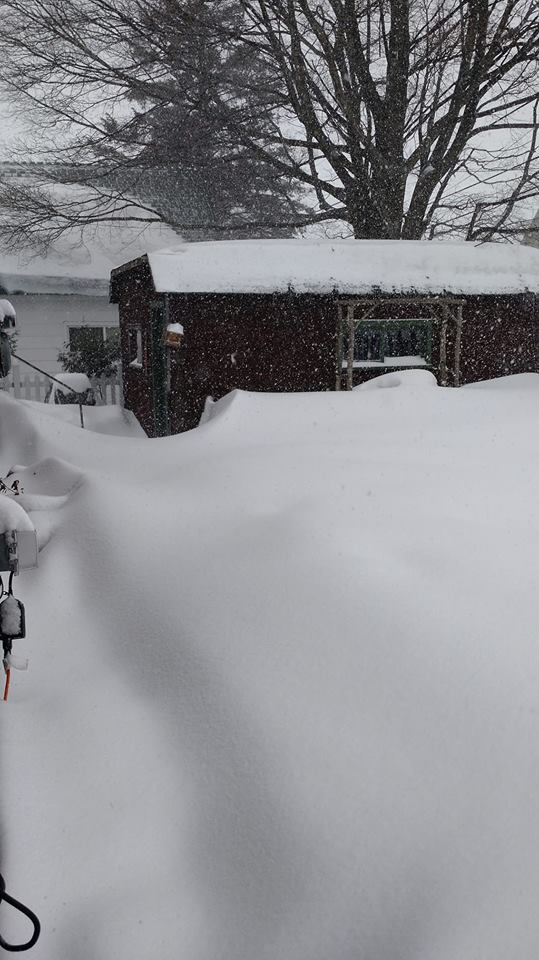
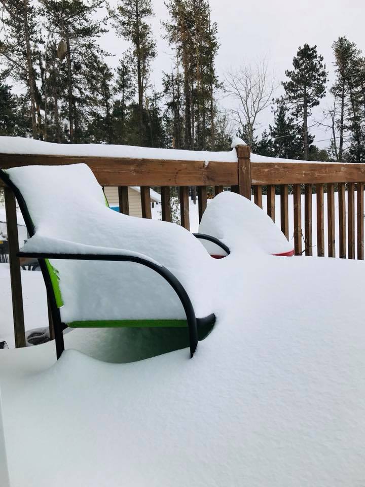
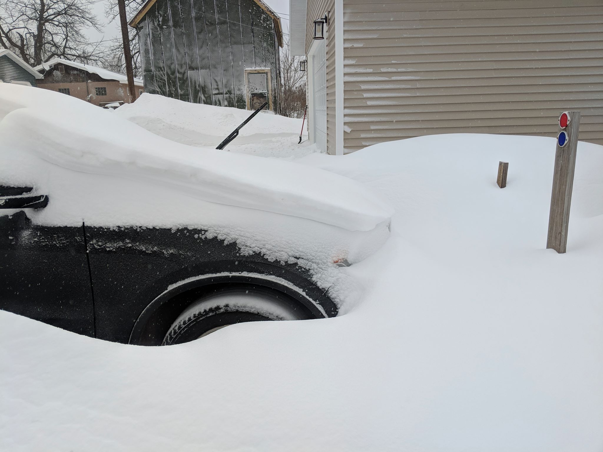
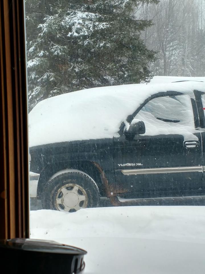
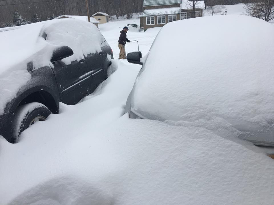
Here's a look at pictures from across Upper Michigan shared with us from social media. Thank you everyone who shared their pictures with us!
 |
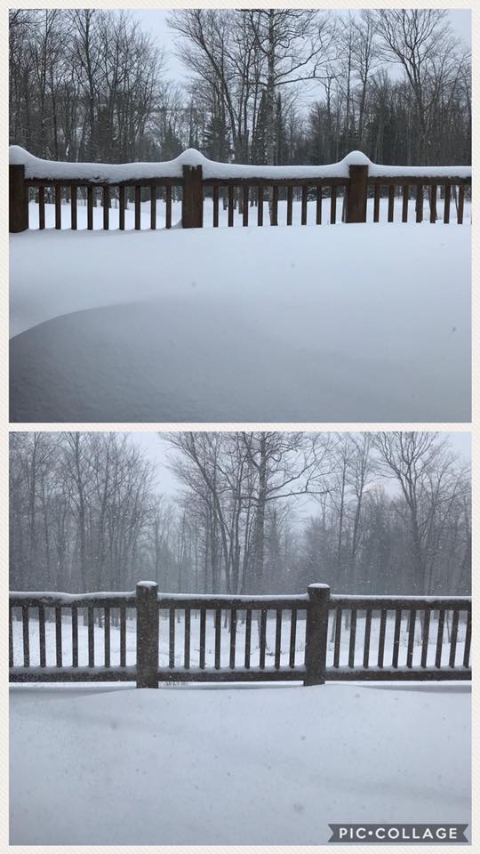 |
| Hancock - Jen Martin Davis | Humbolt - Kylie Jo Carey |
 |
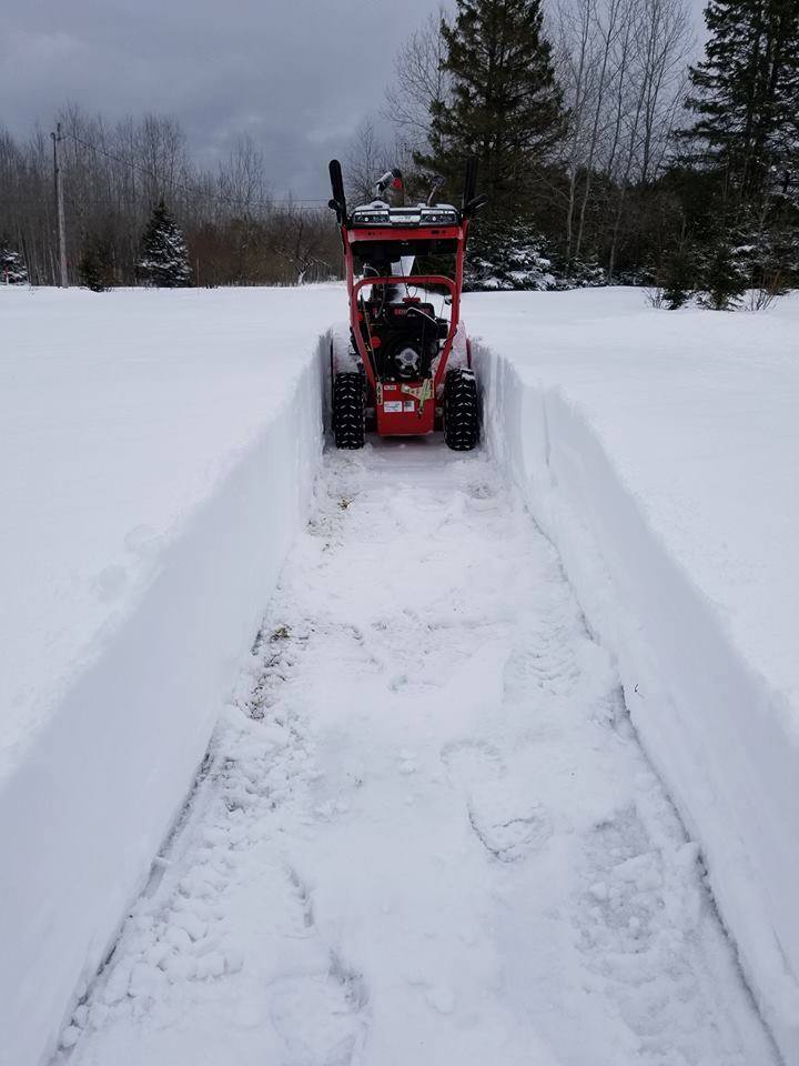 |
| Harvey - Andy-Sue Fortin | Keweenaw Bay - Ed Nephler |
 |
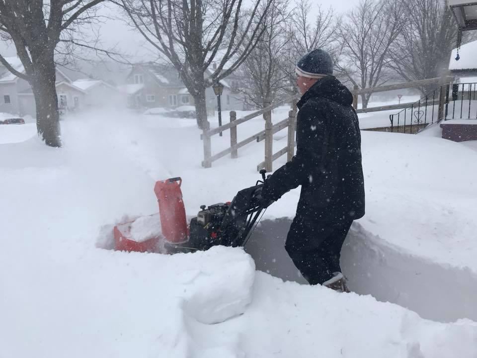 |
| Negaunee - Abbie Kapper Tiremen | Negaunee - Dawn Evans |
 |
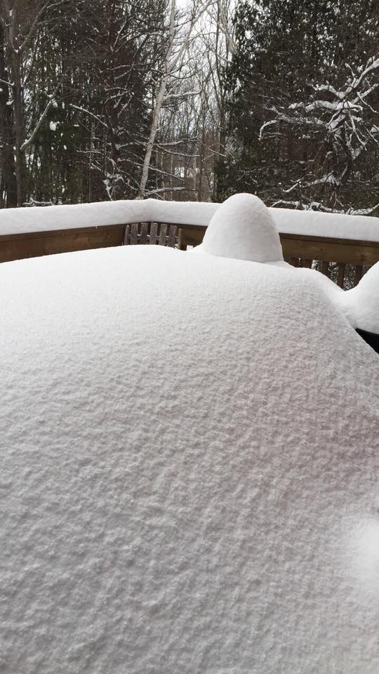 |
| Bergland - Rhonda Huettl | South of Marquette - Virginia Killough |
 |
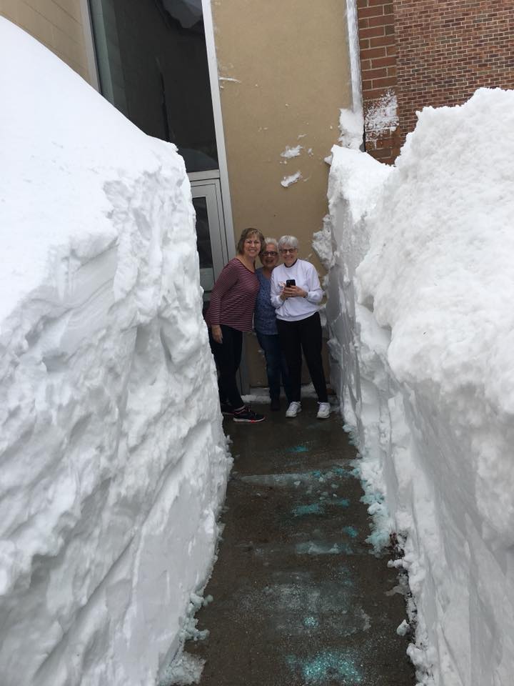 |
| Negaunee - Abbie Kapper Tireman | Snow Drifts at YMCA Marinette-Menominee (used with permission) |
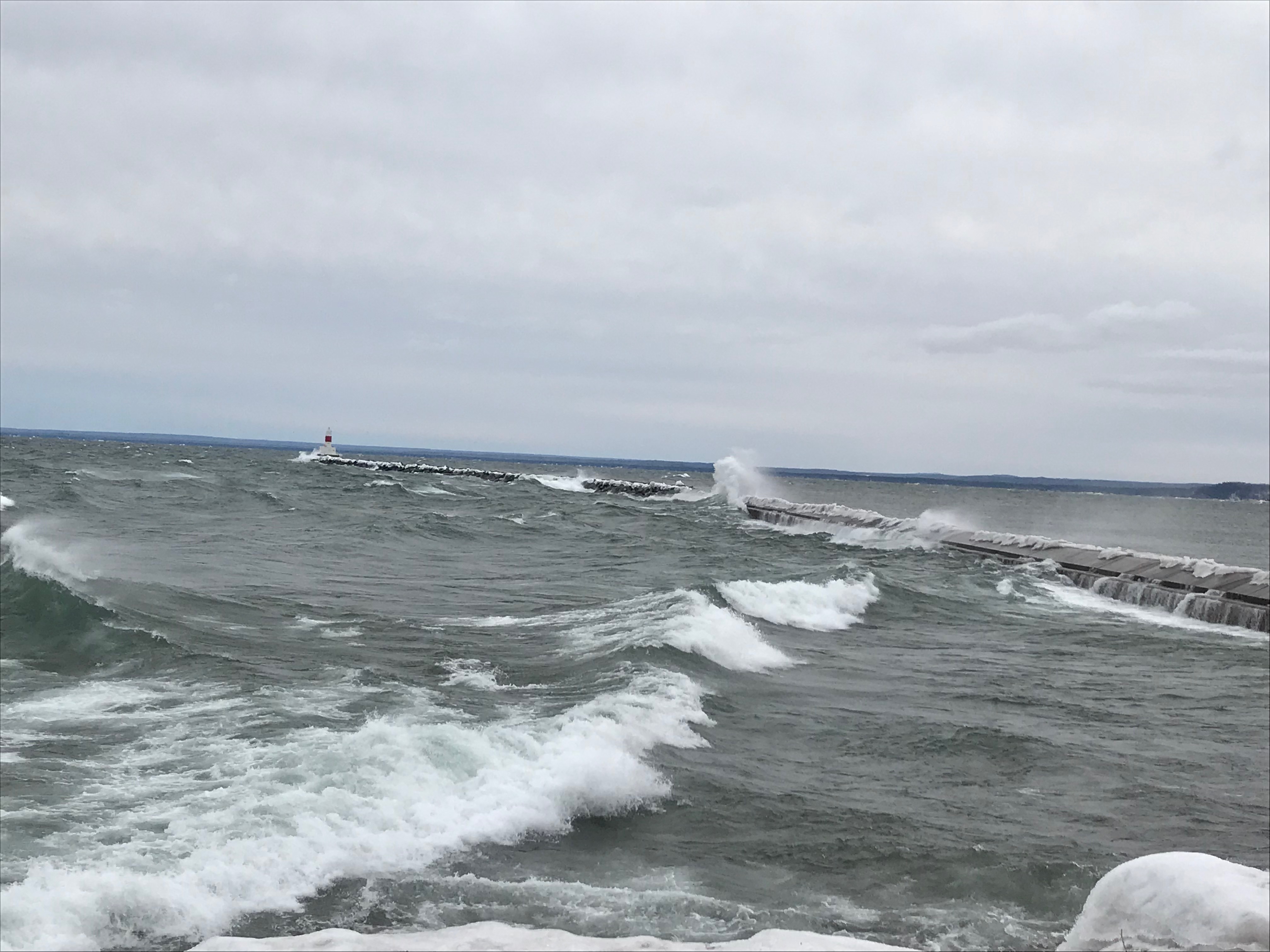 |
| Waves on Lake Superior - Jaclyn Ritzman |
 |
Media use of NWS Web News Stories is encouraged! Please acknowledge the NWS as the source of any news information accessed from this site. |
 |