Severe Thunderstorms August 10, 2021
|
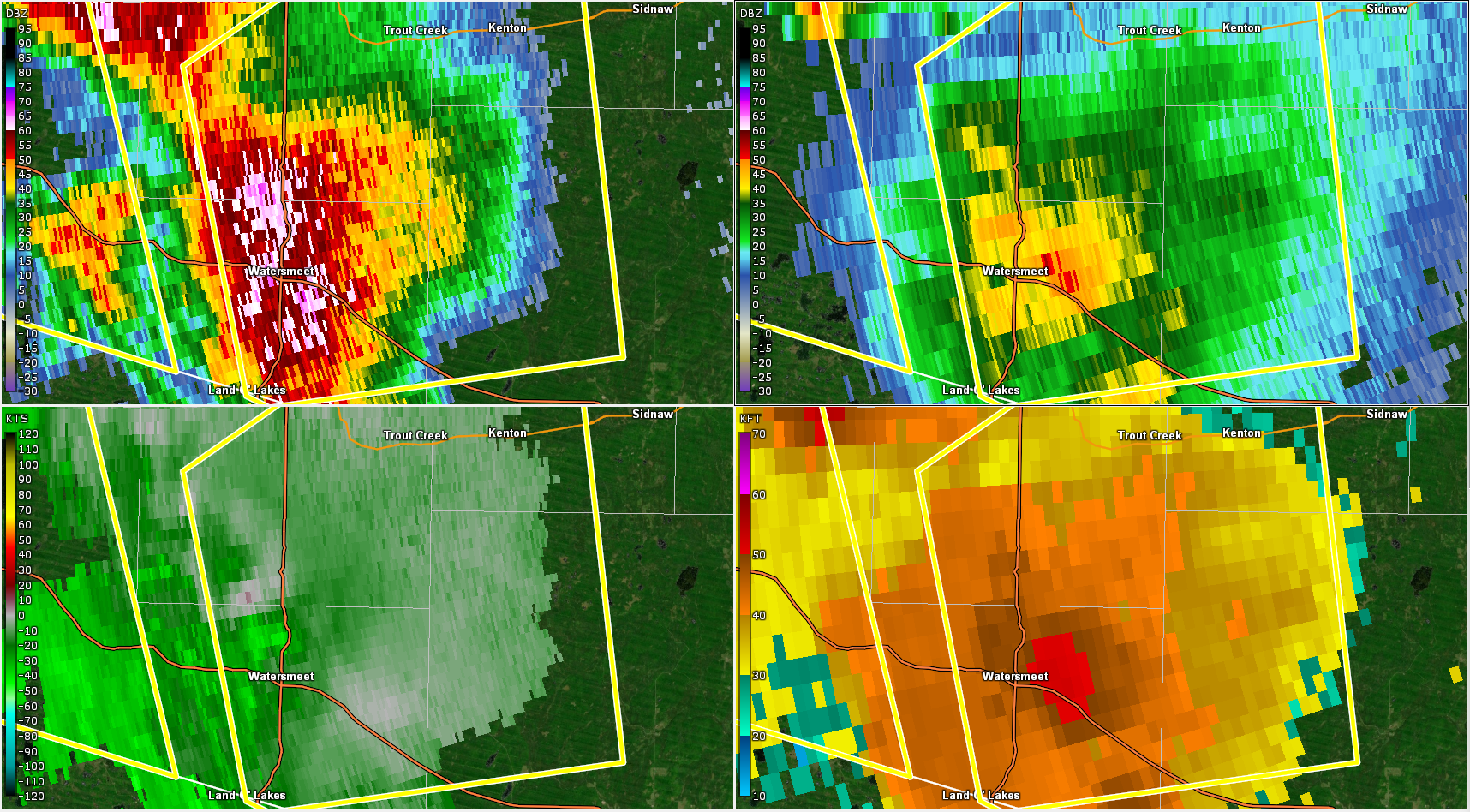
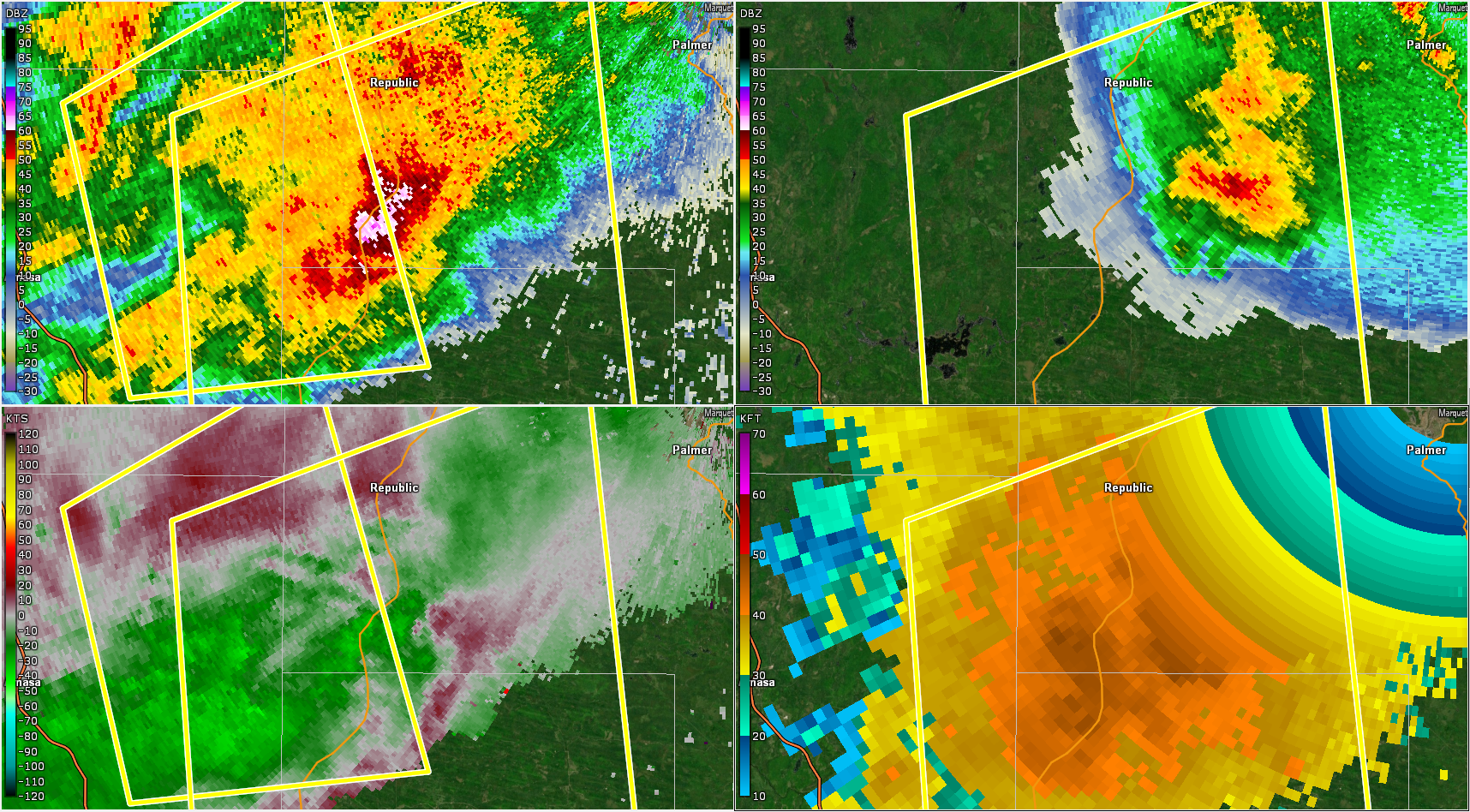
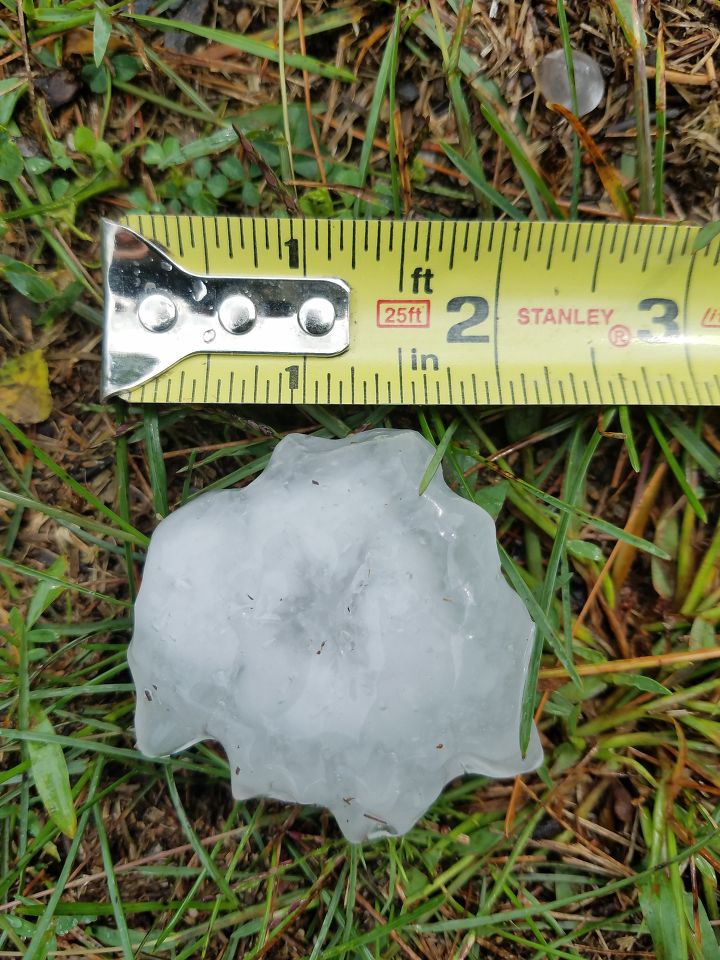
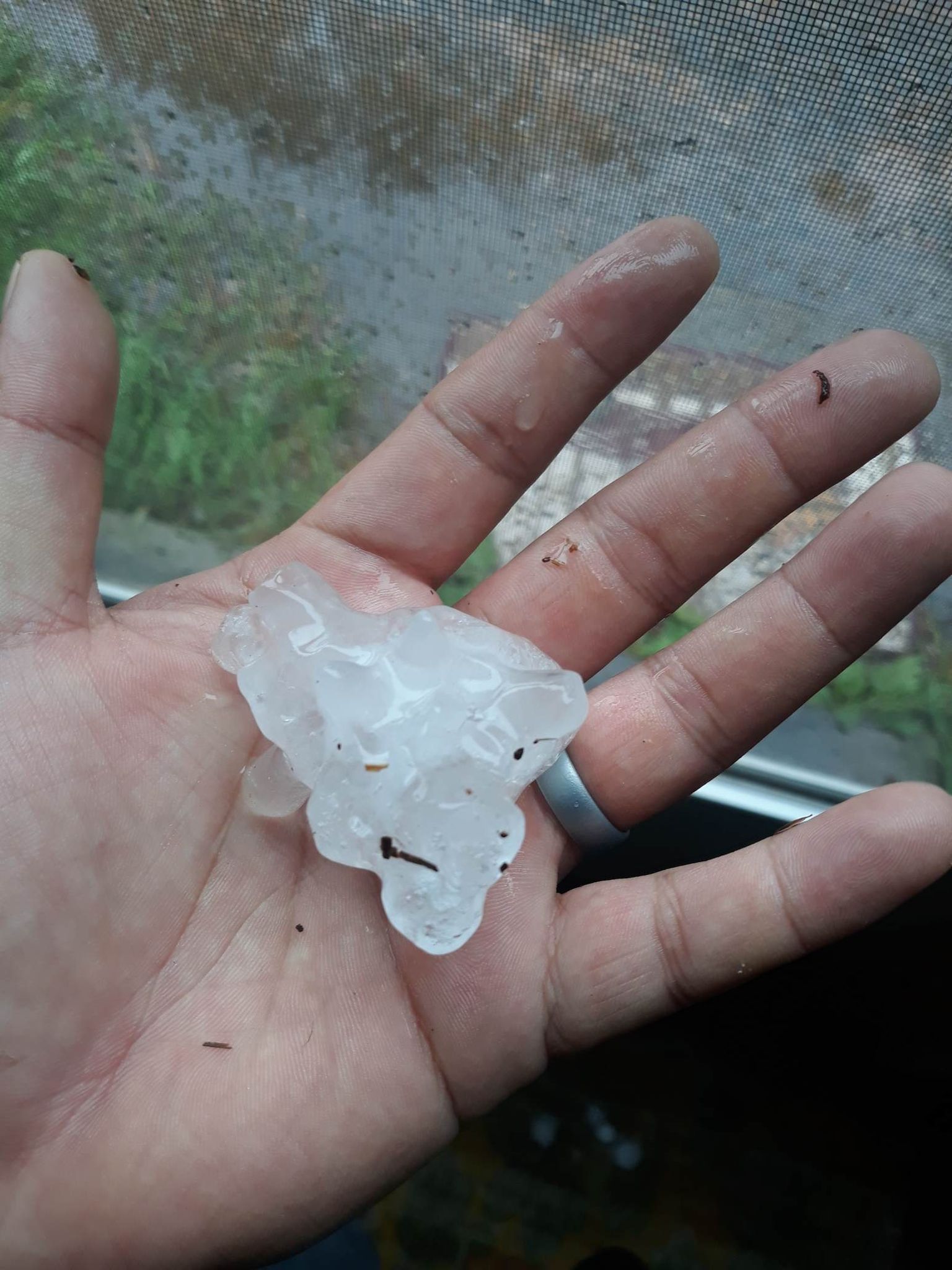
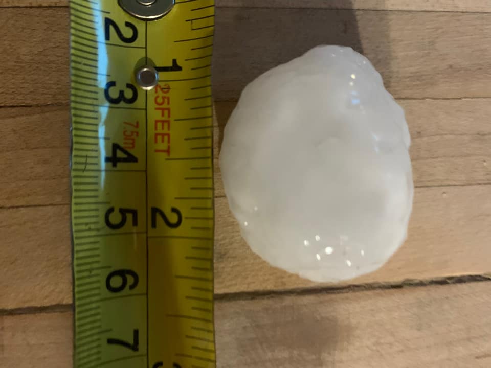
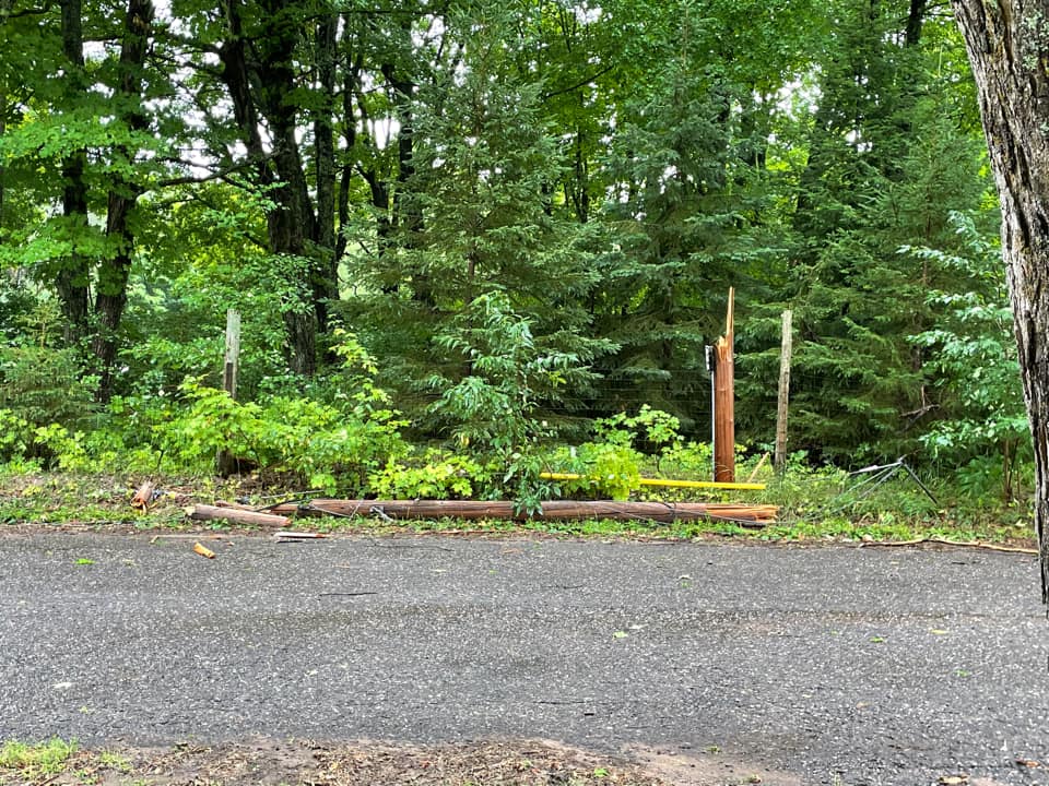
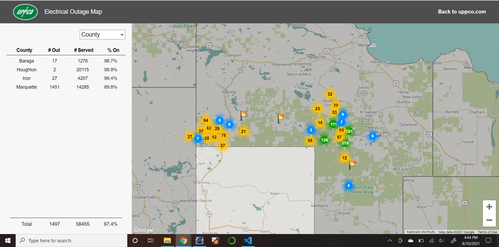
Severe thunderstorms tracked across much of Upper Michigan from late morning through early evening on Tuesday, August 10. Throughout the event there was an elevated stable layer that mostly prevented the strong winds aloft in the storms from reaching the surface. Therefore, the main threat early on was large hail. The storms produced hail up to baseball size near Watersmeet, and up to ping pong ball size near Witch Lake. However, as the day went on, the storms became surface-based and took advantage of a shallow surface-based mixed layer to produce some localized wind damage in two pockets. One of those pockets was around Witch Lake and the other around Gwinn and Shag Lake. There were thousands of customers without power in these areas because of downed trees and snapped power poles. A second storm behind the main line pulsed up and produced quarter size hail in Harvey before quickly weakening again. Large hail was also reported in Trenary. |
|
Environment
 |
 |
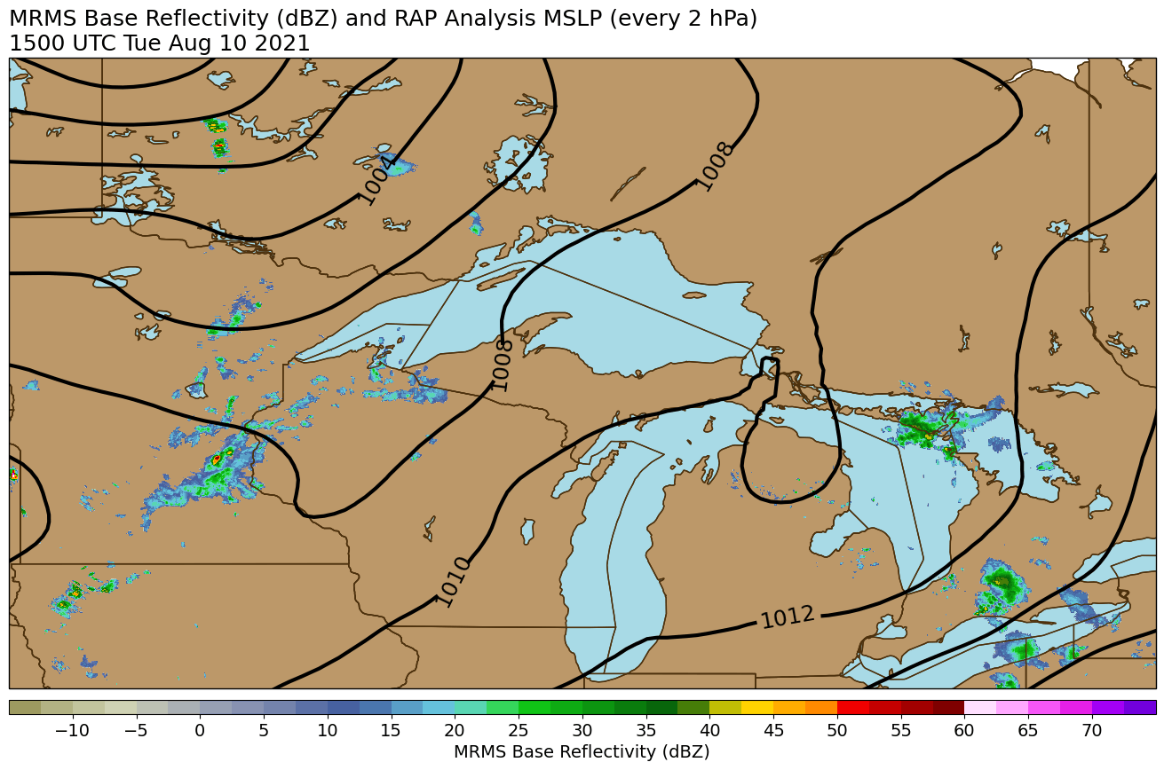 |
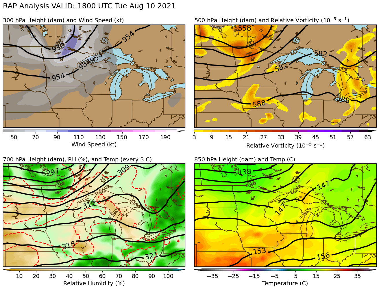
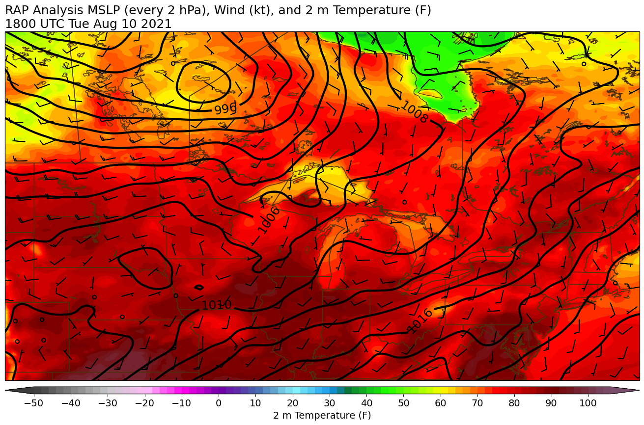
| Strong upper-level trough to the west and moderate to strong mid- and upper-level flow overspreading the area ahead of a cold front | Storms initiated on the cold front stretching from northwest Wisconsin into northern Iowa then moved east | GIF loop of mean sea level pressure and radar reflectivity showing storms developing in northwest Wisconsin and then moving across the U.P. |
 |
 |
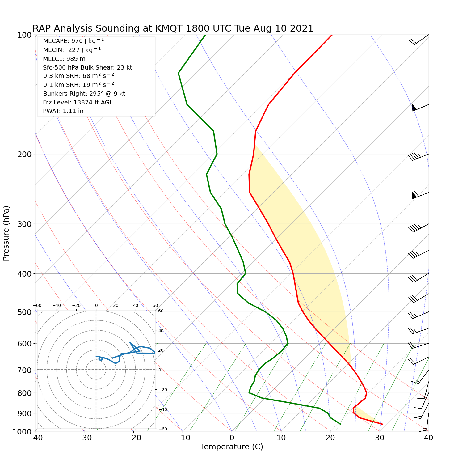 |
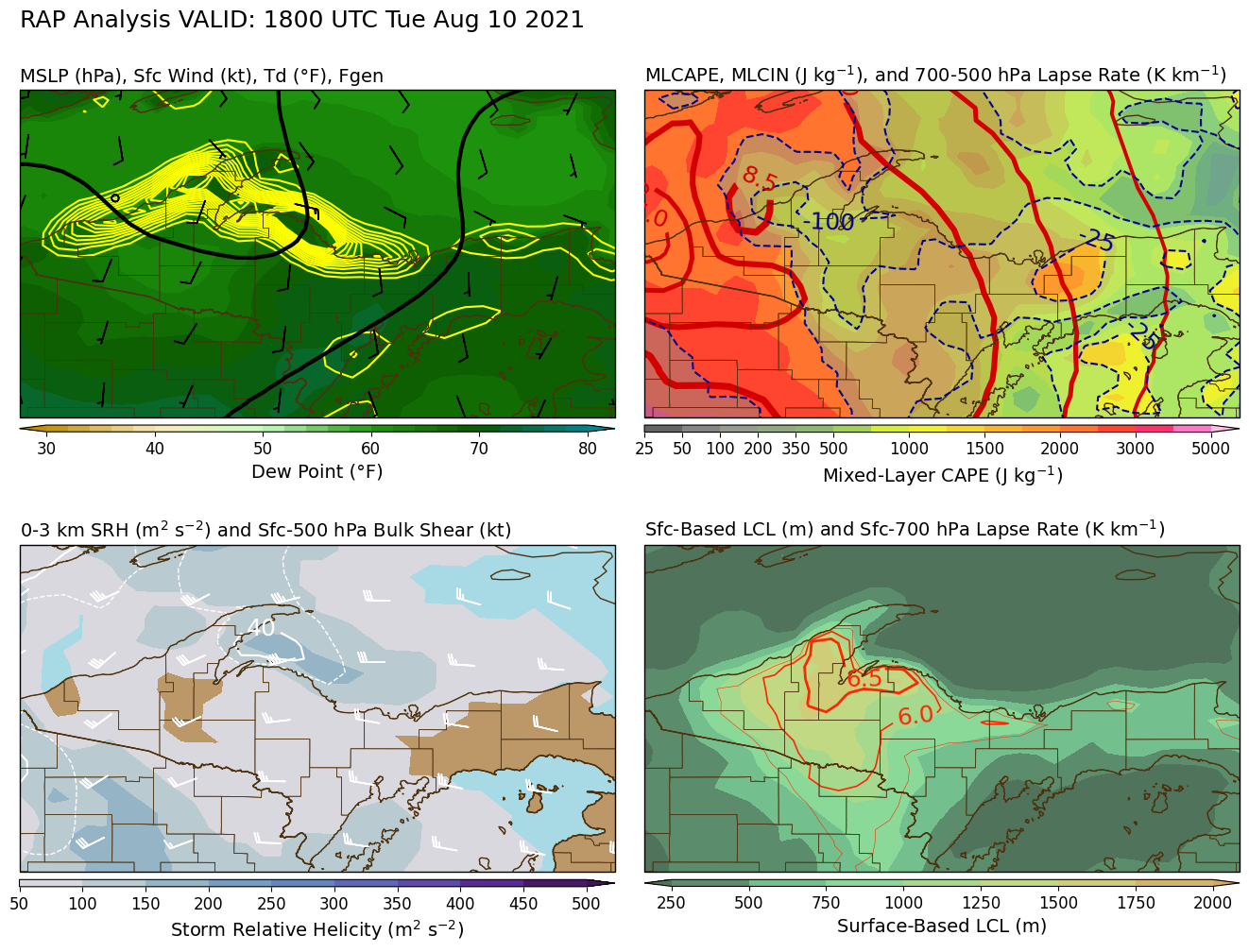
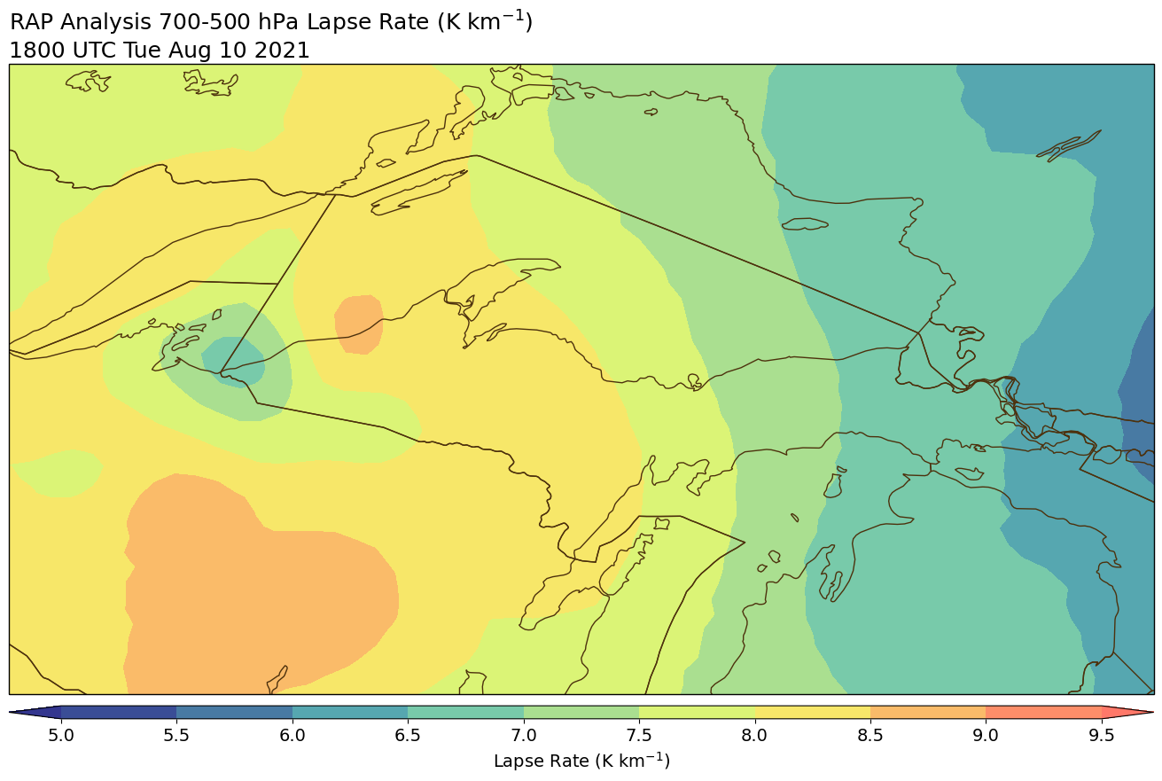
| High dew points, moderate to strong MLCAPE (but also substantial MLCIN), weak to moderate shear, and poor low-level lapse rates | Steep mid-level lapse rates around 8 C/km or more | Vertical profile near MQT showing elevated CAPE with a substantial SBCIN and a high LFC |
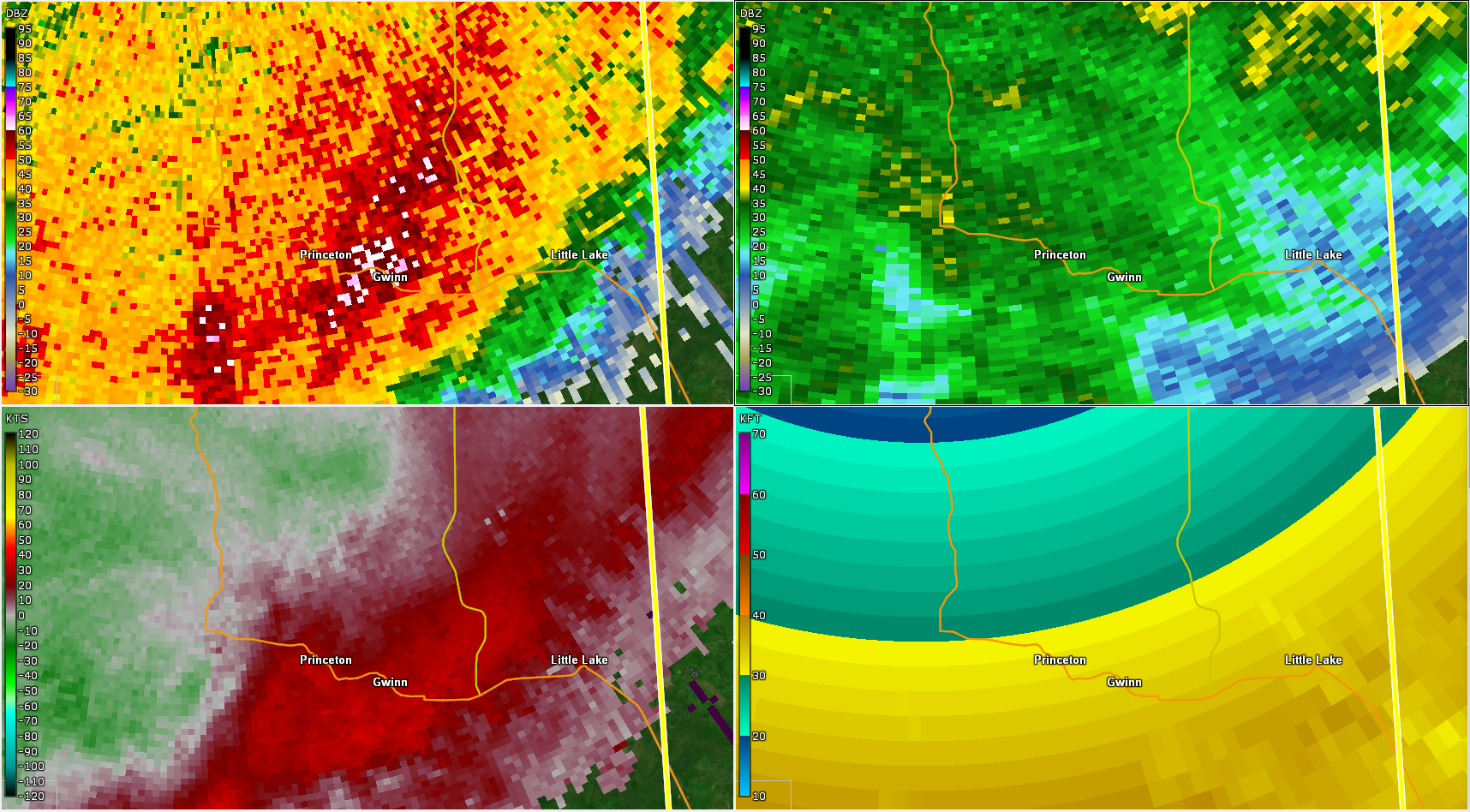
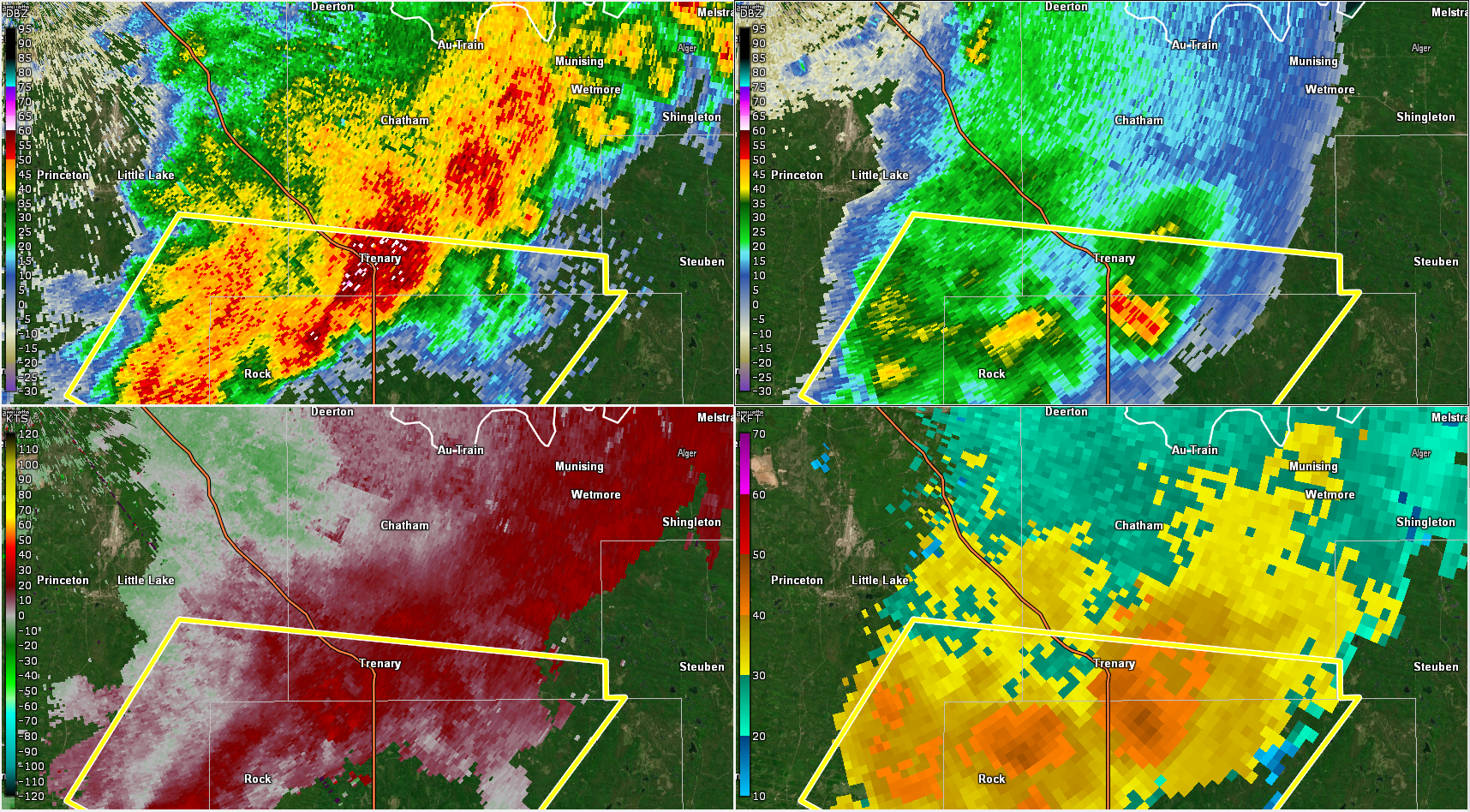
Radar
Each image shows...
Top left: near-surface radar reflectivity
Top right: reflectivity at around 35,000 to 39,000 feet
Bottom left: near-surface radial velocity (component of wind towards or away from radar)
Bottom right: estimated maximum storm height in thousands of feet
 |
 |
 |
 |
| Near Watersmeet at 1:05 pm CDT | Near Witch Lake at 3:54 pm EDT | Near Gwinn at 4:31 pm EDT. Note that the storm top estimate does not work due to the storm's close proximity to the radar. |
Near Trenary at 5:15 pm EDT |
Photos
 |
 |
 |
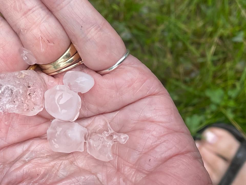
 |
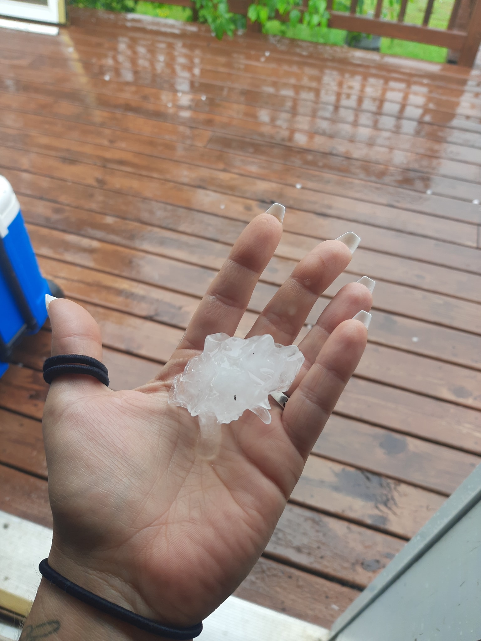
| 2-inch diameter hail in Watersmeet courtesy of Karl Bohnak | Large hail in Watermseet | Large hail in Watersmeet | Large hail in Witch Lake |
 |
 |
 |
 |
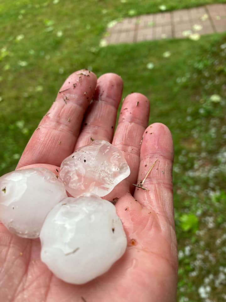
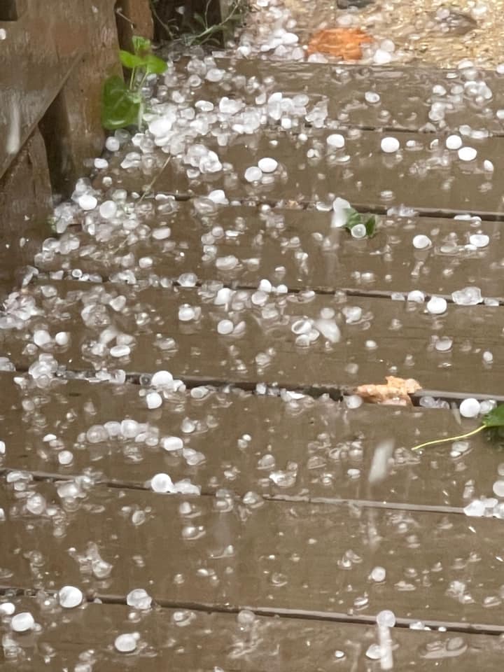
| Ping pong ball size hail near Witch Lake | Snapped power poles near Gwinn | Map of power outages shortly after the storms moved through | 0.5-inch diameter hail near Gwinn |
 |
 |
 |
 |
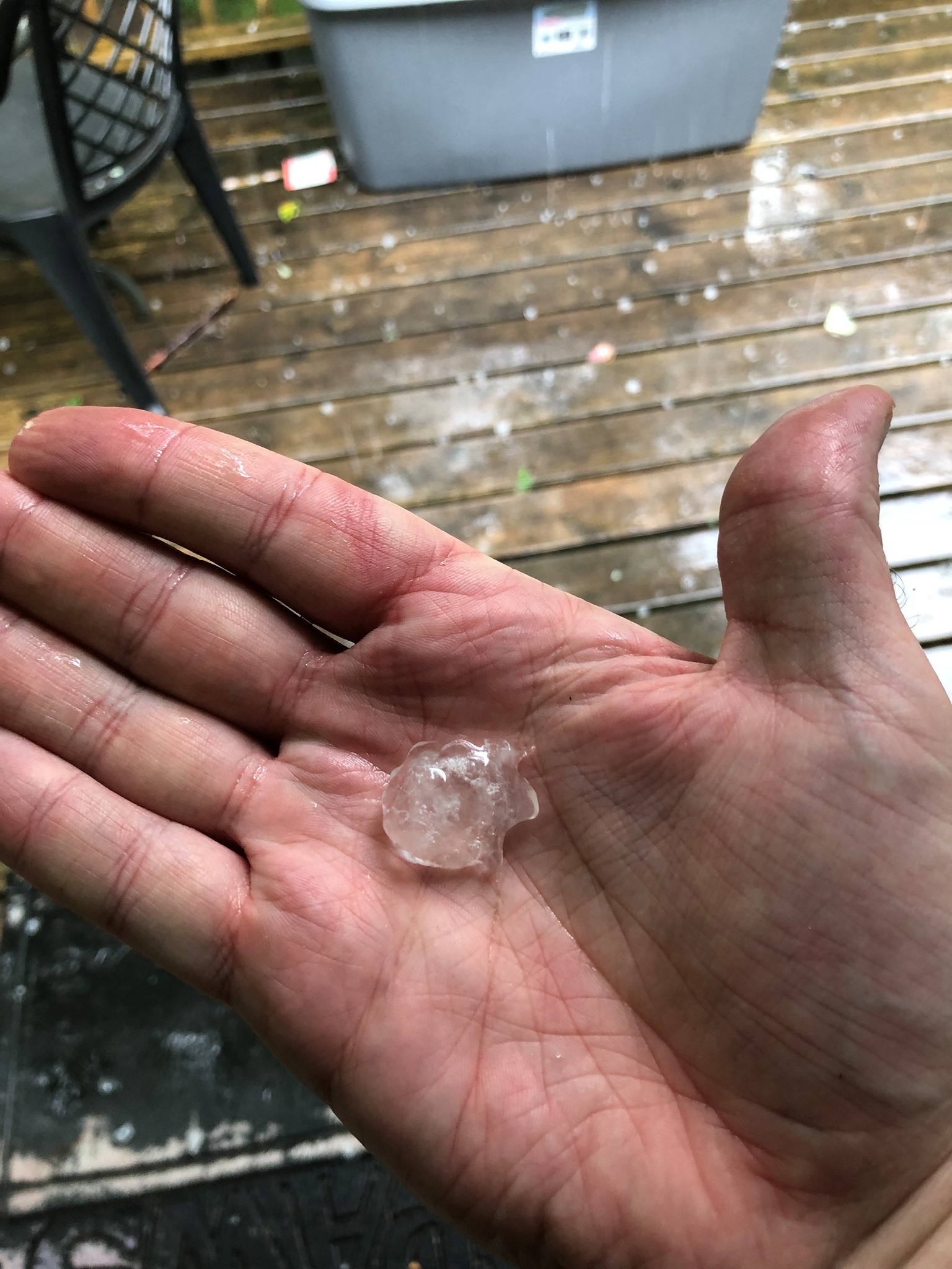
| Pea size hail near KI Sawyer | Hail in Harvey, courtesy of Phil Britton | Quarter-size hail in Harvey, courtesy of Linda Nellist | Hail in Harvey, courtesy of Linda Nellist |
 |
Media use of NWS Web News Stories is encouraged! Please acknowledge the NWS as the source of any news information accessed from this site. |
|


Social Media Messaging