Tropical Storm Helene - September 22, 2000
 On the 19th of September (2000), Hurricane Hunter reconnaissance aircraft observed a closed surface circulation in the tropical wave moving through the Caribbean. Helene slowly intensified on the 19th and 20th and became a tropical storm September 21.
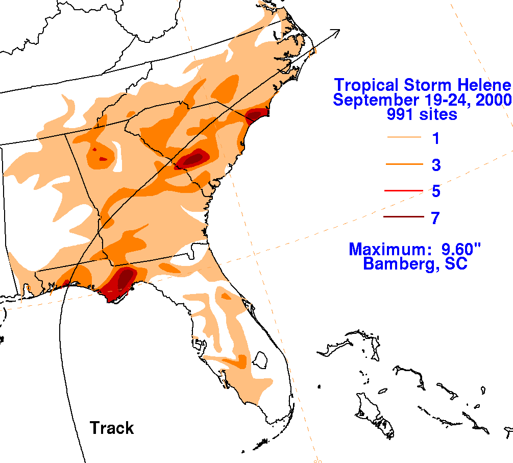
Tropical Storm Helene made landfall near Fort Walton Beach, FL on the morning of September 22nd in 2000. Peak wind gusts around the time of Helene's landfall were only 35 knots in Destin and 38 knots at Pensacola Beach. The graphic to the right shows the track of Helene as it trekked across the Gulf and across the southeastern US in late September as well as the storm total rainfall rainfall (courtesy of NOAA WPC).
Helene produced heavy rain across the northwest Florida panhandle and southern Alabama. The heaviest rainfall fell over Okaloosa County near where the center of Helene made landfall. The highest storm total rainfall amounts across the Florida panhandle were 4.6 inches in Crestview and 2.7 inches at Eglin AFB. Due to the region being in a drought for much of the summer, there were no major flooding reports during Helene.
Storm surge was also estimated around 1 foot, which only resulted in minor coastal flooding and beach erosion, especially near Fort Pickens and on Dauphin Island. A newly built protective sand berm on Dauphin Island was partially eroded and several boardwalks were damaged by high surf and storm surge.
Additional Information
NHC Advisory Archive
WPC Archive
NHC Tropical Cyclone Report - Tropical Storm Helene
Acknowledgements: Page created by Morgan Barry (forecaster).
LAST UPDATED: November 2016