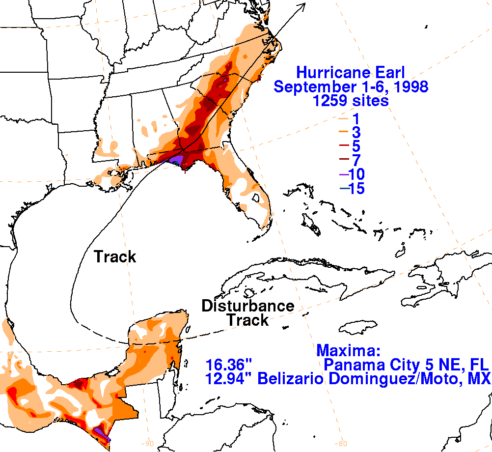
Hurricane Earl - September 3, 1998
 On September 1, 1998, Earl became a tropical storm as it moved northeast (east of a sharp upper level trough, which was not forecast well by the short range models at that time according to NWS WPC) across the Gulf. Hurricane Hunter reconnaissance aircraft data showed Earl strengthening to a hurricane in the late morning hours on September 2. Earl continued to strengthen and peaked as a Category 2 Hurricane on the morning of September 3rd.
Hurricane Earl weakened as it made landfall just east of our area (near Panama City, FL) on September 3, 1998 and quickly transitioned into a subtropical cyclone in southern Georgia on September 3. Earl caused only minor damage across the area from Dauphin Island, AL to Destin, FL.
Earl produced several inches of rain across the northwest Florida panhandle, which can be viewed in the track and rainfall graphic to the right (courtesy of NOAA WPC). The highest 3-day rainfall totals (ending at midnight on September 4th) across the northwest Florida panhandle were 6.31 inches at Eglin AFB, 6.03 inches in Crestview, 5.45 inches at Hurlburt AFB and 3.06 inches at the Pensacola International Airport. Mobile Regional Airport reported 2.45 inches during Hurricane Early. Some minor flooding was reported across southern Mobile County, AL and across southern Okaloosa County, FL.
Storm surge heights along the Alabama coast (estimated) were around 1-2 feet across Mobile and Baldwin Counties. Storm surge heights along the northwest Florida panhandle (estimated) were 2-3 feet across Escambia County, around 3 feet across Santa Rosa County and around 4 feet across Okaloosa County. Minor beach erosion due to the storm surge occurred across those counties in the northwest Florida panhandle. Norriego Point at Destin Harbour had a 400 foot breach caused by high waves and storm surge. Also, several sea turtle nests were sadly destroyed by the high waves and surge from Pensacola Beach to Destin in the Florida panhandle.
Additional Information
NHC Advisory Archive
WPC Archive
NHC Tropical Cyclone Report - Hurricane Earl
Acknowledgements: Page created by Morgan Barry (forecaster).
LAST UPDATED: November 2016