
Heavy Rain Impacts the Gulf Coast
April 14, 2014
.png)
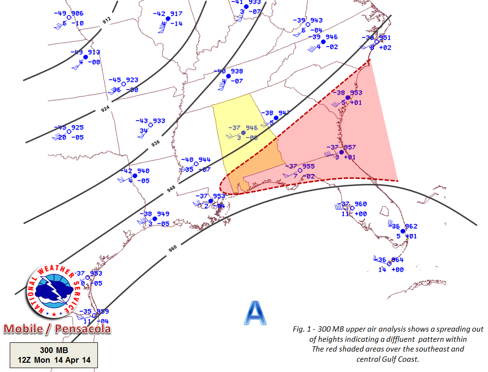
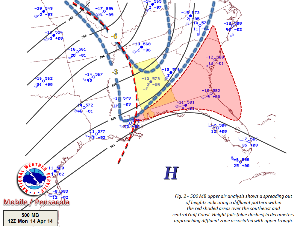
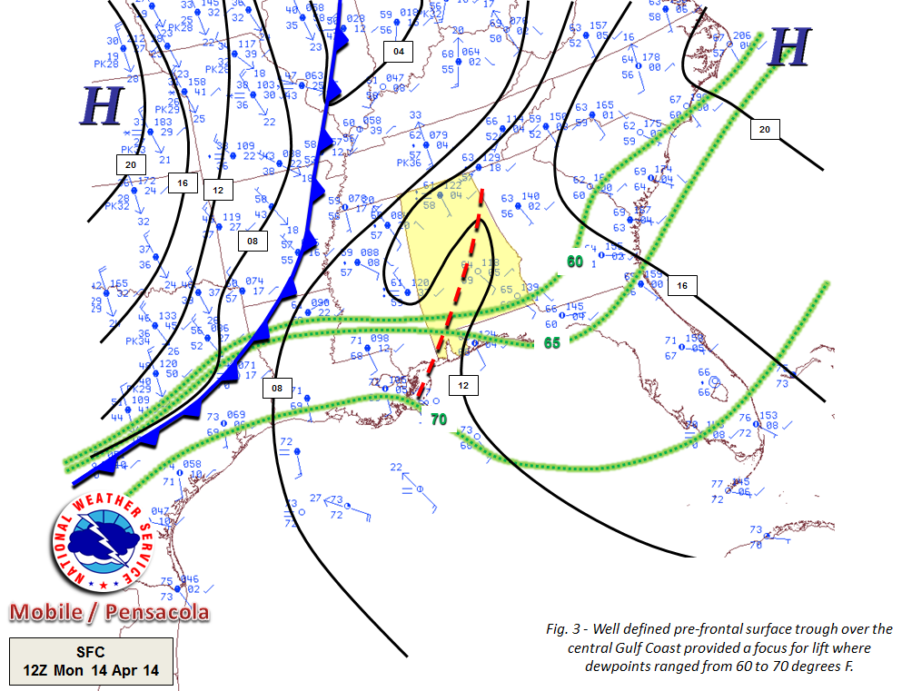
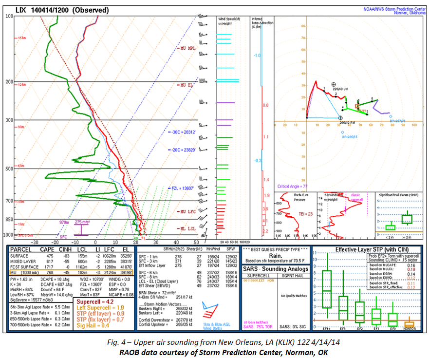
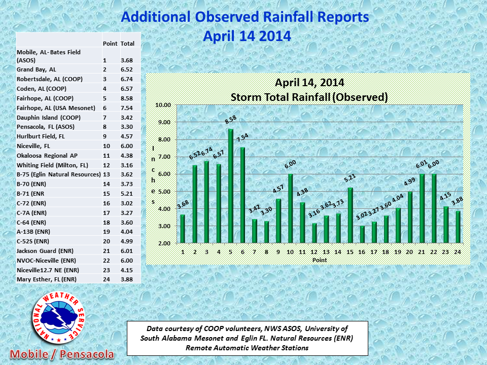
An active upper level southern stream storm system was positioned over the central Gulf Coast on the morning of April 14. Aloft, amplified upper level ridge of high pressure over the central Gulf caused a highly diffluent flow to originate from the Southeast to across the Mississippi Gulf Coast. At same time, an area of mid level height falls associated with an eastward moving trough pushed across the lower Mississippi River Valley causing an area of enhanced lift to set up over the central Gulf Coast (Figs. 1 and 2). At the surface, (Fig. 3) a well defined pre-frontal trough provided a focus for lift and was analyzed from central Alabama southwest to the Mississippi Sound. RAOB data (Fig. 4) from KLIX (New Orleans, LA) from 12Z April 14, indicated precipitable water values near 1.65 inches was more than sufficient for heavy rains given the upper level support positioned across the area. These moisture values were well above normal (Fig. 5) for the middle of April.
National Weather Service Mobile, AL Meteorologists issued a Flash Flood Watch for the central Gulf Coast early in the morning of Monday April 14 in anticipation of excessive rainfall.
.png)
.png)
The following pictures show the damage caused by the force of water when rivers, creek beds and culverts become rain swollen. A good reminder is, if driving and water covers the road, the best course of action is to turn around, don't drown.
Helpful resources regarding flooding - Turn Around, Don't Drown
.png)
.png)
.png)
Acknowledgements: Page created by Joe Maniscalco (Forecaster). The author wishes to thank Cody Lindsey (Forecaster) for reviewing this page. The forecast team of NWS Mobile; the NWS Storm Prediction Center in Norman, OK for sounding plots; Matthew Bunkers (NWS Rapid City, SD); and Scott Lincoln (NWS Lower MS River Forecast Center) for providing precipitable water climatic charts. Much appreciation goes to CoCoRaHS volunteers, NWS Mobile COOP Observers, Dr. Sytske K. Kimball (University of South Alabama Mesonet Coordinator) and to William Pizzolato (Soil Conservation
Technician and Erosion Control Project Manager for Eglin Air Force Base) in providing Remote Automated Weather Station (RAWS) rainfall observations. Emergency Management Agencies (EMA) for their reports on road conditions. Appreciation goes to WKRG News 5 for photos and to all other media partners, weather spotters, and public for their weather reports and photos provided via social media outlets. Page updated by Morgan Barry (Forecaster).
LAST UPDATED: December 2017


.png)