Catastrophic Super Typhoon Bavi's eyewall has reached Rota and is expected to bring dangerous winds, heavy rainfall and storm surge to Guam, Rota, Tinian and Saipan. A Typhoon Warning remains in effect. Heavy to excessive rainfall will continue to bring a flooding threat from coastal Mid-Atlantic to southern New England through Monday. Read More >
Miami - South Florida
Weather Forecast Office
Today's Weather Impact Levels
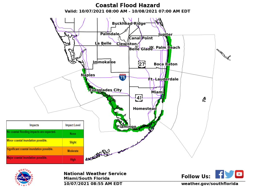
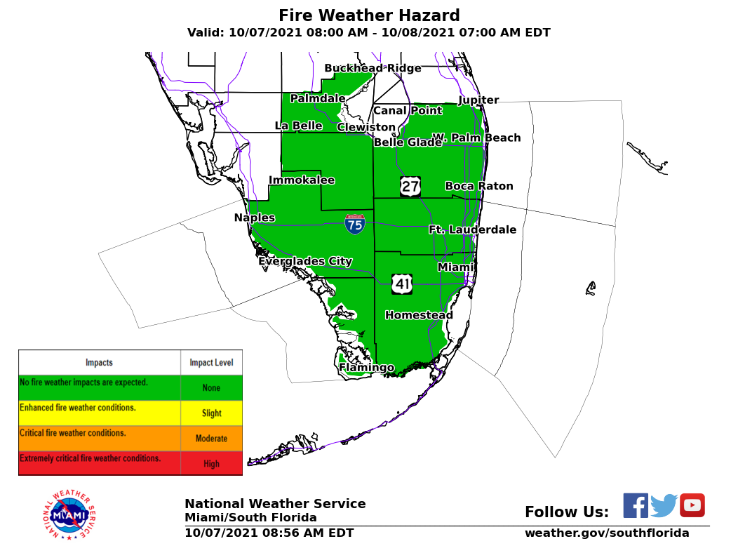
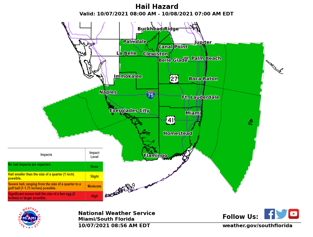
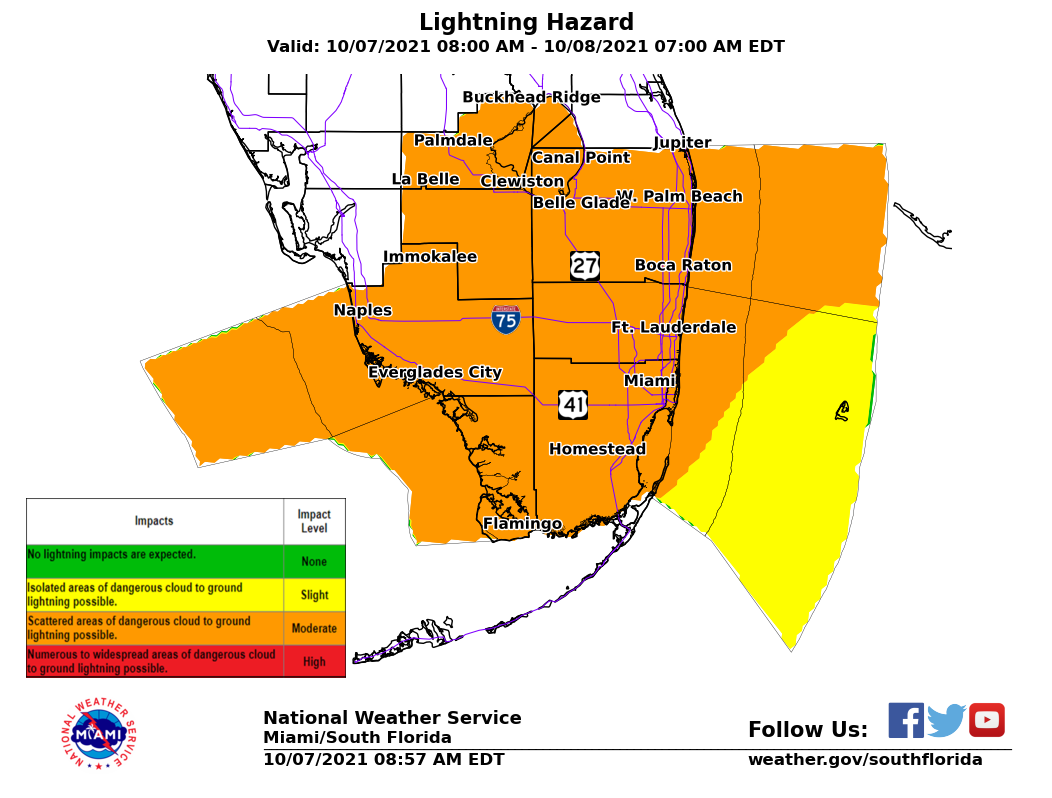
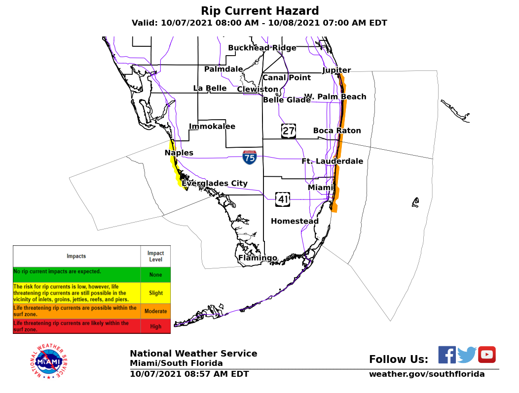
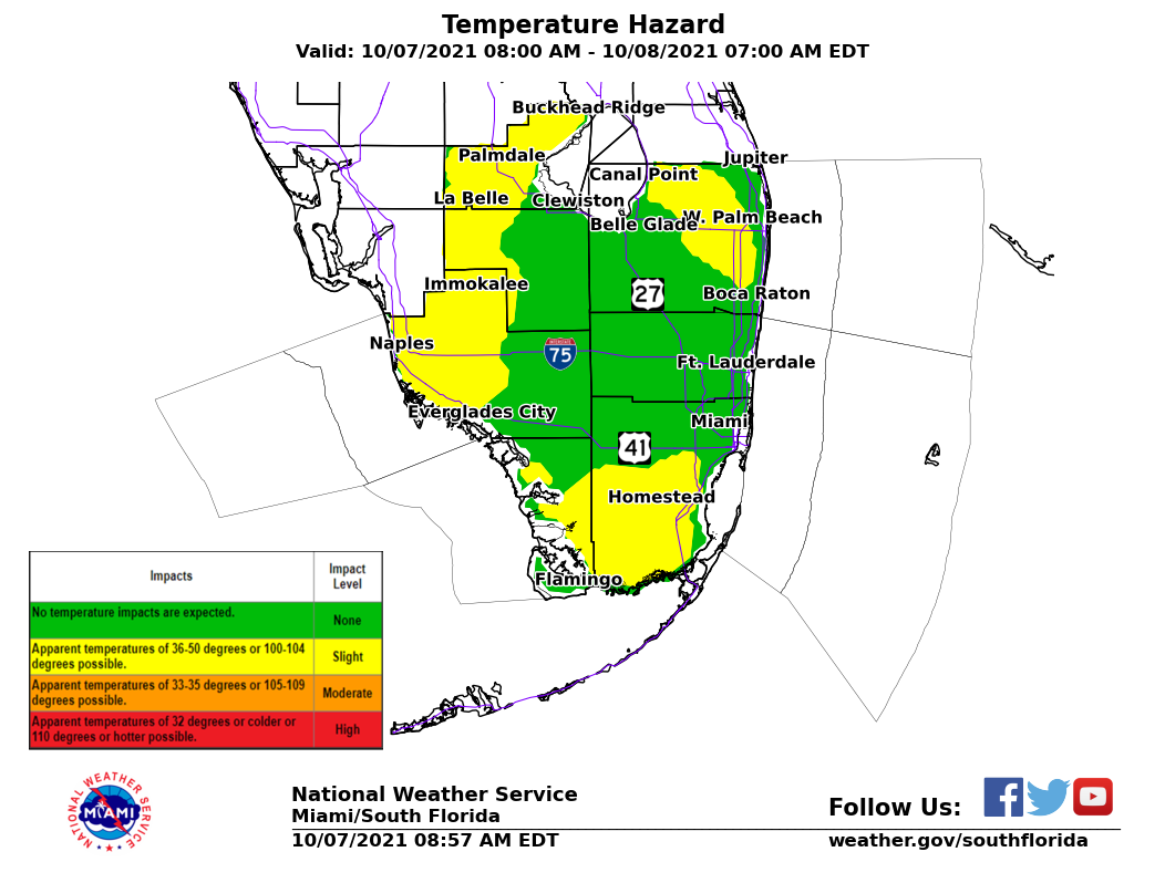
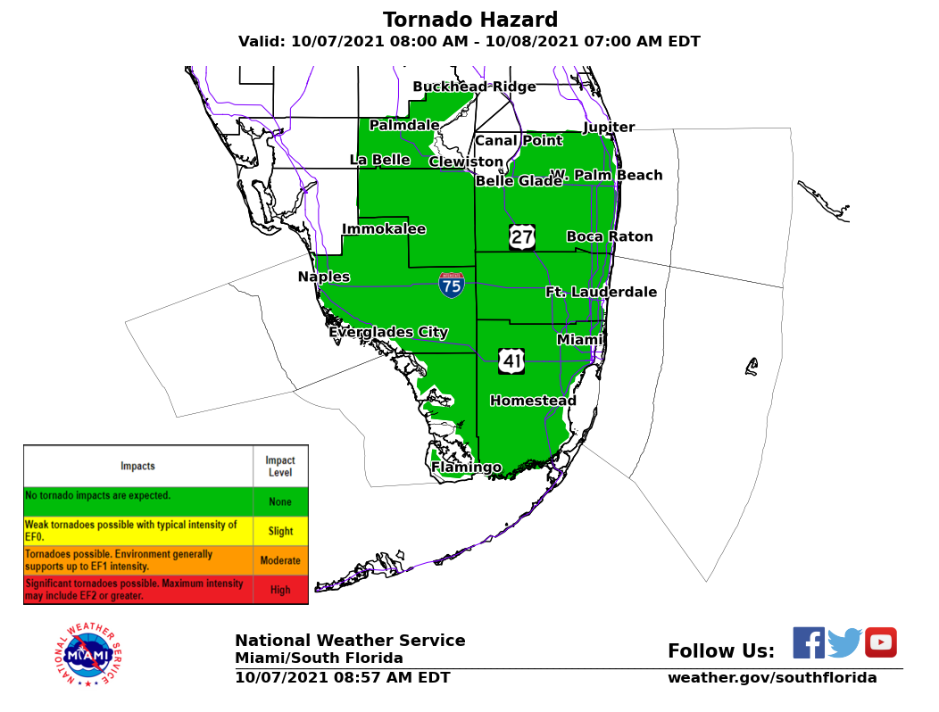
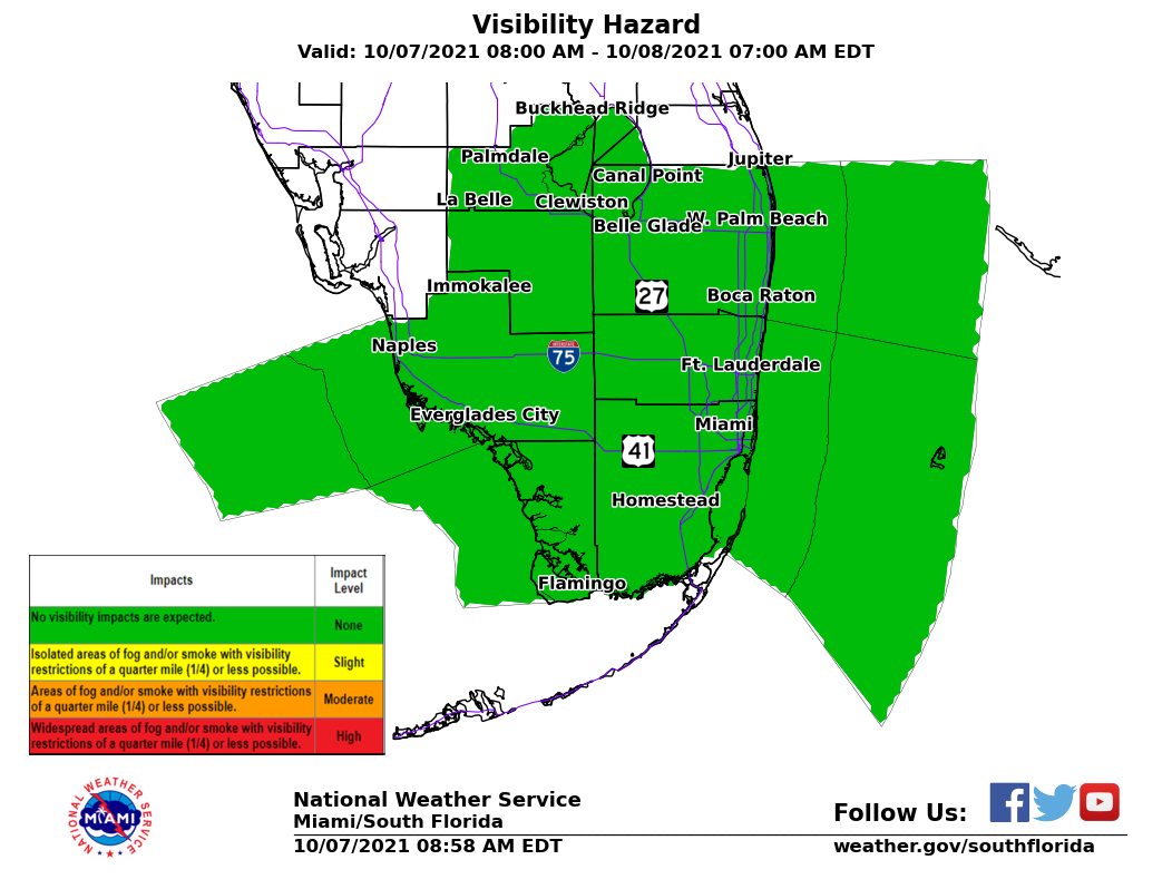
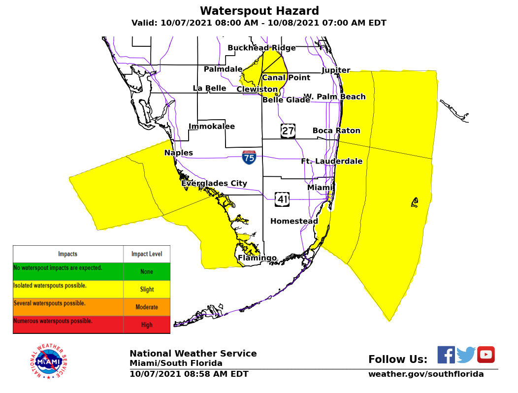
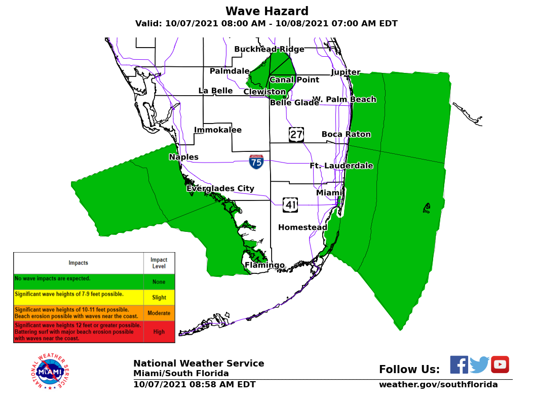
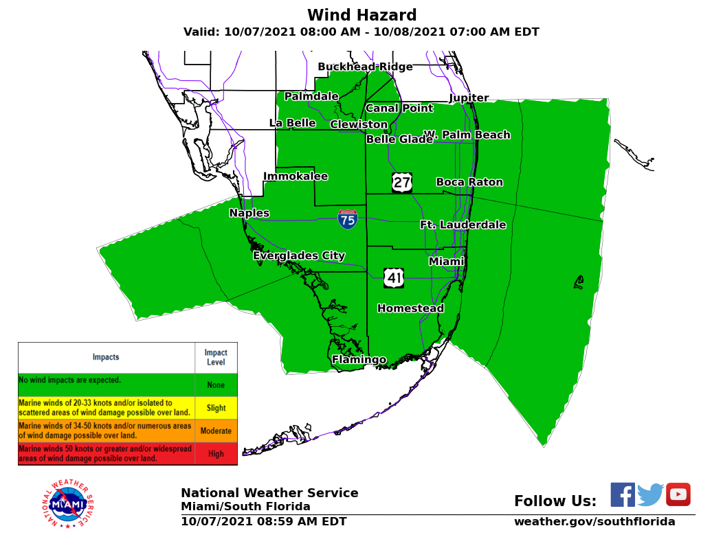
Impact LevelsRepresents the impact level for various weather hazards common to South Florida and the adjacent local waters. Thresholds are None, Slight, Moderate, or High. These impact levels are designed to provide decision support for the Day 1 period. |
||||||||||||||||||||
|
||||||||||||||||||||
CURRENT HAZARDS
Submit a Storm Report
Outlooks
Graphical Hazardous Weather Outlook
Self Briefing Page
National Hazards
Tropics / Hurricanes
Local Storm Reports
CURRENT WEATHER
Surface Observations
Satellite
Observed Precipitation
MesoAnalysis
Rivers / Lakes
Latest Sounding
Lake Okeechobee
PAST WEATHER
Tropical Cyclone Reports
Past Events
Recent Rainfall
FORECASTS
Forecast Discussion
Tropical Weather
Probabilistic Page
Heat Page
Cold Weather Page
Marine Weather
Fire Weather
Beach Forecast
Aviation Weather
Probabilistic QPF
Hourly Forecasts
Activity Planner
Graphical Forecast
International Weather
RADAR IMAGERY
National
Miami Radar
Key West Radar
Across Florida
CLIMATE
Local Climate Info
More Local Climate Info
Climate Graphs
US Dept of Commerce
National Oceanic and Atmospheric Administration
National Weather Service
Miami - South Florida
11691 SW 17th Street
Miami, FL 33165
305-229-4522
Comments? Questions? Please Contact Us.